sincerely yours, & j.dtmcahocdimage.emnrd.state.nm.us/imaging/filestore/santafeadmin/cf/ada...
TRANSCRIPT

T_3 Puro Oil Cccrtpangr Voat crrico Box 671 jlLOlrxad, Ecscss 75701
Ca It-arch 30, 19u3# effective as of ftarca 19, igS5» Arthur A. Eater, Acting Street©? of tl:s Geoloc ceJL Survey, approved ths> teri_in_tlca of t:.o l^inaiaatool Seep unit a_Teec_mt, lea County, Eew Ebslco, So. iij-c3-OOOl-6570, pursuaat to tbe last paragraph of aectioa 20 thereof.
I__clG30& aro five copies of tfte aprxroved cpplicstiaa for your records. rccueat that you furalab cofctce of this asxuoval to czch interested
voa&ias interest owner, lessee, &nd lessor at t&oir last toowa oddres8.
Sincerely yours,
& j.DtmcAH For ttee isirector
Lr.cloaurcs 5
cc: Roswell 2 (w/2 copies approved application) J
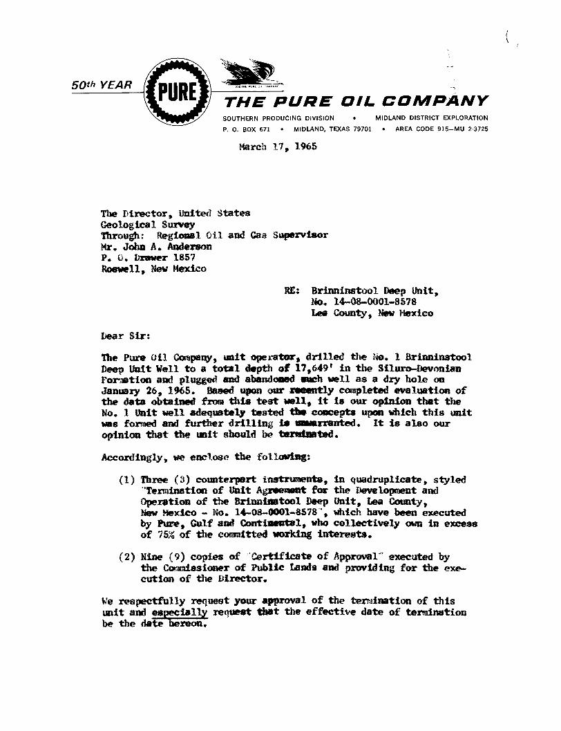
50™ YEAR
SOUTHERN PRODUCING DIVISION
THE PURE OIL COMPANY MIDLAND DISTRICT EXPLORATION
P. 0. BOX 671 MIDLAND, TEXAS 79701 AREA CODE 915-MU 2-3725
March 17, 1965
The Director, United States Geological Survey Through: Regional Oil and Gas Supervisor Mr. John A. Anderson P. O. Drawer 1857 Roswell, New Mexico
Dear Sir:
Tha Pure Oil Company, unit operator, drilled the m. 1 Brinninatool Deep Wait Well to a total depth of 17,649' in the Siluro-Devonias Formation and plugged and abandoned euch well as a dry hole oa January 26, 1965. Baaed upon our recently completed evaluation of the data obtained from this test well, i t la our opinion that the No. 1 Unit well adequately tested the concepts upon which this unit was formed and further drilling la unwarranted. It is also our opinion that the unit should be terminated.
Accordingly, we enclose the following:
(1) Three (3) counterpart inatrunents, in quadruplicate, styled Termination of Unit Agreement for the Development and Operation of the Brinninstool Deep unit, Lea County, Hew Mexico - No. 14-08-0001-8578 ", which have been executed by Pure, Gulf and Continental, who collectively own in excess of 75% of the committed working interests.
(2) Nine (9) copies of Certificate of Approval" executed by the Cos amiss loner of Public Lands and providing for the execution of the Director.
We respectfully request your approval of the termination of this unit and especially reciueat that the effective date of termination be tho date hereon.
RE: Brinninstool Deep Unit, Mo. 14-08-0001-8578 Lea County, Hew Mexico

Page 2 The Director, United States Geological Survey March 17, 1965
Please return to ua five (5) completely executed copies of item (2) for further handling. Item (1) enclosures are for your f i l e .
Very truly yours,
THE PURE OIL COMPANY
ORIGINAL SIGNED BY E. B. WHITE
E. B. White
E8W:md Encls,
ce; Commissioner of Public lands State of New Mexico P. 0. Box 1148 Santa Fe, New Mexico Attn: Mrs. Marian M, Rhea
New Mexico Oil Conservation Commission P. 0. Box 2088 Santa Fe, New Mexico Attn: Mr. A. L. Porter, Jr,
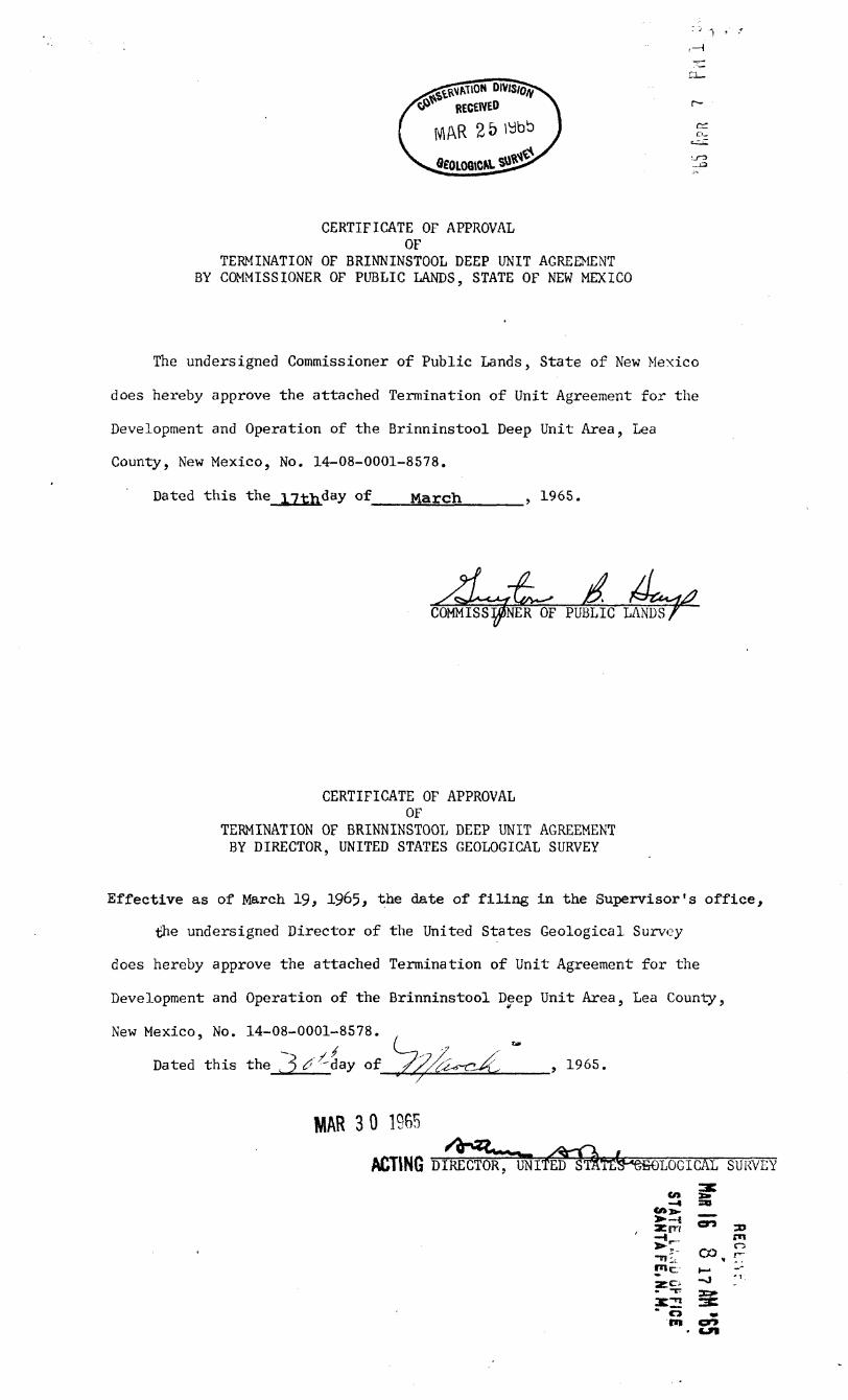
CERTIFICATE OF APPROVAL OF
TERMINATION OF BRINNINSTOOL DEEP UNIT AGREEMENT BY COMMISSIONER OF PUBLIC LANDS, STATE OF NEW MEXICO
The undersigned Commissioner of Public Lands, State of New Mexico
does hereby approve the attached Termination of Unit Agreement for the
Development and Operation of the Brinninstool Deep Unit Area, Lea
County, New Mexico, No. 14-08-0001-8578.
Dated this the 17th^ay of March , 1965.
COMMISSIONER OF PUBLIC LANDS,
CERTIFICATE OF APPROVAL OF
TERMINATION OF BRINNINSTOOL DEEP UNIT AGREEMENT BY DIRECTOR, UNITED STATES GEOLOGICAL SURVEY
Effective as of March 19, 1965, the date of f i l i n g i n the Supervisor's of f i c e ,
the undersigned Director of the United States Geological Survey
does hereby approve the attached Termination of Unit Agreement for the
Development and Operation of the Brinninstool Deep Unit Area, Lea County,
New Mexico, No. 14-08-0001-8578.
Dated this the 3 ^day of / / L * ~ r . X . 1965.
MAR 3 0 1965
ACTING DIRECTOR u ITED^ST^TE^efiOLOGICAL SURVEY
tn x» —« so
t l > >
aern c " 3»
* o »

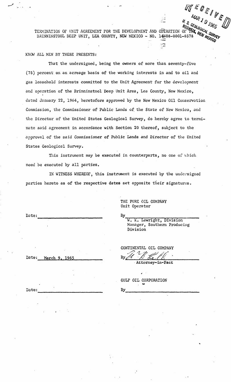
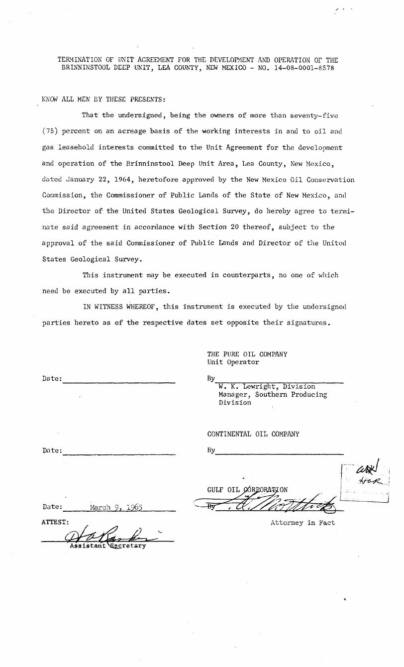
TERMINATION OF UNIT AGREEMENT FOR BRINNINSTOOL DEEP UNIT. LEA COUNTY
t THE DEVELOPMENT AND OPERATION Oj%4i^?^i I'TY, NEW MEXICO - NO. 14-08-0001-^578 ^^EXlCn ""Wed
KNCW ALL MEN BY THESE PRESENTS:
That the undersigned, being the owners of more than seventy-five
(75) percent on an acreage basis of the working interests in and to o i l and
gas leasehold interests committed to the Unit Agreement for the development
and operation of the Brinninstool Deep Unit Area, Lea County, New Mexico,
dated January 22, 1964, heretofore approved by the New Mexico Oil Conservation
Commission, the Commissioner of Public Lands of the State of New Mexico, and
the Director of the United States Geological'Survey, do hereby agree to termi
nate said agreement in accordance with Section 20 thereof, subject to the
approval of the said Commissioner of Public Lands and Director of the United
States Geological Survey.
This instrument may be executed in counterparts, no one of which
need be executed by a l l parties.
IN WITNESS WHEREOF, this instrument is executed by the undersigned
parties hereto as of the respective dates set opposite their signatures.
THE PURE OIL COMP Unit Ope fot
Date: MAR 8 1965
APPROVED
Desc.
Form
Terms 4-/ V O W
Date:
CONTINENTAL OIL COMPANY
By
Date:
»
GULF OIL CORPORATION
By

STATE OF TEXAS jj 5 ss
COUNTY OF HARRIS jj
The foregoing instrument was acknowledged before me this f (,'ay of ^y^^sTsCs/ty , 1965, by W. K. Lewright, Division Manager, of the Southern Producing Division of THE PURE OIL COMPANY, a Corporation, on behalf of said Corporation.
^ J s/ Notaiy Public
My Commission Expires:
STATE OF NEW MEXICO \ \
COUNTY OF CHAVES jj
The foregoing instrument was acknowledged before me this day of , 1965, by , ^ of CONTINENTAL OIL COMPANY, a corporation, on behalf of said corporation.
Notary Public My Commission' Expires:
STATE OF NEW MEXICO \ \
COUNTY OF CHAVES \
The foregoing instrument was acknowledged before me this day of , 1965, by • ,
of GULF OIL CORPORATION, a corporation, on behalf of said corporation.
Notary Public My Commission Expires:
-2-

TERMINATION OF UNIT AGREEMENT FOR THE DEVELOPMENT AND OPERATION OF THE ^ 1 S /
BRINNINSTOOL DEEP UNIT, LEA COUNTY, NEW MEXICO - NO. 14-08-0001^578 **
KNOW ALL MEN BY THESE PRESENTS:
That the undersigned, being the owners of more than seventy-five
(75) percent on an acreage basis of the working interests i n and to o i l and
gas leasehold interests committed to the Unit Agreement for the development
and operation of the Brinninstool Deep Unit Area, Lea County, New Mexico,
dated January 22, 1964, heretofore approved by the New Mexico Oil Conservation
Commission, the Commissioner of Public Lands of the State of New Mexico, and
the Director of the United States Geological Survey, do hereby agree to termi
nate said agreement in accordance with Section 20 thereof, subject to the
approval of the said Commissioner of Public Lands and Director of the United
States Geological Survey.
This instrument may be executed i n counterparts, no one of which
need be executed by a l l parties.
IN WITNESS WHEREOF, this instrument is executed by the undersigned
.parties hereto as of the respective dates set opposite their signatures.
Date:
THE PURE OIL COMPANY Unit Operator
By ^ W. K. Lewright, Division Manager, Southern Producing Division
Date:
Date:
ATTEST:
March 9. 1965
Assistant \i£cretary
CONTINENTAL OIL COMPANY
By
GULF OIL CORP'
Attorney i n Fact
STATE OF TEXAS jj 5 ss
COUNTY OF HARRIS jj
The foregoing instrument was acknowledged before me this day of , 1965, by W. K. Lewright, Division Manager, of the Southern Producing Division of THE PURE OIL COMPANY, a Corporation, on behalf of said Corporation.
Notary Public My Commission Expires:
STATE OF NEW MEXICO jj
COUNTY OF CHAVES jj
The foregoing instrument was acknowledged before me this day of ., 1965, by_
of CONTINENTAL OIL COMPANY, a corporation, on behalf of said corporation.
Notary Public My Commission Expires:
STATE OF NEW MEXICO jj
5 COUNTY OF CHAVES jj
The foregoing instrument was acknowledged before me this 9th day of March , 1965, by F. 0. MORTLOCK
Attorney in Fact of GULF OIL CORPORATION, a Pennsylvania corporation, on behalf of said corporation. ( j v
Notary Public j My Commission Expires: My CotawMiort Expire* Au^wr 15, 1966
- 2 -
TERMINATION OF UNIT AGREEMENT FOR THE DEVELOPMENT AND OPERATION OF T?<^ -JJ-ty „ BRINNINSTOOL DEEP UNIT, LEA COUNTY, NEW MEXICO - NO. 14508-0001-8578 ^ f t f f i t y
KNOW ALL MEN BY THESE PRESENTS:
That the undersigned, being the owners of more than seventy-five
(75) percent on an acreage basis of the working interests in and to o i l and
gas leasehold interests committed to the Unit Agreement for the development
and operation of the Brinninstool Deep Unit Area, Lea County, New Mexico,
dated January 22, 1964, heretofore approved by the New Mexico Oil Conservation
Commission, the Commissioner of Public Lands of the State of New Mexico, and
the Director of the United States Geological Survey, do hereby agree to termi
nate said agreement in accordance with Section 20 thereof, subject to the
approval of the said Commissioner of Public Lands and Director of the United
States Geological Survey.
This instrument may be executed in counterparts, no one of which
need be executed by a l l parties.
IN WITNESS WHEREOF, this instrument is executed by the undersigned
parties hereto as of the respective dates set opposite their signatux*es.
THE PURE OIL COMPANY Unit Operator
Date: By W. K. Lewright, Division Manager, Southern Producing Division
CONTINENTAL OIL COMPANY
Date: March 9. 1965 Attorney-in-Fact
Date:
GULF OIL CORPORATION
By

Sl'ATE OF TEXAS jj I ss
COUNTY OF HARRIS jj
The foregoing instrument was acknowledged before me this day of , 1965, by W. K. Lewright, Division Manager, of the Southern Producing Division of THE PURE OIL COMPANY, a Corporation, on behalf of said Corporation.
Notary Public My Commission Expires:
STATE OF NEW MEXICO jj
COUNTY OF CHAVES jj
The foregoing instrument was acknowledged before me this 9th day oi' March , 1965, by W. R. Hall , Attorney-in-Fact
of CONTINENTAL OIL COMPANY, a Delaware corporation, on Behalf of said corporation.
Notary Public y
My Commission Expires:
August 19. 196S
STATE OF NEW MEXICO jj \
COUNTY OF CHAVES jj
The foregoing instrument was acknowledged before me this day of , 1965, by ,
of GULF OIL CORPORATION, a corporation, on behalf of said corporation.
My Commission Expires: Notary Public

TERMINATION OF UNIT AGREEMENT FOR THE DEVELOPMENT AND OPERATIOF THE BRINNINSTOOL DEEP UNIT, LEA COUNTY, NEW MEXICO - NO. 14-08-0001-8578
KNOW ALL MEN BY THESE PRESENTS:
That the undersigned, being the owners of more than seventy-five
(75) percent on an acreage basis of the working interests in and to o i l and
gas leasehold interests committed to the Unit Agreement for the development
and operation of the Brinninstool Deep Unit Area, Lea County, New Mexico,
dated January 22, 1964, heretofore approved by the New Mexico Oil Conservation
Commission, the Commissioner of Public Lands of the State of New Mexico, and
the Director of the United States Geological Survey, do hereby agree to termi
nate said agreement in accordance with Section 20 thereof, subject to the
approval of the said Commissioner of Public Lands and Director of the United
States Geological Survey.
This instrument may be executed in counterparts, no one of which
need be executed by a l l parties.
IN WITNESS WHEREOF, this instrument is executed by the undersigned
parties hereto as of the respective dates set opposite their signatures.
Date: MAR 8 1965
THE PURE OIL COMPA Unit Ope
ewrfght, Division outhern Producing
s i o n
APPROVED
Desc.
Terms
Date:
CONTINENTAL OIL COMPANY
By
Date:
GULF OIL CORPORATION
By

STATE OF TEXAS jj I ss
COUNTY OF HARRIS jj
The foregoing instrument was acknowledged before me this j / day of y ^ 7 ^ ^ ^ j ( L \ y i 1965, by W. K. Lewright, Division Manager, of the Southern Producing Division of THE PURE OIL COMPANY, a Corporation, on behalf of said Corporation.
My Commission Expires:
/; /far -1/
( - X t (£&-><y ^ ^ ^ Z C A L * ^ JO ANN BREWER y Notary Public
STATE OF NEW MEXICO jj \
COUNTY OF CHAVES jj
The foregoing instrument was acknowledged before me this day of , 1965, by_
of CONTINENTAL OIL COMPANY, a corporation, on behalf of said corporation.
Notary Public My Commission Expires:
STATE OF NEW MEXICO \ \
COUNTY OF CHAVES jj
The foregoing instrument was acknowledged before me this day of , 1965, by ; ,
of GULF OIL CORPORATION, a corporation, on behalf of said corporation.
Notary Public My Commission Expires:
-2-
TERMINATION OF UNIT AGREEMENT FOR THE DEVELOPMENT AND OPERATION OF THE BRINNINSTOOL DEEP UNIT, LEA COUNTY, NEW MEXICO - NO. 14-08-0001-8578
KNOW ALL MEN BY THESE PRESENTS:
That the undersigned, being the owners of more than seventy-five
(75) percent on an acreage basis of the working interests in and to o i l and
gas leasehold interests committed to the Unit Agreement for the development
and operation of the Brinninstool Deep Unit Area, Lea County, New Mexico,
dated January 22, 1964, heretofore approved by the New Mexico Oil Conservation
Commission, the Commissioner of Public Lands of the State of New Mexico, and
the Director of the United States Geological Survey, do hereby agree to termi
nate said agreement in accordance with Section 20 thereof, subject to the
approval of the said Commissioner of Public Lands and Director of the United
States Geological Survey.
This instrument may be executed in counterparts, no one of which
need be executed by a l l parties.
IN WITNESS WHEREOF, this instrument is executed by the undersigned
parties hereto as of the respective dates set opposite their signatures.
THE PURE OIL COMPANY Unit Operator
Date: By W. K. Lewright, Division Manager, Southern Producing Division
CONTINENTAL OIL COMPANY
Da t e: By
1 &*h*L
1

STATE OF TEXAS $ jj ss
COUNTY OF HARRIS jj
The foregoing instrument was acknowledged before me this day of , 1965, by W. K. Lewright, Division Manager, of the Southern Producing Division of THE PURE OIL COMPANY, a Corporation, on behalf of said Corporation.
Notary Public My Commission Expires:
STATE OF NEW MEXICO jj $
COUNTY OF CHAVES jj
The foregoing instrument was acknowledged before me this day of , 1965, by ,
of CONTINENTAL OIL COMPANY, a corporal Ion, on behalf of said corporation.
Notary Public My Commission Expires:
STATE OF NEW MEXICO jj
COUNTY OF CRAVES jj
T'te foregoing instrument was acknowledged before me this 9th day of March , 1965, by F. 0. MORTLOCK , Attorney in Fact of GULF OIL CORPORATION, a Pennsylvania corporation,
on Behalf of said corporation. f~J
V h u ^ L'~7TTS- U Notary P u b l i c 7 /
My Commission Expires:
-2-1

TERMINATION OF UNIT AGREEMENT FOR THE DEVELOPMENT AND OPERATION OF THE BRINNINSTOOL DEEP UNIT, LEA COUNTY, NEW MEXICO - NO. 14-08-0001-8578
KNOW ALL MEN BY THESE PRESENTS:
That the undersigned, being the owners of more than seventy-five
(75) percent on an acreage basis of the working interests in and to o i l and
gas leasehold interests committed to the Unit Agreement for the development
and operation of the Brinninstool Deep Unit Area, Lea County, New Mexico,
dated January 22, 1964, heretofore approved by the New Mexico Oil Conservation
Commission, the Commissioner of Public Lands of the State of New Mexico, and
the Director of the United States Geological Survey, do hereby agree to termi
nate said agreement in accordance with Section 20 thereof, subject to the
approval of the said Commissioner of Public Lands and Director of the United
States Geological Survey.
This instrument may be executed in counterparts, no one of which
need be executed by a l l parties.
IN WITNESS WHEREOF, this instrument is executed by the undersigned
parties hereto as of the respective dates set opposite their signatures.
THE PURE OIL COMPANY Unit Operator
Date: By W. K. Lewright, Division Manager, Southern Producing Division
CONTINENTAL OIL COMPANY
Date: March 9. 1965 Attorney-in-Fact
GULF OIL CORPORATION
Date: By

STATE OF TEXAS jj jj ss
COUNTY OF HARRIS jj
The foregoing instrument was acknowledged before me this day of , 1965, by W. K. Lewright, Division Manager, of the Southern Producing Division of THE PURE OIL COMPANY, a Corporation, on behalf of said Corporation.
My Commission Expires: Notary Public
STATE OF MEW MEXICO jj x
COUNTY OF CHAVES jj
The foregoing instrument was acknowledged before me this 9th day of March , 1965, by W. R. Hall , Attorney-in-Fact
of CONTINENTAL OIL COMPANY, a Delaware corporation, on behr.lf of said corporation.
Notary Public y
Ky Commission Expires:
August 19, 1968
STATE OF NEW MEXICO jj \
COUNTY OF CHAVES jj
of The foregoing instrument was acknowledged before me this
., 1965, by day
on behalf of said corporation. of GULF OIL CORPORATION, a corporation 3
My Commission Expires: Notary Public
-2-
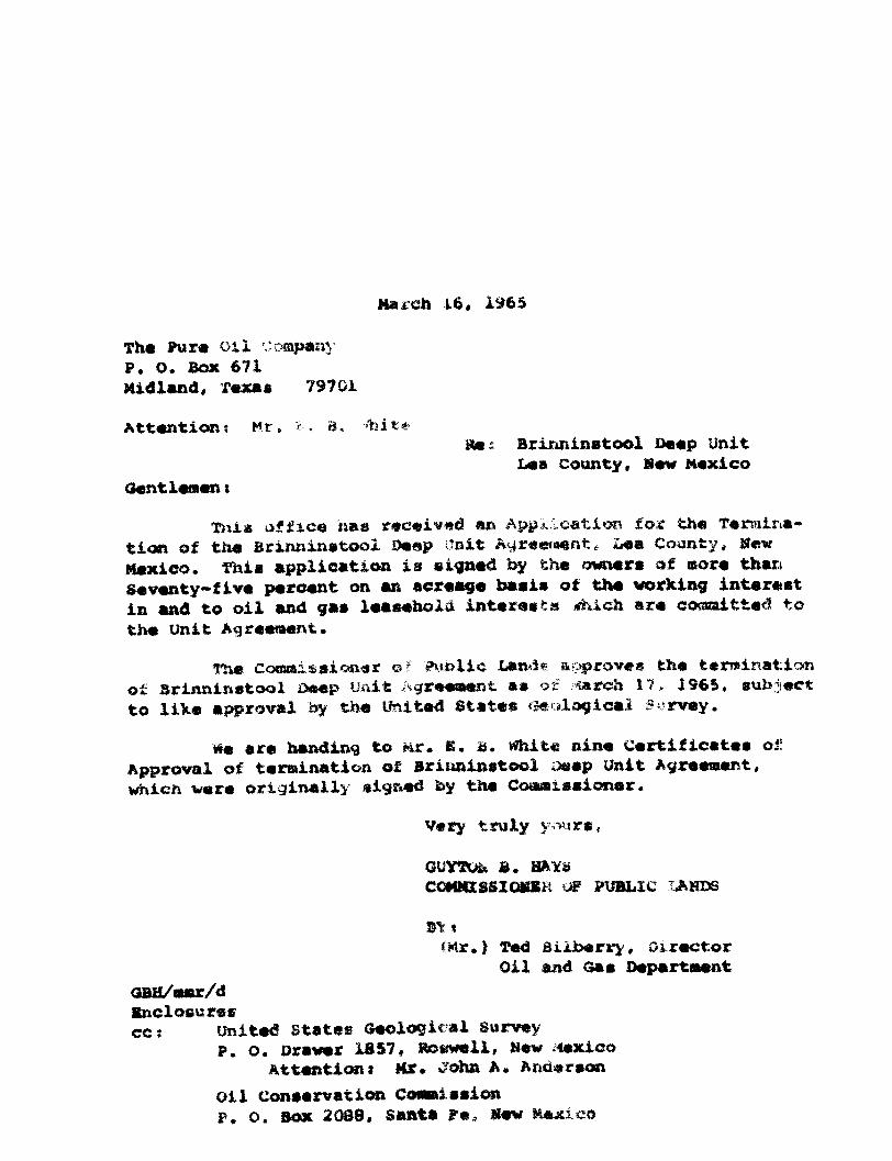
March i6, 1965
The Pura o i l company P. 0. Box 671 Midland, Texas 79701
Attention: Hr, c. a, '"nit* Re: Brinninstool Deep Unit
Lea County, Sew Mexico Gentlemen:
Thla office has received an Application for tha Termination of tha Brinninatool Deep Unit Agreement* Laa County, Hew Haxico, Thia application i s signed by tha owners af more than Seventy-fiv« percent on an acreage oaaia of the working interest in and to o i l and gas leasehold interests .Tti.cn are eo«taitte<3 to the Unit Agreement.
The CoKraissionar of Public Lande a^iproves the termination o£ Brinninstool Deep Unit Agreeaent as of rmrah 17, 1965, subject to liXe approval by the United States i l l o g i c a l Survey.
We are handing to Mr. B. B. White nine Certificatee of Approval of termination of Briiminatool oeep Unit Agreement, whien were originally signed by the Cooaxaaioner.
Very truly ymtrs,
GUYTUi* £. HAY*
COMMISSI OMSK Jc PUBLIC X^HDS
St %
*Mr.) Ted Bilberry, Director Oil and Oas Department
GBH/mstr/d Enclosures cc: united states Geological Survey
P. O. Drawer 1857, Roswell, New Mexico Attention! Mr. John A. Anderson
o i l Conservation Comassaion P. o. Box 2083, Santa ?«» Mew Mexico

THE PURE OIL COMPANY SOUTHERN PRODUCING DIVISION • M IDLAND DISTRICT EXPLORATION
P. 0 . BOX 671 • M IDLAND, TEXAS 79701 • AREA CODE 9 1 5 - M U 2-3725
March 12, 1965
Mr. Guyton B. Hays Commissioner of Public Lands State of New Mexico P. 0. Box 1148 Santa Fe, New Mexico
Attention: Mrs. Marian M. Rhea, Supervisor Unit Division
RE: Brinninstool Deep Unit, No. 14-08-0001-8578 Lea County, New Mexico
Dear Sir:
The Pure Oil Company No. 1 Brinninstool Deep Unit well was d r i l l e d to a t o t a l depth of 17,649' in the Siluro-Devonian Formation and was plugged and abandoned as a dry hole on January 26, 1965. In our opinion, the No. 1 Unit well adequately tested the concepts upon which this unit was formed. I t i s our opinion that further d r i l l i n g is unwarranted and the Unit should be terminated. Accordingly, we enclose the following:
(1) Three (3) counterpart instruments, i n duplicate, styled "Termination of Unit Agreement For the Development and Operation of the Brinninstool Deep Unit, Lea County, New Mexico - No. 14-08-0001-8578 , which have been executed by Pure, Gulf and Continental, who collectively own in excess of 75% of the committed working interests.
(2) Nine (9) copies of "Certificate of Approval , to be executed by the Commissioner and the Director.
We respectfully request your early approval of the termination of this unit and ask that you execute a l l copies of item (2) in the

Page 2 Mr. Guyton B. Hays March 12, 1965
space so provided and return a l l copies to us for submittal to the t.S.G.S. Upon complete approval, we w i l l furnish you your required number of copies. Item (1) enclosures are for your f i l e .
Very truly yours,
THE PURE OIL COMPANY
ORIGINAL SIGNED Jj'{ E. B. WHITE
E. B. White
EBW:md Encls.
cc: New Mexico Oil Conservation Coomssion, w/encls. P. 0. Box 2088
v Santa Fe, New Mexico Attn: Mr. A. L. Porter, Jr.
United States Geological Survey P. 0. Drawer 1857 Roswell, New Mexico Attn: Mr. John A. Anderson

Drawer 1857 I3S4 MAR b PH 8«v Mexico 88201
The Pure C i l Coapany P. 0. Box 671 Midland, Texas 79701
Gent kaen:
e hereby acknowledge receipt of tbe iollo^ins described r a t i f i c a t ies and joiwiar relating to the Brinninstool Beep unit ©greeaent Ho. 14-08-0001-S578, County, Haw Htxl-.o:
Executed by
pa laser and McCarver, d/b/a ?-K Dri l l ing uwapany, leaser of State land unit tract 28
Joinder to Bate deceived
Unit agreeasmt February 27, 1964
State land unit tract 2$ w i l l considered ful ly co«Htitt«<J effective March 1, 1964, subject to approval fey the Cowsiasioner of Public Lands of the State of ttev Mexico, pursuant to section 29 of the Britminatooi Deep unit agr*s««©»t.
Copies of tha rat i f i cat ion and joinder are being distributed to the appropriate Federal off ice*.
Sincerely yours,
J0H« A. ANDE&SOW Vugional Oi l and Gas Supervisor
* Washington (w/cy joinder) BLM-Santa Fe (w/cy joinder) Hobba (w/cy joinder) NMOCC-Ltr. only -Com. of Public Lands-Ltr. oaly Accounts

50*h YEAR
THE PURE OIL COMPANY SOUTHERN PRODUCING DIVISION
asSTHC PORE OIL CO«P»NT
MIDLAND DISTRICT EXPLORATION
P. 0. BOX 671 MIDLAND, TEXAS 79701 AREA CODE 915-MU 2-3725
February 13, 1964
New Mexico Oil Conservation Commission P. 0. Box 871 Santa Fe, New Mexico
Attention: Mr. A. L. Porter, Jr.
RE: Brinninstool Deep Unit Area Lea County, New Mexico
Gentlemen:
Pursuant to your Order No. R-2648, enclosed is complete executed copy of Unit Agreement covering the captioned.
Attached to such agreement is a copy of CERTIFICATION - DETERMINATION NO. 14-08-0001-8578 whereby the U.S.G.S. has approved the captioned effective as of February 12, 1964, together with a l e t t e r from the U.S.G.S. dated February 12, 1964, advising of such approval.
Also attached thereto is a copy of Certificate of Approval executed by the Commissioner of Public Lands, State of New Mexico.
Very tru l y yours,
THE PURE OIL COMPANY
E. B. White
EBW:md Ends.

UNITED STATES DEPARTMENT OF THE INTERIOR
GEOLOGICAL SURVEY W A S H I N G T O N 25. D . C .
FEB I 2 1964
The Pure Oil Company P. 0. Box 671 Midland, Texas 79701
Gentlemen:
On February 12, 196k, Acting Director of the Geological Survey approved the Brinninstool Deep unit agreement, Lea County, Mew Mexico, f i l e d by your company as unit operator. This agreement has been designated No. 14-08-0001-8578 and is effec tive as of the date of approval.
Enclosed are 3 copies of the approved unit agreement for your records. We request that you furnish the State of New Mexico and any other interested principal with whatever evidence of this approval i s deemed appropriate.
Sincerely yours,
Enclosures 3
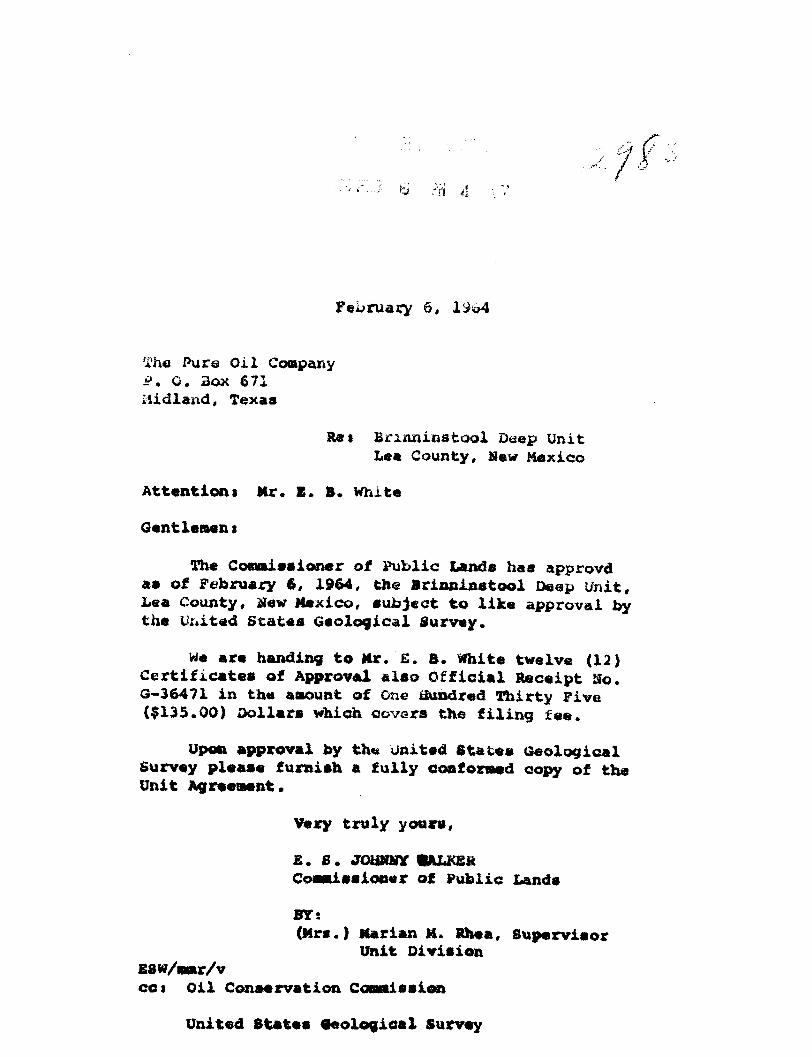
February 6, 1964
The Pure Oil Company P. 0. Box 671 Midland, Texas
Res Brinninstool Deep Unit Lea County, Haw Mexico
Attention! Mr. E. ». White
Gentlement
The Cosaissioner of Public Lands has approvd as of February 6, 1964, tne Brinninstool Deep Unit, Lea County, STew Mexico, subject to like approval by the United States Geological Survey.
Me are handing to Mr. £. B. White twelve (12) Certificates of Approval also Official Receipt Ho. G-36471 in the aaount of One tiundred Thirty Five ($135.00) Dollars whioh covers the filing fee.
Upon approval by the united States Geological Survey please furnish a fully conformed copy of the Unit Agreement.
Very truly yours,
£. S. JOHNHY fJALKER Coesiissloner of Public Lands
BY; (Mrs.) Marian M. Rhea, Supervisor
Unit Division E8w/«sr/v cct Oil Conservation Conniesion
United States Oeological Survey

State of New/Vlexico r
E . « . J O H N N Y W A L K E R C O M M I S S I O N E R
P. O. B O X 7t1 S A N T A F E , NSW M E X I C O
January 29, 1964
The Pure Oil Company P. O. Box 671 Midland, Texas
Re: Proposed Brinninstool Deep Unit Lea County, New Mexico
Attention: Mr. E. B. White
Gentlemen:
This office i s approving as to form and content your Proposed Brinninstool Deep Unit, subject to the two changes which I discussed with you on the telephone this morning.
These changes are as follows>
(1) Section 21, Page 20, line 34 end of sentence delete period insert semicolon and add = " Provided, further, that no such alteration or modification shall be effective as to any land of the State of New Mexico, as to the rate of prospecting and develop' ing in the absence of the specific written approval thereof by the Commissioner and as to any lands of

The Pure Oil Company Attention: Mr. E. B. White January 29, 1964 - page 2 -
the State of New Mexico or privately owned lands subject to this Agreement as to the guantity and rate of production in the absence of specific written approval thereof by the Commissioner."
(2) Section 29, Page 24, line 5, delete line five and insert: "within 60 days by the Director or the Land Commissioner, provided, however, that as to State Lands such subsequent joinder must be approved by the Land Commissioner."
We thank you for your courtesy i n this matter.
Very truly yours,
E. S. JOHNNY WALKER COMMISSIONER OF PUBLIC LANDS
BY:^<~U-~^. ^ (Mrs.) Marian M. Rhea, Supervisor
Unit Division
ESW/mmr/v cc:
Oil Conservation Commission Santa Fe, New Mexico
United States Geological Survey P. 0. Drawer 1857 Roswell, New Mexico

CERTIFICATE OF APPROVAL
BY COMMISSIONER OF PUBLIC LANDS, STATE OF NEW MEXICO
BRINHTB8T00L DSSP UHIT LEA COPBTY. MBit MEXICO
There having been presented to the undersigned Commissioner of Public Lands of the State of New Mexico for examination, the attached Agreement for the development and operation of acreage which i s described w i t h i n the attached Agreement, dated January 22, 1964 , which has been executed or is to be executed by parties owning and holding o i l and gas leases and roy a l t y interests i n and under the property described, and upon examination of said Agreement, the Commissioner finds:
(a) That such agreement w i l l tend to promote the conservation of o i l and gas and the better u t i l i z a t i o n of reservoir energy i n said area.
(b) That under the proposed agreement the State of New Mexico w i l l receive i t s f a i r share of the recoverable o i l or gas i n place under i t s lands i n the area.
(c) That each beneficiary I n s t i t u t i o n of the State of New Mexico w i l l receive i t s f a i r and equitable share of the recoverable o i l and gas under i t s lands w i t h i n the area.
(d) That such agreement is i n other respects for the best interests of the state, with respect to state lands.
NOW, THEREFORE, by v i r t u e of the authority conferred upon me under Sections 7-11-39, 7-H-lj.O, 7 - H - i t l , 7-H-i|-7, 7-11-^8, New Mexico Statutes Annotated 1953 Compilation, I , the undersigned, Commissioner of Public Lands of the State of New Mexico, for the purpose of more properly conserving the o i l and gas resources of the State, do hereby consent to and approve the said Agreement, and any leases embracing lands of the State of New Mexico w i t h i n the area shall be and the same are hereby amended to conform with the terms thereof, and shall remain i n f u l l force and effect according to the terms and conditions of said Agreement. This approval i s subject to a l l of the provisions of the aforesaid statutes.
IN WITNESS WHEREOF, this Certificate of Approval is executed, with seal affixed, this 6th day of February 19 64
ml ssione zv^b^Vublic Lt Commissioner or puhiic Lane of the State of New Mexico
FEB 10 1964 f
FEB 3 1964 U. S. GEOLOGICAL SURVEY ROSWELL, NEW MEXICO

CERTIFICATION - DETERMINATION
NO. 14-03-0001 85 78
Pursuant to the authority vested in the Secretary of Interior as
to Federal Lands, under the Act approved February 25, 1920, 41 Stat. 437, as
amended, 30 U.S.C. Sees. 181, et seq., and delegated to the Director of the
Geological Survey pursuant to Departmental Order No. 2365 of October 8, 1947,
43 C.F.R. Sec. 4.611, 12 F.R. 6784, I do hereby:
A. Approve the attached agreement for the development and operation
of the Brinninstool Deep Unit Area, Lea County, State of New Mexico.
B. Certify and determine that the unit plan of development and
operation contemplated i n the attached agreement is necessary and advisable
in the public interest for the purpose of more properly conserving the natural
resources.
C. Certify and determine that the d r i l l i n g , producing, rental,
minimum royalty, and royalty requirements of a l l Federal leases committed to
said agreement are hereby established, altered, changed, or revoked to conform
with the terms and conditions of this agreement.
i&pti^DIRECTOR, UNITED STATES GEOLOGICAL SURVEY.
, f £ o ' '<L 1963
DATED
50th YEAR THE PURE OIL COMPANY SOUTHERN PRODUCING DIVISION • MIDLAND DISTRICT EXPLORATION
P. 0. BOX 671 • MIDLAND, TEXAS 79701 • AREA CODE 915-MU 2-3725
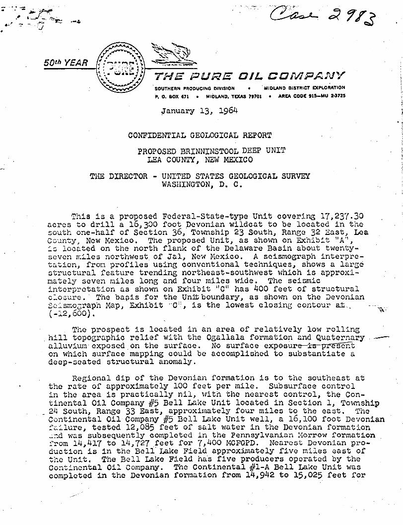
January 13, 1964
CONFIDENTIAL GEOLOGICAL REPORT
PROPOSED BRINNINSTOOL DEEP UNIT LEA COUNTY, NSW MEXICO
THE DIRECTOR - UNITED STATES GEOLOGICAL SURVEY WASHINGTON, D. C.
This Is a proposed Federal-State-type Unit covering 17,237.30 acres to d r i l l a 16,300 foot Devonian wildcat to be located i n the south one-half of Section 36,' Township 23 South, Range 32 Ea3t, Lea County, New Mexico. The proposed Unit, as shown on Exhibit "A'1, Is located on the north flank of the Delaware Basin about twenty-seven miles northwest, of Jal, New Mexico. A seismograph interpretation, fron profiles using conventional techniques, shows a large structural feature trending northeast-southwest which i s approximately seven miles long and four miles wide. The seismic interpretation as shown on Exhibit "C" has 400 feet of structural closure. The basis for the Unjt boundary, as shown on the Devonian Seismograph Map, Exhibit "C':, i s the lowest closing contour at-., .... (-12,600). X v
The prospect i s located i n an area of re l a t i v e l y low r o l l i n g h i l l topographic r e l i e f with the Ogallala formation and Quaternary* — alluvium exposed on the surface. No surface expe^ure—i^-^pr^sent on which surface mapping could be accomplished to substantiate a deep-seated structural anomaly.
Regional dip of the Devonian formation i s to the southeast at the rate of approximately 100 feet per mile. Subsurface control i n the area i s practically n i l , with the nearest control, the Continental O i l Company #5 Bell Lake Unit located i n Section 1, Township 24 South, Range 33 East, approximately four miles to the east. The Continental Oil Company #5 Bell Lake Unit well, a 16,100 foot Devonian f a i l u r e , tested 12,085 feet of salt water i n the Devonian formation „nd was subsequently completed i n the Pennsylvanian Morrow formation from 14,417 to 14,727 feet for 7,400 MCFGPD. Nearest Devonian production i s i n the Bell' Lake Field approximately five miles east of the Unit. The Bell Lake Field has five producers operated by the Continental Oil Company. The Continental #1-A Bell Lake Unit was completed i n the Devonian formation from 14,942 to 15>025 feet for

-2-
15,500 MCFGPD plus 14.4 barrels of formation water. The #2 B e l l Lake Unit was completed i n the Pennsylvanian Strawn formation f o r 140 barrels of d i s t i l l a t e per day plus 13,100 MCFGPD. The #3 B e l l Lake Unit was completed i n the Bone Spring formation from 8,670 to 8,817 feet f o r 53 barrels of o i l per day plus 2 barrels of formation water. The #4 B e l l Lake Unit was completed i n the Devonian formation from 14,736 to 14,938 feet f o r 64,000 MCFGPD.
The Brinninstool proposed Unit i s i n an area favorable f o r production from the upper Delaware Mountain group as shown on Exhibit "B". The Cruz Fi e l d , T r i s t e Draw Fi e l d and the north one-half of the Double :'X" Field are productive from the uppermost Delaware Sand member of the Delaware Mountain group from depths of 4,900 feet down to 5,200 feet w i t h i n the proposed Unit area. Exhibit "E" i s a Gamma Ray - Acoustic c o r r e l a t i o n log of the Max Wilson #1 Continental Federal, located 1980 feet FWL and 660 feet FNL of Section 28, Township 23 South, Range 32 East, and i s the deepest t e s t d r i l l e d i n the proposed u n i t area. I t was completed as a dry hole i n the Cherry Canyon formation of the Delaware Mountain group. The top of the Cherry Canyon formation was picked from the log at a depth of 5*923 feet . U n i t i z a t i o n of r i g h t s w i l l begin at the top of Cherry Canyon formation at an estimated depth of approximately 5*923 feet i n the proposed Brinninstool Unit t e s t . Exhibit "F" i s a Gamma Ray - Sonic corr e l a t i o n log of the Continental O i l Company's #7 B e l l Lake Unit, a Wolfcamp dry hole located 660 feet FNL and FEL of Section 1, Township 24 South, Range 33 East and approximately four miles east of the Unit o u t l i n e . The top of the Cherry Canyon formation was picked from the log of the #7 B e l l Lake Unit at a depth of 6,260 feet . The Cherry Canyon formation i n the Unit t e s t w i l l be encountered w e l l below the deepest producing depth i n any of the f i e l d s located w i t h i n the Unit o u t l i n e . No production has been established from the Cherry Canyon formation i n t h i s area of the Delaware Basin.
The proposed Brinninstool Unit te s t should penetrate about 1,200 feet of red beds before encountering the top of the Rustler Anhydrite. The evaporite and s a l t section should be about 3*800 feet t h i c k . Approximately 3,900 feet of basin type Delaware sandstone, shale, and limestone should be present. The Bone Spring limestone, sandstone, and shale section should be 2,400 feet i n thickness. The Wolfcamp may vary from 900 to 1,350 feet i n thickness. The Pennsylvanian formation should contain approximately 2,200 feet of limestone, sandstone, and shale. The Mississippian section should contain 1,200 feet of limestone and shale. I n a l l , the t e s t should penetrate 16,000 feet of sediments; however, on a s t r u c t u r a l l y high t e s t , i t i s not unreasonable to expect considerable thinning of pre-Wolfcamp beds over Devonian highs. The columnar section i s shown on Exhibit "D".

0 0 UNITED STATES
DEPARTMENT OF THE INTERIOR GEOLOGICAL SURVEY
W A S H I N G T O N 25, D . C .
The Pure O i l Company P. G. Box 671 Midland, Texas 79701
JAN 2 1 1964
Attention: Mr. E. B. White
Gentlemen:
Your application of January 13, f i l e d w ith the O i l and Gas Supervi s o r , Roswell, New Mexico, requests the designation of 17,237.30 acres, more or less, Lea County, New Mexico, as l o g i c a l l y subject to exploration and development under the u n i t i z a t i o n provisions of the Mineral Leasing Act, as amended.
Pursuant to u n i t plan regulations of December 22, 1950, 30 CFR 226.3 (1961 r e p r i n t ) , the land requested as described i n your application and outlined on your map marked "Exhibit A, Brinninstool Unit, Lea County, New Mexico," i s hereby designated as a l o g i c a l unit area. Inasmuch as u n i t i z a t i o n w i l l be l i m i t e d to a l l formations below the top of the Cherry Canyon formation of the Delaware Mountain Group, Permian Age, the u n i t should be i d e n t i f i e d as the "Brinninstool Deep Unit" by the u n i t agreement submitted f o r the area hereby designated. Cur review of the area indicates the t o t a l acreage to be 17,237.32 acres. Accordingly, i f your recheck confirms our f i g u r e , your records should be so conformed.
The u n i t agreement submitted for the area designated should provide fo r the d r i l l i n g of the i n i t i a l exploratory well to test formations of Devonian age, or to a depth of 16,300 feet. The 1961 reprint of the standard form of unit agreement should be used, with the modifications proposed by your application, the addition of the language required,by the State of New Mexico, and the following additional modification to update the Nondiscrimination section:
The "Fair Employment" section of the 1961 re p r i n t should be replaced w i t h the following:
"Nondiscrimination: I n connection w i t h the performance of work under t h i s agreement, the operator agrees to comply wit h a l l of the provisions of 301 (1) to (7) inclusive, of Executive Order 10925, as amended, (28 F.R. 6485), which are hereby incorporated by reference i n t h i s agreement."
In the absence of any type of land requiring special provisions or any objections not now apparent, a duly executed agreement identical
.S3

to the 1961 reprint, modified only as outlined above, will be approved i f submitted in approvable status within a reasonable time. However, the right is reserved to deny approval of any executed agreement which, in our opinion, does not have full commitment of sufficient lands to afford effective control of unit operations.
When the executed agreement is transmitted to the Supervisor for approval, include the latest status of a l l acreage. In preparation of Exhibits A and B, follow closely the format of the sample exhibits attached to the 1961 reprint of the standard form.
Inasmuch as this unit contains State of New Mexico lands, we are sending a copy of this letter to the Commissioner of Public Lands at Santa Fe, and you are requested to contact said Commissioner in tonnection with this letter prior to soliciting joinders.
Sincerely yours,
Acting Director

-3-
The potential pay zones and expected depths are as follows:
Cherry Canyon sandstone 6,100 feet Bone Spring limestone 8,900 feet Wolfcamp limestone 11,300 feet Pennsylvanian limestone 12,650 feet Pennsylvanian sandstone 13,800 feet Devonian dolomite 16,000 feet
Considering the inherent d i f f i c u l t i e s of shallow high velocity sediments, we feel the data are of f a i r to good quality, and we have mapped the probable existence of a deep structure which should be tested for probable entrapment of hydrocarbons.
Respectfully submitted,
W. tf. Henry Geologist
WJH :bh