significant gold depositsgemstonebookstore.pbworks.com/f/significant+gold+deposits.pdf ·...
TRANSCRIPT

SIGNIFICANT GOLD DEPOSITS by
W. Dan Hausel
W. Dan Hausel, Geological Consulting LLC
Gilbert, AZ 85233
ABSTRACT According to the available records, only 400,000 ounces of gold, 160,000 ounces of silver, 900 ounces of platinum,
17,000 ounces of palladium, 29,000 pounds of lead, nearly 64 million pounds of copper and 135 million tons of iron
were produced in Wyoming in the past (Hausel, 1998a). Even so, the geology is favorable for discovery of
significant precious metal deposits and with continued exploration by mining companies, precious metal production
in Wyoming should dramatically eclipse past production.
INTRODUCTION Minor to significant gold is scattered throughout the stratigraphic record of Wyoming, with the greatest
concentrations in Precambrian and Tertiary rocks (Figure 1). Much of Wyoming is underlain by cratonic rocks
(Archean). This complex includes several significant precious metal deposits; the most notable are structurally
complex gold deposits associated with shear zones within folded greenstone belts. Gold found in such belts may
have the highest potential for significant gold discoveries in Wyoming, although the complexity of the structural
control on mineralization has befuddled most prospectors and geologists.
Figure 1. Mining districts and mineralized terrains in Wyoming.

In southeastern Wyoming, thick successions of Proterozoic metasedimentary rocks crop out in miogeosynclinal
wedges that unconformably overlie the Archean basement. These include quartzite-hosted Cu-Ag-Au deposits, Au-
Ag veins, and radioactive Witwatersrand-type metaconglomerates with isolated gold and diamond anomalies. The
miogeoclinal terrain is separated from a metavolcanic terrain to the south by a Precambrian suture zone (Houston
and others, 1968). This suture, or shear zone, hosts a few scattered Cu-Au-Ag and Pt- Pd-bearing deposits in
cataclastics.
South of the suture, Proterozoic rocks (1.8 to 1.6 Ga) include volcanogenic Zn-Cu-Ag massive sulfide deposits, at
least one Au-Cu porphyry (Copper King), two large layered mafic complexes (1.8 Ga) and a pyroxenite massif with
anomalous Pd-Ni-Au-Pt-Ag-Cu at Puzzler Hill. Along the northern edge of one layered mafic complex (Mullen
Creek) Pd-Pt-Cu-Au-Ag was recovered from the New Rambler mine at the start of the 20th century. One estimate
suggests that 900 ounces of Pt and 17,000 ounces of Pd were recovered along with the copper and gold.
A 350 mi2 anorthosite batholith (1.4-1.5 Ga) in the Laramie Mountains has long been considered a possible source
of low-grade aluminum as well as extensive disseminated and massive Ti-Fe-V deposits. In addition, one isolated
deposit near the southern margin of the batholith is interpreted as a Cu-Au-Ag-W-Mo vein deposit. Even more
impressive is the potential for world-class iolite gem deposit with possibilities for more than a trillion carats in
gemstones recently recognized by the author. Another world-class iolite gemstone deposit was identified to the west
of the anorthosite complex within the Archean basement terrain that hosts some of the largest colored gemstones on
earth (Hausel, 2005).
Phanerozoic rocks have few precious metal occurrences. Where found, these include Au-REE anomalies in
Cambrian conglomerates and Ag-Cu-Zn stratabound mineralization in Jurassic redbeds. Rocks of Late Cretaceous
age along the flanks of some uplifts have scattered black titaniferous sandstones. Detrital heavy minerals with
anomalous Ti, Zr, REE, and in some cases Au, are found in some of these.
However, Tertiary rocks host significant anomalies. Some of the largest ore deposits and areas of mineralization in
the state include Cu-Ag porphyries in the Absaroka Mountains. This deeply incised volcanic plateau includes
several composite stocks with zoned hydrothermal alteration and mineralization with significant Cu, Ag, Pb, Zn, Au
and Mo.
In the Black Hills of northeastern Wyoming, Au-Th-REE mineralization is found associated with alkalic igneous
rocks. In addition to disseminated Au and Th-REE mineralization, some Pb-Zn-Ag replacement mineralization is
known. The Rattlesnake Hills greenstone belt in central Wyoming was intruded by several Tertiary alkalic plugs that
disrupted the Archean complex and provided some disseminated gold. Both moderate- and low-grade disseminated
Au mineralization was discovered in this district during reconnaissance in 1982 by the author (Hausel, 1994).
Gold in breccias in a Tertiary alkalic complex in the Bear Lodge Mountains is also notable. This mineralization
along with disseminated REE provides attractive exploration targets. In addition to gold associated with volcanism,
Tertiary rocks included some widespread auriferous paleoplacers. Laramide uplifts provided large volumes of
fluvial conglomerate and fanglomerate several of which contain considerable low-grade gold. Most notable are the
Oregon Buttes-Dickie Springs, McGraw Flats and Miracle Mile paleoplacers, although others most likely will be
discovered. Modern placers were mined for gold at a number of locations in Wyoming.
ARCHEAN GOLD DEPOSITS The Archean geology of Wyoming is compared to South Africa, Western Australia and the Canadian Superior
Province – all significant sources for greenstone gold mineralization. These areas include Archean cratonic rocks
that for the most part have remained undisturbed for more than a billion years. The Wyoming craton, however, was
modified by brittle deformation during the Laramide orogeny such that the current topography reveals blocks of
ancient cratonic rock exposed in the core of several mountain ranges in a sea of younger Phanerozoic sedimentary
rock and large portions of the craton lie hidden under Phanerozoic sedimentary rocks under the basins.
According to Condie (1976), the Wyoming craton may have been part of the Superior Province of Canada. Within
and along the margin of the Wyoming craton are some notable precious metal deposits that include the Stillwater
complex (Pt, Pd, Cr), Jardine (Au), Homestake (Au), South Pass (Au, Fe), Seminoe Mountains (Au, Fe), Rattesnake

Hills (Au), Lake Owen (Pd, Pt, V), Mullen Creek (Pd, Pt, V), Puzzler Hill (Pd, Pt, Ni, Au), Copper King (Au, Cu)
and Ferris Haggarty (Cu, Au, Ag).
This Province is formed of a vast region of high-grade gneiss and migmatite intruded by granite and granodiorite
with fragmented greenstone belts, eugeoclinal successions, layered mafic complexes, and high-grade supracrustal
belts (Figure 1).
Granite-Greenstone Belts Houston (1983) describes the low-grade metamorphosed supracrustal successions in the southern portion of the
Wyoming craton to exhibit similarities to greenstone belts in other cratons. In the northern region of the Wyoming
craton, the metamorphic rank of the supracrustal belts generally increases: these belts are lithologically distinct and
consist of intercalated amphibolite and gneiss with subordinate metasedimentary rocks consisting of quartzite,
metapelite, BIF (banded iron formation), amphibolite and minor metacarbonate. Exceptions include the Jardine belt
of the Snowy Range block of the Beartooth Mountains in the northern portion of the craton, which was reported by
Thurston (1986) to have similarities to the South Pass greenstone belt in the Wind River Mountains. It was
Houston's contention that the greenstone belts represented the greatest potential for Archean mineralization in the
Province.
In general, the Wyoming greenstone belts form tripartite successions of low-rank metamorphosed (upper greenschist
to middle amphibolite facies) sedimentary, volcanic, and plutonic rock folded into a regional synclinorium. Bedding
and most structural elements (i.e., foliation, isoclinal fold axes, auriferous shears) parallel the principal axis of the
synclinorium. Although amphibolites-facies metamorphism predominates, the rank is relatively low resulting in
preservation of primary textures. Pillow structures and porphyritic, amygdaloidal, spinifex and cumulate textures are
preserved in some greenstone belts. Graded bedding, quartz pebbles, cross-bedding, and cut and fill channels occur
in some metasedimentary rocks.
The lower portions of the greenstone belts are formed of ultramafic to mafic metavolcanic rock that includes
hornblendic amphibolite, serpentinite, tremolite-talc-chlorite schist and metabasalt. These have compositions that
suggest their precursors were high-magnesian tholeiitic basalts and tuffs, and komatiitic basalts and peridotites
(Hausel, 1993).
These underlying successions are overlain by calc-alkalic metavolcanic rocks including meta-andesite, metadacite,
felsic schist, as well as high-iron tholeiitic metabasalts (amphibolite, greenstone and metabasalt) and some
metakomatiite (actinolite schist, hornblende-plagioclase amphibolite, tremolite-talc-chlorite schist, and minor
serpentinite). Metasedimentary rocks include metagreywacke, BIF with lesser quartzite, graphitic schist,
metaconglomerate and metapelite.
Greenstone belts in Wyoming include South Pass (Hausel, 1991), Rattlesnake Hills (Hausel, 1996) and Tin Cup in
the Granite Mountains, the Seminoe Mountains (Hausel, 1994), Casper Mountain, Sellers Mountain, Esterbrook and
Elmers Rock (Graff and others, 1982) in the Laramie Range, as well as smaller fragments in the Laramie, Medicine
Bow, and Sierra Madre ranges (Condie, 1967; Houston, 1983). Of these, the South Pass, Seminoe Mountains and
Rattlesnake regions have high potential for discovery of major gold deposits.
South Pass Greenstone (Gold) Belt
The South Pass granite-greenstone terrain represents a fragment of an Archean volcano-sedimentary belt exposed
over 350 to 400 mi2 near the southeastern edge of the Wind River Mountains. A large segment of the greenstone
terrain projects under a blanket (<1 ft to > 2,000 ft) of Tertiary arkosic sandstone, siltstone and conglomerate, and at
least two major gold deposits are interpreted to lie under this blanket (Love and others, 1978, Anweiler and others,
1980, Hausel, 1991, Foster Howland, personal communication). Based on geology and structure, this terrain is
believed to host major undiscovered and undeveloped gold deposits in auriferous shear zones and veins, and in
associated Tertiary paleoplacers and modern placers.
Successful exploration will need to focus on the following concepts: (1) all primary gold deposits are structurally
controlled and unrelated to any particular rock type (i.e., ore shoots are structurally controlled with little to no
evidence of lithologic control). (2) The total estimated gold content in paleoplacers is significant and suggests

hidden major lode gold deposits under the Tertiary sediments near the greenstone belt. (3) Exploration of the
Tertiary paleoplacers should focus on black sand concentrates and magnetic anomalies in the paleoplacers. (4)
Modern placers lie downstream from known lode. (5) Exploration of any modern placer (and paleoplacers) should
focus on past flash flooding events since the gold is focused in pay-streaks between layers of unproductive gravel.
(6) When dealing with lodes and placers in the district, one must visualize 3-dimensional models as nearly all
exploration in the past has overlooked several ore deposits due to improper exploration models.
Geological evidence supports the existence of at least three major gold deposits in the district along with several
smaller (but potentially productive) deposits. Major gold deposits are predicted to lie under Tertiary sedimentary
cover near McGraw Flats and Dickie Springs. A third major gold deposit was identified at the Carissa mine near
South Pass City. Detailed sampling and structural mapping between the Carissa and Miners Delight mines and in the
Lewiston district will most likely lead to other significant gold deposits. A detailed sampling program would
undoubtedly reveal several ore shoots, but even after the ore shoots were revealed, it will take proper interpretation
of the shoots to find minable ore, as nearly all prospectors and geologists in past years have misinterpreted the
complex geology related to known ore shoots.
Lode deposits. Shear zones in the greenstone belt have been described as narrow, foliation-parallel, cataclastic zones
that exhibit brittle and ductile deformation and have strike lengths of dozens to more than 11,000 ft (Hausel and
Hull, 1990). Widths are typically 2 to 15 feet, although greater widths occur at some mines, most notably the
Carissa. For the most part, these structures are weakly mineralized along much of their trends with localized ore
shoots that most likely follow the dip of cold closures. Shoots occur at pinches, swells, fold closures, attitude
changes, and at intersections of structures: the most notable were recognized as steeply plunging fold closures, or
classical saddle reef deposits (Hausel, 1991).
Historic reports indicate the tenor of shoots ranged from a trace to as much as 3,100 opt (ounces per ton) Au (Figure
2). Average mine grades varied from 2.06 ppm (0.06 opt) to 68.6 ppm (2.0 opt) Au with minor Ag (Hausel, 1989a).
The continuation of these structures down dip has not been fully tested since the deepest gold mine (Carissa) is only
400 feet deep, and drilling has penetrated the mineralized structures to depths of only 930 feet below the surface
(deQuadros, 1989). All other properties lack much if any subsurface exploration. This fact along provides evidence
for incompetence in past exploration as nearly all lode deposits in the South Pass greenstone belt represent steeply
plunging saddle reefs that continue to depths potentially of a few to several thousand feet.
Figure 2. (a) Visible gold and wire gold in specimen from Carissa mine and (b) gossaniferous quartz from
Carissa mine containing considerable visible gold.
Many auriferous shears and veins are localized in metagreywacke and hornblendic amphibolite with fewer in
graphitic schist, meta-andesite, greenstone, greenschist, metatonalite, and actinolite schist. A large proportion of the
shears are found along or adjacent to lithologic contacts of rocks of contrasting competency (Bayley, 1968; Hausel,
1987). The source of gold in shear zones was suggested by Bow (1986) to have been rocks of komatiite affinity. But
recent stable isotope and fluid inclusion studies by Spry and McGowan (1989) are redolent of a greywacke source.
Hausel (1991), however, was impressed by the ubiquitous occurrence of structurally controlled gold anomalies
throughout the greenstone belt, essentially all independent of rock type and proposed that the gold was derived by
metamorphic secretion during a 2.8 Ga regional metamorphic event, and the shears served as a permeable layer for
gold mineralization that was focused in fold apexes along shear zones in subsequent deformation. Thus the entire

strike length of shear zones typically contain weakly to anomalous gold with periodic highly anomalous ore shoots
in steeply plunging tight to isoclinal folds along the shear zones that continue down plunge several hundred to
several thousand feet. Four deposits investigated by the author for this type of mineralization included the Carissa,
Duncan, Lone Pine and Tabor Grand mines.
The Carissa mine is a major gold deposit with possibilities for a few to several million ounces of gold. The principal
shear is 5 to 50 feet wide and enclosed by a broad rehealed fracture zone of weakly mineralized ore (Figure 3).
Locally, the ore shoot is as much as 1000 feet wide and mostly unexplored. Beeler (1908) reported the ore averaged
10.29 ppm (0.3 opt) Au. Composite chip samples taken in the shear envelop yielded anomalous gold over a 300 ft
width (Curran, 1926; Hausel, 1989a). Drill intercepts below the mine workings recovered core with 16 feet of ore
that averaged 0.13 opt Au. Other drill holes intercepted 80 feet of mineralized rock that yielded 0.03 to 2.54 opt Au.
The remainder of the shear envelope remains unexplored. Significant gold was intercepted in the mine workings,
along strike beyond the mine workings and to depths of 970 feet (nearly 600 feet below the historic mine workings).
Deeper tests along this structure would undoubtedly result in additional gold intersects. Based on the available
sampling, the Carissa contains a mineralized zone that is a minimum of 970 feet deep, 300 feet wide with at least
750 feet of strike length. Potentially, this ore shoot is 1000 feet wide, several thousand feet deep and 1000 feet long!
This major gold deposit was questionably withdrawn from mining and exploration by the State Legislature without
any geological studies or research.
Figure 3. (a) Exposed shear zone at the Carissa mine (geologist for scale), and (b) Steve Gyorvary posses at 350
foot station in the Carissa workings prior to the mine being incorporated into the South Pass historic site.
At the Duncan mine, the foliation-parallel shear is folded and splayed producing a classical saddle reef ore shoot
(Figure 4). The splay has an aggregate width of >40 feet adjacent to the shaft. Within the fold closure, gold values
are greatly enhanced, and the nose of the steeply plunging drag fold averages ten times the amount of gold in the
fold limbs.
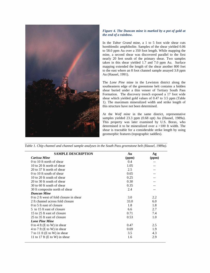
Figure 4. The Duncan mine is marked by a pot of gold at
the end of a rainbow.
In the Tabor Grand mine, a 1 to 5 foot wide shear cuts
hornblendic amphibolite. Samples of the shear yielded 0.06
to 58.0 ppm Au over a 350 foot length. While mapping the
mine, a second shear was discovered parallel to the first
nearly 20 feet south of the primary shear. Two samples
taken in this shear yielded 1.7 and 7.0 ppm Au. Surface
mapping extended the length of the shear another 800 feet
to the east where an 8 foot channel sample assayed 3.8 ppm
Au (Hausel, 1991).
The Lone Pine mine in the Lewiston district along the
southeastern edge of the greenstone belt contains a hidden
shear buried under a thin veneer of Tertiary South Pass
Formation. The discovery trench exposed a 17 foot wide
shear which yielded gold values of 0.47 to 3.5 ppm (Table
1). The maximum mineralized width and strike length of
this structure have not been determined.
At the Wolf mine in the same district, representative
samples yielded 23.3 ppm (0.68 opt) Au (Hausel, 1989a).
This property was later examined by U.S. Borax, who
determined it to be mineralized over a >100 ft width. The
shear is traceable for a considerable strike length by using
geomorphic features (topographic saddles).
___________________________________________________________________________________
Table 1. Chip channel and channel sample analyses in the South Pass greenstone belt (Hausel, 1989a).
___________________________________________________________________________________
SAMPLE DESCRIPTION Au Ag
Carissa Mine (ppm) (ppm)
0 to 10 ft north of shear 0.4 --
10 to 20 ft north of shear 1.05 --
20 to 37 ft north of shear 2.5 --
0 to 10 ft south of shear 0.65 --
10 to 20 ft south of shear 0.25 --
20 to 30 ft south of shear 0.30 --
30 to 60 ft south of shear 0.35 --
30 ft composite north of shear 2.4 --
Duncan Mine
0 to 2 ft west of fold closure in shear 3.0 2.2
2 ft channel across fold closure 33.0 6.0
0 to 5 ft east of closure 1.8 1.8
5 to 15 ft east of closure 6.6 2.7
15 to 25 ft east of closure 0.71 7.4
25 to 35 ft east of closure 0.53 1.0
Lone Pine Mine
0 to 4 ft (E to W) in shear 0.47 2.5
4 to 7 ft (E to W) in shear 0.69 1.9
7 to 11 ft (E to W) in shear 3.5 4.3
11 to 17 ft (E to W) in shear 1.6 2.9
__________________________________________________________________________________

The South Pass greenstone belt has extensive iron deposits in the limbs of the South Pass synclinorium (see Hausel,
1991). The possibility of gold in the iron formation apparently was not considered during the 20 year operation of
the Atlantic City iron mine. More than 90 million tons of iron ore were recovered, but it was not tested for gold.
Samples collected a short distance southwest in the BIF by the author yielded anomalous gold (maximum of 1.3
ppm) as well as samples along the southeastern margin of the greenstone belt.
Hidden gold deposits. There is little doubt that hidden gold deposits underlie Tertiary cover along the northern and
southern margins of the greenstone belt. Both of these deposits are probably major deposits particularly since they
have released millions of ounces of gold during past erosional episodes. The US Geological Survey traced the
McGraw Flats paleoplacers to a source area near Roundtop Mountain immediately east of the Atlantic City Iron Ore
mine (Antweiler and others, 1980). The resulting paleoplacers and placers downslope from this source area were
estimated to potentially host 4 to 5 million ounces of gold. The probably source area is overlain by Tertiary
sediments that most likely cover significant gold mineralization.
At Dickie Springs, enormous paleoplacers were estimated by the US Geological Survey to host as much as 28.5
million ounces of gold (Love and others, 1978) (figure 5). The source of the gold was unknown. However,
exploration by Hecla Mining Company in the 1980s resulted in the discovery of distinct linear magnetic anomaly
marking the edge of the South Pass greenstone belt beneath the present site of the Continental Fault scarp. The
anomaly was accompanied by IP anomalies that suggest potential sulfide facies BIF at depth. Some gold-bearing
sulfide facies iron formation cobbles were found in this area in the paleoplacers during exploration (Foster Howland,
personal communication, 1989).
In addition to the paleoplacers gold, considerable gold has been recovered from modern placers in the South Pass
Greenstone belt (Figure 6).
Figure 5. Gold recovered
from Dickie Springs near
Oregon Buttes. Photo
from J. David Love.
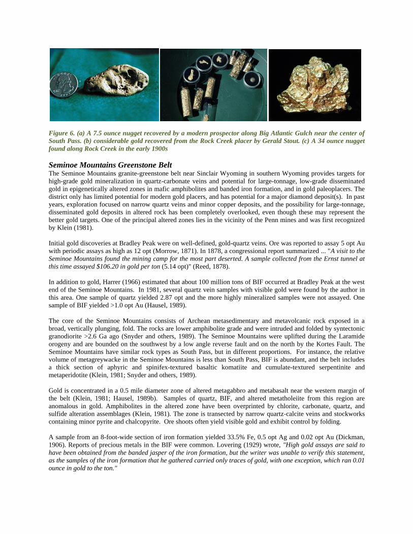
Figure 6. (a) A 7.5 ounce nugget recovered by a modern prospector along Big Atlantic Gulch near the center of
South Pass. (b) considerable gold recovered from the Rock Creek placer by Gerald Stout. (c) A 34 ounce nugget
found along Rock Creek in the early 1900s
Seminoe Mountains Greenstone Belt The Seminoe Mountains granite-greenstone belt near Sinclair Wyoming in southern Wyoming provides targets for
high-grade gold mineralization in quartz-carbonate veins and potential for large-tonnage, low-grade disseminated
gold in epigenetically altered zones in mafic amphibolites and banded iron formation, and in gold paleoplacers. The
district only has limited potential for modern gold placers, and has potential for a major diamond deposit(s). In past
years, exploration focused on narrow quartz veins and minor copper deposits, and the possibility for large-tonnage,
disseminated gold deposits in altered rock has been completely overlooked, even though these may represent the
better gold targets. One of the principal altered zones lies in the vicinity of the Penn mines and was first recognized
by Klein (1981).
Initial gold discoveries at Bradley Peak were on well-defined, gold-quartz veins. Ore was reported to assay 5 opt Au
with periodic assays as high as 12 opt (Morrow, 1871). In 1878, a congressional report summarized ... "A visit to the
Seminoe Mountains found the mining camp for the most part deserted. A sample collected from the Ernst tunnel at
this time assayed $106.20 in gold per ton (5.14 opt)" (Reed, 1878).
In addition to gold, Harrer (1966) estimated that about 100 million tons of BIF occurred at Bradley Peak at the west
end of the Seminoe Mountains. In 1981, several quartz vein samples with visible gold were found by the author in
this area. One sample of quartz yielded 2.87 opt and the more highly mineralized samples were not assayed. One
sample of BIF yielded >1.0 opt Au (Hausel, 1989).
The core of the Seminoe Mountains consists of Archean metasedimentary and metavolcanic rock exposed in a
broad, vertically plunging, fold. The rocks are lower amphibolite grade and were intruded and folded by syntectonic
granodiorite >2.6 Ga ago (Snyder and others, 1989). The Seminoe Mountains were uplifted during the Laramide
orogeny and are bounded on the southwest by a low angle reverse fault and on the north by the Kortes Fault. The
Seminoe Mountains have similar rock types as South Pass, but in different proportions. For instance, the relative
volume of metagreywacke in the Seminoe Mountains is less than South Pass, BIF is abundant, and the belt includes
a thick section of aphyric and spinifex-textured basaltic komatiite and cumulate-textured serpentinite and
metaperidotite (Klein, 1981; Snyder and others, 1989).
Gold is concentrated in a 0.5 mile diameter zone of altered metagabbro and metabasalt near the western margin of
the belt (Klein, 1981; Hausel, 1989b). Samples of quartz, BIF, and altered metatholeiite from this region are
anomalous in gold. Amphibolites in the altered zone have been overprinted by chlorite, carbonate, quartz, and
sulfide alteration assemblages (Klein, 1981). The zone is transected by narrow quartz-calcite veins and stockworks
containing minor pyrite and chalcopyrite. Ore shoots often yield visible gold and exhibit control by folding.
A sample from an 8-foot-wide section of iron formation yielded 33.5% Fe, 0.5 opt Ag and 0.02 opt Au (Dickman,
1906). Reports of precious metals in the BIF were common. Lovering (1929) wrote, "High gold assays are said to
have been obtained from the banded jasper of the iron formation, but the writer was unable to verify this statement,
as the samples of the iron formation that he gathered carried only traces of gold, with one exception, which ran 0.01
ounce in gold to the ton."

In 1981, the author collected select samples of quartz and BIF in the Penn mines area at Bradley Peak. BIF samples
were selected because of physical evidence of epigenetic alteration (crosscutting carbonate veins with pyrite). One
was highly anomalous and yielded 1.36 opt Au. In every sample but one, clear evidence of epigenesis was present.
Another sample yielded anomalous zinc (0.28% Zn), supporting an epigenetic origin for gold. One BIF sample was
found at the Penn Mines that contained visible gold (John Wells, personal communication, 1984).
Vein samples in the vicinity of Bradley Peak generally yield anomalous gold. These are narrow (<3 feet wide),
sulfide-bearing (pyrite and chalcopyrite), quartz-carbonate veins in propyllitically-altered amphibolites (metabasalt
and metagabbro). The propyllitically-altered zone is confined to the eastern half of section 6, T25N, R85W. The
amphibolites are moderately to pervasively altered to chlorite, carbonate, actinolite and epidote. Samples from the
altered zone range from <0.05 ppm to 89.3 ppm (2.6 oz/ton) Au, <1.0 to 55.0 ppm (1.6 oz/ton) Ag, 0.03 to 3.75%
Cu, 3.0 ppm to 0.39% Pb, and 22 ppm to 4.3% Zn.
At a few locations, wallrocks were found that exhibit distinct limonitic alteration and/or are cut by quartz-carbonate
veinlets and were sampled. Limonite-stained metatholeiite with secondary quartz is often anomalous in precious
metal. One sample collected by the author yielded 9.8 ppm Au, 12.0 ppm Ag, and 0.81 % Cu. Another sample of
chloritized metatholeiite yielded 0.12 ppm Au, <1.0 ppm Ag, and 0.09% Cu. A widespread sampling program of
this area is needed.
Quartz veins exhibit three orientations on Bradley Peak (N70°E, N50°W & N-S). Isoclinally folded quartz was
sampled at two locations along Bradley Peak. These yielded anomalous precious metals (4.6 ppm & 6.8 ppm Au, 5.2
ppm & 4.2 ppm Ag) and suggest enrichment in fold closures. Vein-vein and vein-shear intersections could not be
assessed during this study because of lack of exposure.
The Deserted Treasure #1 adit on Bradley Peak was driven across foliation to intersect a N70°E trending, 46°N
dipping vein cropping out on the surface for 300 to 400 feet. A sample of sulfide-bearing boxwork quartz from the
mine dump assayed 1.2 ppm Au and 3.6 ppm Ag and several samples of quartz contained visible gold.
The nearby Deserted Treasure #2 adit was driven across foliation to intersect the same vein. Select samples from the
mine dump were highly anomalous and yielded 0.87 ppm to 89.3 ppm Au, <2.0 to 18.0 ppm Ag, and 0.06 to 0.39%
Cu. In 1981, samples with visible gold were also collected from this dump (Hausel, 1994). At the King mine
located downslope from the Deserted Treasure adits, a select sample yielded 6.8 ppm Au and 4.2 ppm Ag (Hausel,
1994).
The Sunday Morning prospect was developed on a copper-stained shear in metavolcanics. A channel cut across the
shear yielded 1.8% Cu, 45.4 ppm Ag, and 0.07 ppm Au. A grab sample of cupriferous quartz from the dump assayed
5.8% Cu, 26.9 ppm Ag, 2.1 ppm Au and 0.2% Pb. This shear (the Apex shear) is traceable along a northeasterly
trend for 2 miles and is marked by well-developed penetrative foliation. Copper mineralization is confined to small,
localized pods, in the shear zone. Both chrysocolla and cuprite are common. Bishop (1964) reported some visible
gold.
At the Apex adit, a short distance west from the Sunday Morning prospect, the shear grades into a quartz breccia
vein with angular clasts of country rock and more than one generation of quartz. Visible gold was collected near the
portal (Charlie Kortes, personal communication, 1989). Samples assayed 0.1 to 3.81% Cu, 0.3 to 63.8 ppm Ag,
0.001 to 0.013 ppm Au, 61 ppm to 0.95% Pb and 68 ppm to 0.23% Zn.
Gold Placers. Modern placers are not significant as all streams in the district are immature, intermittent and not
conducive to significant placer development. Even so, some placer gold exists in Deweese Creek as it drains the
Penn Mines at Bradley Peak. A large, unexplored, gold and probable diamond paleoplacer occurs along the northern
flank of the range. This Tertiary paleoplacer consists of unconsolidated conglomerate with BIF pebbles, cobbles and
some boulders. Where sampled, colors and flakes of native gold were panned as well as kimberlitic indicator
minerals.
On the east side of the North Platte River, the author recovered visible gold, four grains of chromian diopside and
eight rounded yellow-orange to purple pyrope garnet. The pyropes had characteristic color and scheen of sub-calcic,
high chrome, magnesian pyrope typical of diamond-stability indicators. West of the North Platte River, a second

sample collected more than a mile from the first, yielded gold with pyrope garnets. Some of the garnets were tested
on the University of Wyoming microprobe and all yielded sub-calcic, high chrome magnesian chemistry similar to
G10 diamond stability pyropes. The presence of these garnets suggests the presence of an undiscovered highly
diamondiferous pipe that shed debris into the paleoplacer. The presence of chromian diopside in the sample east of
the North Platte River supports a nearby diamond source and one distinct depression was found upstream from this
location. The roughly elliptical to circular depression is located in granite. At another location, at the junction of
Little Long Creek and Long Creek a few miles to the west, several flakes of visible gold were recovered from the
paleoplacer indicating that this is a widespread, previously unreported gold deposit (Charlie Kortes, personal
communication, 1990).
Rattlesnake Hills greenstone belt The Rattlesnake Hills supracrustal belt is located in the Granite Mountains. Within this belt, a 500 ft long,
mineralized vein (metachert), was found in 1981, and named the Lost Muffler prospect. Composite chip samples 3.6
ft in length were taken in the vein, and assayed 7.5 and 4.5 ppm Au (Hausel, 1989a). Later exploration in this area
intersected auriferous BIF and gold-bearing Tertiary alkalic igneous rock. Drill intercepts included 10 ft of 10.3
ppm Au in BIF and 250 ft of 2.1 ppm in the Tertiary volcanics.
The Rattlesnake Hills (RSH) in central Wyoming form an Archean age greenstone belt intruded by 42 alkalic
intrusives. Several types of gold mineralization have been recognized in the district (Hausel, 1996).
(1) Exhalative gold (moderate to low-grade) in cherts and silicified zones parallel to foliation.
(2) Stockwork gold in basement gneisses
(3) Secondary gold in veinlets crosscutting banded iron formation
(4) Disseminated gold in Tertiary breccias.
The possibility of gold in (1) localized skarns along the northern flank of the exposed RSH and also in (2)
gossaniferous Tertiary alkalic intrusives have not yet been investigated.
Gold in the RSH was initially recognized by Hausel (1996). Since the discovery, several companies have entered the
area beginning with American Copper & Nickel Company a short time following the initial discovery. ACNC
focused on gold-bearing exhalites. Later, Canyon Resources initiated exploration in the district for disseminated
gold, which was followed by Newmont Gold Company. Newmont identified a gold resource of about 250,000
ounces of low-grade gold based on drilling. However, this was based on RC holes that showed gold values of about
1/5th that of a single core hole. Potentially, the gold was being lost in RC drilling and possibly a >1 million once
gold deposit was identified. Currently, Bald Mountain mining is exploring this region.
RSH consists of refolded Archean metamorphic rocks intruded by several Tertiary (42 Ma) alkalic plugs and dikes
(Pekarek, 1977). The Precambrian rocks have been subjected to several episodes of deformation. According to
Hausel (1996), three episodes of folding are recorded in the Precambrian rocks, and at least two later episodes of
brittle deformation disrupted the greenstone terrain during the Phanerozoic.
The RSH is dominated by a thick metagreywacke succession, which encloses 2,000 to 5,000 feet of metatholeiitic
volcanics with minor metasediments that include metagabbro, metabasalt, uncommon graphitic schist and metachert.
The metagreywackes are underlain by 2,500 feet of metavolcanics dominated by well-preserved pillow metabasalts
and amphibolites with minor intercalated ultramafics and intermediate metavolcanic schists.
In the vicinity of three Tertiary alkalic plugs - Goat Mountain, Sandy Mountain, and Oshihan Hill in sections 23, 24,
and 25, T32N, R88W, the metatholeiites and metagreywackes have been brecciated and are locally gossaniferous.
The supracrustals lie in contact with gneiss along the southwestern flank of the belt, which has been fractured and
rehealed producing a stockwork-like network of veinlets. A sample of the iron-stained gneiss (Hausel, 1996).
Other Supracrustal Belts
The Wyoming Province encloses medium to high-rank metamorphosed supracrustal belts. These belts occur in the
Tobacco Root Mountains, the Ruby and Gravelly Ranges of Montana, and the Copper Mountain district of the Owl
Creek Mountains, Wyoming. In Wyoming, the Hartville uplift in the southeastern corner of the Province consists of
relatively low-rank metamorphosed eugeoclinal sedimentary and volcanic rocks with numerous gold anomalies.

Copper Mountain. The Copper Mountain district in the eastern Owl Creek Mountains is interpreted as a high-grade
supracrustal belt (Hausel and others, 1985). It is intensely metamorphosed and isoclinally folded such that all
primary textures have been essentially destroyed or overprinted by foliation. Two mappable units in the belt are
similar in appearance and consist of intercalated amphibolite and quartzofeldspathic gneiss. A third unit is formed of
gneiss, amphibolite, BIF, metapelite, and quartzite.
Scattered mineral deposits in the Copper Mountain district include stratiform scheelite, vein Cu and Au, and REE-
Ta pegmatites. One relatively significant development (the DePass mine) lies along the eastern edge of the district
in a 50 ft wide Proterozoic mafic dike emplaced in Archean granite. This mine was driven into the dike and
produced a minimum of 568,000 lbs of mill concentrates in the early 1900s with receipts for Cu, Au, and Ag. The
mine has more than 11,000 ft of workings (Hausel and others, 1981). Other than the DePass mine, this belt appears
to have little potential for gold mineralization.
Hartville uplift. The Hartville uplift in southeastern Wyoming has yielded more than 5 million lbs of copper and 45
million tons of iron from Archean schists and overlying Phanerozoic rocks. Mineral deposits in the region of
interest for gold include the McCann Pass pyritiferous massive sulfide deposit, and scattered Cu-Ag-Au-U
unconformity deposits. The Silver Cliff mine in the northern portion of the uplift was initially developed for gold
and silver in the 1870s and later mined for uranium in the early and mid 1900s (Hausel, 1989a). Mineralization at
the Silver Cliff is localized in fault gouge and along a Precambrian-Cambrian unconformity.
The Hartville uplift is principally known for its massive hematite. Hematite was mined for many decades from
hematite schist until 1981. Total recorded production amounted to more than 45 million tons of ore with some by-
product copper. These deposits often contain copper as well as anomalous gold. For instance, the Michigan mine in
the central portion of the uplift encloses two hematite pods. The northern ore body contains 75 million tons of 25%
Fe, and the southern deposit contains 41 million tons of 24% Fe (Wilson, undated). The upper portion of these
deposits are copper stained and have anomalous gold (Woodfill, 1987).
Unconformity deposits in the northern Hartville uplift are found at the Silver Cliff shaft. This shaft was developed
on a Precambrian-Phanerozoic unconformity and mineralized reverse fault. Assay reports indicate the ore
contained none to 10.88 % Cu, none to 15.04 opt Ag, 0.001 to 3.39% U3O8 with anomalous gold (Wilmarth and
Johnson, 1954). In the southern portion of the uplift, Kerr McGee explored a copper-stained Precambrian-Paleozoic
unconformity recovering samples with cerargyrite, unmangite, electrum, and native gold (Kerr McGee Corp., 1988).
South of the Silver Cliff mine, a contact between hanging wall dolomite and footwall schist is mineralized over a 1
to 15 ft thickness. Lenses from the Copper Belt Group assayed 2 to 8 % Cu and the adjacent altered iron-stained
schist contained 0.05 to 0.58 opt Au and 2 to 5 opt Ag (Ball, 1907).
In the southern portion of the uplift, an extensive gossan at "Gossan Hill" along the McCann Pass fault was
prospected in the 1970s. Outcrop and shallow drill holes recovered samples with elevated Cu, As, and Zn. Deeper
drilling intersected thick zones of anomalous mineralization including 10 ft of 0.8% Zn, and 2 ft of 1.2 % Zn and
0.08 opt Au (Woodfill, 1987).
PROTEROZOIC MINERALIZATION Most Proterozoic rocks in Wyoming are restricted to the southeastern corner of the state in the Laramie, Medicine
Bow, and Sierra Madre Mountains. Precious and base metals south of the Cheyenne Belt shear zone occur in quartz
veins, massive sulfides, a porphyry, and in layered mafic intrusions. In the Keystone district of the Medicine Bow
Mountains, N60°W-trending shears are loci for narrow veins. These are gold- and copper-bearing, pyritic, quartz-
carbonate veins in tensional faults subsidiary to the Mullen Creek-Nash Fork shear zone (Currey, 1965).
Mineralization was accompanied by silicification in the form of small, irregular quartz veinlets and the wallrock is
enriched in epidote.
Gold was found in quartz and in pyrite and pyrrhotite masses in mylonite selvages adjacent to the vein. The vein lies
in sheared diabase that intrudes quartz-biotite gneiss country rock. The shear is 2 to 6 ft wide, locally splays to 300 ft
and continues 4,500 ft to the southeast to the Florence mine. Available information indicates the Keystone ore
averaged 41 ppm Au. When the Keystone mine ceased operations in 1893, 100,000 tons of reserves were reported

in site. Eight samples collected from the mine dump by Loucks (1976) yielded 6.5 ppm to 300 ppm (0.19 to 8.75
opt) Au and averaged 117 ppm (3.41 opt) Au. At the southeastern end of the Keystone trend, the Florence mine was
developed in quartz diorite. The ore occurred as 'kidneys' of auriferous pyrite which assayed from 257 ppm to 1,656
ppm (7.5 to 48 opt) Au (Currey, 1965). Samples collected from the mine dump by Loucks (1976) yielded values
ranging from 2.06 ppm to 799 ppm (0.06 to 23.3 opt) Au.
Volcanogenic massive sulfide deposits occur in the Green Mountain Formation (Proterozoic) of the southern Sierra
Madre. However, these are zinc and copper dominate and contain very little gold. But at least one deposit in this
terrain in the Laramie Range has been classified as a Au-Cu porphyry. The Copper King mine in the Silver Crown
district west of Cheyenne (Klein, 1974), was developed in weakly foliated and hydrothermally altered quartz
monzonite and granodiorite. A shaft sunk in a potassium-silicate altered zone is surrounded by propylitically altered
rock (Hausel, 1997).
The Copper King was initially drilled by the U.S. Bureau of Mines in the 1950s, later by Asarco, and more recently
by Caledonia Resources, Ltd., Royal Gold and others. Drilling outlined a 35 million ton open pitable ore body
averaging 0.755 ppm Au and 0.21 % Cu (Nevin, 1973). Caledonia Resources outlined a higher grade zone
consisting of 4.5 million tons averaging 1.5 ppm Au that was open in several directions. The Copper King porphyry
is mineralized along a 600 to 700 ft strike length, and a 300 ft width that is open at depth (Stockwatch, 1987).
Currently, the resources suggest a million ounce equivalent deposit of gold with some copper.
Two large layered mafic complexes (1.8 Ga) may have been part of a larger layered complex (Figure 7). This
deposit in the Medicine Bow Mountains has considerable potential for palladium, platinum and vanadium. The 60
mi2 Mullen Creek mafic complex abuts against, and is sheared by, the Mullen Creek-Nash Fork shear zone. This
complex is highly deformed and metamorphosed. Along the northeastern corner of the complex was the historic
New Rambler mine. The New Rambler shaft was collared in sheared and hydrothermally altered mafic rock and
sporadically operated from 1900 to 1918 producing 6,100 tons of copper ore with values in Au, Ag, Pt, and Pd
(Hausel, 1989a). The source of the platinoids was suggested by McCallum and Orback (1968) to be hydrothermally
remobilized from a platinum reef hidden at depth. Six miles east of the Mullen Creek mafic complex is a second
layered intrusive (Lake Owen complex). This intrusive is of similar size, but is essentially unmetamorphosed.
Exploration activities in the past few years have isolated some significant Pt, Au, and Pd anomalies in the complex.
Figure 7. Location map of
the Wyoming Platinum-
Palladium-Nickel province
which encloses the Mullen
Creek, Lake Owen and
Puzzler Hill deposits.
North of the shear,
precious metals are found
in narrow veins and in
thick quartzites with some
copper. Gold was detected
in quartz pebble
conglomerate and in shear
zones in this area. Vein
deposits in the Gold Hill
district occur as narrow,
rich, quartz veins with
common visible gold.
Specimen samples testify
to the richness of the veins.
Historic reports claim some
specimen grade material from the Acme mine at Gold Hill assayed 2,100 opt Au. Unfortunately, these veins are
narrow (0.5-2 ft wide) and spotty. One shear examined by the author in the Lewis Lake area of the Medicine Bow
Mountains is >100 ft wide and traceable for 2,000 ft. The shear occurs in limonitic quartz-mica schist. Samples of
pyritized schist from the shear yielded 4.1 ppm (0.12 opt) Au (Dersch, 1990).
Mineralized quartzites occur at several localities in the Sierra Madre. Gossans in quartzites were prospected in the
late 1800s and led to the development of some important copper mines. Two prominent mines were the Ferris-
Haggerty and the Doane-Rambler. The Ferris-Haggerty is interpreted as a remobilized stratabound deposit (Hausel,
1986). During its operation (1902 to 1908) the Ferris-Haggerty was an internationally prominent mine. The massive
chalcocite minor chalcopyrite ore was found filling irregular quartzite breccias along the contact between hanging
wall schist and the underlying quartzite (Spencer, 1904) of the Magnolia Formation. Ore shoots greater than 20 ft
thick were high-graded for the rich (30-40 % Cu) ore, and much of the lower grade material was left as waste. These
shoots averaged 6 to 8 % Cu and carried some Au and Ag (Beeler, 1905; Spencer, 1904). Beeler (1905) reported the
ore contained 3.4 to 15 ppm (0.1-0.44 opt) Au. The mine was mapped during World War II, and according to Ralph
E. Platt (pers. comm., 1988), the steeply dipping quartzite flattens out in the lower mine workings and large blocks
of "low grade" ore (6-8% Cu) remain in place. The property was explored for stratiform Cu-Au-Ag mineralization
by Exxon Minerals in the early to mid 1980s and significant gold anomalies were discovered. More recently, the ore
zone was examined by the author. The ore has the appearance of a copper-bearing Protorozoic metaconglomerate.
Proterozoic age quartz pebble conglomerate occurs in the thick miogeoclinal wedge in the northern Medicine Bow
Mountains and Sierra Madre. These conglomerates were of considerable interest in the late 1970s after they were
discovered to be radioactive (Houston and Karlstrom, 1979). During the mapping of these conglomerates some
samples were tested for precious metal content. Gold values as high as 10 ppm were detected from a conglomerate
near Dexter Peak in the Sierra Madre. Even though similarities to the Witwatersrand conglomerates have been noted
(e.g. Karlstrom and others, 1981), these rocks still have received only minor attention for gold. Exxon explored and
drilled some of the conglomerates in the late 1970s in search of U and Th.
PHANEROZOIC MINERALIZATION Gold anomalies are scattered throughout the Phanerozoic record, although most are weak with the exception of gold
associated with some Tertiary volcanics, paleoplacers and some modern placers. The Cenozoic of Wyoming
includes poorly studied and unexplored gold and silver deposits and anomalies. Only a few are discussed and the
reader is referred to Hausel (1989a) for a treatise on these.
In northwestern Wyoming, paleoplacers and associated reworked modern placers cover an extensive region. These
quartzitic conglomerates and sandstones range in age from Late Cretaceous to Miocene and include associated
Quaternary placers. The average gold content is anomalous, and the gold is very fine (Table 3) (Antweiler and Love,
1967). Most past prospecting activities have been confined to reworked alluvial and bench placers primarily along
the Hoback and Snake Rivers.
_____________________________________________________________________
Stratigraphic unit Average Au (ppb) Maximum assay (ppb)
Quaternary alluvium 103 2,000
Miocene (?) conglomerate 65 290
Pass Peak Fm(Eocene) 47 250
Wind River Fm(Eocene) 222 2,000
Early? Eocene conglomerate 94 400
Pinyon Conglomerate
(Paleocene)
86 6,000
Ft Union Fm (Paleocene) 35 300
Harebell Fm (Late Cretaceous) 65 1,000
Table 3. Reported gold content of conglomerates in northwestern Wyoming (Antweiler and Love, 1967).
________________________________________________________________________________
At the Twin Creek paleoplacer on the northeastern margin of the South Pass greenstone belt, more than one billion
cubic yards of gold-bearing gravel were described by Antweiler and others (1980). The Oregon Buttes paleoplacer
along the southern margin of the South Pass greenstone belt is estimated to contain more than 28.5 million ounces of
gold (Love and others, 1978). Other significant paleoplacers occur in and along the margins of the greenstone belt,
but for the most part remain unexplored.
In 1910, gold was discovered along the Wind River, Little Wind River, and Popo Agie River in the basin. The
precious metal was found in terrace gravels capping benches and buttes and in the nearby plains, mesas, and uplands
for thousands of feet to a few miles from the present drainages. The deposits were reported to average 12 to 14 feet
thick over widths of 3 to 4 miles. The gold is very fine tablet-like particles smaller than a pinhead. In 1913, gravels
were tested and varied from none to 0.016 oz/yd3 and averaged less than 0.0025 oz/ yd3 Au. Two dredges operated
in the Wind River. The Neble Dredge operated in a pay zone that ranged from 0.007 to 0.016 oz/ yd3 and averaged
0.014 oz/ yd3. The gold-bearing gravels averaged about 22 feet thick. The Clark Dredge, a few miles west of the
Neble Dredge, treated gravels averaged 0.038 oz/ yd3 (Schrader, 1913). The demise of the district was the gold was
too fine to be recovered efficiently.
In the Black Hills, mineralization is reported in the Tertiary alkalic complexes of the Bear Lodge Mountains,
Mineral Hill district, and Black Buttes. In the Bear Lodge Mountains, gold has been reported in fluorite veins,
pegmatites, and in feldspathic breccia. A potential for large auriferous breccias in alkalic host rocks in this area is
considered very high. One elongate intrusive breccia (120 by 2,000 ft) contained disseminated gold ranging from
0.34 to 1.7 ppm. The deposit averages 0.72 ppm (International Curator Resources Ltd, 1988 Ann. Rept.). This region
also includes one of the largest, low-grade rare earth and thorium deposits in the United States (Staatz, 1983).
The Mineral Hill district to the east has a history of placer gold and tin production. The author identified two
horizontal pyritiferous quartz veins at the Treadwell open cut that yielded maximum gold values of 130 ppm (3.79
opt) and silver values as high as 330 ppm (9.62 opt) (Hausel, 1997). Previous work in the district by Welch (1974)
identified several gold anomalies including a jasperoid that assayed 5 ppm Au and 7 ppm Ag. Black Buttes lies 8
miles west of Mineral Hill and is formed of Tertiary phonolites and trachytes intruded into Paleozoic limestone.
Contact replacement mineralization (Zn, Pb, Ag, Mo, F) occurs in the Pahasapa Limestone (Mississippian), but the
surface exposures are limited (Hausel, 1989a).
The Absaroka Mountains in northwestern Wyoming include several Cu-Ag porphyry complexes, several of which
are located within wilderness. These two porphyries contain anomalous Cu, Mo, Pb, Zn, Ag, Au, and Ti, and include
disseminated, stockwork, and vein mineralization (Hausel, 1982). Published reports indicate the porphyry hosts a
minimum of 1.23 billion lbs of Cu, 13,500 lbs of Mo, 121,000 oz of Au, and 5.6 million ounces of Ag (Paydirt,
1985). The contained metals are worth a minimum of $1.5 billion at 1989 prices. Some vein samples collected at
the back of some silver mines in the district averaged >100 opt Ag over the width of the veins and shear zones.
Throughout Wyoming, many enigmatic gold anomalies have been reported. These include gold associated with coal
in the Black Hills, gold anomalies in uranium roll fronts (Gordon Marlatt, pers. comm., 1989). Marlatt investigated a
200 mi2 anomaly in the Green River Basin in the vicinity of Farson (south of South Pass) and recovered one sample
with visible gold. The gold occurred as a irregular-shaped microscopic sliver. Many of these anomalies are possibly
due to detrital gold eroded from nearby gold districts. But others are not easily explained by detrital transportation
but instead may represent geochemically transported gold leached from Tertiary ash falls (Gordon Marlatt, pers.
comm., 1988). Other gold anomalies were detected in a number of locations along the northern edge of the Medicine
Bow Mountains near Arlington (Hausel and others, 1994). Most remain unexplored.
Most commercial modern placers in the State were mined for gold, although the Douglas Creek placers in
southeastern Wyoming also possess platinum and palladium and potentially diamonds, the Clarks Camp placers in
the northern Wind River Range contain anomalous monazite in addition to gold, and the Mineral Hill placers in
northeastern Wyoming also have tin, tantalite, and magnetite. Monazite placers also occur in the Shirley Basin in
southeastern Wyoming (J.D. Love, pers. comm., 1990). Statistics on gold nuggets are incomplete, although walnut-
size nuggets have been recovered from the Mineral Hill district, the Douglas Creek district, and the South Pass
greenstone belt. The largest nugget found in Wyoming may have been a 34 ounce nugget from Rock Creek in the
South Pass greenstone belt. History also records a boulder with nearly 40 pounds of gold was found in the same
area prior to 1905 (Hausel, 1989a). This region also has several potentially rich, but unexplored placers (Hausel,
1991). Many other placers have also yielded significant gold including the Douglas Creek district in the Medicine
Bow Mountains and some placers in the Sierra Madre (figure 8).

Figure 8. Placer gold from Douglas Creek
near the Keystone mine.
SUMMARY Significant gold mineralization in Wyoming
has been identified in Archean greenstone
belts, Tertiary alkalics, and in Tertiary
paleoplacers. The geology of the state suggests
that some major gold deposits remain
undiscovered and unexplored in some of these
regions. The author anticipates that continued
rise in gold prices will lead to significant gold
discoveries in several of these areas including
South Pass, Seminoe Mountains, Rattlesnake
Hills, Bear Lodge and Mineral Hill in particular.
REFERENCES Allen, F.S., 1942, "Letter to the Board of Directors of the Polaris Mining Company," Geological Survey of
Wyoming, mineral files (unpublished), 3p.
Allsman, P.T., Majors, F.H., Mahoney, S.R., and Young,W.A.,1949, "Investigation of Sublette Ridge vanadium
deposits, Lincoln County, Wyoming," U.S. Bureau of Mines, Report of Investigations 4476, 8p.
Antweiler, J.C., and Love, J.D., 1967, "Gold-bearing sedimentary rocks in northwest Wyoming-A preliminary
report," U.S. Geological Survey, Circular 541, 12p.
Antweiler, J.C., Love, J.D., Mosier, E.L., and Campbell, W.L., 1980, "Oligocene gold-bearing conglomerate,
southeast margin of Wind River Mountains, Wyoming," Wyoming Geological Association, 32nd Annual Field
Conference Guidebook., p.223-237.
Ball, S.H., 1907, "Copper deposits of the Hartville uplift, Wyoming," U.S. Geological Survey Bulletin 315-B, p. 93-
107.
Bayley, R.W.,1968, "Ore deposits of the Atlantic City district, Fremont County, Wyoming," in J.D. Ridge (end), Ore
Deposits of the United States, 1933-1967, AIME, New York, N.Y, p. 589-604.
Bayley, R.W., and James, H.L., 1973, "Precambrian iron-formations of the United States," Economic Geology, v.
68, p. 934-959.
Beeler, H.C., 1905, "Mining in the Grand Encampment copper district, Carbon and Albany Counties, Wyoming,"
Office of the State Geologist, misc. rept., Cheyenne, 32p.
Beeler, H.C., 1908, "A brief review on the South Pass gold district, Fremont County, Wyoming," Office of the State
Geologist, misc. rept., Cheyenne, 23p.
Boberg, W.W.,1986, "Lake Alice copper district, Lincoln County, Wyoming," in S. Roberts (ed), Metallic and
Nonmetallic Deposits of Wyoming and Adjacent Areas, Geological Survey of Wyoming, Public Information
Circular 25, p.54-55.
Borrowman, S.R., and Rosenbaum, J.B., 1962, "Recovery of thorium from a Wyoming ore," U.S. Bureau of Mines,
Report of Investigations 5917, 8p.
Bow, C.S., 1986, "Structural and lithologic controls on Archean greywacke-hosted gold mineralization within the
Sweetwater district, Wyoming, USA," in Turbidite-Hosted Gold Deposits, Geological Association of Canada,
Spec. Pap. 32, p.107-118.
Condie, K.C., 1976, "The Wyoming Province in the western United States," in B.F. Windley (ed), The Early History
of the Earth, John Wiley & Sons, New York, p.499-510.
Conoco Minerals Company,1982, "Summary report on the Huston and Fletcher Parks massive sulfide deposits,"
Geological Survey of Wyoming, mineral files, 82p.
Currey, D.R.,1965, "The Keystone gold-copper prospect area, Albany County, Wyoming," Geological Survey of
Wyoming, Preliminary Report 3, 12p.
Darton, N.H.,1906, "Mineral resources of the Bighorn Mountain region," U.S. Geological Survey, Bulletin 285,
p.303-310.
deQuadros, A.M.,1989, "Report on the diamond drill program July-August 1989 at the Carissa mine property, South
Pass City, Fremont County, Wyoming, for Consolidated McKinney Resources Ltd.," Vancouver, B.C.:
(unpublished report), 76 p., plus drill logs and assays.
Dersch, J.S., 1990, "Snowy Range withdrawal," U.S. Bureau of Land Management, Mineral Report WYW-115104,
19p.
Graff, P.J., Sears, J.W., Holden, G.S., and Hausel, W.D., 1982, Geology of Elmers Rock greenstone belt, Laramie
Range, Wyoming: Geological Survey of Wyoming Report of Investigations 14, 22 p.
Harrer, C.M., 1966, "Wyoming iron-ore deposits," U.S. Bureau of Mines, Information Circular 8315, 114p.
Hausel, W.D.,1982, "General geologic setting and mineralization of the porphyry copper deposits, Absaroka
volcanic plateau, Wyoming," Wyoming Geological Association, 33rd Annual Field Conference Guidebook,
p.297-313.
Hausel, W.D.,1986, "Mineral deposits of the Encampment mining district, Sierra Madre, Wyoming-Colorado,"
Geological Survey of Wyoming, Report of Investigations 37, 31p.
Hausel, W.D., 1987, "Structural control of Archean gold mineralization within the South Pass greenstone terrain,
Wyoming (USA)," in R.W. Hurst, T.E. Davis, and S.S. Augustithis (eds), The Practical Applications of Trace
Elements And Isotopes to Mineral Resource Evaluation, Theophrastus Publications, Athens, Greece, p.199-216.
Hausel, W.D., 1989a, Geology of Wyoming's Precious Metal Lode and Placer Deposits: Geological Survey of
Wyoming, Bulletin 68, 248p.
Hausel, W.D.,1989b, "Precambrian geology of the Seminoe gold district, Bradley Peak Quadrangle, Carbon County,
Wyoming," Geological Survey of Wyoming, Open File Report 89-10, scale 1:24,000.
Hausel, W.D., 1990a, "Geologic map of the South Pass granite-greenstone belt, southern Wind River Mountains,
Wyoming," Geological Survey of Wyoming, Report of Investigations 44, scale 1: 48,000.
Hausel, W.D., 1990b, "Au, Ag, Cu, Zn, Pb, Cr, and Ni anomalies from rock samples from Bradley Peak, Seminoe
Mountains," Geological Survey of Wyoming, Mineral Report 90-2 (unpublished), 10 p.
Hausel, W.D.,1991, "Economic geology of the South Pass granite-greenstone belt, Wind River Mountains, western
Wyoming," Geological Survey of Wyoming, Report of Investigations 44, 129 p.
Hausel, W.D., 1993, Metal and gemstone deposits of Wyoming in Geology of Wyoming: Geological Survey of
Wyoming Memoir 5, p. 816-835.
Hausel, W.D., 1994, Economic geology of the Seminoe Mountains mining district, Carbon County, Wyoming:
Wyoming State Geological Survey Report of Investigations 50, 31 p.
Hausel, W.D., 1996, Economic geology of the Rattlesnake Hills supracrustal belt, Natrona County, Wyoming:
Geological Survey of Wyoming Report of Investigations 52, 28 p.
Hausel, W.D., 1997, Geology of Wyoming’s Copper, Lead, zinc, Molybdenum and Associated Metal Deposits:
Geological Survey of Wyoming Bulletin 70, 224 p.
Hausel, W.D., Graff, P.J., and Albert, K.G.,1985, "Economic geology of the Copper Mountain supracrustal belt,
Owl Creek Mountains, Fremont County, Wyoming," Geological Survey of Wyoming, Report of Investigations
28, 33p.
Hausel, W.D., and Hull, J.M., 1990, "Guide to gold mineralization and Archean geology of the South Pass
greenstone belt, Wind River Range, Wyoming," in Sheila Roberts (ed), Geologic Field Tours of Western
Wyoming, and Parts of Adjacent Idaho, Montana, and Utah: Geological Survey of Wyoming, Public
Information Circular 29, p. 178-191.
Hausel, W.D., Marlatt, G.G., Nielsen, E.L., and Gregory, R.W., 1994, Study of metals and precious stones in
southern Wyoming: Geological Survey of Wyoming Open File Report 94-2, 61 p.
Houston, R.S., 1983, "Wyoming Precambrian Province-example of the evolution of mineral deposits through
time?", in Sheila Roberts, (ed), Metallic and Nonmetallic deposits of Wyoming and Adjacent Areas, 1983
Conference Proceedings: Geological Survey of Wyoming, Public Information Circular 25, p.1-12.
Houston, R.S., and Karlstrom, K.E.,1979, "Uranium-bearing quartz pebble conglomerates-exploration model and
United States resource potential," U.S. Department of Energy, Open File Report GJBX-1(80),510p.
Karlstrom, K.E., Houston, R.S., Flurkey, A.J., Coolidge, C.M., Kratochvil, A.L., and Sever, C.K.,1981, "Volume 1,
A summary of the geology and uranium potential of Precambrian conglomerates in southeastern Wyoming,"
U.S. Department of Energy, Open File Report GJBX-139(81), 541p.
Kerr McGee Corporation, 1988, "Letter and report to W. D. Hausel from W.P. Leedy on the discovery of umangite,"
Geological Survey of Wyoming, mineral files, 7p.
King, J.K.,and Harris, R.E.,1987, "Rare earth elements and yttrium in Wyoming," Geological Survey of Wyoming,
Open File Report 87-8, 43p.

Klein, T.L.,1974, "Geology and mineral resources of the Silver Crown district, Laramie County, Wyoming,"
Geological Survey of Wyoming, Preliminary Report 14, 27p.
Klein, T.L.,1981, "The geology and geochemistry of the sulfide deposits of the Seminoe district, Carbon County,
Wyoming," Ph.D. thesis, Colorado School of Mines, Golden, 232p.
Loose, S.A., and Boberg, W.W.,1987, "Sedimentary facies control on mineralization at the Lake Alice district in the
Wyoming Overthrust Belt," Wyoming Geological Association, 38th Annual Field Conference Guidebook,
p.309-327.
Loucks, R.R.,1976, "Platinum-gold-copper mineralization, central Medicine Bow Mountains, Wyoming," M.S.
thesis, Colorado State University, Fort Collins, 290p.
Love, J.D.,1984, "Gold, silver, and other selected trace elements in the Phosphoria Formation of western Wyoming,"
Wyoming Geological Association, 35th Annual Field Conference Guidebook, p.379-391.
Love, J.D., and Antweiler, J.C.,1973, "Copper, silver and zinc in the Nugget Sandstone, western Wyoming,"
Wyoming Geological Association, 25th Annual Field Conference Guidebook, p.139-147.
Love, J.D., Antweiler, J.C., and Mosier, E.L.,1978, "A new look at the origin and volume of the Dickie Springs-
Oregon Gulch placer gold at the south end of the Wind River Mountains," Wyoming Geological Association,
30th Annual Field Conference Guidebook, p.379-391.
McCallum, M.E., and Orback, C.J.,1968, "The New Rambler copper-gold-platinum district, Albany and Carbon
Counties, Wyoming," Geological Survey of Wyoming, Preliminary Report 8, 12p.
McKinney, A.A., and Horst, H.W.,1953, "Deadwood conglomerate monazite deposit, Bald Mountain area, Sheridan
and Big Horn Counties, Wyoming," U.S. Atomic Energy Commission, RME-3128, 40p.
Nevin, A.E.,1973, "Interim report, Copper King property, Laramie County, Wyoming," Henrietta Mines Ltd.
company report: Geological Survey of Wyoming, mineral files (unpublished), 16p.
Schrader, F.C.,1913, "Gold placers on Wind and Bighorn Rivers, Wyoming," U.S. Geological Survey, Bulletin 580,
p.127-143.
Snyder, G.L., Hausel, W.D., Klein, T.L., Houston, R.S., and Graff, P.J.,1989, "Precambrian rocks and
mineralization, southern Wyoming Province," 28th International Geological Congress, Field Trip Guidebook
T332, 48p.
Spencer, A.C.,1904, "Copper deposits of the Encampment district, Wyoming," U.S. Geological Survey, Professional
Paper 25, 107p.
Spry, P.G., and McGowan, K.I.,1989, "Origin of Archean lode gold mineralization at Atlantic City-South Pass,
Wyoming: fluid inclusion stable isotope study," 28th International Geological Congress, Abstracts, v.3. p.3-163.
Staatz, M.H.,1983, "Geology and descriptions of thorium and rare earth deposits in the southern Bear Lodge
Mountains, northeastern Wyoming," U.S. Geological Survey, Professional Paper 1049-D, 52p.
Stockwatch, 1987, "Exploration update on Caledonia Resources Ltd.," September, 1987, Canjex Publishing, Ltd.,
Vancouver, B.C., p.9
Thurston, P.B.,1986, "Geochemistry and provenance of Archean metasedimentary rocks in the southwestern
Beartooth Mountains: M.S. Thesis, Montana State University, Bozeman, 74p.
Welch, C.M.,1974, "A preliminary report on the geology of the Mineral Hill area, Crook County, Wyoming," M.S.
thesis, South Dakota School of Mines, Rapid City, 83p.
Wilmarth, V.R., and Johnson, D.H.,1954, "Uranophane at Silver Cliff mine, Lusk, Wyoming," U.S. Geological
Survey, Bulletin 1009-A, 12p.
Wilson, W.H., undated, "Muskrat Creek", Geological Survey of Wyoming, mineral files (unpublished), 6p.
Wilson, W.H.,1951, "A monazite deposit in the Big Horn Mountains, Sheridan and Big Horn Counties, Wyoming,"
Geological Survey of Wyoming, Mineral Report 51-3 (unpublished), 3p.
Woodfill, R.D.,1987, "Hartville uplift, southeastern Wyoming", unpublished consultant's report, Geological Survey
of Wyoming, mineral files, 20p.