serving residents of northeast kansas since 1878 the ... · students gained appreciation for the...
TRANSCRIPT
Ariel Cohen (NWS Topeka,
KS, Science and Operations
Officer) teamed up with Brian
Haines (NWS Wilmington,
OH, Forecaster), Alan
Gerard (Chief of the National
Severe Storms Laboratory
Warning Research and
Development Division), Lisa
Gerard (Alan’s wife), and John
Banghoff (graduate student in
meteorology at Pennsylvania
State University) to deliver a
dozen classes of instruction
and hands-on severe weather
forecasting activities to
approximately 350 students at
Ariel’s hometown schools in Worthington and
Columbus, Ohio.
At Ariel’s high school, Thomas Worthington
High School, the presenters introduced ninth
grade students in the Science, Technology,
Engineering, and Math (STEM) program and
general science classes to meteorological
analysis and forecasting. Students learned about
the ingredients for severe thunderstorms, and
how hand analysis of weather observations
plays a key role in diagnosing environmental
conditions potentially favorable for severe
storm development. The presenters guided
students through a hands-on activity, in which
the freshmen manually analyzed their own
surface weather maps corresponding to a
tornado event. They simulated the issuance and
verification of their own Tornado Watches
based upon their analyses, and even
experienced the importance of leading team
collaboration and consensus-building for
forecasts. Students gained appreciation for the
importance of studying science to message
potentially critical, life-saving information
pertinent to severe thunderstorms and
tornadoes.
For the students at Ariel’s elementary school,
Worthington Estates Elementary School, this
was an opportunity to introduce fourth graders
to the basics of weather and forecasting, along
with severe weather safety. Students rotated
through different classrooms in which present-
ers showed photos and videos illustrating
severe storms and tornadoes, discussed severe
weather safety, illustrated remote sensing and
meteorological instrumentation, and led hands-
on activities in which students created their
own weather instruments.
NWS Topeka Meteorologists Give Back
to their Hometown Schools
The Topeka Tiller N a t ion a l
We a th e r S e rv i c e
To pe k a , KS
Volume 11, Issue 1 Spring 2018
By Ariel Cohen, Science and Operations Officer
Serving Residents of Northeast Kansas Since 1878
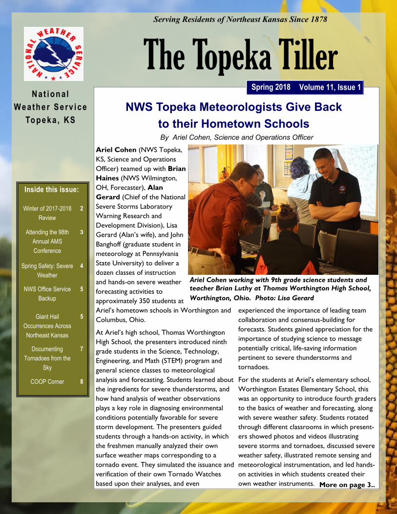
Ariel Cohen working with 9th grade science students and
teacher Brian Luthy at Thomas Worthington High School,
Worthington, Ohio. Photo: Lisa Gerard
More on page 3..
Inside this issue:
Winter of 2017-2018
Review
2
Attending the 98th
Annual AMS
Conference
3
Spring Safety: Severe
Weather
4
NWS Office Service
Backup
5
Giant Hail
Occurrences Across
Northeast Kansas
5
Documenting
Tornadoes from the
Sky
7
COOP Corner 8

Winter of 2017-2018 Review
Winter conditions in the area were generally less
severe than normal. Light to moderate wintry
precipitation events were fairly frequent, but
heavy amounts did not fall during any one storm
and helped keep the total precipitation for the
season below normal. Although there were
several days of both well above and well below
normal temperatures, on the whole,
temperatures for the season were very close to
normal.
The first month of the season brought a variety
of conditions. Temperatures on December 4
were quite warm, peaking in the middle 60s to
lower 70s, including a record high of 68 degrees
at Concordia. Light snow fell across the area on
Christmas Eve, with 0.5 to 2.5 inch amounts
common and the highest amounts near the
Nebraska border. Very cold air moved into
Kansas December 31 with wind chill values as
low as -15 to -25 degrees and low temperatures
on New Year’s Day of -4 to -15 degrees.
The middle and end of January saw a variety of weather
conditions as well. Three light precipitation events
occurred from January 11 to January 14, the heaviest on
January 11 when 2 to 4 inches of snow and light freezing
rain fell. Another surge of very cold air reached
the state January 15 and 16 with wind chills both
days in the -15 to -20 degree range. Just five
days later, on January 21, temperatures rose into
the middle 60s, feeling around 85 degrees
warmer. Warm conditions returned January 25
with highs in the 60s and a record high
temperature of 68 degrees set at Topeka.
The first ten days of February saw three light
snowfall events with 0.5 to 3 inch amounts
common in each one. A wider variety of
precipitation fell from February 19 through
February 22. Hail up to the size of nickels fell in
portions of Marshall and Riley counties in the
late evening of February 19, while much of
northeast and east central Kansas experienced
freezing rain and sleet accompanied by some
thunderstorms on February 20. Light freezing
rain and freezing drizzle returned to much of this
same area on February 22.
Topeka Tiller Page 2
By Kyle Poage, General Forecaster
Map depicting the departure of average temperatures from
normal for the winter.
Map depicting the departure of average precipitation from normal
for the winter.

The team of presenters also led atmospheric sciences
students at Ariel’s and John’s alma mater, Ohio State
University, through a severe weather forecasting workshop,
where students used meteorological data to collaborate
their own simulated outlooks in small groups, before
reaching a class outlook consensus. Students learned the
value of collaboration and teamwork in providing an
improved, unified, and consistent message of important
forecast information.
This is the second year that Ariel has worked with Alan,
Lisa, and others to deliver outreach to his hometown
schools. Students and teachers have shown tremendous
appreciation for the meteorologists giving back to the
schools, which not only strengthens bonds between the
NWS and the community, but also motivates students to
achieve their dreams. Yet another meteorologist at NWS
Topeka has undertaken similar initiatives. NWS Topeka
Meteorologist Bryan Baerg has also reached out to his
middle school in McPherson, KS, McPherson Middle School,
where he presented to around 300 students in the past
year. He taught students about what a day in the life of an
NWS employee is like, severe storm ingredients, weather
safety, and career paths in meteorology. Similar to Ariel for
his hometown schools, this was a very special opportunity
for Bryan to inspire students at his hometown school to
pursue their dreams.
Page 3 Volume 11, Issue 1
NWS Topeka Meteorologists Give Back to their Hometown
Schools (continued)...
Bryan Baerg (NWS Topeka, KS) speaking to students
at McPherson Middle School in McPherson, KS.
From January 7th-11th, 2018, NWS meteorologist Audra
Hennecke attended the 98th Annual American
Meteorological Society (AMS) Conference in Austin,
Texas. The annual AMS meeting is the largest gathering of
weather, water, and climate communities in the world, and
this year over 4,000 scientists, educators, students, and
other professionals attended. Such conferences provide a
valuable opportunity to share, learn, and collaborate on a
broad range of topics within the weather, water, and climate
communities. This year the theme of the conference was
“Transforming Communication in the Weather, Water, and
Climate Enterprise,” which is very fitting considering the
growing technological ways in which we can communicate
critical weather information to both core partners and the
public. By the numbers, this conference was made up of 419
sessions, 2,181 oral presentations, 1,126 poster
presentations, and 21,900 sq. ft. of special exhibits.
One of those 2,181 oral presentations was done by Audra,
where she presented: “A Social Science Analysis of
Weather Messaging in the Decision Support Services
Situation Report for Northeast Kansas Integrated Warning
Team Core Partners.” This presentation shared the results
from the social science analysis that was done on feedback
received from NWS core partners through a survey and
small focus groups. This analysis focused on gathering
information regarding the usefulness of weather messaging
within the Situation Report product, how this product is
utilized during their decision-making process, and what
improvements can be made to ensure consistent clear and
concise weather messaging. Presenting at this conference
provided an amazing opportunity to share this valuable
information with others in the weather community
(especially within the NWS) so that they too can hopefully
apply these results to improve how they communicate
hazardous weather information to their core partners.
Attending the 98th Annual AMS Conference
Spring Safety: Severe Weather
Although the spring season has started off cold and dreary,
temperatures are bound to warm up and severe weather
season once again takes over the central Plains. Are you
prepared and have a plan ready to go when a warning is
issued? Do you know how to receive warning information
no matter where you are at? Reduce your risk from
severe weather by paying attention to weather conditions
and having a plan in place on where to go and what to do
when a warning is issued!
No matter what the weather hazard, put together a plan
that indicates where you and your family will go in the
event a severe thunderstorm, flash flood, or tornado
warning is issued. Make sure to practice that plan as
people are much more likely to follow through if they have
already practiced it at least once. Also, be sure you have
at least two methods to receive weather information and
warnings, and think about what you would do if the power
goes out.
Wireless Emergency Alerts are a new way to get this
information directly onto your mobile device. Warnings
are essentially “pushed” to your phone and use GPS in
order to alert you when you are in or enter an area where
this is a warning. Besides this, there are many other free
or low cost options available for your mobile device.
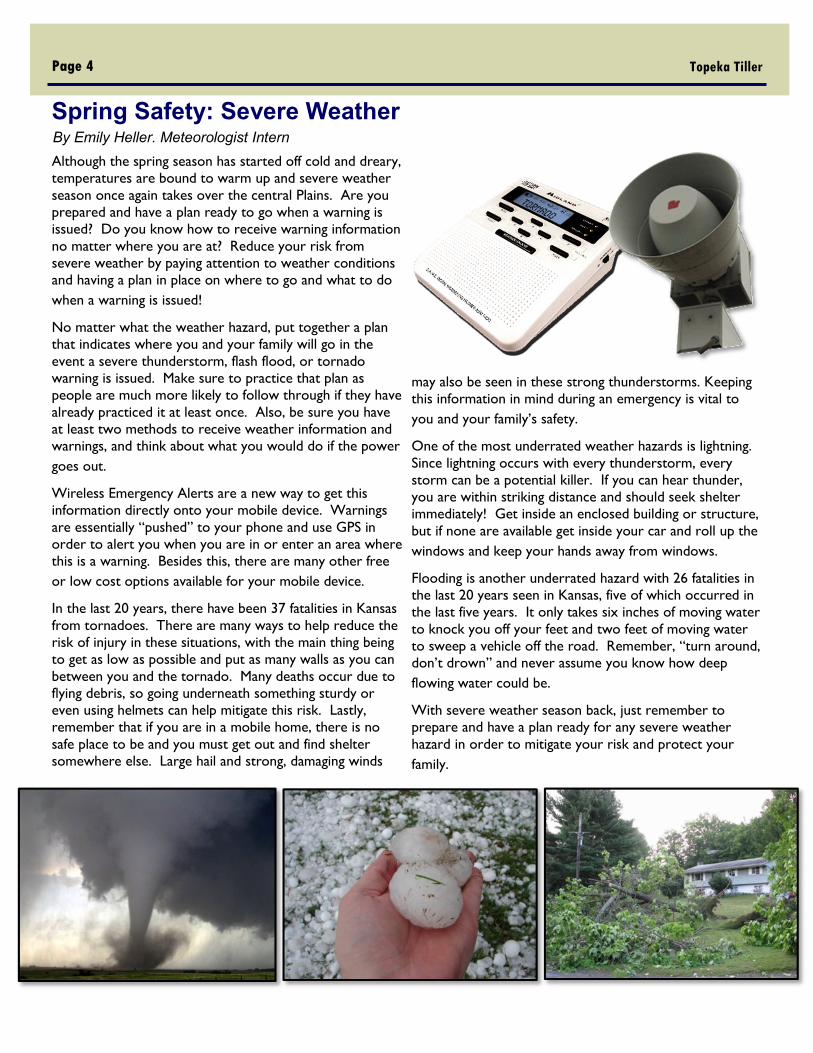
In the last 20 years, there have been 37 fatalities in Kansas
from tornadoes. There are many ways to help reduce the
risk of injury in these situations, with the main thing being
to get as low as possible and put as many walls as you can
between you and the tornado. Many deaths occur due to
flying debris, so going underneath something sturdy or
even using helmets can help mitigate this risk. Lastly,
remember that if you are in a mobile home, there is no
safe place to be and you must get out and find shelter
somewhere else. Large hail and strong, damaging winds
may also be seen in these strong thunderstorms. Keeping
this information in mind during an emergency is vital to
you and your family’s safety.
One of the most underrated weather hazards is lightning.
Since lightning occurs with every thunderstorm, every
storm can be a potential killer. If you can hear thunder,
you are within striking distance and should seek shelter
immediately! Get inside an enclosed building or structure,
but if none are available get inside your car and roll up the
windows and keep your hands away from windows.
Flooding is another underrated hazard with 26 fatalities in
the last 20 years seen in Kansas, five of which occurred in
the last five years. It only takes six inches of moving water
to knock you off your feet and two feet of moving water
to sweep a vehicle off the road. Remember, “turn around,
don’t drown” and never assume you know how deep
flowing water could be.
With severe weather season back, just remember to
prepare and have a plan ready for any severe weather
hazard in order to mitigate your risk and protect your
family.
Topeka Tiller Page 4
By Emily Heller. Meteorologist Intern

Page 5 Volume 11, Issue 1
When NWS Offices Need Backup
It was a dark and stormy night, but rest assured that the
staff at the National Weather Service in Topeka is on duty
and issuing warnings to help protect the people of
northeast Kansas. A supercell thunderstorm producing a
tornado takes direct aim at the National Weather Service
office itself, and the staff needs to take cover...what then?
The National Weather Service has a plan in place for just
such an emergency. Whether it's a physical threat to the
office such as a tornado or a large scale software upgrade,
each office within the NWS has both backup office
responsibilities for other offices as well as offices to back
them up. For Topeka, our primary NWS backup office is
NWS Wichita, with a secondary backup at NWS Kansas
City / Pleasant Hill. And if the scale of the impact is large
enough that all of these offices are impacted, we have a
tertiary backup in Cheyenne, Wyoming. Often times we
choose our backup office based on who has more
available staffing or less ongoing activity. So for example if
Wichita is busy with school outreach and spotter talks but
Pleasant Hill has extra staff on hand, the latter may take
over for us.
Many times backups are planned for upgrades to
computers or equipment, but what if they aren't? What if
there is a situation like the above where an office that is
actively issuing warnings finds themselves needing to take
cover? There's a plan for that, and this happened to the
NWS in Wichita on April 14th, 2012 when the office
needed to take cover for about half an hour as a tornadic
storm approached their office. With the click of a button,
Topeka instantly become able to issue warnings on their
behalf. NWS Topeka issued a tornado emergency for the
Wichita area, given the strength of the tornado in a
heavily populated area. More information about this day
can be found on the NWS Wichita website at: https://
www.weather.gov/ict/april14_additionalinfo
What if there is uncertainty about the weather on a back-
up day that has been prearranged? At times staff can
move between offices, backing up their own office at the
remote office site. Kansas City was set for a major
upgrade in July of 2015, but as the day drew closer it
became apparent that storms were expected. Instead of
having NWS Topeka take over all of the backup duties as
usual, a forecaster from Kansas City came over to join the
office in Topeka and set up shop to operate as NWS
Pleasant Hill. That day produced tornadoes and flooding
over northeast Kansas, with the two meteorologists from
Topeka and Kansas City sitting side by side issuing
warnings for the same tornadic storm as it crossed the
boundary between our areas of responsibility near
Eudora.
So whether it's a quiet weather day or a very busy one,
your NWS is here and ready to go to protect life and
property across the country - even when it's some of our
own.
By Kris Craven, Lead Forecaster
Giant Hail Occurrences Across Northeast Kansas By Bill Gargan, Lead Forecaster
Giant hail is defined as a hail stone with a
diameter of 4 inches (softball size) or greater.
Since 1950 there have been 35 reports of giant
hail across the Topeka NWS County Warning
Area of northeast Kansas. Since 1990, the
number of giant hail reports has been
increasing, probably due to an increase in
storm chasers and storm spotters who follow
severe thunderstorms across the area. There
are probably many more giant hailstones
produced by intense supercells that fall in rural
areas across northeast Kansas that never get
observed or reported.
The red circle region shows the increase of large hail reports
since about 1990.

Giant Hail (Continued…) All giant hail is produced from rotating thunderstorms
called supercell thunderstorms. The more intense super-
cell thunderstorms, with the stronger low and mid level
rotation (mesocyclone), have the greater chance to
produce giant hail. Intense supercell thunderstorms may
also produce tornadoes, damaging wind gusts along with
the giant hail. However, some intense supercell
thunderstorms that develop during the night and morning
hours are elevated above a shallow cooler air mass at the
surface. Often the only hazard with elevated intense
supercell thunderstorms is giant hail.
The largest hail stone observed and recorded across
northeast Kansas occurred in Topeka, KS on May 21st of
2011. This hail stone measured 5.25 inches in diameter.
The largest hailstone to fall in the state of Kansas occurred
in Southwest Wichita on September 15, 2010. This hail
stone measured 7.75 inches in diameter beating the previ-
ous record setting hailstone from Coffeyville, KS which
measured 5.7 inches in diameter on September 3, 1970.
The world record largest hail stone was 8.0 inches in di-
ameter that fell in Vivian, SD on July 23rd, 2010.
The most damaging giant hail event across northeast
Kansas occurred during the morning hours of June 2,
2008, when an intense elevated supercell (shown on radar)
moved east across Keats, KS into the southwest and
southern sections of Manhattan. The large hail up to 4.25
inches in diameter (Softball to Grapefruit size) caused 5
million dollars’ worth of damage.
Topeka Tiller Page 6
The supercell that produced the 5.25” diameter hail
stone had a strong mid level mesocyclone at about
10,000 feet off the surface as seen by this image form
the NWS Doppler Radar in Alma, KS .
The blue star shows where largest hail report (5.25”) in
northeast Kansas fell on May 21, 2011 and was
observed by a storm spotter near the intersection of SW
21st St and SW McAllister Dr.
A large hailstone fell in west central Topeka on May 21,
2011. This hail stone measure just over 4.75”.
22,000 feet off the surface the supercell that produced the Keats and Manhattan
damaging hail at 954 AM CDT had a mid level rotational velocity of 41 KTS (right
image) and reflectivity core of nearly 90 dbz (left image).
Page 7 Volume 11, Issue 1
The last ten to fifteen years have witnessed an explosion in
new technologies to aid in the documentation of severe
weather. The ability for the public to take and upload
photos/videos instantly online, combined with GIS-based
storm surveying tools at the fingertips of NWS storm
surveyors, has led to major improvements in the
timeliness and quality of post-event storm surveys. In
addition to ground data, airborne and satellite
photographic technologies have seen remarkable advances
in this timeframe. In the past, NWS aerial damage surveys
were limited to Civil Air Patrol flights or flights from
private pilots, which were often expensive and reserved
for only high impact events. Since the beginning of the 21st
century, the following new tools have been leveraged by
the NWS:
Satellite Imagery: Research studies into the usefulness
of satellite imagery in storm surveying began in the late
1990s, but it wasn’t until 2011 that the NWS was able
to utilize satellite imagery to augment a damage
survey. In 2013, the NWS partnered with the U.S.
Geological Survey to provide NWS offices with the
ability to order high resolution satellite data (<1 m
resolution) for an impacted location and receive it in a
matter of weeks. In addition to this on-demand
imagery, high-resolution satellite data is available on
other platforms such as Google Earth and updated
relatively frequently.
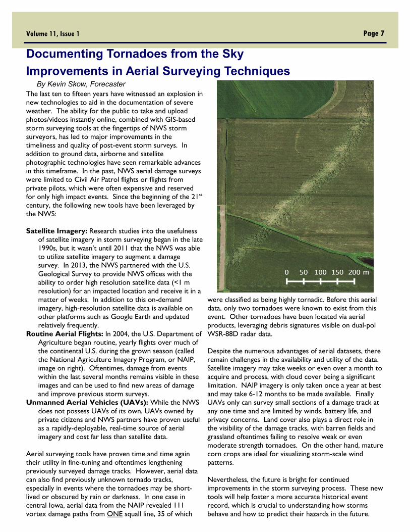
Routine Aerial Flights: In 2004, the U.S. Department of
Agriculture began routine, yearly flights over much of
the continental U.S. during the grown season (called
the National Agriculture Imagery Program, or NAIP,
image on right). Oftentimes, damage from events
within the last several months remains visible in these
images and can be used to find new areas of damage
and improve previous storm surveys.
Unmanned Aerial Vehicles (UAVs): While the NWS
does not possess UAVs of its own, UAVs owned by
private citizens and NWS partners have proven useful
as a rapidly-deployable, real-time source of aerial
imagery and cost far less than satellite data.
Aerial surveying tools have proven time and time again
their utility in fine-tuning and oftentimes lengthening
previously surveyed damage tracks. However, aerial data
can also find previously unknown tornado tracks,
especially in events where the tornadoes may be short-
lived or obscured by rain or darkness. In one case in
central Iowa, aerial data from the NAIP revealed 111
vortex damage paths from ONE squall line, 35 of which
were classified as being highly tornadic. Before this aerial
data, only two tornadoes were known to exist from this
event. Other tornadoes have been located via aerial
products, leveraging debris signatures visible on dual-pol
WSR-88D radar data.
Despite the numerous advantages of aerial datasets, there
remain challenges in the availability and utility of the data.
Satellite imagery may take weeks or even over a month to
acquire and process, with cloud cover being a significant
limitation. NAIP imagery is only taken once a year at best
and may take 6-12 months to be made available. Finally
UAVs only can survey small sections of a damage track at
any one time and are limited by winds, battery life, and
privacy concerns. Land cover also plays a direct role in
the visibility of the damage tracks, with barren fields and
grassland oftentimes failing to resolve weak or even
moderate strength tornadoes. On the other hand, mature
corn crops are ideal for visualizing storm-scale wind
patterns.
Nevertheless, the future is bright for continued
improvements in the storm surveying process. These new
tools will help foster a more accurate historical event
record, which is crucial to understanding how storms
behave and how to predict their hazards in the future.
Documenting Tornadoes from the Sky
Improvements in Aerial Surveying Techniques By Kevin Skow, Forecaster

Page 8 Volume 11, Issue 1
Spring is in the air once again! That means all liquid precipitation, so I’d like to ask that everyone place their inner rain gauge
tubes and funnels on their rain gauges.
Some exciting equipment upgrades will hopefully be coming soon within the next year or so! It has been a while since the
Maximum/Minimum Temperature System (MMTS) has been upgraded. The older systems are becoming more difficult to repair
due to parts no longer being produced. The new system should be RF (radio frequency) based, so we will no longer require a
wire to be attached to the temperature sensor and readout! As I get a better timeline, I will let those affected know about
system replacements and how that will work.
I want to thank everyone for a wonderful job this fall and winter season! I will be travelling to each of you sometime this year,
so looking forward to visiting with all our COOP observers! Thanks for all you do! I wanted to take the time to recognize a
few observers for their dedication throughout the years, and who received Length of Serve Awards for the latter half of 2017!
COOP Corner
Other award recipients included:
Barry Finlayson for 65 years of service for the gauge located
at the Washington Power Plant.
Debra Kruse, of Bremen, for 20 years of service.
Debra Kruse: 20 years
John Foster: 20 years
Jim Kraft: 10 years
Carol Linden: 25 years
James and Mary Graf Pierson: 10 years
Lance Bailey: 10 years
Kevin Foerschler: 20 years
Loren and Deborah Sudbeck 10 years
of Service!
City of Holton 10 years!
Nancy and Leo Pollard have been
providing observations for
precipitation and river readings for 35
years! They took over for Leo’s
Father, Roland Kraft, in 1982, and Mr.
Roland had performed the duty since
November 1962. Therefore, the
Polard family has been performing the
observations in their family for the
past 55 years. We thank you for your
family’s service for this length of time!
The USACE Perry Lake Project
received an Honored 50 year
Institution Award for 50 years of
service taking weather observations for
the NWS Cooperative Program. Perry
Lake observes the temperature,
precipitation, both the standard rain
gauge, and the Fischer Porter HPD rain
gauge, and evaporation. We thank
Jason and John for helping with this
program through their tenure at the
lake. Thank you!!
Thank you one and all for all that you do! It does not go unnoticed or unappreciated. If you have any problems or questions,
please do not hesitate to contact me at [email protected] or 785-232-1493.

Severe Weather Spotting Card :
Weather to Report:
Hail (report any size)
Strong Wind Gusts (58+ MPH)
Any notable wind damage to trees, homes, businesses
Funnel Cloud/Rotating Wall Cloud or Tornado
What to Include in your Report:
Your Name and/or Call Sign (Spotter Number)
Your Location
Time and Date of Event
Location and Duration of Event
National Weather Service
Topeka, Kansas
1116 NE Strait Ave
Topeka, KS 66616
Local Forecast Phone: 785-234-2592
E-mail: [email protected]
Editor: Emily Heller, Meteorologist Intern
Follow Us on Social Media!