service profile surveying - gai consultants · hydrographic surveying and mapping for cadd. ......
TRANSCRIPT

The survey teams at GAI Consultants—a dedicated and experienced group of skilled professionals that provide services ranging from boundary and topographic surveys to specialized surveys for archaeology projects. Our surveys cover any discipline in any market including transportation, development, energy, and industry.
Providing valuable survey information accurately and early means clients and contractors avoid spending thousands of dollars in potentially damaging lost time and litigation liability.
GAI field survey crews, working closely with in-house mapping specialists, have access to an extensive library of computerized mapping software including Terramodel, Arc-Info, GRASS, Microstation and AutoCAD.
Design Surveys—Design surveys are the foundation upon which designs are based. GAI
records boundary line locations, topography, physical features, on-site buildings and utilities, encroachments, and easements. Quality foundation design plans are produced from these details.
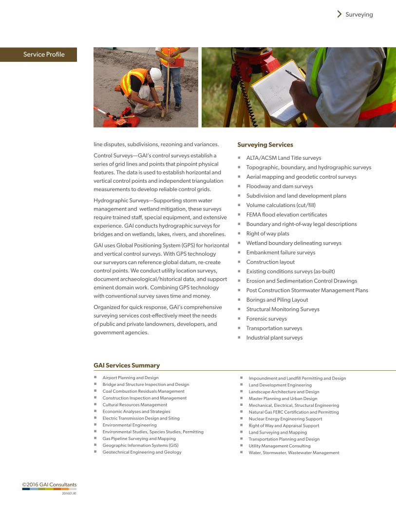
Topographic Surveys—GAI uses the latest technology in field equipment, recorders, and computer mapping for accurate topographic surveys that incorporate ground run, aerial, tree, utility location, wetland, floodplain and hydrographic surveying and mapping for CADD.
Construction Surveys—Conducted on site during the initial preparation stage of construction, these surveys provide information critical to establishing location and elevation. GAI saves clients and contractors thousands of dollars in potentially damaging lost time and litigation liability by providing this key information accurately and early.
Boundary Surveys—GAI’s boundary surveys identify land titles and ownership, and document real estate financing, appraisals and sales, insurance, as-built delineations, encroachment delineation, boundary
SurveyingService Profile
Transforming ideas into reality® since 1958, GAI is an employee-owned, engineering, planning, and environmental consulting firm providing local expertise to worldwide clients in the energy, transportation, development, government, and industrial markets.
gaiconsultants.com
line disputes, subdivisions, rezoning and variances.
Control Surveys—GAI’s control surveys establish a series of grid lines and points that pinpoint physical features. The data is used to establish horizontal and vertical control points and independent triangulation measurements to develop reliable control grids.
Hydrographic Surveys—Supporting storm water management and wetland mitigation, these surveys require trained staff, special equipment, and extensive experience. GAI conducts hydrographic surveys for bridges and on wetlands, lakes, rivers, and shorelines.
GAI uses Global Positioning System (GPS) for horizontal and vertical control surveys. With GPS technology our surveyors can reference global datum, re-create control points. We conduct utility location surveys, document archaeological/historical data, and support eminent domain work. Combining GPS technology with conventional survey saves time and money.
Organized for quick response, GAI’s comprehensive surveying services cost-effectively meet the needs of public and private landowners, developers, and government agencies.
Surveying Services
� ALTA/ACSM Land Title surveys
� Topographic, boundary, and hydrographic surveys
� Aerial mapping and geodetic control surveys
� Floodway and dam surveys
� Subdivision and land development plans
� Volume calculations (cut/fill)
� FEMA flood elevation certificates
� Boundary and right-of-way legal descriptions
� Right of way plats
� Wetland boundary delineating surveys
� Embankment failure surveys
� Construction layout
� Existing conditions surveys (as-built)
� Erosion and Sedimentation Control Drawings
� Post Construction Stormwater Management Plans
� Borings and Piling Layout
� Structural Monitoring Surveys
� Forensic surveys
� Transportation surveys
� Industrial plant surveys
Service Profile
Surveying
GAI Services Summary
� Airport Planning and Design
� Bridge and Structure Inspection and Design
� Coal Combustion Residuals Management
� Construction Inspection and Management
� Cultural Resources Management
� Economic Analyses and Strategies
� Electric Transmission Design and Siting
� Environmental Engineering
� Environmental Studies, Species Studies, Permitting
� Gas Pipeline Surveying and Mapping
� Geographic Information Systems (GIS)
� Geotechnical Engineering and Geology
� Impoundment and Landfill Permitting and Design
� Land Development Engineering
� Landscape Architecture and Design
� Master Planning and Urban Design
� Mechanical, Electrical, Structural Engineering
� Natural Gas FERC Certification and Permitting
� Nuclear Energy Engineering Support
� Right of Way and Appraisal Support
� Land Surveying and Mapping
� Transportation Planning and Design
� Utility Management Consulting
� Water, Stormwater, Wastewater Management
©2016 GAI Consultants
201601.R1