september 15 pag field tour - thompson okanagan...
TRANSCRIPT
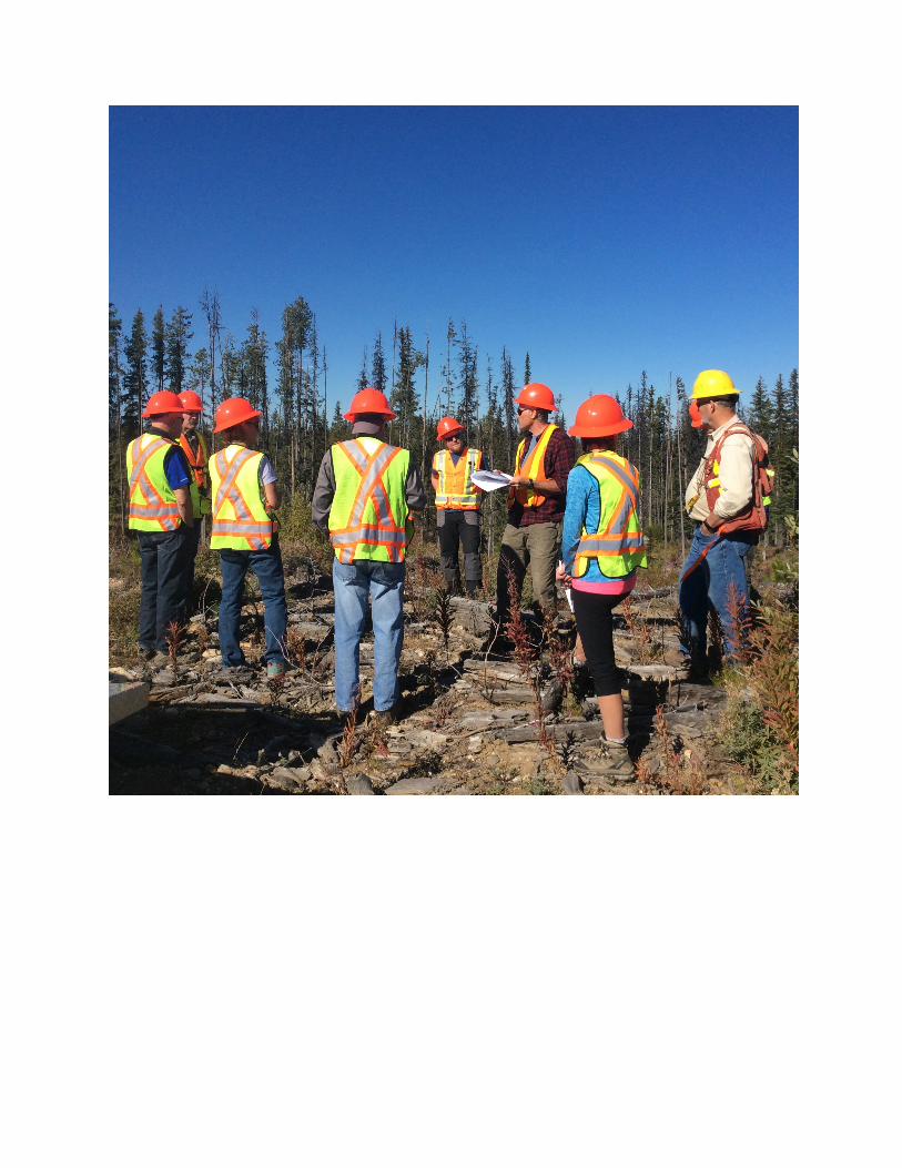
September 15 2016 Okanagan SFM Public Advisory Group
Field Tour - East of Kelowna
Theme: Look at recent large scale mountain pine beetle salvage operations in Mugford Operating area (Belgo Creek) and compare to mountain pine beetle salvage that occurred in 1979 in the Mission Ridge area.
Location: East of Kelowna in Mugford operating area situated in Belgo Ck sub-drainage of Mission Creek. Access through Philpot Road off of Highway 33, Mugford Ridge and Mission Ridge.
ITINERARY
Confirmed attending (Sept 13, 2016): Mike Watson, Scott Smith, Don Dobson, Suzan Lapp, Heather Rice, Doug Flintoff, Trevor Jolleys, Nancy P., Dave Gill, Paul Ross, Sylvain J., Tony Zanotto
8:45: Meet at Cosco Parking Lot, carpool arrangements
9:00: Departure (Highway 33 to Philpot Rd, to Mugford Ridge FSR)
10:00: Arrive at Stop 1a
• large scale recent mpb salvage of lodgepole pine leading forest • retention plan / connectivity corridors • Stand Level biodiversity examples • Reforestation
10:45: Travel to Stop 1b
• Examine condition of stream banks, sediment delivery, stream channel condition, retention around streams.
11:00: Travel to Stop 1c
• Examine condition of stream banks, sediment delivery, stream channel condition, retention around streams. No evidence of cumulative effects.
11:15: Travel to Stop 2 a, b: Road rehab examples
• Long skid trail completely rehabbed • In block road rehabbed with maintenance of quad trail for planting.
11:45: Travel to Stop 3, area of salvage in mixed forest (Option for lunch stop if behind schedule)
• large scale mpb salvage in mixed species forest (more retention options)
12:15: Travel to Stop 4-a tributary stream to Belgo Ck at approx. 16.5 km on Philpot
• stream condition at bridge and downstream • sedimentation control techniques •
12:30: LUNCH @ Stop 3
1:45: Travel to 48 km Mission Ridge FSR to look at large area harvested during early eighties mpb outbreak.
• road condition • reforestation, stand tending activities • Forest Health, old bear damage • Stand development (timber and biodiversity)
2:30: Travel down Mission Ridge FSR to junction of Three Forks and Highway 33 in Joe Rich
3:30: Anticipated arrival at Highway 33. (Could disband here or have optional stop at Belgo Ck crossing of highway 33.
SPEAKING NOTES
Stop1a:
2008 mpb numbers on increase on Aberdeen Plateau, became a priority to initiate salvage plan for Mugford Operating Area
Elements of Mugford Retention Plan
Discussion with district regulating body resulted in recommendation to target 20 % retention that could include OGMAs, WTRAs, Riparian Reserves, Non Pl leading types, sensitive sites.
Existing cut blocks in 10 to 20 ha range logged circa 1994-99
Retention areas anchored on stream network to protect areas of higher biodiversity and attempt to create network. Reserves around streams are larger than ‘legal’

requirements. Considered old MoE ‘Forest Ecosystem Network’ areas in identification of retention candidate areas.
Hydrological Implications: mostly below snow sensitive line, well roaded, stable soils, stable stream channels, main concern is sediment delivery from surface erosion on roads and landings.
Stand Level: Stubs, single tree, WTRA, CWD
Area viewed is several blocks aggregating to approx. 800 ha gross area
A835307: K5ZU
• Sold and Logged 2009, 187 ha NAR, 211 ha gross
• Summer logged
• Natural reforestation with planting of draws and burn piles (NAR 187 ha, approx. 20 ha planted, 2014)
• Significant cost savings approx. $70,000.
• Regen Survey:
o 6700 sph,Pl60Bl30Sx10, Ht 0.6 m in 2014
o 1057 wss, Pl80Bl11Sx9,
In coming years, road requirements will be assessed and a deactivation plan developed and implemented.
Stop 1b: Stream crossing
Examine condition of stream banks, sediment delivery, stream channel condition, retention around streams.
Stop 1c:
Stream crossing, examine conditions of stream banks, sediment delivery, stream channel condition, retention around streams.
Stop 2a, b: Road and Trail Rehab
• ex 1 trail completely rehabbed K5ZW
• ex. 2 on block temp road rehabbed with quad trail for planting access ON APPROX ¼ OF ROAD LENGTH.
Stop 3: Mountain pine beetle salvage in area of diverse tree species.
• Pl predominant but significant amounts of Sx Bl and some Fd.
• Allows for more retention and less extensive aggregate harvesting.
• Easier to mitigate impacts on non-timber values (wildlife, visuals)
• TSL A85321 K5KW Harvested 2012
o Nat and Plant, 2015 survey five strata ranging from 3000 to 9000 sph
Stop 4: Stream crossing at Philpot Road, confluence to Belgo Creek
• stream appears to be in good condition
• sediment mitigation techniques in design of bridge (Don Dobson)
Stop 6: Managed stand from historic large scale harvesting
• Harvested 1979 175 ha, planted, spaced circa 1996 at age 18 approx. 4.5 m tall to 1400 sph
• Current stand condition is thrifty
o approx. 35 yrs old , ranging 10-15 m tall
o approximating merch size of some areas currently being harvested
o thrifty shrub and herb layer
o evidence of recovered bear damage
Summary:
• Existing biophysical attributes play critical role in block design and retention options. Two scenarios examined: 100% Pl vs variable species
• Managed stands develop over time into thrifty healthy forests supporting multiple uses. Water quality and stream integrity protected.
• Thank you.