sensor fusion method for altitude estimation in mini-uav...
TRANSCRIPT
ECAI 2015 - International Conference – 7th Edition Electronics, Computers and Artificial Intelligence 25 June -27 June, 2015, Bucharest, ROMÂNIA
Sensor Fusion Method for Altitude Estimation in Mini-UAV Applications
Grigore Stamatescu, Iulia Stamatescu, Dan Popescu
Dpt. of Automatic Control and Industrial Informatics University “Politehnica” of Bucharest, Romania
Cristian Mateescu Teamnet International Bucharest, Romania
Abstract – The emergence of unmanned aerial vehicles for large scale monitoring of ground infrastructure has challenged new designs for electronic sensor systems capable of timely, accurate and computationally effective measurements. A conventional design issue is balancing the complexity of the sensing subsystem with advanced data processing algorithms in order to obtain quality information regarding the airplane's posture and orientation. The paper presents the generic architecture of the navigation sensing system for a fixed-wing mini-UAV, at both the physical and algorithm levels. The focus is set on a sub-problem, namely altitude estimation by sensor fusion using barometric pressure and GPS data. Results are discussed based on actual flight log data and the approach is extended towards speed estimation: air, ground and wind influence. Conclusions are drawn regarding efficient implementation of the method in relation to the on-board embedded processing capabilities.
Keywords-embedded sensing; data processing; sensor fusion; mini-UAV; altitude estimation.
I. INTRODUCTION Several application areas are nowadays able to
benefit from the development and increasing capabilities for surveillance of aerial robotic platforms. These cover not only military scenarios such as event detection for border monitoring but also civilian and industrial scenarios where the objective consists of aerial inspection for road or large scale pipeline infrastructures. Current research is mainly focused on extending the capability of these platforms, commonly denoted as unmanned aerial vehicles (UAVs) or drones, by embedding even more advanced sensors and increasing the range and on-board processing and communication ressources. At a higher conceptual level, proposals have been made for multi-UAV synchronization and cooperation by means of multi-agent systems paradigms and associated optimization methods [1] or for ground sensor network supported integration for data collection [2]. Also, the term unmanned aerial system (UAS) is used to describe the ensemble of the UAV supervised/controlled by a ground control station (GCS) with human oversight.
A main component of UAV design consists of selection and integration of embedded sensors which are typically grouped into subsystems. The inertial measurement unit (IMU) includes tri-axial acceleration and rotation/gyroscope sensing. As an IMU extension, the attitude and heading reference systems (AHRS)
include reference heading sensing by means of a digital compass and fusion methods for indirect computing of calibrated pitch/roll and heading measurements. An essential design goal is implementing an optimal tradeoff between sensor quality (and usually cost) and the complexity of the on-board data processing routines in order to guarantee quality measurements for the UAV/UAS platform.
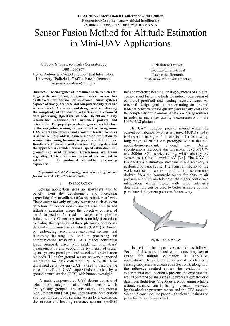
The UAV reference project, around which the current contribution revolves is named MUROS and it is illustrated in Figure 1. It consists of a fixed-wing, long range, electric UAV prototype with a flexible, application-dependant, payload bay. Design specifications include a 4m wingspan, 10kg MTOW and 3000m AGL service ceiling, which classify the system as a Class I, mini-UAV [3,4]. The UAV is launched via a sling-type mechanism and recovery is perfomed by parachuting. The main contribution of the work consists of combining altitude measurements derived from the barometric sensor for absolute air pressure and GPS module data into higher confidence information which, along with wind influence determination, can be used to better estimate optimal parachute deployment positions for recovery.
Figure 1 MUROS UAV
The rest of the paper is structured as follows. Section 2 discusses related work concerning sensor fusion for altitude estimation in UAV/UAS applications. The system architecture of the electronic sensing subsystem is discussed in Section 3, along with the reference method chosen for evaluation on experimental data. Section 4 presents the experimental results obtained by analyzing and processing real-world data from flight logs. The focus is on obtaining reliable altitude measurements by fusing information provided by the absolute pressure sensor and the GPS module. Section 5 concludes the paper with relevant insight and paths for future development.

Grigore Stamatescu, Iulia Stamatescu, Dan Popescu and Cristian Mateescu
2
II. RELATED WORK Significant work has been carried out for attitude
estimation i.e. deriving pitch/roll angles relative to an absolute coordinate frame. State-of-the-art methods combine linear or non-linear filtering methods like the (Extended) Kalman Filter enhanced through optimization and prediction steps using particle filters or neural networks. In this direction the current problem of effectively measuring altitude by leveraging two or more sensors has been mainly treated as a sub-problem but with a considerable impact in certain flight stages such as take-off, landing and turbulent flight areas.
The authors of [6] first identify the main sources of errors. For GPS altitude measurement these are classified as: intermittent – temporary obstructions leading to a limited number of satellites and systematic – propagation effects and hardware design limitations. For the barometric sensor requires proper calibration to compensate output drift and the accuracy has to be estimated beforehand. Subsequently an algorithm for fusing GPS and barometric sensors by is proposed which combines available data to produce higher-confidence information resulting in effect in the minimization of the tolerance level for the estimated altitude.
In [7] a relevant method and application is presented where precise altitude estimation is required for improving the landing procedure of a rotorcraft. Salient findings include the usage of a wavelet filter for pre-processing – eliminating high frequency noise from the raw signals, along with an adaptive extended Kalman filter (AEKF). Also, besided the barometric sensors, the rotorcraft includes differential GPS (DGPS) and ultrasonic sensors.
The hardware design of an autopilot unit with both barometric and ultrasound sensors is discussed in [8]. The authors first perform experimental characterization and calibration of the two sensors and then devise a filtering method for combining the two measurement vectors. Results shown that by careful tuning of the filter parameters, the particular noise types for both sensors can be successfully reduced. A framework for data fusion applied to altitude and vertical speed estimation is described in [9]. This helps mitigate in this case the relatively low sampling rate of the GPS module, of around 5Hz, and the quick saturation of the ultrasonic rangefinder.
To showcase alternative methods for efficient altitude estimation, some authors describe systems based on image processing, either from single or stereo vision cameras [10] with the field of view alligned to the z axis of the UAV. The required steps include compulsory calibration of the camera(s) and performing the geometric computation which allows deriving distance from the overlapping fields of view of the two perspectives. Albeit with a higher computational load, the results show promise when compared to a precision laser altimeter with a final mean error of 2.41% for the landing and take-off phases. Acknowledging these contributions, the novel aspect of our work includes the application of a sensor fusion method for accurate estimation of altitude form barometric sensor and GPS data on a fixed-wing UAV.
III. SYSTEM DESIGN AND METHOD DESCRIPTION This section covers in brief the design of the
electronic sensing subsystem aboard the MUROS UAV and the theoretical basis of the Fuzzy Sensor Fusion and Validation (FUSVAF) method.
A. Sensor system design A schematic representation of the electronic sensor
system for the MUROS platform is depicted in Figure 2. The list of embedded sensors include: tri-axial accelerometer, three single axis gyroscopes, digital compass, absolute and relative pressure sensors for altitude and air speed measurements. Thus the electronic sensor system is able to provide both IMU/AHRS functionality and air data references for altitude and speed. The GPS module is not part of this subsystem but is connected via the CAN bus.
Data acquisition is controlled by a microcontroller using low level communication buses like SPI and I2C while external communcation with the other subsystems is handled through a Controller Area Network (CAN) bus. A separate bus supplies power to the embedded components.
Figure 2 Electronic sensor system with IMU/AHRS functionality
The absolute pressure sensor, S_PS, from the Freescale Xtrinsic family uses a micro-electromechanical sensing element to provide digital, high resolution 24 bit ADC, pressure and altitude measurements over the I2C bus. The relationship which determines the pressure-altitude conversion is the following:
ℎ = 44330,77 1 − ( ++,).,/0.1231 + 𝑂𝑂𝑂𝑂𝑂𝑂𝑂𝑂𝑂𝑂𝑂𝑂
where h is the output altitude, p0 is the barometric pressure at sea level (101326 Pa) and p is the measured absolute pressure. The absolute pressure is determined by sensing external pressure relative to an internal pre-determined reference value, set during manufacturing. Though over a large range of altitudes, the relationship between pressure and altitude is not linear, a linear approximation was proven suitable for smaller ranges, often encountered during mini-UAV operation.
Optimizing the phyisical layout, together with suitable housing can help minimize measurement noise and

Sensor Fusion Method for Altitude Estimation in Mini-UAV Applications
3
reducing the computational burden of subsequent filtering.
B. FUSVAF Method FUSVAF was initially proposed and extended by
[11] and applied for machine condition monitoring and diagnostics.
The underlying principle is assigning confidence values to individual sensor readings. These are dynamically adjusted using a fuzzy-based method for determinining the boundaries of validation curves at each step. These incorporate domain specific knowledge and sensor characteristics to reject erroneous or faulty sensor readings. The aggregation method for the confidence values consists of a weighted average. As described in [11], the validation curves can take the form of a piece-wise bell curve:
𝑣𝑣 𝑧𝑧 = 𝑂𝑂<=<>?@
A
and within this curve the fuzzy validation gate is defined based on a maximum possible negative change and maximum possible positive change. The assignement of the confidence values is derived next as:
𝜎𝜎 =
0, 𝑧𝑧 < 𝑣𝑣E
𝑂𝑂<=<>?F
A
− 𝑂𝑂<=<GF?F
A
1 − 𝑂𝑂<=<GF?F
A , 𝑣𝑣E < 𝑧𝑧 ≤ 𝑥𝑥
𝑂𝑂<=<>?J
A
− 𝑂𝑂<=<GJ?J
A
1 − 𝑂𝑂<=<GJ?J
A , 𝑥𝑥 < 𝑧𝑧 ≤ 𝑣𝑣K
0, 𝑧𝑧 > 𝑣𝑣K
where 𝜎𝜎 represents the confidence value computed for a given sensor, 𝑣𝑣E and 𝑣𝑣K are the left and right validation gate margins respectively with associated parameters 𝑎𝑎E and 𝑎𝑎K . 𝑧𝑧 is the sensor reading, while 𝑥𝑥 is the predicted value.
Subsequently, the main equation to determine the estimated fused value 𝑥𝑥N:
𝑥𝑥N =𝑧𝑧O𝜎𝜎 𝑧𝑧O + 𝛼𝛼𝑥𝑥
𝜔𝜔ROS/
𝜎𝜎 𝑧𝑧O + 𝛼𝛼𝜔𝜔
ROS/
where zi are the measurements, σ are the confidence values, α is an adaptive parameter which represents system state, ω is a constant scaling factor and 𝑥𝑥 is the predicted value.
The second step is the implementation of the prediction stage which uses and exponentially weighted moving average filter (EWMA), according to:
𝑥𝑥 𝑘𝑘 + 1 = 𝛼𝛼𝑥𝑥 𝑘𝑘 + 1 − 𝛼𝛼 𝑥𝑥N(𝑘𝑘)
where 𝑥𝑥(𝑘𝑘) is the predicted value at the discrete time step k and 𝑥𝑥N is the fused value at time k. α can be used to tune the prediction depending on the process dynamics and observed changes. The method allows thus a dynamic adjustment of the fused output, by integration of new knowledge derived from the process, sensor characterstics or expert input.
In our particular case with adapt the method to the two streams of sensor values, namely barometric and GPS altitudes.
IV. EXPERIMENTAL RESULTS Experimental data has been collected during a test
flight of the MUROS prototype. Figure 3 illustrates the altitude measurements stemming from the barometric sensors and the GPS including the observed relative error for the test flight range. The relative error is computed using the formula:
𝜀𝜀?EV % =Δℎ
ℎY+Z [?= − ℎY+Z [OR∙ 100
where Δℎ = ℎ+K]Z − ℎY+Z , hpres is the altitude determined by measuring absolute air pressure and hgps is the GPS module altitude.
Figure 3 Altimeter and GPS measurements
The empirical cummulative distribution function of the relative altitude error is presented in Figure 4. In 96% of the cases the error is below 1%.
Figure 4 Empirical CDF of the relative error
The FUSVAF method is applied to these data streams and the fused altitude measurements are presented in Figure 5. The fused value can be used as a reliable reference for the various flight phases.
Figure 5 Fused altitude measurements
0 1 2 3 4 5 6 7x 10⁵
0
100
200
300
400
Sample
Altit
ude
[m]
Comparative analysis of altimeter and GPS altitude readings
0 1 2 3 4 5 6 7x 10⁵
0
5
10
15
20
Rel
ativ
e er
ror
AltimGPSErr
0 0.5 1 1.5 2 2.5 3 3.5 4 4.5 50
0.1
0.2
0.3
0.4
0.5
0.6
0.7
0.8
0.9
1
e [%]
F(e)
Empirical CDF of Relative Error
1 2 3 4 5 6x 10⁵
0
50
100
150
200
250
300
350Fused Altitude Measurements
Sample
Altit
ude
[m]

Grigore Stamatescu, Iulia Stamatescu, Dan Popescu and Cristian Mateescu
4
Extending the analysis to the study of airspeed the following relation holds true (Figure 6):
𝑉𝑉? = 𝑉𝑉Z − 𝑉𝑉G
where 𝑉𝑉? is the airspeed vector, 𝑉𝑉Z is the ground speed vector and 𝑉𝑉G is a vector reflecting wind speed and drift upon the aircraft.
Figure 6 Air, ground and wind speed vectors
In Figure 7 we present the measurements obtained from a second pressure sensor which uses a Pitot tube to measure relative air pressure in order to detect the air speed of the UAV. In this case the speed reported by the GPS module is the ground speed while the error reflects wind influence. In this case it can be observed that the relative pressure measurements are significantly more noisy that the previous absolute altitude measurements [12].
Figure 7 Airspeed and ground speed measurements
V. CONCLUSION AND FUTURE WORK The paper presented the application of the FUSVAF
sensor fusion method for altitude estimation in mini-UAV applications, by combining absolute pressure with GPS data. By assigning confindence values to sensor readings we carry out experimental data fusion across heterogenous sensors with different measurement principles. Besides enabling redundancy, this leads to higher confidence information to be used by the on-board autopilot in various stages of the flight
The results show promise and we aim at better evaluating the computational load for online implementation on the embedded platform. The extension towards wind speed estimation can also represent a future research direction.
ACKNOWLEDGMENT The work of Grigore Stamatescu has been funded
by the Sectoral Operational Programme Human Resources Development 2007-2013 of the Ministry of European Funds through the Financial Agreement POSDRU/159/1.5/S/134398. The work of Dan Popescu and Cristian Mateescu was supported by a grant of the Romanian Space Agency, “Multisensory Robotic System for Aerial Monitoring of Critical Infrastructure Systems” (MUROS), project number 71/2013.
REFERENCES [1] Xuzhi Chen; Wei He; Zhe Wu, "Research of UAV's multiple
routes planning based on Multi-Agent Particle Swarm Optimization," Intelligent Control and Information Processing (ICICIP), 2013 Fourth International Conference on , vol., no., pp.765,769, 9-11 June 2013
[2] G. Stamatescu, D. Popescu, C. Mateescu, Dynamic task planning of aerial robotic platforms for ground sensor data collection and processing, in: 24th International Conference on Robotics in Alpe-Adria-Danube Region (RAAD), 2015.
[3] Joint Doctrine Note (JDN) 3/10, “Unmanned Aircraft Systems: Terminology, Definitions and Classification”, UK Ministry of Defence, June 2010, Available on-line: https://www.gov.uk/government/uploads/system/uploads/attachment_data/file/33713/JDN310Amendedweb1June10.pdf
[4] Watts, A.C.; Ambrosia, V.G.; Hinkley, E.A. Unmanned Aircraft Systems in Remote Sensing and Scientific Research: Classification and Considerations of Use. Remote Sens. 2012, 4, 1671-1692.
[5] Stamatescu, G.; Popescu, D.; Dobrescu, R., "Cognitive radio as solution for ground-aerial surveillance through WSN and UAV infrastructure," Electronics, Computers and Artificial Intelligence (ECAI), 2014 6th International Conference on , vol., no., pp.51,56, 23-25 Oct. 2014
[6] Zaliva, V.; Franchetti, F., "Barometric and GPS altitude sensor fusion," Acoustics, Speech and Signal Processing (ICASSP), 2014 IEEE International Conference on , vol., no., pp.7525,7529, 4-9 May 2014
[7] Lei, X.; Li, J. An Adaptive Altitude Information Fusion Method for Autonomous Landing Processes of Small Unmanned Aerial Rotorcraft. Sensors 2012, 12, 13212-13224.
[8] Szafranski, G.; Czyba, R.; Janusz, W.; Blotnicki, W., "Altitude estimation for the UAV's applications based on sensors fusion algorithm," Unmanned Aircraft Systems (ICUAS), 2013 International Conference on , vol., no., pp.508,515, 28-31 May 2013
[9] Blachuta, M.; Czyba, R.; Wojciech, J.; Szafranski, G., “Data Fusion Algorithm for the Altitude and Vertical Speed Estimation of the VTOL Platform”. J Intell Robot Syst 74:413–420, 2014.
[10] Eynard, D.; Vasseur, P.; Demonceaux, C.; Fremont, V., "UAV altitude estimation by mixed stereoscopic vision," Intelligent Robots and Systems (IROS), 2010 IEEE/RSJ International Conference on , vol., no., pp.646,651, 18-22 Oct. 2010
[11] K. Goebel and W. Yan, “Correcting Sensor Drift and Intermittency Faults With Data Fusion and Automated Learning,” IEEE Systems Journal, vol. 2, no. 2, pp. 189–197, Jun. 2008.
[12] Yanjie Wang; Shudao Zhou; Hao Li; Guotao Zhu; Kejing Wei, "Meteorological UAV Pitot-static tube wind error source and sensitivity analysis," Remote Sensing, Environment and Transportation Engineering (RSETE), 2011 International Conference on , vol., no., pp.1341,1344, 24-26 June 20.
Va
Vs
Vv
1 2 3 4 5 6x 10⁵
0
20
40
60
Sample
Airs
peed
1 2 3 4 5 6x 10⁵
0
50
100
Sample
Airs
peed
Comparative analysis − Indicated Airspeed versus Ground speed (GPS)
AirGround
Err [%]