sdi implementation at the local administration … 5b – current trends in sdi hartmut müller and...
TRANSCRIPT

TS 5B – Current Trends in SDI Hartmut Müller and Stephan von St. Vith SDI Implementation at the Local Administration Level of Germany FIG Working Week 2009 Surveyors Key Role in Accelerated Development Eilat, Israel, 3-8 May 2009
1/13
SDI Implementation at the Local Administration Level of Germany
Hartmut MÜLLER and Stephan von St. VITH, Germany
Key words: SDI, Municipality, eGovernment, Geospatial Basic Data SUMMARY Germany is a federal republic consisting of 16 states (so called "Laender"). At the local level the Federation comprises more than 300 counties and more than 13,000 municipalities. The tasks of local authorities in Germany are complex. A large number of employees care about the needs of the citizens in many fields of life: education, sports, civil protection, nature conservation, preservation of ancient monuments, building inspection, motorcar permit, social welfare, youth matters, decrees, to name a few of them. The economic success of a country intertwines with the efficiency of its public administration. E-Government has the potential to considerably improve the efficiency of administration processes. A well functioning spatial data infrastructure can provide for a basis for spatial data discovery, evaluation, download and application for users and providers within all levels of government, the commercial sector, the non-profit sector, academia and the general public. The paper describes the current status of local SDI implementation in Germany with an emphasis on already captured spatial data, realized applications and used software. Application of land tools like urban planning, land-use regulations and property registration are shown. A case study is given for the county of Bernkastel-Wittlich in German State Rhineland-Palatinate. Integration of preparatory and legally binding land-use plans into the spatial basic data infrastructure as well as other practical results of a working SDI at the German local level are explained.

TS 5B – Current Trends in SDI Hartmut Müller and Stephan von St. Vith SDI Implementation at the Local Administration Level of Germany FIG Working Week 2009 Surveyors Key Role in Accelerated Development Eilat, Israel, 3-8 May 2009
2/13
SDI Implementation at the Local Administration Level of Germany
Hartmut MÜLLER and Stephan von St. VITH, Germany 1. INTRODUCTION Germany is a federal republic consisting of 16 states (so called "Laender"). One of these federal states is Rhineland-Palatinate with 4 million inhabitants. Rhineland-Palatinate itself consists of 24 counties (see Figure 1). The tasks of a local authority which is responsible for the administration of a county in Germany are complex. Several hundred employees care about the needs of the citizens in many fields of life: education, sports, civil protection, nature conservation, preservation of ancient monuments, building inspection, motorcar permit, social welfare, youth matters, decrees, to name a few of them.
Figure 1 Federal Republic of Germany,
Federal State of Rhineland-Palatinate consisting of 24 counties 2. E-GOVERNMENT AND SPATIAL DATA INFRASTRUCTURE The economic success of a county intertwines with the efficiency of its public administration. E-Government has the potential to considerably improve the efficiency of administration
Federal States (16)
Federal State of Rhineland-Palatinate
Independent cities in Rheinland-Palatinate (14)
Counties in Rhineland-Palatinate (24)

TS 5B – Current Trends in SDI Hartmut Müller and Stephan von St. Vith SDI Implementation at the Local Administration Level of Germany FIG Working Week 2009 Surveyors Key Role in Accelerated Development Eilat, Israel, 3-8 May 2009
3/13
processes. Horizontal and vertical integration of administration processes where different administration agencies are involved is difficult at the moment because of many heterogeneous IT systems driven at the Federation level, at the Federation States level comprising 16 states, at the County level comprising more than 300 counties and at the Municipality level comprising more than 13,000 municipalities. Actually, in Germany several initiatives are in progress to improve the integrated electronic support of workflows. The government of the federal state Rhineland-Palatinate intends to promote the GIS-implementation in context of an overall e-government solution. Figure 2 provides for an overview of the organisational structure of Deutschland-Online, Germany's national eGovernment strategy of the federal government, federal-state governments and municipal administrations.
Figure 2 Organisational structure of Germany's national eGovernment strategy Deutschland-Online. Source Deutschland-Online, 2009.
A spatial data infrastructure provides for a basis for spatial data discovery, evaluation, download and application for users and providers within all levels of government, the commercial sector, the non-profit sector, academia and the general public. Figure 3 gives an overview of INSPIRE – Infrastructure for Spatial Information in Europe system architecture which yields an example of an SDI conception.

TS 5B – Current Trends in SDI Hartmut Müller and Stephan von St. Vith SDI Implementation at the Local Administration Level of Germany FIG Working Week 2009 Surveyors Key Role in Accelerated Development Eilat, Israel, 3-8 May 2009
4/13
Figure 3 SDI approach of INSPIRE – Infrastructure for Spatial Information in Europe (Source Bernard, 2008, see also INSPIRE, 2007)
2.1 Provision of Geospatial Basic Data in Germany In Germany, the surveying, mapping, and cadastral authorities of the Federal States provide for the fundamental data for spatial referencing (Spatial Basic Data) to support public, industrial and private users. Spatial Basic Data concerning property registration and topography of the earth’s surface are recorded and provided in different digital formats (see Figure 4, Figure 5). Further efforts have to be made to bring together those elements of an SDI which are already available with all other SDI components provided by a broad community of current and potential users. Improvements are necessary at both, technical and organisational, levels. Integration of SDIs from different levels is a core part of functionality. Guidelines on how to achieve this integration can help to promote the integration work in practice.

TS 5B – Current Trends in SDI Hartmut Müller and Stephan von St. Vith SDI Implementation at the Local Administration Level of Germany FIG Working Week 2009 Surveyors Key Role in Accelerated Development Eilat, Israel, 3-8 May 2009
5/13
Figure 4 Geospatial basic data countrywide available in Germany, Real estate record (left), Real estate map (right)
Figure 5 Geospatial basic data countrywide available in Germany, Digital orthophoto (left), topographic map (half left), digital height model (half right), digital landscape model (right)
2.2 SDI Implementation at the German local level A broad survey took place to explore the current situation in local administration bodies in the south-western part of Germany. The result of this survey was a documentation concerning the current status of the use of geoprocessing software tools and the users’ needs with regard to spatial data structures and spatial data processing routines. Implementation of a spatial data infrastructure including all needed data, IT functionality, personnel skills, etc. is an ample task, sometimes long lasting and costly. That is why, usually, a step by step approach has to be used (see Table 1). Cost benefit considerations were made to identify the potential benefits
TS 5B – Current Trends in SDI Hartmut Müller and Stephan von St. Vith SDI Implementation at the Local Administration Level of Germany FIG Working Week 2009 Surveyors Key Role in Accelerated Development Eilat, Israel, 3-8 May 2009
6/13
obtainable through an SDI. Currently, the implementation of the developed strategy takes place at several involved institutions.
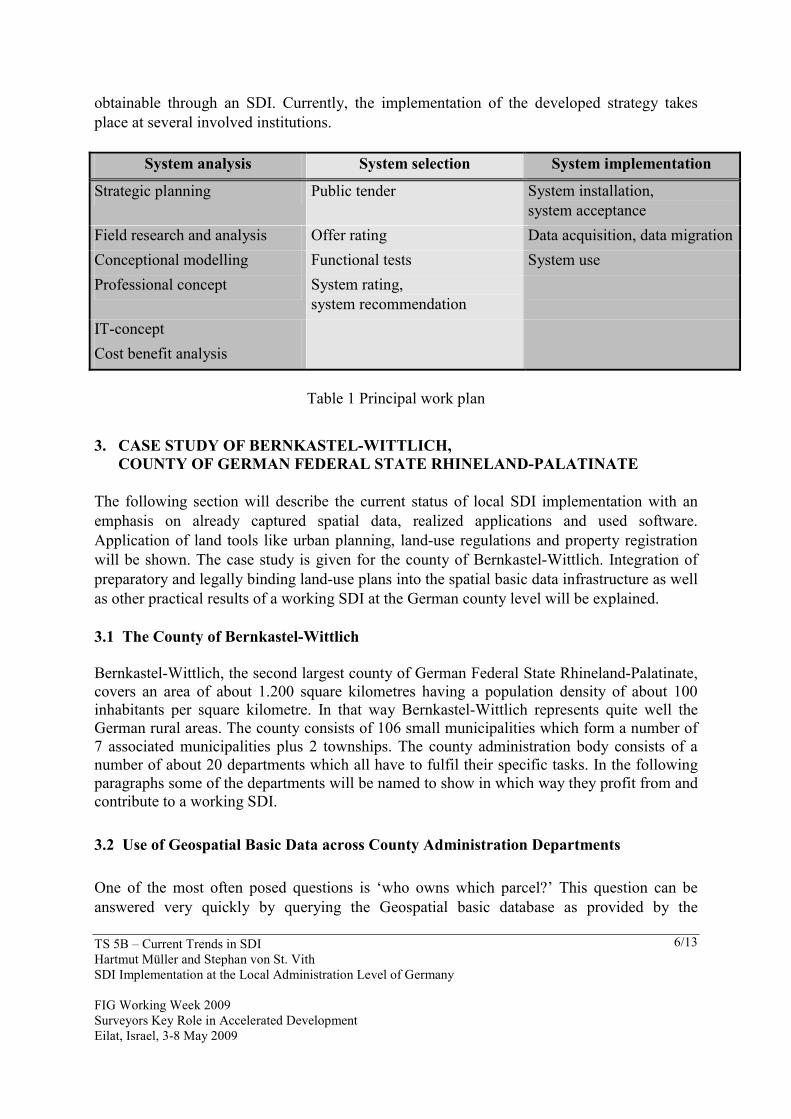
System analysis System selection System implementation
Strategic planning Public tender System installation, system acceptance
Field research and analysis Offer rating Data acquisition, data migrationConceptional modelling Functional tests System use Professional concept System rating,
system recommendation
IT-concept Cost benefit analysis
Table 1 Principal work plan
3. CASE STUDY OF BERNKASTEL-WITTLICH,
COUNTY OF GERMAN FEDERAL STATE RHINELAND-PALATINATE The following section will describe the current status of local SDI implementation with an emphasis on already captured spatial data, realized applications and used software. Application of land tools like urban planning, land-use regulations and property registration will be shown. The case study is given for the county of Bernkastel-Wittlich. Integration of preparatory and legally binding land-use plans into the spatial basic data infrastructure as well as other practical results of a working SDI at the German county level will be explained. 3.1 The County of Bernkastel-Wittlich Bernkastel-Wittlich, the second largest county of German Federal State Rhineland-Palatinate, covers an area of about 1.200 square kilometres having a population density of about 100 inhabitants per square kilometre. In that way Bernkastel-Wittlich represents quite well the German rural areas. The county consists of 106 small municipalities which form a number of 7 associated municipalities plus 2 townships. The county administration body consists of a number of about 20 departments which all have to fulfil their specific tasks. In the following paragraphs some of the departments will be named to show in which way they profit from and contribute to a working SDI. 3.2 Use of Geospatial Basic Data across County Administration Departments One of the most often posed questions is ‘who owns which parcel?’ This question can be answered very quickly by querying the Geospatial basic database as provided by the

TS 5B – Current Trends in SDI Hartmut Müller and Stephan von St. Vith SDI Implementation at the Local Administration Level of Germany FIG Working Week 2009 Surveyors Key Role in Accelerated Development Eilat, Israel, 3-8 May 2009
7/13
Surveying Authorities (see section 2.1). Therefore, this application is widely acknowledged within the administration office and is used very frequently. Technically spoken, the information has to be retrieved from the automated land survey register (ALK) and from the automated register of real owners (ALB), see Figure 6.
Figure 6 Information retrieval from automated land survey register (ALK) and automated register of real owners (ALB)
3.3 Applications in the Department of Buildings and Environment Figure 7 shows how habitats and reserves can be retrieved both in graphical and textual form by using a feasible Wep Map Service. In that way any person in charge has the information showing protected areas instantly available. If any and in which way a specified area has a protected status is an indispensable information which is crucial for many spatially related decisions.

TS 5B – Current Trends in SDI Hartmut Müller and Stephan von St. Vith SDI Implementation at the Local Administration Level of Germany FIG Working Week 2009 Surveyors Key Role in Accelerated Development Eilat, Israel, 3-8 May 2009
8/13
Figure 7 OGC Web Map Service WMS Protection areas (left), direct link to describing information (right)
Citizens have to apply for a building permit to erect a new or to change an existing building. Permits will be granted only if the application is in accordance with the land-use regulations which are defined by the planning authorities in the course of a democratic participatory well defined process. Legally binding land-use plans provide for the base to compare applications for building permits with the legal land-use regulations which are valid in the area under discussion. Figure 8 shows how this check can be done very easily by using a WMS which is connected with the software used for the administration of building permits.
Figure 8 Interactive Processing of building permit applications by using a WMS providing for legally binding land-use plans

TS 5B – Current Trends in SDI Hartmut Müller and Stephan von St. Vith SDI Implementation at the Local Administration Level of Germany FIG Working Week 2009 Surveyors Key Role in Accelerated Development Eilat, Israel, 3-8 May 2009
9/13
3.4 Applications in the Health Department Health prevention is one of the tasks of a public administration. Actions have to be taken as fast as possible in case of an avian influenza case, for instance. To minimise processing times in an emergency case it is highly desirable to get a list of possibly affected locations of domestic animals on stock at a push of a button. Geocoding of locations in conjunction with standand GIS functions like buffering and intersection of spatial datasets provides for the solution of the information problem. Figure 9 shows a simulated avian influenza case together with possibly affected locations.
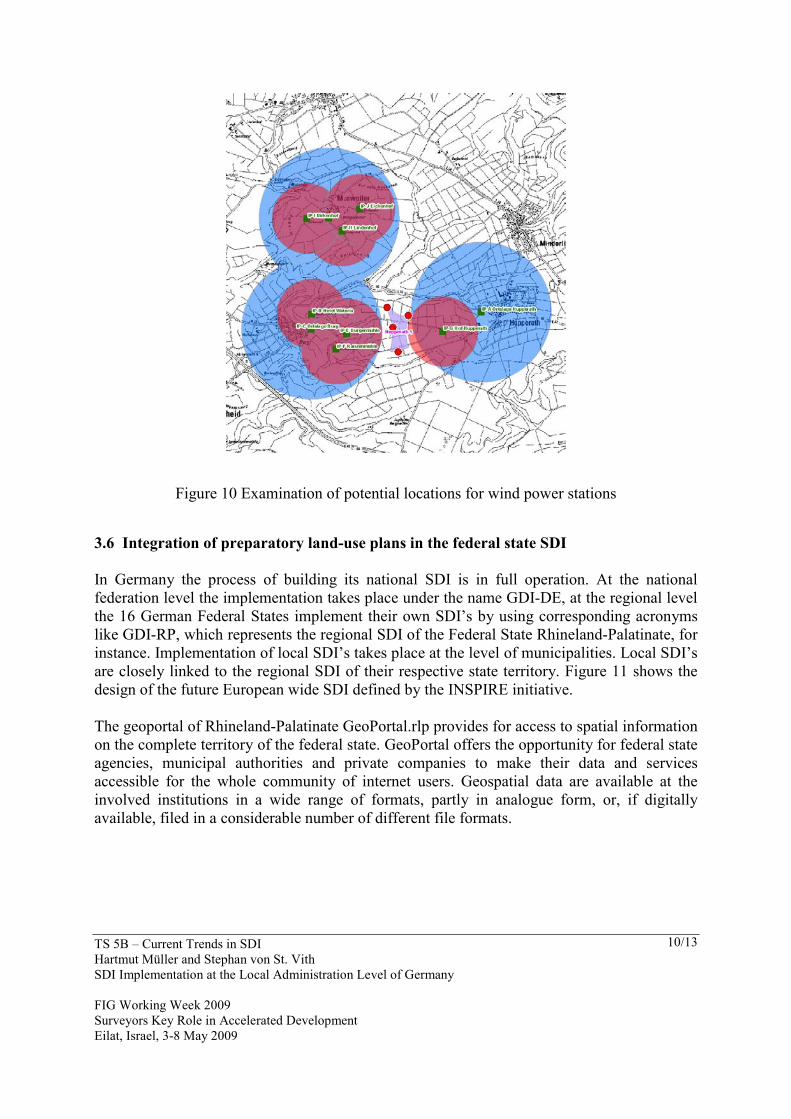
Figure 9 Simulation of avian influenza case and resulting possibly affected locations 3.5 Applications in the Planning Department Potential locations for wind power stations have to meet certain criteria, like a minimum distance from built areas and from roads, they do not have to be within areas which are preserved for other purposes, etc. The examination of potential locations can be sped up considerably by having the needed spatial information laid down in maps and textual documents available (see Figure 10).
TS 5B – Current Trends in SDI Hartmut Müller and Stephan von St. Vith SDI Implementation at the Local Administration Level of Germany FIG Working Week 2009 Surveyors Key Role in Accelerated Development Eilat, Israel, 3-8 May 2009
10/13
Figure 10 Examination of potential locations for wind power stations 3.6 Integration of preparatory land-use plans in the federal state SDI In Germany the process of building its national SDI is in full operation. At the national federation level the implementation takes place under the name GDI-DE, at the regional level the 16 German Federal States implement their own SDI’s by using corresponding acronyms like GDI-RP, which represents the regional SDI of the Federal State Rhineland-Palatinate, for instance. Implementation of local SDI’s takes place at the level of municipalities. Local SDI’s are closely linked to the regional SDI of their respective state territory. Figure 11 shows the design of the future European wide SDI defined by the INSPIRE initiative. The geoportal of Rhineland-Palatinate GeoPortal.rlp provides for access to spatial information on the complete territory of the federal state. GeoPortal offers the opportunity for federal state agencies, municipal authorities and private companies to make their data and services accessible for the whole community of internet users. Geospatial data are available at the involved institutions in a wide range of formats, partly in analogue form, or, if digitally available, filed in a considerable number of different file formats.

TS 5B – Current Trends in SDI Hartmut Müller and Stephan von St. Vith SDI Implementation at the Local Administration Level of Germany FIG Working Week 2009 Surveyors Key Role in Accelerated Development Eilat, Israel, 3-8 May 2009
11/13
Figure 11 Cascading Services from EU level over National and State level to local level
Figure 12 Preparatory land-use plan provided by county administration as a service within federal state SDI
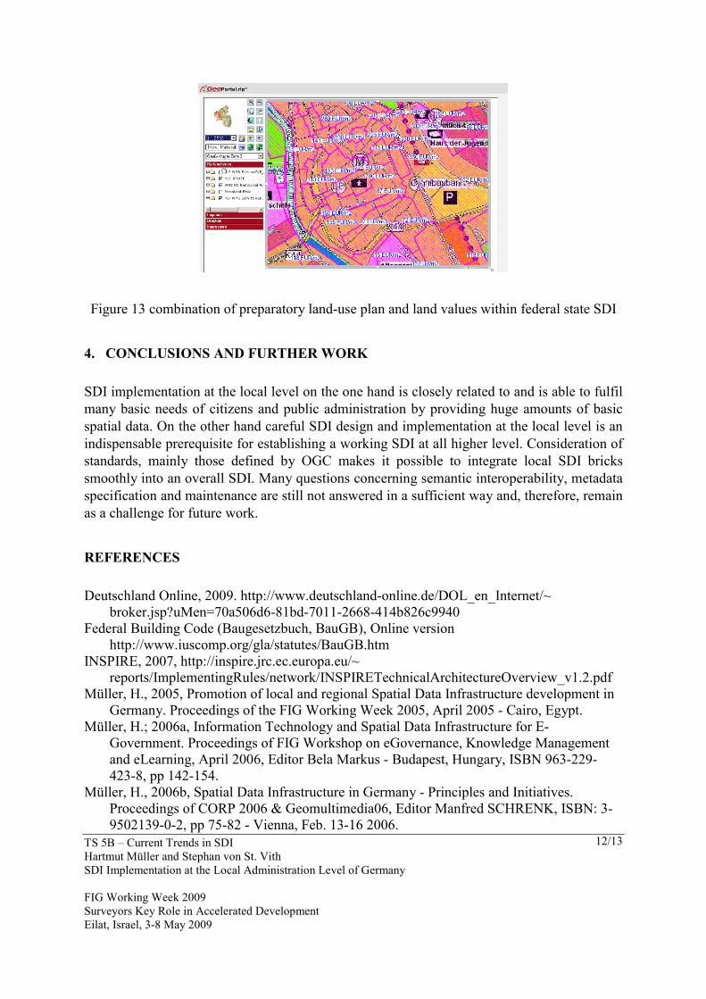
Figure 12 shows a preparatory land-use plan of the pilot authority Bernkastel-Wittlich which is provided in the Geoportal.rlp as a Web Map Service. In that way, valid planning regulations are accessible by any interested person. The combination of land-use regulation and appraisal issues is of particular interest. From Figure 13 it can be seen how such a combined view to an area of interest may look like. In this way potential investors can retrieve valuable information needed within their decision process.
TS 5B – Current Trends in SDI Hartmut Müller and Stephan von St. Vith SDI Implementation at the Local Administration Level of Germany FIG Working Week 2009 Surveyors Key Role in Accelerated Development Eilat, Israel, 3-8 May 2009
12/13
Figure 13 combination of preparatory land-use plan and land values within federal state SDI 4. CONCLUSIONS AND FURTHER WORK SDI implementation at the local level on the one hand is closely related to and is able to fulfil many basic needs of citizens and public administration by providing huge amounts of basic spatial data. On the other hand careful SDI design and implementation at the local level is an indispensable prerequisite for establishing a working SDI at all higher level. Consideration of standards, mainly those defined by OGC makes it possible to integrate local SDI bricks smoothly into an overall SDI. Many questions concerning semantic interoperability, metadata specification and maintenance are still not answered in a sufficient way and, therefore, remain as a challenge for future work. REFERENCES Deutschland Online, 2009. http://www.deutschland-online.de/DOL_en_Internet/~
broker.jsp?uMen=70a506d6-81bd-7011-2668-414b826c9940 Federal Building Code (Baugesetzbuch, BauGB), Online version
http://www.iuscomp.org/gla/statutes/BauGB.htm INSPIRE, 2007, http://inspire.jrc.ec.europa.eu/~
reports/ImplementingRules/network/INSPIRETechnicalArchitectureOverview_v1.2.pdf Müller, H., 2005, Promotion of local and regional Spatial Data Infrastructure development in
Germany. Proceedings of the FIG Working Week 2005, April 2005 - Cairo, Egypt. Müller, H.; 2006a, Information Technology and Spatial Data Infrastructure for E-
Government. Proceedings of FIG Workshop on eGovernance, Knowledge Management and eLearning, April 2006, Editor Bela Markus - Budapest, Hungary, ISBN 963-229-423-8, pp 142-154.
Müller, H., 2006b, Spatial Data Infrastructure in Germany - Principles and Initiatives. Proceedings of CORP 2006 & Geomultimedia06, Editor Manfred SCHRENK, ISBN: 3-9502139-0-2, pp 75-82 - Vienna, Feb. 13-16 2006.

TS 5B – Current Trends in SDI Hartmut Müller and Stephan von St. Vith SDI Implementation at the Local Administration Level of Germany FIG Working Week 2009 Surveyors Key Role in Accelerated Development Eilat, Israel, 3-8 May 2009
13/13
Müller, H., Siebold, M., 2008, Good-Practice Example of a German Regional SDI as a Component of the Future INSPIRE Framework. Surveying and Land Information Science, The National Society of Professional Surveyors, The American Association for Geodetic Surveying, and The Geographic and Land Information Society, Volume 68, Number 2, June 2008 , pp. 93-99.
Müller, H., Wuerriehausen, F., 2009, Geoportals as a general-purpose tool to Support the Development. FIG Commission 3 Workshop on “Spatial Information for Management of Sustainable Urban Areas”, Mainz, Germany, 2-4 February 2009.
Open Geospatial Consortium, 2009, www.opengeospatial.org Von St. Vith, Stefan, 2009,:Local SDI Implementation at County Level in Germany. FIG
Commission 3 Workshop on “Spatial Information for Management of Sustainable Urban Areas”, Mainz, Germany, 2-4 February 2009.
BIOGRAPHICAL NOTES Hartmut Müller got his diploma and doctoral degree at Karlsruhe University. After 8 years of research he turned into the marketing and software development departments of international enterprises for 6 years. Since 1991 he has been working as a professor at Mainz University of Applied sciences. Since 1998 he has been a member of the board of i3mainz, Institute for Spatial Information and Surveying Technology. In the DVW – German Association of Geodesy, Geoinformation and Land Management he is the chair of working group 2 –Spatial Information and Spatial Data Management. Stephan von St. Vith holds a diploma in Geography. From 2000 to 2005 he worked with a German ESRI partner company. Since 2005 he is the GIS administrator of the administration of German county Bernkastel-Wittlich. CONTACTS Prof. Dr.-Ing. Hartmut Müller Mainz University of Applied Sciences Lucy-Hillebrand-Str. 2 D-55128 Mainz GERMANY Tel. + 49 6131 628 1438 Fax +49 6131 628 1409 Email: [email protected], www.i3mainz.fh-mainz.de Stephan von St. Vith, Kreisverwaltung Bernkastel-Wittlich Kurfürstenstraße 16 D-54516 Wittlich GERMANY Tel. + 49 6571 14 316 Fax +49 6571 940 033 Email : [email protected], www.bernkastel-wittlich.de