schedule of matters arising changes -...
TRANSCRIPT

Newport City Council
Local Development Plan
Matters Arising Changes
June 2014

1
1. Background
1.1 Newport City Council is currently undergoing the Examination of the Newport Local
Development Plan (LDP). If, and when, these Plan proposals are adopted they will form the
development plan for Newport and will be the basis for decisions on land use planning
affecting the area.
1.2 The Council is now consulting on a number of proposed changes that have arisen as a result
of Matters Arising to date during Hearing Sessions 1-19 of the Examination. These changes
have been made to the submitted version of the Local Development Plan (December 2013).
The changes also include a number of Minor Changes that were made following consultation
on the Revised Deposit LDP (June 2013) and reported to Full Council during December 2013
and formed part of the submitted Plan.
1.3 The Matters Arising Changes set out in this document do not change the overall LDP
Strategy. The changes are being proposed by the Council pursuant to the appointed
Inspector's independent examination of the LDP. All Matters Arising can be viewed in this
document and also on the Examination website www.newport.gov.uk/ldp.
2. Consultation
2.1 These proposed Matters Arising Changes (MACs) are now the subject of public consultation.
2.2 These MACs are subject to formal consultation, from Friday 20th June 2014 to 5pm on
Friday 1 August 2014.
2.3 Copies of the Matters Arising consultation document (along with related updates in terms of
the Sustainability Appraisal (incorporating the Strategic Environmental Assessment) and the
Habitats Regulations Assessment) are also available to view and comment on. The
documents are available for public inspection at the Civic Centre, Newport Libraries and
Information Station. They are also available to view and download on the Councils website
www.newport.gov.uk/planningpolicy.
2.4 A consultation form has been provided and is available to download from the Council’s
website. It is important to note that representations should specify the matters and grounds
to which they relate, but please note at this stage they must only relate to the changes
proposed in the Matters Arising consultation document. These representations will then be
forwarded to the Planning Inspectorate, for consideration by the Inspector appointed to
examine the soundness of the plan.
2.5 Representations relating to the Matters Arising consultation document should be sent to
arrive no later than 5pm on Friday 1 August 2014 either in writing to:

2
Newport City Council Planning Policy Civic Centre Godfrey Road
Newport
NP204UR
or emailed to [email protected]
2.6 Further information regarding the consultation process is available from the Planning Policy
Team at the above address (postal and e-mail) or by calling 01633 656656.
2.7 Any questions relating to the Public Examination should be directed to the Programme
Officer Sue Hennah on 07950 954994 or on email: [email protected]
3. The Consultation Document
3.1 The proposed MACs have been made to the submitted version of the Local Development Plan (December 2013). The policy and paragraph numbering relates directly to the submitted version of the Plan. For ease of reference a tracked changes version of the Plan, noting the proposed MAC, and updated plans (Proposals/Constraints/Inset Plans) are available to view and download at: www.newport.gov.uk/planningpolicy.
3.2 This Schedule is set out in Chapter order. The proposed changes all have individual reference
numbers e.g. MAC1.1, which should be referenced in responses made to the consultation.
3.3 The changes proposed have been subject to Sustainability Appraisal and Habitat Regulation Assessment Screen which are contained in separate documents. Both documents are also available for comment and can be viewed on the Council’s website at www.newport.gov.uk/planningpolicy.
3.4 The changes are indicated in the form of yellow shading for additions and strikethroughs for deletions.

3
Chapter 1 – Introduction and Overview
Ref Policy / Allocation as per the Submitted LDP Dec 2013
Page/paragraph as per the Submitted LDP Dec 2013
Matters Arising Changes Reason
MAC 1.1
Regional Context Page 13 Paragraph 1.44
1.44 The Green Belt between Marshfield and Cardiff is the first area of statutory Green Belt in Wales. This was designated in the adopted Newport Unitary Development Plan 1996 – 2011 following earlier regional collaboration through SEWSPG on Green Belt issues around the capital. The Green Belt will continue to be protected throughout this Plan period, and will also be expanded slightly.
Need to delete reference to expansion of Green Belt.
MAC 1.2
Objective 10 – Waste
Page 12 Objective 10 – Waste
Add words “where appropriate” after “proximity principle”.
Objective 10 – Waste To ensure that waste management choices are based on the proximity principle, where appropriate, and a hierarchy of reduce, reuse, recovery and safe disposal, and that there is adequate provision for facilities to enable this to happen.
To provide further clarity and conform to national guidance.

4
Chapter 2 – Spatial Strategy and Strategic Policies
Ref Policy / Allocation as per the Submitted LDP Dec 2013
Page/paragraph as per the Submitted LDP Dec 2013
Matters Arising Changes Reason
MAC 2.1
Spatial Strategy Page 16 Paragraph 2.2
Amend Paragraph 2.2 to read: 2.2 Key elements of the Plan’s spatial strategy are:
to maximise the use of brownfield sites in the interests of sustainability, regeneration, community cohesion, and urban form;
to develop the Eastern Expansion Area of the City, focused on the former Llanwern Steelworks;
to regenerate the retail core of the City Centre;
to protect the landscape, including maintaining, and slightly extending, the statutory Green Belt on the Cardiff boundary;
to conserve protected sites and species, and encourage biodiversity;
to foster growth of the City in line with its role in the region, its locational advantages and its distinct sense of place;
to build upon the success of Newport’s national and international class sporting facilities.
Need to delete reference to expansion of Green Belt.
MAC 2.2
SP2 - Health Page 18 SP2 Health
DEVELOPMENT PROPOSALS SHOULD SEEK TO MAXIMISE THEIR POSITIVE CONTRIBUTION TO HEALTH AND WELL-BEING, AND MINIMISE ANY NEGATIVE EFFECTS BY BEING LOCATED IN THE MOST SUSTAINABLE LOCATIONS, CLOSE TO PUBLIC TRANSPORT LINKS AND PROVIDING EFFICIENT WALKING AND CYCLING ROUTES (GREEN INFRASTRUCTURE) AND OTHER GREEN INFRASTRUCTURE AS PART OF DEVELOPMENT SCHEMES.
To add clarity to the Policy.

5
MAC 2.3
SP3 – Flood Risk Page 20 Paragraph 2.18
Amend paragraph 2.18 to read: There is a clear requirement to address the issue of flood risk and flood resilience and resistance measures in developments. The plan sets out its approach to flood risk in Policy GP1: Climate Change.
To ensure total range of flood mitigation approaches are noted in the supporting text.
MAC 2.4
SP5 Countryside Page 21 Policy text
Policy SP5 will be amended to read: DEVELOPMENT IN THE COUNTRYSIDE (THAT IS, THAT AREA OF LAND LYING BEYOND THE SETTLEMENT BOUNDARIES SHOWN ON THE PROPOSAL AND INSET MAPS) WILL ONLY BE PERMITTED WHERE THE USE IS APPROPRIATE IN THE COUNTRYSIDE, RESPECTS THE LANDSCAPE CHARACTER AND BIODIVERSITY OF THE IMMEDIATE AND SURROUNDING AREA AND IS APPROPRIATE IN SCALE AND DESIGN. HOUSING DEVELOPMENT, RURAL DIVERSIFICATION AND RURAL ENTERPRISE USES, BEYOND SETTLEMENT BOUNDARIES, WILL ONLY BE APPROPRIATE WHERE THEY COMPLY WITH NATIONAL PLANNING POLICY.
Replace full stop with comma.
MAC 2.5
SP5 Countryside Page 21 Paragraph 2.22
2.22 The Council recognises the importance of protecting the countryside both for its own sake and because it provides a vital landscape setting for the urban area and transport corridors. The countryside has value for landscape, natural resources, agriculture, ecology, geology, history, archaeology and outdoor recreation. It will rarely be the appropriate location for development, except where this is for the specific benefit of the rural economy or the use satisfies policies H10 – Conversions in the Countryside and H12 – Replacement Dwellings in the Countryside.
To provide a cross reference to relevant policies in the Plan.
MAC 2.6
SP6 Green Belt Page 22 Policy Text and Supporting Text
Amend policy and supporting text to read: SP6 Green Belt THE GREEN BELT IS MAINTAINED ALONG THE NEWPORT – CARDIFF BOUNDARY AND EXTENDED NORTHWARDS TO THE M4 MOTORWAY. WITHIN THIS AREA, DEVELOPMENT WHICH PREJUDICES THE OPEN NATURE OF THE LAND WILL NOT BE PERMITTED. AN INCREASE IN SIZE OF A
To reflect the deletion of the proposed extension to the Green Belt and clarify the acceptable level volume increases to dwellings in the designated area.

6
1 PPW (Edition 5, November 2012). Available at: http://wales.gov.uk/topics/planning/policy/ppw/?lang=en
DWELLING OF MORE THAN 30% OF THE VOLUME OF THE ORIGINAL SIZE OF THE DWELLING, OR AS EXISTED IN 1948, WILL NOT BE APPROVED.
2.23 The Green Belt that lies between Marshfield and Cardiff was
designated, following regional discussions, by the Newport Unitary Development Plan 1996 – 2011 as the first green belt in Wales. Green Belts are normally expected to have a life beyond that of one development plan1, so the existing green belt is maintained. and a small addition made to extend it northwards to the M4 motorway to provide a more logical and distinct boundary. The extension is also considered necessary to respond to development within the Local Authority area, and pressure for development within the neighbouring Local Authority of Cardiff nearest the Newport boundary.
2.24 The Newport – Cardiff gap, being only about 3 miles wide in places,
and sitting between two of the only five cities of Wales, is crucial to the maintenance of urban form. There is no appetite for the cities to merge, and indeed much public support for the maintenance of this gap and the separate identity of the cities.
2.25 Planning Policy Wales (Paragraph 4.8.14 – 4.8.18) sets out what is
considered inappropriate development within Green Belt allocations, and should be referred to for guidance.
2.26 Any application to increase the size of a dwelling by more than 30% is
likely to have a negative impact on the openness of the Green Belt and will not be approved.
MAC 2.7
SP7 Green Wedge Page22 Policy Text and
Amend policy and supporting text to read:
To reflect the addition of the proposed Green Wedge and clarify the

7
Supporting Text SP7 Green Wedges GREEN WEDGES HAVE BEEN IDENTIFIED IN ORDER TO PREVENT COALESCENCE BETWEEN THE FOLLOWING SETTLEMENTS:
i) NEWPORT AND CARDIFF; ii) ROGERSTONE AND RISCA; iii) BETTWS, MALPAS AND CWMBRAN; iv) CAERLEON AND CWMBRAN.
WITHIN THESE AREAS DEVELOPMENT WHICH PREJUDICES THE OPEN NATURE OF THE LAND WILL NOT BE PERMITTED. AN INCREASE IN SIZE OF A DWELLING OF MORE THAN 30% OF THE VOLUME OF THE ORIGINAL SIZE OF THE DWELLING, OR AS EXISTED IN 1948, WILL NOT BE APPROVED. 2.27 2.25 Green Wedges have been designated on a common basis with the
other local planning authorities in South Wales. The prime purpose of Green Wedges is to prevent coalescence between urban areas. The designation is not made necessarily on the basis of the physical quality of the landscape, but rather to maintain their openness. The areas designated tend to have significant importance for their openness and for their role in maintaining the distinct identify of separate communities.
2.28 Planning Policy Wales (Paragraph 4.8.14 – 4.8.18) sets out what is
considered inappropriate development within green wedge allocations, and should be referred to for guidance.
2.29 Any application to increase the size of a dwelling by more than 30% is
likely to have a negative impact on the openness of the green wedge and will not be approved.
acceptable level volume increases to dwellings in the designated area.
MAC 2.8
SP8 Special Landscape Areas
Page 23 Policy Text
Amend Policy SP8 to read: SPECIAL LANDSCAPE AREAS ARE DESIGNATED AS FOLLOWS WITHIN WHICH
The area is already protected by the Historic Park and Garden allocation.
8
PROPOSALS WILL BE REQUIRED TO CONTRIBUTE POSITIVELY TO THE AREA THROUGH HIGH QUALITY DESIGN, MATERIALS AND MANAGEMENT SCHEMES THAT DEMONSTRATE A CLEAR APPRECIATION OF THE AREA’S SPECIAL FEATURES: i) NORTH OF BETTWS ii) WEST OF RHIWDERIN iii) WENTLOOGE LEVELS iv) RIVER USK v) CALDICOT LEVELS vi) WENTWOOD vii) TREDEGAR PARK
MAC 2.9
SP10 House Building Requirement
Page 24 Policy Text
SP10 Housing Building Requirement PROVISION IS MADE FOR 11,622 11,623 UNITS TO DELIVER A HOUSING REQUIREMENT OF 10,350 UNITS OVER THE PLAN PERIOD. THE AFFORDABLE HOUSING REQUIREMENT FOR THE PLAN PERIOD IS SET AT 8,901 UNITS AND THE AFFORDABLE HOUSING TARGET FOR THE PLAN PERIOD IS SET AT 2,527 2,061 UNITS. THE LAND WILL BE PROVIDED PRIMARILY ON PREVIOUSLY DEVELOPED LAND IN THE FOLLOWING WAYS: i) SITES WITH PLANNING PERMISSION, INCLUDING SITES UNDER CONSTRUCTION; ii) THE EASTERN EXPANSION AREA; iii) ALLOCATIONS SET OUT IN POLICY H1; AND iv) INFILL, WINDFALL AND SMALL SITES. HOUSING DEVELOPMENT OUTSIDE SETTLEMENT BOUNDARIES WILL NOT BE PERMITTED UNLESS COMPLIANT WITH POLICY H5 OR SET OUT IN NATIONAL PLANNING POLICY.
To reflect the revisions made to the Housing Supply in Policy H1.
MAC 2.10
SP11 Eastern Expansion Area
Page25 Policy and Supporting Text
Policy SP11 will be amended to read:
LAND TO THE EAST OF THE CITY THE EASTERN EXPANSION AREA CONSISTS OF THE FORMER LLANWERN STEELWORKS REGENERATION SITE KNOWN AS
The policy has been amended to reflect the wider nature of the Eastern Expansion Area.
9
2 Available at: http://www.newport.gov.uk/stellent/groups/public/documents/plans_and_strategies/cont115277.pdf
GLAN LLYN H1(47) AND EM1(vii), CENTERED ON , AND HOUSING SITES AT LLANWERN VILLAGE H1(3), HARTRIDGE HIGH SCHOOL H1(19) AND WOODLANDS JIGSAW SITE H1(55). THIS EASTERN EXPANSION AREA IS IDENTIFIED AS A RESIDENTIAL LED MIXED USE, SUSTAINABLE URBAN EXPANSION AREA AND WHICH WILL BE REQUIRED TO PROVIDE A RANGE AND CHOICE OF HOUSING, EMPLOYMENT LAND AND COMMUNITY USES. Paragraph 2.37 will be amended to read: 2.37 In addition to the former steelworks site there is also the area to the
West of Llanwern Village H1(3) which has planning permission for 1,100 units, of which 23% is affordable (253 units). This greenfield development proposes a residential development with associated community facilities such as a school forming part of the overall Eastern Expansion Area2. Other land is included within the Eastern Expansion Area, and further detail Two additional housing sites are also identified as part of the Eastern Expansion Area this includes the 65 units at the residential site adjacent to Hartridge High School (H1(19)) and the 200 units at the greenfield site at Jigsaw Site (H1(55)) which directly adjoins the Hartridge High School site. Further detail of the overall area can be found in Supplementary Planning Guidance.
MAC 2.11
SP11 Eastern Expansion Area
Page 26 Paragraph 2.38
2.38 This area enjoys good access to the City Centre via the Southern Distributor Road and Usk Way, which facilitates good public transport opportunities. Development of this area is seen to have much more potential benefit to the City Centre than development to the north, which could lead to loss of trade to Cwmbran, or to the west, where trade could be drawn to Cardiff. The area also includes a proposed station, including park-and-ride, at Llanwern, which is included in the regional transport strategy. A north-south link across the railway will provide access to the station, a second main access for the Llanwern
Need to make it clear that railway infrastructure can only be constructed by a third party.

10
Village development, and assist the provision of good bus services to residential areas, north and south. It is expected that a third party will construct a railway station (including a park-and-ride service) at Llanwern in order to make the area more accessible. A north-south link across the railway will provide an access to the station and a second main access to the Llanwern Village development. It will also encourage the provision of good bus services to local residential areas. The improvement and opening up to the public traffic of Queensway will improve access to the motorway to the east for all of South East Newport and beyond.
MAC 2.12
SP12 Community Facilities
Page 27 Paragraph 2.41
2.41 Proposals for new facilities should be situated in sustainable locations, particularly those that attract a high number of visitors, such as community centres, leisure centres and theatres, etc. Such facilities need to be accessible by a choice of transport modes and should be situated within or adjacent to the defined urban and village settlements or the community that the facility is serving., close to the population it is to serve. The re-use of existing buildings is preferable to new build particularly in the village areas. Applications will also be considered against other relevant Policies of the Plan, including the GP Policies.
To provide clarity to where the policy will be applied.
MAC 2.13
SP13 Planning Obligations
Page 28 Policy and Supporting Text
SP13 Planning Obligations
DEVELOPMENT WILL BE REQUIRED TO HELP DELIVER MORE SUSTAINABLE COMMUNITIES BY MAKING CONTRIBUTIONS TO LOCAL AND REGIONAL INFRASTRUCTURE IN PROPORTION TO ITS SCALE AND THE SUSTAINABILITY OF ITS LOCATION THROUGH THE COMMUNITY INFRASTRUCTURE LEVY (ONCE IN PLACE) AND SECTION 106 AGREEMENTS.
2.44 Development places demands on existing infrastructure, and it may also require new infrastructure to be provided. Development should therefore contribute to costs. Contributions will be secured through a variety of means, including Section 106 legal agreements, and the Community Infrastructure Levy (CIL) . If development sites are proven to be
To provide clarity and certainty as regards to where development proposals will be subject to S106 Obligations and where subject to CIL.
11
unviable the Council will need to decide what the priorities are on a site by site basis. The appropriate level of contributions will be set out in the Planning Obligations Supplementary Planning Guidance and in the Community Infrastructure Levy Charging Schedule, which will reflect the contents of the Infrastructure Plan , the LDP and the Financial Viability Study. Some elements of infrastructure may be jointly provided from contributions from more than one local Authority area where the infrastructure is of more than local significance.
2.45 There may be many stakeholders with an interest in the Community Infrastructure Levy, for example as landowners, developers, applicants for planning permission, infrastructure providers, both physical and community, community groups and providers of statutory or other services. Discussions will need to focus on key elements of infrastructure that are needed either to facilitate development in the first place or to provide what is needed because of that development. In addition a ‘meaningful’ proportion of CIL may be given to local neighbourhood communities.
DEVELOPMENT WILL BE REQUIRED TO HELP DELIVER MORE SUSTAINABLE COMMUNITIES BY PROVIDING, OR MAKING CONTRIBUTIONS TOWARDS, LOCAL AND REGIONAL INFRASTRUCTURE IN PROPORTION TO ITS SCALE AND THE SUSTAINABILITY OF ITS LOCATION.
THIS LIST IS NOT EXHAUSTIVE, BUT THE FOLLOWING ARE INFRASTRUCTURE PRIORITIES THAT DEVELOPERS WILL BE EXPECTED TO PROVIDE OR CONTRIBUTE TO IN ORDER TO MITIGATE ANY NEGATIVE CONSEQUENCES OF DEVELOPMENT:
EDUCATIONAL FACILITIES AND/OR THEIR UPGRADES;
AFFORDABLE HOUSING;
IMPROVEMENTS TO THE HIGHWAY NETWORK, INCLUDING WALKING

12
AND CYCLING ROUTES AND PUBLIC TRANSPORT;
OUTDOOR RECREATION;
PROTECTION, ENHANCEMENT AND MANAGEMENT OF THE NATURAL, HISTORIC AND BUILT ENVIRONMENTS;
COMMUNITY FACILITIES AND/OR THEIR UPGRADES; AND
IMPROVEMENTS TO THE PUBLIC REALM.”
Supporting text:
2.44 In order to mitigate the impact of development, S106 planning obligations will be sought to enhance the quality of the development, provide community benefits and infrastructure facilities. The Planning Obligations SPG will provide the framework and requirements for planning obligations for new developments. The Council will negotiate planning obligations on a site-by-site basis where these are necessary to make the development acceptable in planning terms. Obligations will be directly related to the development and fairly and reasonably related in scale and kind to the development. As part of this process, the level of affordable housing provision will be set at a rate that reflects individual site viability, based upon ‘open book’ appraisals and potentially independent third party analysis.
2.45 The Community Infrastructure Levy (CIL) system came into force in April 2010 and will potentially have implications on the range and nature of contributions sought through S106 planning obligations during the Plan period. Any such considerations would be accommodated through the preparation of Supplementary Planning Guidance. S106 planning obligations will continue to ensure that ‘site specific’ mitigation is sought to make a

13
development acceptable in planning terms. Additionally, a separate CIL Regulation 123 List would identify infrastructure that addresses the ‘broader’ impacts of development. It is anticipated that a Pre-Draft Charging Schedule and Infrastructure Delivery Plan will be published in early autumn 2014, followed by adoption prior to April 2015.
2.46 Following the adoption of CIL, there will be two limitations on the use of planning obligations: firstly, there will be no circumstances where a developer will pay CIL and S106 for the same infrastructure in relation to the same development; secondly, pooled contributions will only be sought from up to five separate S106 obligations for an item of infrastructure which is not intended to be funded by CIL.
MAC 2.14
SP15 Integrated Transport
Page 29 Policy Text
SP15 INTEGRATED TRANSPORT
INTEGRATED TRANSPORT WILL BE IMPLEMENTED PURSUED IN LINE WITH THE SEWTA REGIONAL TRANSPORT PLAN, INCLUDING NATIONAL AND REGIONAL TRANSPORT STRATEGIES. SUCH TRANSPORT WILL COMPRISE:
i) A CO-ORDINATED PEDESTRIAN NETWORK, INCLUDING SCHEMES SUCH AS “SAFE ROUTES IN COMMUNITIES”;
ii) IMPLEMENTATION OF THE CYCLING STRATEGY;
iii) INNOVATIVE FORMS OF PUBLIC TRANSPORT SUCH AS BUS PRIORITY, SAFEGUARDING AND ENHANCEMENT OF RAIL ROUTES AND IDENTIFICATION OF NEW STATIONS;
iv) DESIGNATION OF TRANSPORT INTERCHANGES FOR PARK AND RIDE, PARK AND SHARE, AND ROAD TO RAIL FREIGHT CENTRES;
To reflect that the Council will be pursuing such integrated transport methods rather than implementing them and to reflect changes in the status of the SEWTA Regional Transport Plan.

14
v) A CENTRAL AREA PARKING STRATEGY CO-ORDINATED WITH AND IN CO-OPERATION WITH LOCAL AUTHORITIES IN THE SEWTA REGION;
vi) FACILITIES FOR PUBLIC TRANSPORT, WALKING AND CYCLING IN MAJOR NEW DEVELOPMENT;
vii) INTERCHANGE BETWEEN BUS, BICYCLE AND CAR TO ENABLE SUSTAINABLE USE OF THE COUNTRYSIDE.
SIGNIFICANT DEVELOPMENT PROPOSALS SHALL BE ACCOMPANIED BY TRAVEL PLANS.
MAC 2.15
SP15 Integrated Transport
Page 30 Supporting Text Paragraph 2.50
2.50 Newport occupies a strategic location in the region and integration of transport needs to be considered not just in local terms but also in the wider context. The South East Wales Transport Alliance (SEWTA) provides an important means of achieving this. SEWTA is an alliance of 10 local authorities in South East Wales, which prepares and co-ordinates regional transport Policies, plans and programmes on behalf of its constituent councils. One of its main objectives is to co-ordinate the delivery of an integrated transport strategy for South East Wales, including the identification of transport proposals and a five year programme set out in the Regional Transport Plan. Transport proposals must seek to assist with the aspirations of the Regional Transport Plan.
To reflect the changes in the regional working group.
MAC 2.16
SP16 Major Road Schemes
Page 30 Policy Text
SP16 Major Road Schemes
LAND WILL BE SAFEGUARDED FOR THE FOLLOWING STRATEGIC HIGHWAY SCHEMES:
i) M4 MOTORWAY JUNCTION 28 TREDEGAR PARK INTERCHANGE IMPROVEMENT;
ii) EASTERN EXTENSION OF THE SOUTHERN DISTRIBUTOR ROAD ALONG
To update policy with road schemes that are scheduled to be delivered within the plan period.

15
QUEENSWAY THROUGH THE GLAN LLYN REGENERATION AND LLANWERN STEELWORKS SITES;
ii) iii)WESTERN EXTENSION OF THE SOUTHERN DISTRIBUTOR ROAD AS THE DUFFRYN LINK ROAD BETWEEN MAESGLAS AND COEDKERNEW;
iii) v)OLD GREEN JUNCTION REMODELLING;
(iii) NORTH-SOUTH LINK – LLANWERN.
MAC 2.17
SP16 Major Road Schemes
Page 31 Supporting Text Paragraph 2.52
Paragraph 2.52 will be reworded to state:
2.57 2.52Junction 28 (Tredegar Park) is where traffic from the Rogerstone and Bassaleg areas, and from all the western valleys of Gwent, join or cross the M4. The junction experiences congestion and improvements are proposed for this strategic junction in the network. Much of the traffic originating in Rogerstone, Bassaleg and the western valleys of Gwent joins or crosses the M4 at Junction 28 (Tredegar Park). By the end of 2016, the Welsh Government will have completed a programme of improvements designed to ease congestion at this strategic junction. Policy GP5 provides guidance on the obligations on developers of schemes in the Gwent Levels.
To provide clarity in relation to Junction 28 (Tredegar Park).
MAC 2.18
SP16 Major Road Schemes
Page 31 Supporting Text Paragraph 2.56
Paragraph 2.56 will be reworded to state: 2.61 2.56 The Duffryn Link proposed route corridor lies within the Gwent
Levels – St Brides SSSI. The SSSI is notified for its range of aquatic plants and invertebrates associated with the reens and ditches of the drainage system, under the Wildlife and Countryside Act 1981 (as amended). The Duffryn Link is likely to result in crossing the Percoed Reen. The Reen is a known commuting otter habitat connecting to the River Usk SAC (otters are one of the qualifying features of this European site). Otters are also European Protected Species under the Conservation of Habitats and Species Regulations 2010 (as amended). Percoed Reen
To ensure that both the European and National designations of ecological conservation importance are covered in the supporting text.
16
also supports the special interest of the Gwent Levels – St Brides SSSI. Any works affecting a Reen the Percoed Reen must be completed in a sensitive manner for otters, to maintain the favourable conservation status of this species, and to conserve and enhance the special interests of the Gwent Levels – St Brides SSSI. The Reen must be maintained in situ (this watercourse must not be culverted) with a minimum of 5m of bank side habitat retained on either side. Works affecting a watercourse within the Internal Drainage Board area will need to adhere to their standard buffer requirements, see para 2.16 5 for more details. Developers will be required to complete an otter survey to determine levels of otter activity in the affected area, which should be used to inform the design of the road and any mitigation that is required. Relevant licences under Regulation 53 of the Conservation of Habitats and Species Regulations 2010 (as amended) may be required from NRW. A sensitive working programme must be compiled to minimise disturbance to this species (this may include obtaining relevant licenses from NRW). Furthermore, should the Percoed Reen need to be crossed, the crossing will need to be designed to ensure continued otter movement up and downstream (even in flood conditions).
2.62 2.56 In accordance with Policy GP5 the developer will be expected to
provide sufficient information to enable a Habitat Regulation Assessment of these works to be carried out as part of the planning process. In accordance with Policy GP5 the developer will be expected to demonstrate how the special interest of the Gwent Levels – St Brides SSSI will be safeguarded, with respect to the Wildlife and Countryside Act 1981 (as amended).
MAC 2.19
SP17 & SP18 Policies and Supporting Text
Merge SP17 and SP18, and the supporting text, to create single strategic level employment land policy. See Appendix 1 for Policy SP17
To provide on how the Council will meet its Employment Land Requirement.
MAC SP21 Waste Page 36 SP21 Waste Management To accord with national guidance.

17
2.20 Management Policy and Supporting Text
THE SUSTAINABLE MANAGEMENT OF WASTE ARISINGS IN NEWPORT WILL BE FACILITATED BY PROMOTING AND SUPPORTING ADDITIONAL TREATMENT FACILITIES, MEASURES AND STRATEGIES THAT REPRESENT THE BEST PRACTICABLE ENVIRONMENTAL OPTION, HAVEING REGARD TO THE WASTE HIERARCHY, AND THE PROXIMITY PRINCIPLE AND CONTRIBUTE TO AN INTEGRATED NETWORK OF FACILITIES. 2.78 Planning Authorities are required by European Directives and National
Guidance to ensure that waste is recovered or disposed of without harming the environment, whilst also meeting stringent waste related targets. The choice of waste management options for a particular waste stream will be guided by the policy principles established in TAN 21 (2014), with particular reference to: The Waste Hierarchy; An Integrated and Adequate Network; Nearest Appropriate Installation; Self Sufficiency; and Protection of Human Health and the Environment. “Best Practicable Environmental Option” (BPEO) taking into account the environmental and economic costs and benefits of different options. The Welsh Government also supports the “proximity principle” requiring that waste should be disposed of, or otherwise managed close to the point at which it is generated, and the principle of “regional self-sufficiency”, each region aiming to provide, as far as possible, sufficient capacity for managing the waste which arises within it.
MAC 2.21
SP22 Minerals Page 36 Policy Text
THE PLAN WILL FULFIL ITS CONTRIBUTION TO THE REGIONAL DEMAND BY: i) SAFEGUARDING LOCALISED POTENTIAL HARDROCK AND SAND &
GRAVEL RESOURCE BLOCKS;
The amendment to the policy does not amend the meaning of the criterion. The resource blocks by definition are local and potential.
MAC 2.22
SP22 Minerals Page 37 Supporting Text Paragraphs 2.80 and 2.81
2.80 Land use planning policy guidance for mineral exhaustion and related development is set out in Minerals Planning Policy Wales (2001) and supplemented by Mineral Technical Advice Note 1: Aggregate (2004) and Technical Advice Note 2: Coal (2009). Mineral planning is considered at the regional scale, the overall consideration
Updated to reflect the reviewed status of the Regional Technical Statement.

18
of supply and demand for the South Wales region is carried out by the South Wales Regional Aggregates Working Party (SWRAWP). The role of the SWRAWP is to examine issues of aggregate provision and to produce a Regional Technical Statement (RTS) (2008) setting out the strategy for the provision of aggregates in South Wales. Newport has no active working quarries and rock reserves are extremely modest therefore projection is not based on existing shares. The recommendations from the RTS have been investigated and are set out in the recent ‘Former Gwent’ Aggregates Safeguarding Study, undertaken by Cuesta Consulting (2009).
2.81 The RTS sets out the need for Newport to provide 8 to 8.5 million tonnes of aggregate and National Mineral Planning Policy requires Planning Authorities to maintain a landbank of supply for both hard rock and sand & gravel reserves. There is no current landbank within the Newport boundary, resources are limited and adjoining authorities are unable to take on the provision. Therefore Newport will consider proposed mineral workings in the regional context due to the limited resource to enable an individual landbank policy to be applied, as recognised in Section 17 of MPPW.
2.87 2..80 Land use planning policy guidance for mineral extraction and
related development is set out in Minerals Planning Policy Wales (2001) and supplemented by Mineral Technical Advice Note 1: Aggregate (2004) and Technical Advice Note 2: Coal (2009). Mineral planning is considered at the regional scale, the overall consideration of supply and demand for the South Wales region is carried out by the South Wales Regional Aggregates Working Party (SWRAWP). The role of the SWRAWP is to examine issues of aggregate provision and to produce a Regional Technical Statement (RTS) which sets out the strategy for the provision of aggregates in South Wales.
2.88 2.81 There is no current landbank in Newport and resources are

19
limited. National Planning Policy requires local authorities to maintain a landbank to meet demand where there is an insufficient landbank of permitted reserves to meet the identified demand. The RTS First Review (2014) does not require Newport to make specific provision for the supply of primary land-won aggregate, based on the limited availability of resources within the area and a lack of evidence of demand from past sales of land-won aggregate over the past 10 years. Applications for mineral workings will be considered on a case by case basis, recognising that circumstances can change in the future. The RTS First Review requires Newport to safeguard of potential resources, continue the use of marine, secondary and recycled aggregates and protect wharves and rail for the sustainable transportation of aggregate.

20
Chapter 3 – General Policies
Ref Policy / Allocation as per the Submitted LDP Dec 2013
Page/paragraph as per the Submitted LDP Dec 2013
Matters Arising Changes Reason
MAC 3.1
GP1 – Climate Change
Page 39 GP1 General Development Principles – Climate Change DEVELOPMENT PROPOSALS SHOULD: i) BE DESIGNED TO WITHSTAND THE PREDICTED CHANGES
IN THE LOCAL CLIMATE AND TO REDUCE THE RISK OF FLOODING ON SITE AND ELSEWHERE BY DEMONSTRATING WHERE APPROPRIATE THAT UNLESS THE RISKS AND CONSEQUENCES OF FLOODING ARE DEMONSTRATED AS BEING CAN BE ACCEPTABLY MANAGED, INCLUDING AVOIDING THE AVOIDANCE USE OF NON-PERMEABLE HARD SURFACES;
ii) BE DESIGNED TO MINIMISE ENERGY REQUIREMENTS AND INCORPORATE APPROPRIATE RENEWABLE, LOW OR ZERO CARBON ENERGY SOURCES, INCLUDING ON SITE ENERGY PROVISION WHERE PRACTICABLE;
iii) BE DESIGNED TO REUSE OR RECYCLE EXISTING CONSTRUCTION MATERIALS PRESENT ON THE SITE;
iv) MEET THE RELEVANT BREEAM OR CODE FOR SUSTAINABLE HOMES LEVEL.
To add clarification to the Policy.
MAC 3.2
GP5 – Natural Environment
Page 45 Paragraph 3.27
3.1 This Plan aims to achieve the protection and enhancement of habitats and species, especially those identified as being of national or local importance (identified in the UK Biodiversity Action Plan and the Newport Local Biodiversity Action Plan) and to provide a net benefit to biodiversity as well as avoiding any net loss of biodiversity. The City Council has a duty under
To clarify the Council’s position on the loss of biodiversity.

21
3 Further information is available in TAN5, available at: http://wales.gov.uk/topics/planning/policy/tans/tan5/?lang=en
the Natural Environment and Rural Communities Act (2006), or as amended, to have regard to the purpose of conserving biodiversity.
MAC 3.3
GP5 – Natural Environment
Page 44 Paragraph 3.24
3.24 The network of national sites within Newport includes Sites of Special Scientific Interest (SSSI) and National Nature Reserves (NNR) which have been identified on the Constraints Map and are protected under the Wildlife and Countryside Act (1981), or as amended. These sites require the fullest regard to the intrinsic value of the site and their nature conservation value. Development with the potential to affect a recognised site will be closely scrutinised for any direct or indirect effects. The developer must demonstrate the case for development and why it could not be located on a site of less significance for nature conservation.3 Where a site is known to be a habitat or commuting route of a European Protected Species under the Conservation of Habitats and Species Regulations 2010 (as amended), development proposals must be completed in a sensitive manner, to protect the conservation status of the internationally and nationally important site.
To ensure that both the European and National designations of ecological conservation importance are covered in the supporting text.
MAC 3.4
GP6 Page 47 Policy text (criterion iii)
GP6 General Development Principles – Quality of Design GOOD QUALITY DESIGN WILL BE SOUGHT IN ALL FORMS OF DEVELOPMENT. THE AIM IS TO CREATE A SAFE, ACCESSIBLE, ATTRACTIVE AND CONVENIENT ENVIRONMENT. IN CONSIDERING DEVELOPMENT PROPOSALS THE FOLLOWING FUNDAMENTAL DESIGN PRINCIPLES SHOULD BE ADDRESSED: i) CONTEXT OF THE SITE: ALL DEVELOPMENT SHOULD BE
Provide clarification in accordance with inspector’s request.

22
SENSITIVE TO THE UNIQUE QUALITIES OF THE SITE AND RESPOND POSITIVELY TO THE CHARACTER OF THE AREA;
ii) ACCESS, PERMEABILITY AND LAYOUT: ALL DEVELOPMENT SHOULD MAINTAIN A HIGH LEVEL OF PEDESTRIAN ACCESS, CONNECTIVITY AND LAID OUT SO AS TO MINIMISE NOISE POLLUTION;
iii) PRESERVATION AND ENHANCEMENT: WHERE POSSIBLE DEVELOPMENT SHOULD REFLECT THE CHARACTER OF THE LOCALITY BUT AVOID THE INAPPROPRIATE REPLICATION OF NEIGHBOURING ARCHITECTURAL STYLES. THE DESIGNER IS ENCOURAGED TO DISPLAY CREATIVITY AND INNOVATION IN DESIGN;
iv) SCALE AND FORM OF DEVELOPMENT: NEW DEVELOPMENT SHOULD APPROPRIATELY REFLECT THE SCALE OF ADJACENT TOWNSCAPE. CARE SHOULD BE TAKEN TO AVOID OVER-SCALED DEVELOPMENT;
v) MATERIALS AND DETAILING: HIGH QUALITY, DURABLE AND PREFERABLY RENEWABLE MATERIALS SHOULD BE USED TO COMPLEMENT THE SITE CONTEXT. DETAILING SHOULD BE INCORPORATED AS AN INTEGRAL PART OF THE DESIGN AT AN EARLY STAGE;
vi) SUSTAINABILITY: NEW DEVELOPMENT SHOULD BE INHERENTLY ROBUST, ENERGY AND WATER EFFICIENT, FLOOD RESILIENT AND ADAPTABLE, THEREBY FACILITATING THE FLEXIBLE RE-USE OF THE BUILDING. WHERE EXISTING BUILDINGS ARE PRESENT, IMAGINATIVE AND SENSITIVE SOLUTIONS SHOULD BE SOUGHT TO ACHIEVE THE RE-USE OF THE BUILDINGS.

23
Chapter 4 – Environment
Ref Policy / Allocation as per the Submitted LDP Dec 2013
Page/paragraph as per the Submitted LDP Dec 2013
Matters Arising Changes Reason
MAC 4.1
N/A N/A No MAC 4.1. MAC removed.
MAC 4.2 CE5 Historic Landscapes, Parks, Gardens and Battlefield
Page 54 Policy and Supporting Text
Policy and supporting text to be amended to read:
CE5
SITES INCLUDED IN THE REGISTER OF LANDSCAPES, PARKS AND
GARDENS OF SPECIAL HISTORIC INTEREST AND IDENTIFIED HISTORIC
BATTLEFIELDS SHOULD BE PROTECTED, CONSERVED, ENHANCED AND
WHERE APPROPRIATE RESTORED. ATTENTION WILL ALSO BE GIVEN TO
THEIR SETTING.
Paragraph 4.23 is to be amended to read:
The Welsh Government has proposed that Cadw should compile and
maintain a non-statutory register of Historic Battlefields in Wales in order
to protect our most significant sites for the future. Their protection as
cultural and heritage assets is supported, and their contribution to
tourism, recreation and education recognised.
Historic Battlefields are a significant part of the historic landscape and their protection as cultural and heritage asset is supported. Their
To ensure supporting text is clear.

24
contribution to tourism, recreation and education is recognised and welcomed. Cadw should be contacted for information on the location and process of identification. There will be a presumption in favour of the conservation and enhancement of the site.
MAC 4.3
CE6 Locally Listed Buildings and Sites
Page 55 Supporting Text Paragraph 4.25
Paragraph 4.25 to be amended to read:
Development which is proposed to have an impact upon such a
recognised site will require its status to be an added dimension in the
overall consideration of a planning application, with emphasis given to
the need for justification for the loss or unsatisfactory alteration of such
buildings, and to intervention in development proposals to secure their
conservation and enhancement.
The locally listed status of a building or site would be a consideration at the planning application stage. Justification will be required for the loss or unsatisfactory alteration of such buildings or sites, and intervention will be sought to secure their conservation and enhancement.
To ensure supporting text is clear.
MAC 4.4
CE8 Conservation Areas
Page 57 Policy Text
Policy CE8 to be amended to read:
DEVELOPMENT WITHIN OR ADJACENT TO CONSERVATION AREAS WILL
BE REQUIRED TO:
i) BE DESIGNED TO PRESERVE OR ENHANCE THE
ARCHAEOLOGICAL OR HISTORIC CHARACTER OR APPEARANCE
OF THE CONSERVATION AREA, HAVING REGARD TO THE
CONSERVATION AREA APRAISAL WHERE APPROPRIATE.
ii) AVOID THE REMOVAL OF EXISTING HISTORIC FEATURES,
INCLUDING TRADITIONAL SHOPFRONTS AND JOINERY.
iii) USE MATERIALS WHICH ARE TRADITIONAL, OR APPROPRIATE
TO THEIR CONTEXT.
iv) COMPLEMENT OR REFLECT THE ARCHITECTURAL QUALITIES OF
To clarify the objective of the policy to the overarching character of the area that is wider than its historic or archaeological value.
25
NEARBY BUILDINGS WHICH MAE A POSITIVE CONTRIBUTION TO
THE CHARACTER OF THE AREA.
v) PAY SPECIAL ATTENTION TO THE SETTINGS OF BUILDINGS, AND
AVOID THE LOSS OF ANY EXISITNG DOMESTIC GARDENS AND
OPEN SPACES WHICH CONTRIBUTE TO THE CHARACTER OF THE
AREA.
vi) AVOID ADVERSE IMPACT ON ANY SIGNIFICANT VIEWS, WITHIN,
TOWARDS AND OUTWARDS FROM THE CONSERVATION AREA.
MAC 4.5
CE11 Renewable Energy
Page 62 Policy CE11 and supporting text 4.50 – 4.57
CE11 Renewable Energy
RENEWABLE ENERGY SCHEMES WILL BE CONSIDERED
FAVOURABLY, SUBJECT TO THERE BEING NO OVER-RIDING
ENVIRONMENTAL AND AMENITY CONSIDERATIONS. AND
THE SPECIAL QUALITIES OF THE GWENT LEVELS ARE NOT
COMPROMISED. SMALL SCALE MICROGENERATION WILL
BE ENCOURAGED WITHIN THE SETTLEMENT BOUNDARY.
LARGE SCALE PROPOSALS MAY BE MORE
APPROPRIATELY LOCATED OUTSIDE OF THE DEFINED
SETTLEMENT BOUNDARY IF NO APPROPRIATE
BROWNFIELD SITES EXIST. PREFERENCE WILL BE GIVEN
TO RENEWABLE ENERGY SCHEMES PROPOSED WITHIN
THE DEFINED SETTLEMENT BOUNDARY AND IN CLOSE
PROXIMITY TO THE REQUIRED INFRASTRUCTURE. THE
CUMULATIVE IMPACTS OF OTHER RENEWABLE ENERGY
SCHEMES WILL BE AN IMPORTANT CONSIDERATION.
4.50 The development of renewable sources of energy can
make a valuable contribution to tackling the rate of climate
change and enable us to live in a more sustainable
manner. TAN 8: Planning for Renewable Energy (2005)
To add clarity to the appropriate locations for renewable energy.
26
sets out the Welsh Government’s commitment to
facilitating the development of renewable energy sources.
Detailed guidance on different types of renewable energy
technologies including design and locational
considerations are set out in TAN 8: Planning for
Renewable Energy, and developers should have regard to
these when proposing renewable energy schemes. The
Council is undertaking has undertaken a Renewable
Energy Assessment. This will sets out the potential for
renewable energy resources and technologies within
Newport. It should be considered when assessing
renewable energy proposals, and the potential contribution
renewable energy can make within development.
4.51 Particular care should be taken in assessing proposals for
renewable energy projects in sensitive, designated areas,
such as areas of high landscape quality, and areas of
nature conservation, or archaeological or historical
importance. The Gwent Levels are recognised as an
internationally important resource in terms of landscape
and heritage and nationally important for ecology.
Proposals which affect the special qualities of the Gwent
Levels, or any other protected site, will be resisted unless
it can be demonstrated that there will be no significant
adverse effects.
4.52 In Newport, although a variety of renewable energy
projects may be proposed, the most common installations
of larger scale proposals seeking planning permission in
recent years have been solar or wind power

27
developments, through the provision of solar panel farms
or the erection of wind turbines.
4.53 Wind turbines can fulfil an important role in the creation of
energy, but they can also have a visual, noise and ecology
impact over a wide area that can be unacceptably
damaging to the environment and amenity. A technical
capacity study for wind turbines within Newport has been
undertaken, the conclusions and recommendations of
which will be taken into consideration in the determination
of wind turbine applications.
4.54 With regards to solar energy, key considerations in their
assessment will include the ecological, landscape and
visual impact of a scheme. The potential for reflective
‘glint and glare’ will need to be explored as well as
potential ecological and visual impacts from installation
techniques such as cable trenches and the removal of
hedgerows. Similarly the impact of associated
infrastructure and security measures will need to be
considered.
4.55 Brownfield sites within the settlement boundary will be
favourably considered and where possible, should be
considered before greenfield options. The use of
brownfield sites is a more sustainable option in terms of
land take up and usually benefits from being surrounded
by potential energy users or closer grid connections,
reducing the requirements and impact of associated
infrastructure. Development of larger scale renewable

28
energy schemes may be acceptable on greenfield sites
where it can be demonstrated that there will be no
significant adverse impacts on the environment and local
communities. The use of existing buildings, for example
the fitting of solar panels, will be encouraged subject to it
satisfying the Policies of the Plan. The installation of solar
panels (up to 50MW) on non-domestic buildings are
permitted development under Part 43 (installation of non-
domestic micro generation equipment) of Schedule 2 of
the General Permitted Development Order.
4.56 The positive contribution renewable energy schemes can
make to sustainability and climate change must be
balanced with the need to protect the environment and
amenity. The cumulative impact of proposals, in both
greenfield and brownfield locations, will therefore be a
careful consideration in the acceptability of a scheme.
Developers will need to consider the number of other
similar developments in the locality and the impact they
would have collectively.
4.57 Smaller scale micro-generation which involves the
production of heat or power on a very small scale
ordinarily for use where it is made, is most appropriately
located within existing settlement boundaries, however
exceptions may be appropriate in certain circumstances.
Installations on or within curtilages of buildings should be
of a scale and design appropriate to their surroundings
and in accordance with GP Polices of this Plan. Particular
regard should be had to design within Conservation Areas,

29
on Listed Buildings and within the Gwent Levels Special
Landscape Area4. Renewable energy schemes should be
considered as an integral part of new build development
schemes. Design of renewable energy installations should
be referred to in the relevant Design and Access
Statement.
4.58 A range of micro-generation technology is permitted
development under Part 40 (installation of domestic micro-
generation equipment) and Part 43 (installation of non
domestic micro generation equipment) of the General
Permitted Development Order, and should be referred to
for further guidance. Renewable energy schemes will be
encouraged especially within settlement boundaries.
Chapter 5 – Housing
4 Further guidance on this can be found in the Cadw Publication (2010) on ‘Renewable energy and your historic building’.
http://cadw.wales.gov.uk/docs/cadw/publications/Micro_gen_booklet_EN.pdf

30
Ref Policy / Allocation as per the Submitted LDP Dec 2013
Page/paragraph as per the Submitted LDP Dec 2013
Matters Arising Changes Reason
MAC 5.1
H1 Housing Sites
Page 64 H1 Table
Changes to Policy H1 Housing Supply are set out in Appendix 2 below. This include the deletion of: H28 – Church Street H35 – East of Usk Road H50 – Herbert Road/Enterprise House Additional new H1 sites have been added at: H61 – Postal Exchange H62 – Queens Hill School H63 – Telford Depot H64 – Uskside Paint Mills
Refinement and update of housing supply figures and how the Council will meet the Housing Requirement figure.
MAC 5.2
H3 Housing Mix and Density
Page 70 Policy Text
H3 Housing Mix and Density RESIDENTIAL DEVELOPMENT OF 10 DWELLINGS OR MORE SHOULD BE DESIGNED TO PROVIDE A MIX OF HOUSING TYPES AND DENSITIES TO MEET A RANGE OF NEEDS AND SHOULD BE BUILT AT A DENSITY OF AT LEAST 30 DWELLINGS PER HECTARE. A LOWER DENSITY WILL ONLY BE ACCEPTABLE WHERE IT IS DEMONSTRATED:
i) PHYSICAL OR INFRASTRUCTURE CONSTRAINTS PREVENT THE MINIMUM DENSITY FROM
BEING REACHED, OR; ii) THE MINIMUM DENSITY WOULD HAVE AN UNACCEPTABLE IMPACT ON
DESIGN/CHARACTER OF THE SURROUNDING AREA, OR; iii) THERE IS A PARTICULAR LACK OF CHOICE OF HOUSING TYPES WITHIN A LOCAL
COMMUNITY. A minimum density of 30 dwellings per hectare will ensure development land is used efficiently which will help to create sustainable communities. A lower density will only be acceptable in accordance with the criteria listed above. Lower densities might be acceptable where it can be demonstrated there is a lack of choice of housing types within a local community. In particular,
The policy has been updated to reflect the minimum density set out in the monitoring section of the Plan. The policy has also been worded to allow some level of flexibility where appropriate.

31
some communities within Newport are dominated by high density housing and a lower form of density would provide greater choice. In demonstrating criterion iii) consideration should also be given to Policy GP2 and how the proposed development will impact on the character or appearance of the surrounding area.
While it may not be appropriate for small sites (of less than 10 dwellings) to provide a range of housing types and densities, the normal pattern should be for a mix of units to be provided. In this way the range and choice of housing opportunities available to people should be made as comprehensive as possible.
MAC 5.3
H4 Affordable Housing
Page 70 Policy and Supporting Text
Policy H4 will be updated to read: H4 Affordable Housing RESIDENTIAL DEVELOPMENTS OF 0.33 HECTARES OR 10 OF MORE DWELLINGS, WHATEVER THE SIZE OF THE SITE, WITHIN IN THE SETTLEMENT BOUNDARY, OR 0.2 HECTARES OR 3 OR MORE DWELLINGS, WHATEVER THE SIZE OF THE SITE, WITHIN THE DEFINED VILLAGE BOUNDARIES WILL BE REQUIRED TO INCLUDE 30% AFFORDABLE HOUSING DWELLINGS, PROVISION WILL BE SET TO REFLECT SITE VIABILITY. ON-SITE PROVISION OF AFFORDABLE HOUSING WILL BE REQUIRED ON ALL NEW HOUSING SITES OF 10 OR MORE DWELLINGS WITHIN THE SETTLEMENT BOUNDARY, OR 3 OR MORE DWELLINGS WITHIN THE DEFINED VILLLAGE BOUNDARIES. THE AUTHORITY WILL SEEK THE PROVISION OF AFFORDABLE HOUSING IN ACCORDANCE WITH THE RELEVANT SUB MARKET AREA TARGET NOTED BELOW; 40% CAERLEON AND RURAL NEWPORT 30% ROGERSTONE AND WEST NEWPORT 20% EAST NEWPORT 10% MALPAS AND BETTWS (THE SUBMARKET AREAS ARE DEFINED ON THE AFFORDABLE HOUSING SUBMARKET AREA PLAN OVERLEAF*)
The Policy has been reworded to reflect the revised approach to the provision of affordable housing. It introduces a split target approach and the use of commuted sums below the threshold.

32
SPECIFIC SITE TARGETS MAY VARY SUBJECT TO VIABILITY AND NEGOTIATION. FOR NEW HOUSING SITES OF FEWER THAN 10 DWELLINGS WITHIN THE SETTLEMENT BOUNDARY, OR FEWER THAN 3 DWELLINGS WITHIN THE DEFINED VILLAGE BOUNDARIES, THE COUNCIL WILL SEEK A COMMUTED SUM CONTRIBUTION. THE AFFORDABLE HOUSING SPG CLARIFIES THE METHODOLOGY FOR CALCULATING THE COMMUTED SUM PAYMENTS. *The Plan is available to view in Appendix 3 5.14 The Local Housing Market Assessment indicates an on-going requirement for
affordable housing totalling 86% of the overall housing requirement for the LDP in excess of 30%. Many people are not able either to access and/or to afford open market housing. Therefore in accordance with Planning Policy Wales and Technical Advice Note 2: Planning And Affordable Housing (2006), new development will be required to include affordable housing. Further information will be provided in Affordable Housing Supplementary Planning Guidance. The viability of development is undertaken on a site-by-site basis. As such, the percentage of affordable housing provision is set at a rate that reflects individual site viability. It is recognised that 30% is a realistic figure of what schemes are likely to be able to sustain, and the guidance clarifies the factors that will be taken into account in negotiating the appropriate percentage for each scheme, necessary safeguards, and how the requirement should be delivered. Where a developer can demonstrate to the satisfaction of the Authority that the expected percentage is not deliverable, they may negotiate with the LPA to ensure delivery of a reasonable number of affordable homes, which contributes to meeting the need of the area. It is recognised that due to the various values associated with sub market areas of Newport a split target approach has been set. The sub market targets are a realistic figure of what schemes are likely to be able to sustain. The high level of affordable housing need in Newport means that the Council requires those sites meeting the policy threshold to provide on-site affordable housing provision. If the site does not meet the threshold then a commuted sum is required. The SPG clarifies the factors that will be taken into account in negotiating the appropriate percentage or each scheme, necessary safeguards, and how the requirement should be delivered.

33
MAC 5.4
H5Affordable Housing Exceptions
Page 71 Supporting text Paragraph 5.15
5.15 Planning Policy Wales allows for the release of sites for affordable housing, including Gypsy and Traveller accommodation, as an exception to normal housing Policies. A local needs survey will be to be required to show that there is a genuine local need for this type of accommodation. The need for Gypsy and Traveller accommodation is defined by the Council. Gypsy and Traveller families will need to demonstrate a genuine local connection and genuine need to locate in the area. GP Policies will also apply. Alternatives should be explored before Green Belt and Green Wedge locations are considered. GP policies will apply to all proposals, and sites in the Green Belt or Green Wedges should not be considered until all other possibilities have been explored and discounted.
Need to delete references to G&T accommodation from explanatory text to H5 (paragraph 5.15).
MAC 5.5
H7 Annexes to Residential Dwellings
Page 71 Policy text and supporting text Paragraphs 5.17 and 5.18
H7 Annexes to Residential Dwellings
ANNEXES TO RESIDENTIAL DWELLINGS THAT ARE CAPABLE OF OCCUPATION AS SELF-CONTAINED ACCOMMODATION WILL BE CONSIDERED AS IF THEY WERE NEW DWELLINGS. 5.17 Where proposals come forward for the provision of additional accommodation within the curtilage of a dwelling, for example by way of ‘granny annexes’ or accommodation for other family members, perhaps related to a business, these will be treated as separate dwellings where they are capable of self-contained use, either initially or with subsequent adaptation. While justification may be advanced for the use initially, the building will normally remain long after this use is no longer required. In the interests of the environment, it is important therefore, that any building or use permitted should be appropriate to the site. Other relevant Policies of this Plan, such as that on Sub-division of Curtilages, Infill and Backland Development, should therefore be considered. 5.18 Where the annex would need to remain as part of the original dwelling unit as it was not capable of independent occupation, then it will be considered in that light, rather than as a new dwelling.
PROPOSALS FOR THE PROVISION OF SELF-CONTAINED ANNEXE ACCOMMODATION WILL BE PERMITTED PROVIDED THAT: i) THE PROPOSED ANNEXE IS OF LIMITED SIZE AND PROVIDES ONLY ESSENTIAL
ACCOMMODATION THAT IS COMMENSURATE WITH THE NEEDS OF THE USER
Need to recast policy H7 and supporting text in order to form a criteria-based approach.

34
AND SUPPLEMENTARY TO THE FACILITIES AND ACCOMMODATION AVAILABLE IN THE ASSOCIATED DWELLINGHOUSE.
ii) THE ANNEXE IS SITED AS CLOSE AS POSSIBLE TO THE ASSOCIATED DWELLINGHOUSE.
iii) IT HAS BEEN DEMONSTRATED THAT THERE IS A FUNCTIONAL LINK WITH THE ASSOCIATED DWELLINGHOUSE IN RESPECT OF THE RELATIONSHIP WITH THE OCCUPIERS OF THE ASSOCIATED DWELLINGHOUSE AND THE SERVICES/FACILITIES AVAILABLE FOR THE USER OF THE ANNEXE.
iv) THE ANNEXE IS LOCATED WITHIN THE EXISTING CURTILAGE OF THE ASSOCIATED DWELLINGHOUSE AND NO SEPARATE CURTILAGE, VEHICULAR ACCESS OR SEGREGATED PARKING AREA SHALL BE CREATED.
5.17 For the purposes of this policy, an annexe is defined as accommodation that is ancillary to a main dwellinghouse. This means that even a self-contained annexe must support a house in some way, not function independently of one. It follows, therefore, that a house and its annexe must occupy a single planning unit and share a vehicular access, a parking area and a garden. The Council will control the layout of any proposal in order to prevent the separation of an annexe from a main dwellinghouse. Any scheme that fails to demonstrate a reasonable degree of dependency between an annexe and a main dwellinghouse will be assessed as a proposal for a new dwelling.
MAC 5.6
H12 Replacement Dwellings in the Countryside
Page 75 Supporting Text Paragraph 5.26
5.26 This Policy is designed to allow the updating of residential accommodation, particularly where this is now seen to be substandard, but only in the context of allowing a modest increase in its size, not to allow a much larger dwelling that would be on a different scale to the original. If such a proposal is made, it will be treated as if it were a new dwelling in the countryside. In either case, the requirements of any other relevant Policies of the Plan will of course also need to be met. While the 30% volume limit should be applied in principle, where it can be demonstrated that an increase above 30% will not have a detrimental impact upon the character and appearance of the surrounding area such development may be considered acceptable.
Text has been added to clarify the objective of the policy.
MAC H13 Extension Page 75 5.27 This Policy is designed to prevent the urbanisation of the countryside through progressive Text has been added to

35
5.7 to Dwellings in the Countryside
Supporting Text Paragraph 5.27
increases in the size of existing dwellings that could alter the character of the rural area. While the 30% volume limit should be applied in principle, where it can be demonstrated that an increase above 30% will not have a detrimental impact upon the character and appearance of the surrounding area such development may be considered acceptable.
clarify the objective of the policy.
MAC 5.8
H15 Gypsy and Traveller Transit Accommodation
Page 75 Policy and Supporting Text
H15 Gypsy and Traveller Transit Accommodation
LAND SITES ARE IS ALLOCATED FOR GYPSY AND TRAVELLER TRANSIT ACCOMMODATION AT THE FORMER RINGLAND ALLOTMENTS (1.22ha). i) LAND AT CELTIC WAY, COEDKERNEW - 1.5ha; AND ii) CONTINGENCY SITE AT i) THE FORMER RINGLAND ALLOTMENTS FOR EITHER TRANSIT
OR RESIDENTIAL ACCOMMODATION (1.22ha). 5.30 Some Gypsy and Traveller families still have a nomadic style of living and the Council must
provide transit sites for their use. Occupants at these locations will be allowed to pitch for a set number of weeks per year as determined by the Council, for which a fee will be payable in advance. A Newport Gypsy and Traveller Accommodation Needs Assessment was completed by Fordham Consultants in January 2010 and up to date information such as the annual caravan count, informs the Council that 7 pitches are required at this location during the plan period.
5.31 A contingency site has been identified at the Former Ringland Allotments for either transit
or residential accommodation. This is in the event that all identified families in social accommodation need or in need of transit provision, cannot be accommodated in their entirety on the preferred transit and residential sites as identified in Policies H15 and H16.
To reflect the deletion of the proposed Transit Site at Celtic Way.
MAC 5.9
H16 Gypsy and Traveller Residential Accommodation
Page 76 Policy and Supporting Text
H16 Gypsy and Traveller Residential Accommodation
LAND IS SITES ARE ALLOCATED FOR PERMANENT GYPSY AND TRAVELLER RESIDENTIAL ACCOMMODATION AT HARTRIDGE FARM ROAD, RINGLAND – (8.64ha).
i) HARTRIDGE FARM ROAD, RINGLAND – (8.64ha); AND ii) CONTINGENCY SITE AT FORMER RINGLAND ALLOTMENTS FOR EITHER TRANSIT OR
RESIDENTIAL ACCOMMODATION - 1.22ha.
To reflect the deletion of the proposed Transit Site at Celtic Way and the use of the Former Ringland Allotments as a Transit site.

36
5 Available at: http://www.newport.gov.uk/stellent/groups/public/documents/plans_and_strategies/cont712235.pdf
5.32 Some Gypsy and Traveller families, for various reasons, live in one place for longer periods
of time. Permanent residential accommodation will be provided to those families and individuals that have no alternative place to live (this assessment is carried out by Housing Services). Occupants will be provided with pitches on a year round basis paying rent and council taxes to the Local Authority. A Newport Gypsy and Traveller Accommodation Needs Assessment was completed by Fordham Consultants in January 2010 and up to date evidence provides the Council with information of who is in accommodation need.
5.33 Newport City Council has an immediate unmet need for permanent residential pitches in
Newport. These families have already been identified by the Council. The immediate need will be accommodated at Hartridge Farm Road between 2013 and 2015 between 2014 and 2016. Additional on-site pitches will be provided in a phased approach throughout the Plan Period. Details of the proposed phasing approach at the Hartridge Farm Road site are provided in the Delivery and Implementation Background Paper5 of the Plan.
5.34 A contingency site has been identified at the Former Ringland Allotments for either transit or residential accommodation. This is in the event that all identified families in social accommodation need or in need of transit provision, cannot be accommodated in their entirety on the preferred transit and residential sites as identified in Policies H15 and H16.
MAC 5.10
N/A N/A No MAC 5.10. MAC removed.

37
Chapter 6 – Employment
Ref Policy / Allocation as per the Submitted LDP Dec 2013
Page/paragraph as per the Submitted LDP Dec 2013
Matters Arising Changes Reason
MAC 6.1
Chapter 6 - Employment
Entire chapter Pages 78 - 84
The entire chapter concerning employment has been rewritten and is set out in Appendix 4.
As a result of discussion at hearing session.

38
Chapter 7 – Transport
Ref Policy / Allocation as per the Submitted LDP Dec 2013
Page/paragraph as per the Submitted LDP Dec 2013
Matters Arising Changes Reason
MAC 7.1
T1 Railways Page 86 Policy Text
T1 Railways THE RAILWAY SYSTEM WILL BE SAFEGUARDED AND DEVELOPED BY: THE COUNCIL WILL SUPPORT PROPOSALS FOR THE RAILWAY SYSTEM, INCLUDING: i) THE PROVISION OF NEW STATIONS AT:
a) LLANWERN; b) CAERLEON; c) COEDKERNEW. d) PYE CORNER, BASSALEG;
ii) THE PROMOTION OF EARLY IMPLEMENTATION OF TRAIN SERVICES ON THE EBBW VALLEY LINE INTO NEWPORT;
iii) THE PROMOTION OF EARLY IMPLEMENTATION OF ELECTRIFICATION OF THE LONDON – SOUTH WALES MAINLINE;
iv) THE PROTECTION OF DISUSED LINES FROM DEVELOPMENT;
v) PROTECTING AND ENCOURAGING RAIL ACCESS TO INDUSTRIAL DEVELOPMENT, ESPECIALLY ON THE LINES TO NEWPORT DOCKS AND USKMOUTH;
vi) SUPPORTING APPLICATIONS FOR GOVERNMENT GRANT FOR NEW RAIL FACILITIES;
vii) SUPPORTING AND PROGRESSING SCHEMES FOR PARK AND RIDE.
The powers to deliver a railway are with the Welsh Government. The Council support the delivery of the identified Railway Schemes.

39
MAC 7.2
T1 Railways Page 86 Supporting Text
Add additional supporting text after paragraph 7.9: 7.6 These proposals are in line with the Regional Transport Plan
prepared by SEWTA , and have importance for many reasons, including sustainability and especially carbon reduction, economic development and regional cohesion. These proposals will be implemented by Welsh Government or other third parties and are important for many reasons, including sustainability and especially carbon reduction, economic development and regional cohesion.
7.7 The re-opening of the Western Valley line between Ebbw Vale and
Newport is seen as an important strategic link for commuters to the City area. The current service runs from Ebbw Vale to Cardiff and has been hailed as successful, and it is therefore important to open up the route between Ebbw Vale and Newport to encourage sustainable travel to Newport the City from these valley areas. Along with this improvement will be the provision of a new station at Pye Corner (Bassaleg).
7.8 The need for stations at Coedkernew and Caerleon had been
identified as far back as 1990 in the Gwent Rail Study produced for the former Gwent County Council. Newport City Council will continue to promote the provision of these stations as contributors to sustainable and integrated transport.
7.9 Stations at Llanwern and Coedkernew would be located within major employment areas and would be served by strategic highway schemes (Queensway and the Duffryn Link). The stations would provide the opportunity for sustainable access to the employment areas, and for park and ride developments to serve the City and elsewhere. The station at Coedkernew would likely
To clarity that railway stations will be implemented by the Welsh Government and other third parties. The land on which new Railway stations would be developed will not be safeguarded in the Plan, as the development is outside the remit and control of the Local Authority.

40
result in the Percoed Reen being crossed. Guidance on this issue is provided at paragraph 2.61.
MAC 7.3
T4 Parking Page 88 Policy Text
T4 Parking CAR PARKING IN DEVELOPMENT PROPOSALS SHALL BE PROVIDED IN ACCORDANCE WITH THE STANDARDS SET OUT IN SUPPLEMENTARY PLANNING GUIDANCE. DEVELOPMENT WILL BE REQUIRED TO PROVIDE APPROPRIATE LEVELS OF PARKING, WITHIN DEFINED PARKING ZONES, IN ACCORDANCE WITH ADOPTED PARKING STANDARDS
To provide clarity as to the car parking standards that will be applied.
41
Chapter 8 – Retailing and the City Centre
Ref Policy / Allocation as per the Submitted LDP Dec 2013
Page/paragraph as per the Submitted LDP Dec 2013
Matters Arising Changes Reason
MAC 8.1
R2 Primary Shopping Frontage
Page 92 Policy Text
R2 Primary Shopping Frontage WITHIN THE PRIMARY SHOPPING FRONTAGE AREAS IDENTIFIED, PROPOSALS FOR THE CHANGE OF USE OF GROUND FLOOR RETAIL PREMISES TO NON-RETAIL USES WILL ONLY BE PERMITTED PROVIDED THAT: i) THE PROPOSAL, EITHER IN ITS OWN RIGHT OR IN CONJUNCTION WITH
OTHER EXISTING AND APPROVED NON-RETAIL USES, WOULD NOT RESULT IN A BREAK IN THE RETAIL FRONTAGE WHICH EXCEEDS 15 METRES;
ii) THE PROPOSAL IS NOT ADJACENT TO ANOTHER NON-RETAIL UNIT; iii) 80% OF THE TOTAL LENGTH OF FRONTAGE IS MAINTAINED IN RETAIL USE; iv) THE PROPOSAL DOES NOT INVOLVE A PROMINENT OR CORNER UNIT; v) DESIGN ASPECTS ARE ACCEPTABLE, PARTICULARLY WITH REGARD TO THE
INTENDED SHOPFRONT TREATMENT; vi) PROPOSED USES ARE WITHIN CLASS A (AS DEFINED BY THE TOWN AND
COUNTRY PLANNING USE CLASSES ORDER 1987 OR AS AMENDED) OR OTHER SUI GENERIS USES AS MAY BE ACCEPTABLE OR COMPRISE A SUI GENERIS USE APPROPRIATE TO THE PRIMARY SHOPPING AREA;
vii) ANY ANTICIPATED ENVIRONMENTAL DISTURBANCE CAN BE EFFECTIVELY CONTROLLED THROUGH THE USE OF PLANNING CONDITIONS OR NOISE ABATEMENT ZONE CONTROLS.
To add clarity to the uses considered acceptable in the Primary Shopping Frontage area.
MAC 8.2
R6 Retail Proposals in District Centres
Page 95 Policy and Supporting Text
District Centres 8.1 District Centres form an important part of Newport’s retail hierarchy. They
provide a range of shops and services for its immediate area and are usually accessible by a means of transport and/or are within a short walking distance of the surrounding population.
To apply standard criteria to all District Centres.

42
R6 Retail Proposals in District Centres
WITHIN NEWPORT RETAIL PARK DISTRICT CENTRE AND WITHIN AND ADJACENT TO THE FOLLOWING DISTRICT CENTRES: - BEECHWOOD DISTRICT CENTRE - CAERLEON DISTRICT CENTRE - CAERLEON ROAD DISTRICT CENTRE - COMMERCIAL ROAD DISTRICT CENTRE - CORPORATION ROAD DISTRICT CENTRE - HANDPOST DISTRICT CENTRE - MAINDEE DISTRICT CENTRE - MALPAS DISTRICT CENTRE; AND IMPROVED SHOPPING FACILITIES WILL BE FAVOURED PROVIDED THAT: i) THE PROPOSAL IS OF A SCALE APPROPRIATE TO THE PARTICULAR
CENTRE; ii) THE PROPOSAL WOULD NOT HAVE AN ADVERSE IMPACT ON THE
VITALITY AND VIABILITY OF THE CITY CENTRE; iii) PROPOSALS TO VARY/REMOVE CONDITIONS, CHANGE THE RANGE
OF GOODS SOLD AND CHANGE THE SIZE OF UNITS WOULD NOT ADVERSELY AFFECT THE VITALITY AND VIABILITY OF THE CITY CENTRE OR CHANGE THE CENTRE’S ROLE AS A DISTRICT CENTRE;
iii)iv THE PROPOSAL IS FULLY ACCESSIBLE ON FOOT, BY BICYCLE AND BY PUBLIC TRANSPORT;
iv)v SATISFACTORY CAR PARKING, ACCESS AND SERVICING ARRANGEMENTS EXIST OR CAN BE PROVIDED.
8.2 Newport’s District Centres vary in size, but are predominantly linear
concentrations of commercial and shop premises along main roads leading in and out of the City. The exception to this is Newport Retail Park District Centre, which wais a purpose built Retail Park. A detailed boundary for each of the District Centres is set out in the Insets to the Proposals Maps. More detailed background information on the identification of the District Centres and their defined boundaries can be found in the District Centre

43
Background Paper 2013. Policy R7 should be referred to for proposals relating to Newport Retail Park District Centre.
8.3 Opportunities may exist for redevelopment schemes in or well related to
the specifically listed District Centres which could result in a strengthening of the retail function of that centre. New proposals or variations of conditions should, however, be at an appropriate scale for the District Centre in question, and the range of goods sold should not directly compete with the City Centre to the detriment of its vitality and viability and maintain the centre’s position in the retail hierarchy, as a District Centre. Accessibility, parking and designing for surveillance are considerations that will be assessed against the General Development Principle Policies of this Plan. The Pillgwenlly Regeneration Framework provides additional guidance for development within the Commercial Road District Centre.
8.4 Newport Retail Park District Centre was designated in the Unitary
Development Plan to provide local shopping facilities for the Eastern Expansion Area and surrounding residential areas in east Newport. Newport Retail Park District Centre fulfils a role as a District Centre, but has the potential to develop to a sub-regional role, which differentiates it from the other District Centres listed in Policy R6. A boundary for Newport Retail Park District Centre is defined in the District Centre Inset Plans. Within the defined boundary, Newport Retail Park District Centre will be assessed as a District Centre within the retail hierarchy for the application of the sequential test. Retail development in areas outside the defined District Centre will be assessed as out of centre sites, subject to the sequential test, will have to demonstrate need and if these tests are met will have planning conditions restricting the range of goods sold. The application of these tests will help the vitality and viability of the City Centre.
8.5 The creation and enhancement of existing links between the District Centre

44
and the Eastern Expansion Area are necessary to improve the functional connection between the two uses to justify its allocation as a District Centre. Where new development comes forward, the design and layout of the proposals should seek to facilitate and enhance movement between the District Centre and the residential development it will serve, particularly on foot and by bicycle.
8.6 With the exception of Newport Retail Park, Newport’s District Centres are
traditional in style, largely made up of rows of terraced shop premises. Retail proposals within the District Centres should be designed in a sensitive and appropriate manner and enhance the traditional features of the building. Good quality design will be sought in new shop fronts, in accordance with Policy GP6 – Quality of Design. Additional guidance on acceptable shopfront shutters design will be provided in Supplementary Planning Guidance.
8.7 Proposals will need to demonstrate that the highway and transportation
network can cope with new development, and that delivery and servicing requirements can be satisfactorily met. An appropriate provision of car parking will also need to be provided. In common with other development, the development should be accessible by non-car modes, i.e. footpaths, cycle paths and bus routes. Pedestrian and cycle routes linking the District Centre to the surrounding area should form an integral part of any proposals.
8.7 Traditional outdoor markets can add variety to a shopping area and can be
a means of facilitating more independently run retail businesses and enhancing the local economy. Such forms of retail provision are directed to established District Centres. The co-location of traditional outdoor markets with existing shops can have spin off benefits for both types of retail provision and can enhance the vitality and viability of a retail centre. Frequently run markets that exceed the threshold set out in The Town & Country Planning (General Permitted Development) Order 1995 as

45
amended, will require planning permission. Such market proposals will need to meet the Policies of the Plan, including the General Development Principles Policies. Impact on highway safety, residential amenity and car parking provision will need to be carefully considered.
MAC 8.3
R7 Retail Proposals in Newport Retail Park District Centre
Page 96 Policy Text and Supporting Text
Newport Retail Park R7 Retail Proposals in Newport Retail Park District Centre NEWPORT RETAIL PARK IS A DISTRICT CENTRE, AS DEFINED BY TAN 4, TO PROVIDE LOCAL SHOPPING FACILITIES FOR THE EASTERN EXPANSION AREA. THE SCALE OF EXISTING RETAILING AND OTHER FACILITIES IN AND AROUND THE NEWPORT RETAIL PARK HAS THE CAPACITY TO PERFORM A MUCH WIDER ROLE. IN ORDER TO ACHIEVE THE POLICY OBJECTIVE, THE BOUNDARY OF THE DISTRICT CENTRE HAS BEEN DEFINED. EXISTING FACILITIES OUTSIDE OF THIS BOUNDARY WILL BE REGARDED AS BEING OUT OF CENTRE. PROPOSALS IN NEWPORT RETAIL PARK WILL BE PERMITTED PROVIDED THAT EACH OF THE FOLLOWING CRITERIA ARE MET WHERE APPLICABLE: i) THERE WILL BE NO MORE THAN ONE LARGE CONVENIENCE STORE WITH A FLOORSPACE IN EXCESS OF 929 SQ M RETAIL SALES FLOORSPACE* IN THE DISTRICT CENTRE; OTHER SMALLER CONVENIENCE STORES SERVING A LOCAL FUNCTION WILL BE ACCEPTABLE; ii) CLASS A1 RETAIL DEVELOPMENT WHICH INCREASES THE TOTAL NET FLOORSPACE IN THE DISTRICT CENTRE (AS MEASURED IN JANUARY 2013) BY MORE THAN 500 SQ M WILL BE REQUIRED TO DEMONSTRATE THAT THEY ACCORD WITH THE STRATEGIC OBJECTIVE OF PROVIDING LOCAL SERVICES FOR THE EASTERN EXPANSION AREA, COMPLY WITH THE SEQUENTIAL TEST AND DO NOT HAVE A HARMFUL IMPACT ON OTHER CENTRES; iii) THE TYPE OR RANGE OF GOODS SOLD DOES NOT THREATEN THE VITALITY OR VIABILITY OF THE CITY CENTRE; iv) THE INTRODUCTION OF OTHER CLASS ‘A’ SERVICES AND RELATED COMMUNITY FACILITIES WILL BE SUPPORTED WHERE THEY WILL PRIMARILY SERVE THE EASTERN EXPANSION AREA AND WILL BE SUBJECT TO CONTROL TO
The Policy is to be deleted and Newport Retail Park District Centre incorporated into Policy R6 to apply standard criteria to all District Centres.
46
PREVENT THEIR CHANGE OF USE TO CLASS A1 USE; v) THE SITING AND DESIGN OF THE PROPOSALS SHOULD ENHANCE AND IMPROVE LINKS TO THE ADJOINING RESIDENTIAL DEVELOPMENT, PARTICULARLY FOR PEDESTRIANS AND CYCLISTS; vi) THE SURROUNDING HIGHWAY AND TRANSPORTATION NETWORK HAS CAPACITY TO SERVE THE DEVELOPMENT, AND THAT ACCESS AND SERVICING ARRANGEMENTS CAN BE ACCOMMODATED IN A SATISFACTORY MANNER; vii) THE PROPOSAL IS FULLY ACCESSIBLE ON FOOT, BY BICYCLE AND BY PUBLIC TRANSPORT; viii) SATISFACTORY CAR PARKING ARRANGEMENTS EXIST OR CAN BE PROVIDED. *Retail sales floorspace is defined as follows: the area within the shop or store which is visible to the public and to which the public has access, including fitting rooms, checkouts, the area in front of checkouts, serving counters and the area behind used by serving staff, area occupied by retail concessionaires, customer service areas, internal lobbies in which goods are displayed, customer cafés and toilet. For the application of policies in this Plan, the retail sales floorspace of shop units with a small customer area with limited display but a large back of house storage area (such as catalogue showrooms) will be treated as comprising 80% of the gross internal floorspace (GIA) of the unit. 8.6 Newport Retail Park District Centre has successfully developed into a centre
which provides shops, jobs and helps retain retail expenditure within Newport. However, Newport Retail Park has now developed to such an extent that it has more than sufficient floorspace and types of traders present to fulfil a role as District Centre, even allowing for the significant development planned to occur in the Eastern Expansion Area of the City (see Newport Retail Study and Capacity Assessment, Colliers International, July 2010 and Newport Retail Park supplement, January 2013). Given its location and critical mass, further development of the District Centre will pose a threat to the viability and vitality of the City Centre, not only in terms of any additional development itself, but also in terms of increasing the cumulative attraction of the District

47
Centre and therefore restrictions are placed on its further development. 8.7 A boundary for Newport Retail Park District Centre is defined in Inset Plan 25.
The defined area reflects the purpose of the policy designation, i.e. to provide local shopping facilities for the Eastern Expansion Area and surrounding settlements, and to limit the potential for competition with the higher tier ‘town’ centre.
8.8 Within the boundary, Newport Retail Park District Centre will be assessed as a
District Centre within the retail hierarchy for the application of the sequential test. Retail development in areas outside the defined District Centre will be subject to the sequential test, will have to demonstrate need and if those tests are met will have planning conditions restricting the range of goods sold. The application of these tests will help the vitality and viability of the City Centre and accords with National Planning Policy.
8.9 The Colliers International Retail Study (July 2010) does not identify any
significant quantitative need for additional convenience goods floorspace in the City during the Plan period, unless it were to enhance the City Centre’s retail offer. With specific reference to Newport Retail Park, the study concludes that a further expansion of convenience retailing would change the function and character of the District Centre, expanding it beyond what is appropriate in a District Centre and thereby changing its position in the retail hierarchy to the detriment of the City Centre.
8.10 In order to restrict the overall level of convenience store provision, additional
convenience stores over 929 sqm retail sales floorspace within the centre will not be supported. This threshold is appropriate because based upon the current actual retail sales floorspace of operators, it would support smaller stores serving a local and possibly more specialised function, such as convenience stores, discounters and small supermarkets, but would prevent new superstores which would draw trade from a wider area and serve a function that is not commensurate with the District Centre’s role.

48
8.11 Notwithstanding the above, all retail development that increases the net retail
floorspace of the centre in excess of 500 sq m retail sales area will be subject to the sequential test and assessment of need to evaluate its impact on the City Centre and the District Centre. The threshold allows for a level of retail development that is appropriate for Newport Retail Park’s justification as a District Centre, whilst provides a mechanism to assess additional retail development in a manner compatible with the retail hierarchy and national retail planning policy and allow for impact on the City Centre to be minimised.
8.12 Retail floorspace will be measured against the position calculated by the Council at January 2013:
Unit/Source Gross Retail Floorspace Notes
Tesco: figures from planning app ref: 08/0407
12,765 sq m 2,486 sq m Total: 15,251 sq m
2,486 sq m are Tesco concession units with consent for A1, A2 & A3.
Stadium: source RPS info submitted for planning app: 12/1242
27,597 sq m 376 sq m Total: 27,973 sq m
376 sq m – gross ancillary floorspace for M&S and Asda café which have been added to the gross A1 as they are ancillary A3 uses not dedicated A3 units.
Total gross retail floorspace for the LDP defined District Centre
43,224 sq m
8.13 When applying the Policy to planning applications quoting a gross internal
area, it may be necessary to make an assumption about the net to gross ratio in order to estimate retail sales floorspace. Whilst these ratios vary from retailer to retailer, the general convention is 65-70% for large foodstores and 80-85% for retail warehouses and larger units. The Council will require clarification from applicants as to the actual retail sales floorspace being

49
sought. Where appropriate conditions may be used to control sales floorspace.
8.14 The Colliers Study (July 2010) also recommends a restriction on the range of
goods sold at the Newport Retail Park District Centre to avoid it evolving in a way which impacts adversely on the City Centre.
8.15 The primary purpose of the Newport Retail Park District Centre is to serve the
Eastern Expansion area. Proposals for non-retail Class A uses will be encouraged provided they are of an appropriate scale to serve the local area.
8.16 The creation and enhancement of existing links between the District Centre
and the Eastern Expansion Area are necessary to improve the functional connection between the two uses to justify its allocation as a District Centre. Where new development comes forward, the design and layout of the proposals should seek to facilitate and enhance movement between the District Centre and the residential development it will serve, particularly on foot and by bicycle.
8.17 Proposals will need to demonstrate that the highway and transportation
network can cope with new development, and that delivery and servicing requirements can be satisfactorily met. An appropriate provision of car parking will also need to be provided. In common with other development, the development should be accessible by non-car modes, i.e. footpaths, cyclepaths and bus routes. Pedestrian and cycle routes linking the District Centre to the Eastern Expansion Area should form an integral part of any proposals.
MAC 8.4
R10 Change of Use to Non-Retail Uses Inside Local Centres
Page 101 Policy Text
R10 Change of Use to Non-Retail Uses Inside Local Centres PROPOSALS FOR CHANGE OF USE OF EXISTING SHOP PREMISES TO FINANCIAL AND PROFESSIONAL SERVICES (USE CLASS A2), FOOD AND DRINK USES (USE CLASS A3), AND LEISURE AND COMMUNITY USES WITHIN LOCAL CENTRES WILL BE PERMITTED ONLY WHERE:

50
i) THE CONCENTRATION OF SUCH USES AT GROUND FLOOR LEVEL WOULD NOT PREJUDICE THE VIABILITY OF THE CENTRE’S RETAILING ROLE;
ii) THERE WILL BE NO UNACCEPTABLE ADVERSE EFFECTS ON THE LOCAL HIGHWAY NETWORK; AND
iii) THERE WILL BE NO UNACCEPTABLE EFFECTS ON LOCAL RESIDENTIAL AMENITY OR THE GENERAL CHARACTER OF THE AREA IN TERMS OF NOISE AND DISTURBANCE OR EXTRA TRAFFIC GENERATED.
MAC 8.5
R12 Development of Existing Out-of-Centre Retail Sites
Page 102 Policy Text
R12 Development of Existing Out-of-Centre Retail Sites
OUTSIDE THE CITY CENTRE AND DISTRICT CENTRES, PROPOSALS FOR REDEVELOPMENTS OF AND EXTENSIONS TO LARGE OUT-OF-CENTRE RETAIL OUTLETS, INCLUDING AND GARDEN CENTRES, REFURBISHMENT OR REDEVELOPMENT OF EXISTING STORES AND EXTENSIONS TO EXISTING OUTLETS, AND INCLUDING INVOLVING INCREASES IN FLOORSPACE TO PREVIOUS CONSENTS AND/OR CHANGES TO THE RANGE OF GOODS SOLD WILL ONLY BE PERMITTED PROVIDED THAT: i) NEED IS IDENTIFIED; ii) THE PROPOSED DEVELOPMENT WOULD NOT, EITHER IN ITS OWN RIGHT,
OR CUMULATIVELY WITH OTHER OUT OF CENTRE DEVELOPMENTS AND OUTSTANDING PLANNING PERMISSIONS, HAVE AN ADVERSE EFFECT ON DEFINED RETAIL CENTRES AS A CONSEQUENCE OF THE TYPE OR RANGE OF GOODS SOLD;
iii) THE SEQUENTIAL TEST CAN BE SATISFIED HAVING REGARD TO THE AVAILABILITY, SUITABILITY AND VIABILITY OF CITY AND DISTRICT CENTRE SITES, OR EDGE-OF-CENTRE SITES WHICH COULD ACCOMMODATE THE PROPOSED RETAIL USES;
iv) THE PROPOSAL WOULD NOT INCREASE THE LAND AREA OF THE SITE; v) THE SURROUNDING HIGHWAY AND TRANSPORTATION NETWORK HAS
CAPACITY TO SERVE THE DEVELOPMENT, AND THAT ACCESSING AND SERVICING ARRANGEMENTS CAN BE ACCOMMODATED IN A SATISFACTORY MANNER;
To add clarity to what types of developments the policy will apply to.

51
vi) THE PROPOSAL IS FULLY ACCESSIBLE ON FOOT, BY BICYCLE AND BY PUBLIC TRANSPORT.
MAC 8.6
R12 Development of Existing Out-of-Centre Retail Sites
Page 102 Supporting Text Paragraph 8.42
8.13 The desire on the part of retailers to improve the appearance and functioning of their premises is recognised, but care is required to ensure that there are not increases in floorspace for comparison goods, including convenience stores, that could adversely affect the City Centre or other defined retail centres. This Policy will also apply to the insertion of mezzanine floors, where planning permission is required. Conditions on ranges of goods to be sold will be imposed on new permissions, both for the new development and to bring up to date any existing consent.
To add clarity.

52
Chapter 9 – Community Facilities
Ref Policy / Allocation as per the Submitted LDP Dec 2013
Page/paragraph as per the Submitted LDP Dec 2013
Matters Arising Changes Reason
MAC 9.1
CF1 Protection of Playing Fields, Land and Buildings Used for Leisure, Sport, Recreation and Play
Page 105 Policy Text
CF1 Protection of Playing Fields, Land and Buildings Used for Leisure, Sport, Recreation and Play
THE REDEVELOPMENT FOR OTHER PURPOSES OF PLAYING FIELDS, OTHER LAND AND BUILDINGS USED FOR SPORT, RECREATION, AREAS OF PLAY AND COMMUNITY USES, WILL ONLY BE PERMITTED WHERE:
i) ALTERNATIVE PROVISION OF THE SAME BENEFIT IS MADE AVAILABLE IN THE IMMEDIATE LOCALITY; OR
ii) THE LAND OR BUILDING(S) IS SURPLUS TO LONG TERM REQUIREMENTS.
Paragraph 9.8.:
9.8 Proposals which involve the loss of recreational facilities will rarely be acceptable. In considering proposals for development, full account will need to be taken of the community needs for recreation space, having regard to current level of provision and deficiencies, and to the impact on the locality. To meet criterion ii) developers will be required to evidence that the land or building(s) is surplus to requirements. This can be done by utilising the Council’s Assessment of Outdoor Play Space and site specific assessment of need.
To add clarity to how the Policy will be applied.
MAC 9.2
CF2 Outdoor Play Space Requirements
Page 105 Policy and Supporting Text
CF2 Outdoor Play Space Requirements
WHERE DEVELOPMENT RESULTS IN THE LOSS OF OPEN SPACE OR A REQUIREMENT FOR OPEN SPACE IS DEMONSTRATED IN CONJUNCTION WITH POLICY SP13, PROVISION OF OPEN SPACE IN ACCORDANCE WITH THE FIELDS IN
To clarify that contributions will be sought in line with Policy SP13 and set out the basis on which the policy will be utilised.

53
Ref Policy / Allocation as per the Submitted LDP Dec 2013
Page/paragraph as per the Submitted LDP Dec 2013
Matters Arising Changes Reason
TRUST STANDARD (OR AS AMENDED) WILL BE SOUGHT. TO SERVE ALL NEW HOUSING DEVELOPMENTS, AND THE DEVELOPER WILL BE REQUIRED TO PAY A COMMUTED SUM TO COVER FUTURE MAINTENANCE. Support text Para. 9.14 will also be reworded:
9.14 Developers will be required to secure the provision of outdoor play space through planning conditions or a legal agreement with the Council. Wherever possible, provision should be made on site as an integral part of the development and in a location well related to the proposed residential properties. Where the site is too small to secure appropriate provision, or where a number of residential developments are proposed, consideration will be given to combining their open space provision to form a larger, more useable and more manageable area in the locality which will be of direct benefit to the proposed developments. Alternatively, where some or all of the provision needs to be made off site, a financial contribution may be appropriate to allow facilities to be improved in a suitable location nearby. Commuted sums will be sought from developers where the maintenance of the open space is to be the responsibility of the Council. 9.14 The provision of open and play space is calculated on a site by site basis. If
there is a deficit of open space or play space that serve the development, sites and/or contributions will then be requested from developers through a section 106 agreement, in accordance with Policy SP13. Wherever possible, provision should be made on site as an integral part of the development and in a location well related to the proposed residential properties. Where the site is too small to secure appropriate provision, or where a number of residential developments are proposed, consideration will be given to combining their open space provision to form a larger, more useable and more manageable area in the locality which will be of direct benefit to the

54
Ref Policy / Allocation as per the Submitted LDP Dec 2013
Page/paragraph as per the Submitted LDP Dec 2013
Matters Arising Changes Reason
proposed developments. Alternatively, where some or all of the provision needs to be made off site, a financial contribution may be appropriate to allow facilities to be improved in a suitable location nearby. In addition, commuted sums will be sought from developers where the maintenance of the open space is to be the responsibility of the Council.
9.15Following the adoption of CIL, a CIL Regulation 123 List will set out
infrastructure requirements needed to support growth in the City. Any specific open space infrastructure that is identified on the List will not be the subject of a S106 planning obligation. Developers should contact the Local Planning Authority regarding precise requirements.
MAC 9.3
CF13 School Sites Page 113 Policy and Supporting Text
POLICY CF13: SCHOOL SITES
NEW OR ENLARGED SCHOOLS ARE REQUIRED AT THE FOLLOWING SITES:
i) FORMER WHITEHEAD WORKS, CARDIFF ROAD
ii) JUBILEE PARK (FORMER ALCAN/NOVELIS SITE), ROGERSTONE
iii) GLAN LLYN, LLANWERN (2 PRIMARY SCHOOLS)
iv) LLANWERN VILLAGE
v) DUFFRYN HIGH
vi) DUFFRYN JUNIORS AND INFANTS.
vii) SOUTH OF PERCOED LANE, DUFFRYN
To reflect the latest position with regards to the delivery of new schools.

55
Ref Policy / Allocation as per the Submitted LDP Dec 2013
Page/paragraph as per the Submitted LDP Dec 2013
Matters Arising Changes Reason
9.52 There is a need for additional and enhanced school facilities to meet future educational needs. Where specific needs have been identified by Education Services, land has been allocated and is shown on the Proposals Map. The Council will seek S106 obligations, contributions towards the cost of additional education provision generated as a result of the associated residential development, towards the provision of additional educational facilities for the aforementioned sites. Negotiated contributions will be fairly and reasonably related in scale and kind to the proposed development. Where appropriate on site provision will be required. Detail regarding planning contributions is provided in Policy SP13 and will be further detailed in SPG.
9.53 The provision of two primary schools has been agreed as part of the Glan
Llyn (former Llanwern Steelworks site) development. A further primary school has been agreed on the Llanwern Village element of the Eastern Expansion Area.
9.54 The Jubilee Park (former Novelis (Alcan)) site at Rogerstone is identified as
a regeneration site for a predominantly residential led development. The provision of a A primary school will be provided on-site as part of this development.
9.55 On-site primary school provision will be required as part of the
Whiteheads regeneration site. 9.56 Additional Welsh medium primary school provision is going to be needed
within the Plan period. The exact location of this facility will be determined as part of an education provision review including the appropriate use of Duffryn High School, Duffryn Juniors and Infants and

56
Ref Policy / Allocation as per the Submitted LDP Dec 2013
Page/paragraph as per the Submitted LDP Dec 2013
Matters Arising Changes Reason
the South of Percoed Lane, Duffryn site.

57
Chapter 10 – Minerals
Ref Policy / Allocation as per the Submitted LDP Dec 2013
Page/paragraph as per the Submitted LDP Dec 2013
Matters Arising Changes Reason
MAC 10.1
M1 Safeguarding of Mineral Resource
Page 114 Policy Text
Policy M1 will be updated to read: DEVELOPMENT THAT WOULD STERILISE OR HINDER EXTRACTION OF IDENTIFIED SAFEGUARDED MINERAL RESOURCE AREAS AS SHOWN ON THE PROPOSALS MAP FOR; a) HARDROCK RESOURCES; OR b) SAND & GRAVEL RESOURCES;
WILL NOT BE PERMITTED UNLESS; i) TEMPORARY DEVELOPMENT CAN BE IMPLEMENTED AND
RESTORED WITHIN THE TIMESCALE THAT THE MINERAL IS LIKELY TO BE REQUIRED; OR
THERE IS AN OVERRIDING NEED FOR THE PROPOSED DEVELOPMENT, AND; ii) THE RESOURCE IS RECOVERED BEFORE THE DEVELOPMENT IS
UNDERTAKEN; iii) THE DEVELOPER CAN EVIDENCE THAT WORKING THE
RESOURCE IS IMPRACTICAL OR ENVIRONMENTALLY UNACCEPTABLE.
Policy has been reworded to ensure that it is sufficiently clear in articulating the status of the safeguarded areas. The approach to development proposals in those areas and circumstances of overriding need.
MAC 10.2
M1 Safeguarding of Mineral Resource
Page 114 Supporting Text Paragraphs 10.2,10.3 & 10.5
Paragraphs 10.2, 10.3 and 10.5 will be updated to read: 10.2 The identified mineral resource areas are identified on the
Proposals Map. These can be divided into two groupings - the
To reflect the amended policy wording and source of aggregate safeguarding sites.

58
potential Hardrock resource and potential land based Sand & Gravel resource. The resource layers are taken from the British Geological Survey Aggregate Safeguarding Map for Wales 2012.
10.3 Newport currently receives land won aggregates from cross-
boundary sources, this is in part due to the lack of active aggregate workings and mineral resource within the Authority boundary. Liason with adjoining authorities will be continued to ensure an adequate supply is maintained. National planning policy (MPPW(2000) and MTAN1(2004)) require potential hardrock resources to be safeguarded. The potential hardrock resource blocks have been identified on the Proposals Map. Developers would be are required to provide information on the resource and satisfy national planning policy and the relevant policies within the Plan. Of particular note are those involving the natural environment and landscape due to the location of many of the resource blocks. Any workable deposits identified would need to be safeguarded or where an overriding need is evidenced they are to be extracted prior to development.
10.5 In addition, national planning policy (MPPW (2000) and MTAN1
(2004)) requires land-based Sand & Gravel resources to be safeguarded. The potential Sand & Gravel resource blocks have been identified on the Proposals Map. Developers are required to provide information on the resource including detailed borehole information and satisfy national planning policy and the relevant policeis within the Plan. Of particular note are those involoving the natural environment and landscape due to the location of many of the resource blocks. Any workable deposits identified would need to be safeguarded or where an overriding need is evidenced, they are to be extracted prior to development.

59
MAC 10.3
M2 Mineral Development
Page 115 Policy Text
Policy M2 will be updated to read: PROPOSALS FOR MINERAL EXTRACTION OR SIMILAR DEVELOPMENT WILL BE PERMITTED PROVIDED THEY SATISFY WILL BE CONSIDERED AGAINST THE FOLLOWING CRITERIA;
i) EVIDENCE OF LOCAL, REGIONAL OR NATIONAL NEED; ii) ANY ADVERSE IMPACT ON POLLUTION, DRAINAGE,
LANDSCAPE, THE NATURAL AND HISTORIC ENVIRONMENT, AGRICULTUAL LAND QUALITY AND LAND STABILITY IS ADEQUATELY MANAGED;
iii) ADJOINING AREAS ARE NOT ADVERSELY IMPACTED IN TERMS OF NOISE, DUST, VIBRATION AND TRAFFIC GENERATION LEVELS.
To reword the policy so that it is more positively worded.
MAC 10.4
M3 Oil and Gas Page 116 Policy Text
Policy M3 will be updated to read: PROPOSALS FOR EXPLORATION, APPRAISAL AND PRODUCTION OF OIL AND GAS CAN HAVE ADVERSE ENVIRONMENTAL IMPACTS. THE SITING AND CONTROL OF SUCH DEVELOPMENT WILL NEED TO ENSURE SENSITIVE AREAS AND POTENTIAL IMPACTS ON ADJOINING AREAS ARE AVOIDED, MANAGED AND RESTORED. EXPLORATION PROPOSALS WILL NORMALLY BE SUBJECT TO A ONE YEAR TIME LIMIT. WILL BE CONSIDERED AGAINST THE FOLLOWING CRITERIA: I) ANY ADVERSE IMPACT ON POLLUTION, DRAINAGE, LANDSCAPE,
THE NATURAL AND HISTORIC ENVIRONMENT, AGRICULTURAL LAND QUALITY AND LAND STABILITY IS ADEQUATELY MANAGED AND MEASURES ARE IN PLACE TO RESTORE THE SITE;
II) ADJOINING AREAS ARE NOT ADVERSELY IMPACTED IN TERMS OF NOISE, DUST, VIBRATION AND TRAFFIC GENERATION LEVELS;
III) PROPOSALS FOR EXPLORATION ARE TIME LIMITED.
The policy has been reworded to supply further detail as to what criteria will need to be satisfied to meet the policy objectives.

60
Chapter 11 – Waste
Ref Policy / Allocation as per the Submitted LDP Dec 2013
Page/paragraph as per the Submitted LDP Dec 2013
Matters Arising Changes Reason
MAC 11.1
Chapter 10 -Waste Page 117 Paragraph 11.1
11.1 Newport has strict EU waste related targets to meet. Newport is aiming to meet these targets through a combination of approaches that adhere to aim to provide an integrated network of facilities the proximity principle, dealing with waste as close to where it was generated as possible and to the waste hierarchy of reduce, reuse, recovery and disposal. At present Newport’s municipal waste is dealt with through the following methods:
Recycling initiatives and collections carried out in partnership with Wastesavers (a community not for profit recycling group);
Food collections - Newport is currently working with Rhondda Cynon Taff and Merthyr Tydfil to procure an anaerobic digestion facility to treat food waste collections. Biogen has been announced as the preferred bidder for the anaerobic digestion hub at Bryn Pica, Aberdare. The build and commission process is expected to be complete for 2014;
A contract tender for the collection of green/card waste has been awarded to New Earth Solutions for 3 years with option for further 2 years without the need to re-tender. The Council’s Docks Way Waste Disposal Site also accepts garden waste.
Landfill of residual waste at Docksway Waste Disposal Facility, Newport. The waste disposal site accommodates a number of waste management facilities in addition to its landfill element. Facilities include household waste recycling centre, open windrow composting facility, landfill gas engines and a waste transfer station. Docks Way Waste Disposal site is a key waste management facility in Newport and will continue to be for the life of the plan period. The landfill element of the site currently has 16 years capacity remaining.
To provide a complete list of how Newport deals with its municipal waste.

61
MAC 11.2
W1 – Waste Site Allocations
Page 117 Policy and Supporting Text
W1 Waste Site Allocations LAND IS SAFEGUARDED FOR WASTE DISPOSAL PURPOSES AT DOCKS
WAY WASTE DISPOSAL SITE. 11.2 Docks Way Waste Disposal site accommodates a number of waste
management facilities in addition to its landfill element. Facilities include household waste recycling centre, open windrow composting facility, landfill gas engines and a waste transfer station. Docks Way Waste Disposal site is a key waste management facility in Newport and is therefore safeguarded for waste disposal purposes.
To reflect that Docks Way Waste Disposal Site is an existing waste facility rather than a new allocation.
MAC 11.3
W2 – Sites for Waste Management Facilities
Page 118 Policy Text
W21 Sites for Waste Management Facilities
ALL ALLOCATED, PERMITTED AND EXISTING B2 INDUSTRIAL SITES ARE IDENTIFIED AS POTENTIALLY SUITABLE LOCATIONS FOR NEW WASTE MANAGEMENT FACILITIES SUBJECT TO DETAILED ASSESSMENTS., TO MEET THE ESTIMATED LAND REQUIREMENT OF UP TO 12.6 HECTARES.
To ensure the Policy accords with the requirements of TAN 21 Waste.
MAC 11.4
W3 – Waste Management Proposals
Page 118 Policy and Supporting Text
W32 Waste Management Proposals DEVELOPMENT PROPOSALS FOR SUSTAINABLE WASTE
MANAGEMENT FACILITIES WILL BE PERMITTED SUBJECT TO PROVIDED THAT:
MEETING NATIONAL PLANNING POLICY CONSIDERATIONS; i) THE PROPOSAL WOULD NOT RESULT IN AN UNACCEPTABLE HARM
ON NATURE CONSERVATION INTERESTS OR OF ARCHAEOLOGICAL OR GEOLOGICAL IMPORTANCE;
ii) THE RISKS AND CONSEQUENCES OF FLOODING CAN BE ACCEPTABLY MANAGED;
iii) THE PROPOSAL IS OF A HIGH QUALITY DESIGN AND WOULD NOT RESULT IN AN UNACCEPTABLE IMPACT ON LANDSCAPE QUALITY.
iv) THERE IS NO IMPACT ON AMENITY THROUGH NOISE, AIR
To provide clarity on the criteria developments will be assessed against.

62
POLLUTION, ODOURS, DUST AND EMISSIONS THAT CANNOT BE APPROPRIATELY CONTROLLED BY MITIGATING MEASURES;
v) THE DEVELOPMENT WOULD NOT RESULT IN UNACCEPTABLE HARM TO HEALTH;
vi) THE TRAFFIC GENERATED CAN BE ACCOMMODATED SAFELY ON THE EXISTING HIGHWAY NETWORK OR SUITABLE ARRANGEMENTS ARE MADE FOF THE TRANSPORTATION OF WASTE BY RAIL;
vii) THE NEED FOR PROPOSALS FOR DISPOSING OF THE TYPE, QUANTITY AND SOURCE OF WASTE ASSESSED AGAINST THE LOCAL AND REGIONAL REQUIREMENTS BEING ESTABLISHED.
63
Chapter 12 – Monitoring Framework
Ref Policy / Allocation as per the Submitted LDP Dec 2013
Page/paragraph as per the Submitted LDP Dec 2013
Matters Arising Changes Reason
MAC 12.1
Chapter 12 121 – 131 Due to the number of changes suggested a revised Monitoring Framework Chapter is set out in Appendix 5.
To ensure the Monitoring Framework is appropriate and fit for purpose.

64
Chapter 13 – Infrastructure Requirements
Ref Policy / Allocation as per the Submitted LDP Dec 2013
Page/paragraph as per the Submitted LDP Dec 2013
Matters Arising Changes Reason
MAC 13.1
Chapter 13
Page 132 Supporting Text Paragraph 13.1
13.1 This Chapter focuses on the delivery and implementation of the land use allocations contained in the retrospective Policies set out in the previous chapters. This is a The information provided is a summary to be used for indicative purposes only and has been provided to fulfil the requirement of Local Development Plan Wales (2005) paragraph 1.21 which emphasises the importance of ensuring that all proposals within the Local Development Plan (LDP) are ‘realistic and likely to be implemented within the plan.
To clarify the indicative nature of the delivery and implementation information.
MAC 13.2
Chapter 13
Page 133 Table
Updated all Delivery and Implementation summary tables, set out in Appendix 6.
To ensure the summary reflect the most up to date information concerning all allocations within the Plan.

65
Chapter 14 – Procedures
Ref Policy / Allocation as per the Submitted LDP Dec 2013
Page/paragraph as per the Submitted LDP Dec 2013
Matters Arising Changes Reason
MAC 14.1
N/A Following the Glossary on Page 146
Insert a list of all proposals/designations and constraints as shown on the Proposals and Constraints Maps PROPOSALS MAP DESIGNATIONS: Environmental Spaces and Corridors CE4 Archaeologically Sensitive Area CE7 Conservation Area CE8 Local Nature Reserve CE9 Coastal Zone CE10 Leisure and Sporting Facilities CF1 Allotment CF6 Celtic Manor Resort CF9 Education Sites CF13 Employment EM1 Newport Docks EM2 Housing Policies H1 Gypsy and Traveller Transit Accommodation H15 Gypsy and Traveller Residential Accommodation H16 Safeguarding of Mineral Resource M1 Wharves and Rail M4 District Centres R6 Local Centres R8, R9 Urban Boundary SP5 Countryside SP5 Green Belt SP6 Green Wedges SP7
To provide clarity as to the entire list of proposals/designations and constraints as shown on the Proposals and Constraints Maps

66
Special Landscape Area SP8 Eastern Expansion Area SP11 Major Road Schemes SP16 Long Distance Walk/ Cycleway T5 CONSTRAINTS MAP DESIGNATIONS Line of Relief M4 M4 Protected Corridor Site of Special Scientific Interest (SSSI) GP5 Special Area of Conservation (SAC) GP5 RAMSAR & Special Protection Area (SPA) GP5 TAN 15 Zone B GP1 TAN 15 Zone C2 GP1 TAN 15 Zone C1 GP1 National Nature Reserve GP5 Landscape of Outstanding Historic Interest CE5 Historic Park or Garden CE5 Newport Council’s Administrative Boundary Scheduled Ancient Monuments CE7 Local Nature Reserve GP5 RIGS CE9 Coal Authority Development Risk
MAC 14.2
Procedures Supplementary Planning Guidance
Page 141 Table of Paragraph 14.2 Site Specific Development Briefs
The Proposed Actions and Priority set out for the Eastern Expansion Area, Supplementary Planning Guidance, will be amended to read:
SPG Current Status
Proposed Action to link SPG to LDP
Priority
Eastern Expansion
Adopted May 2007
Revise with
High 2014-2016
To reflect the importance of the guidance concerning the Eastern Expansion area to the future development in the area.

67
Area updated situation and re-adopt with minimal changes.
Medium 2016- 2020

68
Changes to Proposals, Constraints and Inset Plans
Ref Policy / Allocation as per the Submitted LDP Dec 2013
Plan as per the Submitted LDP Dec 2013
Matters Arising Changes Reason
MAC 15.1
SP5 Countryside Proposals Plan The Urban Boundary has moved northwards as a result of the reduced allocations at EM1 i), EM1(ii), EM1 (iv) and removal of EM2 ii).
The correct M4 safeguarded corridor reduced EM1(ii) and EM1 (iv) which consequently changes the Urban Boundary.
MAC 15.2
SP5 Countryside Proposals plan and inset maps
The Council has assessed Newport’s villages in order to identify the most suitable locations for development outside the main urban area. In the light of this review, the following villages will be retained in the Local Development Plan:
Bishton;
Castleton;
Christchurch (minor boundary amendment – see Appendix 7);
Llanvaches;
Llanwern;
Marshfield (Land to R/O of 64 Marshfield Rd included in the boundary to reflect planning approval and minor boundary amendment to south of The Croft – see Appendix 7);
Parc Seymour;
St Bride’s Wentlooge (minor boundary amendment – see Appendix 7); and
Underwood.
The following villages, by contrast, will cease to have boundaries in the Plan, and will be treated as countryside
Inspector advised NCC to review the boundaries of its villages.

69
for the purposes of planning applications:
Goldcliff;
Llandevaud;
Lower Machen;
Nash;
Peterstone Wentlooge;
Penhow; and
Redwick. The proposals and inset maps will be updated in order to reflect these changes.
MAC 15.3
SP6 Green Belt Proposals Plan Delete the proposed extension to designated Green Belt and allocate it as Green Wedge.
Due to on-going development pressure a Green Wedge allocation is considered necessary.
MAC 15.4
N/A N/A No MAC 15.4. MAC removed.
MAC 15.5
SP7 Green Wedge Proposals Plan The Proposals Plan is to be amended so that: The area at Newport and Cardiff (north of Druidstone road) is designated as a Green Wedge rather than the proposed extension to the Green Belt. The Rogerstone and Risca green wedge is to better reflect the corresponding allocation in the Caerphilly authority area. Pontymason Lane should form the eastern boundary of the green wedge. The Bettws, Malpas and Cwmbran green wedge is to be amended so that the area to the west of Craig-y-Ceiliog Road is removed in light of the urban form of Newport and
Cross Boundary Consistency.

70
the neighbouring areas in Cwmbran.
MAC 15.6
SP8 Special Landscape Areas Proposals Plan The Special Landscape area has increased northwards as a result of the reduced allocations at EM1(ii) and EM1 (iv).
The correct M4 safeguarded corridor reduced EM1(ii) and EM1 (iv) which consequently expanded the Special Landscape Area.
MAC 15.7
SP8 Special Landscape Areas Proposals Plan The Special Landscape Area at Tredegar Park is to be deleted.
The area is already protected by the Historic Park and Garden allocation.
MAC 15.8
SP16 Major Road Schemes Constraints Plan Delete SP16 ii) and SP16 iv). Remaining Safeguarded Areas will be shown on the Constraints Plan.
To reflect changes to policy SP16
MAC 15.9
SP22 Minerals Proposals Plan Amend minerals safeguarding areas on Proposals Plan to replicate BGS safeguarding maps.
To reflect changes to policy SP22
MAC 15.10
CE10 Coastal Zone Proposals Plan The Undeveloped Coastal Zone Boundary has moved northwards as a result of the reduced allocations at EM1(ii) and EM1 (iv).
The correct M4 safeguarded corridor reduced EM1(ii) and EM1 (iv) which consequently changed the Undeveloped Coastal Zone Boundary.
MAC 15.11
EM1 i) Employment Land at Duffryn H15 Gypsy and Traveller Transit Accommodation
Proposals Plan Delete the Gypsy and Traveller Allocation at Celtic Way and reallocate as Employment Land.
To reflect the deletion of Celtic Way as a Gypsy and Traveller site.
MAC 15.12
H1 – Housing Sites Proposals Plan Delete Housing Sites at: H28 – Church Street H35 – East of Usk Road H50 – Herbert Road/Enterprise House Add new H1 sites at: H61 – Postal Exchange H62 – Queens Hill School H63 – Telford Depot H64 – Uskside Paint Mills
To reflect changes made to Policy H1 Housing Sites.

71
MAC 15.13
EM1 Employment Land Allocations
Proposals Plan Update all Employment and Regeneration site allocations to reflect the updated position set out in Policy EM1.
As a result of discussion at Hearing Session 6.
MAC 15.14
T1 Railways Proposals Plan Delete allocations of Railway Stations. To reflect the changes made to policy T1.
MAC 15.15
T5 Walking and Cycling Proposals Plan Update Proposals Plan to include agreed Long Distance Walkway and Cycleway associated with Housing Site H1(12) Former Tredegar Park Golf Course.
To reflect the up to date position in terms of an agreed route associated with the housing permission at Tredegar Park Golf Course.
MAC 15.16
T8 All Wales Costal Path Proposals Plan Update Proposals Plan to include All Wales Costal Path To show the spatial extent of the Coastal Path identified in Policy.
MAC 15.17
Local Centres Proposals Plan/Inset Plans
A set of Inset Maps defining the Local Centres is attached at Appendix 8. Local Centres that have been agreed but not implemented at Glan Llyn (H1(47)) and the Former Alcan Site (Jubliee Park) (H1(54)) are shown indicatively on the Proposals Map and on Inset 4 for Llanwern Village (H1(3)).
Local Centres have been defined in order for Policy R9 and R10 to be applied spatially.
MAC 15.18
CF13 School Sites Proposals Plan Indicative areas have been allocated on the Proposals Plan for the following schools:
FORMER NOVELIS SITE, ROGERSTONE
GLAN LLYN, LLANWERN (2 PRIMARY SCHOOLS)
LLANWERN VILLAGE
The following School sites have been removed from the Proposals Plans:
v) Duffryn High
vi) Duffryn Juniors and Infants
To clarify the allocation of proposed education sites in the Plan.

72
vii)South of Percoed Reen
MAC 15.19
M1 Safeguarding of Mineral Resource
Proposals Plan The Proposals Map will be updated to reflect both category 1 & 2 of the British Geological Survey Aggregate Safeguarding Map for Wales 2012.
To include both Category 1 & 2 resources because Newport has a limited supply of aggregate.
MAC 15.20
M1 Safeguarding of Mineral Resource
Proposals Plan The legend of the Proposal Plans wil be amended to read: Hardrock Resource Safeguarding Area M1(a) Sand & Gravel Resource Safeguarding Area M1(b) The Proposals Plan will identify if the polygon is safeguarded for Hardrock Resources (M1(a)) or Sand & Gravel Resources (M1(b)).
To clarify the difference between Hardrock and Sand& Gravel resources.
MAC 15.21
M4 Wharves and Rail Proposals Plan The following rail siding will be denoted on the Proposal Plans to provide clarity as to which sites are required for the transportation of aggregate by rail:
Newport Docks
To clarify the exact location of the safeguarded rail sidings.
MAC 15.22
W1 – Waste Site Allocations Proposals Plans Remove W1 Waste Allocation at Docks Way from the Proposals Plan.
To reflect the Docks Way Waste Disposal Site is an existing waste facility rather than a new allocation.

Appendices
Appendix 1 Revised Policy SP17 Employment Land
Appendix 2 Revised Chapter 5 Housing – Introduction and Policy H1
Appendix 3 Affordable Housing
Appendix 4 Revised Chapter 6 Employment – Entire Chapter
Appendix 5 Revised Chapter 12 Monitoring Framework – Entire Chapter
Appendix 6 Revised Chapter 13 Infrastructure Requirement – Summary Tables
Appendix 7 Minor Amendments to Village Boundaries
Appendix 8 Local Centre Boundaries

Appendix 1 – Updated SP17 Employment Land
SP17 Employment Land
PROVISION WILL BE MADE FOR APPROXIMATELY 160 HECTARES OF EMPLOYMENT LAND FOR THE PERIOD 2011 - 2026.
2.66 This requirement has been assessed taking into account:
labour supply projections, reflecting the population projections;
historic take-up of employment land; and
employment sector projections. 2.67 The employment forecasts for Newport have been based on Experian Economic
forecasts. Newport's economy is therefore expected to grow by an additional 7,400 jobs over the LDP period.
2.68 In terms of allocating space to support delivery of these jobs, it has been identified
that Newport requires a minimum of 21.5 hectares of employment land specifically for Class B uses, including offices and industrial/warehousing uses. There needs to be sufficient suitable warehousing land to meet the gross requirements coming forward in advance of industrial land disposals projected by the decline in industrial employment over the Plan Period. For this reason an additional 13.5 hectares of land has been allocated on the grounds of being the type of land which is fit for purpose by today’s market standards.
2.69 Therefore, in total, the Plan has a minimum requirement of 35 hectares for net
employment land for the Plan Period. The Plan identifies a total supply of 160 hectares of employment land which exceeds the minimum requirement, but is required so that sufficient flexibility can be provided to promote growth and also take account of various constrained sites which cannot be considered as ‘normal supply’. For example, EM1 (i) Duffryn and EM1 (ii) East of Queensway Meadows are controlled by the Welsh Government and only designated for single large user projects of at least 10ha at a time. Similarly, EM1 (iv) Solutia will only be released for development if it is within Solutia’s interest and does not compromise their existing facility. Therefore, 160ha is considered an appropriate land supply to provide sufficient flexibility for future employment growth. The take-up of land for the various types of employment uses will continue to be monitored.
2.70 The land allocated under Policy EM1 relates to net additional requirement for employment land. The land is needed to accommodate net growth in the stock and any losses from the existing employment stock will need replacing. Policy EM3 will be used to assess proposals for the redevelopment or alternative uses of existing employment sites.
2.71 The Plan has a focus on urban regeneration, and seeks to provide employment on such sites. These tend to be relatively small in scale, though may sustain high density uses. There may, however, be a need at some time for larger sites with lower density uses, which could not be accommodated within the urban area. More peripheral locations, adjacent to other employment uses and good transport links, may therefore be the only realistic prospect if such uses are to be located in the Newport area at all. Provision is made therefore, in order to facilitate the achievement of the Economic Development Strategy.
2.72 Sites within the inner urban area, although they tend to be small, provide valuable opportunities for higher density development in sustainable locations. The recent office developments in the George Street area provide good examples of the value of such locations. They are accessible by a choice of means of transport, including walking, cycling and public transport, and they are close to the City Centre, which helps to sustain and improve the City Centre’s viability and vitality.
2.73 The sites in west Newport are close to major arterial routes, which make them well-
connected nationally, regionally and locally. Substantial development has already occurred in this area, and there are business advantages in locating near to other similar uses. If interested parties were to decide on a railway station in relative proximity to the site, then this could potentially enhance accessibility of the area. Where development may impinge upon the Site of Special Scientific Interest (SSSI), particular care will be needed to ensure the protection of the features of importance, which is primarily the network of reens and the associated flora and fauna. Paragraph 2.56 sets out how this will need to be addressed. More information can be found in Policy GP5.
2.74 South East Newport is one of the older industrial areas of the City, but there are
opportunities for further development and redevelopment. This area is well connected to the transport network, and if interested parties were to decide on a railway station in relative proximity to the site, then this could potentially enhance accessibility of the area. With major housing growth proposed locally, there will be clear benefits in the provision of employment in this area. Where development may impinge upon a (SSSI), particular care will be needed to ensure the protection of the features of importance, which is primarily the network of reens and the associated flora and fauna.
2.75 In addition to the potential impact on the River Usk Special Area of Conservation (SAC), developers must consider their potential impact on the Severn Estuary designated sites. The extent of activity of the birds that are features of the Severn Estuary Special Protection Area (SPA) and Ramsar site is unknown. Therefore developers will be responsible for carrying out a suitable bird survey to determine likely significant effects, if any. A sensitive working programme must be compiled to minimise disturbance to these species. The developer will be expected to provide sufficient information to enable a Habitat Regulation Assessment of these works to be carried out as part of the planning process.
Relevant Objectives and Background Paper
Objectives: 1. Sustainable Use of Land, 3. Economic Growth Background Paper: Employment Land Review, Roger Tym and Partner, 2013.

APPENDIX 2 – REVISED H1 POLICY
5 Housing
Housing Supply
5.1 Policy SP10 sets out the housing requirement for the Plan period. Policy H1
identifies how the requirement will be met and the main sources of housing land. The
table below sets out the total number of units anticipated to be delivered over the
Plan period (2011 -2026). A base date of 1st April 2013 has been used in the
preparation of the housing figures. The total housing supply for the Plan period
includes small sites and windfall completions and sets out the housing completion
figures achieved up to the base date of 1st April 2013. The housing supply includes
an additional 12% provision above the housing requirement of 10,350 units to ensure
flexibility.
Housing Supply 2011 - 2026
Source Anticipated Supply
Total Completions 2011 – 31/03/2013 (all residential completions)
805
H1 Sites – Units Remaining 2013 – 2026 8847
Units under construction @ 01/04/13 203
Small sites (below 10 units) for 13 years 2013 – 2026 (41 per annum)
533
Windfall Allowance (10 or more units) for 13 years 2013 – 2026 (95 per annum)
1235
Total 11,623
H1 Housing Sites
THE SITES LISTED IN TABLE H1 OF 10 OR MORE DWELLINGS ARE IDENTIFIED FOR RESIDENTIAL DEVELOPMENT:
See Table H1 overleaf for Housing Sites 5.2 Housing sites that are adjacent to the River Usk SAC may have implications on this
European site through disturbance, loss of habitat, barriers to movement and water
pollution. However, implications can be minimised/avoided through appropriate
mitigation measures. In accordance with Policy GP5, the developer will be expected
to provide sufficient information in order for a Habitat Regulation Assessment to be
undertaken to ensure there are no likely significant effects upon the River Usk SAC.

TABLE H1 – HOUSING SITES LDP Ref
Site Name Hectares
Total Capacity of the Site
Completions 2011 – 2013
Under Construction @ 01/04/13
Estimated Remaining Units to be delivered between 2013 – 2026
Affordable Housing Units within Plan period
Site Status/Notes as @ 1
st April 2013
H1 Adj. McReadys Ponthir Road 2.51 54 0 0 54 0 Planning permission in place
H3 Llanwern Village 44 1100 0 0 1100 253 Planning permission in place
H4 Pirelli 10.50 250 0 0 250 75 Planning permission in place
H5 Glebelands 2.83 153 0 0 153 0 Planning permission in place
H7 Bethesda Close 1.01 22 0 0 22 0 Planning permission in place
H8 Severn Stiles 0.30 23 0 0 23 23 Planning permission in place
H9 Frobisher Road 0.51 10 0 0 10 0 Planning permission in place
H10 Pencoed Castle 9.60 12 0 0 12 0 Planning permission in place
H11 Laburnum Drive 0.13 20 0 20 0 0 Under Construction
H12 Former Tredegar Park Golf Course 9.3 150 0 0 150 30 Planning permission in place
H13 Allt Yr Yn Campus 5.7 125 2 5 118 0 Under Construction
H14 Monmouthshire Bank Sidings 11.30 575 0 0 390 35 Planning permission in place
H15 Victoria Wharf 1.16 130 0 0 130 0 Housing Proposal
H16 Penmaen Wharf 0.83 160 0 0 160 16 Planning permission in place
H17 Former Hurrans Garden Centre 1.95 60 7 31 22 12 Under Construction
H19 Land at Hartridge High School 2.54 65 0 0 65 10 Planning permission in place
H21 Former Floors 2 Go 0.12 10 0 0 10 0 Subject to S106
H23 Traston Lane 0.76 21 0 0 21 0 Planning permission in place
H24 30-33 High Street 0.06 24 0 0 24 0 Subject to S106
H25 Taylors Garage 2 71 0 0 71 15 Planning permission in place
H26 Ty Du Works 0.41 26 0 0 26 8 Subject to S106
H30 Rear of South Wales Argus 2.30 82 0 0 82 16 Housing Proposal
H31 Roman Lodge Hotel 0.17 10 0 0 10 0 Subject to S106
H32 Former Sainsbury’s 2.10 140 0 0 140 42 Subject to S106
H34 Bankside Coverack Road 0.49 38 0 0 38 12 Subject to S106

H36 Farmwood Close 2.3 108 0 10 0 0 Under Construction
H37 City Vizion 3.2 464 85 14 315 65 Under Construction
H38 Lysaghts Village (Orb works) 11.8 517 77 47 338 25 Under Construction
H39 Former Bettws Comprehensive 5.9 229 78 12 125 0 Under Construction
H40 Westmark, Old Town Dock 1.17 154 64 0 90 0 Under Construction
H41 Trinity View 19.4 194 9 1 6 0 Under Construction
H42 Black Clawson (Alexandra Gate) 3.5 354 25 38 0 0 Under Construction
H43 Portskewett Street 1.3 117 0 0 25 0 Under Construction
H44 Turner Street 0.65 32 26 6 0 0 Under Construction
H45 Lysaghts Parc 5.8 176 0 0 100 0 Under Construction
H47 Glan Llyn 193 4000 45 10 2207 441 Under Construction
H51 Whitehead Works 18.7 400 0 0 330 120 Housing proposal
H52 Old Town Dock Remainder 13.9 350 0 0 350 0 Housing Proposal
H53 Bideford Road 1.1 35 0 0 35 11 Housing Proposal
H54 Former Alcan (Jubilee Park) 40 1064 0 0 930 93 Subject to S106
H55 Jigsaw Site, Hartridge 7.8 200 0 0 200 40 Housing Proposal
H56 Opposite Belmont Lodge 6.92 122 0 0 122 0 Planning permission in place
H57 Treberth Crescent 0.66 58 0 0 58 58 Planning permission in place
H58 Panasonic 7.20 250 0 0 250 75 Housing Proposal
H59 24 Crawford Street 0.36 10 0 0 10 0 Subject to S106
H60 Parry Drive 0.33 15 6 9 0 0 Under Construction
H61 Former Postal Exchange, Mill Street
0.2 70 0 0 70 21 Housing Proposal
H62 Former Queens Hill School 4.4 92 0 0 92 28 Housing Proposal
H63 Telford Depot 1.6 60 0 0 60 12 Housing Proposal
H64 Uskside Paint Mills 0.2 53 0 0 53 11 Housing Proposal
Total number of units contributing to the land supply 203 8847 1547 Grand Total 10597

St Cadocs Hospital Site 5.3 The Welsh Health Estates and Gwent Healthcare Trust have made clear their long
term intention to phase out the hospital use on the St Cadocs site. The Newport
Unitary Development Plan allocated the site for a mix use scheme including 8
hectares of land for up to 250 residential units, Environmental Space, and a railway
station. Given the uncertainty over the timing of the release of the land and
deliverability within the Plan period, a housing allocation has not been made in the
Local Development Plan. The site does not therefore contribute to the housing
requirement figures and should it come forward for development would be considered
as a windfall site.
5.4 If the site becomes available for development within the Plan period, the former
housing allocation of the existing hospital buildings would be assessed as a
brownfield site within the settlement boundary, and would have to satisfy relevant
Policies of the Plan. The Council would seek a comprehensive approach to the
development of the site, including the incorporation of the railway station and
protection of the remaining western Environmental Space.
5.5 A full Transport Assessment will be required, including improved access points as
appropriate and an assessment of the Caerleon one-way system and railway bridge.
Opportunities for the retention and conversion of the historic buildings and important
landscape elements should be explored as part of development proposals for the
site.
Eastern Expansion Area Site
5.6 This is dealt with under Policy SP11 above.
SMALL SITES
5.7 A small site is where less than 10 dwellings are proposed. Over the past 5 years,
completions on small sites have averaged 41 units per annum. Using this as a basis
for future estimations, the remaining 13 years of the Plan period is anticipated to
contribute 533 units to the housing supply.
INFILL AND WINDFALL SITES
5.8 Infill and windfall sites are also factored into the housing land supply figures. These
are large sites where the total number of dwellings on site is 10 units or above. They
are sites that have not been identified within the Plan as by definition they are
development opportunities that come forward unexpectedly. The 7 year period
2006/07 – 2012/13 provided 990 windfall units, averaging 141 units per annum. A
windfall allowance of 95 units per annum has been factored in to the housing supply.
This is based on sites of 50 units of less continuing to be the most common form of
windfall site over the Plan period.

APPENDIX 3
AFFORDABLE HOUSING TARGETS MAP


APPENDIX 4 – EMPLOYMENT CHAPTER
6 Employment 6.1 The overall employment land requirement is set out in Strategic Policy SP17
Employment Land.
Newport Economic Context 6.2 Newport has seen both significant declines and recoveries in the number of people in
work over the decade to 20091. This is symptomatic of an economy undergoing significant structural change or one highly exposed to the global economy, both of which apply to Newport. Manufacturing employment has declined, with base metal manufacturing particularly affected. Growth in employment has occurred, however, in four major sectors: health and social work, education, public administration and transport and communication. Wholesale and retail is also a major employment sector for Newport, but in 2010 was only marginally above its proportion in 2000. Finance and real estate started with a higher proportion of total employment than wholesale and retail in 2000, surged to be the biggest sector in 2006, but then fell back significantly each year to 2009.
6.3 The City now needs to respond to the current and likely future economic
circumstances, and in the context of its position in the wider world. Newport has advantages of connectivity, which have been important in the past in securing inward investment, and which continue to be a positive factor both in attracting new employers and in encouraging indigenous growth.
6.4 The allocation of 160 hectares for employment land is made to secure a supply of
new, deliverable development land to allow Newport to respond flexibly to the future needs of business. It also provides land to offset any unforeseen losses to the Newport stock of sites.
6.5 It is considered that the Plan provides a good range of land allocations within EM1 so the right type of development can be located in the most appropriate location. For example, office development can be supported at City Centre locations, heavier industry will be more suited to locations at Solutia and east of Queensway Meadows, while medium sized prestige business park development can be supported at Duffryn and larger units for distribution located at Gwent Europark. EM1 Employment Land Allocations
THE FOLLOWING SITES ARE ALLOCATED AS EMPLOYMENT LAND ALLOCATIONS: i) DUFFRYN – 38.5 HECTARES FOR B1, B2, AND B8 USES; ii) EAST OF QUEENSWAY MEADOWS, SOUTH OF GLAN LLYN – 22
HECTARES FOR B1, B2 AND B8 USES; iii) CELTIC SPRINGS – 6 HECTARES PRIMARILY FOR B1 USE; iv) SOLUTIA – 35 HECTARES FOR B1, B2, B8 AND LEISURE USE; v) GWENT EUROPARK – 16 HECTARES FOR B8 DISTRIBUTION USES;
1 See page 8 of the Employment Context Paper prepared for the Council by Aecom, available at:
http://www.newport.gov.uk/stellent/groups/public/documents/plans_and_strategies/cont636721.pdf Newport City Council Economic Development Strategy 2011- 2015 is available at: http://www.newport.gov.uk/stellent/groups/public/documents/plans_and_strategies/cont639411.pdf

vi) LAND OFF CHARTIST DRIVE, ROGERSTONE – 2 HECTARES FOR B1, B2 AND B8 USES;
vii) LLANWERN FORMER STEELWORKS EASTERN END – 35.5 HECTARES FOR B1, B2, AND B8 USES;
viii) PHOENIX PARK (FORMER PIRELLI WORKS), CORPORATION ROAD – 2 HECTARES FOR B1, B2 AND ANCILLARY USES;
ix) GODFREY ROAD (REAR OF STATION) – 2 HECTARES FOR BUSINESS AND COMMERCIAL USES;
x) CARDIFF ROAD (MONMOUTHSHIRE BANK SIDINGS) – 1.2 HECTARES
B1 USES.
THE ALLOCATIONS WILL BE PROTECTED FOR EMPLOYMENT USES, AND ALTERNATIVE USES FOR THE SITES WILL BE RESISTED.
Duffryn
6.6 This is a large scale strategic development area well connected to the M4, containing some of the most prestigious employment developments within Newport. It is a well established area that has proceeded over a number of years on the basis of the Council’s informal Duffryn development strategy set out in the 1990’s. There are some areas of development potential still available on this prestigious site for B1, B2, and B8 uses; however, the owner (Welsh Government) has designated the site for single large user projects of at least 10ha at a time.
6.7 The allocation at Duffryn may result in the loss of habitat (and disturbance of
adjacent habitats) in particular it may impact upon the Percoed Reen. Paragraph 2.56 sets out how this will need to be addressed. Therefore, in accordance with Policy GP5, the developer will be expected to provide sufficient information to enable a Habitat Regulation Assessment of these works to be carried out as part of the planning process. Part of the allocation also lies within the St Brides Site of Special Scientific Interest (SSSI). Conservation and enhancement of the SSSI features will need to be central to the consideration of any future employment proposals for this area. The developer will also ensure there is no adverse impact on the Imperial Park substation operated by National Grid.
East of Queensway Meadows, South of Glan Llyn
6.8 This site is well connected to the Southern Distributor Road and is an excellent
strategic location for B1, B2 and B8 uses. Development of this area is affected by a Welsh Government Direction safeguarding the route of the M4 relief road (see constraints map); any development proposals will need to reflect this. The Welsh Government’s M4 Corridor Enhancement Measures Study is looking at a wide variety of options. The Strategic Flood Consequence Assessment for the Plan identifies this site as requiring a Flood Consequence Assessment at the planning application stage. This assessment would require hydraulic modelling to be undertaken.
6.9 The allocation at East of Queensway Meadows may result in the loss of habitat (and
disturbance of adjacent habitats) in particular it may impact upon Reens. Paragraph 2.56 sets out how this will need to be addressed. In accordance with Policy GP5 the developer will be expected to provide sufficient information to enable a Habitat Regulation Assessment of these works to be carried out as part of the planning process. The allocation lies adjacent the Nash and Goldcliff Site of Special Scientific Interest (SSSI), and proposals should have consideration of the designation. Similar to EM1 (i) Duffryn, this site is owned by Welsh Government and has been designated for single large user projects of at least 10ha at a time.

Cleppa Park/ Celtic Springs
6.10 This development site benefits from excellent strategic connectivity and the intentions for it are primarily for B1 business uses that will integrate well with the existing uses such as the Prison Service Offices. Proposals on this site should also have regard to Policy SP18.
Solutia
6.11 This site is well connected to the Southern Distributor Road and is an excellent strategic location for B1, B2 and B8 uses. Proximity to Newport International Sports Village also gives it potential for leisure uses related to the Sports Village. Development of this area is affected by a Welsh Government Direction safeguarding the route of the M4 relief road (see constraints map); any development proposals will need to reflect this. The Strategic Flood Consequence Assessment for the Plan identifies this site as requiring a Flood Consequence Assessment at the planning application stage. This assessment would require hydraulic modelling to be undertaken.
6.12 The allocation at Solutia may result in the loss of habitat (and disturbance of adjacent
habitats); in particular it may impact upon Reens. Paragraph 2.56 sets out how this will need to be addressed. In accordance with Policy GP5 the developer will be expected to provide sufficient information to enable a Habitat Regulation Assessment of these works to be carried out as part of the planning process. The allocation lies adjacent the Nash and Goldcliff Site of Special Scientific Interest (SSSI), and proposals should have consideration of the designation. A SINC is located on part of the site, and measures may be required in order to mitigate any impact upon the designation. It is noted that this site will only be released, if the owner (Solutia), considers development will not compromise their existing facility and it is within their interest. Gwent Europark
6.13 This development area is shared with Monmouthshire County Council administrative area. The site is partly developed with 16 hectares remaining for B8 distribution uses. It is very well located for access to the motorway and rail network. The site is located within a SSSI therefore the conservation and enhancement of the SSSI features will need to be central to the consideration of any future strategic employment proposals for this area and satisfy the relevant requirement of GP5. Paragraph 2.56 sets out how the impact upon the reens will need to be addressed. Environmental Impact Assessment Regulations will need to be referred to. Proposals on this site should also have regard to Policy SP17.
Land off Chartist Drive, Rogerstone
6.14 This site is allocated to retain and encourage the focus on employment uses in this location.
Llanwern Former Steelworks Eastern End
6.15 With planning permission granted in March 2010, the 35.5 Hectares of employment land (B1, B2 and B8) will act as a buffer to the new housing on the western end at Glan Llyn. An area adjacent the employment allocation has been safe-guarded as a Park and Ride facility for the proposed Rail Station as allocated in Policy T1.

Phoenix Park (Part of the Former Pirelli Works)
6.16 In May 2011 this site was granted outline planning permission for B1 and B2 employment uses on this site.
Godfrey Road (Rear of Station)
6.17 Being adjacent to the newly redeveloped Newport train station, this site is ideal for office (B1) development. A high quality of design will be sought in this prominent location in the City, and proposals will be expected to have regard to the masterplan for the site. Cardiff Road (Monmouthshire Bank Sidings)
6.18 Permission was granted on appeal in January 2011 for a residential redevelopment scheme, (Site H1(14) Monmouthshire Bank Sidings) located south of this employment allocation. This employment site was part of the same planning appeal and is now subject to a Unilateral Undertaking. The Unilateral Undertaking identifies this 1.2 ha site for possible employment purposes. The developer is required to undertake a joint marketing strategy for a period of two years to secure and promote the land for employment purposes. The Unilateral Undertaking restricts the end user(s) to B1 planning uses only. In the event that a marketing strategy does not identify a commercial developer who is willing to proceed, then the developer will discuss the potential future planning uses of the land with the Council, including B8, Health Trust and residential development could be an option.
EM2 Newport Docks THE EXISTING 206 HECTARE EMPLOYMENT SITE AT NEWPORT DOCKS IS PROTECTED FOR B1, B2 AND B8 USES. THE COUNCIL WILL SUPPORT SUCH DEVELOPMENT WHERE IT CAN BE DEMONSTRATED THAT THE DEVELOPMENT IS COMPLEMENTARY TO AND DOES NOT HINDER THE OPERATIONAL USE OF THE PORT.
6.19 There is a surplus of land within Newport Docks which could better meet Newport’s economic development objectives if brought into alternative, productive, employment generating uses within Use Class B1, B2 or B8. Proposals should be in accordance with Technical Advice Note 18 which sets out guidance on the assessment of development in docks areas. Complementary uses should relate to the primary purpose of the port operation namely bulk handling, warehousing and storage facilities. Complementary uses may also include energy and infrastructure projects.
6.20 Newport Docks provides a particular opportunity to provide for port related employment. One aspect of this is in energy generation, where it has certain locational advantages, including accessibility for fuel and distance from residential or other uses upon which there might be an impact. Recent schemes granted planning permission have included a biomass powerplant, the erection of wind turbines and the installation of solar PV panels. Development that reduces emissions of greenhouse gases in a sustainable manner similar to those already permitted, including renewable and low carbon energy generation, will be supported.
6.21 A Welsh Government Direction concerning a safeguarding corridor for the M4 relief road affects the site (see constraints map). The route is still subject to consultation,

and has not at this stage been confirmed. Development proposals will need to have regard to this.
6.22 The allocation at Newport Docks may result in barriers to movement and disturbance of features of the River Usk as well as the qualifying bird species of the Severn Estuary SPA and Ramsar site. Effects can be avoided or minimised through appropriate mitigation measures. In accordance with Policy GP5, the developer will be expected to provide sufficient information in order for a Habitat Regulation Assessment to be undertaken to ensure there are no likely significant effects upon the River Usk SAC and the Severn Estuary SPA and Ramsar site.
6.23 The plan sets out within its Mineral Policies the need to safeguard wharves and rail
for the continued transportation of aggregate. Proposals within the dock area will need to consider their impact upon the future transportation requirements as the majority of aggregate supply for Newport is based on marine won sand and gravel supply.
EM3 Alternative uses of Employment Land DEVELOPMENT PROPOSALS PROMOTING ALTERNATIVE USES ON EXISTING EMPLOYMENT SITES WILL BE RESISTED UNLESS: i) THE SITE HAS BEEN MARKETED FOR EMPLOYMENT PURPOSES FOR
A MINIMUM OF 12 MONTHS; ii) THERE REMAINS A SUFFICIENT RANGE AND CHOICE OF
EMPLOYMENT LAND AND PREMISES TO MEET LDP REQUIREMENTS AND LOCAL DEMAND;
iii) THE DEVELOPMENT HAS NO ADVERSE IMPACT ON EXISTING OR ALLOCATED EMPLOYMENT SITES;
iv) THE DEVELOPMENT HAS NO ADVERSE IMPACT ON AMENITY OR THE ENVIRONMENT.
6.24 The Policy relates to the assessment of alternative development proposals on
business, industrial and warehousing land. It applies to all land within the B1, B2 and B8 Use Classes Order. The Policy should be used in relation to established employment areas; alternative proposals on new employment allocations set out in Policy EM1 will be resisted.
6.25 In relation to Criterion i), proposals for alternative uses should include information that demonstrates that the site and property has been marketed for a new employment use and that an on-going use for employment purposes is no longer viable.
6.26 When submitting an application for the alternative use of an employment site, the Applicant or Agent will be expected to provide a statement to the Council to ascertain how long a particular site has been marketed for employment use and the degree of interest.
6.27 Information from the Agent or Applicant regarding demand (in relation to Criterion i)) will usually take the form of a marketing report or correspondence from the relevant property agent. The content should include:
Details of existing occupiers, if any;

If appropriate, the length of time a property or site has been vacant;
The type of use which the property/site has been marketed for, and what the marketing strategy involved and its duration;
The amount of interest in the site during the marketing period - this should detail the number of queries, the type of use sought, and if known, the reason for not pursuing the initial query; and,
Whether the relocation of existing occupiers to other suitable accommodation will be facilitated.
6.28 If demand has been established on a site for employment use, this is taken as evidence of a need to retain the site for such purposes. The site should be marketed at a realistic price reflecting the employment status of the site, for a period of not less than 12 months. The demand information provided may be economically sensitive, and will normally be treated as confidential.
6.29 In relation to Criterion ii), proposals for alternative uses on either existing land in industrial/business use will need to consider the impact on future supply levels. Proposals affecting employment land must be closely scrutinised to assess the extent to which the loss of the site would itself, or cumulatively with other losses, have an adverse effect on the range and choice of development opportunities. The cumulative impact of other losses will include all extant planning permissions or applications with a resolution to approve subject to the signing of a legal agreement. The maintenance of a portfolio of sites, particularly of good quality, is vital to achieving successful economic development.

APPENDIX 5 – MONITORING FRAMEWORK
12 Monitoring Framework 12.1 In order to assess the effectiveness of the policies within the Plan, the Council is
required to produce an Annual Monitoring Report (AMR) to be submitted to the Welsh
Government by 31st October each year following adoption.
12.2 The AMR is an important document which will help the Council understand whether
the LDP polices are functioning as intended and consequently whether the LDP
Strategy is being implemented. A set of indicators have been comprised which will
act as a benchmark in measuring performance. Indicators will be noted as either
‘Contextual’, ‘Core’ or ‘Local’:
Contextual Indicators
These are broad indicators which help monitor the effectiveness of the LDP at a strategic level and are designed to give an overall picture of how Newport as a whole is performing.
Core Indicators
The Local Development Plan Manual (2006) sets out a number of core output indicators which are considered to be essential for assessing implementation of national policy.
Local Indicators
The Council has identified local indicators which are more specific to Newport and considered important in monitoring the effectiveness of the LDP.
12.3 All indicators are linked to monitoring targets which set out the position that needs to
be achieved in order to help deliver the LDP Strategy. If monitoring targets are not being met, trigger points are included to assess the extent to which circumstances have diverged from the target. The trigger points will indicate if certain parts of the Plan are not achieving their desired outcomes. If these triggers points are activated, then the AMR will consider the necessary action which is required.
12.4 Options are available to the Council with respect to each indicator, monitoring target
and trigger point. The AMR will assess the severity of the situation associated with
each indicator and recommend an appropriate response in accordance with the table
below:
Continue Monitoring (Green)
Where indicators are suggesting the LDP Policies are being implemented effectively and there is no cause for review.
Training Required (Blue)
Where indicators are suggesting that LDP Policies are not being implemented as intended and further officer or Member training is required.
Supplementary Planning Guidance Required (Purple)
Indicators may suggest the need for further guidance to be provided in addition to those already identified in the Plan.

Further Research (Yellow)
Where indicators are suggesting the LDP Policies are not being effective as they should further research and investigation is required.
Policy Review (Orange)
Where indicators are suggesting the LDP Policies are failing to implement the strategy a formal review of the Policy is required. Further investigation and research may be required before a decision to formally review is confirmed.
Plan Review (Red)
Where indicators are suggesting the LDP strategy is failing and a formal review of the Plan is required. This option to fully review the Plan will need to be fully investigated and undertaken following serious consideration.
12.5 In addition to the ‘Contextual’, ‘Core’ or ‘Local’ indicators, the Sustainability Appraisal
Report also contains a set of separate indicators and targets that will be monitored
through the duration of the LDP.
Contextual Indicators 12.6 The Welsh Government has deemed it appropriate for an Authority to include some
contextual indicators in the monitoring framework in order to describe the background
against which LDP policy operates. The following contextual indicators will provide a
broader environmental, social and economic picture of the LDP area:
CONTEXTUAL INDICATORS
SOURCE OF INFORMATION
MONITORING TARGET TRIGGER POINT
% of population in the 100 most deprived wards in Wales
Welsh Index of Multiple Deprivation
The percentage of population in the 100 most deprived wards in Wales decreases.
The percentage of population in the 100 most deprived wards in Wales increases for 2 or more consecutive years.
The number of reported crime incidents by type as a total.
Local Crime Statistics, Home Office
The number of reported crime incidents decreases.
The number of reported crime incidents increases for 2 or more consecutive years.
Economic activity rates of Newport residents
Regional Labour Market Statistics (ONS) and Stats Wales
The percentage of the economically active population increases.
The percentage of population economically active decreases for 2 consecutive years.
Number of Newport residents out-commuting to work in locations outside of the City boundaries
WG: Statistics on commuting in Wales – Statistical Directorate
The number of residents out-commuting decreases.
The percentage of residents out-commuting increases for 2 or more consecutive years.
Core and Local Indicators 12.7 All Core and Local Indicators are linked to the objectives of the Plan and each
indicator notes which specific LDP policies are relevant.

Objective 1 – Sustainable Use of Land 12.8 To ensure that all development makes the most efficient use of natural resources by
seeking to locate development in the most sustainable locations, minimises the
impact on the environment and makes a positive contribution to local communities.
RELEVANT LDP
POLICIES
CORE AND LOCAL INDICATORS
SOURCE OF INFORMATION
MONITORING TARGET
TRIGGER POINTS
OB1MT1
SP1 SP5 SP7 H6 H12
CORE Amount of greenfield lost to development (ha) which is not allocated in the Development Plan or does not meet the requirements of the relevant Local Development Plan Policies.
NCC Development Management
No greenfield land is lost to development (unless it is in accordance with policies within the Plan)
1 (or more) application permitted for development in any year
OB1MT2
SP1 CE4
CORE Amount of Environmental Space lost to development (ha)
NCC Development Management
No Environmental Space is lost to development (unless it is in accordance with policies within the Plan or exceptions set out in TAN16 (2009))
1 (or more) application permitted for development in any year
OB1MT3
SP1 SP3 GP1
CORE Amount of development (by TAN 15 paragraph 5.1 development category) permitted in C1 and C2 floodplain areas not meeting all TAN 15 (2004) tests (paragraph 6.2 i-v)
Natural Resources Wales
No permissions granted for highly vulnerable development within C1 and C2 floodplain area (unless it is in accordance with TAN 15)
1 (or more) permission is given which does not meet the requirements of TAN15 in any year
OB1 MT4
SP1 SP22 M1 M2
LOCAL Amount of development within a mineral safeguarding area
NCC Planning Policy
No permanent sterilising development will be permitted within a mineral safeguarding area (unless it is in accordance with policies within the Plan)
1 (or more) application permitted for development in any year

Objective 2 – Climate Change 12.9 To ensure that development and land uses in Newport make a positive contribution to
minimising, adapting or mitigating against the causes and impacts of climate change,
by incorporating the principles of sustainable design, changes to travel behaviour,
managing the risks and consequences of flooding, and improving efficiency in the use
of energy, waste and water.
Objective 3 – Economic Growth 12.10 To enable a diverse economy that meets the needs of the people of Newport and
those of the wider South East Wales economic region.
1 No trigger identified. The number and capacity of renewable energy development permitted is a
useful indicator to collect for information purposes only. The Council does not have any targets that it needs to meet that relate to this indicator.
RELEVANT LDP
POLICIES
CORE AND LOCAL INDICATORS
SOURCE OF INFORMATI
ON
MONITORING TARGET TRIGGER POINT
OB2MT1
GP1 CE11
LOCAL Number and capacity of renewable energy developments permitted
NCC Development Management
An increase in the number of renewable energy schemes permitted
No trigger identified
1
OB2MT2
SP2 SP9 GP1 GP5
LOCAL Number of planning permissions granted contrary to the advice of Natural Resources Wales on environmental grounds
NCC Development Management
No planning consents issued where there is an outstanding objection from Natural Resources Wales
1 (or more) permission recorded in any year
OB2MT3
SP4 LOCAL Number of planning permissions granted contrary to the advice of the Water supplier concerning adequate levels of water quality and quantity and waste water provision
Dwr Cymru / Welsh Water Natural Resources Wales
No planning consents issued where there is an outstanding objection concerning provision of water quality and quantity and waste water from water supplier.
1 (or more) permission recorded in any year
RELEVANT LDP
POLICIES
CORE AND LOCAL INDICATORS
SOURCE OF INFORMATI
ON
MONITORING TARGET TRIGGER POINT
OB3MT1
SP17 EM1
CORE Net employment land development (ha) i.e. amount of land in hectares taken up annually for employment purposes in Newport)
NCC Business Services NCC Development Management
Annual take up of a minimum of 2.3 ha of land on EM1 allocations
Less than 1.4ha of land on EM1 allocations is developed in any year.
OB3MT2
SP17 EM1 EM2
CORE Net employment land supply (ha) i.e.
NCC Business Services
A 5 year supply of land for employment purposes is maintained throughout the
The available employment

EM3 amount of land in hectares available for employment purposes in Newport.
NCC Development Management
plan period. land supply falls below 5 years (53 ha).
OB3 MT3
SP17 EM1 EM3
LOCAL Job creation over the Plan period.
Regional Labour Market Statistics (ONS) and Stats Wales
7,400 jobs created within Newport over the Plan period Base of 72,500 jobs (Stats Wales 2011) 2012 +272 jobs (72,772) 2013 - 470 jobs (72,302) 2014 +460 jobs (72,762) 2015 +621 jobs (73,383) 2016 +670 jobs (74,053) 2017 +650 jobs (74,703) 2018 +580 jobs (75,283) 2019 +710 jobs (75,993) 2020 +661 jobs (76,654) 2021 +501 jobs (77,155) 2022 +501 jobs (77,656) 2023 +501 jobs (78,157) 2024 +511 jobs (78,668) 2025 +591 jobs (79,259) 2026 +641 jobs (79,990)
Job creation rates fall below the cumulative expected levels for 2 consecutive years.
OB3MT4
EM1 EM3
LOCAL Amount of existing B class employment land or EM1 allocation land lost to other uses
NCC Development Management
No existing B class Employment Sites or EM1 allocations are lost to non-employment use unless in accordance with Policy EM3
1 (or more) permission recorded in any year
OB3MT5
R1 R2 R3
LOCAL Total vacant commercial units in the City Centre (recorded April every year)
Business Services / Economic Development
Vacancy rates in the City Centre decrease (Base rate April 2014: 25% of commercial units within City Centre are vacant)
An increase in the vacancy rates is recorded for 2 consecutive years.
OB3MT6
R1 R2 R3 R4
LOCAL Number of applications approved for non-retail use in primary and secondary frontage without meeting the requirements outlined in the relevant LDP Policies.
NCC Development Management
80% or more of Primary Shopping Frontage is in A1 use. 60% or more of Secondary Frontage is in A1 use.
Less than 80% of Primary Shopping Frontage has an A1 use. Less than 60% of Secondary Shopping Frontage has an A1 use.
OB3MT7
R1
LOCAL Number of retail developments permitted outside of the City Centre not in accordance with an
NCC Development Management
No retail developments outside of the City Centre are permitted over the Plan period (unless in accordance
1 retail development is permitted outside City Centre in

Objective 4 – Housing 12.11 To ensure that there is an adequate supply of land for housing in the most
sustainable locations, and to ensure that the quantity, quality and variety of housing
provision meets the needs of the population. Also to foster the creation of places
which contribute to local distinctiveness and thriving communities.
assessment of need and strict application of the sequential test.
with an assessment of need and strict application of the sequential test)
any year which is not in accordance with an assessment of need and strict application of the sequential test.
RELEVANT LDP
POLICIES
CORE AND LOCAL INDICATORS
SOURCE OF INFORMATION
MONITORING TARGET
TRIGGER POINT
OB4 MT1
H1 SP1
CORE Amount of new housing development (ha) developed on previously developed land (brownfield redevelopment and conversions) expressed as a % of all housing development developed per annum.
NCC Development Management
A minimum of 80% of all housing completions are delivered on previously developed land
Less than 80% of housing completions are delivered on previously developed land in any year.
OB4 MT2
H1 SP1
CORE The housing land supply taken from the current Housing Land Availability Study (TAN 1) (2006)
NCC Planning Policy
A 5 year supply of land for residential development is maintained throughout the Plan period.
Less than a 5 year supply of residential land is recorded for any year
OB4 MT3
H1 SP1
LOCAL Annual Dwelling Completions – LDP Strategy
NCC Planning Policy
Deliver a total of 10,350 units over the Plan Period. Dwellings will be delivered in accordance with the breakdown identified below. The delivery rates are based on the economic/growth forecasts which underpin the strategy of the Plan, but have be realigned to factor in expected delivery
The total number of dwellings delivered falls below the cumulative number identified for 2 consecutive years.

rates. Expected delivery rates are based on the JHLAS 2013 and developer intentions. 2011 – 358 2012 – 717 (+359) 2013 – 1,289 (+572) 2014 – 1,990 (+701) 2015 – 2,849 (+859) 2016 – 3,762 (+913) 2017 – 4,638 (+876) 2018 – 5,628 (+990) 2019 – 6,547 (+919) 2020 – 7,307 (+760) 2021 – 7,990 (+683) 2022 – 8,659 (+669) 2023 – 9,315 (+656) 2024 – 9,849 (+534) 2025 – 10,350 (+501)
OB4 MT4
H1 (H3) LOCAL Annual Dwelling Completions of a Strategic Housing Site – Llanwern Village
NCC Planning Policy
Deliver a total of 1,100 units over the Plan Period. Dwellings will be delivered in accordance with the breakdown identified below: 2011 – 0 2012 – 0 2013 – 0 2014 – 40 2015 – 120 (+80) 2016 – 240 (+120) 2017 – 360 (+120) 2018 – 480 (+120) 2019 – 600 (+120) 2020 – 720 (+120) 2021 – 840 (+120) 2022 – 960 (+120) 2023 – 1,080 (+120) 2024 – 1,100 (+20) 2025 – 0
The total number of dwellings delivered falls below the number identified for 2 consecutive years.
OB4 MT5
H1 (H47) LOCAL Annual Dwelling Completions of a Strategic Housing Site – Glan Llyn (Former Llanwern Steelworks)
NCC Planning Policy
Deliver a total of 2,262 units over the Plan Period. Dwellings will be delivered in accordance with the breakdown identified below: 2011 – 10 2012 – 45 (+35) 2013 – 115 (+70)
The total number of dwellings delivered falls below the number identified for 2 consecutive years.

2014 – 225 (+110) 2015 – 410 (+185) 2016 – 598 (+188) 2017 – 782 (+184) 2018 – 967 (+185) 2019 – 1,152 (+185) 2020 – 1,337 (+185) 2021 – 1,522 (+185) 2022 – 1,707 (+185) 2023 – 1,892 (+185) 2024 – 2,077 (+185) 2025 – 2,262 (+185)
OB4 MT6
H1 H4 SP10
CORE The number of net additional affordable dwellings built in the LPA’s area (TAN 2) (2006)
NCC Planning Policy
Provision of 2,061 affordable units over the Plan period, based on: 2011-2016 = 531 2016-2021 = 963 2021-2026 = 567
Delivering fewer affordable homes than: 531 by 2016 963 by 2021 567 by 2026
OB4 MT7
H4 SP10
LOCAL Changes in residual values across housing submarket areas of:
Caerleon & Rural
Newport
Rogerstone &
West Newport
East Newport
Malpas & Bettws
HM Land Registry House Price Index. RICS Building Cost Information Service (BCIS) Tender Prices. Development Appraisal Toolkit
Deliver the maximum level of Affordable Housing considered viable.
An increase or decrease of 5% of residual value in any submarket area in one year.
OB4 MT8
H1 CORE Percentage of housing development completed on H1 housing sites.
NCC Planning Policy
H1 Housing sites account for 85% of total delivery. Windfall and small sites account for 15%.
Less than 85% of housing is developed on H1 housing sites over 2 consecutive years.
OB4 MT9
H3 CORE Average density of permitted housing developments of 10 or more dwellings.
NCC Development Management
Developments of 10 dwellings or more will have a minimum density of 30 per hectare (unless in accordance with criteria set in Policy H3)
1 (or more) permission is given with an average density of <30 dwellings per hectare
OB4 MT10
H5 SP10
LOCAL Number of dwellings permitted annually outside the defined
NCC Development Management
No dwellings permitted outside the defined settlement boundaries that do not meet the
1 (or more) permission outside the defined

settlement boundaries that do not meet the requirements of theLDP Policies
This excludes replacement dwellings and conversions
requirement of the Plan
settlement boundary that does not meet the requirements of the Plan is recorded in any year
OB4 MT11
H16
LOCAL Delivery of Hartridge Farm Road (H16(i)) as a permanent residential site for Gypsies and Travellers.
NCC Planning Policy NCC Housing Service
Delivery of 23 pitches by 2016 to meet immediate need. Then an approximately: 10 pitches by 2021 & 10 pitches by 2026.
Less than 23 pitches have been developed at Hartridge Farm Road by 2016.
OB4 MT12
H16 H17
LOCAL Number of Gypsy/Traveller Sites for residential accommodation
NCC Planning Policy NCC Housing Service
Appropriate provision is made for Gypsy/Travellers that the Council has a statutory duty to accommodate.
Gypsy/Travellers registered as homeless will be assessed and added to the Council’s Housing Waiting List
OB4 MT13
H15 LOCAL Delivery of the Former Ringland Allotments Site (H15(i)) as a transit site for Gypsies and Travellers.
NCC Planning Policy NCC Housing Service
Delivery of 7 transit pitches by 2016 to meet the immediate need.
Less than 7 pitches have been developed at the Former Ringland Allotments Site by 2016
OB4 MT14
H15 H17
LOCAL Number of Gypsy/Traveller Sites for transit accommodation
NCC Planning Policy NCC Housing Service
Appropriate provision is made for Gypsy/Traveller transit need
An increase in unauthorised sites (that cannot be accommodated on the transit site) is recorded by the biannual Gypsy/Traveller Count on a year on year basis over a 2 year period.

Objective 5 – Conservation and the Built Environment 12.12 To ensure that all development or use of land does not adversely affect, and seeks to
preserve or enhance, the quality of the historic and built environment.
Objective 6 – Conservation and the Natural Environment 12.13 To protect and enhance the quality of the natural environment, including protected
and non-protected species and habitats, regardless of greenfield or brownfield status,
and also including the protection of controlled waters.
RELEVANT
LDP POLICIES
CORE AND LOCAL INDICATORS
SOURCE OF INFORMATION
MONITORING
TARGET
TRIGGER
POINT
OB6MT1
GP5 LOCAL Development granted permission that leads to the loss of SSSI or SINC that does not meet the requirements of the LDP Policies.
NCC Countryside Team / NCC Development Management
No net loss of area of SINC to development (unless it is in accordance with policies within the Plan)
Any net loss of SSSI or SINC to development which does not meet the requirements of the Plan recorded over any year
OB6MT2
SP9 GP5
LOCAL The amount of protected woodland and trees lost to development per annum (ha).
NCC Countryside Team
No net loss of protected woodland and trees (unless it is in accordance with
Loss of any protected woodlands and TPOs recorded in any year
2 Whether a development would negatively impact on a Scheduled Ancient Monument, registered
historic park and garden, Listed Building or conservations area is a subjective issue. If this trigger is hit, further investigation would be conducted to establish why the LPA went against the advice of the statutory heritage advisor. If there was a valid reason for this, further action is not considered necessary
RELEVANT LDP POLICIES
CORE AND LOCAL INDICATORS
SOURCE OF INFORMATION
MONITORING TARGET
TRIGGER POINT
OB5MT1
SP9 LOCAL Number of applications permitted that will adversely affect Scheduled Ancient Monuments, registered historic parks and gardens, Listed Buildings or conservations areas.
NCC Development Management CADW NCC Conservation Officer GGAT
No developments permitted over the course of the Plan when there is an outstanding objection from statutory heritage advisors
Further investigation if 1 (or more) planning permissions are given where there is an outstanding objection from statutory heritage advisors over any year
2

policies within the Plan)
OB6MT3
SP4 SP5 SP6
LOCAL The number of developments permitted within the green belt or green wedge that do not accord with the relevant Policies of the Local Development Plan.
NCC Development Management
No developments permitted (unless it is in accordance with policies within the Plan)
1 (or more) development permitted in any year
Objectives 7, 8 and 9 Community Facilities and Infrastructure (7) Culture and Accessibility (8) Health and Well-being (9) 12.14 Objectives 7, 8 and 9 help to ensure the provision of appropriate new, and/or
enhanced existing community facilities which will provide cultural benefits. The
merged objectives also aim to enhance accessibility to key services, particularly
through walking and cycling which consequently help to enhance health and well-
being.
RELEVANT LDP POLICIES
CORE AND LOCAL
INDICATORS
SOURCE OF INFORMATION
MONITORING
TARGET
TRIGGER
POINT
OB7 MT1
SP12 SP13
LOCAL Number of community facilities lost to alternative forms of development that do not meet the requirements of the relevant LDP Policies.
NCC Planning Policy
No community facilities lost over the course of the Plan period unless justified by the policy framework.
1 community facility lost is recorded in any year
OB7 MT2
SP1 SP13 SP14
LOCAL To increase sustainable forms of transport by encouraging walking and cycling
NCC Planning Highways Policy
No development will be permitted where there is an outstanding objection from Highways with regard to an over reliance on the private motor car and/or lack of sustainable transport initiatives.
1 (or more) planning permission is given where there is an outstanding objection from Highways on grounds of a development being unsustainable.

Objective 10 – Waste 12.15 To ensure that waste management choices are based on the proximity principle,
where appropriate, and a hierarchy of reduce, reuse, recovery and safe disposal, and
that there is adequate provision for facilities to enable this to happen.
3 No trigger identified as TAN 21 (2014) notes that waste capacity and targets will be set at a regional
level. These regional targets have not yet been set.
RELEVANT LDP POLICIES
CORE AND LOCAL
INDICATORS
SOURCE OF INFORMATION
MONITORING
TARGET
TRIGGER
POINT
OB1
MT1
SP21 Maintain sufficient land and facilities to cater for Newport’s waste capacity
NCC Waste Section
Maintain a sufficient capacity to cater for Newport’s waste (to be confirmed at a regional level in accordance with TAN 21)
No Trigger3

APPENDIX 6 – INFRASTRUCTURE REQUIREMENTS – SUMMARY TABLES Housing Allocation Summary Information
LDP Reference Total
Units to
deliver within LDP
Phasing of Development Implementation and Funding Source
Planning Status
2011-16
2016-21
2021-26
HOUSING ALLOCATIONS (H1)
H1(1) McReadys, Ponthir Rd
54 54 Implemented and funded through the private sector(including Section 106)
Full Planning Permission
H1(3) Llanwern Village 1100 120 600 380 Implemented and funded through the private sector (including Section 106)
Outline Planning Permission
H1(4) Pirelli 250 75 175 Implemented and funded through the private sector (subject to Section 106)
Outline Planning Permission
H1(5) Glebelands 153 51 102 Implemented and funded through the private sector
Full Planning Permission
H1(7) Bethesda Close 22 22 Implemented and funded through the private sector (including Section 106)
Outline Planning Permission
H1(8) The Severn Stiles
23 23 Implemented and funded through the private sector (including Section 106)
Full Planning Permission
H1(9) Frobisher Road 10 10 Implemented and funded through the private sector (including Section 106)
Outline Planning Permission
H1(10) Pencoed Castle 12 6 6 Implemented and funded through the private sector (including Section 106)
Full Planning Permission
H1(11) Laburnum Drive 20 20 Implemented and funded through the private sector (including Section 106)
Full Planning Permission
H1(12) Former Tredegar Park Golf Course
150 60 90 Implemented and funded through the private sector
Outline Planning Permission
H1(13) Allt Yr Yn 125 97 28 Implemented and Full Planning

LDP Reference Total Units
to deliver within LDP
Phasing of Development Implementation and Funding Source
Planning Status
2011-16
2016-21
2021-26
Campus funded through the private sector (including Section 106)
Permission
H1(14) Monmouthshire Bank Sidings
390 90 150 150 Implemented and funded through the private sector (including Section 106)
Full Planning Permission
H1(15) Victoria Wharf, Old Town Dock
130 130 Implemented and funded through the private sector (including Section 106)
Full Planning Permission
H1(16) Penmaen Wharf 160 160 Implemented and funded through the private sector (including Section 106)
Full Planning Permission
H1(17) Former Hurrans Garden Centre
60 60 Implemented and funded through the private sector (including Section 106)
Full Planning Permission
H1(19) Hartridge High School
65 65 Implemented and funded through the private sector
Outline Planning Permission
H1(21) Former Floors 2 Go
10 10 Implemented and funded through the private sector (including Section 106)
Permission subjection to S106
H1(23) Traston Lane 21 21 Implemented and funded through the private sector (including Section 106)
Full Planning Permission
H1 (24) 30-33 High Street
24 24 Implemented and funded through the private sector (subject to Section 106)
Full Planning Permission
H1(25) Taylors Garage 71 71 Implemented and funded through the private sector (including Section 106)
Full Planning Permission
H1(26) Ty Du Works 26 26 Implemented and funded through the private sector (subject to Section 106)
Full Planning Permission
H1(28) Church Street 16 16 Implemented and funded through the
Outline Planning

LDP Reference Total Units
to deliver within LDP
Phasing of Development Implementation and Funding Source
Planning Status
2011-16
2016-21
2021-26
private sector Permission
H1(30) Rear of South Wales Argus
82 70 12 Implemented and funded through the private sector (including Section 106)
Full Planning Permission
H1(31) Roman Lodge Hotel
10 10 Implemented and funded through the private sector (subject to Section 106)
Planning Permission subject to S106
H1(32) Former Sainsburys
140 135 5 Implemented and funded through the private sector (subject to Section 106)
Outline Planning Permission subject to S106
H1(34) Bankside Coverack Road
38 38 Implemented and funded through the private sector (subject to Section 106)
Planning Permission subject to S106
H1(35) East Usk Yard 100 100 Implemented and funded through the private sector
Housing Proposal
H1(36) Farmwood Close
10 10 Implemented and funded through the private sector (including Section 106)
Full Planning Permission
H1(37) City Vizion 414 189 150 75 Implemented and funded through the private sector (including Section 106)
Full Planning Permission
H1(38) Lysaghts Village (Orb Works)
462 214 150 98 Implemented and funded through the private sector (including Section 106)
Full Planning Permission
H1(39) Former Bettws Comprehensive
215 180 35 Implemented and funded through the private sector (including Section 106)
Full Planning Permission
H1(40) Westmark, Old Town Dock
154 64 90 Implemented and funded through the private sector (including Section 106)
Full Planning Permission
H1(41) Trinity View 16 16 Implemented and funded through the private sector (including Section
Full Planning Permission

LDP Reference Total Units
to deliver within LDP
Phasing of Development Implementation and Funding Source
Planning Status
2011-16
2016-21
2021-26
106)
H1(42) Black Clawson 63 63 Implemented and funded through the private sector (including Section 106)
Full Planning Permission
H1(43) Portskewett Street
25 25 Implemented and funded through the private sector (including Section 106)
Full Planning Permission
H1(44) Turner Street 32 32 Implemented and funded through RSL (including Section 106)
Full Planning Permission
H1(45) Lysaghts 100 100 Implemented and funded through RSL (including Section 106)
Planning Permission
H1(47) Glan Llyn 2262 410 927 925 Implemented and funded through the private sector (including Section 106)
Outline Planning Permission
H1(50) Herbert Road & Enterprise House
62 62 Implemented and funded through the private sector
Housing Proposal
H1(51) Whitehead Works
330 30 150 150 Implemented and funded through the private sector
Housing Proposal
H1(52) Old Town Dock Remainder
350 60 150 140 Implemented and funded through the private sector
Housing Proposal
H1(53) Bideford Road 35 35 Implemented and funded through the private sector
Housing Proposal
H1(54) Former Alcan Site
930 130 400 400 Implemented and funded through the private sector (subject to Section 106)
Full Planning Permission subject to S106
H1(55) Woodland Site, Ringland
300 200
125 175 75
Implemented and funded through the private sector
Housing Proposal
H1(56) Opposite Belmont Lodge
122 40 82 Implemented and funded through the private sector (subject to Section 106)
Full Planning Permission subject to S106
H1 (57) Treberth Crescent
58 58 Implemented and funded through the private sector
Full Planning Permission subject to

LDP Reference Total Units
to deliver within LDP
Phasing of Development Implementation and Funding Source
Planning Status
2011-16
2016-21
2021-26
(subject to Section 106)
S106
H1 (58) Panasonic 250 80 170 Implemented and funded through the private sector (subject to Section 106)
Outline Planning Permission subject to S106
H1 (59) 24 Crawford Road
10 10 Implemented and funded through the private sector (subject to Section 106)
Outline Planning Permission subject to S106
H1 (60) Parry Drive 15 15 Implemented and funded through the private sector
Full Planning Permission
H1 (61) Postal Exchange
70 30 35 Implemented and funded through the private sector
Identified in LDP
H1 (62) Queens Hill School
92 30 62 Implemented and funded through the private sector
Identified in LDP
H1 (63) Telford Depot 60 20 40 Implemented and funded through the private sector
Identified in LDP
H1 (64) Uskside Paint Mills
53 53 Implemented and funded through the private sector
Identified in LDP
TOTALS 9474 2471 4420 2578
Gypsy and Traveller Accommodation Summary Information
LDP Reference Total Pitches
Phasing of Development Implementation and Funding Source
Planning Status 2011-
2016 2016-2021
2021-2026
H15 Former Ringland Allotments
7 7 Welsh Government and Local Authority
Identified in the LDP
H16 Hartridge Farm Road
43 23 10 10 Welsh Government and Local Authority
Identified in the LDP
Employment Land Allocation Summary Information
LDP Reference Use Phasing of Development Implementation and Funding Source
Planning Status 2011-
2016 2016-2021
2021-2026
EM1 (i) Duffryn B1, B2 and B8
Implemented and funded through the private sector
Identified in the LDP
EM1 (ii) East of Queensway Meadows, South of Glan Llyn
B1, B2 and B8
Implemented and funded through the private sector
Identified in the LDP
EM1 (iii) Celtic Springs B1 Implemented and funded through the
Identified in the LDP

private sector
EM1 (iv) Solutia B1, B2, B8 and leisure
Implemented and funded through the private sector
Identified in the LDP
EM1 (v) Gwent Europark
B8 distributi
on
Implemented and funded through the private sector
Identified in the LDP
EM1 (vi) Land off Chartist Drive
B1, B2 and B8
Implemented and funded through the private sector
Identified in the LDP
EM1 (vii) Llanwern former steelworks, eastern end
B1, B2 and B8
Implemented and funded through the private sector
Identified in the LDP
EM1 (viii) Phoenix Park (former Pirelli works) Corporation Road
B1, B2 and
ancillary use
Implemented and funded through the private sector
Identified in the LDP
EM1 (ix) Godfrey Road (Rear of Station)
Business and
Commercial
uses
Implemented and funded through the private sector
Identified in the LDP
EM1 (x) Cardiff Road (Monmouthshire Bank Sidings)
B1 Implemented and funded through the private sector
Identified in the LDP
Education Allocation Summary Information
LDP Reference Phasing of Development Implementation and Funding Source
Planning Status 2011-
2016 2016-2021
2021-2026
CF13 i) Former Whitehead Works
Primary School
Section 106 contribution from adjacent Monmouthshire Bank Sidings permission for education provision. Implemented and funded through the private and public sector (including section 106)
Identified in the LDP
CF13 ii) Former Novelis Site
Primary School
Implemented and funded through the private and public sector (including section 106)
Site has outline planning permission
CF13 iii) Glan Llyn 2 Primary Schools
Implemented and funded through the private and public sector (including section 106)
Site has outline planning permission. Phase 1 has an agreed reserved matters application
CF13 iv) Llanwern Primary Implemented and Site has

Village School funded through the private and public sector (including section 106)
outline planning permission
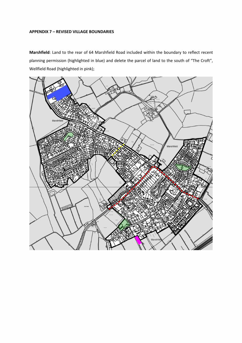
APPENDIX 7 – REVISED VILLAGE BOUNDARIES
Marshfield: Land to the rear of 64 Marshfield Road included within the boundary to reflect recent
planning permission (highlighted in blue) and delete the parcel of land to the south of “The Croft”,
Wellfield Road (highlighted in pink);

Christchurch: Delete the parcel of land to the south of “Spring Gardens”, Christchurch Road
(highlighted in pink).

St Brides: Delete pink area to ensure that three agricultural buildings to the south of Church Farm
remain in the countryside.

APPENDIX 8
LOCAL CENTRE BOUNDARIES

CR
ES
CE
NT
CH
UR
CH
RUPERRA CLOSE
LA
UR
EL D
RIV
E
El Sub Sta
St Basil
's
Store
s
87
Stores
St Basil's
35
2
1
36
14
12
42
9
12
28
27
26
1
9
22
7
4
3
2
18
1
3
5
4
1
2
19scale 1:800
Reproduced from the Ordnance Survey mapping with the permission of the controller of Her Majesty's Stationery Office. (C) Crown Copyright. Unauthorised reproduction infringes Crown Copyright and may lead to prosecution or civil proceedings.
Newport City Council 100024210 (2014) Newport Local Development Plan 2011 - 2026
Inset LC1
Laurel Drive, Bassaleg Local Centre%

El S
ub S
ta
Cec
il La
ne
Car Park
Thornbury
Park
LB
Post
Thornbury Park
EB
EN
EZ
ER
DR
IVE
Playground
Bowling Green
12
5
Benson A
venue
6
Leslie Terrace
Wills R
ow
12
9
3
Dav
id W
alk
8
1
3
Wat
kins
Wal
k
1
3
Har
old
Wal
k
Benson A
venue
Alan Close
8
5
Phillip's Green
8
1
1
5
Phillip's Green
Reginald Terrace
1
5
4
3
1
5
32
PO
Cef
n W
ood
Bap
tist C
hurc
h
4
Shopping Centre
1
Windsor Place
38
12
15
46
42
2
47
1
Station
Police
112
145
108
110
106
147
1 to
5
53
57
44
to
20 to
31
40
39
10
54
13
to19
48
14
scale 1:1,000
Reproduced from the Ordnance Survey mapping with the permission of the controller of Her Majesty's Stationery Office. (C) Crown Copyright. Unauthorised reproduction infringes Crown Copyright and may lead to prosecution or civil proceedings.
Newport City Council 100024210 (2014) Newport Local Development Plan 2011 - 2026
Inset LC2
Thornbury Park, Highcross Local Centre%
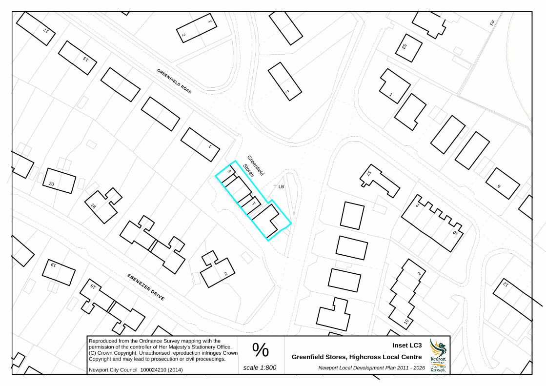
FF
EBENEZER DRIVE
GREENFIELD ROAD
LB
1
9
12
53
2
1
2
2
10
57
10
22
16
2
15
1
1
6
Stores
19
20
Greenfield
17
13
1
2
scale 1:800
Reproduced from the Ordnance Survey mapping with the permission of the controller of Her Majesty's Stationery Office. (C) Crown Copyright. Unauthorised reproduction infringes Crown Copyright and may lead to prosecution or civil proceedings.
Newport City Council 100024210 (2014) Newport Local Development Plan 2011 - 2026
Inset LC3
Greenfield Stores, Highcross Local Centre%

BROOKSIDE
21.2m
MalpasSM
Weir
SM
Centre
22.1m
LB
22.7m
Bettws
SM
Sluices
Sluice
Corporation Yard
SM
SM
21.4m
Weir
SM
SM
TONE CLOSE
El Sub Sta
Saint David Lewis
Shelter
533
537
13
Lambourne House
12
1510
14
16
2
Catholic Church
4
512
31
Shelter
CentreHealth
23
PO
29 to 3
4Council Offices
35
28
(PH)
The Nightingale
Pol Stn
38
40
36
37
39
Library
Free Church
Bettws
4
12
6
16
14
10
1
2
13
7
1
27 to
51
37
28
25
2
480
478476
scale 1:1,000
Reproduced from the Ordnance Survey mapping with the permission of the controller of Her Majesty's Stationery Office. (C) Crown Copyright. Unauthorised reproduction infringes Crown Copyright and may lead to prosecution or civil proceedings.
Newport City Council 100024210 (2014) Newport Local Development Plan 2011 - 2026
Inset LC4
Bettws Local Centre%

ROAD
PILLM
AWR
GR
AIG
PA
RK
PA
RA
DE
GR
AIG
PA
RK
VIL
LA
S
GRAIG PARK ROAD
27.9m
El S
ub
Sta
32.2m
WESTFIELD WAY
MALPAS R
OAD
Car Park
HO
LLY
BU
SH
AV
EN
UE
LB
TCB
COOLGREANY
HOLLYBUSH AVENUE
CLOSE
CRESC
ENT
COOLG
REANY
Mon
mou
thsh
ire a
nd B
reco
n Can
al
Centre
Community
1
366
Shelter7
380
22
31
385
387
22
373
PO
375
Surgery
371
Westfield Lower
School
36
9
7
5 10
2
1
20
56
56
2
5052
21
3b 3a5a
31
1
3
13
20
415
417
2
388
382
421
13
42
ClubClinic
43
Sur
gery
1
2
17
23
28
24
24
35
12
14
23
11
14
10
8
42028
17
6
8
21
2
21
17
18
360
Shelter
120
12
2
348
350
1 2
Hall
2
7
10
11
334
Club
1
2
PH
349
351
353
22
1
13
12
2
scale 1:1,500
Reproduced from the Ordnance Survey mapping with the permission of the controller of Her Majesty's Stationery Office. (C) Crown Copyright. Unauthorised reproduction infringes Crown Copyright and may lead to prosecution or civil proceedings.
Newport City Council 100024210 (2014) Newport Local Development Plan 2011 - 2026
Inset LC5
Malpas Road Local Centre%

Shelter
FB
LLEW
ELLY
N W
ALK
MA
LPA
S R
OA
D
CHAPMAN CLOSE
LB
PCB
Playground
DAVY CLOSE
RUSSELL
DRIV
E
24
163
7 39
18
14
10
17
15
19
12
1
533
Mount Pleasant
4
(PH
)
8
Parc-y-prior
Court
8
Almond
39
3
1
2
14
45
8
37
2
216
10
21
25
3710
11 6
7
13
9
4
21
Surgery
22
11
1
15
PO
31
1
7
21
6
7
2
29
5
9
19 1
10
16
21
scale 1:1,000
Reproduced from the Ordnance Survey mapping with the permission of the controller of Her Majesty's Stationery Office. (C) Crown Copyright. Unauthorised reproduction infringes Crown Copyright and may lead to prosecution or civil proceedings.
Newport City Council 100024210 (2014) Newport Local Development Plan 2011 - 2026
Inset LC6
Russell Drive, Malpas Local Centre%

ALMOND D
RIVE
TCB
MAGNOLIA
CLOSE
FB
LB
CLO
SE
WIS
TA
RIA
MA
LPA
S R
OA
D
93
176
81
102
2
164
14
9
10
92
8
2
129
131
1
114
105
12
103
110
14
120
147
1
2
133
139
64
186
24
163
7 39
18
14
101
2
4
1
(PH
)
8
Parc-y-prior
Court
8
7
Almond
1115
978
21
6
scale 1:1,000
Reproduced from the Ordnance Survey mapping with the permission of the controller of Her Majesty's Stationery Office. (C) Crown Copyright. Unauthorised reproduction infringes Crown Copyright and may lead to prosecution or civil proceedings.
Newport City Council 100024210 (2014)Newport Local Development Plan 2011 - 2026
Inset LC7
Almond Drive, Malpas Local Centre%

Ps
Car Park
21.1m
SIDNEY STREET
MP
158.7
5
31.7m
ALB
ER
T T
ER
RA
CE
Sig
nal G
antr
y
25.8m
LB
21.2m
EAST STREET
FAULKNER ROAD
LB
22.5m
Slo
pin
g
CLYTHA PARK
ROAD
CA
ER
AU
RO
AD
maso
nry
TU
NN
EL T
ER
RA
CE
FORD STREET
26.0m
FB
73
1174
a
21
13
19a
35
12
18
PH
3
4
13
5
5
6
1
17
6
9
13
76
1
7
Garage
9
4
2
16
10
8
42c
35
1
42b42a
2
PO
1
5
6
89
Clinic
30
7
80
1
79
13
74b
26
10
12
scale 1:1,000
Reproduced from the Ordnance Survey mapping with the permission of the controller of Her Majesty's Stationery Office. (C) Crown Copyright. Unauthorised reproduction infringes Crown Copyright and may lead to prosecution or civil proceedings.
Newport City Council 100024210 (2014) Newport Local Development Plan 2011 - 2026
Inset LC8
Clytha Park Road Local Centre%

58.3m
Stone
CLIFTON
El Sub Sta
59.6m
59.1m STOW HILL
18
6
16
25
23
8
Deanery
St Woolos' Cathedral
1
Dea
nery
Gar
dens
4
5
4
3
6
11
13
20
10
1a
1
Friars
76
25
9
1
3
Court
8
PH
Severn
Terra
ce
109
Cathedral Chambers
1
107
Lych Gate
5
8
2
121119
117
Friars
Cre
scent
2
6
2
4
1
8
12
12a
116a
118 13b
12b
2
116
9
14
b
128
1
120
1
122
a
20
Clinic
129
scale 1:800
Reproduced from the Ordnance Survey mapping with the permission of the controller of Her Majesty's Stationery Office. (C) Crown Copyright. Unauthorised reproduction infringes Crown Copyright and may lead to prosecution or civil proceedings.
Newport City Council 100024210 (2014) Newport Local Development Plan 2011 - 2026
Inset LC9
St Woolos Local Centre%

66.6m
68.4m
HIGHFIELD ROAD
66.2m
62.0m
61.5m
TCB23
Centrica Lodge
101
105
16
Garage
111
PO
11330
24
26
11
27
129
14
127
123
Shelter
2
22
Gaer
Park
Clu
b 1
313
scale 1:800
Reproduced from the Ordnance Survey mapping with the permission of the controller of Her Majesty's Stationery Office. (C) Crown Copyright. Unauthorised reproduction infringes Crown Copyright and may lead to prosecution or civil proceedings.
Newport City Council 100024210 (2014) Newport Local Development Plan 2011 - 2026
Inset LC10
Bassaleg Road Local Centre%

SHAKESPEARE C
RESCENT
61.6m
Playing Field
GA
ER
RO
AD
LBTCB
50.0m
BEN
JO
NSO
N W
AY
58.5m
Fortlee
12
11 6
4
10
7
61
2
59
St Martins C
ourt
1 to 1
11
Hillview
1
9
8
3
5
Stra
tford
Hou
se
143
47
56
45
39
145
PCB
Community Centre and Youth Club
129
17
27
127
131
24
133
83
35
87
53
97
scale 1:1,000
Reproduced from the Ordnance Survey mapping with the permission of the controller of Her Majesty's Stationery Office. (C) Crown Copyright. Unauthorised reproduction infringes Crown Copyright and may lead to prosecution or civil proceedings.
Newport City Council 100024210 (2014) Newport Local Development Plan 2011 - 2026
Inset LC11
Gaer Road Local Centre%
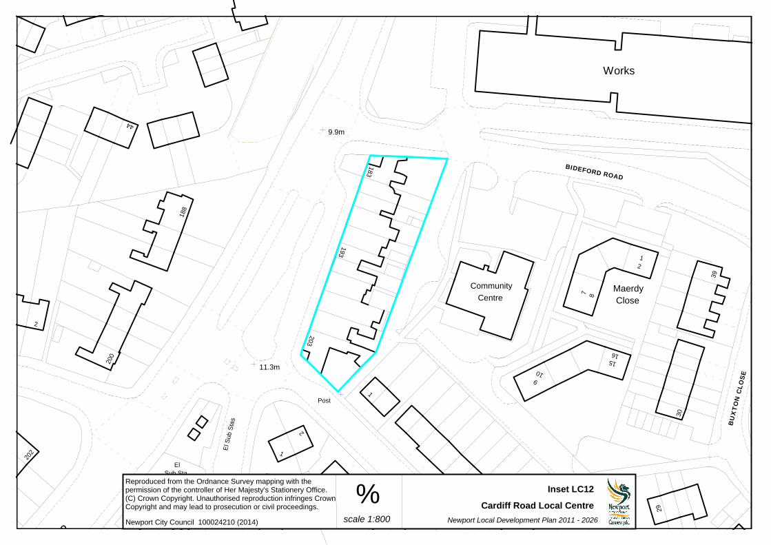
9.9m
BIDEFORD ROAD
Post
11.3m
Post
CARDIF
F ROAD
Sub Sta
El
BU
XT
ON
CLO
SE
15
2
Close
Maerdy
1
16
39
Works
Community
7 8
910
Centre
183
188
44
200
2
203
193
1
38
29
30
15
1
2
205
14
El S
ub S
tas
202
scale 1:800
Reproduced from the Ordnance Survey mapping with the permission of the controller of Her Majesty's Stationery Office. (C) Crown Copyright. Unauthorised reproduction infringes Crown Copyright and may lead to prosecution or civil proceedings.
Newport City Council 100024210 (2014) Newport Local Development Plan 2011 - 2026
Inset LC12
Cardiff Road Local Centre%
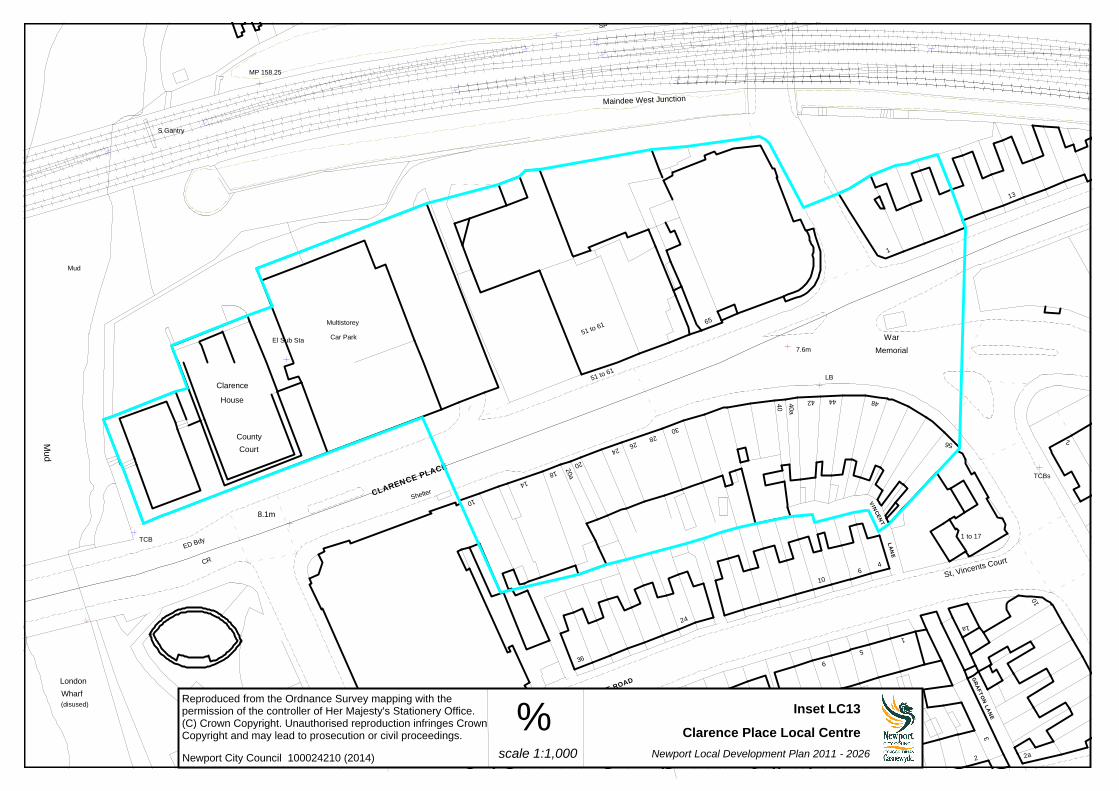
GR
AFTO
N L
AN
E
TCBs
CLARENCE PLACE
8.1m
TCB
7.6m Memorial
War
LB
MP 158.25
S Gantry
SP
Wharf
(disused)
London
Maindee West Junction
VIN
CEN
T
LA
NE
El Sub Sta
ST VINCENT ROAD
ED Bdy
CR
Mud
Mud
51 to 61
1 to 17
4
10
5
1
9
10St, Vincents Court
1a
2a2
3
56 2
48
13
444240a
40
30
65
2426
20
18
28
14
20a
24
36
31
21
Shelter
10
Clarence
Multistorey
Car Park
6
1
County
Court
House
51 to 61
scale 1:1,000
Reproduced from the Ordnance Survey mapping with the permission of the controller of Her Majesty's Stationery Office. (C) Crown Copyright. Unauthorised reproduction infringes Crown Copyright and may lead to prosecution or civil proceedings.
Newport City Council 100024210 (2014) Newport Local Development Plan 2011 - 2026
Inset LC13
Clarence Place Local Centre%

57.1m
50.8m
LB
CARADOG C
LOSE
TCB
HA
DR
IAN
CLO
SE
ROMAN WAY
CAESAR CRESCEN
T
2PO 63
1
Cou
rtKent
61
1
2
100
4
El S
ub Sta
56
1
Lincoln Court
1 to
9
Mith
ras W
ay
15
53
13
1 to 20
Hereford
1 to 12
7
Court
Gloucester Court
1
75
37
11
13
12
16
55
102
1 to 12
Flint Court
Essex Court
1 to 16
61
53
56
58
scale 1:800
Reproduced from the Ordnance Survey mapping with the permission of the controller of Her Majesty's Stationery Office. (C) Crown Copyright. Unauthorised reproduction infringes Crown Copyright and may lead to prosecution or civil proceedings.
Newport City Council 100024210 (2014) Newport Local Development Plan 2011 - 2026
Inset LC14
Roman Way, Caerleon Local Centre%

PENKIN
24.4m
GILBERT
PENKIN CLOSE
Alway Parade
CLO
SE
27.3m
VAUGHAN W
ILLIAM
S
LADYHIL
L ROAD
DRIV
E
24.4m
AB
ER
TH
AW
AV
EN
UE
36
1
3
Police Station
PO
Kingdom Hall
9
Health Centre
19
3
2
1
El Sub Sta
16
17
7
Vicarage
St Teilo Church
5
26
26
32
128
3
5
15
2
4
19
scale 1:800
Reproduced from the Ordnance Survey mapping with the permission of the controller of Her Majesty's Stationery Office. (C) Crown Copyright. Unauthorised reproduction infringes Crown Copyright and may lead to prosecution or civil proceedings.
Newport City Council 100024210 (2014) Newport Local Development Plan 2011 - 2026
Inset LC15
Alway Local Centre%

Cot Farm
Walk
Posts
Ringland C
entre
25.6m
COTFARMGARDENS
CO
T F
AR
M
CIR
CLE
Play Area
LB
Sports Court
FB
FB
FB
12
a
12
Library
3
1006
1
106102
104
1
57
73
1
21
2
65
71
81
87
42
1 to 83
44
136
133
144
45
141
28 to
31
33
32
13
7
8 to
11
27
Court
Milton
129137
41
19
3818
40
39
20
PH
Shelter
scale 1:875
Reproduced from the Ordnance Survey mapping with the permission of the controller of Her Majesty's Stationery Office. (C) Crown Copyright. Unauthorised reproduction infringes Crown Copyright and may lead to prosecution or civil proceedings.
Newport City Council 100024210 (2014) Newport Local Development Plan 2011 - 2026
Inset LC16
Ringland Local Centre%

FOSSE ROAD
PONT FAEN ROAD
FA
LLO
WFIE
LD
DR
IVE
Gas Governor
HIL
LV
IEW
CR
ES
CE
NT
48
55
53
60
11
72
70
16
5818
14
68
74
32
1
22
34
14
42
22a
7
26
28
30
20
1
2
7
1
69
56
16
1
The Man of Steel
Surgery
(PH)
127
1
39
scale 1:875
Reproduced from the Ordnance Survey mapping with the permission of the controller of Her Majesty's Stationery Office. (C) Crown Copyright. Unauthorised reproduction infringes Crown Copyright and may lead to prosecution or civil proceedings.
Newport City Council 100024210 (2014) Newport Local Development Plan 2011 - 2026
Inset LC17
Moorland Park, Lliswerry Local Centre%

El Sub Sta
CEDARS
THE
LB
HAZEL ROAD
108 36
26
Health Centre
23
13
48
5
24
66
76 70
62
59
Court
6
Pol Sta
5
Sprin
gfield
Club
Church
Shelte
r
10
2
9
1
31
10 t
o 1
8
21
11
1 to 9
The Oaks
15
610
16
200
scale 1:800
Reproduced from the Ordnance Survey mapping with the permission of the controller of Her Majesty's Stationery Office. (C) Crown Copyright. Unauthorised reproduction infringes Crown Copyright and may lead to prosecution or civil proceedings.
Newport City Council 100024210 (2014)Newport Local Development Plan 2011 - 2026
Inset LC18
Underwood Local Centre%

17
LC19 – Former Alcan Site (H54)LC20 – Glan Llyn (H47)LC21 – Llanwern Village (H3)
Local Centres for LC19 – Former Alcan Site (H54) and LC20 – Glan Llyn (H47) are shown indicatively on the Proposals Plans and on Inset 4 (formerly Inset 9) for LC21 – Llanwern Village (H3).