scenic estate landscape design - bass coast...
TRANSCRIPT
scenic estate landscape design
DRAFT masterplan report
revision B
prepared by hansen partnership
on behalf of bass coast shire council
july 2013
2scenic estate, DRAFT masterplan report | hansen partnership pty ltd
cont
ents
contents
registertitle revision date
masterplan report A 11/07/2013
masterplan report B 17/07/2013
table of contents1 Introduction 31.1 Project objectives 31.2 Key stakeholders 31.3 Project team 31.4 Methodology 3
2 Information gathering 42.1 Aboriginal and Historical Heritage Assessment 42.2 Vegetation Quality assessment of BCSC owned blocks 6
3 Opportunities & Constraints 8
4 Masterplan 104.1 Pedestrian movement 124.2 Vehicle movement 144.3 Landscape 154.4 Attractions and facilities 16
scenic estate, DRAFT masterplan report | hansen partnership pty ltd3
intro
duct
ion1.4 Methodology
Preparation of the Masterplan has comprised the following tasks:
▪ Information gathering:
▪ desktop based investigations;
▪ site inspection;
▪ planning background review;
▪ review of circulated reports and background information;
▪ mapping of physical opportunities and constraints.
▪ Consultation - Hansen have facilitated the following consultation meetings with attendance by BCSC and key stakeholders:
▪ key stakeholder meeting held on 23rd May 2013 - The intention of this meeting was to work together to discuss issues and ideas, develop initial design principles which would inform the future landscape design.
▪ concept masterplan presentation held on 24th June 2013 - This workshop meeting provided an interactive forum for the review of the draft Masterplan, identification of any knowledge gaps, identification of opportunities for further development of ideas, discussion of budgetary considerations and the prioritisation of ideas for programming and implementation.
▪ Landscape Masterplan - A broad illustrative plan for future use and development.
▪ Reporting - development of an explanatory report outlining the strategic justification for the Landscape Masterplan and the provision of descriptions for key elements and implementation strategy and prioritisation.
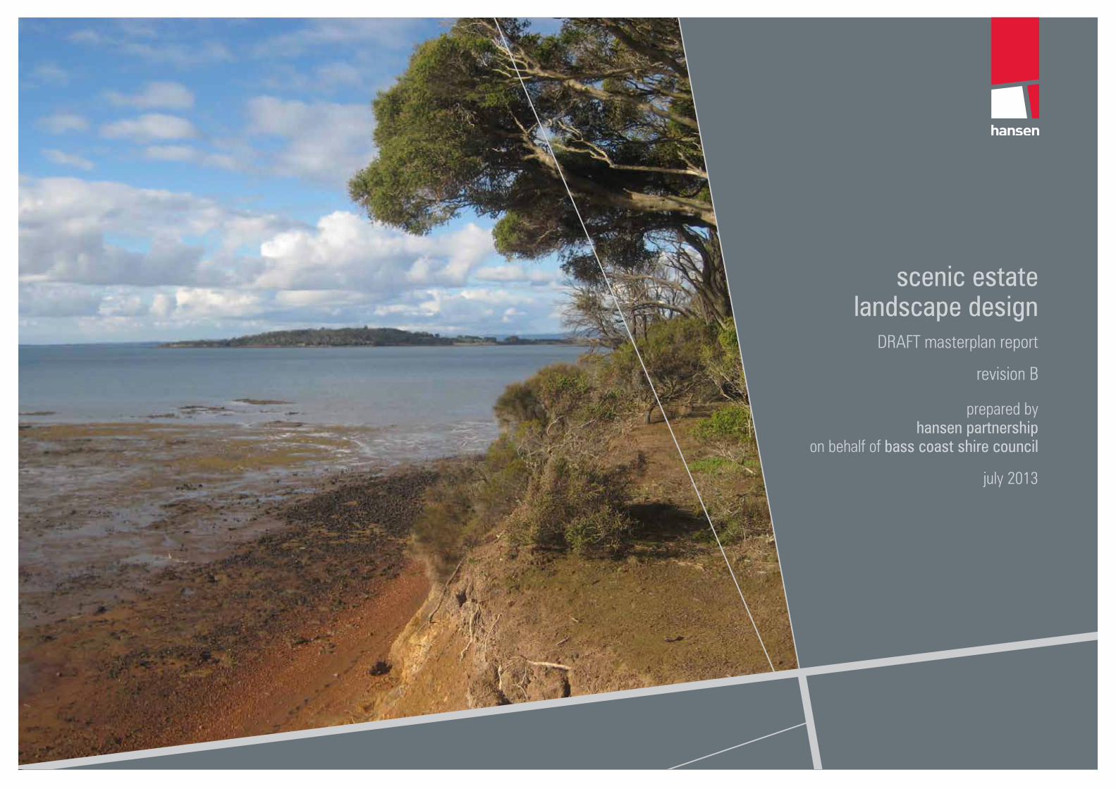
Scenic Estate is located on the Phillip Island Road, opposite the entrance to Forrest Caves, approximately 300 metres to the south east of Surf Beach, and just over two kilometres from Cape Woolamai. Scenic Estate covers just over 28 hectares including the roads and the reserve and is bounded by Western Port to the North, private agricultural land to the east and west and Phillip Island Road to the south. Originally earmarked for a residential development, the state government declared it an inappropriate subdivision as the land is low lying, swampy and not suitable for residential use and is prohibited to build on.
Bass Coast Shire Council (BCSC) owns approximately 50% of the blocks, with the remaining 50% owned privately. The 50% of the blocks that Council own will be used for conservation purposes. The Phillip Island Nature Parks manage the foreshore reserve and a large block on the foreshore and Parks Victoria manage the abutting Churchill Island Marine National Park which is part of the Western Port Ramsar Site. These three organisations are working together to improve the management of Scenic Estate and enhance the existing bushland that can be enjoyed by the public for conservation purposes.
BCSC have engaged Hansen Partnership to prepare a Landscape Masterplan for the Scenic Estate with a view to setting in place a framework for the future operation of the reserve.
1.1 Project objectivesKey project objectives as outlined in the project brief are as follows:
1. Boardwalk on Council owned and Phillip Island Nature Park managed land to the Ramsar Wetland;
2. Locate area for viewing platforms/lookouts with interpretation signage;
3. Provide ample car parking spaces;
4. Locate an appropriate entrance point; and
5. Consider vegetation quality assessment to maximise offset credits.
1.2 Key stakeholdersIn addition to the wider community, there are a number of key stakeholders that are involved in either determining or influencing the Masterplan design.
These include:
▪ Bass Coast Shire Council - Project client and facilitators of the Scenic Estate Landscape Masterplan Project including engagement and direction of the project team.
▪ Phillip Island Nature Parks - Manage the foreshore reserve and a large block on the foreshore.
▪ Parks Victoria - Manage the abutting Churchill Island Marine National Park which is part of the Western Port Ramsar Site.
1.3 Project teamBass Coast Shire Council
The client for the project is Bass Coast Shire Council led by Diana Whitington, Environment Officer and Alison Creighton, Environment Manager.
Hansen Partnership
Hansen Partnership (Hansen) is an award-winning Australian urban planning, urban design, landscape development management consultancy with offices in Melbourne and in Ho Chi Minh City, Vietnam. The firm has extensive experience in Landscape Architecture, Planning and Urban Design and development projects throughout Australia and overseas. The reputation of the firm in strategic planning is unsurpassed, with an emphasis on innovative approaches to planning for the future. The firm incorporates an award winning urban design and landscape architectural team, which is focused on ‘strategic design’ in key metropolitan and regional locations.
1 Introduction
key stakeholder meeting on site key stakeholder meeting on site
4scenic estate, DRAFT masterplan report | hansen partnership pty ltd
info
rmat
ion
gath
erin
g
Historical HeritageRecommendation 1: As there are no known historical sites or areas considered to have historical potential there is no requirement for any further historical investigations.
Recommendation 2: There are no other known historical heritage issues in regard to the proposed development.
Recommendation 3: If a CHMP is undertaken, a historical heritage assessment must be undertaken at the same time. A historical heritage assessment requires little additional work during the course of the CHMP process, and will ensure that no historical heritage issues exist within the study area.
The following is a brief summary of key points gathered from relevant background documents including:
▪ Aboriginal and Historical Heritage Assessment, by Ecology and Heritage Partners, April 2013; and
▪ Scenic Estate Vegetation Quality assessment of BCSC owned blocks, Bass Coast Landscare Network, October 2012
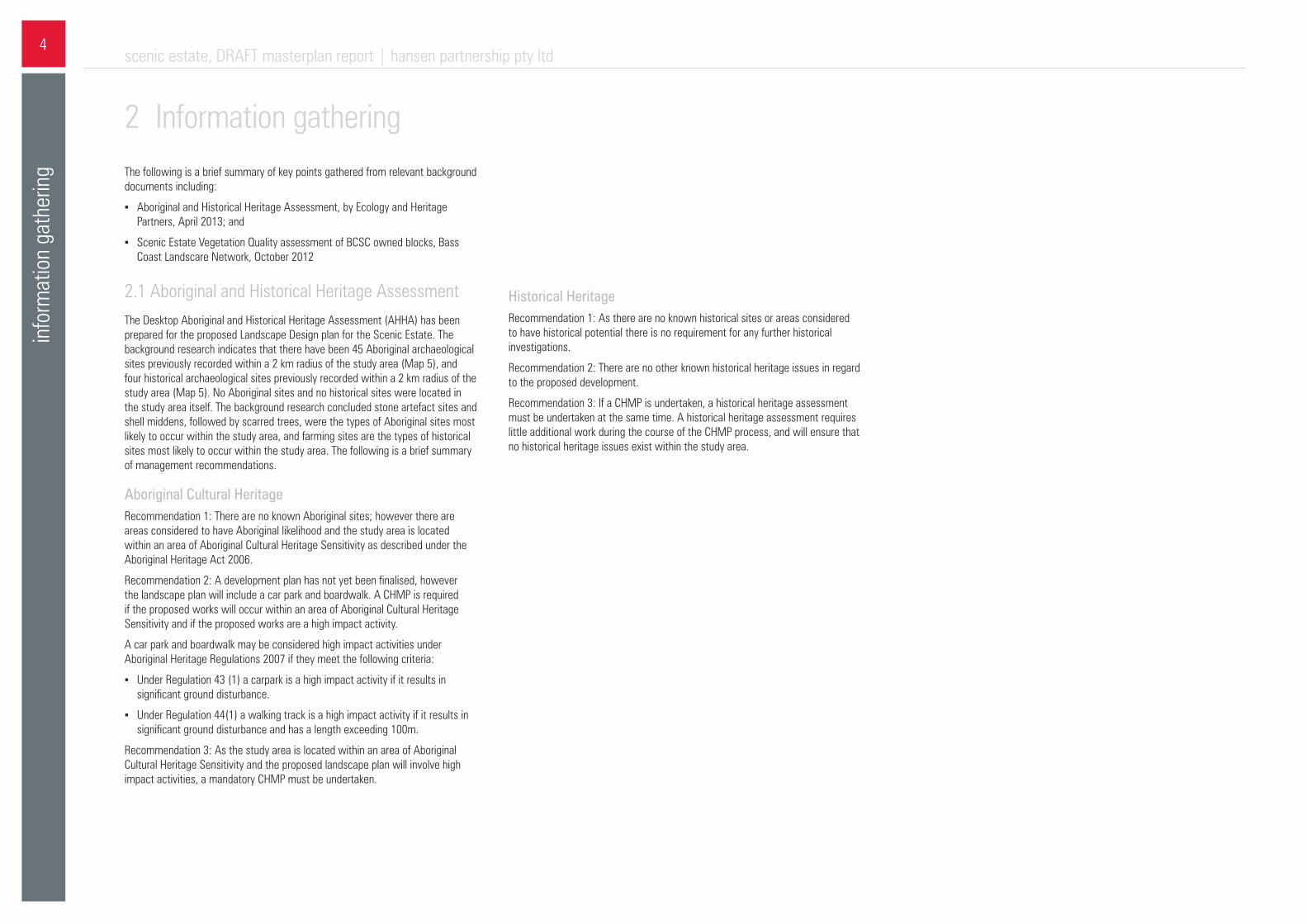
2.1 Aboriginal and Historical Heritage AssessmentThe Desktop Aboriginal and Historical Heritage Assessment (AHHA) has been prepared for the proposed Landscape Design plan for the Scenic Estate. The background research indicates that there have been 45 Aboriginal archaeological sites previously recorded within a 2 km radius of the study area (Map 5), and four historical archaeological sites previously recorded within a 2 km radius of the study area (Map 5). No Aboriginal sites and no historical sites were located in the study area itself. The background research concluded stone artefact sites and shell middens, followed by scarred trees, were the types of Aboriginal sites most likely to occur within the study area, and farming sites are the types of historical sites most likely to occur within the study area. The following is a brief summary of management recommendations.
Aboriginal Cultural HeritageRecommendation 1: There are no known Aboriginal sites; however there are areas considered to have Aboriginal likelihood and the study area is located within an area of Aboriginal Cultural Heritage Sensitivity as described under the Aboriginal Heritage Act 2006.
Recommendation 2: A development plan has not yet been finalised, however the landscape plan will include a car park and boardwalk. A CHMP is required if the proposed works will occur within an area of Aboriginal Cultural Heritage Sensitivity and if the proposed works are a high impact activity.
A car park and boardwalk may be considered high impact activities under Aboriginal Heritage Regulations 2007 if they meet the following criteria:
▪ Under Regulation 43 (1) a carpark is a high impact activity if it results in significant ground disturbance.
▪ Under Regulation 44(1) a walking track is a high impact activity if it results in significant ground disturbance and has a length exceeding 100m.
Recommendation 3: As the study area is located within an area of Aboriginal Cultural Heritage Sensitivity and the proposed landscape plan will involve high impact activities, a mandatory CHMP must be undertaken.
2 Information gathering

scenic estate, DRAFT masterplan report | hansen partnership pty ltd5
info
rmat
ion
gath
erin
g
Phillip Island Rd
Woolam
ai Beach R
d
Rhy
ll - N
ewha
ven
Rd
Phillip IslandCoastal Reserve
CHURCHILLISLAND SEALERS SITE
(H7921-0014)
CHURCHILLISLAND
(H7921-0002)
2020
30
20
10
20
20
10
20
10
20
10
20
10
10
20
20
40
40
20
20
10
20
20
20
20
10
10
30
10
20
10
CHURCHILLISLAND(H1614)
HO2
HO16
7920-0003
7920-0008
7920-0069
7920-0070
7920-00717920-0072
7920-0073
7920-00747920-0075
7920-0076
7920-0077
7920-0078
7920-0079
7920-0080
7920-0081
7920-0082
7920-0083 7920-0084
7920-0085
7920-0086
7920-0087
7920-00887920-0089
7920-00907920-0091
7920-0092 7920-0093
7920-0094
7920-0095
7920-00967920-00977920-0098
7920-0099
7920-0100
7920-01017920-0102
7920-0103
7920-0104
7920-0105
7920-01067920-0107
7920-0108
7920-0210
4853_Map05_HeritageSites 9/04/2013 stimms
0 500
Metres
Map 5Aboriginal and HistoricalHeritage SitesAboriginal and HistoricalHeritage Assessment
VicMap Data: The State of Victoria does not warrant theaccuracy or completeness of information in this publicationand any person using or relying upon such information doesso on the basis that the State of Victoria shall bear noresponsibility or liability whatsoever for any errors, faults,defects or omissions in the information.
BassCoast
(S)
Melbourne
Newhaven
Local Government: City of Greater Geelong25k Mapsheet: Geelong 7721-1-3Coordinate System: MGA Zone 55 (GDA94)Map Scale: 1:24,000
LegendStudy Area
Parks and Reserves
Crown Land
Archaeological RecordsAboriginal Sites
Artefact ScatterShell Midden
Historical Sites
Heritage Register
Heritage Overlay
Heritage Inventory
Map 5 - Aboriginal and Historical Heritage Sites map

8scenic estate, DRAFT masterplan report | hansen partnership pty ltd
oppo
rtuni
ties
& co
nstra
ints
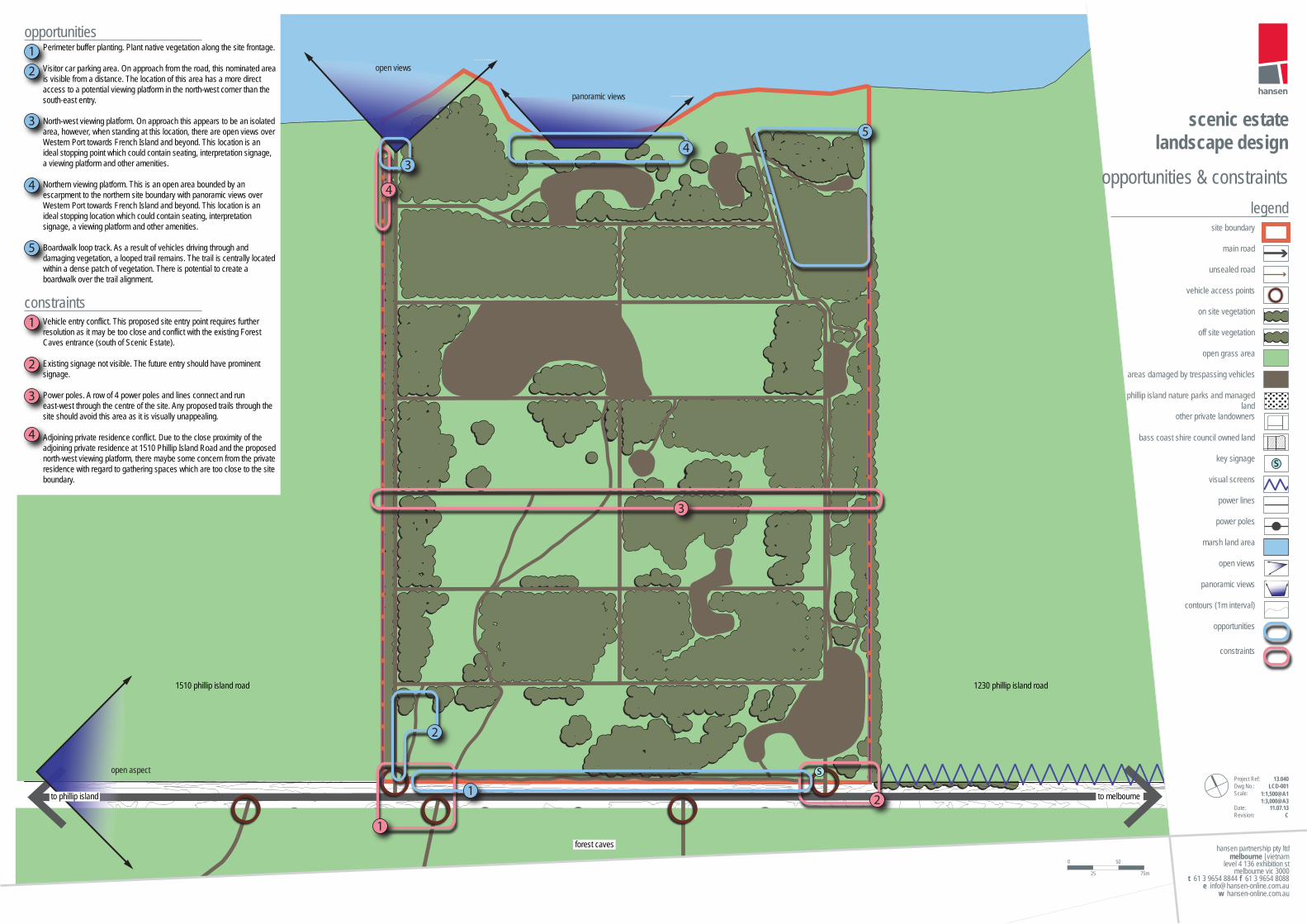
3 Opportunities & ConstraintsFollowing site investigations and background review, an Opportunities & Constraints Plan was prepared as a means of identifying and describing the key findings.
scenic estate, DRAFT masterplan report | hansen partnership pty ltd9
mas
ter p
lan
repo
rt in
form
atio
n ga
ther
ing
open aspect
open views
panoramic views
level 4 136 exhibition stmelbourne vic 3000
w hansen-online.com.au
| vietnammelbourne
t 61 3 9654 8844 f 61 3 9654 8088 e [email protected]
hansen partnership pty ltd
scenic estate landscape design
opportunities & constraints
Project Ref: Dwg No.:Scale:
Date:Revision:
13.040 LCD-001
11.07.13C
legend
main road
unsealed road
power lines
power poles
marsh land area
panoramic views
contours (1m interval)
vehicle access points
on site vegetation
off site vegetation
open grass area
site boundary
opportunities
constraints
visual screens
open views
areas damaged by trespassing vehicles
key signage s
other private landowners
phillip island nature parks and managed land
bass coast shire council owned land
1510 phillip island road 1230 phillip island road
to melbourneto phillip island
forest caves
s
1
2
1
2
3
43
5
4
Perimeter buffer planting. Plant native vegetation along the site frontage.
Visitor car parking area. On approach from the road, this nominated area is visible from a distance. The location of this area has a more direct access to a potential viewing platform in the north-west corner than the south-east entry.
North-west viewing platform. On approach this appears to be an isolated area, however, when standing at this location, there are open views over Western Port towards French Island and beyond. This location is an ideal stopping point which could contain seating, interpretation signage, a viewing platform and other amenities.
Northern viewing platform. This is an open area bounded by an escarpment to the northern site boundary with panoramic views over Western Port towards French Island and beyond. This location is an ideal stopping location which could contain seating, interpretation signage, a viewing platform and other amenities.
Boardwalk loop track. As a result of vehicles driving through and damaging vegetation, a looped trail remains. The trail is centrally located within a dense patch of vegetation. There is potential to create a boardwalk over the trail alignment.
Vehicle entry conflict. This proposed site entry point requires further resolution as it may be too close and conflict with the existing Forest Caves entrance (south of Scenic Estate).
Existing signage not visible. The future entry should have prominent signage.
Power poles. A row of 4 power poles and lines connect and run east-west through the centre of the site. Any proposed trails through the site should avoid this area as it is visually unappealing.
Adjoining private residence conflict. Due to the close proximity of the adjoining private residence at 1510 Phillip Island Road and the proposed north-west viewing platform, there maybe some concern from the private residence with regard to gathering spaces which are too close to the site boundary.
opportunities
constraints
1
2
3
4
5
1
2
3
4
1:1,500@A11:3,000@A3
0 50
75m25
10scenic estate, DRAFT masterplan report | hansen partnership pty ltd
mas
terp
lan
4 MasterplanThe Masterplan for Scenic Estate comprises the strategic plan to guide the conservation, use and development for the site.
The Masterplan comprises a series of actions, under the headings of pedestrian movement, vehicle movement, landscape, attractions and facilities. Some of the actions relate to specific areas within the site, where as others are more general and relate to elements or activities which can be found throughout the site.
The actions may be interpreted as ‘discrete projects’,which BCSC can progressively implement across the life of the plan. The prioritisation of these projects is elaborated within the implementation strategy chapter of this report.
It is important to note that all future developments mentioned within the Masterplan are subject to separate design processes and are shown in as an indicative manner only.
A brief description of the design intent and vision for each of the actions is outlined below, and is intended to be read in conjunction with the masterplan drawing accompanying the report.

scenic estate, DRAFT masterplan report | hansen partnership pty ltd11
mas
terp
lan
Phillip Island Road
Western Port
legendPedestrian movement
Vehicle movement
Landscape
Attractions and facilities
sealed road
unsealed road
eixisting contours (1m interval)
off site vegetation
boardwalk
wetland
viewing platform
observation tower
picnic areas
2.5m wide walking track
bay viewing area
swamp scrub
coastal scrub
mangroves
grassland
bicycle path
sealed car park
emergency access track
site boundary
bass coast shire council owned land
1:1,500@A11:3,000@A3
0 50
75m25
Forrest Caves
3m wide walking track
revegetation areas
level 4 136 exhibition stmelbourne vic 3000
w hansen-online.com.au
| vietnammelbourne
t 61 3 9654 8844 f 61 3 9654 8088 e [email protected]
hansen partnership pty ltd
scenic estate landscape design
masterplanmasterplan actions
Project Ref: Dwg No.:Scale:
Date:Revision:
13.040 LCD-004
11.07.13A
P1
P3
P3
P4
P4
P4
P5
P5
P2
P2
P2
P2
L1
L1
L1
L1
L2
F1
F3
F2
F5
F5
F5
F4
V2
V4
V3
V1
P1
P3
P4
P5
P2
L1
L2
F1
F3
F2
F5
F4
V2
V4
V3
V1
Shared path entry
Main walking trail
Alternative walking trail
Boardwalk
Picnic area access path
Intersection treatment
Car park
Maintenance and emergency access track
Wildlife crossing
Revegetation to all identi�ed areas
Wetland
Toilet
Bay viewing area
Picnic areas
Observation tower
Viewing platform
12scenic estate, DRAFT masterplan report | hansen partnership pty ltd
mas
terp
lan
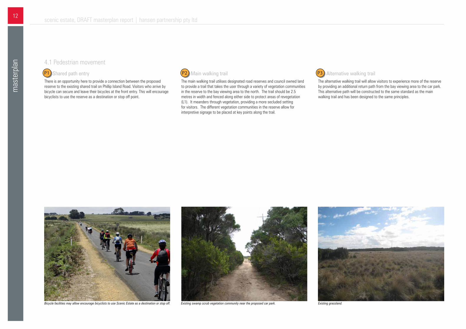
P1- Shared path entryThere is an opportunity here to provide a connection between the proposed reserve to the existing shared trail on Phillip Island Road. Visitors who arrive by bicycle can secure and leave their bicycles at the front entry. This will encourage bicyclists to use the reserve as a destination or stop off point.
4.1 Pedestrian movement
P2 - Main walking trailThe main walking trail utilises designated road reserves and council owned land to provide a trail that takes the user through a variety of vegetation communities in the reserve to the bay viewing area to the north. The trail should be 2.5 metres in width and fenced along either side to protect areas of revegetation (L1). It meanders through vegetation, providing a more secluded setting for visitors. The different vegetation communities in the reserve allow for interpretive signage to be placed at key points along the trail.
Existing swamp scrub vegetation community near the proposed car park.Bicycle facilities may allow encourage bicyclists to use Scenic Estate as a destination or stop off. Existing grassland.
P3- Alternative walking trailThe alternative walking trail will allow visitors to experience more of the reserve by providing an additional return path from the bay viewing area to the car park. This alternative path will be constructed to the same standard as the main walking trail and has been designed to the same principles.
P1 P2 P3
scenic estate, DRAFT masterplan report | hansen partnership pty ltd13
mas
terp
lan
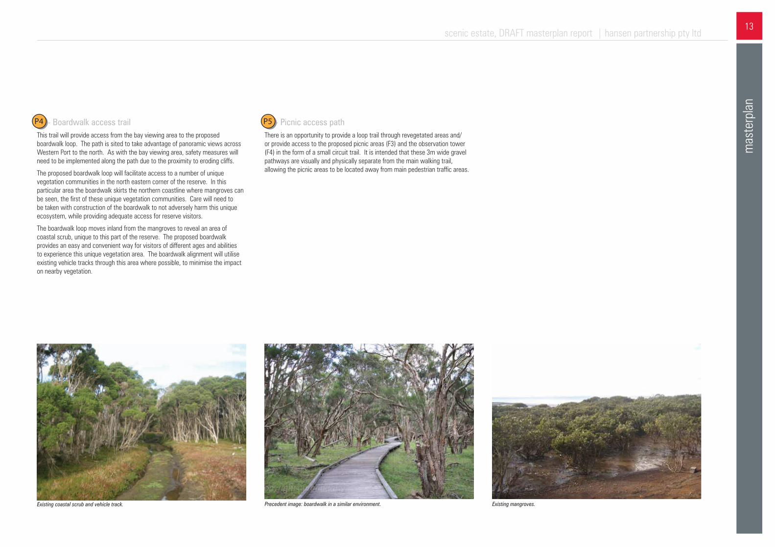
P4 - Boardwalk access trailThis trail will provide access from the bay viewing area to the proposed boardwalk loop. The path is sited to take advantage of panoramic views across Western Port to the north. As with the bay viewing area, safety measures will need to be implemented along the path due to the proximity to eroding cliffs.
The proposed boardwalk loop will facilitate access to a number of unique vegetation communities in the north eastern corner of the reserve. In this particular area the boardwalk skirts the northern coastline where mangroves can be seen, the first of these unique vegetation communities. Care will need to be taken with construction of the boardwalk to not adversely harm this unique ecosystem, while providing adequate access for reserve visitors.
The boardwalk loop moves inland from the mangroves to reveal an area of coastal scrub, unique to this part of the reserve. The proposed boardwalk provides an easy and convenient way for visitors of different ages and abilities to experience this unique vegetation area. The boardwalk alignment will utilise existing vehicle tracks through this area where possible, to minimise the impact on nearby vegetation.
Existing coastal scrub and vehicle track. Precedent image: boardwalk in a similar environment. Existing mangroves.
P5 - Picnic access pathThere is an opportunity to provide a loop trail through revegetated areas and/or provide access to the proposed picnic areas (F3) and the observation tower (F4) in the form of a small circuit trail. It is intended that these 3m wide gravel pathways are visually and physically separate from the main walking trail, allowing the picnic areas to be located away from main pedestrian traffic areas.
P4 P5

14scenic estate, DRAFT masterplan report | hansen partnership pty ltd
mas
terp
lan
3.1- Wildlife crossingA wildlife crossing point is proposed between the reserve and Forrest Caves as it is a known crossing point for Wildlife. The passage is to be constructed under Phillip Island Road and may consist of a concrete culvert with soil base which will provide a passage for a variety of animals. The final location of the wildlife crossing requires further investigation.
V3 - Maintenance and emergency access trackAn existing gravel track is to be utilised as an emergency access track for the reserve, allowing emergency vehicles to access a large area of the reserve, mainly to combat any potential fire threats. Restricted access off Phillip Island Road should be implemented to prevent maintenance issues from unwanted vehicles accessing the reserve.
V1 - Intersection treatmentThere is an opportunity here to provide a single intersection with slip lanes to allow vehicles to more safely turn into the Forrest Caves and the proposed reserve car park. This will need to be brought to a detailed level of resolution by traffic management experts.
V2 - Proposed car parking & reserve entranceThe proposed car park area also contains the main visitor entrance to the reserve. The main entrance has been moved from the existing entrance to the east due to visibility concerns with a crest on Phillip Island road. The car park itself has been sited among existing vegetation and provides for 25 visitor spaces. The main walking trail commences from this area (P2) and there is an opportunity for informative and interpretive signage in this location.
4.2 Vehicle movement
The existing gravel track near the entry to Phillip Island Road.
Precedent image: potential intersection treatment which may be adopted for the reserve. This example is located at the corner of Phillip Island Road and Caves way, 220m east of Scenic
Precedent image: potential car park and reserve entry with vegetation, this example is located at London Bridge Road Car park in Portsea
The existing gravel track near the entry to Phillip Island Road
V2
V4
V3V1
scenic estate, DRAFT masterplan report | hansen partnership pty ltd15
mas
terp
lan
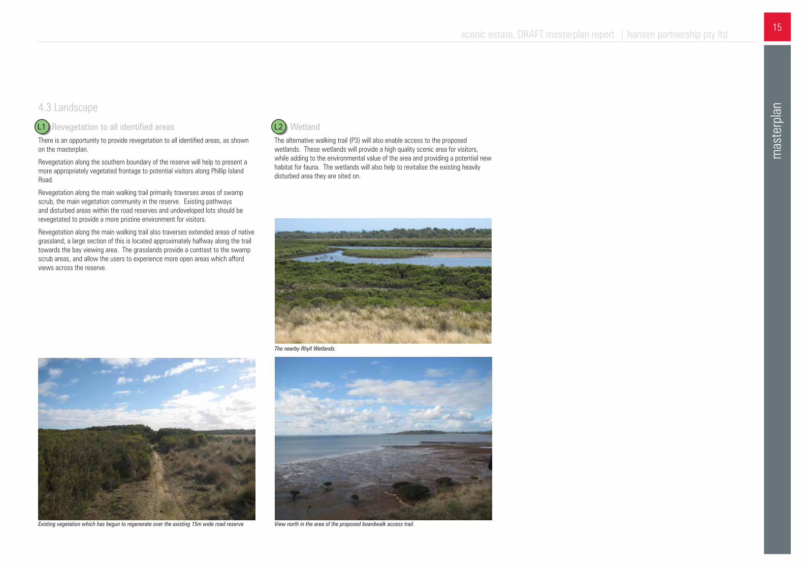
L2 - WetlandThe alternative walking trail (P3) will also enable access to the proposed wetlands. These wetlands will provide a high quality scenic area for visitors, while adding to the environmental value of the area and providing a potential new habitat for fauna. The wetlands will also help to revitalise the existing heavily disturbed area they are sited on.
The nearby Rhyll Wetlands.
View north in the area of the proposed boardwalk access trail.Existing vegetation which has begun to regenerate over the existing 15m wide road reserve
L1- Revegetation to all identified areasThere is an opportunity to provide revegetation to all identified areas, as shown on the masterplan.
Revegetation along the southern boundary of the reserve will help to present a more appropriately vegetated frontage to potential visitors along Phillip Island Road.
Revegetation along the main walking trail primarily traverses areas of swamp scrub, the main vegetation community in the reserve. Existing pathways and disturbed areas within the road reserves and undeveloped lots should be revegetated to provide a more pristine environment for visitors.
Revegetation along the main walking trail also traverses extended areas of native grassland; a large section of this is located approximately halfway along the trail towards the bay viewing area. The grasslands provide a contrast to the swamp scrub areas, and allow the users to experience more open areas which afford views across the reserve.
4.3 Landscape
L1 L2
16scenic estate, DRAFT masterplan report | hansen partnership pty ltd
mas
terp
lan
F3 - Picnic areasProvision for two picnic areas has been made, with the areas located a suitable distance apart to allow for seclusion between the users of the different areas. Both areas are intended to have facilities such as tables, benches and shelters. This will provide an opportunity for visitors to spend more time in the reserve, while facilitating an alternative activity to exploring the reserve.
F2 - Bay viewing areaThe main walking trail (P2) through the reserve terminates at the bay viewing area, which allows users to experience panoramic views to the north, across Western Port. There is potential to include furniture and interpretive signage in this area. Safety measures such as fencing will need to be implemented to ensure the safety of visitors given the proximity of the eroded cliffs to the north of the viewing area.
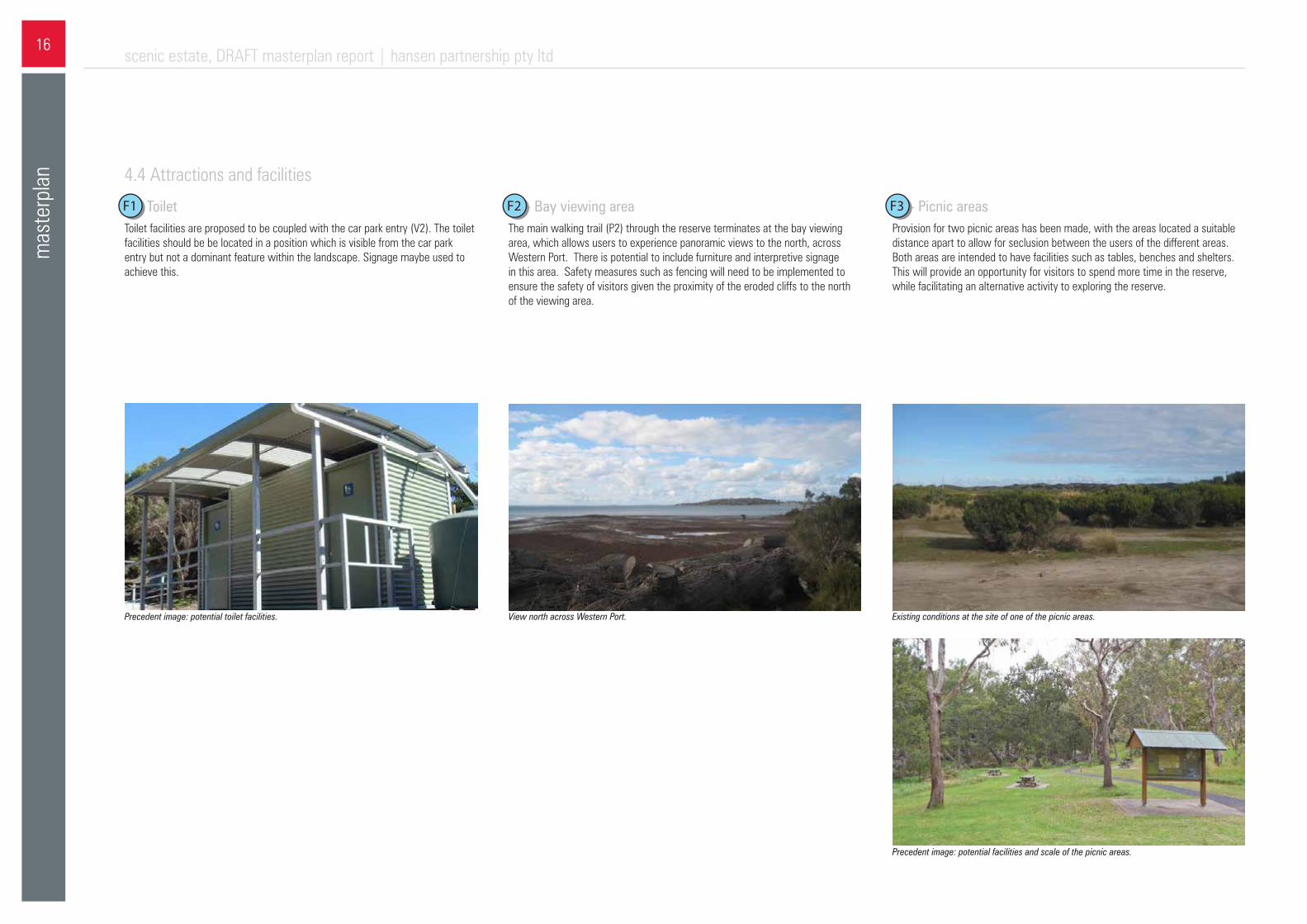
F1- ToiletToilet facilities are proposed to be coupled with the car park entry (V2). The toilet facilities should be be located in a position which is visible from the car park entry but not a dominant feature within the landscape. Signage maybe used to achieve this.
Existing conditions at the site of one of the picnic areas.
Precedent image: potential facilities and scale of the picnic areas.
View north across Western Port.Precedent image: potential toilet facilities.
4.4 Attractions and facilities
F1 F3F2
scenic estate, DRAFT masterplan report | hansen partnership pty ltd17
mas
terp
lan
F5 - Viewing platformThe bay viewing area is to be connected to the picnic areas and viewing platform by a series of access paths in the north western corner of the reserve. These paths allow users to experience the dense coastal bushland present in the area, while being able to access different parts of the reserve more effectively.
A viewing platform in the north western corner of the reserve will provide an alternative, more secluded viewing area while still allowing visitors to experience panoramic views of Western Port Bay to the north. The viewing platform will have to be on a raised deck structure due to safety concerns with the eroding cliffs. It will also be important to locate the platform in an area that effectively screens the property and fence to the west.
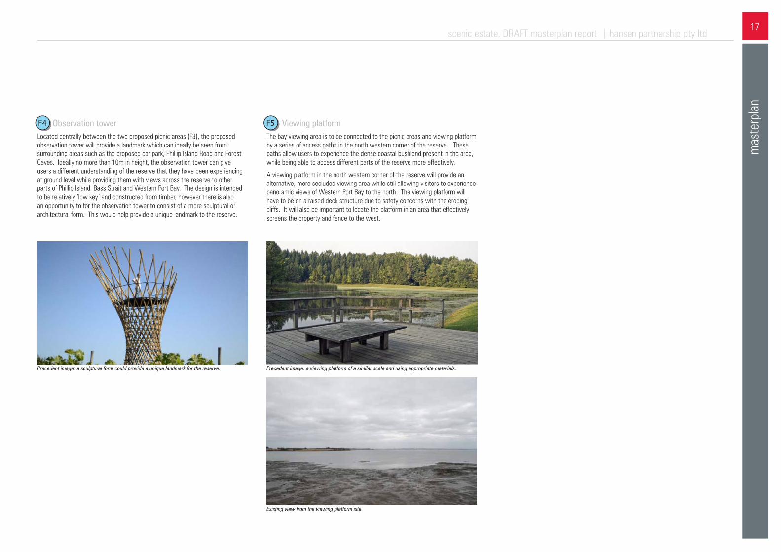
F4 - Observation towerLocated centrally between the two proposed picnic areas (F3), the proposed observation tower will provide a landmark which can ideally be seen from surrounding areas such as the proposed car park, Phillip Island Road and Forest Caves. Ideally no more than 10m in height, the observation tower can give users a different understanding of the reserve that they have been experiencing at ground level while providing them with views across the reserve to other parts of Phillip Island, Bass Strait and Western Port Bay. The design is intended to be relatively ‘low key’ and constructed from timber, however there is also an opportunity to for the observation tower to consist of a more sculptural or architectural form. This would help provide a unique landmark to the reserve.
Precedent image: a sculptural form could provide a unique landmark for the reserve.
Existing view from the viewing platform site.
Precedent image: a viewing platform of a similar scale and using appropriate materials.
F5F4