scec - earthscope (pbo) a confluence of interests ken hudnut u. s. geological survey, pasadena
TRANSCRIPT

SCEC - EarthScope (PBO)a confluence of interests
Ken HudnutKen HudnutU. S. Geological Survey, PasadenaU. S. Geological Survey, Pasadena

How can EarthScope (& ANSS) help How can EarthScope (& ANSS) help to further SCEC science goals?to further SCEC science goals?
• Review what we have (SCEC CMM3 & SCIGN)
• Examine the EarthScope & SCEC proposals
• PBO 2 workshop mini-proposal process defined configuration - backbone & clusters
• PBO committees to select sites - to go from general to specific & meet science goals
• What if something else would be ‘better’?
• Any suggested changes should go to PBO SC
• Identify opportunities for synergy
• Missions & funding levels of agencies and NGO’s
• Joint development of data products
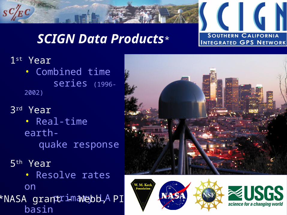
1st Year• Combined time
series (1996-2002)
3rd Year• Real-time earth-
quake response
5th Year• Resolve rates on
primary LA basin
faults (and others)
SCIGN Data Products*
*NASA grant - Webb, PI
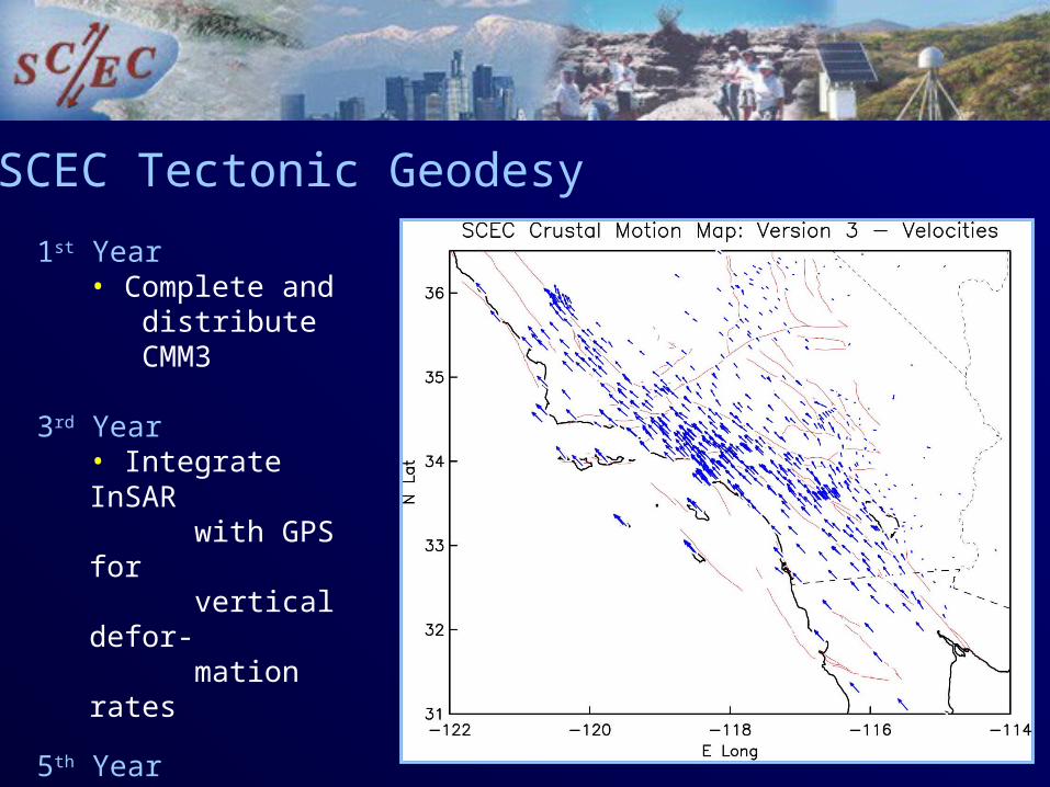
1st Year• Complete and
distribute CMM3
3rd Year• Integrate InSAR
with GPS forvertical defor-mation rates
5th Year• Resolve rate dis-
crepanciesbetween geologyand geodesy
SCEC Tectonic Geodesy
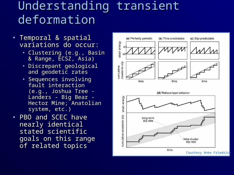
Understanding transient deformationUnderstanding transient deformation
• Temporal & spatial Temporal & spatial variations do occur:variations do occur:• Clustering (e.g., Basin & Clustering (e.g., Basin &
Range, ECSZ, Asia)Range, ECSZ, Asia)• Discrepant geological Discrepant geological
and geodetic ratesand geodetic rates• Sequences involving Sequences involving
fault interaction (e.g., fault interaction (e.g., Joshua Tree - Landers - Joshua Tree - Landers - Big Bear - Hector Mine; Big Bear - Hector Mine; Anatolian system, etc.)Anatolian system, etc.)
• PBO and SCEC have PBO and SCEC have nearly identical stated nearly identical stated scientific goals on this scientific goals on this range of related topicsrange of related topics Courtesy Anke Friedrich
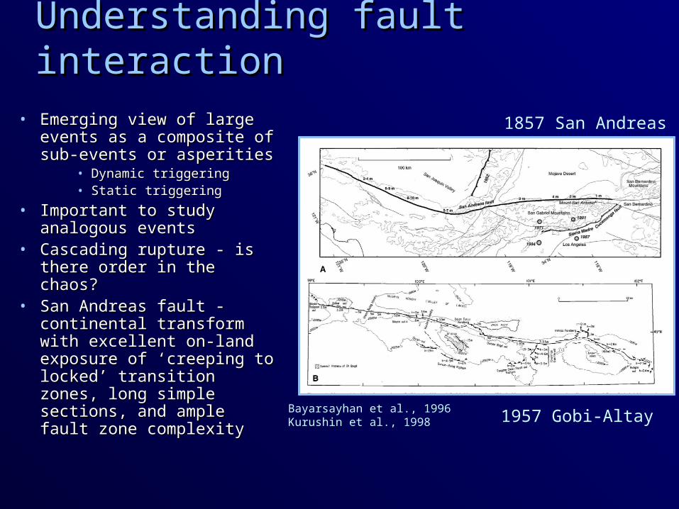
Understanding fault interactionUnderstanding fault interaction
• Emerging view of large Emerging view of large events as a composite of events as a composite of sub-events or asperitiessub-events or asperities
• Dynamic triggeringDynamic triggering• Static triggeringStatic triggering
• Important to study Important to study analogous eventsanalogous events
• Cascading rupture - is Cascading rupture - is there order in the chaos?there order in the chaos?
• San Andreas fault - San Andreas fault - continental transform with continental transform with excellent on-land exposure excellent on-land exposure of ‘creeping to locked’ of ‘creeping to locked’ transition zones, long transition zones, long simple sections, and ample simple sections, and ample fault zone complexityfault zone complexity
Bayarsayhan et al., 1996Kurushin et al., 1998
1857 San Andreas
1957 Gobi-Altay

San Andreas faultSan Andreas fault• 35 mm/yr slip rate;35 mm/yr slip rate;
• >70% of plate motion>70% of plate motion• 1685, 1812, 1857 eq’s1685, 1812, 1857 eq’s
• Big Bend compressionBig Bend compression• 1971 Sylmar (M 6.7)1971 Sylmar (M 6.7)• 1994 Northridge (M 6.7)1994 Northridge (M 6.7)
• SoCal is now heavily SoCal is now heavily ‘wired’ - need more?‘wired’ - need more?
• 150+ BB CISN stations150+ BB CISN stations• 250+ SCIGN stations250+ SCIGN stations• Catalog; SCEC CMM3Catalog; SCEC CMM3• ‘‘Natural laboratory’Natural laboratory’• Likely source of most Likely source of most
future ‘Big Ones’future ‘Big Ones’

What is EarthScope?What is EarthScope?
USArray• 400 station transportable array “big foot”• ~2400 instrument flexible array
PBO • 875 permanent GPS stations• 175 borehole strainmeters/seismometers• 100 campaign (portable) GPS systems• 5 laser strainmeters• Data and data products
SAFOD • 4-km-deep scientific drilling project into the San Andreas fault zone near Parkfield
Fully open data policy

What is PBO?• Five year build out phase
• Five year O&M phase
• Total 10-year operational commitment
• Six regional offices in Alaska, Pacific NW, Basin & Range, Rocky Mtns, Southern and Northern California
• Each region has dedicated resources for recon, permitting, installation, maintenance, and data
• Nominal data set – 30 sec data file downloaded daily
• Potential data sets
• 1 sec real time
• 5 Hz on-demand
• Two precise processing centers
• Two archive/distribution centers

• 125 SCIGN stations proposed for support under NSF existing networks proposal (PBO relies on continued existence of SCIGN & diverse matching funds)
• NSF funded ‘existing arrays’ proposal fully for next 1.5 years - plan & carry out a transition to PBO operations and maintenance by the end of 5 yrs.
• ~170 new continuous GPS stations; SAF, ECSZ, transition zones (along-strike and with depth)
• ~64 borehole strainmeters (yellow); 5 long-base laser strainmeters (Salton Trough ECSZ & PKF vicinities)
PBO and SCIGN

For discussionFor discussion
• CISN, ANSS, EarthScope, and PBO do not optimally address questions in earthquake source physics (e.g., SCEC FARM workshop topic on co-seismic phenomena); how can plans be modified to help rectify this? Are we too late?
• How can we measure Dc? Stress heterogeneity?
• Heaton slip pulses? Need 3D particle motions close to fault (e.g., the San Andreas fault in the Carrizo Plain and Coachella Valley in SoCal - large events ~likely)
• Need high resolution deformation field for co-seismics to map slip distributions - without InSAR EarthScope is deficient; what else can be done? (Geo-EarthScope to provide high-res imagery)
• Fall AGU 2003 & SSA 2004 (Palm Springs)