sanghoon lee, ph.d. - iso/tc 211 · information systems • the csw have been implemented in ......
TRANSCRIPT
Sanghoon Lee, Ph.D. Team Leader/Deputy Director National Geographic Information Institute(NGII) Republic of Korea Korea Representatives for UN-GGIM, UN-GGIM-AP Chair for UN-GGIM-AP WG4(Cadastre and Land Management)
9th December 2015

01
Standard Profiling Overview
Activity Overview
ISO 19100 Standards
Profiling
NGII Standards Publishing
NGII Information Syste
ms Enhancing
Key Enablers for NGII Geospatial Data Strategy 01
Visible
02
Available
03
Usable

Base Standards
02
Metadata
01
ISO 19115-1:2014 Geographic information - Metadata - Part 1: Fundamentals ISO 19115-2:2009 Geographic information - Metadata - Part 2: Extensions for imagery and gridded data
Data Quality 02
ISO 19157:2013 Geographic information -- Data quality
Data Specification 03
ISO 19131:2007/Amd1:2011 Geographic information - Data product specifications
XML Schema
03
ISO/DTS 19115-3 Geographic information -- Metadata -- Part 3: XML schema implementation of metadata fundamentals
Base ISO Standards
Profiling
03
ISO 19106:2004 Geographic information - Profiles

03
Target Data Theme at NGII
- Integraging Geospatial-Statistics Information (Bigdata)
- Vector Map (National Basemap) - Geospatial Imagery (Realistic 3D Citymodel)
- Reference Framework

Profile Process
Mapping Document Generation for Sample Data
Collection and Analysis for Data Configuration (DB Schema, ERD, Reports, Sample Data)
Template Development for Base Standards (19115-1, 19115-2, 19131, 19157)
Mapping NGII attributes with Base Standards
(extended and changed attribute report)
UML Drawing/XML Schema Generation (19115-3)
1st Profile Result Inspection and Filtering (Template Version 2.0)
NGII Standard Development (Metadata, Data Quality, Data Specification)
04
First Mapping Result (Template Version 1.0)
Decision Making &
Policy Decision
Refinement, Normalization (Template Version 3.0)
Standard Profiling Method

Template Method - Summary
05
1
2
3
4
1 Description of template use and stage
Base standard configurations 2
Reference list 3
Degrees of correspondence 4
Standard Profiling Method

Template Method – Profile Elements
06
1
2
3
4
1 Degree of correspondence for class & attributes in base standard
Base standard attributes 2
NGII extended attributes 3
NGII attributes and instances 4
Standard Profiling Method

Template Method – Mapping Result
07
Unified Control Point Metadata Profile Result
[Outcome for Metadata Profile] Aerial Photograph(7 Classes, 33 Attributes), Geospatial Information(7 Classes, 28 Attributes), Orthoimage(7 Classes, 28 Attributes), Unified Control Point(7 Classes, 25 Attributes)
Standard Profiling Method
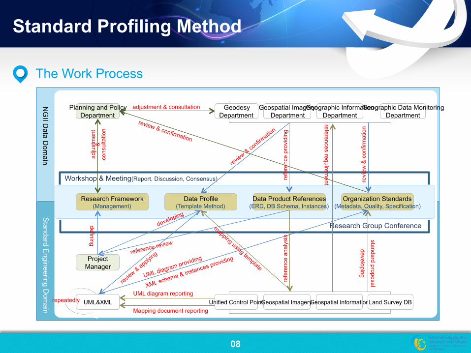
08
The Work Process
Standard E
ngineering Dom
ain N
GII D
ata Dom
ain
Research Framework (Management)
Organization Standards (Metadata, Quality, Specification)
Data Product References (ERD, DB Schema, Instances)
Workshop & Meeting(Report, Discussion, Consensus)
Research Group Conference
Planning and Policy Department
Geospatial Imagery Department
Geographic Information Department
Geographic Data Monitoring Department
Geodesy Department
Geospatial Imagery Geospatial Information Land Survey DB Unified Control Point
Project Manager
defining
adjustment & consultation
references requirement
refe
renc
e pr
ovid
ing
refe
renc
e an
alys
is
UML diagram reporting
Mapping document reporting UML&XML
Data Profile (Template Method)
repeatedly
standard proposal
developing
review & confirmation
UML diagram providing
XML schema & instances providing
adju
stm
ent
&
cons
ulta
tion
revi
ew &
con
firm
atio
n
reference review
Standard Profiling Method

09
Support Activity
Discussios & Dissemination

10
Data Profile
NGII Standard
Metadata Harvesting
• NGII has selected 5 data products and then developed the standard profiles which are based in ISO 19100 series
• Metadata, Data quality, Data specification
• metadata, data quality and data specification for aerial photograph, geospatial information, land survey database, orthoimage, unified control point
• XML schema implementation of metadata, data quality for 4 data products
Description Outcome
01
02
03
• NGII standards(13) are established about metadata, data quality and data specification for 5 data products
• metadata, data quality and data specification for aerial photograph, geospatial information, orthoimage, unified control point
• data specification for land survey database
• metadata harvesting has carried out for extracting effectively from legacy databases
• aerial photograph, geospatial information, orthoimage, unified control point
• code & enumeration • variable type & unit
System Enhancing
04 • The profile results are applied in NGII information systems
• The CSW have been implemented in accordance with the rules established by OGC and ISO 19115 series
• aerial photograph, geospatial information, orthoimage, unified control point
• Data management and service systems
Overview
Profiling Results & Summary

11
The Part of Profile Results
Profiling Results & Summary

14
Backward Compatibility
• Changes to ISO 19115-1:2014 – Deleted core-metadata for gegraphic dataset – Added discovery metatdata in ISO 19115-1 Anne
x F
• Status of ISO 19131:2007/Amd 1:2011 – Included core metadata elements from ISO 1911
5 with the data product
• Needs backward-compatiblity between two standard documents during revision

12
The Part of NGII Standards (Korean, English summary)
Profiling Results & Summary

13
The Part of Metadata Harvesting
§ ISO 19115-1 Annex B.5
CodeLists and enumerations�
§ ISO 19115-2 Annex B.3
CodeLists and enumerations�
§ Variable domain and uni
t system conversion�
§ ISO 19115-1 Annex B.5
CodeLists and enumerations�
§ ISO 19115-2 Annex B.3
CodeLists and enumerations�
§ Legacy database code
and enumeration conver
sion �
§ Collecting metadata
elements from legac
y databases�
§ Synchronizing variable na
me and value between leg
acy databases
Aerial Photograph Legacy Database
Orthoimage Legacy Database
Unified Control Point Legacy Database
Code & enumeration Conversion
Variable type & unit Conversion
Database instances Synchronization Metadata harvesting
Profiling Results & Summary


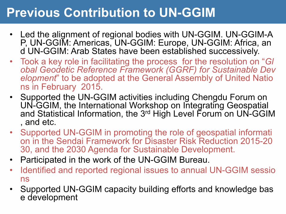
• Led the alignment of regional bodies with UN-GGIM. UN-GGIM-AP, UN-GGIM: Americas, UN-GGIM: Europe, UN-GGIM: Africa, and UN-GGIM: Arab States have been established successively.
• Took a key role in facilitating the process for the resolution on “Global Geodetic Reference Framework (GGRF) for Sustainable Development” to be adopted at the General Assembly of United Nations in February 2015.
• Supported the UN-GGIM activities including Chengdu Forum on UN-GGIM, the International Workshop on Integrating Geospatial and Statistical Information, the 3rd High Level Forum on UN-GGIM, and etc.
• Supported UN-GGIM in promoting the role of geospatial information in the Sendai Framework for Disaster Risk Reduction 2015-2030, and the 2030 Agenda for Sustainable Development.
• Participated in the work of the UN-GGIM Bureau. • Identified and reported regional issues to annual UN-GGIM sessio
ns • Supported UN-GGIM capacity building efforts and knowledge bas
e development
Previous Contribution to UN-GGIM

http://www.un-ggim-ap.org

Working Groups (‘15-’18) WG1 : Geodetic Reference Framework Chair: Dr. John Dawson (Australia) Vice-chair : China, Iran, Japan, Korea, Malaysia, Mongolia, New Zealand • Manage and support Asia Pacific countries to respond to the General Assembly Resolution on A Global Geod
etic Reference Frame (GGRF) for Sustainable Development • Manage the Asia Pacific Reference Frame (APREF) project and provide a regional mechanism to incorporate
Global Navigation Satellite System (GNSS) data and analysis from CORS stations across the Asia Pacific • Manage an annual regional GNSS campaign - Asia Pacific Regional Geodetic Project (APRGP) • Manage the Asia Pacific Regional Height System Unification (APRHSU) project • Support geodetic capacity Building in the Asia Pacific through technical workshops and developing partnershi
ps with other organisations including the International Federation of Surveyors (FIG), the International Association of Geodesy (IAG), the United Nations International Committee for GNSS (UN-ICG) and the Pacific Geospatial and Surveying Council (PGSC)

Working Groups (‘15-’18) WG2 : Disaster Risk Management Chair: Mr. Toru Nagayama (Japan) Vice-chair : China, Indodesia, Mongolia, New zealand • Identify the potential areas for contribution of NGIAs through the use of geospatial information to the effectiv
e implementation of the SFDRR. • Investigate the present roles of disaster management authorities and NGIAs, and find potential areas for ext
ended roles of NGIAs and collaborations with disaster management authorities through the use of geospatial information.
• Collect Best Practices of the use of geospatial information for disaster risk reduction in Asia and the Pacific region
• Compile a guideline to promote NGIAs to contribute through geospatial activities to the effective implementation of the SFDRR and the 2030 Agenda for Sustainable Development, based on the results of the activities No.1 - No.3 prescribed above
• Identify the potential areas of future cooperation with the UN-GGIM Working Group on disasters to be established in accordance with the decision of the fifth session of UN-GGIM
• Encourage Member States to share earth observations infrastructure, technology and data resources for disaster management on a voluntary basis.
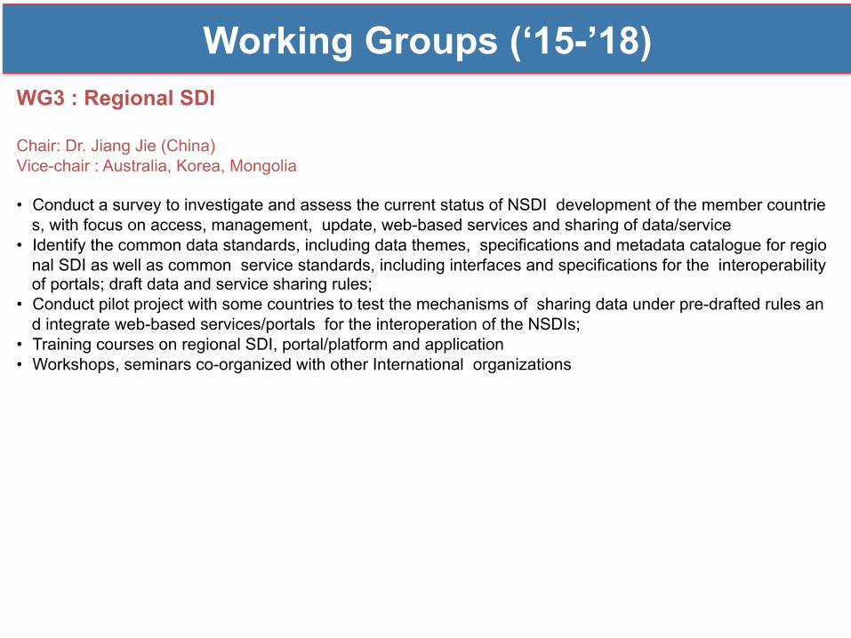
Working Groups (‘15-’18) WG3 : Regional SDI Chair: Dr. Jiang Jie (China) Vice-chair : Australia, Korea, Mongolia • Conduct a survey to investigate and assess the current status of NSDI development of the member countrie
s, with focus on access, management, update, web-based services and sharing of data/service • Identify the common data standards, including data themes, specifications and metadata catalogue for regio
nal SDI as well as common service standards, including interfaces and specifications for the interoperability of portals; draft data and service sharing rules;
• Conduct pilot project with some countries to test the mechanisms of sharing data under pre-drafted rules and integrate web-based services/portals for the interoperation of the NSDIs;
• Training courses on regional SDI, portal/platform and application • Workshops, seminars co-organized with other International organizations
Working Groups (‘15-’18) WG4 : Cadastre and Land Management Chair: Dr. Sanghoon Lee (Korea) Vice-chair : Brunei Darussalam, China, Fiji, Kyrgyzstan, Malaysia, Mongolia, Singapore, Vietnam • Identify land issues in Asia and the Pacific region
• Conduct the 1st and 2nd questionnaires; • Investigate status of land management situation in cultural, social, administrative and technical enviro
nments at different levels; • Analyse results of the responses using matrix analysis between demands (needs) and supply (capabil
ity).
• Propose affordable framework and good practices for Asia and the Pacific region • Identify the concepts and goals of land administration and management for AP region; • Review and analyse the land administration efforts experienced in developed and developing countrie
s; • Share the results of reviews and get feedback on the distributed documents; • Propose affordable framework and country profile considering existing standard model and approach
for land administration and management by working with international organisations.
• Disseminate good practices and enhancing training and capacity development • Propose the strategies for geospatial-enable land management, capacity building, and cost-effective i
mplementations; • Disseminate the affordable framework and good practices to get comments on and revise its; • Make a liaison with UN-GGIM Expert Group on Land Administration and Management; • Hold regional workshop, training and seminars.

SDI Approach for LM.
SDI (Spatial Data Infrastructure)
GGRF (Global Geodetic Reference Framework)
Minimizing Information Gap
Providing sustainable geospatial data
Synergy through Information Integration
Disaster Mgmt. ……….....
Global Problem Solving
Decision Making
Land Admin. & Mgmt.
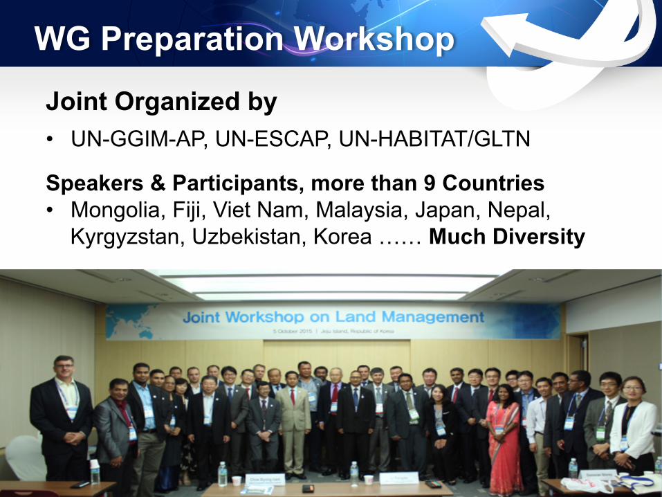
WG Preparation Workshop
Joint Organized by
• UN-GGIM-AP, UN-ESCAP, UN-HABITAT/GLTN
Speakers & Participants, more than 9 Countries • Mongolia, Fiji, Viet Nam, Malaysia, Japan, Nepal, Kyrgyzstan, Uzbekistan, Korea …… Much Diversity

Partnerships and Programs
• Learning Events (peer-to-peer learning, training)
• Regional Workshops • Annual sessions at UNGGIM-AP Plenary Meetings
Invite ISO/TC211 Experts for LADM at Land management workshop in conjunction with UN-GGIM-AP Plenary, Maylasia, OCT. 2016 and advisor for working group
