san francisco celebrates 30 years of trails · birds and experience nature. increasingly, it’s...
TRANSCRIPT
34 Planning November 2019
Why trails?The Bay Trail was—and remains—a bold idea and an ambitious undertaking in terms of scale and geographical reach. The trail passes through nine counties and 47 cities, with many different kinds of experiences to be found in different segments—from busy urban areas along the Embarcadero in downtown San Fran-cisco to more remote and natural settings. Even though it is not fully finished, it is extremely popular and heavily used, with a wealth of benefits for residents. It’s a source of recreation, a way to get away and recharge, and a place to see and watch birds and experience nature. Increasingly, it’s also a transportation resource.
On balance, the benefits of trails are considerable. The 2019 study Investing in Our Future sought to estimate the health, environmental, and economic benefits of completing the East Coast Greenway, which passes through Philadelphia. According to the report, the benefits amount to 10 times the costs of comple-tion, providing some $3 billion annually just for the sections local to Philadelphia.
And there are a range of other values and benefits that may be even harder to add up. “It’s brought us together,” Thompson says. “It connects communi-ties to each other, and it connects us to the waterfront.” It’s hard to underestimate that impact: to be able to hike or cycle around the San Francisco Bay, to see and experience it in its entirely.
Bold trail visions are nothing new to planners, of course. Regional planner Benton MacKaye envisioned what would become the 2,200-mile long Appalachian Trail as early as 1921. That vision now attracts more than three million hikers each year. Along the West Coast, the Pacific Coast Trail provides a similar experience, at an even longer 2,650 miles. In recent decades, this boldness in regional—or even continental-scale trails—has been even greater. The East Coast Greenway (which broke ground in 1991) will allow someone to travel 3,000 miles through 15 states, from Florida to Maine. And the recently completed
EVER GREEN
I spoke recently with Laura Thompson, an ABAG planner who has spearheaded the plan’s implementation for the last 15 years. The accomplishments to date have been impressive: It’s currently a little over 350 miles long (about 100 miles of trails already existed when the project began and were folded in). The Water Trail, an effort to map all the launch and landing sites for nonmotorized boats along the Bay, is also in progress.
The completed parts were the easiest ones to get done, Thompson tells me. Some of the hardest segments of the trail lie ahead, like the one around the San Francisco International Airport, which will require going inland and likely “up and over U.S. Highway 101 twice.” Narrow rights-of-way and extensive sensitive habitats present other design difficulties.
Still, she believes the trail will be
substantially complete in another 10 years. Not bad for such a monumental undertak-ing. That’s due in part to the considerable support the trail has had. It was mandated by Senate Bill 100, introduced by state legislator Bill Lockyer, and has benefited from the support of regional partnerships, dedicated staff, and creative funding.
The Bay Trail’s 30th anniversary coincides with a parallel project along the Bay’s ridge lines. More a traditional natural trail, the Ridge Trail is coordi-nated by a nonprofit, the Bay Area Ridge Trail Council, with lots of volunteer help. It is also about 70 percent complete and will eventually be 550 miles long when completed.
Few cities can boast this kind of sustained commitment to trails—which is why the Bay Area’s efforts serve as such an important lesson for the rest of the country.
San Francisco Celebrates 30 Years of Trails
T HIS PAST JUNE, THE SAN FRANCISCO BAY AREA celebrated the anniversary of a visionary plan. In 1989, the executive board of the Association of Bay Area Govern-ments greenlit the San Francisco Bay Trail, a 500-mile, continuous hiking trail that
stretches along the edge of the Bay. Today, that plan still serves as the blueprint for the trail, which is 70 percent complete.
JOR
GE
GA
RR
IDO
/AL
AM
Y
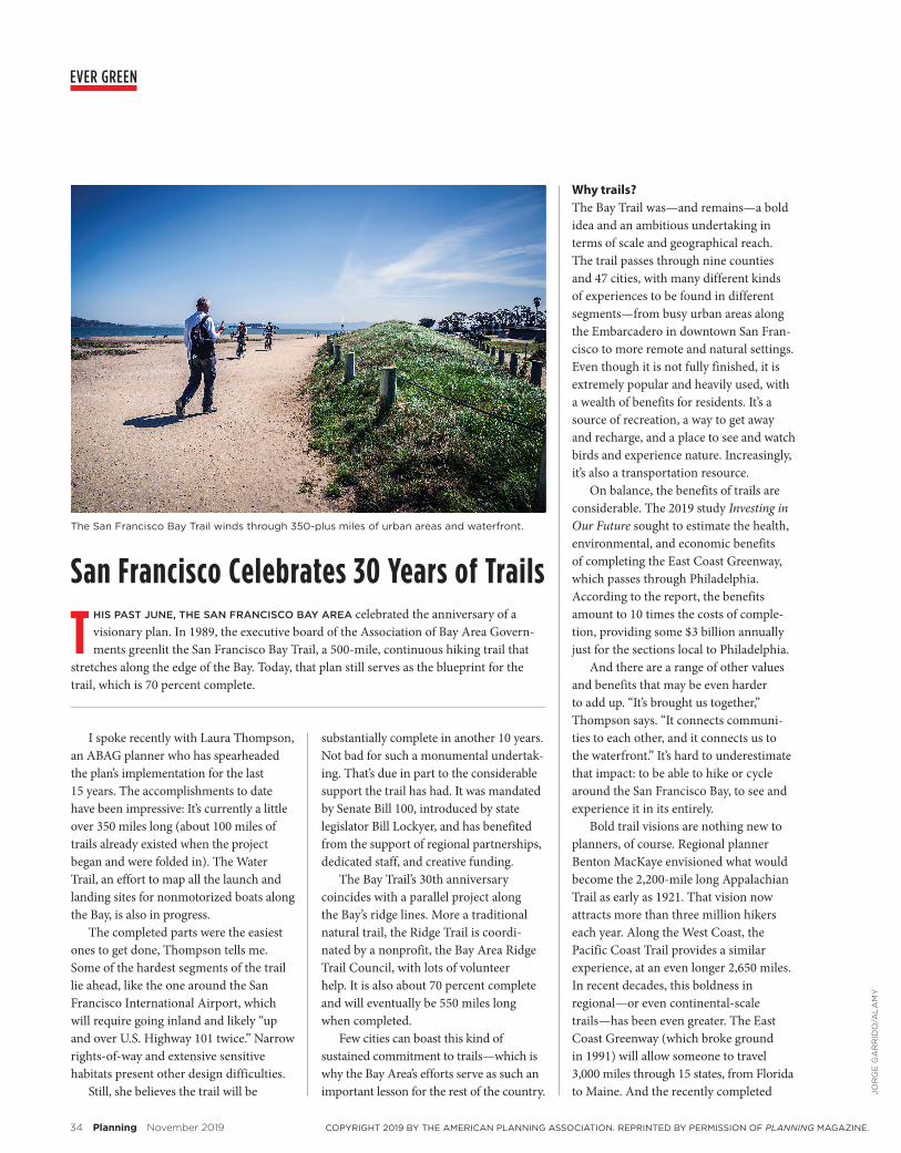
The San Francisco Bay Trail winds through 350-plus miles of urban areas and waterfront.
COPYRIGHT 2019 BY THE AMERICAN PLANNING ASSOCIATION. REPRINTED BY PERMISSION OF PLANNING MAGAZINE.

T H E J O U R N A L O F T H E A M E R I C A N P L A N N I N G A S S O C I AT I O N
Emerging Research for the
Practicing Planner
APA members can get the print and digital JAPA
for only $48 a year!
Subscribe today planning.org/JAPA
JAPA_1119.indd 1 10/1/19 1:39 PM
Planning (ISSN 0001–2610) is published by the American Planning Association, 205 N. Michigan Ave., Suite 1200, Chicago, IL 60601. APA’s membership includes 11 issues annually of Planning. From membership dues, $30 is the subscription fee for Planning. Nonmember subscribers pay $85 a year for 11 issues annually of Planning ($120 foreign). Periodicals postage paid at Chicago, Illinois, and at addi-tional mailing offices. Planning is a registered trademark. Copyright 2019 by the American Planning Association. Reprint permission must be requested in writing from APA. Attn: Postmaster and subscribers please send change of address to: Planning, Subscription Department, Amer-ican Planning Association, 205 N. Michigan Ave., Suite 1200, Chicago, IL 60601; 312–431–9100. Please supply both old and new addresses. Attn: Canadian Postmaster By Canadian agreement 40033287, Canadian return mail should be addressed to Station A, P.O. Box 54, Windsor, Ontario N9A 6J5.
Trans Canadian Trail, with a whopping distance of 14,000 miles, is purported to be the “world’s longest hiking trail.”
Despite all these efforts, San Fran-cisco remains in an urban trails category unmatched by any other city in the world. It is an exemplar of how an urban area can deeply connect its citizenry with the nature around it, enhancing its residents’ health and quality of life.
Lessons from Trail CityIn the Bay Area, the trail plays an ongoing and important role in conservation and restoration. Thompson describes it as an extension of the original efforts of Save the Bay in the 1960s, when three activist women took on the powerful interests aiming to fill and alter the Bay. Today’s South Bay Salt Ponds Restoration Project, which aims to convert salt ponds (evap-oration ponds used to produce salt) back to natural wetlands, is just one example of that continued spirit. Impressively, Bay Area voters also passed Measure AA in 2016, imposing on themselves a $12-per-year parcel tax (for a 20-year period) to fund wetland and habitat restoration projects, water quality improvements, and projects (including construction and maintenance of trails) that expand public access along the shoreline.
The trail and restoration of Bay wetlands just seem to go hand in hand. “I think that the way we’ll be able to carry forward this movement is if we can make sure that people can reach out and touch the Bay and understand it and see it, then they will continue to support it over time,” says Thompson. One ongoing challenge will be responding to sea-level rise, as many of the segments of the trail will be in jeopardy. Already opportunities to move the trail landward have arisen, as local governments are beginning to respond (by moving a levy, for instance). In this way, even when the 500 miles are completed, work on the trail will never completely end.
The region understands the impor-tance of partnerships and working together on this kind of long-term,
massive project, and dedicates the staff power to get it done. “To have this regional entity coordinating completion, I think, has been instrumental in its suc-cess,” Thompson says.
The path of the Ridge Trail is less urban than the Bay Trail’s, allowing hikers to reach more remote, wilder areas. As Janet McBride, executive director of the Ridge Trail Council, tells me, a priority has been providing camping sites for hikers. Once a new BART station opens in San Jose, a hiker could exit the station and travel via a connecting creek trail “right up to just absolute wilderness, in the hills above the city,” says McBride. The Ridge Trail facilitates a connection to wild nature that does not require one to travel to a distant national park. “It’s in your backyard,” she says.
Wedge Cabins, distinctive huts no larger than 156 square feet, have been designed by architecture students at Cal Poly Pomona and are being installed along the trail. “We’re working to con-nect longer and longer stretches so that folks can take on these epic adventures,” she says.
These two trails will eventually intersect and connect with an extensive network of local trails, creating what Thompson calls a “web” of trails. Hiking the Bay—traveling its two 500-plus-mile regional trails—will likely become a bucket list item, a badge of honor. And there is little doubt that residents who hike, bike, and camp along the trails will have a chance to experience their home region, in a remarkably different, but deeply transformative, way.
—Timothy BeatleyBeatley is the Teresa Heinz Professor
of Sustainable Communities at the University of Virginia, where he directs the
Biophilic Cities Project.
JOR
GE
GA
RR
IDO
/AL
AM
Y
FPO
COPYRIGHT 2019 BY THE AMERICAN PLANNING ASSOCIATION. REPRINTED BY PERMISSION OF PLANNING MAGAZINE.