sage grouse mitigation for oil & gas operations on state...
TRANSCRIPT

Sage Grouse Mitigation
for
Oil & Gas Operations on State School Trust Lands
Montana Department of Natural Resources & Conservation
Trust Land Management Division
November 19, 2007
Producing Wells & Active Sage Grouse Leks
Active Leks --
Gas Wells –
CBNG Wells –
Oil Wells –

1
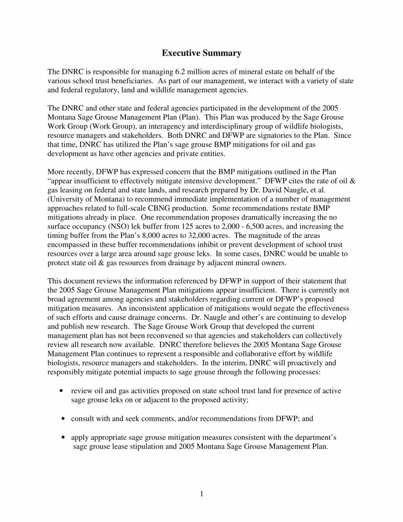
Executive Summary
The DNRC is responsible for managing 6.2 million acres of mineral estate on behalf of the
various school trust beneficiaries. As part of our management, we interact with a variety of state
and federal regulatory, land and wildlife management agencies.
The DNRC and other state and federal agencies participated in the development of the 2005
Montana Sage Grouse Management Plan (Plan). This Plan was produced by the Sage Grouse
Work Group (Work Group), an interagency and interdisciplinary group of wildlife biologists,
resource managers and stakeholders. Both DNRC and DFWP are signatories to the Plan. Since
that time, DNRC has utilized the Plan’s sage grouse BMP mitigations for oil and gas
development as have other agencies and private entities.
More recently, DFWP has expressed concern that the BMP mitigations outlined in the Plan
“appear insufficient to effectively mitigate intensive development.” DFWP cites the rate of oil &
gas leasing on federal and state lands, and research prepared by Dr. David Naugle, et al.
(University of Montana) to recommend immediate implementation of a number of management
approaches related to full-scale CBNG production. Some recommendations restate BMP
mitigations already in place. One recommendation proposes dramatically increasing the no
surface occupancy (NSO) lek buffer from 125 acres to 2,000 - 6,500 acres, and increasing the
timing buffer from the Plan’s 8,000 acres to 32,000 acres. The magnitude of the areas
encompassed in these buffer recommendations inhibit or prevent development of school trust
resources over a large area around sage grouse leks. In some cases, DNRC would be unable to
protect state oil & gas resources from drainage by adjacent mineral owners.
This document reviews the information referenced by DFWP in support of their statement that
the 2005 Sage Grouse Management Plan mitigations appear insufficient. There is currently not
broad agreement among agencies and stakeholders regarding current or DFWP’s proposed
mitigation measures. An inconsistent application of mitigations would negate the effectiveness
of such efforts and cause drainage concerns. Dr. Naugle and other’s are continuing to develop
and publish new research. The Sage Grouse Work Group that developed the current
management plan has not been reconvened so that agencies and stakeholders can collectively
review all research now available. DNRC therefore believes the 2005 Montana Sage Grouse
Management Plan continues to represent a responsible and collaborative effort by wildlife
biologists, resource managers and stakeholders. In the interim, DNRC will proactively and
responsibly mitigate potential impacts to sage grouse through the following processes:
• review oil and gas activities proposed on state school trust land for presence of active
sage grouse leks on or adjacent to the proposed activity;
• consult with and seek comments, and/or recommendations from DFWP; and
• apply appropriate sage grouse mitigation measures consistent with the department’s
sage grouse lease stipulation and 2005 Montana Sage Grouse Management Plan.
2
Background
Sage grouse have become a species of concern across the region due to declining numbers
relative to their historical range and populations. In 2005, the United States Fish & Wildlife
Service (USFWS) evaluated a petition for listing on the Endangered Species List, and found the
request “not warranted.” That decision is currently in litigation.
In Montana, the Department of Fish, Wildlife and Parks (DFWP) reports the sage grouse
population is healthy and stable, with increases noted over the last two years.
“We have been monitoring sage grouse populations for more than 20 years, and
this is the second or third best year we’ve had since then. Hunters should see
plenty of older birds, and I’d expect good numbers of this year’s chicks too.” 1
The DFWP is concerned that Montana’s sage grouse population remain healthy and stable. If
efforts to list sage grouse progress in the future, a healthy population may provide a strong basis
for separating Montana from an ESA listing.
The DNRC and DFWP developed a stipulation, which is placed on eligible oil & gas tracts
nominated for auction. The complete stipulation is as follows:2
“Active sage grouse lek(s) have been identified on or adjacent to this tract. No
activities shall occur on the tract until the proposed action has been approved in
writing by the Director of the Department. If surface activity is proposed on the
tract, the department will consult with the Director of the Department of Fish,
Wildlife and Parks for his or her comments, concerns and recommendations.
Additional mitigation measures may be required, including no-surface occupancy
buffers and/or timing restrictions, which may encompass part or all of the tract.”
This stipulation does not represent a substantive change from the existing review process or
application of BMP mitigations for active sage grouse leks on or adjacent to state oil & gas
leases. Other provisions of the state’s oil & gas lease already require a site specific
environmental review of the proposed activity, followed by application of specific mitigation
measures. This stipulation does formalize engagement of the DFWP Director in the comment
and consultation process. DNRC will continue to work with DFWP field staff as appropriate for
site-specific comments or recommendations.
Sage Grouse Working Group and Management Plan - 2005
The Sage Grouse Management Plan is a comprehensive, 200-page report prepared by the
Montana Sage Grouse Work Group. Work Group members consist of wildlife biologists and
resource managers from federal, state, and private entities, including: Montana Department of
1 Harold Wentland, DFWP Northeast Montana Wildlife Manager, Rocky Mountain Fishing & Hunting News,
August 23, 2007 Edition. 2 DNRC master stipulation list.

3
Fish, Wildlife and Parks; Montana Department of Natural Resources and Conservation; United
States Forest Service; Natural Resource Conservation Service; Federal Bureau of Land
Management; National Wildlife Refuge; United States Fish & Wildlife Service; National
Wildlife Federation; Montana Wildlife Federation; Montana Falconers Association; Montana
Petroleum Association; and Mark Goetz, CVO Research & Consulting.
The Plan examined and characterized key aspects of seasonal habitat, and identified twelve
issues relevant to sage grouse conservation. The Work Group evaluated each of these twelve
areas/activities in terms of their potential impact on sage grouse and the implications posed by
the risks themselves. The result was the development of conservation actions designed to reduce
these risks. These twelve areas are:
• Fire Management
• Grazing Management
• Harvest Management
• Noxious Weed Management
• Mining and Energy Development
• Outreach and Education
• Power Lines and Generation Facilities
• Predation
• Recreational Disturbance
• Roads and Motorized Vehicles
• Vegetation
• Managing Other Wildlife in Sage Grouse Habitat
The Plan was completed in 2005. Both the DNRC and DFWP participated in the Work Group,
and both agencies are signatories to the Plan document. The Plan recommends an NSO buffer
around an active lek encompassing a 0.25-mile radius and a timing buffer restricting surface
activity around an active lek encompassing a 2-mile radius. The timing restriction applies
between March 1 and June 15, coinciding with mating and nesting periods.
The Plan’s recommendations are not binding on participants, but the DNRC has voluntarily
utilized these sage grouse mitigation standards when evaluating oil & gas activity proposals.
DFWP Agency Position – 2007
The DFWP developed a May 2007 agency position paper on sage grouse mitigations. This
followed agency presentations and articles informing the public, land management agencies, and
interested parties of their concerns. The agency position paper asserts the BMPs recommended
by the 2005 Plan appear insufficient, and urges adoption of DFWP’s new recommendations.
Some recommendations are general while others restate existing BMPs already utilized on state
lands. However, one recommendation would significantly increase NSO and timing restriction
buffers. The magnitude of the areas encompassed by these buffers can inhibit or prevent
development of school trust resources. In some cases, DNRC would be unable to protect state
oil & gas resources from drainage by adjacent mineral owners.

4
The 2005 Sage Grouse Management Plan recommends a 0.25-mile radius (125 acres) NSO
buffer and a 2-mile radius (8,000 acres) timing restriction between March 1 and June 15. The
DFWP’s May 2007 agency position paper recommends an NSO buffer radius of 1 to 1.8 miles,
and a timing restriction extending 4 miles from the lek. The DFWP NSO and timing
recommendation would apply to existing leks regardless of status, whereas the 2005 Plan applies
the buffer restrictions to active leks. In terms of area, DFWP’s recommendation would prohibit
all activity on 3 to 10 sections of land around the lek, and place timing restrictions for new
activity on 50 sections around the lek.3
The DFWP cites new research and the significant rate of recent efforts to lease both federal and
state mineral resources, as the basis for their review and conclusion that the 2005 Sage Grouse
Management Plan mitigations appear insufficient to effectively mitigate intensive development.4
Review of DFWP Information
Application of Research to Lek/Infrastructure Buffers
The basis for DFWP’s position draws from their review of research prepared after the
development of the 2005 Sage Grouse Management Plan. Research conducted by Dr. David
Naugle et al. (University of Montana) became available in 2006 and 2007. DFWP cites this
research to assert the 2005 Plan mitigations appear insufficient and urge adoption of DFWP’s
buffer recommended increases in NSO and timing buffers.
Dr. Naugle conducted a statistical analysis of datasets provided by the Montana DFWP and
Wyoming Game & Fish Department covering coal bed natural gas operations in the Powder
River Basin (PRB) of Wyoming and Montana. Dr. Naugle characterized the area affected by
CBNG development by assuming 1) a 350 meter buffer around the CBNG well to represent the
area of development, and 2) a 3.2 kilometer buffer around the lek to represent the area of
influence to the lek. A spatial overlay utilizing these assumptions allows Dr. Naugle to separate
sage grouse leks into three categories: those within CBNG development, those adjacent to or on
the edge of CBNG development, and those outside of CBNG development.5 Correlating lek
count data to these categories allowed Dr. Naugle to analyze the three categories for differences
in sage grouse lek count response over time.
Dr. Naugle did not analyze each sage grouse lek to correlate specific actual surface disturbance
by distance with changes in lek count or activity, and did not have such data to utilize in the
development of his model. Dr. Naugle explains this in his discussion on methodology:
“We selected a 350-m buffer around roads, power lines, and CBNG wells for 2
reasons. First, quantitative estimates of the distance at which infrastructure
affects habitat use or vital rates of sage-grouse were not available, and 350-m is
a reasonable distance over which to expect impacts to occur, such as increased
3 A section of land covers a square 1 mile long on each side – or approximately 640 acres.
4 DFWP Agency Position cover letter dated May 24, 2007.
5 Naugle, et al., Sage Grouse Population Response to CBNG Development in the PRB, Interim Progress Report on
Region-wide Lek-count Analyses, May 26, 2006.

5
risk of predation near power lines or increased risk of vehicle collisions near
roads. Second, we also wished to maintain a consistent relationship between
well, road, and power line variables and the amount of area affected by each
feature.” [emphasis added] 6
Site-specific analysis of leks based on actual buffer area around them was therefore not the focus
of Dr. Naugle’s research cited by DFWP. While Dr. Naugle’s research may provide a model for
broad-scale discussions, it does not focus on the fundamental issue we face as a land
management agency – reasonable site-specific set-backs for CBNG infrastructure based on
quantitative analysis of impacts.
Sage Grouse Population Impacts
Dr. Naugle notes that their preliminary work supports previous findings that region-wide
populations in Wyoming declined severely in 1990-1995, followed by stable trends around a
lower population equilibrium from 1995-2005.
Figure 1: DFWP PowerPoint
CBNG development in the PRB did not begin in earnest until about 1997. Figure 1 is sometimes
used in general discussions on sage grouse population and CBNG development, but Dr. Naugle
does not apply Figure 1 to CBNG-related impacts. Figure 2 below clarifies this distinction
between pre-CBNG and post-CBNG development by including CBNG well count (red dashed
line) within the timeframe portrayed in Figure 1. Figure 1 and 2 apply to Wyoming’s sage
grouse population. Montana did not experience such a decline.7
6 pg 12: Greater Sage Grouse Population Response to Energy Development and Habitat Loss, Pre-Print In-Press,
June 25, 2007. 7 Montana DFWP.

6
Figure 2
Dr. Naugle’s research ultimately focused on data within the 2001-2005 time period.
Within that timeframe, Dr. Naugle used the 350 meter development-buffer methodology
discussed above to look for differences in sage grouse population response over time (via lek
count data) at a landscape level. This produced Figure 3 below, which portrays the relative
change in population as a percentage of 2001 population for two lek categories – inside and
outside CBNG.
Figure 3
This data has been cited by DFWP and others to support a statement that CBNG development
caused a population decline of 82%. However, Dr. Naugle expressly associates the 82% decline
only to those leks he considered inside CBNG development - not all potentially affected leks.
This is a key distinction. Dr. Naugle laid out his research objectives in the 2006 Interim Progress
Report. Objective No. 1 was to test population trends in areas inside, adjacent to, and outside
CBNG development. The interim report includes Dr. Naugle’s more detailed analysis and
discussion related to this test objective. By looking at these three categories, Dr. Naugle was
able to separately show population indices for leks inside and adjacent to CBNG development, as

7
well as for those leks outside CBNG development. Figure 4 shows the more detailed breakdown
presented by Dr. Naugle in the 2006 Interim Progress Report (presented as a percentage of 2001
population, consistent with Dr. Naugle’s 2007 report).
Figure 4
Dr. Naugle summarized his objective and results as follows:
“To test the hypothesis that sage-grouse avoid CBNG development, we examined
trends in population indices at leks adjacent to CBNG development. We
predicted that such leks should show increased population size relative to leks
entirely outside of development because males from areas with development
would move into adjacent undeveloped habitat and attend leks in those areas. As
predicted, leks along the edge of CBNG development showed higher population
indices than leks further away.” 8
Dr. Naugle’s data shows a decrease in population for leks within CBNG development and an
increase in population for leks adjacent to or on the edge of CBNG development. Therefore, the
net population impact that Dr. Naugle’s data attributes to CBNG development consists of
changes his analysis indicated on leks within and adjacent to CBNG activity. Figure 5 below
shows the net changes in leks potentially affected by CBNG (in and adjacent to the
development), and compares that to the control population (outside CBNG activity).
When all potentially impacted leks are compared to the control population, Dr. Naugle’s research
does not show an 82% difference in population index over the 2001-2005 analysis period.
Instead, the impacted population exhibits redistribution and a smaller net decrease. The
8 Naugle, et al., Sage Grouse Population Response to CBNG Development in the PRB, Interim Progress Report on
Region-wide Lek-count Analyses, May 26, 2006.

8
impacted population also shows environmental factors (i.e. non-CBNG) affecting both impacted
and control populations similarly and more significantly over the analysis period.
PRB SG Population Index (2001-2005)Source: Naugle - Interim & Published Report
0
20
40
60
80
100
120
2001 2002 2003 2004 2005
% o
f 2001 P
op
ula
tio
n
Outside CBNG In & Edge CBNG
Figure 5
Dr. Naugle’s 2007 paper excludes his lek attendance hypothesis, discussion and conclusions.
The edge lek data that showed positive population trends relative to the control population is not
presented. Instead, Dr. Naugle’s 2007 paper merges edge lek data into the control dataset. The
larger size of the control population group overwhelms the edge lek population data, and its
inclusion in the control group is imperceptible on the graph in the published paper.
In recent discussions with DFWP and DNRC, Dr. Naugle cited confidence interval issues with
the group of leks located on the edge of CBNG development.9 He maintains that treating these
leks as part of the control group (i.e. the group not affected by CBNG development) is valid. As
revised, leks can have CBNG development impacting up to 40% of the area around them and
still be considered part of the control dataset. Dr. Naugle’s revised definition for the control
dataset differs from that utilized in other recent research.10
Dr. Naugle advises more research is needed to evaluate the response of edge leks to CBNG
development, and that this effort is part of his ongoing research. However, based on his datasets
through 2005, he is limiting the discussion and conclusions to leks within CBNG development
and excluding discussion of population redistribution to adjacent leks.
In recent discussions, Dr. Naugle also asserted that application of mitigation strategies need to be
across landownerships to be effective. DNRC believe that interagency/interdisciplinary review
process established by the Sage Grouse Working Group remains an important step in gaining a
consistent, broadly-based approach for effective mitigation.
9 Meeting with Dr. Naugle, November 7, 2007.
10 Doherty (2007), Taylor (2007), Holleran (2005)
9
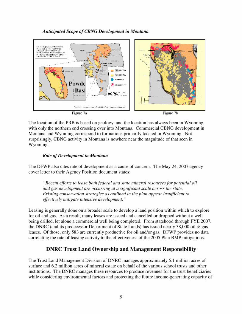
Anticipated Scope of CBNG Development in Montana
Figure 7a Figure 7b
The location of the PRB is based on geology, and the location has always been in Wyoming,
with only the northern end crossing over into Montana. Commercial CBNG development in
Montana and Wyoming correspond to formations primarily located in Wyoming. Not
surprisingly, CBNG activity in Montana is nowhere near the magnitude of that seen in
Wyoming.
Rate of Development in Montana
The DFWP also cites rate of development as a cause of concern. The May 24, 2007 agency
cover letter to their Agency Position document states:
“Recent efforts to lease both federal and state mineral resources for potential oil
and gas development are occurring at a significant scale across the state.
Existing conservation strategies as outlined in the plan appear insufficient to
effectively mitigate intensive development.”
Leasing is generally done on a broader scale to develop a land position within which to explore
for oil and gas. As a result, many leases are issued and cancelled or dropped without a well
being drilled, let alone a commercial well being completed. From statehood through FYE 2007,
the DNRC (and its predecessor Department of State Lands) has issued nearly 38,000 oil & gas
leases. Of those, only 583 are currently productive for oil and/or gas. DFWP provides no data
correlating the rate of leasing activity to the effectiveness of the 2005 Plan BMP mitigations.
DNRC Trust Land Ownership and Management Responsibility
The Trust Land Management Division of DNRC manages approximately 5.1 million acres of
surface and 6.2 million acres of mineral estate on behalf of the various school trusts and other
institutions. The DNRC manages these resources to produce revenues for the trust beneficiaries
while considering environmental factors and protecting the future income-generating capacity of

10
the land. These properties are scattered across Montana, with the mineral estate ownership
comprising about 6.5 percent of the state.
If DNRC were to adopt the DFWP NSO buffer recommendation, exploration and development
could be prohibited on state lands located anywhere within a 2,000 to 6,500 acre area around a
lek. The DFWP timing restriction recommendation would restrict new activity for several weeks
each year on state lands located up to 4 miles away from a lek. These mitigations would apply to
the state school trust land, but would not apply to adjacent privately-owned mineral estate. The
magnitude of the DFWP recommendations are such that oil & gas development could be
significantly impaired or totally prohibited on state ownership, but would continue on adjacent
property. It is essential to apply any new mitigation strategies across all ownerships to be
effective and avoid impact to state ownership.
The potential for adverse impacts to state trust resources and beneficiaries, coupled with
questionable effectiveness of a mitigation applied only to scattered tracts of land, generates a
responsibility to encourage a collaborative approach in implementation of any new mitigation
approaches.
DNRC Position
The agency position paper distributed by DFWP does not appear to fully explore the efficacy of
the 2005 Sage Grouse Management Plan recommendations regarding sage grouse mitigations for
oil & gas development.
Dr. Naugle’s work advises that quantitative research is currently unavailable to determine the
distances at which various types of infrastructure are shown to impact leks. Dr. Naugle also
advises that inconsistent application of mitigation measures would not be effective. Dr. Naugle’s
interim report presented and confirmed his hypothesis that sage grouse would relocate from
within CBNG development to leks adjacent to CBNG development. Citing confidence interval
issues, Dr. Naugle limited his 2007 published paper to an examination of interior leks. However,
Dr. Naugle is continuing his research on edge lek response and is examining lek data for 2006
and 2007.
DFWP expands their application of Dr. Naugle’s research to non-CBNG development. The
infrastructure needed for deep and other shallow natural gas development is different from that
utilized for CBNG. Even if DNRC saw support for DFWP’s position in the information they
cite, it would not automatically extend to non-CBNG development elsewhere in Montana.
The DNRC concurs with DFWP’s philosophy of basing mitigations on research, science, and
collaboration. However, DFWP has not demonstrated the existing BMP mitigations to be
inadequate, and has not demonstrated a correlation between leasing activity and mitigation
effectiveness. DFWP’s own data confirms a healthy, stable, and increasing sage grouse
population. DFWP has not demonstrated the need for, or the effectiveness of, the dramatic
increases recommended for no surface occupancy or timing buffers, particularly if the
mitigations are not consistent across all ownerships.

11
The DFWP represents its May 2007 Agency Position document as justification for changing the
existing sage grouse BMP mitigations:
“Incorporating this information into more appropriately designed conservation measures
will necessitate both fine and large-scale modifications to existing approaches. FWP
looks forward to working with Plan partners to accomplish this task.”
Based on our review of the DFWP document, the DNRC believes the Sage Grouse Work Group
is the proper venue for critical review of new information. Researchers advise of the need for
additional research, and research is ongoing. DNRC therefore continues to request the
reactivation of the Sage Grouse Work Group.
In the interim, DNRC will proactively and responsibly mitigate potential impacts to sage grouse
through the following processes:
• review oil and gas activities proposed on state school trust land for presence of active
sage grouse leks on or adjacent to the proposed activity;
• consult with and seek comments, and/or recommendations from DFWP; and
• apply appropriate sage grouse mitigation measures consistent with the department’s
sage grouse lease stipulation and 2005 Montana Sage Grouse Management