sacramento regional digital orthophoto project roger exline, gis manager sacramento county kallen...
TRANSCRIPT
Sacramento Regional Digital Orthophoto Project
Roger Exline, GIS Manager
Sacramento County
Kallen Bailey, Director of Production
ImageAmerica Corporation
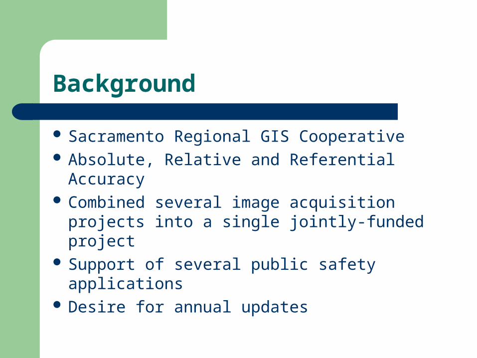
Background
Sacramento Regional GIS Cooperative Absolute, Relative and Referential Accuracy Combined several image acquisition projects
into a single jointly-funded project Support of several public safety applications Desire for annual updates

Project Overview
“The intent of this RFP is to solicit proposals from vendors that utilize various technologies so that the project team can qualitatively compare differences in positional accuracy, resolution, overall usability, cost and conversion time frame.”
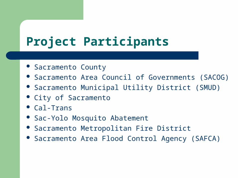
Project Participants
Sacramento County Sacramento Area Council of Governments (SACOG) Sacramento Municipal Utility District (SMUD) City of Sacramento Cal-Trans Sac-Yolo Mosquito Abatement Sacramento Metropolitan Fire District Sacramento Area Flood Control Agency (SAFCA)

Aggressive Project Schedule
1/25/01 Release of RFP 2/16/01 Contractor selected 2/26/01 Contract signed 3/12-13/01 Aerial mission flown 5/15/01 TIFF Imagery delivered
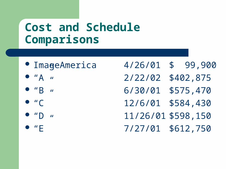
Cost and Schedule Comparisons
ImageAmerica 4/26/01 $ 99,900 “A” 2/22/02 $402,875 “B” 6/30/01 $575,470 “C” 12/6/01 $584,430 “D 11/26/01 $598,150 “E” 7/27/01 $612,750
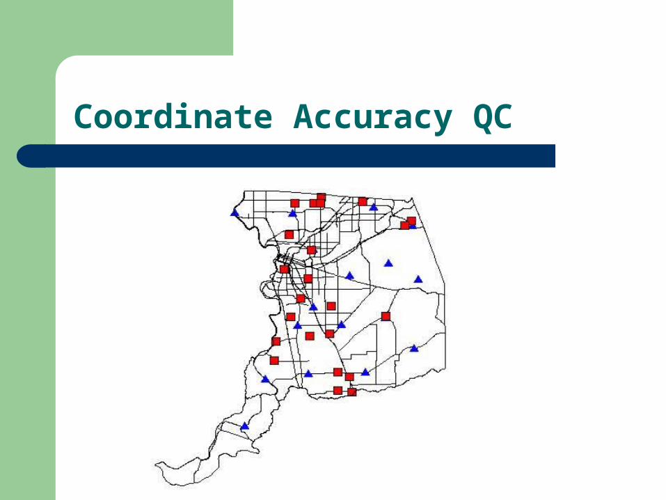
Coordinate Accuracy QC
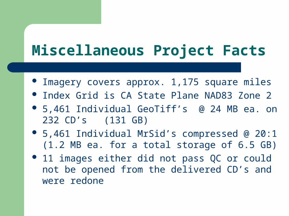
Miscellaneous Project Facts
Imagery covers approx. 1,175 square miles Index Grid is CA State Plane NAD83 Zone 2 5,461 Individual GeoTiff’s @ 24 MB ea. on 232 CD’s
(131 GB) 5,461 Individual MrSid’s compressed @ 20:1 (1.2 MB
ea. for a total storage of 6.5 GB) 11 images either did not pass QC or could not be
opened from the delivered CD’s and were redone

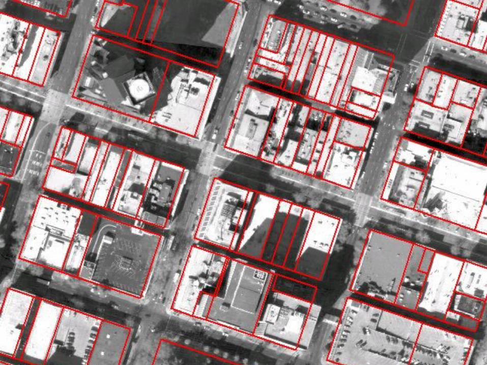
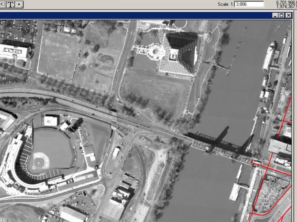
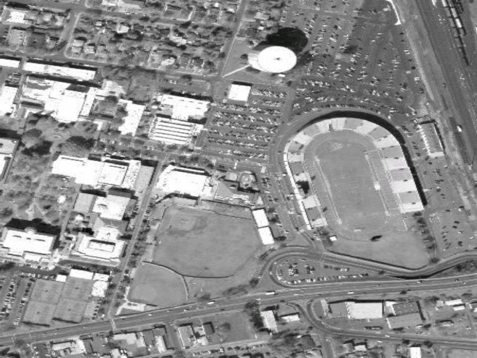
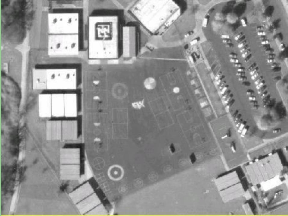
Current Uses of the Orthos
Verification of spatial accuracy of cadastral layers Verification of census block boundaries in support of
legislative redistricting Law enforcement event planning Identification of vineyard areas (glassy-winged
sharpshooter) Determining access and egress routes in rural areas in
support of fire suppression Development of pre-fire plans for commercial and
mercantile development Use by private consultants, engineers and developers


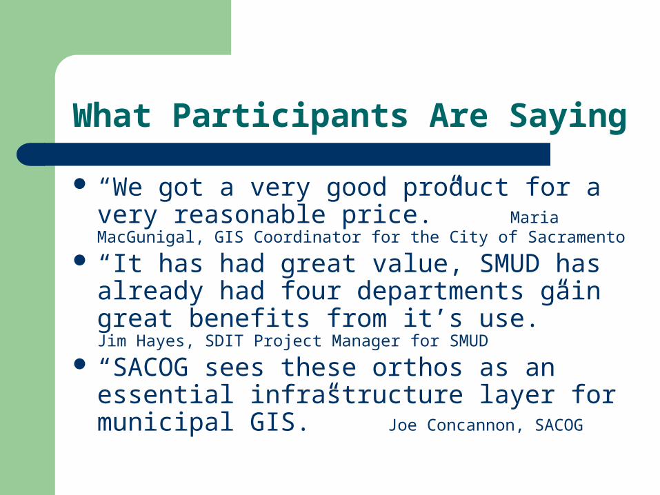
What Participants Are Saying
“We got a very good product for a very reasonable price.” Maria MacGunigal, GIS Coordinator for the City of Sacramento
“It has had great value, SMUD has already had four departments gain great benefits from it’s use.” Jim Hayes, SDIT Project Manager for SMUD
“SACOG sees these orthos as an essential infrastructure layer for municipal GIS.” Joe Concannon, SACOG
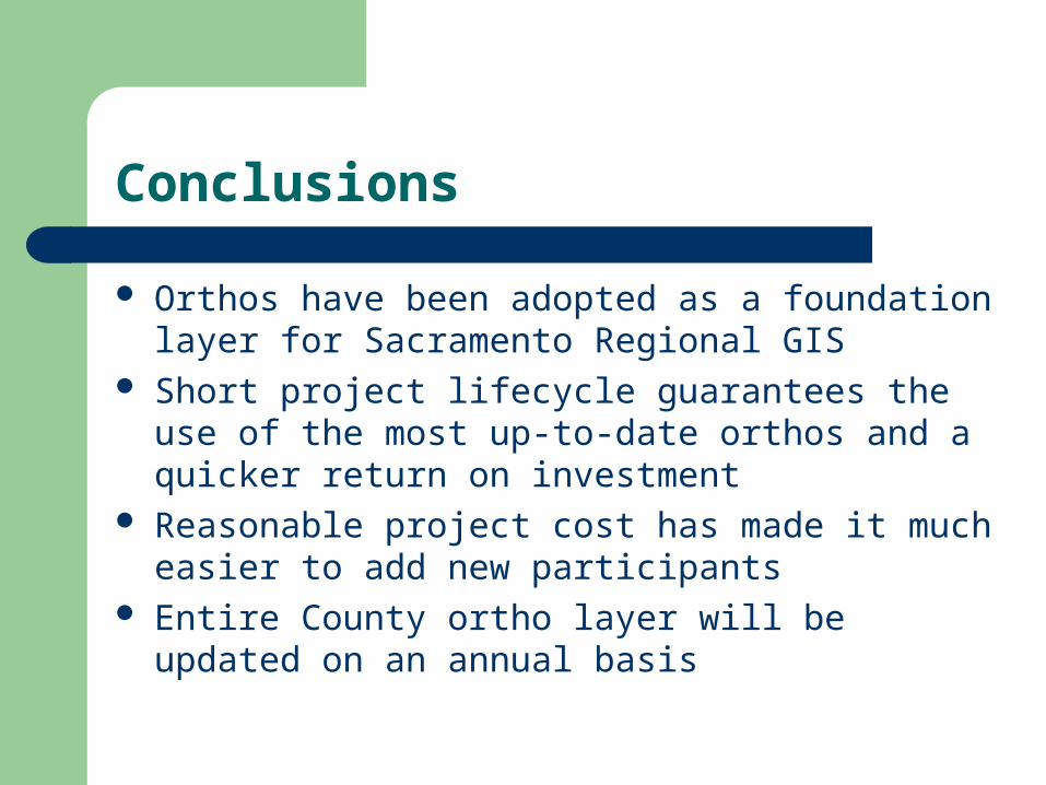
Conclusions
Orthos have been adopted as a foundation layer for Sacramento Regional GIS
Short project lifecycle guarantees the use of the most up-to-date orthos and a quicker return on investment
Reasonable project cost has made it much easier to add new participants
Entire County ortho layer will be updated on an annual basis
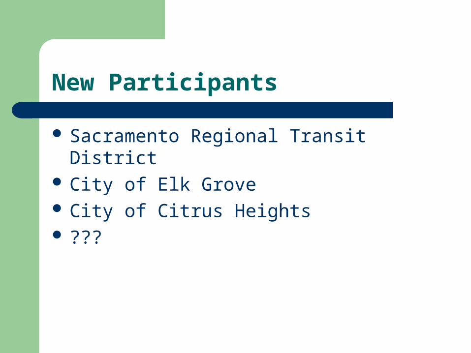
New Participants
Sacramento Regional Transit District City of Elk Grove City of Citrus Heights ???