s4: modeling the reasons for seasonal change
TRANSCRIPT

GLOBE® 2005 S4: Reasons for Seasonal Change Learning Activity - 1 Earth System Science
Ap
pen
dix
Welco
me
Intro
du
ction
Pro
toco
lsLearn
ing A
ctivities!
?S4: Modeling the Reasons for Seasonal Change
PurposeTo understand what causes the Earth’s seasons, with a focus on the Earth’s tilt and its spherical shape
OverviewStudents learn how sunlight spreads over the Earth at different times of the year, emphasizing the solstices and the equinoxes. Students investigate the effect of the Earth’s tilt on the spread of sunlight by modeling different tilts using a three-dimensional polyhedron which they construct from paper. Students calculate the relative sunlight intensity received by the Northern and Southern Hemispheres to understand seasonal differences between the hemispheres.
Student OutcomesStudents can correctly explain how the Earth’s tilt causes seasons.
Students can interpret the effect of different scenarios of Earth’s tilt on the seasons and global climate.
Students can use color visualizations and spatial models to understand phenomena and solve problems.
Science ConceptsEarth and Space Sciences
Seasons result from variations in solar insolation resulting from the tilt of the Earth’s rotation axis.
The sun is the major source of energy at Earth’s surface.
Solar insolation drives atmospheric and ocean circulation.
Sun is a major source of energy for phenomena on Earth’s surface.
Physical SciencesSun is a major source of energy for changes
on the Earth’s surface.
Life Sciences
Sunlight is the major source of energy for ecosystems.
Energy for life derives mainly from the sun.
Living systems require a continuous input of energy to maintain their chemical and physical organizations.
Scientific Inquiry AbilitiesModeling and analyzing three-dimensional
relationships that vary in timeAnalyzing patterns in color visualizationsAssembling a three-dimensional model
from a flat planeUse appropriate tools and techniques.Develop explanations and predictions
using evidence.Recognize and analyze alternative
explanations.Use appropriate mathematics to analyze
data.Communicate results and explanations.
TimeTwo-three 45-minute class periods
LevelMiddle, Secondary
Materials and ToolsGlobe (if not available, any sphere such as
a ball can be used)Overhead projector and transparencies
for class discussionPaper copy of the three-dimensional
polyhedron to assemble, a copy of the sunlight circle and protractor page, a pair of scissors, and tape for each group

GLOBE® 2005 S4: Reasons for Seasonal Change Learning Activity - 2 Earth System Science
PreparationPhotocopy grid (Figure EA-S4-3) onto an
overhead transparency.Assemble a three-dimensional polyhedron
from the paper template.Divide students into groups of 2-3.
PrerequisitesStudents should be familiar with the use of color visualizations. Learning to Use Visualizations: An Example with Elevation and Temperature and Draw Your Own Visualization Learning Activities, in the Atmosphere chapter, are recommended.
BackgroundMost places on the Earth experience seasonal variation during the year: in different areas it may be hot, cold, rainy, or dry depending on the season. Length of daylight can vary as well: latitudes near the poles experience nearly 24-hour sunlight at the peak of summer and nearly 24-hour darkness at the peak of winter. Around the world, people, plants, and animals are adapted to the types of seasonal variation experienced in their own region.
What causes the seasons? Seasonal changes, including temperature and length of daylight, indicate that the sun’s light received by the Earth varies both throughout the year and at different latitudes. But the reasons can be difficult to understand.
The first explanation many people give for seasonal change is that the sun is at different distances from the Earth at different places in its elliptical orbit. It seems to make sense that it would be summer when the Earth is closer to the sun and therefore receiving more of the sun’s energy, and winter when it is farther away; after all, you do feel warmer when you sit closer to a fire. But how would this explain the fact that seasons are opposite in the Northern and Southern Hemispheres and much more extreme at higher latitudes than at the equator?
The biggest reason for seasons is actually the tilt of the Earth. This, coupled with the Earth’s spherical shape, impacts the intensity with which sunlight is received at different latitudes and at different times of the year. Since the Earth’s tilt is not something we can directly experience, its effect is easier to understand using visualization techniques. In this activity, you will use color visualizations and three-dimensional models to learn how the Earth’s tilt and its spherical shape make the seasons occur.
First, here are some important concepts:
1. The Earth receives energy from the sun in the form of insolation.
Scientists call the energy coming to the Earth from the sun insolation (INcoming SOLar radiation). This energy gives Earth both heat and light. As the Earth spins each day on its axis (the invisible straight line running through the North and South poles), the side facing the sun receives direct insolation and therefore experiences daytime - sunlight and warmer temperatures - while the side of the Earth facing away from the sun experiences night.
2. The Earth is tilted by about 23.5° as it rotates around the sun.
As the Earth makes its yearly revolution around the sun, it does not “stand” straight up. In other words, the Earth’s axis is not exactly vertical. Scientists explain this mathematically by saying that the Earth is tilted about 23.5° off of the plane in which it orbits around the sun.
3. The tilt of the Earth stays constant as it orbits the sun.
The Earth’s tilt affects the amount of insolation particular latitudes on Earth receive from the sun. For example, at some times during the year the North Pole is inclined towards the sun (see Figure EA-S4-1, June solstice), and at other times it is inclined away (see Figure EA-S4-1, December solstice). Let’s look at this effect at two important times of the year: an equinox and a solstice.
Equinox (equal night). We experience the vernal and autumnal equinoxes as the two days each year when the length of day and night are equal for every place on Earth. In the Northern Hemisphere, the vernal (spring) equinox occurs around March 21 and the autumnal (fall) equinox

GLOBE® 2005 S4: Reasons for Seasonal Change Learning Activity - 3 Earth System Science
Ap
pen
dix
Welco
me
Intro
du
ction
Pro
toco
lsLearn
ing A
ctivities
is around September 23. In the Southern Hemisphere, the two are reversed: March 21 is the autumnal equinox, and September 23 is the vernal equinox.
At these times, the two hemispheres receive equal amounts of insolation from the sun. Look at Figure EA-S4-1. At the equinoxes, sunlight illuminates the two hemispheres evenly. If you were looking at the Earth from the sun’s point of view, you would be able to see the same amount of each hemisphere, centered on the equator. This is why, at an equinox, the same length of daylight is experienced by each of the hemispheres.
Solstice (stand still). Solstice is the time when one hemisphere experiences its longest day and the other experiences its shortest. It occurs two times each year, on June 22 and December 21. The word “solstice” comes from “sol” meaning “sun” and “stice” meaning “stand still.” This is because the sun appears to stand still as it reaches its highest point at midday (in summer) or lowest (in winter).
A solstice happens because of tilt. In Figure EA-S4-1, look at the picture labeled December solstice. In this case, the North Pole is tilted away from the sun, so that even as the Earth
revolves around its axis the North Pole never receives direct sunlight. Meanwhile, the South Pole is tilted toward the sun, so it experiences its longest day of the year. In the June solstice, the opposite occurs: the North Pole is tilted toward the sun, and the South Pole is tilted away.
4. Energy from the sun spreads unevenly over the Earth due to its spherical shape.
If the poles have 24-hour-long days during their summer, why are they so much colder than the equator? The reason is that the intensity of sunlight is not the same at every point on Earth. Sunlight is spreading over a sphere, not a flat surface. If the Earth were a two-dimensional circle that always faced the sun, it would receive an equal amount of energy at every point. But because the Earth is spherical, the same amount of sunlight that hits 1 square meter of Earth where the sunlight is perpendicular covers a much greater area elsewhere on Earth, where it hits the Earth at a shallower angle.
5. Insolation is strongest where sunlight strikes the Earth at a 90˚ angle to the Earth’s surface.
At any given time, the Earth receives the most direct insolation at the latitude where sunlight strikes at a perpendicular angle. As the angle at which sunlight strikes the Earth changes from 90˚, the same amount of energy is spread over a greater area, so the energy per unit area decreases.
At an equinox (see Figure EA-S4-1), sunlight strikes the Earth at a 90˚ angle at the equator. At a solstice, where the Earth is tilted away from or toward the sun, sunlight strikes the Earth most directly at one of the tropic latitudes (23.5˚ N or 23.5˚ S).
In the activity that follows, you will use a physical model to explore how the Earth’s tilt and spherical shape impact the amount and intensity of light received at a given latitude, which in turn causes seasonal change.
What To Do and How To Do ItIn this activity, students explore the effect of the Earth’s tilt using a three-dimensional model, estimating how different tilts would change the
September Equinox
December Solstice
June Solstice
March Equinox
The distance between the sun and the Earth remains essentially constant throughout the year. The tilt of the Earth also remains constant. At the solstices, the hemisphere that is tilted toward the sun experiences summer.
Figure EA-S4-1: Effect of Earth Tilt

GLOBE® 2005 S4: Reasons for Seasonal Change Learning Activity - 4 Earth System Science
relative amount of insolation falling onto the Northern and Southern Hemispheres during different seasons.
1. Ask students for their initial ideas about the causes of seasonal change.
2. Conduct a class discussion to introduce the important concepts of the Earth’s tilt and how sunlight spreads across the spherical Earth.
3. Introduce the student activity using a paper icosahedron (20-sided polyhedron) as a model of the Earth.
4. Student teams each assemble an icosahedron.
5. Working in small groups, students use their models and Work Sheets to compare expected seasonal effects of several scenarios of Earth tilt: no tilt, actual tilt (23.5˚), and greater than actual tilt (45˚).
6. Analyze results as a class.
This activity can be conducted in either 2 or 3 class periods. Following is one suggested breakdown, using two and one-half periods:
• Conduct step 1 at the end of one class period and assign students to read the Background section as homework.
• Complete steps 2-4 in the second period and steps 5-6 in the third period.
Step 1. Solicit Initial Student Ideas.
Open the topic of seasonal change with a discussion of observable seasonal differences in your geographic area, and solicit ideas from students about what causes those changes to occur. Since seasonal change is so closely linked to people’s experience in most climates, many students will already have ideas about what might be the cause. List these and discuss them; you may also want to revisit the list at the end of the activity to see how beliefs have changed. Several common intuitive ideas follow:
• Because of the elliptical shape of its orbit, the distance between the Earth and the sun varies over the course of the year. It is seems logical to believe that summer happens when the Earth is close to the
sun, and winter when it is farther away. Questions to consider: are seasons the same in both Northern and Southern hemispheres (as implied by this model)? The Earth is relatively close to the sun at two points in its orbit; why do we not experience two summers a year?
• The Earth’s tilt causes seasons. If students suggest this cause, probe further. Frequently the underlying belief is still related to relative distance from the sun: the hemisphere tilted closer to the sun will experience summer because the sun’s rays are stronger with increased proximity. Other students may believe that the Earth’s tilt “wobbles”, which causes seasonal fluctuations.
Step 2. Introduce Concepts of Tilt and the Spread of Solar Energy Over the Globe.
This introduction has three parts: • Introduce color visualizations of seasonal
changes.• Use a globe to illustrate the effect of
Earth’s tilt as it orbits the sun.• Use an overhead projector to illustrate
how insolation spreads over the Earth.
1. Introduce color visualizations of seasonal changes.Using a color overhead or copy of Figure EA-S4-2, orient students to this global visualization of incoming solar energy at the various latitudes during the solstices (June and December) and equinoxes (March and September). Observations:
• The maximum energy is close to 500 watts per square meter – the equivalent energy of five 100-watt light bulbs for every square meter – and the minimum is 0 watts.
• The equator receives much more solar energy, year round, than the poles: an effect of the spherical nature of the Earth, as will be demonstrated shortly.
• The distribution of insolation across the two hemispheres is roughly opposite at the solstices, where one hemisphere experiences winter while the other

GLOBE® 2005 S4: Reasons for Seasonal Change Learning Activity - 5 Earth System Science
Ap
pen
dix
Welco
me
Intro
du
ction
Pro
toco
lsLearn
ing A
ctivities
experiences summer. This is an effect of the Earth’s tilt (pictured in Figure EA-S4-1). The effect of tilt will be demonstrated next.
2. Use a globe to illustrate the effect of Earth’s tilt as it orbits the sun.For this demonstration, use a globe or (if a globe is not available) a ball with the equator and poles marked. The globe should be held at approximately a 23.5˚ clockwise tilt; most globes already have this orientation.
This demonstration will show how sunlight received at various places on Earth changes as the Earth orbits the sun. Students in the class represent the “sun,” and “cast their light” on the parts of the globe that they can see. (When issues of tilt get confusing, thinking about a view of the Earth from the perspective of the sun can be a good tool.) If the configuration of your classroom makes this demonstration difficult, you can “orbit” around a single student sitting in the front of the class, and ask the student to describe what is seen.
• Stand at the front of the class, hold the globe straight up, and then tilt it 23.5˚ clockwise for students to see. This models the equinox in September. Students (in their role as the sun) should be able to see both poles clearly, and have equal views of the Northern and Southern hemispheres. You may want to spin the globe on its axis, to model the rotation of the Earth each day.
• Now, without changing the tilt of the globe, move to your right 1/4 of the way around the room. It is important for you to face in the same direction as you circle the classroom. The Earth has completed 1/4 of its orbit, and you are now modeling the December solstice. Now students should have a better view of the Southern Hemisphere. The South Pole is pointed toward them, so they can see the pole even as you spin the globe (at the peak of summer, the sun never sets at the pole). By contrast, the North Pole is pointed away so that even as the
Earth turns on its axis, students will never have a clear view of the North Pole.
• Complete your “orbit” by moving to the back (March equinox) and left side (June solstice) of the room, always facing in the same direction as you circle.
• Return students’ attention to Figure EA-S4-2. Did this demonstration shed any light on the reasons for the distribution of incoming solar energy for each of the global orientations pictured?
3. Use an overhead projector to illustrate how insolation spreads over the Earth.
Earth’s tilt explains seasonal variation between the two hemispheres, but does not explain the differences in sunlight intensity between latitudes in the same hemisphere. Point again to Figure EA-S4-2: why are the areas above and below the tropics consistently cooler than the area around the equator?
The reason is that sunlight spreads unevenly across a sphere. To demonstrate this, use an overhead transparency of a grid. See Figure EA-S4-3. On this grid, each square represents a constant unit of the sun’s energy.
• First project the image from the overhead directly onto a flat wall or screen, oriented to minimize distortion. The cells projected on the wall should be the same size and shape. If the Earth were flat, all areas of the Earth that are “visible” to the sun at any given time would receive the same intensity of insolation.
• Now project the image from the overhead onto a globe or ball. The light spreads unevenly over the curved surface of the globe so each cell shows as a different size. This means that one “unit” of solar energy is spread over a larger area at higher latitudes.
• The squares should be smallest (indicating the highest intensity of insolation) where the light is shining exactly perpendicular to the globe. If the globe is held straight, this point of greatest light intensity is the equator.

GLOBE® 2005 S4: Reasons for Seasonal Change Learning Activity - 6 Earth System Science
• Return to the visualizations in Figure EA-S4-2, and ask students to interpret the figures with respect to the spread of sunlight. If time allows, you may want them to break into small groups to interpret the figures briefly before discussing them as a full class. At the equinoxes, where is insolation most intense? (At the equator.) What about the solstices? It may be difficult to interpret exactly from the visualizations, but the greatest intensity is experienced at 23.5˚ N (the Tropic of Cancer) during the June solstice, and 23.5˚ S (the Tropic of Capricorn) during the December solstice. Students should be able to relate this to the pictures of Earth’s tilt: during the solstices, sunlight reaches the Earth at a perpendicular angle not at the equator, but at one of the Tropics.
An alternative way to conduct this demonstration is included in the Further Investigations section.
Step 3. Introduce the Student Activity.
For this step, you will need a pre-assembled paper icosahedron (20-sided polyhedron) to serve as a model of Earth, from Figure EA-S4-4. See step 4 of this activity for assembly instructions. In the small group activity, student groups will assemble their own icosahedron of Earth, and use it to calculate the relative intensity of sunlight at different hypothetical degrees of Earth tilt, as you will now demonstrate.
You will also need a student protractor (Figure EA-S4-5) hanging on the wall, a sunlight circle (Figure EA-S4-6), and a copy of Table EA-S4-1 copied onto an overhead transparency so that the class can fill it in together.
You already demonstrated and discussed the effect of Earth’s tilt on insolation received at different latitudes at different times of the year, which in turn causes seasonal change. In this exercise, students will quantify that effect, calculating relative sunlight intensity in the two hemispheres four times per year for each of several scenarios: no tilt, actual tilt (23.5˚), and greater than actual tilt (45˚). You will look at the scenario of actual tilt together as a class; students will then complete the
other two scenarios in their groups and predict how seasons on Earth would be different if the Earth tilted more or less than it actually does.
Model the student activity as follows (students can follow along with the step-by-step instructions in their Work Sheets):
1. Explain that the sunlight circle in Figure EA-S4-6 represents the intensity of light from the sun as it spreads across a sphere (the globe). Like the grid you used earlier on the overhead projector, the sunlight circle is divided into sectors that each represent the same amount of solar energy. The sunlight circle is a flat representation of what happened to the squares on the grid when they were projected onto the globe. Near the poles, the energy spreads over a larger area: hence the elongation of the outermost sectors on the sunlight circle.
2. Position the icosahedron to show the correct tilt of the Earth using the protractor you have hung on the wall. Line up the model Earth’s poles with the 0° mark on the protractor; the equator should be horizontal. Now rotate the Earth clockwise by 23.5˚, as measured by the protractor.
3. Begin by modeling the June solstice. Position the sun (represented by the sunlight circle) at its appropriate orientation to the tilted Earth (see Figure EA-S4-7, step A and B). Hold the sunlight circle perpendicular to the protractor and to the right of the icosahedron. Move the sunlight circle toward the model Earth until it touches at one point.
4. It is helpful to ask students to think about what the sunlight circle represents. Think of the sunlight circle as a cross-section of the light coming to Earth from the sun. Figure EA-S4-7a, Step C shows how the light represented by the circle would project onto the spherical Earth. During the June solstice, you can see that more of the light falls in the Northern Hemisphere, and no light falls on the South Pole at all.

GLOBE® 2005 S4: Reasons for Seasonal Change Learning Activity - 7 Earth System Science
Equ
ator
Trop
ic o
f Cap
ricor
n
Trop
ic o
f Can
cer
Equ
ator
Trop
ic o
f Cap
ricor
n
Trop
ic o
f Can
cer
Equ
ator
Trop
ic o
f Cap
ricor
n
Trop
ic o
f Can
cer
Equ
ator
Trop
ic o
f Cap
ricor
n
Trop
ic o
f Can
cer
June
22
Sol
stic
e
Mar
ch 2
1 E
quin
ox
Sep
tem
ber
23 E
quin
oxDec
embe
r 22
Sol
stic
e
Inco
min
g S
olar
Ene
rgy
Uni
ts:
Wat
ts/m
eter
sq.
010
020
030
040
050
0
Figu
re E
A-S
4-2:
Ear
th-S
un R
elat
ions
hips
: Phy
�
Eart
h-Su
n Re
latio
nshi
ps

GLOBE® 2005 S4: Reasons for Seasonal Change Learning Activity - 8 Earth System Science

GLOBE® 2005 S4: Reasons for Seasonal Change Learning Activity - 9 Earth System Science
Grid
Figure EA-S4-3: Grid to use for Step 3 demonstration showing the spread of sunlight over a sphere

GLOBE® 2005 S4: Reasons for Seasonal Change Learning Activity - 10 Earth System Science
Figure EA-S4-4

GLOBE® 2005 S4: Reasons for Seasonal Change Learning Activity - 11 Earth System Science
Ap
pen
dix
Welco
me
Intro
du
ction
Pro
toco
lsLearn
ing A
ctivities
5. To compare the relative insolation received in the two hemispheres, you will need to know where the equator intersects the sunlight circle. Roll the Earth against the sunlight circle until the equator touches it (Figure EA-S4-7a, Step D), and ask a student to make a pencil mark on the circle where the equator intersects it (it should be on or near one of the darker lines pre-marked on the sunlight circle). Using Figure EA-S4-7b, Step E, as a guide, pencil in a curved line symbolizing the equator on the sunlight circle.
6. Count the energy sectors on the circle that fall above and below the penciled-in equator line. There are 80 total sectors, so the sum of sectors above and below the equator line shall equal 80. For energy sectors that are bisected by the equator line, count the energy unit “in” the hemisphere that over half of the sector falls in (Figure EA-S4-7b, Step F). Fill in the values in Table EA-SR-1 for the line labeled June solstice.
7. Repeat the calculation for the September equinox, December solstice, and March equinox. For each time of year, the tilt of the Earth stays the same – 23.5˚ clockwise on the student protractor – but the sunlight circle is in a different position: behind the Earth for the September equinox, to the left for the December solstice, and directly in front for the March equinox. To help figure out the correct orientation, you might ask students to think back to the demonstration in which you “orbited” around them with the globe: at each time of year, where was the sun with respect to the Earth?
8. What does Table EA-S4-1 tell us? Connect the values in the table back to the visualizations in Figure EA-S4-2, and to what students learned earlier. They may begin to notice patterns: for example, the
insolation intensity at the equinoxes is the same in both hemispheres, and at the solstices the two hemispheres are opposite each other.
Step 4. Student Teams Each Assemble an Icosahedron.
Divide students into teams of 2-3, and give each team scissors, tape, a copy of the Work Sheet, and a copy of the icosahedron. The copy of the icosahedron shows the continents and 3-step instructions for folding. Assembling the icosahedron is useful for building visualization skills, as it demonstrates how a flat projection can become a three-dimensional object.
Guide students through the following steps:
1. Cut along the lines on the front of the icosahedron.
2. Fold in along the dashed lines shown in the folding instructions. The printed continent shapes should be on the outside. Each fold makes an equilateral triangle.
3. Tape the shape together. • Start in the center and work outward,
putting tape on the inside of the figure until the last few edges.
• Match the edges without overlapping; use the equator line and continent outlines as a guide to fit it together like a puzzle.
4. Before taping the last side, insert a pencil into the icosahedron and gently push against any flattened sides to round the shape out.
5. Tape the last side from the outside.
Step 5. Group Problem-Solving
Following the instructions on the Work Sheet, students can now complete Tables EA-S4-2 and EA-S4-3 to model relative insolation with a 0˚ tilt and 45˚ tilt. Before they begin, elicit their predictions about what they will find. Which tilt will cause a colder winter in the Southern Hemisphere? In the Northern Hemisphere?

GLOBE® 2005 S4: Reasons for Seasonal Change Learning Activity - 12 Earth System Science
Note that the instructions in the student Work Sheet ask them to begin by modeling a 23.5˚ tilt and filling in Table EA-S4-1, in case you chose not to model this scenario as a class. If you already completed Table EA-S4-1 together, instruct them to continue with Tables EA-S4-2 and EA-S4-3 in their groups.
As students conduct the activity, they may need help to figure out the correct orientation of the Earth to show different tilts, and the correct orientation of the sunlight circle at particular times of the year. The Earth should always be rotated clockwise by the appropriate angle for the scenario. As you work with each group, help them to think about the implications of the numbers they are writing down: how do the seasonal variations in the different scenarios compare?
The final step in the Work Sheet asks students to graph their results for all three scenarios, and predict what impacts the differences would have on climate and land cover at the poles and near the equator.
Step 6. Group Presentations and Analysis
Have each group present their ideas on how the climate, land cover, and animal adaptations would be different at 0˚ and 45˚ tilts. As students present their answers, encourage them to support their ideas with evidence from the graph and from what they already know about climate and habitats. As the students are describing their ideas, encourage them to use the three-dimensional model and the visualizations in Figure EA-S4-4. How would the colors change in the different scenarios?
Further InvestigationsThe GLOBE Web site allows a table (or spreadsheet) of visualizations to be created permitting a variety of visualizations to be contrasted, for example, in order to look at solar energy at different times of the year. Students can use this feature to conduct further investigations, for example, into how insolation varies over time. The GLOBE Earth Systems Poster provides an excellent table that allows insolation visualizations to be compared and contrasted with visualizations of other
variables such as temperature and vegetation vigor.
This activity explains two primary causes of seasonal change, explaining why seasons are experienced differently at different latitudes. The Seasonal Change on Land and Water Learning Activity explores the effects of large landmasses on the local experience of seasonal change.
Step 3 of this activity offers a mechanism for demonstrating the way that sunlight hits the Earth because of its spherical shape. An alternative demonstration is presented here:
• Copy the grid in Figure EA-S4-3 onto an overhead transparency, and use an overhead projector to project it onto a flat sheet of paper taped to the wall. This represents how the sun’s energy would hit the Earth if the Earth were a flat two-dimensional plane, like the paper.
• Ask a student to trace the projected grid on the paper with a pencil or marker.
• Next, wrap another piece of paper around a globe, ball, or other spherical object, making sure that the paper wraps at least halfway around. Now project the grid onto the globe and have a student trace the grid onto the paper wrapper. Also on this paper, indicate where the equator and poles lie.
• Unwrap the paper from the globe and compare the two tracings. What is different and why? How does the size of the projected grid–with each segment representing areas that receive equal amounts of energy–relate to seasonal change?
• Now, tilt the Earth by approximately 23.5˚ so that one pole is tilted toward the “sun” (the projector) and the other pole is tilted away. What happens to the grid sizes in the two hemispheres? What does that imply for Earth’s temperature patterns?

GLOBE® 2005 S4: Reasons for Seasonal Change Learning Activity - 13 Earth System Science
Figure EA-S4-5: To Model Tilt of the Earth in Different Scenarios
Student Protractor
90
0
23.5
45
0
Figure 5 Modeling the Reasons for Seasonal Change
Student Protractor
90
45
23.5
Figure 5. Student Protractor Use to model tilt of the Earth in different scenarios.

GLOBE® 2005 S4: Reasons for Seasonal Change Learning Activity - 14 Earth System Science
Figure EA-S4-6: The Sunlight Circle represents the distribution of sunlight over the spherical Earth.
Sunlight Circle
Note: The sunlight circle shows how sunlight spreads over the sphere of the Earth. Each section of the sunlight circle represents an equivalent amount of solar energy. Solar energy is greatest at the point on the Earth where sunlight is coming in at a 90˚ angle (represented by the small sectors). As the angle of incoming sunlight changes, the intensity decreases, because the same amount of energy is spread over a greater area on the sphere (represented by large sectors).

GLOBE® 2005 S4: Reasons for Seasonal Change Learning Activity - 15 Earth System Science
How to Use the Icosahedron and Sunlight Circle
Figure EA-S4-7a
Step A/BOrient Globe.
Hold the globe with the North Pole at 0˚ on the protractor.
Rotate the globe clockwise to the desired tilt angle.
Step COrient sunlight circle.
Hold the sunlight circle perpendicular to the protractor to model an equinox.
Step DMark the intersection of the equator with the circle.
Roll the globe until the equator touches the sunlight circle. Mark the point on the circle where the equator touches.

GLOBE® 2005 S4: Reasons for Seasonal Change Learning Activity - 16 Earth System Science
Figure EA-S4-7b: How to Use the Icosahedron and Sunlight Circle
Sun-energy reaching the Southern Hemisphere
Actual line where the equator intersects the sunlight circle
Count this sector in the Southern Hemisphere
Count this sector in the Northern Hemisphere
Sun-energy reaching the Northern Hemisphere
Sun-energy reaching the Northern Hemisphere
Sun-energy reaching the Southern Hemisphere
Step EMark the whole equator.
Draw a curved line connecting your pencil mark to the edges of the circle.
This line marks where the whole equator would intersect the sunlight circle.
Step FEstimate energy sectors.
To estimate the number of energy sectors that fall into each hemisphere, count whole sectors. Where the equator line divides a sector, estimate which hemisphere contains most of the sector, and count it in that
GLOBE® 2005 S4: Reasons for Seasonal Change Learning Activity - 17 Earth System Science
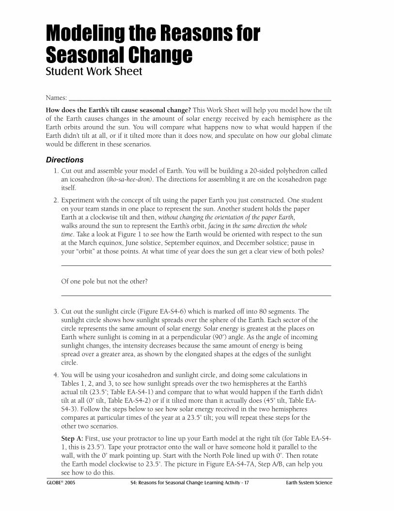
Modeling the Reasons for Seasonal ChangeStudent Work Sheet
Names: __________________________________________________________________________
How does the Earth’s tilt cause seasonal change? This Work Sheet will help you model how the tilt of the Earth causes changes in the amount of solar energy received by each hemisphere as the Earth orbits around the sun. You will compare what happens now to what would happen if the Earth didn’t tilt at all, or if it tilted more than it does now, and speculate on how our global climate would be different in these scenarios.
Directions1. Cut out and assemble your model of Earth. You will be building a 20-sided polyhedron called
an icosahedron (iko-sa-hee-dron). The directions for assembling it are on the icosahedron page itself.
2. Experiment with the concept of tilt using the paper Earth you just constructed. One student on your team stands in one place to represent the sun. Another student holds the paper Earth at a clockwise tilt and then, without changing the orientation of the paper Earth, walks around the sun to represent the Earth’s orbit, facing in the same direction the whole time. Take a look at Figure 1 to see how the Earth would be oriented with respect to the sun at the March equinox, June solstice, September equinox, and December solstice; pause in your “orbit” at those points. At what time of year does the sun get a clear view of both poles?
Of one pole but not the other?
3. Cut out the sunlight circle (Figure EA-S4-6) which is marked off into 80 segments. The sunlight circle shows how sunlight spreads over the sphere of the Earth. Each sector of the circle represents the same amount of solar energy. Solar energy is greatest at the places on Earth where sunlight is coming in at a perpendicular (90˚) angle. As the angle of incoming sunlight changes, the intensity decreases because the same amount of energy is being spread over a greater area, as shown by the elongated shapes at the edges of the sunlight circle.
4. You will be using your icosahedron and sunlight circle, and doing some calculations in Tables 1, 2, and 3, to see how sunlight spreads over the two hemispheres at the Earth’s actual tilt (23.5˚; Table EA-S4-1) and compare that to what would happen if the Earth didn’t tilt at all (0˚ tilt, Table EA-S4-2) or if it tilted more than it actually does (45˚ tilt, Table EA-S4-3). Follow the steps below to see how solar energy received in the two hemispheres compares at particular times of the year at a 23.5˚ tilt; you will repeat these steps for the other two scenarios.
Step A: First, use your protractor to line up your Earth model at the right tilt (for Table EA-S4-1, this is 23.5˚). Tape your protractor onto the wall or have someone hold it parallel to the wall, with the 0˚ mark pointing up. Start with the North Pole lined up with 0˚. Then rotate the Earth model clockwise to 23.5˚. The picture in Figure EA-S4-7A, Step A/B, can help you see how to do this.

GLOBE® 2005 S4: Reasons for Seasonal Change Learning Activity - 18 Earth System Science
Step B: Now position the sun, represented by the sunlight circle, at its appropriate orientation to the tilted Earth. You will be doing this four times, for the two equinoxes and the two solstices. Begin with the June solstice. As shown in Figure EA-S4-7A, Step A/B, hold the sunlight circle perpendicular to the protractor and to the right of the icosahedron. Look at Figure EA-S4-1 to see why this is the correct orientation: the North Pole is tilted toward the sun.
Step C: Move the sunlight circle toward the model Earth, so that it touches at one point in the middle of the sunlight circle. This point is where the sunlight will be hitting the Earth at a 90˚ angle, which means the sun’s energy is most intense at this latitude. Table EA-S4-1 lists the latitudes of perpendicular rays at four points during the year. Did your model intersect at about the right place for the June solstice? Given the Earth’s tilt, why does this latitude make sense?
Predict the latitudes of perpendicular rays for a 0˚ tilt and a 45˚ tilt, and fill in these values in Tables EA-S4-2 and EA-S4-3.
Step D: Now, calculate the amount of energy received in each of the two hemispheres by tracing the position of the equator on the sunlight circle. Without changing the orientation of the Earth, roll it against the sunlight circle until the equator touches the circle, and mark that point on the sunlight circle with a pencil (as shown in Figure EA-S4-7A, step D).
Step E: Draw a curved line from the point you marked on the sunlight circle to the horizontal equator on the sunlight circle (see Figure EA-S4-7A, Step E). This is the intersection of the Earth’s equator with solar energy as it is projected onto the sphere of the Earth. In the sunlight circle, each segment represents one unit of solar energy. The segments above the line you drew represent the solar energy reaching the Northern Hemisphere, and the segments below the line represent the solar energy reaching the Southern Hemisphere.
Step F: Count the number of sectors that fall into each hemisphere, and enter that information into Table EA-S4-1. Figure EA-S4-7a, Step F shows how to count the sectors. If the line passes through a sector, count that sector in the hemisphere it falls mostly into. The total number of sectors you count should add to 80.
Step G: Now repeat Steps A-F for the other times of the year: the September equinox, the December solstice, and the March equinox. Each time, the orientation of the Earth stays the same, but the relative position of the sunlight circle changes as the Earth orbits around the sun. To model an equinox, the sunlight circle should be parallel to the protractor, either in front of the globe or behind it so that, from the perspective of the sun, the Earth is tilted to the left (September) or the right (March). For the December solstice, the sunlight circle should be to the left of the Earth so that the South Pole tilts toward the sun.
Modeling the Reasons for Seasonal Change: Work Sheet - Page 2

GLOBE® 2005 S4: Reasons for Seasonal Change Learning Activity - 19 Earth System Science
Step H: In Table EA-S4-1, calculate relative amounts of sunlight in each hemisphere at the four different times of the year. At what time of year does the Northern Hemisphere receive the greatest amount of solar energy? The least?
5. Now repeat Steps A-H to see how the spread of sunlight over the two hemispheres would change if the Earth did not tilt at all (Table EA-S4-2) or if it tilted by 45˚ (Table EA-S4-3). Each time, all the steps are the same except for the first one, where you rotate the model Earth to the appropriate tilt for the table you’re working on. You may want to mark the sunlight circle with a different color for each scenario.
6. Finally, compare the three scenarios you just modeled by completing the graph “Comparing Sunlight Distribution as the Earth Tilts.” First, decide which hemisphere you want to graph and circle it on the top of the graph. Next, select a symbol (circle, square, *, etc.) to represent values in each of the three tilt scenarios, and enter those in the legend. Finally, using the symbols you selected, graph the percentages you calculated in Tables EA-S4-1, EA-S4-2, and EA-S4-3 to show the change in incoming solar energy in this hemisphere over the course of a year. Draw lines to connect the values you graphed for each tilt scenario: 0˚, 23.5˚, and 45˚
7. Using what you learned in the modeling exercise and the graph you just drew, answer the following questions. Use evidence from the graph and the models to back up your claims.
a. How does the Earth’s tilt affect the seasons? Be as specific as you can about the causes of seasonal change.
b. How does the Earth’s spherical shape change local experience of the seasons at high latitudes and at the equator?
Modeling the Reasons for Seasonal Change: Work Sheet - Page 3

GLOBE® 2005 S4: Reasons for Seasonal Change Learning Activity - 20 Earth System Science
c. How would the seasons be different if the Earth tilted differently than it does? Think about the following observable differences: How would temperatures where you live be different than they are today if the Earth didn’t tilt at all? If it tilted more than it does today?
How might plants and animals adapt differently to their new climates if the Earth didn’t tilt at all? If it tilted more than it does today?
How much larger or smaller would Earth’s regions of permafrost (permanently frozen subsoil) be if the Earth didn’t tilt at all? If it tilted more than it does today?
Modeling the Reasons for Seasonal Change: Work Sheet - Page 4

GLOBE® 2005 S4: Reasons for Seasonal Change Learning Activity - 21 Earth System Science
Table EA-S4-1: Actual Earth Tilt (23.5°)
Total number of segments: 80 Northern Hemisphere Southern Hemisphere
Time of Year Latitude of Number of % of Number of % of perpendicular rays sectors total sectors total
March equinox 0˚
June solstice 23.5˚
September equinox 0˚
December solstice 23.5˚
Table EA-S4-2: No Tilt (0°)
Total number of segments: 80 Northern Hemisphere Southern Hemisphere
Time of Year Latitude of Number of % of Number of % of perpendicular rays sectors total sectors total
March equinox
June solstice
September equinox
December solstice
Table EA-S4-3: Greater-Than-Actual Earth Tilt (45°)
Total number of segments: 80 Northern Hemisphere Southern Hemisphere
Time of Year Latitude of Number of % of Number of % of perpendicular rays sectors total sectors total
March equinox
June solstice
September equinox
December solstice

GLOBE® 2005 S4: Reasons for Seasonal Change Learning Activity - 22 Earth System Science
March 21 June 22 September 23 December 22
10%
30%
80%
100%
How sunlight is distributed over the hemisphere throughout the year
Circle one:
Northern Southern
50%
70%
90%
60%
40%
20%
March 21
Legend
0 tilt symbol
23.5 tilt symbol
45 tilt symbol
Comparing Sunlight Distribution As the Earth Tilts Work Sheet
Comparing Sunlight Distribution: Graph the results of one hemisphere’s data from Tables EA-S4-1, EA-S4-2, and EA-S2-3. to illustrate different distributions of sunlight in different Earth tilt scenarios.

GLOBE® 2005 S4: Reasons for Seasonal Change Learning Activity - 23 Earth System Science
Modeling the Reasons for Seasonal ChangeRubric
For each criterion, evaluate student work using the following score levels and standards.
3 = Shows clear evidence of achieving or exceeding desired performance
2 = Mainly achieves desired performance
1 = Achieves some parts of the performance, but needs improvement
0 = Answer is blank, entirely arbitrary or inappropriate
1. Observe student groups modeling physical phenomena with the icosahedron, sunlight circle, and protractor (steps 1-3 and 4A-C).
Score Level Description
3 Student groups have correctly assembled an icosahedron so that it resembles a sphere. The protractor is taped on the wall at the right orientation so that it can be used to tilt the paper Earth. The students can show the proper orientation of the paper sunlight circle with respect to the Earth at the two solstices and two equinoxes.
2 One of the following is observed: the icosahedron is assembled incorrectly making the modeling difficult, or the protractor and/or sunlight circle are not oriented correctly.
1 Student models are incorrect.
0 Students do not attempt to model the activity.

GLOBE® 2005 S4: Reasons for Seasonal Change Learning Activity - 24 Earth System Science
2. Observe student groups interpreting the modeling exercise above. Students explain their understanding of the physical model.
Score Level Description
3 Students can explain how the alignment of the icosahedron with the sunlight circle correlates with the Earth’s orbit around the sun. The students understand how the tilt affects the location where the suns rays are perpendicular to the Earth, and have recorded this correctly in Tables EA-S4-1, EA-S4-2, EA-S4-3.
2 One of the following is missing: students cannot explain how the sunlight circle correlates with Earth’s orbit, or cannot explain how tilt affects the location of perpendicular rays. The wrong values are entered for perpendicular rays in Tables EA-S4-1, EA-S4-2, EA-S4-3.
1 Student interpretations are incorrect.
0 Students do not attempt to model the activity.
3. Observe student groups calculating numerical values from the icosahedron and sunlight circle for all tilts that are modeled (steps 4D-H and step 5).
Score Level Description
3 Students have marked the sunlight circle with the point where it intersects the Earth and that point is close to the correct darkened line on the sunlight circle. When questioned, students show that they understand that the segments above the equator line represent sunlight hitting the Northern Hemisphere and those falling below represent sunlight hitting the Southern one. Students obtain the correct values for Tables EA-S4-1, EA-S4-2, EA-S4-3. (see values below). For 4H, students answer June solstice and December solstice.
2 Students have placed the line in the incorrect place on the sunlight circle, but have done the counting and percentage calculations correctly. Alternatively, they have placed the line in the correct place, but have done the calculations incorrectly. When questioned, students show that they understand that the segments above the equator line represent sunlight hitting the Northern Hemisphere and those falling below represent sunlight hitting the Southern one. For 4H, students answer June solstice and December solstice.
1 Students fill in the table incorrectly or cannot explain what the values mean.
0 Answer is blank, entirely arbitrary or inappropriate.

GLOBE® 2005 S4: Reasons for Seasonal Change Learning Activity - 25 Earth System Science
4. Students correctly graph the values from the table onto the graph (step 6).
Score Level Description
3 Students have indicated which hemisphere they are graphing, have chosen symbols and filled in the legend. Data from all three tables are shown on the graph. Curves show correct overall pattern (see student example below) and use correct specific values.
2 Students have indicated which hemisphere they are graphing, have chosen symbols and filled in the legend. Data from all three tables are shown on the graph. Curves show correct overall pattern (see number 1 below) but are wrong as regards to their specific value.
1 Legend is missing. Curves are drawn but fail to show the right pattern. All curves should be at their highest during the summer, fall to a middle level during the equinox, fall to their lowest point during the winter, and then rise back to a middle point during the equinox. All curves should show the same value during the equinoxes. One possible reason for the curves being wrong is that students forgot to graph the percentages and instead have graphed the number of squares.
0 Answer is blank, entirely arbitrary or inappropriate.
5. Explain how the Earth’s tilt affects seasons (step 7a).
Score Level Description
3 Student answer includes a mention of sunlight spreading over a sphere, and the tilt altering the locations where the sunlight hits at an angle close to 90˚.
2 Student answer omits one of the two points from level 3.
1 Student logic is incorrect.
0 Answer is blank, entirely arbitrary or inappropriate.
6. Explain how the Earth’s spherical shape changes the seasons at the high latitudes and the equator (step 7b).

GLOBE® 2005 S4: Reasons for Seasonal Change Learning Activity - 26 Earth System Science
Score Level Description
3 Student answers that the high latitudes get less intense sunlight due to the way sunlight spreads over the spherical Earth. Student may refer to class demonstration with globe and grid. Student refers to angle of sunlight being perpendicular at the equator.
2 Student answers that the high latitudes get less sunlight (vs. less intense sunlight). Or, student omits mention of sunlight at the equator.
1 Student only answers for equator or high latitudes and does not mention spread of sunlight.
0 Answer is blank, entirely arbitrary or inappropriate.
7. Explain how the seasons would be different under different scenarios of tilt (step 7c).
Score Level Description
3 Student answers for both no tilt and more tilt. Student’s answers include the following: No tilt: temperatures more even between same latitudes in each hemisphere; vegetation differences around the tropical latitudes would disappear; and the regions of permafrost would be larger as the freezing and thawing of the upper soil layer would not occur. More tilt: temperature extremes would move away from the tropic latitudes toward 45˚ at the solstices; vegetation of the arctic and tundra varieties would spread toward the equator; the regions of permafrost would be smaller.
2 Student omits one or two points from score level 3, or answers them incorrectly.
1 Student does not discuss both no tilt or more tilt, or uses incorrect logic to answer.
0 Answer is blank, entirely arbitrary or inappropriate.

GLOBE® 2005 S4: Reasons for Seasonal Change Learning Activity - 27 Earth System Science
Table EA-S4-1: Actual Earth Tilt (23.5°)
Total number of segments: 80 Northern Hemisphere Southern Hemisphere
Time of Year Latitude of Number of % of Number of % of perpendicular rays sectors total sectors total
March equinox 0˚ 40 50% 40 50%
June solstice 23.5˚ N 60 75% 20 25%
September equinox 0˚ 40 50% 40 50%
December solstice 23.5˚ S 20 25% 60 75%
Table EA-S4-2: No Tilt (0°)
Total number of segments: 80 Northern Hemisphere Southern Hemisphere
Time of Year Latitude of Number of % of Number of % of perpendicular rays sectors total sectors total
March equinox 0˚ 40 50% 40 50%
June solstice 0˚ 40 50% 40 50%
September equinox 0˚ 40 50% 40 50%
December solstice 0˚ 40 50% 40 50%
Table EA-S4-3: Greater-Than-Actual Earth Tilt (45°)
Total number of segments: 80 Northern Hemisphere Southern Hemisphere
Time of Year Latitude of Number of % of Number of % of perpendicular rays sectors total sectors total
March equinox 0˚ 40 50% 40 50%
June solstice 45˚ N 72 90% 8 10%
September equinox 0˚ 40 50% 40 50%
December solstice 45˚ S 8 10% 72 90%

GLOBE® 2005 S4: Reasons for Seasonal Change Learning Activity - 28 Earth System Science
Comparing Sunlight Distribution As the Earth Tilts Work Sheet
March 21 June 22 September 23 December 22
10%
30%
80%
100%
How sunlight is distributed over the hemisphere througout the year
Circle one:
Northern Southern
50%
70%
90%
60%
40%
20%
March 21
Legend
0 tilt symbol
23.5 tilt symbol
45 tilt symbol