s e p t e m b e r / o c t o b e r 2 0 0 8 shielding our
TRANSCRIPT

S e p t e m b e r / O c t o b e r 2 0 0 8
Vol. 6 No. 5
M a r itim e S e rvices F o rti f y S e a po rts
G EO I N T S e c u r es th e E x pe c te d a n d th e U n usua l
Shielding Our Home and Nation

Report Documentation Page Form ApprovedOMB No. 0704-0188
Public reporting burden for the collection of information is estimated to average 1 hour per response, including the time for reviewing instructions, searching existing data sources, gathering andmaintaining the data needed, and completing and reviewing the collection of information. Send comments regarding this burden estimate or any other aspect of this collection of information,including suggestions for reducing this burden, to Washington Headquarters Services, Directorate for Information Operations and Reports, 1215 Jefferson Davis Highway, Suite 1204, ArlingtonVA 22202-4302. Respondents should be aware that notwithstanding any other provision of law, no person shall be subject to a penalty for failing to comply with a collection of information if itdoes not display a currently valid OMB control number.
1. REPORT DATE OCT 2008 2. REPORT TYPE
3. DATES COVERED 00-09-2008 to 00-10-2008
4. TITLE AND SUBTITLE Shielding Our Home and Nation (Pathfinder, September/October 2008)
5a. CONTRACT NUMBER
5b. GRANT NUMBER
5c. PROGRAM ELEMENT NUMBER
6. AUTHOR(S) 5d. PROJECT NUMBER
5e. TASK NUMBER
5f. WORK UNIT NUMBER
7. PERFORMING ORGANIZATION NAME(S) AND ADDRESS(ES) National Geospatial-Intelligence Agency,Office of CorporateCommunications,4600 Sangamore Road ,Bethesda,MD,20816-5003
8. PERFORMING ORGANIZATIONREPORT NUMBER
9. SPONSORING/MONITORING AGENCY NAME(S) AND ADDRESS(ES) 10. SPONSOR/MONITOR’S ACRONYM(S)
11. SPONSOR/MONITOR’S REPORT NUMBER(S)
12. DISTRIBUTION/AVAILABILITY STATEMENT Approved for public release; distribution unlimited
13. SUPPLEMENTARY NOTES
14. ABSTRACT
15. SUBJECT TERMS
16. SECURITY CLASSIFICATION OF: 17. LIMITATION OF ABSTRACT Same as
Report (SAR)
18. NUMBEROF PAGES
27
19a. NAME OFRESPONSIBLE PERSON
a. REPORT unclassified
b. ABSTRACT unclassified
c. THIS PAGE unclassified
Standard Form 298 (Rev. 8-98) Prescribed by ANSI Std Z39-18

On My Mind
GEOINT: Protecting the Homeland by Developing the Operational Picture
After the terrorist attacks of Sept. 11, 2001, the nation increased its determination to prevent terrorist acts aimed against U.S. States citizens and protect our homeland. We mobilized and organized several organizations and institutions responsible for homeland security activities into one organization, the Department of Homeland Security (DHS). The Office of the Director of National Intelligence was established to ensure information sharing across the Intelligence Community. NGA has been, and continues to be, at the forefront of these efforts providing support through our Office of the Americas, our NGA Support Teams (NSTs), reachback support and other liaisons with federal agencies. We are in constant coordination sup-porting efforts for domestic preparedness; border and maritime security; special security event planning; and disaster preparation, recovery and relief.
Domestic PreparednessThe Homeland Security Infrastructure Program (HSIP), created in February 2002, provides the Homeland
Security community with a common operational picture of integrated views of national infrastructure and critical asset information. The teamwork evident in the U.S. Geological Survey’s domestic mapping mission and NGA’s support of national security objectives, as well as numerous other sources within the United States, has resulted in the establishment of a “gold” database of vector, imagery and elevation data. This database helps decision makers and operational planners develop a common frame of reference for daily threat assessments, critical infrastructure vulnerability analysis and domestic crisis response and consequence management.
Border and Maritime SecurityAdditionally, NGA’s support to border and maritime security is making a critical difference. We purchase
high-resolution, color commercial satellite imagery of the 1,951 miles of the U.S.–Mexico border, the 5,552 miles of the U.S.–Canada border, and the 12,380 miles of U.S. coastline. Our use of commercial imagery in these vital regions highlights our broad capabilities and the importance of working with all of our mission partners on unclassified systems.
Special Security EventsPer the Homeland Security Act of 2003, the U.S. Secret Service is the lead federal agency for operational
planning for all National Special Security Events. Their ability to protect senior leaders and foreign dignitaries is based on their ability to prepare for any scenario. NGA is there working hand in hand with the Secret Service providing the geospatial intelligence (GEOINT) they need. This year we have been an integral part in support of events such as the Annapolis Conference, the U.S. visit by Pope Benedict XVI, the Super Bowl, the Major League All Star Game, and the Republican and Democratic National Conventions.
Disaster Preparation, Relief and RecoveryIn addition to providing assistance in battling wildfires in California and flooding in the Midwest, NGA
partnered with the U.S. Northern Command (USNORTHCOM) to conduct the Positive Response Command Post Exercise. This exercise tested the end-to-end GEOINT synchronization between USNORTHCOM and NGA in preparation for the 2008 hurricane season. The intent was to align tasking, collection, production, exploitation and dissemination and assess responsiveness to combatant commander requirements to ensure we could get the right information to the right people at the right time.
Moving ForwardAs a result of our expanding mission set, there has been an increased need for GEOINT data over the
United States. Stringent intelligence oversight regulations enable NGA to effectively perform its required functions while ensuring that the constitutional rights and the privacy of U.S. citizens are protected. The recent revisions to Executive Order 12333 maintain the privacy and civil liberties protections that must be central to the way the Intelligence Community operates.
NGA’s GEOINT contribution to protecting the United States has become a prerequisite for all security groups involved. NGA will continue to work closely with our federal partners, who in turn collaborate with state and local elements, to develop innovative ways to provide the GEOINT they need to protect U.S. citizens, both at home and abroad.
Robert B. Murrett Vice Admiral, USN
Director

13 22
3
Contents2 LettertoOurReaders
3 GuestColumn:NGAProvidesVitalSupporttoHomelandSecurity
5 UpFront:PresidentBushAmendsExecutiveOrder12333
5 UpFront:NewPublicWebSiteDebutsGEOINTOnline
›› F E A T U R E S6 NGAAugmentsU.S.BorderSecurity
8 AgencyProductsReinforceAirportSafety
9 MaritimeServicesFortifySeaports
11 GEOINTSecurestheExpectedandtheUnusual
13 MobileAnalysisVehicleAidsHomelandDefense
14 NewPalanterra™WebServiceIncreasesEventSupport
16 SupportTeamAnswersHomelandSecurityChallenges
17 NGAAssistsFEMAWithMidwestFloodResponse
18 U.S.NationalGridSimplifiesMapping
›› D E P A R T M E N T S20 Partnerships:AfghanistanAerialSurveyYields
GEOINTinTheater
22 OurHeritage:TheDEWLine—ColdWarDefenseattheTopoftheWorld
Pathfinder ›› September/October 2008 ›› Vol. 6 No. 5
On the CoverGeospatial intelligence (GEOINT), so often associated with events overseas, also plays a proper and necessary role in domestic safety and security. Across the country, geospatial professionals from NGA assist dedicated domestic mission partners, frequently units of the Department of Homeland Security, in securing and defending the United States and its people, careful never to infringe on the constitutional rights that U.S. citizens enjoy. The number and variety of events supported by NGA, be they conventions, crises, or natural disaster recovery, reflect the essential value added by GEOINT. From port and border security to the safety of notable gatherings, understanding the geospatial realm lends an indispensable breadth to the preparations and responses of those entrusted with homeland defense. Cover photo illustration by Anika McMillon.
1
Path
finde
r » S
epte
mbe
r/O
ctob
er 2
008
More to the Story?The online Classified Pathfinder, which is accessible by members of the Intelligence Community, may in-clude additional information and expanded sections of some Pathfinder articles. The Classified Pathfinder provides a forum for reading and discussing topics at the level of “Unclassified//For Official Use Only” or higher. For information please contact the editor, Heather Cox, at 301-227-2290.
Published by the National Geospatial-Intelligence Agency Office of Corporate Communications 4600 Sangamore Road, Mail Stop D-54 Bethesda, MD 20816-5003 Telephone: (301) 227-7388, DSN 287-7388 E-mail: [email protected]
DirectorVice Adm. Robert B. Murrett, U.S. NavyDeputy DirectorLloyd RowlandOffice of Corporate Communications, DirectorPaul R. WeiseInternal Communications Branch, Chief Louis J. BruneEditor Jason K. MichasManaging Editor Kelly KempGraphic Designer Carmella E. Bender
Contributing AuthorsLt. Al Armstrong, U.S. Navy Greg Barac Michael Cilladi Gary W. Fuller Matt Gamm Randall Hamilton Drew Herrick Cyril “Joe” Hodapp III Jay D. Krasnow Whitney Margherio John Oswald Andrea Rodenberg Kurt Schulz Nate Smith Jose A. Villanueva Dr. Gary E. Weir
GETTING PUBLISHEDAll members of the geospatial intelligence community are wel-come to submit articles of community-wide interest. Articles are edited for style, content and length. For details on submitting articles, send an e-mail to [email protected].
The Pathfinder is the medium with which the National Geo-spatial-Intelligence Agency enhances and promotes public awareness and understanding of the discipline of geospatial intelligence. The Pathfinder is an authorized Department of Defense publication for members of the Department of Defense. Contents of this publication are not necessarily the official view of, or endorsed by, the U.S. government, Department of Defense or NGA. Articles in the Pathfinder may be reproduced in whole or in part without permission, unless stated otherwise. If they are reproduced, please credit the author and the “National Geospatial-Intelligence Agency, the Pathfinder magazine.” Any reproduction of graphics, photographs and imagery is subject to the original copyright.
Letter to Our Readers
Shielding Our Home and NationWe the People of the United States, in Or-der to form a more perfect Union, establish Justice, insure domestic Tranquility, pro-vide for the common defence, promote the general Welfare, and secure the Blessings of Liberty to ourselves and our Posterity, do ordain and establish this Constitution for the United States of America.
So the Preamble to the U.S. Constitution sets forth clearly our national resolve to defend and secure the welfare and liberty of our republic and its people.
Every federal officer has raised his or her hand and sworn, as I have, a solemn oath to support and defend the Constitution against all enemies, foreign and domestic. The intelligence professionals at NGA take seriously this obligation, in full con-cert with the recently revised Executive Order 12333, which regulates the Intel-ligence Community. Our guest columnist, John Oswald, articulates this issue’s homeland security theme, enumerating many of the topics covered further in these pages.
You, the reader, will examine many, though by no means all, of the actions and initiatives that this agency and its personnel engage in to uphold the laws, liberty, safety and security of the U.S. homeland and its people. NGA performs these tasks always at the discretion of the appropriate federal authority—gener-ally the Department of Homeland Security (DHS) and its components—while carefully guarding all constitutional protections.
Explore NGA’s role in U.S. border, airport and maritime security in three complementary features that reveal a glimpse of the substantial part that the agency plays in these critical efforts. Then, investigate the geospatial resources underpinning security arrangements at many high-profile special events, both recent and past. Discover how the agency’s geospatial support vehicle contributes to event security, and learn of new online technology extending the geospatial advantage.
Survey the work of NGA’s Support Team at the DHS. Small and agile, the team nonetheless provides essential aid. Round out your study with a review of the U.S. National Grid—a simplified geographic coordinate system that promises enhanced public safety as its use becomes widespread. Finally, remember the consequential responsibilities fulfilled by our mission partners as you read about alliances that protected North America and surveyed Afghanistan.
The duty to bolster national security includes the need to guard our country and the lives of its citizens. These necessities guide every NGA activity. Never alone, this agency relies on many partnerships and innovations, as this issue il-lustrates. Technical advances often gird this collective endeavor. The November/December Pathfinder will focus on technology, with an emphasis on geospatial data and its applications.
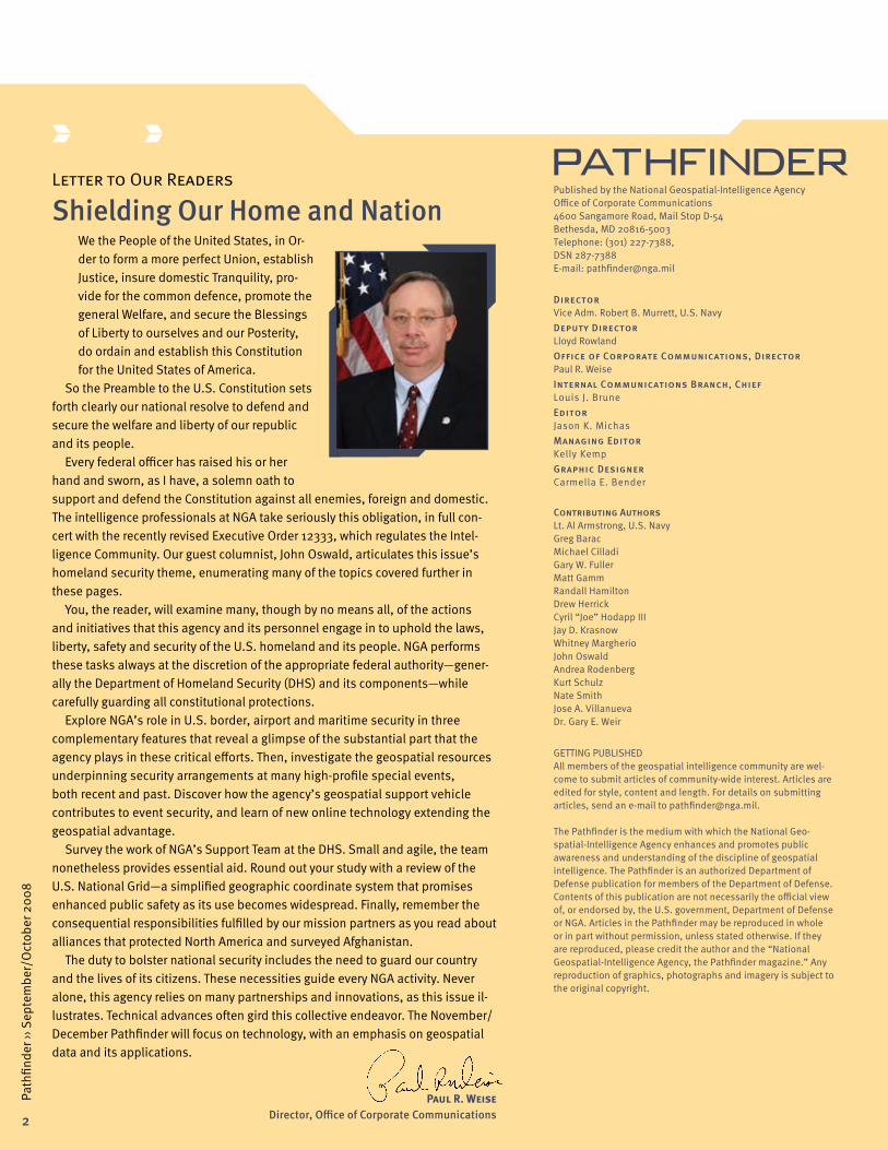
Paul R. Weise Director, Office of Corporate Communications
2
Path
finde
r ›› S
epte
mbe
r/O
ctob
er 2
008

As the Midwest faced significant flooding along the Mississippi River this past June, NGA stepped in to support, offering its geospatial intelligence (GEOINT) ca-pabilities to assist the Federal Emergency Management Agency (FEMA) in mitigating the disaster. While NGA’s work in national crisis situations such as this, the Califor-nia wildfires, and Hurricane Katrina has been especially visible in recent years, the agency also has important roles supporting National Special Security Events, as federal agencies require it. This can involve events as varied as each year’s Super Bowl, national political con-ventions, the Olympics, or the 400th anniversary of the Jamestown settlement in Virginia celebrated last year. NGA is ready to provide GEOINT support whenever the nation needs it.
A Supporting RoleA key agency role in domestic support is to deliver
situational awareness through GEOINT products, creat-ing what we call the common operating picture for state and local partners, as well as federal partners such as the Department of Homeland Security (DHS). The agen-cy’s mission partners use these products for a spectrum of operations planning and execution. NGA provides this assistance as part of the National Response Plan, which guides all federal departments and agencies responsible for an important element of any given national security incident. The agency has offices that respond to disaster situations, enhance border security knowledge, and use GEOINT to prepare for major events. The agency is also working on a one-stop database for geospatial informa-tion to support homeland security.
NGA can support multiple points along a crisis timeline. The agency can create products ready to help emergency authorities coordinate if a disaster occurs, provide up-to-date situational awareness in the midst of the crisis, or connect officials on the ground to those making decisions. NGA products even help determine the best recovery efforts through comprehensive analy-sis of previous crisis events.
One of the ways NGA has supported the Midwest flood recovery has been through its work with the U.S. Coast Guard’s (USCG’s) Marine Transportation System Recovery Unit Headquarters in St. Louis, Mo. NGA deployed GEOINT
�
Path
finde
r ›› S
epte
mbe
r/O
ctob
er 2
008
analysts forward to the crisis and briefed the command and staff present on the agency’s current support to FEMA. The analysts highlighted various products and ser-vices available for the USCG to use in coordinating their recovery efforts, such as the Midwest Flooding Intellipe-dia page and Google Earth overlay files. The USCG battle captains found the Midwest Flooding Extent Google Earth overlays, along with the real-time National Oceanic and Atmospheric Administration (NOAA) river-gauge overlays, to be extremely impressive and useful to their mission. They found the overlays so helpful that they installed GEOINT capabilities on their systems, allowing them to use overlay files for their own briefings. NGA also provided GEOINT products that highlighted important community infrastructure in the flooded areas, such as hospitals and schools. FEMA used these products to determine how to deliver supplies and gauge damage.
The NGA Earth crisis response portal (nga-earth.org) also served as an important tool for sharing information during the flood recovery operations. NGA created the
Guest Column
NGA Provides Vital Support to Homeland Security By John Oswald, Director, Analysis & Production Directorate
Photo by Larry Franklin
John Oswald, Director, Analysis & Production Directorate

�
Path
finde
r ›› S
epte
mbe
r/O
ctob
er 2
008
Web site during Hurricane Katrina recovery efforts, and it offers updated commercial imagery of the affected areas to first responders or anyone with Internet access through an easy-to-use viewer tool. The availability of commercial imagery has broadened the agency’s ability to share information with the general public.
NGA products also play a vital role in border security operations, identifying routes, trends and gaps in pro-tection for homeland security mission partners. GEOINT supports everything from cross-border tunnel monitoring to predictive analysis in the effort to track smuggling networks. GEOINT is a valuable part of decision-making at DHS, for the Secretary of Homeland Security as well as the U.S. Customs and Border Protection guards overlook-ing the Rio Grande.
After the Sept. 11, 2001, terrorist attacks, there was a critical need to develop a system that would provide a common operating picture in an emergency for govern-ment partners on all levels—local, state, and federal. NGA responded by working to develop an inclusive database of geospatial information called the Homeland Security Infrastructure Program (HSIP), in collaboration
with DHS and the U.S. Geological Survey (USGS), which provides a common resource authorities can use in those situations. NGA is also creating a subset of this program that will offer valuable information, such as locations of fire stations and hospitals, to state and local first responders and administrators. When completed, it will provide critical support to preparedness efforts with-in their area. NGA currently envisions the construction of an entire unclassified environment for the storage, access, discovery, visualization and dissemination of unclassified GEOINT. All of these systems are crucial to ensuring that organizations working against a domestic threat and needing understanding of an affected area or current GEOINT will be able to access it.
DHS even applies GEOINT to high-profile sporting and entertainment events. Requests for NGA support and GEOINT capabilities are common for major events we’re all familiar with—the Super Bowl, the NCAA basketball tour-naments, and even the Grammy Awards. Though these are different applications from NGA’s work with disaster re-covery, GEOINT analysis can still provide valuable insight to those in charge of planning for these events.
U.S. Coast Guard photo by Petty Officer Mike Lutz
U.S. Coast Guard Cutter Bainbridge Island stands watch over the Statue of Liberty in New York Harbor. NGA supports the U.S. Coast Guard and other components of the Department of Homeland Security as requested by federal authorities.
5
Path
finde
r ›› S
epte
mbe
r/O
ctob
er 2
008
Up Front
New Public Web Site Debuts GEOINT Online
By Gary W. Fuller
In August 2008, NGA officially launched its newly redesigned public Web site, www.nga.mil, and simul-taneously introduced a new geospatial intelligence (GEOINT) tool, GEOINT Online (GO), as an integral part of the agency’s growing Web presence for GEOINT content, tradecraft and support.
The new Web site provides much more information to users about NGA’s ongoing activities, products, services, partners and the incredible wealth of GEO-INT that NGA produces or acquires, including links to current and past issues of the Pathfinder.
The Web site also features GO, where users can discover and access GEOINT using a variety of search and browse capabilities. GO provides online data, in-formation and access to unclassified GEOINT content and support for homeland security and defense at the federal, state and local level, as well as for NGA’s global navigation and civil community customers.
This new service makes it easier to download, view, understand and use GEOINT products and data. GO is
intended to be NGA’s “single face to the customer,” with an anticipated version release each year, along with more frequent updates to content and services.
Merging the NGA Web site redesign and the launch of GO afforded a great opportunity to deliver new capa-bility for GEOINT consumers. Agile development re-quires both new technology and the transformation of business processes. NGA is transforming itself from a product producer to a services provider. The new Web site and the debut of GO are a few of the changes that the agency is making to be more agile and responsive to customers’ needs.
GaryW.Fulleris a Senior System
Engineer and Strategic Planner with an NGA con-tractor supporting GEOINT Online.
Our First PriorityNGA fulfills its national GEOINT role when its support
is specifically requested by agencies that are respon-sible for matters of domestic security. The agency takes very seriously the protection of the personal rights and freedoms of U.S. persons. It is only in these limited cases and under well-defined rules that NGA provides any domestic GEOINT. Agency offices always make sure that Proper Use Memoranda are examined and approved before any domestic imagery is used.
When NGA’s unique support is requested for situ-ations from disasters to some of the nation’s favorite events, we will not hesitate to assist NGA’s federal partners with GEOINT capabilities. This agency’s respon-sibility is the safety and freedom of the American people, whether they are in the path of a major storm or they are enjoying the big game.
Up Front
President Bush Amends Executive Order 12333
On July 30, 2008, President Bush signed an updated Executive Order (E.O.) 12333 that governs the Intelli-gence Community (IC), including its roles and respon-sibilities in accordance with the U.S. Constitution and law. President Reagan originally established this important oversight guidance in 1981.
The amended E.O. authorizes the Director of National Intelligence to name functional managers and names the Director of NGA as the functional manager of geo-spatial intelligence (GEOINT)—affirming NGA’s place within the IC and summarizing the agency’s functions and authorities.
Nothing in E.O. 12333 alters how NGA collects intel-ligence, nor NGA’s diligent protection of the privacy rights and civil liberties of U.S. persons. The revised order better aligns the IC to respond to a changing threat environment, while balancing the fundamental obligation to protect U.S. citizens and their privacy.
The revised E.O. 12333 enables NGA to more capably integrate GEOINT capabilities across the IC by setting standards; ensuring coordination; and developing and implementing strategic guidance, policies and procedures related to GEOINT activities.

�
Path
finde
r ›› S
epte
mbe
r/O
ctob
er 2
008
NGA Augments U.S. Border Security By Whitney Margherio and Nate Smith
The U.S. Department of Homeland Security (DHS), national policymakers and Intelligence Community (IC) mission partners all rely on NGA for indispensable geospatial intelligence (GEOINT) analysis, reporting and products relevant to U.S.–Mexico border security.
These actionable products afford customers a bird’s-eye view of the southwest border environment. NGA’s support and products have even served as a catalyst for changes to DHS operations and procedures for protect-ing the U.S.–Mexico border. DHS has incorporated NGA products and reporting into their daily briefs, mission planning and enforcement strategies. NGA’s collabora-tive environment has provided a forum for officials of the U.S. Customs and Border Protection (CBP),
an element of DHS, to interact and partner with members of the IC to more effectively protect and defend the nation’s borders.
In late 2005, NGA’s Office of the Americas formed the Border Security branch initially focused on providing situational awareness tools and data support to CBP and the Immigration and Customs Enforcement Agency (ICE), another DHS element. However, a DHS request for infor-mation to help locate and characterize illicit activity near the border with Mexico became the impetus to shift the branch’s focus to GEOINT analysis to provide customers with a visually rich depiction of the geography, culture and criminal networks that operate throughout northern
Mexico and across the border region. As a result of the NGA’s initial success, the focus area for smuggling activities was
expanded to include all of Mexico, and the responsibilities were shared among several branches and NGA Support
Teams that work issues relevant to the U.S.–Mexico border area. All
products and reports that detail actions affecting U.S. bor-
der security are coordi-nated through these
units. Additionally, analysts continue to collaborate
with mission partners throughout
the IC and the U.S. government that focus on
homeland security. Through frequent interaction, NGA analysts have established strong relationships with their customers and counterparts. The resulting synergy enhances
the analytical content of NGA products as mission partners contribute their expertise. These relation-
ships have fostered a unified and successful effort to address
intelligence problems along the U.S.–Mexico border.

�
Path
finde
r ›› S
epte
mbe
r/O
ctob
er 2
008
As partner relationships have developed, NGA’s view of the border has expanded from a tactical to a strategic one in order to improve the agency’s predictive analysis capabilities. In one case, analysts used imagery, vector data and intelligence reporting to examine alien smug-gling organization (ASO) networks. The resulting report provided DHS and other key customers with insight into the vitality and sophistication of ASO operations. DHS enthusiastically received the strategically focused report, which became a pattern to follow as the office strengthened its analytical capabilities.
The increased reliance on geographic information systems (GISs) for situational information and a deeper understanding of GEOINT techniques led the CBP and other agencies supporting homeland security along the southwest border to incorporate the use of geospatial in-formation and GIS tools into their daily operations. As an example, the Border Security branch analyzed pedestrian mobility along a 26-mile area of the U.S.–Mexico border. The mobility analysis identified possible smuggling routes by eliminating areas that were less likely to be used due to harsh terrain. The resulting visual model allowed CBP Border Patrol agents to focus enforcement efforts on areas where smugglers were more likely to cross.
Another result of NGA’s collaboration with DHS, the Secure Border Initiative (SBI), enables DHS to monitor, mitigate and provide indications and warnings for incidents occurring at the borders. Analysts used geospatial files (land use, land cover, elevation data, road networks, etc.) to build a model that would identify areas suitable for sen-sor deployment. The analysts then conducted a visibility study on the suitable sites to determine optimal sensor placement. The resulting analysis was used by DHS policymakers to justify repositioning of some SBI sensors to increase monitoring and detection capabilities along the U.S.–Mexico border.
Additionally, NGA published the United States Cross Border Tunnel project. This interactive GEOINT product depicts the locations and descriptions of all known illegal tunnels crossing the U.S. border. Using reports provided by Border Patrol agents as a starting point, analysts applied geospatial analysis and open source research to pinpoint each tunnel’s exact location and identify its dimensions and intended purpose. This strategic product allows users to see the big picture of all tunnels discovered, yet provides detailed information about each tunnel. The product was very well received by major customers involved in U.S. border security.
Border security remains a high-priority and high-vis-ibility issue, and NGA has significantly increased its production of reports on issues affecting the border, particularly the southwest region. Many of these have received positive feedback from IC seniors and national policymakers, including the director of DHS. NGA ana-lysts will continue to observe developments along the border and provide a unique geospatial perspective for homeland defense.
WhitneyMargherio(Left)andNateSmith(Right)
Whitney Margherio is a DIA Analyst on rotation to NGA’s Office of the Americas,
where she works on border security issues as well as other transnational threats in Latin America.
Nate Smith is a Geospatial Analyst in the Office of the Americas, where he works on border security issues as well as other transnational threats in Latin America.
A National Guard member stands watch on the U.S. border with Mexico.U.S. Army photo by Sgt. Jim Greenhill
The interactive United States Cross Border Tunnel project depicts all known illegal tunnels crossing the U.S. border.Graphics provided by NGA

8
Path
finde
r ›› S
epte
mbe
r/O
ctob
er 2
008
Agency Products Reinforce Airport Safety By Matt Gamm and Cyril “Joe” Hodapp III
Drawing on their depth of civil and military aero-nautical experience, a team of NGA cartographers, imagery analysts and geospatial analysts has developed several products to help secure the nation’s airports. These products are used by the Transportation Security Administration (TSA) and other federal agencies for situ-ational awareness and emergency planning and can be distributed to state and local law enforcement offices in the event of a crisis or for force protection.
In 2006, the TSA’s primary operational hub, the Freedom Center, requested infrastructure graphics for approximately 100 major U.S. airports and the areas around them. Analysts from the NGA Office of Global Navigation and Office of the Americas developed large-scale graphics showing infrastructure to a distance of three to five nautical miles beyond an airport’s perimeter, including boundary fences, entry and exit points, runway identifications and lengths, vital facilities and surround-ing roadways.
The graphics incorporate information from several sources, including the Homeland Security Infrastructure Program (HSIP), a comprehensive database of imagery and geospatial data related to critical domestic infra-structure; the Digital Aeronautical Flight Information File (DAFIF™), which provides aeronautical and flight planning information for the Department of Defense; and imagery-derived vector data. The graphics use CitySphere™ com-mercial imagery primarily or U.S. Geological Survey aerial imagery when CitySphere™ imagery isn’t available.
Another product offered to TSA uses stereo imagery to provide geospatial foundation layers. Analysts create shapefiles of aeronautical data they col-lect on airport runways and taxiways, adjacent buildings, vertical obstructions higher than 100 feet, navigational aids and instrument landing systems. Analysts are also working to output the data as Google Earth Keyhole Markup Language (KML) files, a format for expressing geographic
features. Customers use the files to project the buildings three-dimen-
sionally using ArcGlobe or Google Earth, which allows a much greater visual understanding of an airport and its facilities.
The analysts are also furnishing TSA and other federal agencies with interactive Aeronautical Geospatial Intelli-gence Datasets (AGIDS) for long-range incident planning. The AGIDS provide imagery- and HSIP-derived vector data in an interactive format along with large-scale de-pictions of the major U.S. airports in Portable Document Format (PDF).
Each product provided to TSA adds value to the nation’s efforts to protect its airports. NGA’s ongoing support of TSA’s efforts demonstrates the agency’s com-mitment to homeland defense.
MatthewGamm(Left)andCyril“Joe”HodappIII(Right)
Matthew Gamm is an Aeronautical Intel-ligence Analyst in the Aeronautical Services
North America Branch of the Office of Global Navigation.
Cyril “Joe” Hodapp III is a Geospatial Analyst in the Homeland Security Infrastructure Branch of the Office of the Americas.

9
Path
finde
r ›› S
epte
mbe
r/O
ctob
er 2
008
Maritime Services Fortify Seaports By Lt. Al Armstrong, U.S. Navy
NGA contributes indispensable geospatial resources to the nation’s increasing efforts to sustain international maritime safety and secure U.S. seaports against attack. The agency traces the roots of its maritime support to one of the primary missions of the Defense Mapping Agency—to provide timely and tailored nautical charts and navigational data to military, merchant marine and private vessel operators to ensure safety of navigation worldwide. Through its Office of Global Navigation, Maritime Services, NGA fulfills that same objective today, providing products in both hard-copy and digital formats. However, the agency’s func-tional mission to the maritime community has expanded as technology and demand for services have emerged. While traditional support focused on overseas charts and data, requirements
for increased services have surfaced from within U.S. ports and harbors.
NGA plays a vital and proactive role in port security through the Worldwide Navigational Warning Service (WWNWS). NGA directs the U.S. portion of the WWNWS and also transmits the service’s worldwide navigation safety warnings about port closures, exclusion zones and waterway conditions to all military and commercial vessels before ships arrive at their desired destinations. Known as “the Watch,” NGA’s role in the WWNWS is unmatched, being the only global maritime warning ser-vice of its kind in the world. As part of normal port entry procedures, the Watch also broadcasts the requirements for all vessels to submit their Port Entry Notification. This mandatory notification must be submitted 96 hours before any vessel enters port to inform the port of the vessel’s identification, port of origin, cargo and offload intentions in support of the Maritime Domain Awareness initiative, the U.S. effort to enhance port security.
In 2003, NGA introduced an interactive geospatial product that has significantly increased the visualiza-tion of a port’s spatial environment. HarborView™ is a stand-alone program designed to use the most recent commercial satellite imagery available over selected
Quartermaster 3rd Class Nicholas Rader charts a course on a map on the bridge of the Nimitz-class nuclear-powered aircraft carrier USS Ronald Reagan (CVN 76) while the ship pulls into its homeport of San Diego, Calif. U.S. Navy photo by Mass Communication Specialist Seaman Aaron Holt

10
Path
finde
r ›› S
epte
mbe
r/O
ctob
er 2
008
ports to help maintain the currency, accuracy and geographic integrity of the Digital Nautical Chart (DNC), a database of worldwide maritime safety charts. Ad-ditionally, HarborView™ creates an interactive 3-D scene visualization of these ports that mariners and mission analysts in the U.S. Navy, U.S. Coast Guard and other federal government agencies can use for port familiariza-tion and security, mission planning and force protection.
The HarborView™ interactive scene visualization combines recent imagery with the DNC, digital eleva-tion models, bathymetry data, airborne Light Detection and Ranging data, and ground and aerial photography. These data sets afford port security personnel and mis-sion planners the ability to maneuver both above and below the water’s surface and to query navigational aids and associated DNC data. A range of analytical tools and visualization options are also available, such as mensuration, ranging, line-of-sight analysis and GPS connectivity. Users can even insert and manipulate geographic information systems data, variable fog vis-ibility conditions and night vision features. The result is a product that provides tremendous benefit to U.S. port security offices and other end users. Over 410 Harbor-View™ models from around the world were available as of July 2008, including models of 110 U.S. ports. Another 80 ports are either scheduled for modeling or in various stages of completion.
Lt.AlArmstronga U.S. Navy Hydrog-
rapher, is an NGA Staff Officer in the Analysis & Production Directorate, Office of Global Navigation, Maritime Services.
NGA distributes the HarborView™ scene viewer and the individual port models to U.S. federal government personnel, as well as state and local agencies involved in homeland security port activities. The U.S. Coast Guard has been one of the primary port security users of HarborView™ with over 100 port models distributed to different ships and commands, resulting in substan-tial positive feedback. To solidify this rela-tionship, and to promote HarborView’s™ value for port security, for the last three years NGA has provided each U.S. Coast Guard Academy graduate who majored in geospatial information systems with copies of the HarborView™ scene viewer and port models of their first duty station.
A major technological innovation building on Harbor-View™ is currently under development. A new program, Global Port Infrastructure Data (GPID), will retain the legacy capabilities of the HarborView™ program while providing 3-D features as searchable data sets fully compatible with the National System for Geospatial Intelligence Entity Catalog, a standard collection of geospatial feature data from across the Intelligence Com-munity. Additionally, GPID will generate 3-D port models in a format that, besides being fully viewable in the HarborView™ scene viewer, will be importable or view-able on a number of other software packages, including FalconView, ArcGIS and the NGA version of Google Earth. With its cutting-edge features, GPID continues NGA’s tradition of providing the finest maritime support.
The work of NGA and its Maritime Services remains es-sential to the defense of America’s ports and mainland. Whether keeping watch or developing new visualization tools, the agency upholds its responsibility to advance maritime safety and port security.
U.S Navy photo by Mass Communications Specialist 2nd Class Walter Pels
The USS Bonhomme Richard (LHD 6) arrives at Naval Station Pearl Harbor, Hawaii, June 27, 2008.

11
Path
finde
r ›› S
epte
mbe
r/O
ctob
er 2
008
GEOINT Secures the Expected and the Unusual By Randall Hamilton
One of NGA’s vital missions is to provide geospatial intelligence (GEOINT) support to the lead federal agencies for security operations at National Special Security Events (NSSEs), as certified by the Department of Homeland Security (DHS). Two such events were held this summer: the Democratic National Convention in Denver, Colo., Aug. 25–28, and the Republican National Convention in Minneapolis, Minn., Sept. 1–4. NGA analysts in the Office of the Americas, North America and Homeland Security Division, supported security efforts at these events with situational awareness tools and extensive data covering the areas in and surrounding the convention sites and by deploying analysts to provide updated GEOINT onsite.
Analysts prepared for several months before these na-tional conventions to compile many types of information about each site. These data were then brought together and depicted on various graphics with such diverse themes as the following:
» Locations of and information about local fire sta-tions, police stations, emergency management services and hospitals
» Local critical infrastructure including power sta-tions, transmission lines, electrical substations and pipelines
» Transportation networks including roads and high-ways, rail lines, ferries and airports
» Locations of schools, universities, museums, shop-ping areas and tourist attractions
» Information regarding specific venues and events occurring in and around the geographic areas of the conventions
» Depictions of areas potentially affected by protests or other events
» Any other specific data deemed essential for secur-ing the two locations, for example, various hotels at which delegates stayed or temporary flight restric-tions that may have needed to be established over the areas
Some of these graphics were vector-based, using computer-generated maps and symbols to depict needed features—but most were image-based, using georeferenced aerial imagery overlaid with symbols of features that fell within the represented areas. Analysts
assembled the graphics into event books for use by the FBI, the lead intelligence and law enforcement agency for each convention. In addition, analysts who deployed to the conventions had at their disposal the resources of the Domestic Mobile Integrated Geospatial-Intelligence System (DMIGS—a self-contained, mobile GEOINT office with workstations, a conference center, which enables communication and data transfer between itself and NGA locations to help them gain access to and manipulate any additional data they needed in order to keep the security operations running smoothly and efficiently.
Events like the national political conventions are typi-cal of NSSEs supported by NGA. In the last five years, for example, NGA has given geospatial support for such events as the inauguration ceremony of President George W. Bush in 2005, the State of the Union Addresses in 2006 and 2007, and each U.N. General Assembly since 2003. Whether they occur annually or every few years, these recurring events are the type most commonly sup-ported by NGA, and they afford analysts greater lead time to prepare and assemble the data required to implement security operations.
Also typical are events involving visiting foreign dignitaries. With or without much advance notice, NGA provides geospatial information in support of security op-erations for these events, too. Events supported by NGA have included the 30th G8 Summit, held in Sea Island, Ga., in 2004; the Annapolis Conference in Annapolis, Md.,
U.S. Air Force photos by Tech. Sgt. Dawn M. Price

12
Path
finde
r ›› S
epte
mbe
r/O
ctob
er 2
008
in 2007; and the visit of Pope Benedict XVI to Washington, D.C., and New York City in April 2008. Analysts even provided geospatial support for security at the funerals of Presidents Ronald Reagan and Gerald Ford.
NGA delivers geospatial support for security at other events, too. However, superficially, these events may not seem typical. That the agency provides support at some of these venues may seem somewhat unusual at first glance, but because these events draw so many people to a single location at one time, they are treated with the same security-conscious zeal as an event of national or international political importance. The least surprising of these, because of their multinational nature, are the Olympic Games. Terrorists have targeted the Olympics before: during the 1972 Olympic Games in Munich, ter-rorists held and killed 11 members of the Israeli Olympic team; in 1996, a domestic terrorist bombed the Centen-nial Olympic Park during the games in Atlanta; and in April of this year, Chinese officials announced that they had uncovered a terrorist plot to disrupt the Summer Olympics in Beijing with suicide bombings and the ab-duction of tourists.
Other major sporting events not only attract large num-bers of people but also have become iconic in American culture. They are so much a part of American tradition and psyche that they warrant special security consideration. One of these is the Super Bowl. Because of its immense popularity and its status as a symbol of American society, Super Bowl XXXVI, in 2002, was the first NSSE to be
RandallHamiltonis a Geospatial Analyst
in the Homeland Security Infrastructure Branch of the Office of the Americas.
designated after the Sept. 11 attacks on New York City and the Pentagon—before DHS was established. In 2003, NGA decided to support security operations at every Super Bowl game from then on. Knowing that, it isn’t too much of a stretch to guess that NGA also supports security op-erations at an annual event involving America’s national pastime: the Major League Baseball All-Star Game. And there are still other sporting events that might seem somewhat unusual to consider, but which the agency supports. For example, analysts supported security operations for the Daytona 500 at Daytona Beach, Fla., in 2006, and the NCAA Men’s and Women’s Basketball Championships in 2007.
NGA has played—and will continue to play—an impor-tant role in providing geospatial support for the security of a variety of events. Whether the event is one of national political importance, involves the protection of foreign dignitaries, or is focused upon a symbol of American tradition, NGA continues to supply accurate, up-to-date geospatial information to help ensure the security and safety of everyone concerned.
U.S. Air Force photo by Tech. Sgt. Craig ClapperPresident George W. Bush greets Pope Benedict XVI at Andrews Air Force Base, Md., April 15, 2008.
Department of Homeland Security photo
NGA supports the security of major events when requested by federal authorities.

13
Path
finde
r ›› S
epte
mbe
r/O
ctob
er 2
008
Mobile Analysis Vehicle Aids Homeland Defense By Andrea Rodenberg
A vehicle designed to enhance NGA’s contribution to the domestic geospatial mission is proving its value around the country. Deploying only when requested by a lead domestic federal agency, the Domestic Mobile Inte-grated Geospatial-Intelligence System (DMIGS) plays an integral part in disaster recovery and homeland defense. The DMIGS vehicle allows analysts to operate with full connectivity to NGA. It contains a large plotter for printing maps and imagery and a separate conference space with teleconference and video-teleconference capability.
In 2005, the DMIGS concept arose from discussions at NGA. The agency conceptualized DMIGS as a modified version of the vehicle used by the military, the Mobile Integrated Geospatial-Intelligence System (MIGS), and formed plans to turn DMIGS into a reality.
Following Hurricane Katrina, NGA formalized its domes-tic mission using lessons learned about the high-profile impact of geospatial intelligence (GEOINT) in national disaster recovery. Katrina also provided the catalyst to move the first DMIGS vehicle from concept to a fully fund-ed program. NGA analysts in the DMIGS program train on the usage of the vehicle, the capabilities of the systems and software available on the DMIGS, and the processes for supporting domestic deployment operations.
NGA commissioned the DMIGS in 2006, just in time to answer a request from the Federal Emergency Management Agency (FEMA), which operates under the Department of Homeland Security (DHS). FEMA asked NGA to prepare and deploy response teams for Hurricane Ernesto, the first hurricane of that season. Since then, the DMIGS has provided a home base for domestic deployers supporting a myriad of activities and security events on U.S. soil.
This year alone, DMIGS has deployed or will deploy to support a number of National Special Security Events, which are so designated by DHS. These events range from Super Bowl XLII to the U.S. visit of Pope Benedict XVI to
the Democratic and Republican National Conventions. The DMIGS will also stand ready during the 2008 hur-ricane season to support relief measures in the event of a disaster. Lending its deployment expertise, NGA’s Office of Global Support (OGS) serves as the mission manager for the DMIGS and the agency’s lead for domestic deploy-ment logistics and operations.
The DMIGS is the major component of NGA’s domestic deployment equipment, but OGS also supplies large tents for domestic deployment operations, which pro-vide analysts with air-conditioned spaces for working and sleeping. Annually, an NGA contractor sets up the full complement of domestic deployment equipment to perform system testing and familiarization readiness for NGA domestic deployers. The main purpose of these setups is to ensure that everything is in working order. However, the NGA Support Teams to DHS and the FBI, along with analysts from NGA’s Office of the Americas, have visited the setup site for demonstrations of the space and equipment.
NGA’s domestic requirements have expanded as the power of GEOINT has gained visibility and added value to the agency’s support of mission partners at domestic events. DHS and its components with which NGA fre-quently works domestic events (including FEMA, the U.S. Coast Guard, the U.S. Secret Service, the U.S. Customs and Border Protection, and the Transportation Security Administration) are taking notice, as are the FBI and other government agencies.
The DMIGS mission promises to expand further in the future as the vehicle and the analysts that deploy with it continue to add tangible value to domestic events. As the DMIGS success illustrates, NGA’s domestic mission is just another way that the agency collaborates with its mission partners to harness the full capabilities of GEOINT for the defense, intelligence and civilian communities.
AndreaRodenbergis a contractor at NGA,
serving as the Communi-cations Officer for the Office of Global Support.
The NGA DMIGS plays an integral role in disaster recovery and homeland defense.Photo by Larry Franklin
14
Path
finde
r ›› S
epte
mbe
r/O
ctob
er 2
008
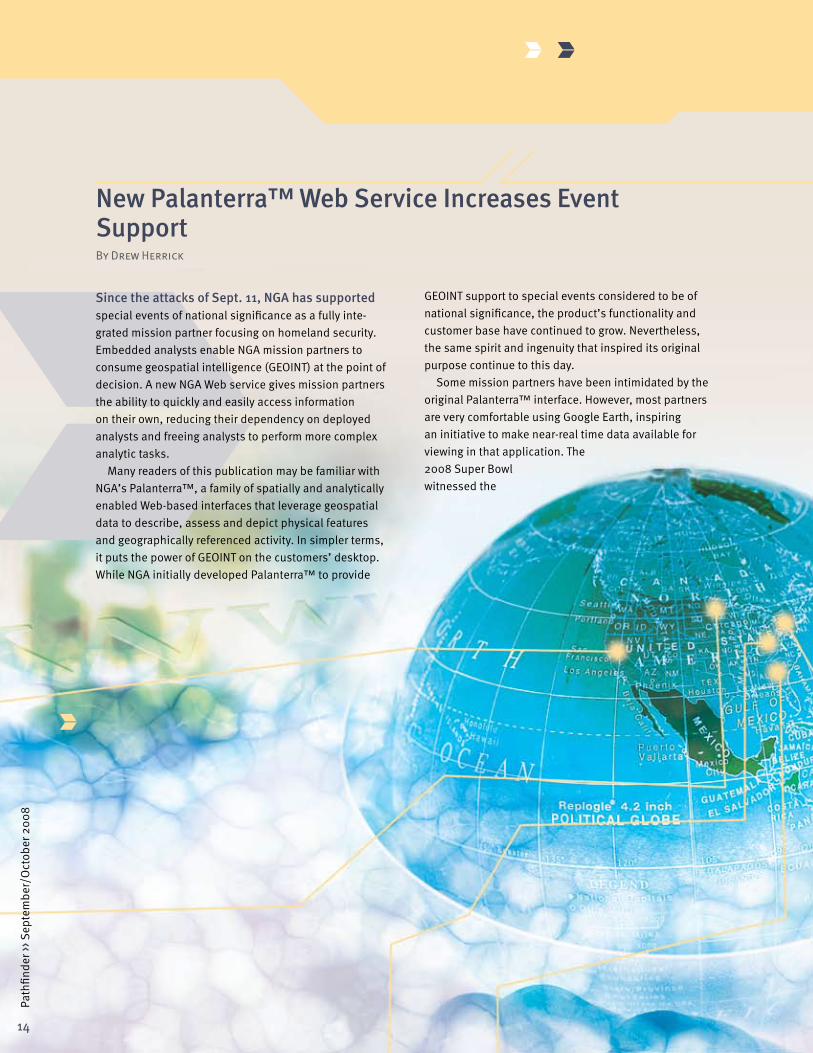
New Palanterra™ Web Service Increases Event Support By Drew Herrick
Since the attacks of Sept. 11, NGA has supported special events of national significance as a fully inte-grated mission partner focusing on homeland security. Embedded analysts enable NGA mission partners to consume geospatial intelligence (GEOINT) at the point of decision. A new NGA Web service gives mission partners the ability to quickly and easily access information on their own, reducing their dependency on deployed analysts and freeing analysts to perform more complex analytic tasks.
Many readers of this publication may be familiar with NGA’s Palanterra™, a family of spatially and analytically enabled Web-based interfaces that leverage geospatial data to describe, assess and depict physical features and geographically referenced activity. In simpler terms, it puts the power of GEOINT on the customers’ desktop. While NGA initially developed Palanterra™ to provide
GEOINT support to special events considered to be of national significance, the product’s functionality and customer base have continued to grow. Nevertheless, the same spirit and ingenuity that inspired its original purpose continue to this day.
Some mission partners have been intimidated by the original Palanterra™ interface. However, most partners are very comfortable using Google Earth, inspiring an initiative to make near-real time data available for viewing in that application. The 2008 Super Bowl witnessed the

15
Path
finde
r ›› S
epte
mbe
r/O
ctob
er 2
008
implementation of the Palanterra™ Event KML, a new Web service. KML, or Keyhole Markup Language, refers to a file format developed for expressing geographic features in Google Earth.
The Palanterra™ Event KML is designed to increase the situational awareness of analysts and mission part-ners. The service delivers geospatial and temporal vi-sualization of planned activities and reported incidents related to the public safety and security of National Special Security Events (NSSEs), as determined by the Department of Homeland Security.
A key benefit of this new service for deployed NGA analysts is that it requires less time. Analysts supporting a special event enter the planned event and reported
incident data into the Palanterra™ database via the same operations interface that Palanterra™ has
always used. However, analysts spend less time retrieving the data. The Palanterra™
Event KML delivers the data as network links, which allow for data publishing
and retrieval from a Web or network server in a manner similar to a
Web browser. For example, an NGA analyst places a network link on a relevant topic page in Intellipedia, the Intelligence Community’s wiki environ-ment. A customer then selects the link, which opens Google Earth and adds the link as a
data layer. Customers can even receive information as a Web feed
if desired.At preset intervals, the link reaches
into the Palanterra™ database for infor-mation and refreshes itself to display the
data in near-real time. NGA analysts populate and maintain the database working under the
auspices of, and in coordination with, the lead fed-eral agencies for a given event, typically the U.S. Secret Service and the FBI. Data is accessible on proprietary
DrewHerrickis the Deputy Technical
Executive in the Office of the Americas, where he works to implement new technologies and processes.
domains used by federal, state and local officials charged with the public safety and security of the event. All users viewing the information are responsible for handling it according to appropriately indicated controls.
The Palanterra™ Event KML has already received praise with its initial rollout. One user remarked with typical enthusiasm, “I’ve always thought Palanterra™ was a neat capability, but I’m even more impressed with the ability to pump that information right into [Google Earth] and be able to incorporate other data as well.” Enhancements to the service continue on a periodic basis as customer feedback is received. One particular improvement, anticipated for the 2008 Democratic and Republican National Conventions, will enhance the data displayed in the balloons that appear when the user holds the mouse over selected items.
The development of the Palanterra™ Event KML was a team effort. Representatives from NGA’s Office of the Americas, North America and Homeland Security Divi-sion (PMH); the NGA Support Team (NST) to the FBI; the Palanterra™ Team and the eGEOINT Management Office held concept and technical exchange meetings. PMH and NST analysts articulated the requirement, while the Palanterra™ and eGEOINT teams worked the develop-ment aspect. All team members worked very closely prior to the initial rollout to ensure the service was working as planned. The team continues to meet regularly to enhance the service.
The development of the Palanterra™ Event KML cre-ates a win-win situation for NGA and its mission partners. Mission partners receive time-sensitive information deliv-ered to their desktop, and NGA analysts are able to focus their efforts on areas requiring their specialized skills.

16
Path
finde
r ›› S
epte
mbe
r/O
ctob
er 2
008
Support Team Answers Homeland Security Challenges By Greg Barac
The Department of Homeland Security (DHS) has a challenging job, so it’s no surprise that the NGA Support Team (NST) assigned to DHS finds its services in high demand. The scope of homeland security ranges from protecting the president of the United States and the American people to managing federal response and re-covery efforts for national crises; protecting the country’s environment and transportation systems; securing the nation’s economic interests in its ports, waterways, coasts and international waters; and safeguarding U.S. borders to keep out terrorists and their weapons. With over 7,000 miles of land borders to monitor, and over 95,000 miles of shoreline and navigable waters, DHS oversees more than 360 ports and processes over 8,000 foreign vessels, 9 mil-lion cargo containers and 200 million passenger vessels annually, and all without interrupting commercial trade.
Considering the scope of its support functions, the NST at DHS is lean, with limited staff allocated across eight of DHS’s components—the U.S. Secret Service, the U.S. Coast Guard, the Federal Emergency Management Agency, the Transportation Security Administration, the Office of Intelligence and Analysis, the National Protec-tion and Programs Directorate, the U.S. Customs and Border Protection, and the National Operations Center. However, the team combines its resources with the robust reachback capabilities of NGA’s Office of Americas and Office of Global Support, also joining forces with the NSTs assigned to the FBI and the U.S. Northern Com-mand, to very effectively support DHS.
In March 2003, 22 organizations merged to create DHS, consolidating nearly 200,000 employees. Taking the age, size and scope of DHS into account, the NST has been working to cultivate the growth of “organic,” or in-house, geospatial intelligence (GEOINT) capabilities across the relatively young DHS components. To facilitate the devel-opment of DHS GEOINT capabilities, the NST’s Technical Executive spearheaded a monumental effort with DHS to develop its Geospatial Architecture Program plan with three primary objectives. First, the plan allows DHS to customize existing technologies developed within NGA to be operated and maintained by DHS for its specific geo-spatial information requirements. Second, it takes advan-tage of existing NGA partnerships for data collection to
support DHS operations. Third, it defines the Geospatial Information Infrastructure (GII), a structured architecture and methods for collecting and sharing geospatial data and services in an interoperable environment supporting federal, state and local homeland security authorities.
The NST’s efforts reinforce the DHS strategy of develop-ing an integrated GII system to connect the activities and resources of all levels of government. To implement this strategy, DHS developed the Homeland Security Informa-tion Network (HSIN) as a single conduit for sharing and disseminating information on domestic terrorist threats and incident management. The HSIN is the primary na-tional information sharing and collaboration tool used in responding to all DHS component operations at all gov-ernment levels. HSIN enables a DHS common operating picture by incorporating the Integrated Common Analytical Viewer (iCAV) tool. The NST led the development of iCAV, a Web-based visualization application built upon Palan-terra™, NGA’s secure online geospatial data viewer. The iCAV tool allows DHS mission partners to access multiple data sets to provide geospatial situational awareness by overlaying imagery with dynamic mission-specific infor-mation such as threats, weather and situation reports.
Using iCAV, the NST and other users can quickly pro-duce substantial numbers of GEOINT products to support DHS in a crisis. For example, during the Virginia Tech shooting in April 2007, the NST employed iCAV to locate and notify the nearest emergency authorities. The iCAV tool is accessible online anytime, anywhere, and to any DHS mission partner having a Web-enabled computer and a HSIN account. The tool unites homeland security mission partners at the federal, state and local levels.
Through an agile team and collaborative GEOINT technologies, NGA continues to add invaluable support to homeland security. NGA can be proud of its part in ensuring a safe and secure nation.
GregBaracis the Director of the
NGA Support Team at the Department of Homeland Security. Previously, he served as the Deputy Direc-tor of NGA’s Office of Global
Support.

17
Path
finde
r ›› S
epte
mbe
r/O
ctob
er 2
008
When devastating floods hit the Midwest in June 2008, NGA analysts from the North America and Home-land Security Division geared their geospatial intelligence (GEOINT) expertise towards the Department of Homeland Security’s (DHS’s) Federal Emergency Management Agen-cy (FEMA). As losses in people and property mounted, FEMA reached out to NGA, requesting GEOINT support that NGA has often provided to FEMA and other federal agen-cies during numerous disasters. The NGA Support Team (NST) to DHS facilitated an ongoing, working relationship with FEMA while NGA analysts exploited near-real-time imagery to evaluate the flooding and create damage as-sessment graphics.
The marrying of disaster response to GEOINT support is nothing new. Following Hurricane Andrew in 1992, this relationship seemed a natural one to pursue. Under the 1988 Robert T. Stafford Disaster Relief and Emergency As-sistance Act, which provides the authority for most federal disaster response activities, FEMA and the National Photographic Interpretation Center, an NGA predecessor, began coordinating GEOINT support in an essential rela-tionship that continues more than fifteen years later.
During floods or other crises, one day’s priorities are often overcome by the next day’s events. The NST at DHS ensured that NGA’s support remained relevant during the Midwest floods by constantly retasking and interacting with FEMA leadership daily. Under FEMA’s guidance, NGA established commercial collection and exploitation priorities throughout the affected areas. Analysts created readiness graphics, custom maps, Google Earth files, and shapefiles showing the extent of the flooding for respond-ers. NGA analysts also rapidly produced assessment reports to facilitate situational awareness for senior level policymakers and other federal authorities.
NGA analysts worked hard to provide FEMA with the critical GEOINT needed to save lives and property, but NGA’s relationship with FEMA reaches beyond flooding. As requested, NGA supports FEMA with critical GEOINT for all federally declared disasters, including hurricanes,
which have become a critical mission for NGA analysts working homeland security issues—one that fully engages the FEMA–NGA relationship.
No matter the disaster, NGA’s customer-centric re-sponses to FEMA’s requirements highlight the importance of effective GEOINT and interagency collaboration. By tapping NGA’s capabilities as a force multiplier, FEMA responds more effectively to save lives and property.
NGA Assists FEMA With Midwest Flood Response By Michael Cilladi
MichaelCilladiis an Analyst in the Office of the
Americas, North America and Home-land Security Division.
NGA assisted the Federal Emergency Management Agency with products and support.

18
Path
finde
r ›› S
epte
mbe
r/O
ctob
er 2
008
U.S. National Grid Simplifies Mapping By Kurt Schulz
In this era of GPS, homeland security and geospatial support to disaster relief operations, the civilian sector is beginning to realize what the military has known since World War I: for land navigation, the geographic coordi-nate system using latitude and longitude is not well-suited for referencing locations. The geospatial community, in-cluding NGA, has established and is working to implement a simple rectangular X, Y coordinate system for domestic location referencing, the U.S. National Grid (USNG).
The geographic coordinate system is essential for referencing large areas of the Earth, but for small areas, it has serious drawbacks—it uses angular units (degrees, minutes and seconds), which are cumbersome when expressing distance or converting coordinate values between map scales, and the spacing of latitude and longitude varies across the Earth, resulting in compli-cated calculations. USNG avoids these problems.
For example, rather than express distance in degrees, minutes and seconds, a gardener of a small backyard plot would more likely construct a simple X, Y grid, using linear units such as feet or meters. That way, the azalea hedge could be expressed as “60 feet long” instead of “0.6 seconds of latitude from end to end.”
The same principle applies to land navigation, as the Allies realized during World War I. They abandoned geographic coordinates in favor of X, Y coordinates for guiding artillery fire and reporting positions, placing co-ordinates derived from rectangular grids on maps cover-ing Allied areas of operation. This method was continued throughout World War II, but the global nature of that war made apparent the need for a uniform, worldwide system. In 1947, efforts by the U.S. Army Map Service and other Allied mapping organizations resulted in the development and adoption of the Universal Transverse Mercator (UTM) coordinate system, which uses a rectan-gular grid, and its associated location reporting method, the Military Grid Reference System (MGRS).
Half a century later, the civilian sector began to grapple with the issue of map grids for location report-ing. With the rapid growth of GPS technology in the 1990s, anyone could use a handheld GPS receiver to quickly determine precise geographic positions. GPS
soon became essential for emergency response, disaster relief, and search-and-rescue operations.
Unfortunately, this advance remained hampered by the geographic coordinate system and other inadequate position referencing systems. Street addresses offered only limited accuracy and range, and locally produced map grids each followed their own standards and defini-tions. The need for a standardized rectangular grid refer-ence system for civilian use became obvious.
Recognizing this need, leading members of the U.S. mapping sciences community formed the Public XY Map-ping Project in 1997. Representatives of the National Im-agery and Mapping Agency, which would become NGA, soon became involved in the project. After considering several possibilities, the project committee concluded that a UTM-based, slightly modified version of MGRS would be the best choice for a standardized, national map grid for civilian use. In 2001, the U.S. National Grid became a standard for the interagency Federal Geo-graphic Data Committee (FGDC), which was established in 1990 to coordinate geospatial data nationally. USNG is the preferred grid for applications of the National Spatial Data Infrastructure, the FGDC’s data publishing effort.
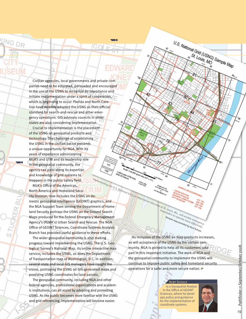
The USNG is functionally equivalent to MGRS. In this system, the U.S. is divided into 6°x 8° grid zones, each with a three-character designator. These zones are fur-ther divided into 100-kilometer grid squares, each with a two-letter identifier. A location within a 100-kilometer grid square is referenced with an alphanumeric value composed of the grid zone designator, the grid square identifier, and X, Y coordinates measured, in meters, from the southwest corner of the grid square.
Currently, first responders and public safety officials have little training or experience with grid systems for loca-tion referencing, and many geographic information system (GIS) managers at the state and local level are unfamiliar with the USNG. For many, the response to Hurricane Katrina dramatically revealed the need to adopt a national standard. Trapped residents reported their addresses, but many street signs and house numbers were submerged or destroyed. Specialists converted addresses to coor-dinates, but many responders lacked the training and technology to relate coordinate values to actual locations.
19
Path
finde
r ›› S
epte
mbe
r/O
ctob
er 2
008
Civilian agencies, local governments and private com-panies need to be educated, persuaded and encouraged in the use of the USNG to recognize its importance and initiate implementation under a spirit of cooperation, which is beginning to occur. Florida and North Caro-lina have recently adopted the USNG as their official standard for search-and-rescue and other emer-gency operations. GIS advisory councils in other states are also considering implementation.
Crucial to implementation is the placement of the USNG on geospatial products and technology. The challenge of establishing the USNG in the civilian sector presents a unique opportunity for NGA. With its years of experience administering MGRS and UTM and its leadership role in the geospatial community, the agency can pass along its expertise and knowledge of grid systems to mappers in the public safety field.
NGA’s Office of the Americas, North America and Homeland Secu-rity Division, now includes the USNG on do-mestic geospatial intelligence (GEOINT) graphics, and the NGA Support Team serving the Department of Home-land Security portrays the USNG on the Ground Search Maps produced for the Federal Emergency Management Agency’s (FEMA’s) Urban Search and Rescue. The NGA Office of GEOINT Sciences, Coordinate Systems Analysis Branch has provided useful guidance to these efforts.
The wider geospatial community is also making progress toward implementing the USNG. The U.S. Geo-logical Survey’s National Map, its online interactive map service, includes the USNG, as does the Department of Transportation map of Washington, D.C. In addition, several state and local GIS managers have caught the vision, portraying the USNG on GIS-generated maps and providing USNG coordinates for land parcels.
The geospatial community, including NGA and other federal agencies, professional organizations and academ-ic institutions, can all assist by adopting and promoting USNG. As the public becomes more familiar with the USNG and grid referencing, implementation will become easier.
KurtSchulzis a Geospatial Analyst
in the Office of GEOINT Sciences, where he devel-ops policy and guidance for the implementation of coordinate systems.
As inclusion of the USNG on map products increases, so will acceptance of the USNG by the civilian com-munity. NGA is poised to help all its customers take part in this important initiative. The work of NGA and the geospatial community to implement the USNG will continue to improve public safety and homeland security operations for a safer and more secure nation.
Implementing the U.S. National Grid, as depicted on this map of St. Louis, Mo., will enable emergency
responders to operate more effectively.
Sample map provided by Kurt Schulz

Partnerships
Afghanistan Aerial Survey Yields GEOINT in Theater By Jay D. Krasnow and Jose A. Villanueva
Although NGA is known for taking the lead in creating immediate geospatial intelligence (GEOINT) solutions for world crises, the agency is equally known for participating in long-term international cooperative projects that span several years. In the summer of 2006, NGA joined the Naval Research Laboratory (NRL) when it led a comprehensive aerial survey of Afghanistan called Operation Rampant Lion 1 (RL 1). The government of Afghanistan, the U.S. Geological Survey and the Canadian Forces (CF) also participated. Essentially a nation-building operation, RL 1 collected an integrated set of aerogeophysical data to support reconstruction, economic development, and infrastructure and natural resources assessment efforts. NGA used the acquired data to derive GEOINT products for combat and counter-narcotics operations.
Two years later, Rampant Lion 2 (RL 2) proceeded as a smoothly executed second phase of this multiyear project because of the solid partnerships developed during RL 1. In March 2008, the CF deployed an inte-grated GEOINT Support Team (GIST) advance party to an in-country Airfield to support air and ground operations. This advance party included a geodetic survey capability to establish ground controls as well as a small liaison team to coordinate operational requirements and logisti-cal support. In early April, NRL scientific staff, the full CF GIST, and the U.S. Navy air and ground crews that operate the P-3 airborne collection aircraft arrived at the airfield. The NRL staff went airborne within days of its ar-rival. Shortly after, the NGA Support Team to RL 2 arrived. NGA’s Remote Replication System (RRS) personnel and hardware also played a critical role by ensuring effective and timely dissemination of data.
RL 2 mission deliverables will include individual im-ages and orthomosaics captured from the electro-optical Applanix Digital Sensor System (a commercial camera system for digital mapping), as well as Light Detection and Ranging, unprocessed hyperspectral, processed gravity, processed aeromagnetic and thermal infrared sensor data.
NGA worked with domestic and international partners to bring RL 2 imagery and derived GEOINT products to deployed U.S. and allied forces and analysts in the field on relatively short timelines. From their facility in Afghanistan, the CF GIST and NRL scientists processed electro-optical imagery as it came off the aircraft. Once the images were processed, NGA’s RRS crew replicated the images for NGA Geospatial Support Teams and other customers and shipped them on hard drives to opera-tional sites across Afghanistan to support warfighters. Meanwhile, a British and Canadian delegation worked alongside NGA personnel to process hyperspectral data.
The work has already paid off. For example, on April 30, the RRS crew provided the 24th Marine Expeditionary Unit with a 34-image mosaic over part of the Helmand River Valley, the world’s largest opium-producing region. This mosaic was so valuable that the users immediately requested a larger mosaic (115 images) covering their area of operations.
Though RL I data processing and delivery took up to two years, RL 2 data and derived GEOINT products have been pushed to planners and warfighters in Afghanistan since shortly after the first sortie. As NRL processes the data at its headquarters in Washington, copies are for-warded to scientists in NGA’s Innovision Directorate and to analysts in NGA’s Analysis and Production and Source Directorates, who create multisensor, fused GEOINT products for agency customers. NRL plans to deliver the final data sets to NGA in the fall of 2009.
RL 2’s success was a product of effective collaboration across a broad coalition of organizations within NGA and the National System for Geospatial Intelligence and from among Commonwealth partners. Each organization ap-plied its skills, capabilities and unyielding commitment to ensure the attainment of the mission goal of providing timely and accurate GEOINT to the warfighter. The follow-ing list highlights the main mission participants:
» NGA, including deployed personnel and those serving within the continental United States from throughout the agency
20
Path
finde
r ›› S
epte
mbe
r/O
ctob
er 2
008

21
Path
finde
r ›› S
epte
mbe
r/O
ctob
er 2
008
» The Department of Defense’s Office of Counternar-cotics, Counterproliferation and Global Threats.
» The U.S. Central Command» The NRL » The P-3 air and ground crews, Naval Air Station
Patuxent River, Md.» The Canadian Department of National Defence,
including the Directorate of Geospatial Intelligence, the Mapping and Charting Establishment, the CF Joint Imagery Centre, and Defence Research and Development Canada
» The British Defence Science and Technology Lab and the British Joint Air Reconnaissance Intelligence Center
The dedicated professionals who put their minds and muscle into RL 2 have effectively addressed a number of GEOINT operational gaps identified by warfighters,
JayD.Krasnow(Left)andJoseA.Villanueva(Right)
are Staff Officers in the Joint Planning and Assessments
Staff, where they work on issues spanning the Analysis & Produc-
tion and Source Operations & Management Directorates.
such as the need for wide-area coverage, high-resolution electro-optical imagery at the lowest classification and releasability level for maximum sharing among partners. RL 2 data will continue to be a valuable resource in meet-ing NGA’s commitments to customers and partners in a highly critical theater of operation.
U.S. Navy crews operated a P-3 Orion aircraft during Rampant Lion 2.Photo by PH1 Larry A. Franklin

Our Heritage
The DEW Line—Cold War Defense at the Top of the World By Dr. Gary E. Weir
At first glance, the image on this page seems to confirm the existence of the monolith in Stanley Kubrick’s film “2001, A Space Odyssey.” That mysterious structure established a fictional link between human evolution and a higher intelligence in distant space. This monolith, looking out over an imposing arctic landscape, should also remind us of special links and fruitful relationships critical to geospatial intelligence (GEOINT), only forged closer to home, during NGA’s Cold War past.
This black structure, an ultra-high frequency direc-tional antenna, and many others like it, formed part of the Distant Early Warning, or DEW, Line designed in 1954 at President Dwight Eisenhower’s direction. He wanted a means of detecting the possibility of Soviet bombers
armed with nuclear weapons coming in over the North Pole. The con-
struction of a series of stations
starting in Alaska and stretching across all of northern Canada and then on to Greenland began shortly after both the president’s authorization and the decision of our Commonwealth partner, Canada, to collaborate.
With U.S. funding support, Canada accomplished all of the surveys, many in their largely uncharted and inhospi-
table northern territories. The Canadians also built the stations with contract assistance from the Federal
Electric Corporation, then a division of IT&T, and manned the
22
Path
finde
r ›› S
epte
mbe
r/O
ctob
er 2
008
Photo courtesy of Charles Carney
Ultra-high frequency directional antennae formed part of the Distant Early Warning Line.

23
Path
finde
r ›› S
epte
mbe
r/O
ctob
er 2
008Dr.GaryE.Weir
is the NGA Historian.
facilities on their soil with personnel from both the Royal Canadian Air Force and the U.S. Air Force. The U.S. sub-sidiary of AT&T, Western Electric, took responsibility for the electronic systems used by the allied personnel, with Bell Laboratories designing the equipment and conduct-ing the final acceptance tests. Raytheon designed and built the long-range radar systems, and Collins Radio, the U.S. company that supplied Rear Adm. Richard Byrd with the communication devices he took to the South Pole in 1933, supplied scatter radio systems attuned to the arctic environment.
Arctic atmospheric and climate conditions made it difficult to use high-frequency radio waves effectively as the basic means of detection and transmission. Instead a combination of systems using high-powered transmit-ters, ultra-high frequencies, and multiple highly direc-tional antennas worked together in a new way called scatter communications. This innovation made the DEW Line effective. The lowest layer of the atmosphere, called the troposphere, permitted refraction of radio signals due to moisture, sending refracted or “scattered” signals in predictable directions. Those angles determined the positioning of directional antennae clusters formed by
two or three of the black monoliths. In addition, long-range radar provided the
primary detection capability, and shorter-range radars,
mounted on 300-foot
towers, guarded against any Soviet attempt to fly under the coverage.
The creation of the DEW Line brought Canada and the United States together to defend the North American continent against the Soviet threat, leading to the creation of the North American Air Defense Command, NORAD, in 1958. By the time the Line went active, it consisted of 21 stations established along a transconti-nental procession extending for 3,693 statute miles. It took as many as 25,000 people and all sorts of technical and construction skills to fashion the finished product.
In one way the DEW Line had a very short useful life, and in another it still lives and operates in a way we find essential. The effective life of the Line ended with the introduction of intercontinental ballistic missiles. This technology literally took off during 1957 and 1958 with the Soviet R-7, of Sputnik fame, and the American Atlas A. In 1960, the U.S. Navy also perfected the Polaris sub-marine-launched ballistic missile with a range of 1,200 nautical miles. These missiles could fly far above the DEW Line warning net radars and travel at a rate no air-craft could attain. However, the determination displayed in coming together to survey, design, and build, in a very difficult environment, a defensive barrier against early Soviet nuclear capability demonstrated the vitality and flexibility of the Canadian–U.S. relationship. In this case the homeland became North America, and the threat served to bring us together as it did in World War II, as it would in later conflicts, and as it does now in formulat-ing GEOINT to support the war on terrorism.
Distant Early Warning Line stations stretched from Alaska across northern Canada to Greenland.
Image courtesy of the Canadian National Mapping and Charting Establishment


www.nga.mil