rufiji environment management project - … · case studies are best viewed and ... the equator...
TRANSCRIPT
Equator Initiative Case StudiesLocal sustainable development solutions for people, nature, and resilient communities
Tanzania
RUFIJI ENVIRONMENT MANAGEMENT PROJECT
Empowered lives. Resilient nations. Empowered lives. Resilient nations.

UNDP EQUATOR INITIATIVE CASE STUDY SERIESLocal and indigenous communities across the world are advancing innovative sustainable development solutions that work for people and for nature. Few publications or case studies tell the full story of how such initiatives evolve, the breadth of their impacts, or how they change over time. Fewer still have undertaken to tell these stories with community practitioners themselves guiding the narrative.
To mark its 10-year anniversary, the Equator Initiative aims to fill this gap. The following case study is one in a growing series that details the work of Equator Prize winners – vetted and peer-reviewed best practices in community-based environmental conservation and sustainable livelihoods. These cases are intended to inspire the policy dialogue needed to take local success to scale, to improve the global knowledge base on local environment and development solutions, and to serve as models for replication. Case studies are best viewed and understood with reference to ‘The Power of Local Action: Lessons from 10 Years of the Equator Prize’, a compendium of lessons learned and policy guidance that draws from the case material.
Click on the map to visit the Equator Initiative’s searchable case study database.
EditorsEditor-in-Chief: Joseph CorcoranManaging Editor: Oliver HughesContributing Editors: Dearbhla Keegan, Matthew Konsa, Erin Lewis, Whitney Wilding
Contributing WritersEdayatu Abieodun Lamptey, Erin Atwell, Toni Blackman, Jonathan Clay, Joseph Corcoran, Larissa Currado, Sarah Gordon, Oliver Hughes, Wen-Juan Jiang, Sonal Kanabar, Dearbhla Keegan, Matthew Konsa, Rachael Lader, Patrick Lee, Erin Lewis, Jona Liebl, Mengning Ma, Mary McGraw, Gabriele Orlandi, Juliana Quaresma, Peter Schecter, Martin Sommerschuh, Whitney Wilding, Luna Wu
DesignOliver Hughes, Dearbhla Keegan, Matthew Konsa, Amy Korngiebel, Kimberly Koserowski, Erin Lewis, John Mulqueen, Lorena de la Parra, Brandon Payne, Mariajosé Satizábal G.
AcknowledgementsThe Equator Initiative acknowledges with gratitude the Rufiji Environment Management Project, and also the guidance and inputs of Abdalla Said Shah, IUCN Tanzania office. All photo credits courtesy of Rufiji Environment Management Project. Maps courtesy of CIA World Factbook and Wikipedia.
Suggested CitationUnited Nations Development Programme. 2012. Rufiji Environment Management Project. Equator Initiative Case Study Series. New York, NY.

PROJECT SUMMARYBetween 1998 and 2003, this IUCN-led intervention in the Rufiji Delta area of Tanzania worked through the Rufiji District Council to develop village environment management plans in consultation with local communities. The project oversaw the effective transfer of resource management authority from the central government to four pilot villages comprising communities in the floodplain and delta areas affected by the flooding of the river downstream of the Selous Game Reserve. Land-use maps were collaboratively produced by teams of researchers, government officials, and the communities themselves using a combination of modern and traditional means; these maps then formed the basis of participatory land use planning at the village level, focusing on empowering women as prime resource users. The enduring impact of the project has been closer cooperation between communities and local government in preserving the region’s delicate socio-ecological balance.
KEY FACTSEQUATOR PRIZE WINNER: 2004
FOUNDED: 1998
LOCATION: Rufiji District, Tanzania
BENEFICIARIES: Villages in the Rufiji River Delta
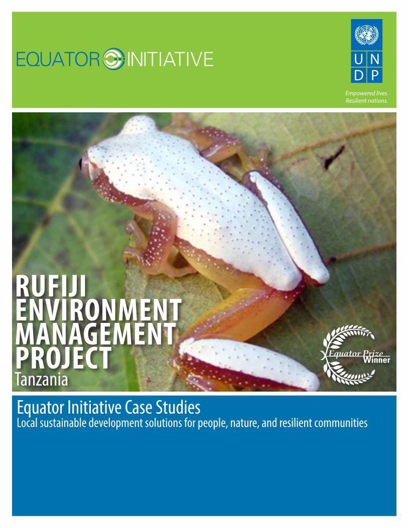
BIODIVERSITY: Rufiji-Mafia-Kilwa Marine Ramsar site
3
RUFIJI ENVIRONMENT MANAGEMENT PROJECTTanzania
TABLE OF CONTENTS
Background and Context 4
Key Activities and Innovations 6
Biodiversity Impacts 7
Socioeconomic Impacts 8
Policy Impacts 9
Sustainability 10
Partners 11

4
The Rufiji River lies entirely within Tanzania, rising in the south-west of the country and reaching the Indian Ocean some 375 miles later, forming a sprawling delta. Located about 250 miles south of Dar es Salaam, the Rufiji River Delta is the largest in Eastern Africa, and contains the largest estuarine mangrove forest on the eastern seaboard of the African continent. Common mangrove species include Rhizophora mucronata, Sonneratia alba and Ceriops tagal, while Avicennia marina and Bruguiera gymnorrhiza occur less frequently. As well as an extensive food web that supports a high diversity of omnivorous crustaceans of commercial importance, the delta ecosystem and Mafia Island are important wintering grounds for migrating birds, including waders and terns. Wildlife such as hippopotamuses, crocodiles and monkeys feed and shelter in the mangrove forests.
In 2004, the delta was included in Tanzania’s fourth site to be named a Wetland of International Importance under the Ramsar Convention. Known as the Rufiji-Mafia-Kilwa Marine Ramsar site, it is a complex of coastal and marine habitats that includes the Rufiji Delta; Mafia Island and surrounding smaller islands, sandbars, and coral reefs located just offshore; the Songo-Songo Archipelago to the south; and adjacent waters, including the Mafia Channel and waters between Mafia and Songo-Songo.
The major ethnic group in Rufiji District is the Wandengereko. Other groups include the Wanyagatwa, who are mainly found in the Rufiji Delta, and Wamatumbi, who are mainly found in the southern part of Rufiji, as well as a number of other smaller ethnic groupings. Collectively, these groups are often referred to as the “Warufiji”, or Rufiji people. The history of Rufiji District is strongly linked to the development of the coastal Swahili culture and the trade links between the East African coast and the countries of the Persian Gulf. The district is home to many people of Arab origin, and Islam is an integral part of the Rufiji culture, guiding both its religious and social systems.
A socio-ecological balance
Farmers in the Rufiji flood plain and the delta area have evolved a system of land use over time that is adapted to the unpredictable floods of the Rufiji River. The system is based on inter-planting and rotating rice, maize, beans, and, to a lesser extent, cotton. In addition, livelihoods are supplemented by the utilization of available natural resources, such as fishing in the rivers and lakes, and harvesting of forest and non-forest products.
In 2002, it was estimated that the forests provided around 60% of locally-raised income within Rufiji District. In 2008, a study concluded that wetland resources were of substantial economic value to households in one of the delta’s villages, Mtanza-Msona: the majority of wetlands harvest and use activities were worth at least TSh 25,000 (around USD 20 at 2008 prices) a year per person, with timber harvesting for sale, fishing, honey collection, building poles and firewood being the most lucrative. The total annual value of wetland resource use to the village’s 428 households was TSh 226 million (USD 192,000), or just over USD 100 per capita.
The shared use of natural resources was governed by both complex sharing of ecosystems between villages or lineages and by local perceptions of space as sacred groves or as having assigned spiritual values. Traditionally, the floodplain and hill tribes have had an informal mutual aid agreement that stipulates that, in years of bad rainfall, the floodplain people cannot refuse to provide the hill people with food, and vice-versa in years with insufficient floods. The forests and woodlands have also acted as safety nets during times of drought and rainfall, providing subsistence nutrition or timber that can be sold for food. Numerous taboos exist on harvesting of certain species, and their harvesting requires complex rituals.
Background and Context
55
From government-led to collaborative forest management
The delicate socio-ecological balance was upset during the course of successive German, British, and Tanzanian governments, however. The Forest Ordinance of 1957 allowed for the creation of forest reserves by government decree after considering any objections by interested parties to this de jure transfer of rights from local communities to the state. The Tanzanian state has repeatedly used its authority over mangrove forests to exert control over Rufiji Delta communities and resources. In 1987, for instance, the Forestry Division declared a ban on the cutting of all mangroves in the northern Rufiji Delta, with forest officers posted to the area to enforce this. The devolution of resource management to local government, in combination with improved road access and the opening-up of the Tanzanian economy, led to increasingly unsustainable use of the forests. By creating ‘forest reserves’ for the exclusive use of the government, local communities were effectively excluded from using these socially, culturally, and economically important resources. Meanwhile, various large-scale extractive projects have been proposed for the delta, including commercial shrimp harvesting.
In the context of an increasing recognition of the value of common property regimes, however, legislation changes during the late 1990s introduced the principle of participatory forest management. Community-based forest management and (CBFM) and joint forest management (JFM) agreements were established across Tanzania, allowing for the partial devolution of forest management to local communities. The latter category takes place on reserved forest land that is owned and managed by the national or district-level governments, typically through the Forestry and Beekeeping Division. Village-level elected councils and environmental council representatives can sign joint management agreements (JMAs) with the state that establish cost and benefit-sharing arrangements for forest management.
The REMP intervention
Between 1998 and 2003, the Rufiji Environment Management Project (REMP), implemented by Rufiji District Council with financial support from the government of the Netherlands and technical assistance from IUCN, promoted such a transfer of authority from the central government to four pilot villages in Rufiji District. The four villages - Mtanza-Msona, Jaja, Twasalie and Mbunjumvuleni – comprised several local communities in the floodplain and delta ecosystems affected by the flooding of the river downstream of the Selous Game Reserve, and also included several upland forests of local importance.
The project’s goal was “to promote the long-term conservation through wise use of the lower Rufiji forests, woodlands and wetlands, such that biodiversity is conserved, critical ecological functions are maintained, renewable natural resources are used sustainably, and the livelihoods of the area’s inhabitants are secured and enhanced.” Various components of this included: environmental planning and mapping within the floodplain and delta; implementing pilot community development projects based on the sustainable use of natural resources; raising awareness of the importance of conservation at the village, district, and regional levels; and influencing national policies on natural resource management.
The project was run from the District Headquarters in Utete by the Rufiji District Administration, through an Environmental Management Team coordinated by the District Executive Director. Two technical advisers were employed by IUCN, while other project partners, including the National Environmental Management Council (NEMC), the Rufiji Basin Development Authority (RUBADA), the Royal Netherlands Embassy, and the Ministry of Natural Resources and Tourism collaborated formally through their participation in the Project Steering Committee. Although REMP Phase I ended in October 2003, the project left in place Village Environment Management Plans in its four pilot sites and a district-level Environment Management Team that have sustained its work in Rufiji District.
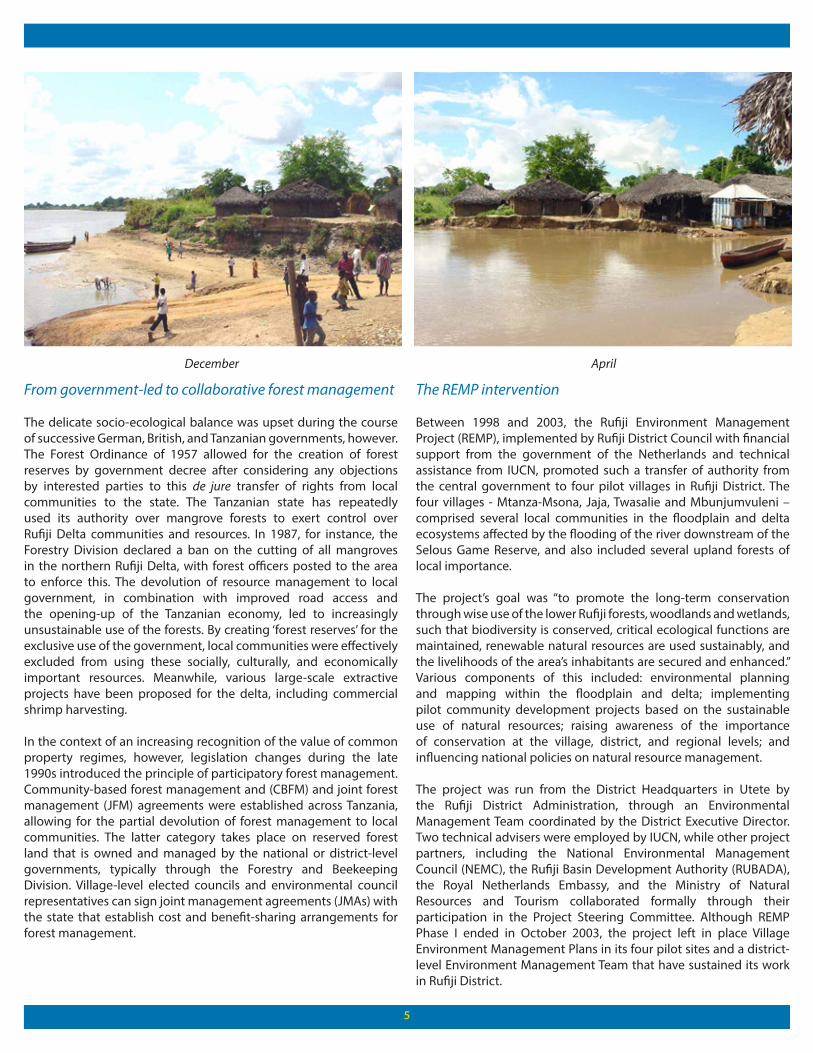
December April

6
Key Activities and Innovations
The project’s chief objective was to support local communities in increasing their legal control and management over land and natural resources falling within their village lands, including fisheries as well as forested land. Open access to natural resources was curtailed, replaced by communities taking on new responsibilities for common property resources.
Participatory mapping
Central to this objective was the drawing up of Village Environmental Management Plans (VEMPs). The land tenure situation in the Rufiji floodplain is historically complex. During Tanzania’s Ujamaa policy of the 1970s, communities had been moved from the floodplain and resettled in the terraces as part of the “villagisation” scheme. During the 1980s, many of these communities returned to the floodplain.
The result was that, in 1998, there were no maps accurately displaying the use of land by local communities, and the land tenure situation was unclear. This was particularly true in the floodplain, which was considered under-utilised by the local authorities, but was in fact extensively cultivated by the local Warufiji populations, resulting in a patchwork of fields in use and in fallow. The transfer of the management of natural resources had to be built on a thorough understanding of prevailing land-use practices linked to zoning into agro-ecological units. This would also help to better communicate to policy makers the functional use of space in the delta.
A two- pronged methodology was employed in which traditional mapping exercises were combined with modern technology. Land-use maps were collaboratively produced by teams of researchers, government officials, and the communities themselves using Landsat images, aerial photographs, detailed landscape analysis, ground-truthing, and incorporation of the results into a geographic information system (GIS). The mapping of the four areas by the villagers themselves, equipped with GPS, was instrumental in their subsequent recognition as Village Forest Reserves. Another aim of the
participatory mapping exercise was to improve communication and the sharing of information between project managers, government institutions, villagers, and researchers, and to reach a consensus on the current land tenure situation. The highly participatory GIS mapping process proved to be an effective tool for improving these channels of communication.
7
Impacts
BIODIVERSITY IMPACTSThe work of the Rufiji Environment Management Programme took place against a background of environmental threats to the delta’s resources. In the mid-1990s, the African Fishing Company (AFC) proposed building the world’s largest shrimp aquaculture facility in the Rufiji Delta, which would have involved cutting 1,200 hectares of mangroves for the construction of shrimp ponds. Tanzania’s National Environmental Management Council urged the government to reject the project due to its negative impacts on forests, fish and the marine environment, land use, water resources, and agriculture, and the threat it would pose to the habitats of a variety of endangered species. The damage was expected to outweigh the estimated USD 500 million annual profits from the project. Despite these objections, the Tanzanian government approved the project.
Resistance to the scheme persisted, led by local protests against its harmful environmental impacts. The proposal stood in contrast to the wise-use practices being promoted through the Rufiji project, and was opposed by Warufiji communities who were reliant on the delta’s mangrove forests for their livelihoods. These protests held up the implementation of the project until, in August 2001, the decision was made to liquidate AFC’s shipping vessels to offset the company’s debt that had accumulated due to the delay. This brought an end to the project, ensuring that the delta’s mangrove forests were preserved.
Village-based sustainable resource management
Changed perceptions and recognition of the value of the delta’s natural resources to local populations was one positive impact of the REMP intervention; awareness of the value of biodiversity increased not only in the project’s pilot villages and ecosystem sites, but across the catchment area, encompassing almost 200,000 people. Village management regime areas were introduced in the pilot villages, based on the participatory land-use mapping, in which restrictions
on harvesting were formalized in village bylaws. These areas showed several signs of vegetative and faunal recovery within a few years of their implementation. Forests began to recover due to the prevention of fire and illegal harvesting. The recovery of forests and woodland increased their value as habitats for biological diversity.
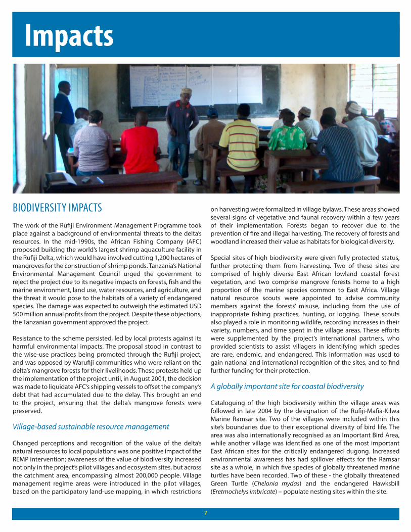
Special sites of high biodiversity were given fully protected status, further protecting them from harvesting. Two of these sites are comprised of highly diverse East African lowland coastal forest vegetation, and two comprise mangrove forests home to a high proportion of the marine species common to East Africa. Village natural resource scouts were appointed to advise community members against the forests’ misuse, including from the use of inappropriate fishing practices, hunting, or logging. These scouts also played a role in monitoring wildlife, recording increases in their variety, numbers, and time spent in the village areas. These efforts were supplemented by the project’s international partners, who provided scientists to assist villagers in identifying which species are rare, endemic, and endangered. This information was used to gain national and international recognition of the sites, and to find further funding for their protection.
A globally important site for coastal biodiversity
Cataloguing of the high biodiversity within the village areas was followed in late 2004 by the designation of the Rufiji-Mafia-Kilwa Marine Ramsar site. Two of the villages were included within this site’s boundaries due to their exceptional diversity of bird life. The area was also internationally recognised as an Important Bird Area, while another village was identified as one of the most important East African sites for the critically endangered dugong. Increased environmental awareness has had spillover effects for the Ramsar site as a whole, in which five species of globally threatened marine turtles have been recorded. Two of these - the globally threatened Green Turtle (Chelonia mydas) and the endangered Hawksbill (Eretmochelys imbricate) – populate nesting sites within the site.

Positive environmental impacts were felt beyond the end of the REMP intervention in 2003. An assessment carried out in the village of Mtanza-Msona from 2005 to 2008 found the Village Environment Committee continuing to oversee controls on fishing, including closed seasons on Lake Mtanza and Lake Makoge and limits on permitted fishing gear and practices, and forest conservation zoning. The Village Council was also playing an important role in the management of a village-gazetted forest reserve north of the Rufiji River. The same assessment found that the village area wetlands supported a high level of species diversity.
The efforts of the REMP intervention played a key role in reversing trends leading to the Rufiji Delta’s environmental destruction, including both local pressures and commercial exploitation. In the process, the project demonstrated the value of effectively communicating results and fully engaging local stakeholders for integrated conservation efforts.
SOCIOECONOMIC IMPACTSThe full and active engagement of local communities depended in large part on their benefitting from the project’s social and economic components. The four villages, home to some 6,700 members in 2004, have gained a degree of legal and management control over forests, woodlands, fisheries and, to some extent, wildlife, within their village lands. For instance, Village Land Forest Reserves have been established in which limited timber harvesting by community members is permitted. The collection of revenues from licenses purchased for timber harvesting (and from fines imposed on those who have harvested timber without licenses) allowed village governments to establish individual Village Environment Committees, and to invest in community development projects selected by village governing assemblies. Improved control and ownership of natural resources has meant that harvests of timber and fish can be planned to maximize the prices received.
These projects included “wise use” small-scale enterprises that were trialed by communities in collaboration with partner organisations. Beekeeping and the sustainable improvement of fishery production from lakes are two examples. Approximately 200 community members took up beekeeping, earning cash income twice a year from their hives’ harvest of honey and wax. Honey also has nutritional and medicinal values for Warufiji households. One village established a campsite to attract tourists, and has generated revenue for village development projects while employing cooks and security personnel on a casual basis.
Strengthening local institutions
REMP also saw improvements in governance at the local and regional levels. Civil participation in the management of the district has improved, as the political chamber of the district authority, made up of locally-elected Ward Councillors, has become more informed on policies and laws governing natural resource use. District officials, meanwhile, have worked to raise the profile of Rufiji on the national stage, and have been heavily involved in sourcing new and additional sources of funding for ecosystem management and for the development of sustainable enterprises. Finally a District Environment Management Plan (DEMP), incorporating lessons learned from the villages, was drafted by the district authority. This example of grassroots action guiding the management of the environment at the district level is indicative of the linkages forged between local communities and government authorities during the lifespan of the REMP intervention.
8

Contributions to women’s empowerment
Integration of gender equality into every aspect of the initiative meant that, in a deeply Islamic society characterized by low levels of human development, the role of women in decision-making processes has vastly improved. Women served as natural resource scouts, supported and encouraged by their spouses. Before REMP, the idea of women piloting motor boats in the delta was unimaginable; thanks to the project’s policy of equal opportunity – reflected in equal budgets for providing training of both female and male candidates – this has become a reality. REMP also saw other “firsts”, such as the first time women participated in community meetings alongside men, and the first time the village of Jaja had equal numbers of women and men on its village government. Women have also participated in equal numbers in presenting the work of REMP at Tanzania’s National Farmer’s Day event, and in providing trainings for other village projects across Tanzania. Women have also become beekeepers, ending taboos on their visiting distant woodland areas. The Tilapia fishpond trials have allowed women to manage and receive profits from fish-farming for the first time in their villages’ histories.
Through negotiations in village assemblies involving project staff and community members, and the principles advocated by REMP being reflected in local governance, the gender divide in Rufiji has narrowed a little. The new sensitivity of male leaders and project staff to the need to facilitate women’s participation is one striking example
of this. Methods to encourage this include: providing childcare so that women can attend meetings; running meetings in fields rather than at the village centre; meeting women separately from their spouses; encouraging women’s caucuses; timing meetings to suit women’s household routines; asking men to remain at home and let their wives represent their households; and using communication methods that do not rely on literacy.
Within the relatively restricted social circumstances of tradition and religion, in a region in which educational attainment remains low, there is evidence that progress towards a lasting change in gender relations has been made.
POLICY IMPACTSThe Rufiji Environment Management Programme remains an important case study in Tanzania for demonstrating the potential benefits and challenges of the decentralisation of the management of natural resources to local communities. This is a model that still requires perfecting, however, and there has been criticism of the lack of clarity over the extent of local access to resources. A recent study (Beymar-Farris and Bassett, 2011) criticized the Joint Management Agreements at the heart of the Rufiji case as an example of an unequal balance of power between government institutions and local communities. Rufiji farmers are restricted from accessing reserve areas for cultivation, limiting their livelihood options. Villagers have also stated that the Forestry and Beekeeping Division bears the sole responsibility for distributing licenses for logging mangrove poles. This has created the impression that the role of villagers as co-managers of forests is not taken seriously.
One serious policy gap concerns uncertainty over land tenure for the delta’s communities. While they have limited access rights to use forest reserves, settlements within these reserves have been declared illegal, often ignoring both the presence of ancestral burial grounds and formally registered village land certificates. This has been exacerbated in recent years by schemes proposed for climate change mitigation within the delta. The Rufiji Delta is listed as one of six Tanzanian sites for Reducing Emission from Deforestation and Forest Degradation (REDD) pilot projects. Proposed ideas have entailed replanting mangrove forests, bringing the government into conflict with local villagers who rely on the land for rice farming. Until the land situation in the delta is clarified, with improved tenurial rights granted to local communities in line with the land-use mapping results of the REMP project, the benefits of improved environmental management will remain limited.
9

10
Sustainability and Replication
SUSTAINABILITYSince the project was implemented and managed by district, regional and village governments, rather than imposing new external staff, the skills and attitude changes wrought by REMP have survived in Rufiji beyond the end of the project. The four Village Environment Management Plans have been approved by Village Assemblies, Ward Development Committees, and the District Council and, through their supportive bylaws, are enshrined in law. The management of natural resources by the village governments was rooted in local capacities and has been a sustainable output of the project.
The project also had large-scale capacity-building impacts. Natural resource monitoring and management, communication, good governance, and technical enterprise skills such as fisheries and beekeeping skills have been adopted by a critical mass of community members, who in turn have also trained others. This means that the skills have been passed on without project support. Technical innovations, such as beekeeping, fisheries, smoking kilns, and energy-saving stoves have also been in sustained use since 2003, and have often been adapted to fit local conditions.
A case study in the legacy of REMP
The lasting effects of REMP’s work in the delta are best seen in the village of Mtanza-Msona, one of the four pilot villages in 1998. Its Village Environment Committee and Village Environment Management Plan have sustained the wise-use principles of environmental management enshrined in the initial project. With continued support from the IUCN Regional Office for Eastern and Southern Africa and the IUCN Tanzania Office, a project team undertook an extensive, integrated assessment of the biodiversity, livelihood and economic value of local wetlands between 2005 and 2008. The project was funded by the UK government through the Darwin Initiative. The study found evidence of local management and conservation activities, although also detailed the various on-site and off-site factors that continue to threaten the ecosystem health of the wetlands.

1111
PARTNERSMtanza-Msona, Jaja, Twasalie and Mbunjumvuleni
The villages, through their respective governments, user groups, planning teams, environment committees, and natural resource scouts, implemented the village environment management planning approach at the core of the REMP project. They played leading roles in the participatory identification of natural resources, opportunities and problem analysis, planning and review of project activities, and the implementation of wise usage plans.
Rufiji District Council
The executive and the political wings of the Rufiji District Council played important roles in the success of REMP. The executive arm provided technical support to the villagers, either from their own staff or by bringing in outside expertise. Examples of technical skills taught included good governance practices, monitoring water levels, managing fish stocks, taking the height of trees, the use of GPS, and drafting and establishing bylaws. The willingness of district staff to expand their own realms of professional interest to research an extended variety of topics contributed hugely to the holistic approach of the project. For instance, crops and livestock officers were willing to find answers to forest and wildlife issues that challenged the villagers, meaning that the villagers’ access to a wide range of information was greatly increased. The lively exchange of information and opinions by officers from all sectors relating to the environment at monthly Environment Management Team meetings greatly contributed to this cross-sectoral approach of the project.
The political and decision-making wing of the District Council – the councillors who represented the communities – played a vital role in supporting village initiatives, appraising their plans, and ultimately approving bylaws.
IUCN – The World Conservation Union
IUCN provided technical assistance for the duration of the project. On-the-ground technical assistance was invaluable in providing on-the-job training to district staff and to villagers, and in bringing them access to national and international innovations. The project often applied the most up-to-date techniques and technologies to one of the most isolated and least developed districts of Tanzania. IUCN also helped to convey the work of the project to a wide audience through its website, reports, and scientific publications in international journals.
Important off-site partners
Apart from the three major on-site partners, others played important roles in REMP’s success. They included the National Environment Management Council, which supported REMP with technical assistance and was an active member of the Project Steering Committee. The Government of the Netherlands was the main project donor, while other donations were received from The Hoag Family Foundation. Other members of the steering committee included the Ministry of Natural Resources and Tourism and the National Planning Commission. Leadership was also seen at the regional level: the Chairperson of the Project Steering Committee was the Regional Administrative Secretary for the Coast Region, assisted by the Regional Natural Resources Adviser, both of whom oversaw the roles played by different partners and ensured that plans and budgets were adhered to.

FURTHER REFERENCE
• Mbiha, E.R. and Senkondo, E.M.M. 2001. A Socioeconomic Profile of the Rufiji Floodplain and Delta. http://www.academicjournals.org/ajhc/E-books/2012/Mar/AJHC-%20March%202012%20Issue.pdf
• Duvail, S., Hamerlynck, O., Nandi, R.X.L., Mwambeso, P., Elibariki, R. 2006. Participatory Mapping for Local Management of Natural Re-sources in Villages of the Rufiji District (Tanzania) http://www.ejisdc.org/ojs2/index.php/ejisdc/article/viewFile/242/163
• Richmond, M.D., Wilson, J.D.K., Mgaya, Y.D. & Le Vay, L. 2002. An analysis of smallholder opportunities in fisheries, coastal and related enterprises in the floodplain and delta areas of the Rufiji River, Tanzania.
• Jane, K. Turpie, 2000. The Use and Value of Natural Resources of the Rufiji Floodplain and Delta, Rufiji District, Tanzania. http://www.equatorinitiative.org/images/stories/2004winners/Rufiji_Env_Proj/use_and_value_natural_res_rufiji.pdf
• Kasthala, G., Hepelwa, A., Hamiss, H., Kwayu, E., Emerton, L., Springate-Baginski, O., Allen, D., and W. Darwall. 2008. An integrated as-sessment of the biodiversity, livelihood and economic value of wetlands in Mtanza-Msona Village, Tanzania. Tanzania Country Office, International Union for Conservation of Nature, Dar es Salaam.
Equator InitiativeEnvironment and Energy GroupUnited Nations Development Programme (UNDP)304 East 45th Street, 6th FloorNew York, NY 10017Tel: +1 646 781-4023 www.equatorinitiative.org
The United Nations Development Programme (UNDP) is the UN’s global development network, advocating for change and con-necting countries to knowledge, experience and resources to help people build a better life.
The Equator Initiative brings together the United Nations, governments, civil society, businesses and grassroots organizations to recognize and advance local sustainable development solutions for people, nature and resilient communities.
©2012 by Equator Initiative All rights reserved
Click the thumbnails below to read more case studies like this: