round 2 meetings-workshops -...
TRANSCRIPT
Round 2Community
Meetings-Workshops
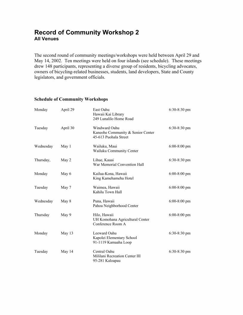
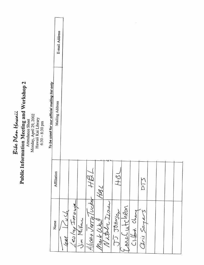
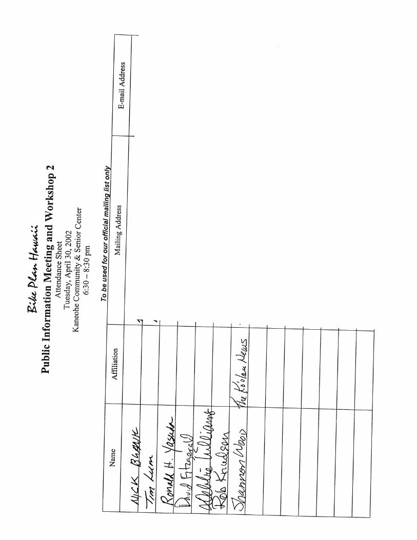
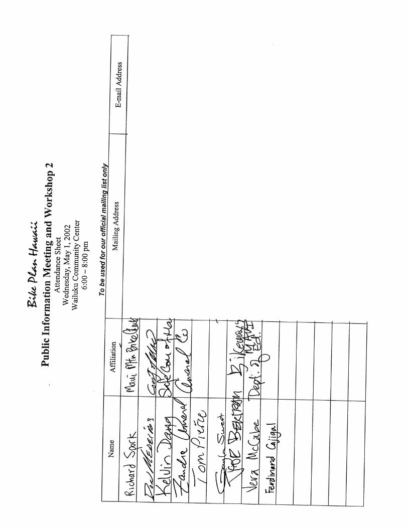
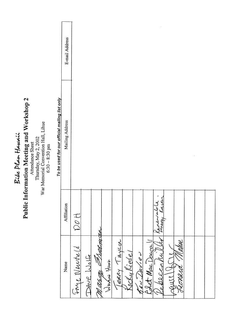
Record of Community Workshop 2 All Venues The second round of community meetings/workshops were held between April 29 and May 14, 2002. Ten meetings were held on four islands (see schedule). These meetings drew 148 participants, representing a diverse group of residents, bicycling advocates, owners of bicycling-related businesses, students, land developers, State and County legislators, and government officials. Schedule of Community Workshops Monday April 29 East Oahu
Hawaii Kai Library 249 Lunalilo Home Road
6:30-8:30 pm
Tuesday April 30 Windward Oahu Kaneohe Community & Senior Center 45-613 Puohala Street
6:30-8:30 pm
Wednesday May 1 Wailuku, Maui Wailuku Community Center
6:00-8:00 pm
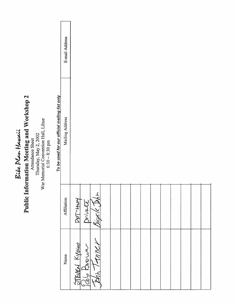
Thursday, May 2 Lihue, Kauai War Memorial Convention Hall
6:30-8:30 pm
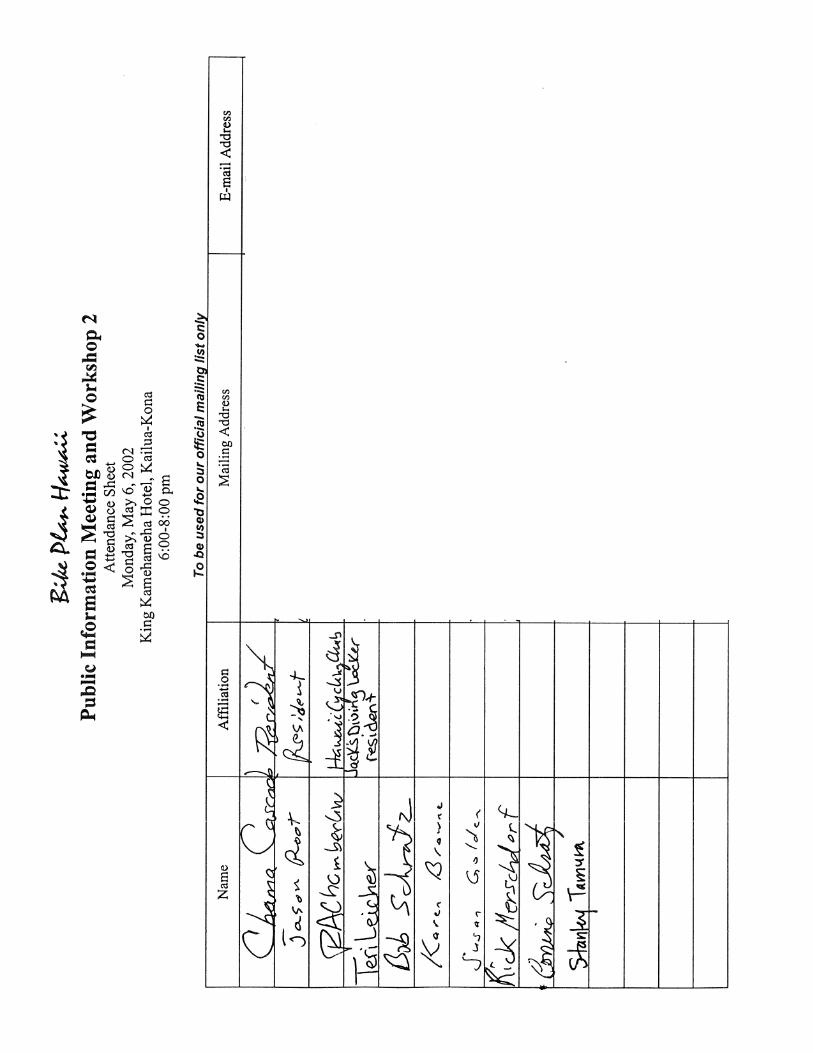
Monday May 6 Kailua-Kona, Hawaii King Kamehameha Hotel
6:00-8:00 pm
Tuesday May 7 Waimea, Hawaii Kahilu Town Hall
6:00-8:00 pm
Wednesday May 8 Puna, Hawaii Pahoa Neighborhood Center
6:00-8:00 pm
Thursday May 9 Hilo, Hawaii UH Komohana Agricultural Center Conference Room A
6:00-8:00 pm
Monday May 13 Leeward Oahu Kapolei Elementary School 91-1119 Kamaaha Loop
6:30-8:30 pm
Tuesday May 14 Central Oahu Mililani Recreation Center III 95-281 Kaloapau
6:30-8:30 pm
Purpose of the Workshop The objectives of this meeting were to review input received from the first round of meetings held in November 2001, introduce the key components of the plan, and solicit feedback on those elements that had been drafted to date, including:
• Proposed Goals, Objectives, and Actions • Methodology to Evaluate Bikeway Proposals • Statewide Bikeway Network (mapped) • Preliminary Prioritization of Bikeway Proposals
Agenda and Public Feedback All of the meetings used the same agenda, beginning with a brief introduction by Vince Llorin, State Bicycle and Pedestrian Coordinator. This was followed by an hour-long PowerPoint presentation that reviewed the planning process and explained the main components of the plan itself. The final segment of the program called for participants to examine maps showing the proposed bikeway network. Workshop participants were asked to provide three types of feedback into the planning process:
• Comment on a preliminary version of the plan objectives and actions • Fill out the evaluation criteria feedback form • Indicate preferred bikeway projects by placing dots on preliminary master plan
maps Questions and Comments Note: At some workshop venues, no questions or comments were raised during the time allotted, therefore, the group moved immediately into the interactive segment. East Honolulu Question: Are the results of the telephone survey statistically significant? Response: Yes, the results can be generalized to the population base from which the sample was drawn; i.e., the Big Island, Maui, Kauai, and the suburban and rural areas of Oahu. The surveyed population inhabits an area that is essentially coterminous with geographic scope of the bike plan. Question: Why does the State’s planning effort exclude a dominant part of the population, i.e., the Honolulu Primary Urban Corridor? Response: The PUC has its own bicycle plan, the Honolulu Bicycle Master Plan, completed in 1999. In developing that plan, the City and County of Honolulu implemented a rigorous public participation process. Because that plan was completed relatively recently, it made sense to focus resources on other parts of the state. Bike Plan Hawaii will fold in the recommendations of the Honolulu Bicycle Master Plan.
2
Question: If Bike Plan Hawaii is expanded in the future to include pedestrians, does that mean the plan will only cover shared-use facilities? Response: No, such a plan would include facilities intended exclusively for either bicycles or pedestrians, as well as shared-use facilities. There are three main reasons for a pedestrian facilities master plan. First, federal transportation policies, beginning with the landmark ISTEA legislation in 1991, increasingly recognize and promote walking as part of a balanced transportation system. In terms of programs and funding opportunities, bicycling and walking are often put in the same category. Second, by virtue of their location at the outer edges of roadways, there’s a strong interrelationship between two. There are shared design issues, for example, at intersections. Improvements to one will often benefit the other—and vice versa. For example, adding a bike lane also increases the buffer between pedestrians and cars. And both modes share an interest in traffic calming measures. Third, since the State has a coordinator for both bicycle and pedestrian facilities, a combined plan would help to structure and prioritize activities in the two arenas. Windward Oahu Comment: In order to reduce conflicts between bicycles and pedestrians on sidewalks, why not stencil a “no bicycling” decal on the pavement? Question: Why not add a 6th “E” for environment? Response: The plan acknowledges that bicycling puts less strain on the environment, through the Education and Encouragement objectives. We have included recommendations to better inform the public about the resource conserving aspects of bicycling and to promote bicycling as an environmentally friendly mode of transportation. Comment: I run an ecotourism website, and get regular inquiries from people who want to bike in Hawaii. Question: Is there a set standard for the width of bike lanes? What about car door accidents? Response: The national standard for developing bicycle facilities was published by the American Association of State Highway and Transportation Officials (AASHTO) in 1999. It specifies a minimum width of 4 feet for bike lanes where there is no on-street parking. The recommended minimum is 5 feet with on-street parking. In this case, the typical allowance is a minimum width of 11 feet, including 5 feet for the bike lane and 6 feet for the marked parking stall. The AASHTO guideline further recommends 13 feet where there is substantial parking or where the turnover of cars is high, e.g., in commercial areas. With an 8-foot wide parking lane, bikes would usually be outside the door zone. When they occur, door accidents can be serious; however, among all types of bike crashes, they tend to be relatively rare. A 1994 study of bicycle/motor vehicle crashes in Portland—a
3

city with high bicycle ridership—found that bicyclists hitting an open door accounted for less than 5 percent of all crashes. Question: I’ve lived in cities with successful bike networks. Why are they successful? Why do they work there? Response: There are cities on the Mainland where people have bought into bicycles, and others were people are resistant to change. In the successful places, they’ve been able to bring about a paradigm shift in how people plan for and construct transportation systems. But it takes a lot of time, and a lot of effort by a lot of people. Along with changes in how people view transportation, there’s an evolution underway in land-use design with more attention to accessibility and a greater mix of uses. Question: What if, under the best-case scenario, bicycling really takes off? Might there be negative consequences, such as loss of gas taxes or car registration fees? Response: If Hawaii gained recognition as a safe place for tourists to bicycle, the inflow of visitor dollars would probably offset the loss of revenues. Many tourists, especially those from overseas, would flood in. Question: Do people in the design profession talk to each other? Older professionals don’t seem to be in tune with the desire for better bicycling facilities. Response: Again, this is part of a paradigm shift. Historically, building bikeways weren’t part of a civil engineer’s training. To do so now requires retraining. Earlier this year, Vince Llorin organized a two-day seminar called “Designing Streets for Pedestrians and Bicycles” as part of a continuing education program for engineers. What’s promising is that because of strong interest among professionals in the public and private sectors, an extra session was added. Comment: There are too few bike racks. Bicyclists should be able to ride right out of the airport. Kona Question: Is it possible to have single-sided paths (i.e., adjacent to one side of the roadway); even though with bicyclists going both ways, it may look like bicyclists are going against traffic? Can’t there be signs instructing bicyclists to watch for vehicles turning at intersections? Response: Although that design solution typically is not recommended, the plan won’t have carte blanche design recommendations, where one size fits all. To some extent, each project needs site specific engineering designs and decisions should be made on a case-by-case basis.
4

Waimea Comment: When the Kawaihae Bypass is designed, there should be a path put in alongside the highway, but separate from it. It is uncomfortable riding alongside high-speed traffic, especially trucks. With the Bypass, there would be few cross streets, so intersections are less of a concern. In fact, the master plan should recommend that paths be provided alongside new highways on a routine basis. When Queen Kaahumanu Highway is widened from Henry Street to Makala (Old Airport Access Road), an 8-foot wide path will be put in on the makai side. Pahoa Comment: What percentage of tourist dollars stay in community if it’s spent by a bicycling tourist versus a motoring tourist? I suspect it’s higher for bicycling tourists. Question: Are there standards for ideal lot sizes to make an area more bicycle- and pedestrian-friendly? Response: Typical lot sizes vary from island to island. It’s about 3,000 SF on Maui, 5,000 SF on Oahu, and 10,000 SF on the Big Island. There’s a concept called the “friction of distance” referring to the effort needed to overcome distances. Of course, the friction of distance is greater for pedestrians and bicyclists than for motorists, so anything that contributes to distance reduces walking and bicycling convenience. At the same time, other important factors need to be considered, such as block size—which is a function of frontage or lot configuration—and the roadway network. With larger lots, blocks are typically larger, because it’s expensive for local roads to serve only a few lots. Evaluation Criteria Bike Plan Hawaii guides development of the bikeway network by categorizing proposals for new facilities into three timeframes: near-term, mid-term, and long-term. The evaluation process incorporates fourteen criteria to determine how the proposals are categorized. Workshop 2 participants were asked to give feedback about the importance of each criterion. Points are given (or, in some cases, subtracted) based on whether a proposed bikeway satisfies the following:
• Serves a population center • Provides access to public facility • Fills a missing link in the network • Provides a direct route • Provides an alternate route along streets with lower speeds and traffic volumes • Is a multi-user/multi-mode facility • Is like to attract visitors • Community has expressed support for the project • Avoids non-vehicular hazards (steep slopes, rock slides, unprotected drop-offs)
5
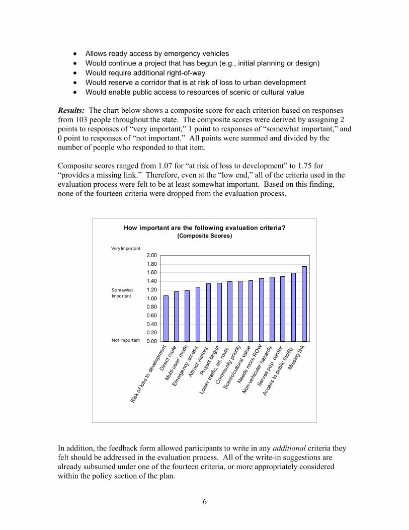
• Allows ready access by emergency vehicles • Would continue a project that has begun (e.g., initial planning or design) • Would require additional right-of-way • Would reserve a corridor that is at risk of loss to urban development • Would enable public access to resources of scenic or cultural value
Results: The chart below shows a composite score for each criterion based on responses from 103 people throughout the state. The composite scores were derived by assigning 2 points to responses of “very important,” 1 point to responses of “somewhat important,” and 0 point to responses of “not important.” All points were summed and divided by the number of people who responded to that item. Composite scores ranged from 1.07 for “at risk of loss to development” to 1.75 for “provides a missing link.” Therefore, even at the “low end,” all of the criteria used in the evaluation process were felt to be at least somewhat important. Based on this finding, none of the fourteen criteria were dropped from the evaluation process.
How important are the following evaluation criteria?(Composite Scores)
0.000.200.400.600.801.001.201.401.601.802.00
Risk
of lo
ss to
dev
elop
men
tDi
rect
rout
eM
ulti-
user
/ mod
e
Emer
genc
y ac
cess
Attra
ct vi
sitor
sPr
ojec
t beg
un
Lowe
r tra
ffic,
alt.
rout
e
Com
mun
ity p
riorit
y
Scen
ic/cu
ltura
l val
ue
Need
s m
ore
ROW
Non-
vehic
ular h
azar
ds
Serv
es p
op. c
ente
r
Acce
ss to
pub
lic fa
cility
Miss
ing lin
k
Not Important
Somewhat Important
Very Important
In addition, the feedback form allowed participants to write in any additional criteria they felt should be addressed in the evaluation process. All of the write-in suggestions are already subsumed under one of the fourteen criteria, or more appropriately considered within the policy section of the plan.
6

Several people mentioned “safety” so it is worth emphasizing that planners have safety as a foremost concern. Because the proposed facilities will be constructed to accepted national standards, it is assumed that all facilities will improve safety. Therefore, safety was attributed to all of the bikeway proposals, rather than being a distinguishing characteristic. Bikeway Preferences To help gauge community preferences for specific bikeway proposals, all workshop participants were asked to indicate their top choices by placing dot stickers on regional and local bike maps. Dots could be distributed as widely as desired or used to “vote” for a particular proposal. This exercise elicited considerable discussion among the participants as they traded stories of riding along different routes or explained the merits of various proposals. The following bikeway proposals garnered five or more dots. Kauai
• Bike path from Nawiliwili Harbor to Lydgate Park • Bike path from Kuna Bay to Anahola • Bike lane on Maluhia (Tree Tunnel) Road from Kaumualii Highway to Koloa • Bike route on Kaumualii Highway from Hanapepe to Maluhia Road • Kauai Commuter Bikeway from Kaumualii Highway (outside Lihue) to Wailua
Oahu
• Bike route on Kalanianaole Highway from Kailua Road to Olomana Golf Links • Bike route on Kalanianaole Highway from Sandy Beach to Kealahou Street • Bike route on Lilipuna Road in Kaneohe • Bike path on cane haul road between Waipio Point Access Road and Waipahu
Road • Bike path through Kipapa Gulch connecting Mililani and the Central Oahu
Regional Park (Waipio) • Bike lane striping at H-2 Mililani interchange • Bike lane along the entire length of Meheula Parkway (in Mililani) • Bike route on Kamehameha Highway between Mililani and Wahiawa • Complete unpaved segment of Pearl Harbor Historic Trail from Waipahu Depot
Road to West Loch Maui
• Bike route along future connection between Kihei/Makena and Upcountry (Ulupalakua)
• Coastal path from Kalama Beach Park to Kilohana Drive • Hookipa Coastal Trail from Hookipa Park to Hamakuapoko Road • Kihei Greenway extension along North-South connector road
7
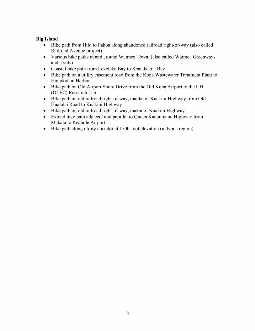
Big Island
• Bike path from Hilo to Pahoa along abandoned railroad right-of-way (also called Railroad Avenue project)
• Various bike paths in and around Waimea Town, (also called Waimea Greenways and Trails)
• Coastal bike path from Lekeleke Bay to Kealakekua Bay • Bike path on a utility easement road from the Kona Wastewater Treatment Plant to
Honokohau Harbor • Bike path on Old Airport Shore Drive from the Old Kona Airport to the UH
(OTEC) Research Lab • Bike path on old railroad right-of-way, mauka of Kuakini Highway from Old
Hualalai Road to Kuakini Highway • Bike path on old railroad right-of-way, makai of Kuakini Highway • Extend bike path adjacent and parallel to Queen Kaahumanu Highway from
Makala to Keahole Airport • Bike path along utility corridor at 1500-foot elevation (in Kona region)
8

Community Workshops (Round 2) April-May 2002Attendance Summary
Date Location Attendees Plan TeamEvaluation
Feedback Form
Mon, Apr. 29 East Oahu 10 4 10Tues, Apr. 30 Windward Oahu 8 4 6Wed, May 1 Wailuku 20 4 15Thurs, May 2 Lihue 14 4 7Mon, May 6 Kailua-Kona 37 4 25Tues, May 7 Waimea 6 4 4Wed, May 8 Pahoa 7 4 5Thurs, May 9 Hilo 7 4 6Mon, May 13 Leeward Oahu 8 3 6Tues, May 14 Central Oahu 31 3 19
Total 148 103