report of the devils lake asin technical review team of the devils lake asin technical review team...
TRANSCRIPT
Report of the Devils Lake Basin Technical Review Team Developed by: ND State Water Commission ND Department of Emergency Services US Army Corps of Engineers
August 2010
Ensuring a safe and secure homeland for all North Dakotans

Lower elevations depicted are based on Devils Lake’s main lakebed
As of publication, lake elevation is 1451.6 feet Mean Sea Level

Introduction
Devils Lake is a Closed Basin Lake (CBL) located in northeast North Dakota, and is a
sub basin of the Red River of the North drainage system. It is a CBL in that, although it
lies within the Red River drainage system, no water has naturally left the Devils Lake
Basin in recorded history (since the 1830s). Instead, the basin's surface runoff flows
through many small coulees (streams) and lakes and is collected by Devils Lake or
Stump Lake (located to the east of Devils Lake). There it remains until it evaporates,
enters the groundwater, or overflows naturally into the Red River via Stump Lake and
the Sheyenne River.
The natural state of Devils Lake is one of fluctuation. There is no “normal” lake level or
natural footprint for it to occupy. Yearly variations in precipitation, long-term climatic
instability, and the unusual hydrologic characteristics of the basin all contribute to this
volatility. Geologic evidence shows that the water level in Devils Lake has fluctuated
significantly from completely dry (about 1400 feet Mean Sea Level, or MSL) to
overflowing into the Sheyenne River (around 1458 feet MSL) since the end of the last
glacial period (about 10,000 years ago). According to the US Geological Survey, this
phenomenon may have occurred at least twice in pre-recorded history. Records from
the first European settlement in the area indicate that the lake level in the 1830s was
above 1440 feet MSL. That level dropped sporadically to reach a low of about 1402 feet
MSL in 1940. It rose again to 1429 feet MSL in 1987, and dropped back to 1423 feet
MSL in 1991. Ironically, one of the most contentious issues in the Devils Lake basin in
the late 1980’s- early 1990’s were concerns over the economic impacts of low lake
levels on the region.
Starting in 1993 and continuing to the present, Devils Lake has steadily risen to record
levels, and caused great damage and devastation in the process. During the spring and
summer of 2010, Devils Lake hovered in the area of 1452 ft MSL. The most recent
assessments of the National Weather Service (NWS) indicate the wet cycle feeding
Devils Lake will last for potentially another decade.
Net evaporation from Devils Lake averaged 8.5 inches per year during 1980-2006, but
varied widely depending on the weather. The US Geological Survey (USGS) probability
model accounts for evaporation on an annual basis. At current lake levels, this would
be equal to approximately 130,000 acre-feet of water evaporated from the lake in an
average year. In comparison, the average inflow for 1993-2006 was approximately
240,000 acre-feet per year.
The first benchmark denoting the advancement of Devils Lake towards an eventual spill
into the Red River of the North is for it to enter Stump Lake. This occurred in May 1999
when the lake reached 1446.6 ft MSL. The next benchmark (at around 1458 ft MSL) is
for water in Stump Lake to overtop the southwest end of that lake, and run into the
Tolna Coulee. From there it will flow into the Sheyenne River (a tributary to the Red),
which eventually exits the United States and terminates at the Hudson Bay in Canada.
The most recent predictions of the NWS regarding a continued wet cycle, if they come
true (and are not otherwise mitigated), could set conditions for such a natural spill of the
lake into the Red River of the North; the first such spill in recorded history.
2010 Technical Review Team Report Background
Throughout the course of the most recent spell of Devils Lake flooding, several studies,
reports, and assessments have been conducted by numerous state and federal
agencies (both singularly and in partnership with each other) in order to gain some
insight into how best to resolve the issue. The vast majority of these reports and
assessments were compiled as a result of collaboration between federal, state, local,
and tribal representatives spanning all disciplines and groups (first responder to policy
level).
The largest and most comprehensive collaboration effort in terms of agency
participation occurred in 1995, and resulted in the Devils Lake Basin Interagency Task
Force report. The Devils Lake Basin Interagency Task Force was formed in May 1995
after the North Dakota congressional delegation requested federal action to augment
President Clinton's May 16, 1995 disaster declaration, and to help coordinate the long-
term flood abatement efforts in the Basin. James Lee Witt, Director of the Federal
Emergency Management Agency (FEMA) at the time, agreed that FEMA would take the
lead in organizing and directing the task force, and appointed Michael Armstrong, then
Director of FEMA's Region Vlll, as its chair.
The 1995 task force's mission was to find and propose intermediate solutions to reduce
the impacts of high lake levels in the Devils Lake Basin. Intermediate solutions were
defined as remedial actions that could be achieved after or along with disaster
response efforts, but before the benefits from any long-term engineered solution could
be realized. The task force, which consisted of representatives of 75 local, state,
tribal, and federal stakeholders, was also charged with collecting pertinent study data
and coordinating the ideas, programs, and activities of the various entities involved in

coping with the rising lake levels. Any suggested solutions that were determined to take
more than five years to implement were to be referred to the U.S. Army Corps of
Engineers and the Bureau of Reclamation for incorporation into a lake stabilization
feasibility engineering study they were performing simultaneously.
The final report was a written product of the task force's work. It was a compilation of
resources and ideas which local and tribal officials could refer to as they worked
together to determine their intent for how the local and regional issues of Devils Lake
flooding would be addressed in their communities.
What was provided to local and tribal officials at the end of the task force’s efforts was a
compilation of six tasks deemed to require immediate action to set conditions for the
success of 18 action items (also identified in the report) judged feasible by the task
force to mitigate the flooding and its impacts in the Devils Lake Basin. These tasks and
action items were revisited in 1996 and 1999 by the task force agencies, resulting in the
publication of two updates detailing progress in each respective task or action item.
In August 2010, the USGS determined there is about a 9% chance of the lake
overflowing (factoring in the current state outlet) in the next 20 years. From a
hydrological standpoint, a 1% chance equates to “high risk” due to the potential
magnitude of damages and impacts to such things as downstream communities,
transportation networks, and agricultural lands. Such a high risk of a natural overflow is
not acceptable, and therefore intervention is essential to reduce this risk. Damages and
devastation were projected to continue in Devils Lake basin communities without
renewed efforts to mitigate them. In addition, potential downstream effects became a
bigger reality as part of the problems of Devils Lake flooding, should relief not come in
time to prevent the natural spill of the lake into the Sheyenne River and onward to the
Red River and Canada.
It was clear to federal and state officials that a renewed, formalized collaboration was
necessary in order to assist local and tribal officials in bringing relief to their
communities, and seek solutions that would lessen or eliminate the effects of continued
CBL flooding. Before such an effort could formally begin, an assessment was necessary
to determine the status of relief efforts implemented in the past so that present actions
took into account past lessons learned to better ensure the success of future
endeavors. The best and most logical point of departure for this activity was to leverage
the 1995 Devils Lake Basin Interagency Task Force report (with subsequent 1996 and
1999 updates) as a basis for current assessments, and with an eye toward supporting
any future multi-agency strategic planning efforts for the basin with these assessments.

With this philosophy in mind, the ND Department of Emergency Services (NDDES), ND
State Water Commission (NDSWC), and US Army Corps of Engineers (USACE)
formally partnered in mid-June of 2010 to participate in a state-led technical review of
the overall Devils Lake Interagency Task Force recommendations.
Although FEMA was the lead agency in the 1995 Devils Lake Basin Interagency Task
Force Report, its updated recommendations will be included in the upcoming Office of
Management and Budget report by the Federal Devils Lake Interagency working group.
The agencies participating in this report effectively represent the disciplines most
decisively engaged with support to local and tribal agencies as a result of Devils Lake
flooding, and possess the ability to accurately determine the status of structural and
non-structural measures in progress. They also can collaborate well on what the
possible next steps could be for any future strategic planning efforts to consider. With
the concurrence and guidance of their senior leadership, these three agencies formed
the Devils Lake Basin Technical Review Team (TRT). Their efforts began in late June
2010 and are documented in this report.
Devils Lake Basin TRT Intent Statement
The intent statement which guided the TRT is listed below:
Task:
Establish a multiagency state/ federal technical review team; consisting of
representatives from NDDES, NDSWC, and USACE; to collaborate on a coordinated
review of the 1995 Devils Lake Basin Interagency Task Force report.
Purpose:
•Jointly review the 1995 Devils Lake Basin Interagency Task Force report (and
subsequent 1996 and 1999 updates)
•Determine the current status of recommendations made in this report and updates
•Validate funding sources for the measures suggested in the 1995 report
•Identify possible next steps for future strategic planning efforts to consider as they
explore options to help relieve flooding impacts in the Devils Lake Basin
End State:
•1995 report, 1996 and 1999 updates reviewed
•Funding sources validated
•Conditions set for transition into a basin-wide strategic planning effort via a compilation
of possible next steps based on the original report
Assessment and Conclusions
The assessment of each of the tasks and action items recommended follows this
section, and is broken out in tabular format. A roll up of possible next steps for future
strategic planning efforts to consider (based off the 1995 report) are detailed
immediately below:
Possible Next Steps:
• A state-owned emergency outlet is currently in operation on the west end of Devils
Lake, and has a capacity of 250 cubic feet per second (cfs). This outlet is only part of
the effort to bring relief to the flooding situation in the basin. Both federal and state
efforts to establish additional east end outlet capacity should continue, in
synchronization with other flood relief efforts and in harmony with the concerns of all
stakeholders.
• One major challenge to increasing outlet capacity is the environmental concerns of
neighboring Minnesota and Canada. The states of North Dakota and Minnesota, along
with the federal government and the government of Canada, should define, as soon as
possible, revised water quality constraints allowable under the Clean
Water Act (US Environmental Protection Agency, or EPA) and the Boundary Waters
Treaty Act of 1909 (Department of State). Without decisions to relax water quality
standards, removing water from Devils Lake with the State’s outlet will be severely
restricted, and decisions regarding additional outlet capacity will be impossible.
• A determination is needed regarding what emergency situations, if any, will provide
leeway for bypassing environmental concerns for outlet management.
• Having additional outlet capacity may eliminate or significantly reduce the need for any
future financial investments in road networks, depending on the elevation at which the
lake is controlled. This includes future damages in the basin as well as potential
downstream damages to transportation networks if the lake spills at its natural overflow
level of 1458 ft MSL.
• Having additional outlet capacity may also potentially relieve parts of the road network
from serving as Roads Acting as Dams (RAADs), and greatly reduce dangers
associated with a RAAD failure.
• Overall lake level management negotiations must be incorporated into discussions on
future outlet structures and outlet planning as a matter operational need, along with
triggers detailing when to start and stop pumping.
• As part of outlet planning, consensus should be achieved on elevations at which
higher levels of sulfate and minor flooding along the Sheyenne are acceptable to reduce

the risk of the more severe damages that would be caused by a natural overflow and
damages around the Devils Lake Basin.
• Federal and/or state support to downstream communities on the Sheyenne River for
water treatment improvements may be necessary due to the potential for increased
sulfate levels from Devils Lake.
• Federal, state and local officials should collaborate and formalize planning for the
downstream effects of flooding (to include formalized hazard analysis and risk
assessment, hazard modeling, preparedness activities, and mitigation efforts) should
Devils Lake begin its natural flow into the Sheyenne River if more outlet capacity is not
realized in time.
• The Extended Storage Acreage Program (ESAP) operated by the ND State Water
Commission (SWC) is part of the overall solution regarding storage, but renewal of this
program is currently held up due to wetlands concerns by the US Environmental
Protection Agency (EPA). The EPA desires to make alterations to an agreement
between Natural Resource Conservation Service (NRCS), U.S. Army Corps of
Engineers (USACE), the U.S. Fish and Wildlife Service (USFWS), and them regarding
this program’s compatibility with wetlands regulation. These desired alterations should
be reviewed for acceptability between all stakeholders so the program can continue.
• Federal and state partners should continue seeking alternatives for storing water, such
as five-year contracts under ESAP versus 10 year ones.
• Flood Insurance Rate Maps (FIRMs) must be brought up to date and placed in digital
format (DFIRMs) so they are compatible with modern Geographical Information
Systems (GIS).
• Mapping processes need to be updated so Base Flood Elevations (BFEs) do not go
"out of date" as the lake continues to rise.
• Continue efforts to increase awareness of land and water management through
education and economic incentives.
• Water quality and soil monitoring should continue on an annual basis. The information
provided is valuable to other studies and solutions for the basin.
• The issues of protecting and/or relocating of sewage treatment, rural utility and rural
water systems will require continued emphasis as CBL flooding continues.
• The lagoon serving the City of Devils Lake will require future, continuous analysis to
determine if continued groundwater rise will impact the operation of this facility.
• The City of Minnewaukan water tower needs relocation due to lake encroachment.
Funding is available, but action on this activity depends on the city’s overall plan for
their future in relation to the lake rise. Decisions are needed from the city on their intent
for the water tower, as well as the overall future strategic direction of the city as a whole.
• Any future, strategic road raises should aim for 1465 feet MSL.

• Future Federal Highway Administration Emergency Relief (ER) program funding
requests exceeding the $100 Million per state per disaster cap are anticipated as lake
levels continue to rise.
• Local governments should conduct/ continue to conduct strategic analysis of which
roads are essential to their network, and plan to abandon those roads which are not
deemed of strategic value.
• The value of flood proofing structures is problematic at best now, in light of projected
continued rises in lake elevations without known relief in sight. If any future flood
proofing is considered, the emphasis should be on flood proofing structures at/ above
elevation 1458 ft MSL.
• The counties of Towner and Nelson are becoming impacted by the rise of the lake and
continued flooding in the basin. Planning for voluntary property acquisitions in these
counties needs to begin now so future efforts can occur in a timely manner.
• Acquisitions, regardless of funding source or program, remain an effective solution for
removing people from the floodplain. They relieve the immediate danger to those in the
floodplain, and help ensure future concerns are alleviated via deed restrictions.
Emphasis is needed to ensure bills containing disaster relief funds are adequately
funded, and supplemental funding is not held up, so future acquisitions (inside and
outside the basin) can continue without delay and within the short construction season
North Dakota has available.
• Continue to research and develop options to assist landowners in removal of
structures before the water reaches them. The State of North Dakota prefers an
extension of the FEMA NFIP flood endorsement policy to current flood insurance
owners who reside on or are directly affected (being flooded) by Devils Lake, allowing
the removal of structures covered under flood insurance before they are inundated. This
preference is based on past overall successes with the NFIP closed basin
endorsement.
• Establish imminent threat criteria for the Flood Mitigation Assistance (FMA) program.
Then, allow implementation of FMA using imminent threat criteria to voluntarily acquire
structures before they are inundated.
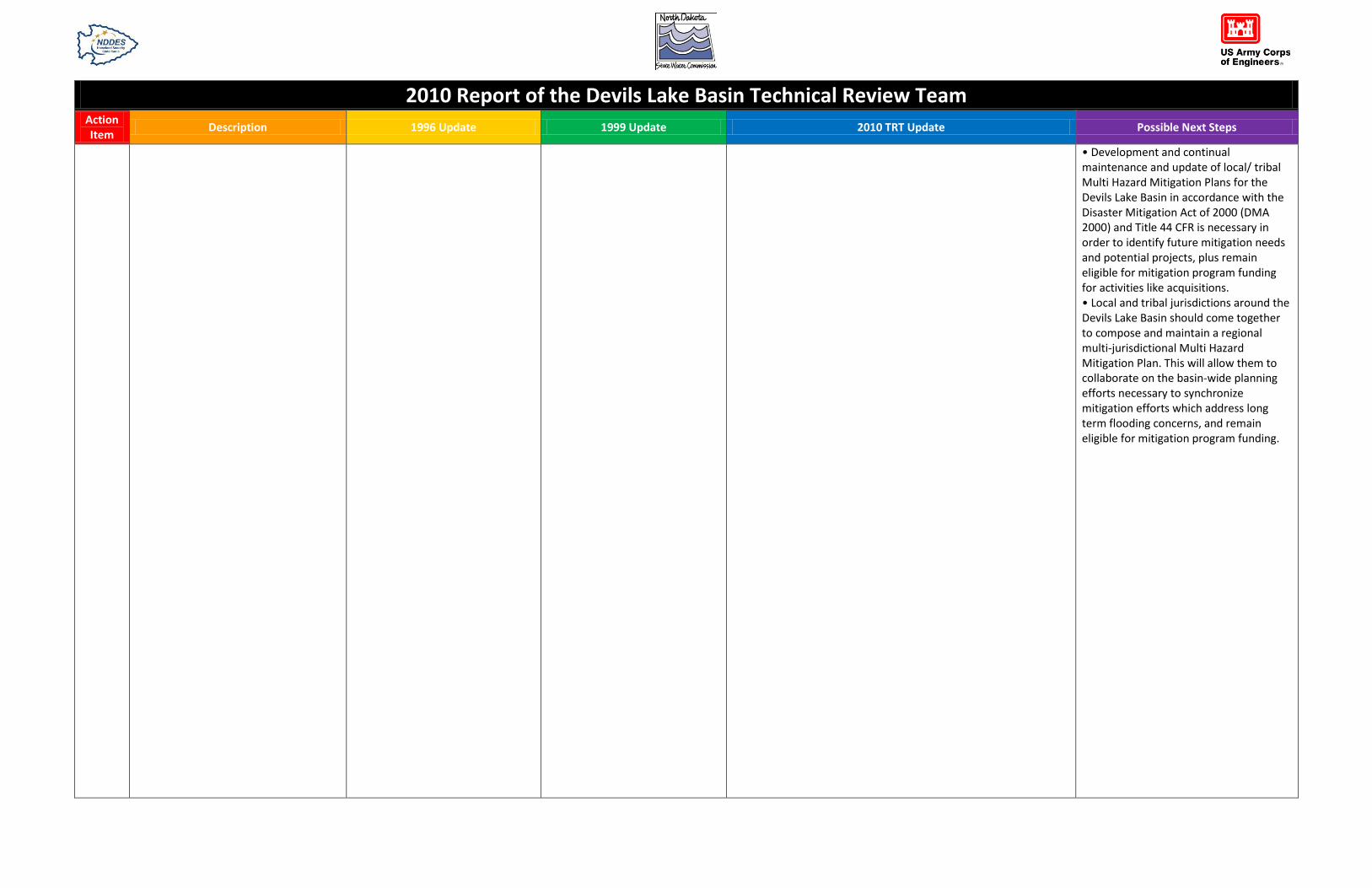
• Development and continual maintenance and update of local/ tribal Multi Hazard
Mitigation Plans for the Devils Lake Basin in accordance with the Disaster Mitigation Act
of 2000 (DMA 2000) and Title 44 CFR is necessary in order to identify future mitigation
needs and potential projects, plus allow local/ tribal jurisdictions to remain eligible for
mitigation program funding for activities like acquisitions.
• Local and tribal jurisdictions around the Devils Lake Basin should come together to
compose and maintain a regional multi-jurisdictional Multi Hazard Mitigation Plan
(MHMP). This will allow them to collaborate on the basin-wide planning efforts
necessary to synchronize mitigation efforts which address long term flooding concerns,
and remain eligible for mitigation program funding.
• Continue efforts to identify financial and technical assistance for flood-impacted
businesses, and to diversify the economic base of the region, so that residents are
encouraged to remain in the area and a tax base is strong enough to support local flood
fighting requirements.
• Sustain advanced emergency planning efforts as the lake continues to rise. The
National Weather Service stated on July 15, 2010 that the wet cycle is projected to
possibly continue another 10 years, and such efforts will remain a necessity to ensure
federal, state, local, and tribal jurisdictions stay out front of the requirements curve.
• Do not wait until a dry cycle begins to start projecting planning requirements for the
eventual drop of lake levels in the long term.
• Archive current emergency planning efforts for flooding for future generations to use
when the lake rises again.
• Continue efforts already in progress to enhance recreation opportunities in the Devils
Lake Basin. One of the few positives to come out of continuous flooding is increased
interest in outdoor activities (especially fishing), particularly from out of state.
• Plan and act knowing Devils Lake will always be in flux; stability will be the exception
rather than the rule.
2010 Report of the Devils Lake Basin Technical Review Team Action Item
Description 1996 Update 1999 Update 2010 TRT Update Possible Next Steps
Task 1
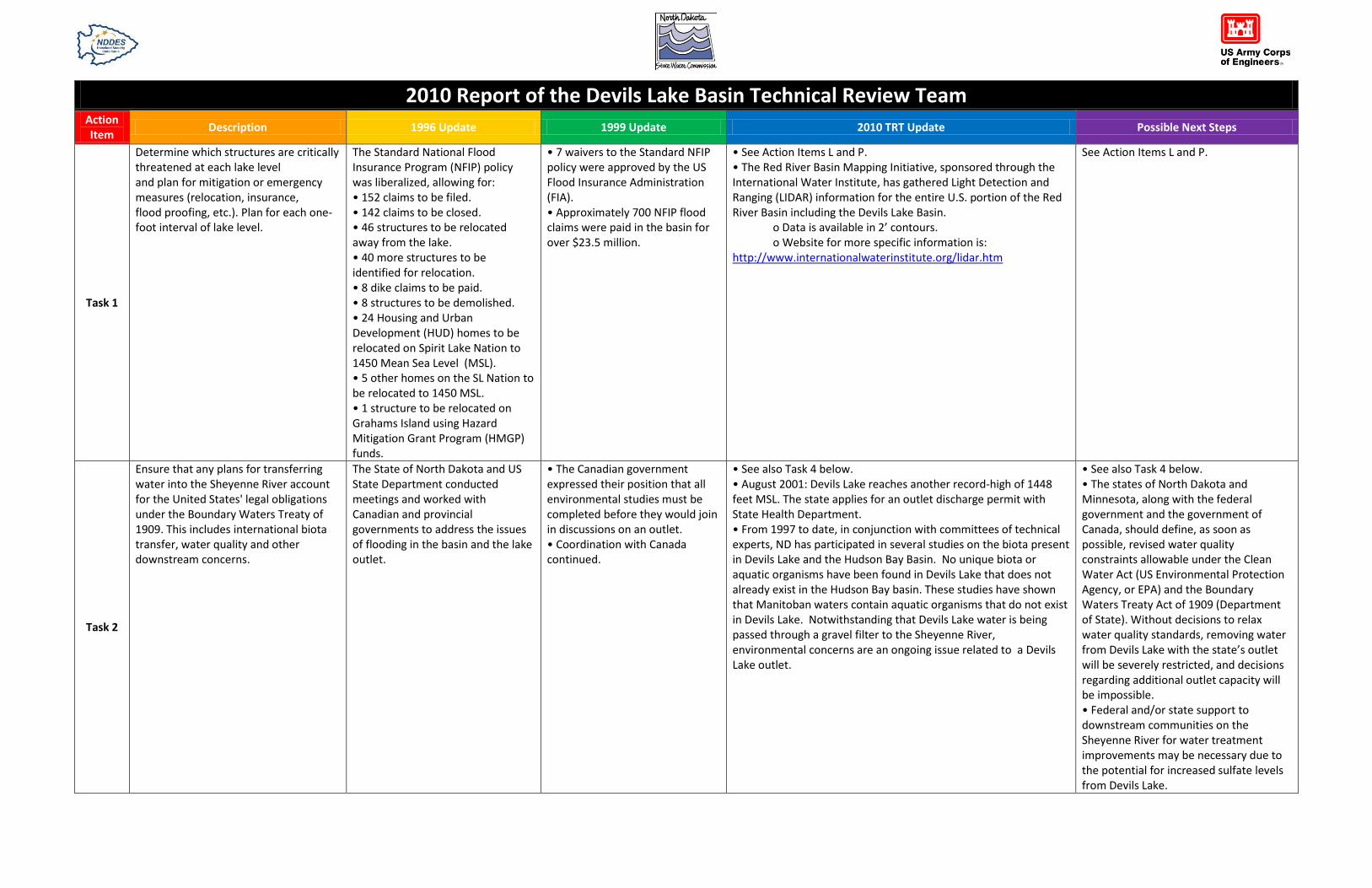
Determine which structures are critically threatened at each lake level and plan for mitigation or emergency measures (relocation, insurance, flood proofing, etc.). Plan for each one-foot interval of lake level.
The Standard National Flood Insurance Program (NFIP) policy was liberalized, allowing for: • 152 claims to be filed. • 142 claims to be closed. • 46 structures to be relocated away from the lake. • 40 more structures to be identified for relocation. • 8 dike claims to be paid. • 8 structures to be demolished. • 24 Housing and Urban Development (HUD) homes to be relocated on Spirit Lake Nation to 1450 Mean Sea Level (MSL). • 5 other homes on the SL Nation to be relocated to 1450 MSL. • 1 structure to be relocated on Grahams Island using Hazard Mitigation Grant Program (HMGP) funds.
• 7 waivers to the Standard NFIP policy were approved by the US Flood Insurance Administration (FIA). • Approximately 700 NFIP flood claims were paid in the basin for over $23.5 million.
• See Action Items L and P. • The Red River Basin Mapping Initiative, sponsored through the International Water Institute, has gathered Light Detection and Ranging (LIDAR) information for the entire U.S. portion of the Red River Basin including the Devils Lake Basin. o Data is available in 2’ contours. o Website for more specific information is: http://www.internationalwaterinstitute.org/lidar.htm
See Action Items L and P.
Task 2
Ensure that any plans for transferring water into the Sheyenne River account for the United States' legal obligations under the Boundary Waters Treaty of 1909. This includes international biota transfer, water quality and other downstream concerns.
The State of North Dakota and US State Department conducted meetings and worked with Canadian and provincial governments to address the issues of flooding in the basin and the lake outlet.
• The Canadian government expressed their position that all environmental studies must be completed before they would join in discussions on an outlet. • Coordination with Canada continued.
• See also Task 4 below. • August 2001: Devils Lake reaches another record-high of 1448 feet MSL. The state applies for an outlet discharge permit with State Health Department. • From 1997 to date, in conjunction with committees of technical experts, ND has participated in several studies on the biota present in Devils Lake and the Hudson Bay Basin. No unique biota or aquatic organisms have been found in Devils Lake that does not already exist in the Hudson Bay basin. These studies have shown that Manitoban waters contain aquatic organisms that do not exist in Devils Lake. Notwithstanding that Devils Lake water is being passed through a gravel filter to the Sheyenne River, environmental concerns are an ongoing issue related to a Devils Lake outlet.
• See also Task 4 below. • The states of North Dakota and Minnesota, along with the federal government and the government of Canada, should define, as soon as possible, revised water quality constraints allowable under the Clean Water Act (US Environmental Protection Agency, or EPA) and the Boundary Waters Treaty Act of 1909 (Department of State). Without decisions to relax water quality standards, removing water from Devils Lake with the state’s outlet will be severely restricted, and decisions regarding additional outlet capacity will be impossible. • Federal and/or state support to downstream communities on the Sheyenne River for water treatment improvements may be necessary due to the potential for increased sulfate levels from Devils Lake.

2010 Report of the Devils Lake Basin Technical Review Team Action Item
Description 1996 Update 1999 Update 2010 TRT Update Possible Next Steps
Task 3
Begin contacting upper basin landowners to raise awareness of the need for both permanent and temporary, voluntary, on-land storage, and explore options for easements.
• A goal of 75,000 acre feet of upper basin storage was established by the task force, equating to one foot of lake level reduction. • 13,500 acre feet of storage was secured, including 1,600 acre feet by US Fish and Wildlife Service (USFWS).
Over 28,000 acre-feet of water storage was achieved through various federal and state programs as identified below: • The ND State Water Commission (NDSWC) had approximately 21,000 acre feet of water being stored under the Available Storage Acreage Program (ASAP). • USFWS had completed 15 wetland development projects on public land, storing 3,146 acre feet of water. • North Dakota Wetlands Trust (NDWT) had 1,586.9 acres of drained wetlands committed to restoration under the Conservation Reserve Program (CRP)-Piggyback Program. The NDWT also had 460.6 acres of drained wetlands committed to restorations and an additional 447.8 acres of existing wetlands protected. • The Natural Resources Conservation Service (NRCS) Emergency Watershed Protection Program had four contracts for 1,153 easement acres in 1997 and 1,670 acres in 1998.
• As of August 2003, water storage through the various programs in the Devils Lake Basin has decreased to 20,000 acre-feet of storage. Satellite images show over 390,000 acres inundated as of 2010 that were not inundated in 1991, thus much of the land previously under storage is now underwater along with potential land that may have been available for storage. • Due to the high cost and short-term nature of ASAP, the NDSWC changed its approach by creating the Extended Storage Acreage Program (ESAP). • ESAP provides for 10-year water storage contracts and is more efficient and cost effective than ASAP. About 1,000 acre-feet of water is stored on 338 acres by ESAP. • The first 10-year contracts are now expiring, and the NDSWC seeks to extend ESAP for another 10-year period. • Four federal agencies have jurisdiction over wetlands: the EPA, NRCS, U.S. Army Corps of Engineers (USACE) and USFWS. North Dakota wants all agencies to agree that water storage created through the ESAP program would not be treated as a jurisdictional wetland. This agreement provided landowners until December 31, 2014 to return ESAP sites to pre-project conditions. • The original ESAP contract ended December 31, 2009. In August of 2009, NDSWC staff began contacting the four federal agencies about renewal of ESAP and the agreement that prevented ESAP sites from being considered a jurisdictional wetland. • The NRCS, USACE, and FWS all agreed to renew the agreement by December of 2009. • In May of 2010, EPA indicated that they would be unable to renew the existing agreement, and that their legal counsel would need to make alterations to the agreement, in order for it to be acceptable. • NDSWC staff is sending letters to the other three federal agencies, informing them of the changed project status.
• Review EPA alterations, and determine if they are acceptable to the other federal agencies, the NDSWC, and landowners. • Continue seeking alternatives for storing water, such as five-year contracts. • If the four federal agencies and NDSWC are able to reach a consensus on the wetland agreement, extend ESAP further.

2010 Report of the Devils Lake Basin Technical Review Team Action Item
Description 1996 Update 1999 Update 2010 TRT Update Possible Next Steps
Task 4
Ensure continual coordination with the ongoing Corps of Engineers/Bureau of Reclamation long-term study, including these concerns: • The planning process for any future outlet from the Devils Lake Basin to the Sheyenne River should consider drawing water from northern West Bay, where the water quality is highest and comparable to that of the Sheyenne. • The feasibility study should include full cooperation with ongoing work and technical discussion on the international treaty issues (see Task 2, above). • The planning process for any future outlet should consider: o the mean lake level and range agreed to by local governments (see Task 5, below); o the interim (and subsequent official) regulatory flood elevations; o including equipment for real- time monitoring of significant components of water quality; o incorporating an inlet component; and o future on-land water storage in the upper Basin.
Approximately $2 million was provided for the USACE/ St. Paul District to conduct a long term lake stabilization feasibility study. Money from this study was also used to develop the Devils Lake emergency outlet plan.
• The 1997 Emergency Supplemental Appropriations Act included $5 million for preconstruction engineering and design and an environmental impact statement for an emergency outlet. • The Fiscal Year 1999 Energy and Water Development Appropriations Act contained $5 million for construction of the outlet subject to completing economic and environmental analyses, reporting to Congress, and consulting with the International Joint Commission concerning the Boundary Waters Treaty Act. • Economic and environmental studies were under way, with a draft of an interim report to Congress scheduled for April 1999. • The Environmental Impact Statement (EIS) Record of Decision (ROD) was scheduled to be issued in May 2000.
• May 1999: Devils Lake reaches 1,446.6 feet MSL and begins overflowing into Stump Lake. • Spring 2001: North Dakota Legislature passes two bills allowing and funding construction of an emergency outlet. • August 2001: Devils Lake reaches another record-high 1448 feet MSL. The state applies for an outlet discharge permit with the State Health Department. • August 15, 2001: Gov. John Hoeven states that Manitoba Premier Gary Doer prefers the risk of a Stump Lake overflow to construction of an outlet, after Doer opposes the outlet construction. • December 2002: NDSWC releases the “2002 Water Quality Report for the State of North Dakota's Devils Lake Outlet Project.” It says that, under a wet scenario, a state emergency outlet operating for 10 years would remove about 171,000 acre-feet of water. At an elevation of 1,447 ft MSL, the report states this acre-feet quantity equates to about 17 inches off Devils Lake, enough of a reduction in damages to pay for the project. • Spring 2003: The North Dakota Legislature unanimously passes Senate Bill (SB)2193, which allows the issuance of bonds for the construction of an emergency outlet from Devils Lake through 2005. • April 2003: USACE issues its final EIS on the feasibility of a permanent Devils Lake outlet. None of the options presented meet federal cost-benefit ratios. It offers an alternative, the Pelican Lake outlet. At its maximum capacity, that would move 300 cubic feet per second (cfs) south to the Sheyenne River with an advanced sand filter and an estimated $185 million price tag, which 35 percent would have to be paid for by the state. That outlet would reduce the chance of a Devils Lake overflow over 50 years from 9.4 percent to 4.6 percent, but it would not prevent a natural overflow. • July 2003: U.S. Secretary of State Colin Powell writes letters to federal agencies addressing the unresolved environmental concerns involving the Boundary Waters Treaty of 1909 between the United States and Canada. • 2004: Devils Lake sets another record, reaching 1,449 feet above sea level. • August 5, 2005: The $28 million state Devils Lake outlet begins pumping water for the first time during a test run. It runs 11 days before shutting down for the year. • 2006: The Devils Lake outlet does not operate, because conditions do not meet the standards of its permit with the North
• The existing state-owned outlet is only part of the effort to bring relief to the flooding situation in the basin. Both federal and state efforts to establish additional east end outlet capacity should continue, in synchronization with other flood relief efforts and in harmony with the concerns of all stakeholders. • Collaborate and formalize planning for downstream effects flooding (to include formalized hazard analysis and risk assessment, hazard modeling, preparedness activities, and mitigation efforts) should Devils Lake begin its natural flow into the Sheyenne River if more outlet capacity is not realized in time.

2010 Report of the Devils Lake Basin Technical Review Team Action Item
Description 1996 Update 1999 Update 2010 TRT Update Possible Next Steps
Dakota Health Department. • June 11, 2007: The outlet resumes its operation for the first time since August 2005. • August 24, 2007: Devils Lake's level is about 1,447.5 feet MSL, more than a foot lower than in 2004. Stump Lake is about the same elevation. Meanwhile, the outlet was shut off a week earlier due to permit restrictions. • 2008: The outlet operation is limited due to permit restrictions. • 2009: The ND State Health Department authorizes 750 parts per million (ppm) sulfate levels (previously 450 ppm) in the Sheyenne River above Baldhill Dam, while still maintaining all EPA/ Boundary Waters Treaty requirements. This allows the state outlet to run at 100 cfs from June to October – the longest duration since completion. • 2009 and 2010: New lake level records are set almost daily outside of freeze up. Current lake level as of July 15, 2010 is 1452.01 ft MSL. • June 10th, 2010: Governor Hoeven sends a letter to Headquarters USACE requesting the Corps undertake action to install a control structure and outlet on the east end of Devils Lake (Stump Lake), provide assistance with the expansion of the State’s existing emergency outlet on the west end of the lake (a 404 permit, and necessary regulatory approval for construction), and assist with funding through the USACE Section 594 program or similar cost share funding to assist with outlet expansion. • June 2010: ND completes outlet expansion from 100cfs to 250cfs – with uninterrupted operation to could remove 100,000 acre-feet of water per year/ per season unless constrained by water quality compliance or flooding. • The National Weather Service (NWS) stated on July 15, 2010 that the wet cycle is projected to possibly continue another 10 years.

2010 Report of the Devils Lake Basin Technical Review Team Action Item
Description 1996 Update 1999 Update 2010 TRT Update Possible Next Steps
Task 5
Reach consensus on the mean level to which Devils Lake should be stabilized and the acceptable range around that mean.
Initial conclusions found that, if Devils Lake is to be stabilized, the mean level to which the lake is to be stabilized will result from the USACE lake stabilization feasibility study listed under Task 4.
No change. • Devils Lake is currently at an elevation of 1452 ft MSL, and if the wet cycle continues lake levels will likely continue to increase. • The state outlet is currently capable of removing approximately 100,000 acre-feet per year from the lake if neither the flood or water quality constraints are triggered. • The average inflow since 1993 has been approximately 240,000 acre-feet. Unless the runoff decreases or the constraints on outlet operation are relaxed, the best that can be hoped for is to reduce the future rate of rise.
• Future consensus should be achieved on elevations at which higher levels of sulfate and minor flooding along the Sheyenne are acceptable in order to reduce the risk of the more severe damages that would be caused by a natural overflow. • Overall lake level management negotiations must be incorporated into discussions on future outlet structures and outlet planning as a matter operational need, along with triggers detailing when to start and stop pumping. • Determinations are needed regarding what emergency situations, if any, will provide leeway for bypassing environmental concerns for outlet management.
Task 6
Develop maps of the regulatory floodplain around the lake. Establish an interim regulatory flood elevation to use until the maps are ready. Regulations based on the elevation adopted by the basin's local governments will guide present and future development, relocation, and redevelopment away from flood prone areas.
The Federal Emergency Management Agency (FEMA) provided funding to USACE to perform this task. The final maps were projected for completion in December, 1997.
• All communities and counties in the basin (with the exception of Cavalier County) were participating in the NFIP. • The Preliminary Flood Insurance Study was completed. This process was delayed because of the continuous rising of the lake level. • Maps of the preliminary study were printed and presented to the communities around Devils Lake in the Spring 1999 for review. • The base flood elevation (1% chance still water elevation) was projected to be 1450 feet MSL. An additional .5 to 3.0 feet was added to the still water elevation depending on location.
• See “Background information on the 10 affected NFIP communities, with historic and current mapping information” at the “*” below. • A FEMA funded restudy to digitize the Ramsey County portion of Devils Lake using a 1450 foot MSL Base Flood Elevation (BFE) is currently on-hold. • A revisitation of the identified flood hazard for the entire lake (affecting all 10 NFIP communities) will need to address: o recognized flood protection of an existing flood protection system for the immediate area of the City of Devils Lake. o an updating of scientific information on the lake (compiled by the US Geological Survey, or USGS). o a physical change in the Stump Lake outlet elevation. o enlisting partners/sponsors to undertake and fund such a restudy. • The lake, on two instances, has passed the regulatory base flood elevation (BFE) of the 1% chance annual flood as identified by detailed technical analysis and formal study by FEMA through the NFIP. The latest example - the Devils Lake gage at Creel Bay on July 15, 2010 (3:00 pm) read 1451.93’ MSL. • By comparison, the BFE currently identified through the NFIP on all its mapping is 1450’ MSL (without wind affected or wave run-up conditions).
• Maps must be brought up to date and placed in digital format so they are compatible with Geographical Information Systems (GIS). • Mapping processes need to be updated so the BFE does not go "out of date" as the water continues to rise.

2010 Report of the Devils Lake Basin Technical Review Team Action Item
Description 1996 Update 1999 Update 2010 TRT Update Possible Next Steps
A
Implement a comprehensive program of both water storage and land and water management.
• See Task 3 above. • A proposal to transfer water from Devils Lake to Stump Lake via a Stump Lake outlet was shelved. The state needed 80-90% of the rights-of-way voluntarily, and was able to secure approximately 56% of the land rights-of-way.
• See Task 3 above. • See Task 3 above. • Water and land management is largely a local prerogative in North Dakota with stimulus and support provided by various state and federal programs. The Devils Lake Joint Water Board has taken a lead role with ongoing involvement over time from most if not all entities listed as potential participants.
See Task 3 above.
B
Increase awareness of land and water management through education and economic incentives.
• The USGS, along with other agencies, developed a brochure to explain the water quality issues present in the basin. • ND State University's Extension Service, in cooperation with the Upper Basin Management Committee, published newspaper advertisements on the importance of upper basin water management.
• Over $2.9 million was been spent on ASAP in the previous three years and $950,000 was been allocated for 1999. • In FY 1996, 1997, and 1998, the EPA provided over $700,000 to the State Water Commission for a variety of wetland related activities, many of which are directed to the Devils Lake Basin.
• With the continued wet cycle and rising lake, many potential storage areas are already holding water. • Most of the participants supporting this task have been working on a continuing basis with the Devils Lake Joint Water Board who has taken a lead in basin water and land management related to the flooding problems. • A listing of many Devils Lake Joint Water Board activities from 1995 through 2005 (when the list was tabulated) is available at this web address: http://www.swc.state.nd.us/4dlink9/4dcgi/GetSubContentPDF/PB-936/BASIN%20PROJECTS%2095-05.pdf • An example is the development of their first comprehensive Devils Lake Basin Water Management Plan in 1995. Development of that plan (and its updates published in 2002 and 2006) have involved broad, formal stakeholder participation with multiple public meeting opportunities. The board will soon begin an update of the 2006 basin plan. • Other examples of projects lead by the board are: o cost-share and management of flood storage with a new control structure at the Morrison Lake outlet. o support for the North American Wetland Conservation Act projects in the basin. o cost share for the Devils Lake Downstream Awareness Coordinator position. o cost share with the USGS and SWC for water quality monitoring programs. o Watershed Restoration Action Strategy program used to conduct water quality monitoring in the upper basin. o coordination of the multi-year Upper Basin Water Utilization Test Project. • The board has remained very active participating/coordinating a wide range of efforts over the years and is expected to continue into the future. The State Water Commission provides technical
Continue efforts already in progress.
2010 Report of the Devils Lake Basin Technical Review Team Action Item
Description 1996 Update 1999 Update 2010 TRT Update Possible Next Steps
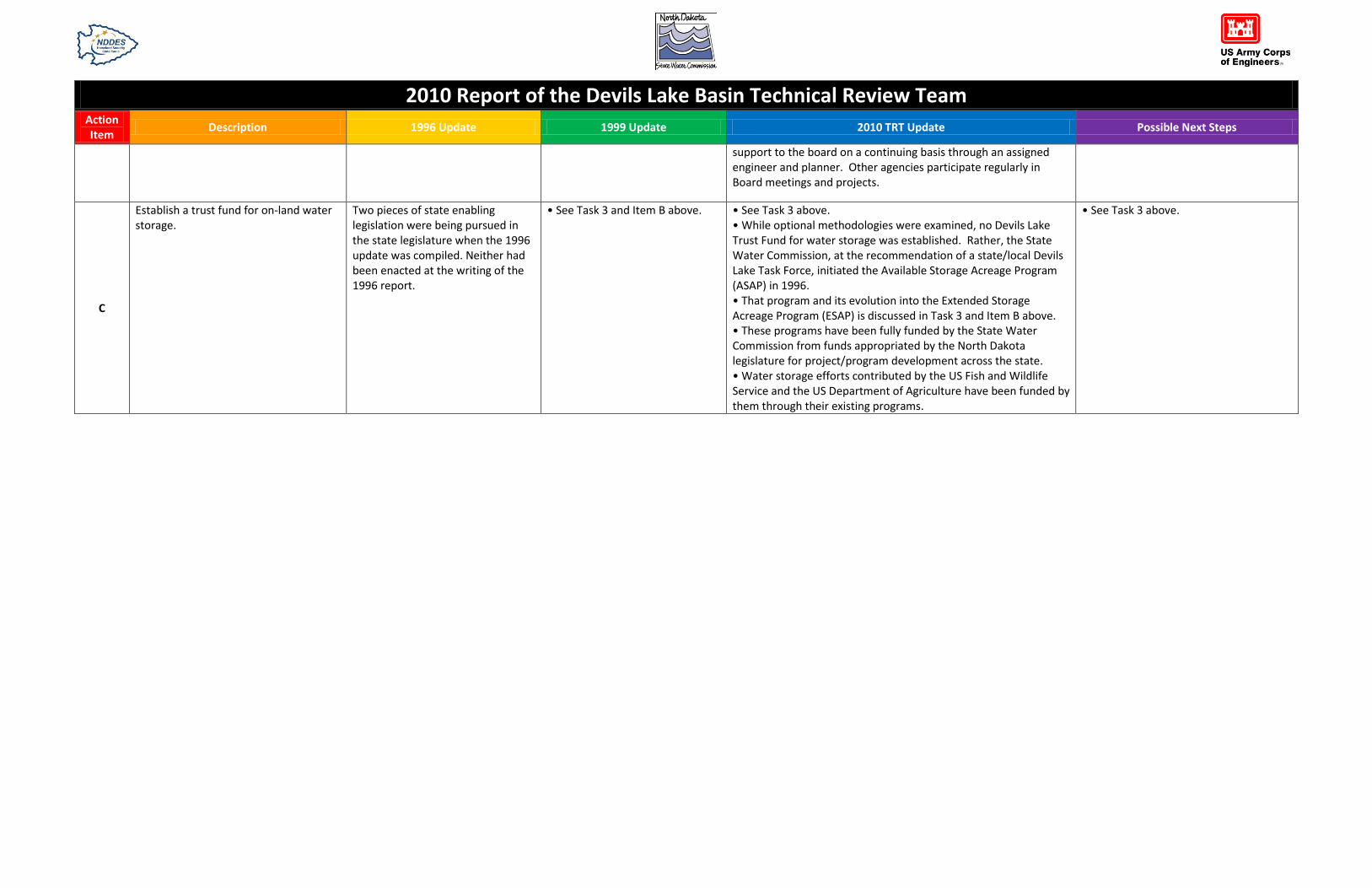
support to the board on a continuing basis through an assigned engineer and planner. Other agencies participate regularly in Board meetings and projects.
C
Establish a trust fund for on-land water storage.
Two pieces of state enabling legislation were being pursued in the state legislature when the 1996 update was compiled. Neither had been enacted at the writing of the 1996 report.
• See Task 3 and Item B above. • See Task 3 above. • While optional methodologies were examined, no Devils Lake Trust Fund for water storage was established. Rather, the State Water Commission, at the recommendation of a state/local Devils Lake Task Force, initiated the Available Storage Acreage Program (ASAP) in 1996. • That program and its evolution into the Extended Storage Acreage Program (ESAP) is discussed in Task 3 and Item B above. • These programs have been fully funded by the State Water Commission from funds appropriated by the North Dakota legislature for project/program development across the state. • Water storage efforts contributed by the US Fish and Wildlife Service and the US Department of Agriculture have been funded by them through their existing programs.
• See Task 3 above.

2010 Report of the Devils Lake Basin Technical Review Team Action Item
Description 1996 Update 1999 Update 2010 TRT Update Possible Next Steps
D
Design and implement a comprehensive water quality monitoring program.
Sampling took place at 9 locations, were analyzed and made available for public review.
• Water quality testing and sampling in the basin continued as an ongoing process by the North Dakota State Health Department and the North Dakota State University Extension Service. • Ten sites were monitored during the following years: o 1995-4 times. o 1996-6 times. o 1997-6 times. o 1998-4 times. • The sites tested were in 6-Mile Bay, Main Bay, Creel Bay, East Bay, Black Tiger Bay, and East Devils Lake. • The State Health Department also worked with the Army Corps of Engineers on the scoping process for the EIS on the Devils Lake Outlet. • The USGS developed a lake level probability computer model. They also collected water quality data in the Devils Lake and downstream (the Sheyenne and Red Rivers) in order to simulate probable future conditions in the lake with and without an outlet.
This remains an ongoing effort. The ND Department of Health is monitoring the Devils Lake chain of lakes four times a year, and the Sheyenne River from Flora, ND to the confluence with the Red River frequently.
Water quality monitoring should continue on an annual basis. The information it provides is valuable to other studies and solutions for the basin.

2010 Report of the Devils Lake Basin Technical Review Team Action Item
Description 1996 Update 1999 Update 2010 TRT Update Possible Next Steps
E
Collect data on salinity of Basin soils. • USFWS worked with the NDSU Extension Service on two demonstration sites on USFWS restored wetlands. Data gathered on acres of salinity-affected soils in the basin was made available to multiple agencies. • NDSU drilled sample sites and conducted studies of the changes in salinity around restored wetlands.
No specific update provided. • Soil monitoring continues as an ongoing effort by multiple agencies.
Soil monitoring should continue on an annual basis. The information it provides is valuable to other studies and solutions for the basin.
F
Consider the flood hazard in development decisions; adopt floodplain management standards and get flood insurance.
• See Task 6 above. • All counties and communities around the lake (except the Spirit Lake Nation) participated in the NFIP at the time of the 1996 report • Flood Insurance workshops were conducted in the basin. Also the floodplain administrators from Creel Township and Ramsey County attended the FEMA floodplain management-National Flood Insurance course. • Nelson, Benson, and Ramsey counties and the City of Minnewaukan adopted 1440 feet MSL as their interim regulatory flood elevation. • The Spirit Lake Sioux Tribe at Fort Totten adopted 1450 feet MSL as their interim regulatory flood elevation, although it was not participating in the National Flood Insurance Program.
See Task 6 above. See Task 6 above. See Task 6 above.

2010 Report of the Devils Lake Basin Technical Review Team Action Item
Description 1996 Update 1999 Update 2010 TRT Update Possible Next Steps
G
Protect and/ or consider relocating sewage treatment and rural utility systems.
• The sewage lagoon in Minnewaukan was relocated and is operational. • Riprap was placed along the tribal sewage lagoon at St. Michaels. • A wetland sewage treatment system for the Fort Totten lagoon was placed in operation.
• The 1997 and 1998 Supplemental Funding bills included provisions to address impacts to the Ramsey County Rural Utility System due to high lake levels. • Lift stations in the Ramsey County Rural Utilities System were raised and the system was upgraded to address the impacts of high lake levels.
Issues and concerns arising in this action item area which have occurred as the lake continued to rise have been adequately addressed when needed, or are being addressed currently. Examples include: • City of Devils Lake lagoons: An embankment raise to 1466 ft MSL will continue to provide protection to this facility. • City of Minnewaukan lagoon: Relocated. • Ramsey County Rural Utilities lift stations: Lift stations were raised and protected, however the lake rise has taken the communities that had used the system. • Benson and Ramsey county transmission line: Relocated.
• Continue to manage this issue as required and in concert with continued lake flooding. • City of Devils Lake lagoons: Analysis of whether continued groundwater rise will impact the operation of this facility is recommended.
H
Identify and remedy individual threatened or damaged drinking water systems.
• Individual systems were addressed on a case-by-case basis. Homeowners were encouraged to cap wells if threatened by rising water. • Spirit Lake Nation worked with federal and state agencies to obtain funding to abandon approximately 100 water wells.
No specific update provided. Issues and concerns arising in this action item area which have occurred as the lake continued to rise have been adequately addressed when needed, or are being addressed currently. An example includes the City of Devils Lake water system, which no longer relies on a pipe under the lake.
• Continue to manage this issue as required and in concert with continued lake flooding. • City of Minnewaukan water tower: This facility needs relocation due to lake encroachment. Funding is available, but action on this activity depends on the city’s overall plan for their future in relation to the lake rise. Decisions are needed from the city on their intent for the water tower, as well as the overall future strategic direction of the city as a whole.
2010 Report of the Devils Lake Basin Technical Review Team Action Item
Description 1996 Update 1999 Update 2010 TRT Update Possible Next Steps
I
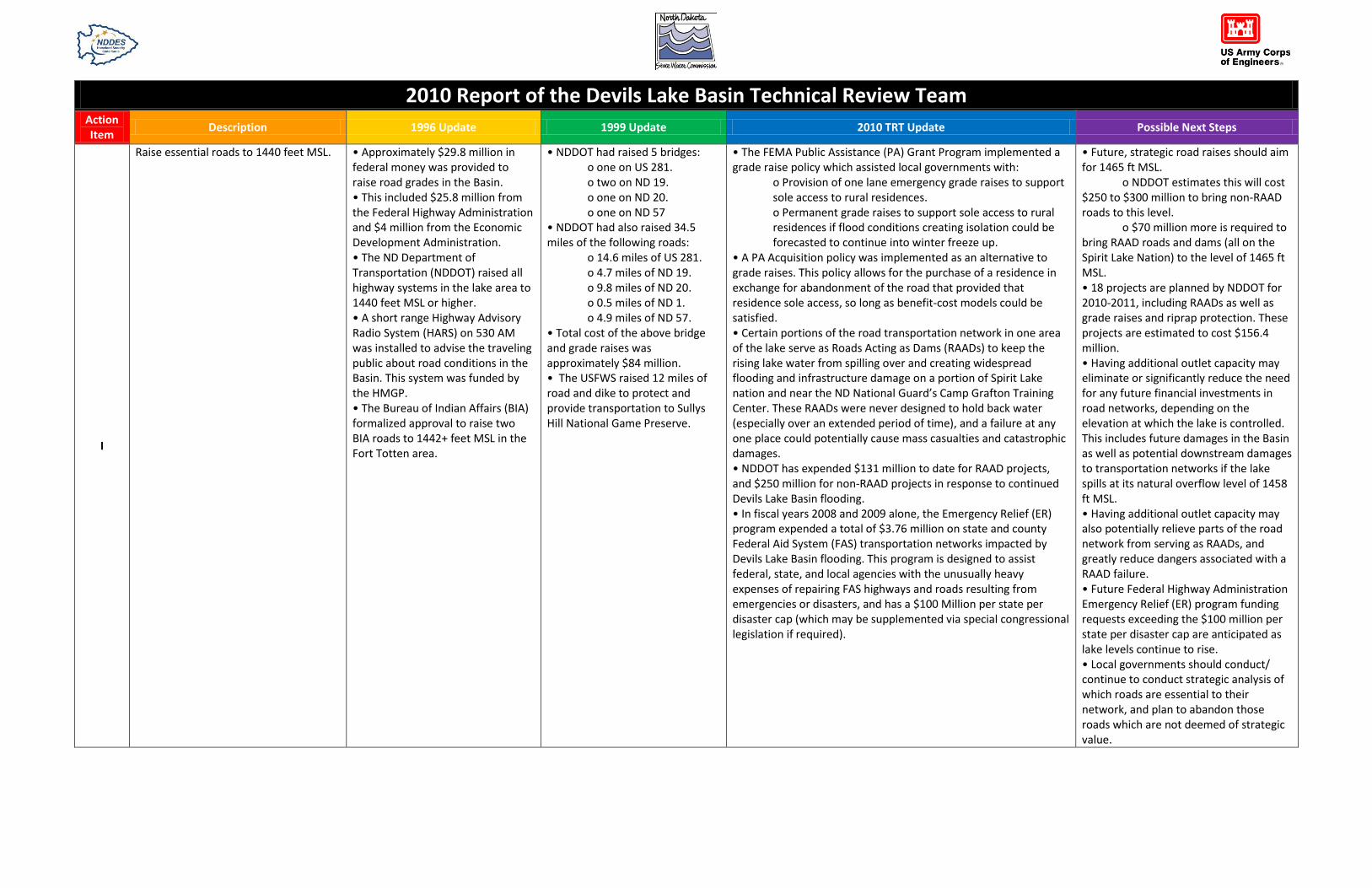
Raise essential roads to 1440 feet MSL. • Approximately $29.8 million in federal money was provided to raise road grades in the Basin. • This included $25.8 million from the Federal Highway Administration and $4 million from the Economic Development Administration. • The ND Department of Transportation (NDDOT) raised all highway systems in the lake area to 1440 feet MSL or higher. • A short range Highway Advisory Radio System (HARS) on 530 AM was installed to advise the traveling public about road conditions in the Basin. This system was funded by the HMGP. • The Bureau of Indian Affairs (BIA) formalized approval to raise two BIA roads to 1442+ feet MSL in the Fort Totten area.
• NDDOT had raised 5 bridges: o one on US 281. o two on ND 19. o one on ND 20. o one on ND 57 • NDDOT had also raised 34.5 miles of the following roads: o 14.6 miles of US 281. o 4.7 miles of ND 19. o 9.8 miles of ND 20. o 0.5 miles of ND 1. o 4.9 miles of ND 57. • Total cost of the above bridge and grade raises was approximately $84 million. • The USFWS raised 12 miles of road and dike to protect and provide transportation to Sullys Hill National Game Preserve.
• The FEMA Public Assistance (PA) Grant Program implemented a grade raise policy which assisted local governments with: o Provision of one lane emergency grade raises to support sole access to rural residences. o Permanent grade raises to support sole access to rural residences if flood conditions creating isolation could be forecasted to continue into winter freeze up. • A PA Acquisition policy was implemented as an alternative to grade raises. This policy allows for the purchase of a residence in exchange for abandonment of the road that provided that residence sole access, so long as benefit-cost models could be satisfied. • Certain portions of the road transportation network in one area of the lake serve as Roads Acting as Dams (RAADs) to keep the rising lake water from spilling over and creating widespread flooding and infrastructure damage on a portion of Spirit Lake nation and near the ND National Guard’s Camp Grafton Training Center. These RAADs were never designed to hold back water (especially over an extended period of time), and a failure at any one place could potentially cause mass casualties and catastrophic damages. • NDDOT has expended $131 million to date for RAAD projects, and $250 million for non-RAAD projects in response to continued Devils Lake Basin flooding. • In fiscal years 2008 and 2009 alone, the Emergency Relief (ER) program expended a total of $3.76 million on state and county Federal Aid System (FAS) transportation networks impacted by Devils Lake Basin flooding. This program is designed to assist federal, state, and local agencies with the unusually heavy expenses of repairing FAS highways and roads resulting from emergencies or disasters, and has a $100 Million per state per disaster cap (which may be supplemented via special congressional legislation if required).
• Future, strategic road raises should aim for 1465 ft MSL. o NDDOT estimates this will cost $250 to $300 million to bring non-RAAD roads to this level. o $70 million more is required to bring RAAD roads and dams (all on the Spirit Lake Nation) to the level of 1465 ft MSL. • 18 projects are planned by NDDOT for 2010-2011, including RAADs as well as grade raises and riprap protection. These projects are estimated to cost $156.4 million. • Having additional outlet capacity may eliminate or significantly reduce the need for any future financial investments in road networks, depending on the elevation at which the lake is controlled. This includes future damages in the Basin as well as potential downstream damages to transportation networks if the lake spills at its natural overflow level of 1458 ft MSL. • Having additional outlet capacity may also potentially relieve parts of the road network from serving as RAADs, and greatly reduce dangers associated with a RAAD failure. • Future Federal Highway Administration Emergency Relief (ER) program funding requests exceeding the $100 million per state per disaster cap are anticipated as lake levels continue to rise. • Local governments should conduct/ continue to conduct strategic analysis of which roads are essential to their network, and plan to abandon those roads which are not deemed of strategic value.

2010 Report of the Devils Lake Basin Technical Review Team Action Item
Description 1996 Update 1999 Update 2010 TRT Update Possible Next Steps
J
Construct an outlet from Devils Lake to the Sheyenne River in order to stabilize the lake level by releasing excess water in high-water years.
• See Task 4 above. • USACE completed its Emergency Outlet Plan for Devils Lake in August, 1996. Two implementation scenarios were described in the plan. • It was estimated, at the time of the 1996 report, that the minimum outlet implementation time would be 29 months-60 months. This assumed timely Congressional authorization and appropriations, and no legal actions which may delay or stop the project. • The ND State Water Commission worked on the outlet environmental and legal considerations.
• See Task 4 above. • See Task 4 above. • The state outlet was completed and placed into service in August of 2005. • By the end of 2009, the outlet had removed over 29,000 acre-feet of water from the lake since it began operation in 2005. • The outlet expansion from 100 cfs to 250 cfs was completed in June 2010.
Re-analyze options and impacts of added capacity on the existing outlet, or another gravity outlet.
K
Use temporary flood proofing to prevent damage to individual structures.
• 49 funding applications were being processed through the North Central Planning District for individual dikes at the time of the compilation of the 1996 update. • However, most structures were being relocated through the liberalization of the Standard NFIP Flood Insurance Policy.
No specific update provided. • The benefit of this action item proved very short term in duration, and in effect only buys time before flood damage occurs or a structure is lost to flooding. • Efforts by individual property owners (over the last 15 years) were successful only in staving off inundation or the effects of wave action for a number of days, weeks or months before a structure was eventually damaged or lost. • This action is a last resort, and can lessen the effect of monetary loss but not the physical loss itself. This action is also a loss avoidance measure as defined by policy governing the NFIP.
• The value of flood proofing structures is problematic at best now, in light of projected continued rises in lake elevations without known relief in sight. If any future flood proofing is considered, the emphasis should be on flood proofing structures at/ above elevation 1458 ft MSL. • Flood proofing structures at lower elevations will not prove beneficial based on the continued rise of the lake.
2010 Report of the Devils Lake Basin Technical Review Team Action Item
Description 1996 Update 1999 Update 2010 TRT Update Possible Next Steps
L
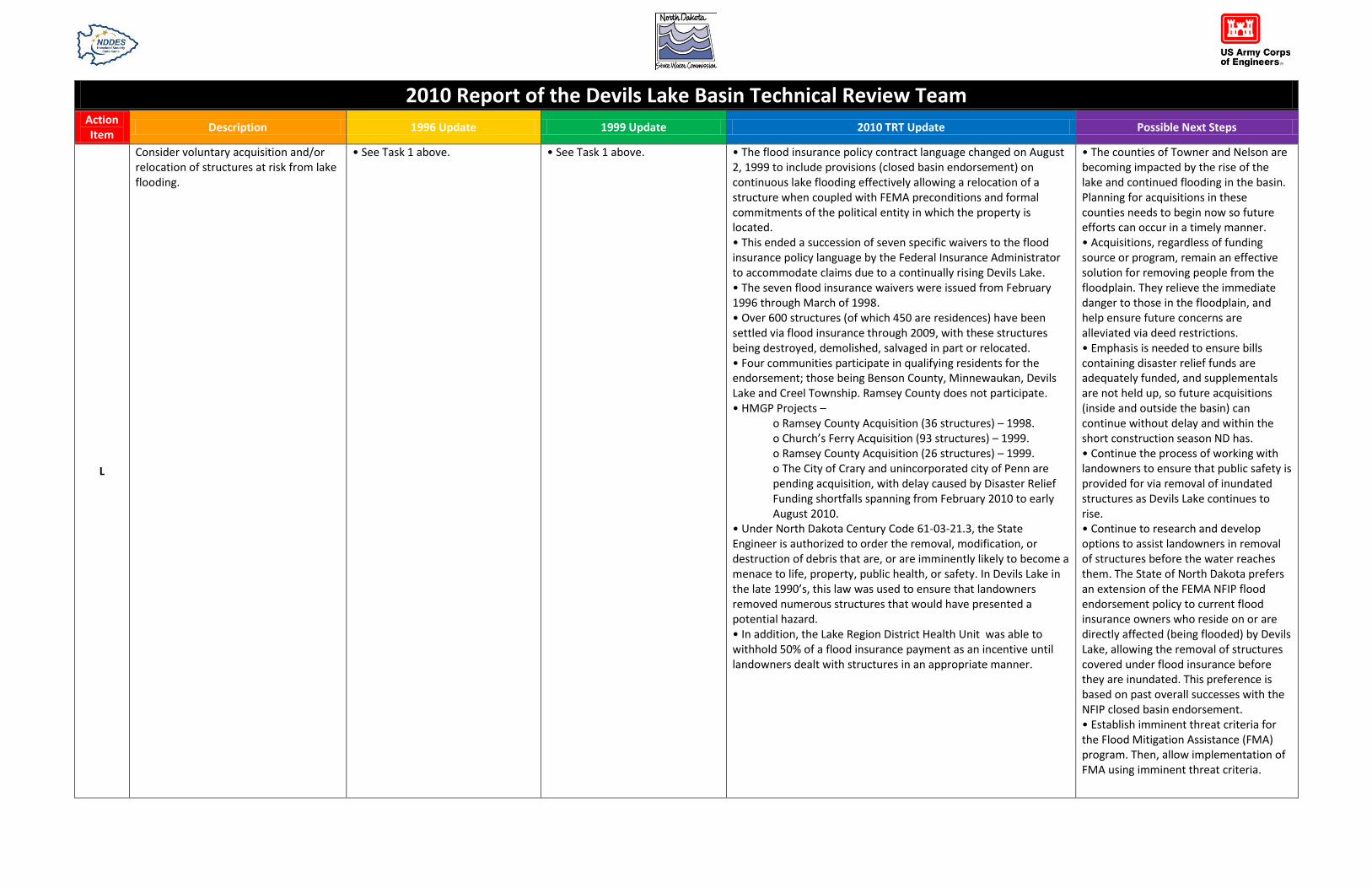
Consider voluntary acquisition and/or relocation of structures at risk from lake flooding.
• See Task 1 above. • See Task 1 above. • The flood insurance policy contract language changed on August 2, 1999 to include provisions (closed basin endorsement) on continuous lake flooding effectively allowing a relocation of a structure when coupled with FEMA preconditions and formal commitments of the political entity in which the property is located. • This ended a succession of seven specific waivers to the flood insurance policy language by the Federal Insurance Administrator to accommodate claims due to a continually rising Devils Lake. • The seven flood insurance waivers were issued from February 1996 through March of 1998. • Over 600 structures (of which 450 are residences) have been settled via flood insurance through 2009, with these structures being destroyed, demolished, salvaged in part or relocated. • Four communities participate in qualifying residents for the endorsement; those being Benson County, Minnewaukan, Devils Lake and Creel Township. Ramsey County does not participate. • HMGP Projects – o Ramsey County Acquisition (36 structures) – 1998. o Church’s Ferry Acquisition (93 structures) – 1999. o Ramsey County Acquisition (26 structures) – 1999. o The City of Crary and unincorporated city of Penn are pending acquisition, with delay caused by Disaster Relief Funding shortfalls spanning from February 2010 to early August 2010. • Under North Dakota Century Code 61-03-21.3, the State Engineer is authorized to order the removal, modification, or destruction of debris that are, or are imminently likely to become a menace to life, property, public health, or safety. In Devils Lake in the late 1990’s, this law was used to ensure that landowners removed numerous structures that would have presented a potential hazard. • In addition, the Lake Region District Health Unit was able to withhold 50% of a flood insurance payment as an incentive until landowners dealt with structures in an appropriate manner.
• The counties of Towner and Nelson are becoming impacted by the rise of the lake and continued flooding in the basin. Planning for acquisitions in these counties needs to begin now so future efforts can occur in a timely manner. • Acquisitions, regardless of funding source or program, remain an effective solution for removing people from the floodplain. They relieve the immediate danger to those in the floodplain, and help ensure future concerns are alleviated via deed restrictions. • Emphasis is needed to ensure bills containing disaster relief funds are adequately funded, and supplementals are not held up, so future acquisitions (inside and outside the basin) can continue without delay and within the short construction season ND has. • Continue the process of working with landowners to ensure that public safety is provided for via removal of inundated structures as Devils Lake continues to rise. • Continue to research and develop options to assist landowners in removal of structures before the water reaches them. The State of North Dakota prefers an extension of the FEMA NFIP flood endorsement policy to current flood insurance owners who reside on or are directly affected (being flooded) by Devils Lake, allowing the removal of structures covered under flood insurance before they are inundated. This preference is based on past overall successes with the NFIP closed basin endorsement. • Establish imminent threat criteria for the Flood Mitigation Assistance (FMA) program. Then, allow implementation of FMA using imminent threat criteria.
2010 Report of the Devils Lake Basin Technical Review Team Action Item
Description 1996 Update 1999 Update 2010 TRT Update Possible Next Steps
• Development and continual maintenance and update of local/ tribal Multi Hazard Mitigation Plans for the Devils Lake Basin in accordance with the Disaster Mitigation Act of 2000 (DMA 2000) and Title 44 CFR is necessary in order to identify future mitigation needs and potential projects, plus remain eligible for mitigation program funding for activities like acquisitions. • Local and tribal jurisdictions around the Devils Lake Basin should come together to compose and maintain a regional multi-jurisdictional Multi Hazard Mitigation Plan. This will allow them to collaborate on the basin-wide planning efforts necessary to synchronize mitigation efforts which address long term flooding concerns, and remain eligible for mitigation program funding.

2010 Report of the Devils Lake Basin Technical Review Team Action Item
Description 1996 Update 1999 Update 2010 TRT Update Possible Next Steps
M Identify financial and technical assistance for flood-impacted businesses.
Two commercial structures were awarded Community Development Block Grants.
No specific update provided. Current programs available are: Forward Devils Lake Development Corporation. • Mini Grant Program. City of Devils Lake. • Lake Region Growth Fund. North Central Planning Council. • NCPC Revolving Loan Fund. • Community Development Loan Fund. • Micro Loan Program. North Dakota Department of Commerce. • Community Services Division. o Community Development Block Grant. • Economic Development & Finance Division. o North Dakota Development Fund. o Ag Products Utilization Commission. • Tourism Division. o Tourism Infrastructure Grant Program. Bank of North Dakota. • PACE Program. • MATCH Program. • Start-up Entrepreneur Program. North Dakota Public Finance Authority. • Capital Finance Program. • Industrial Development Bond Program. North Dakota Job Service. • ND New Jobs Training Program. • Workforce 20/20. Small Business Administration. • SBA 504. • SBA 7(a) Loan Program. • SBA Main Street Program. Economic Development Administration. • Public Works & Economic Development Program. • Economic Adjustment Assistance Program. USDA Rural Development. • Business & Industry Guaranteed Loans. • Intermediary Relending Program. •Rural Business Enterprise Grants. •Rural Economic Development Loan & Grant Program. •Community Facility Loans. •Community Facilities Guaranteed Loan Program. •Grants for Community Facilities.
Continue efforts already in progress.
2010 Report of the Devils Lake Basin Technical Review Team Action Item
Description 1996 Update 1999 Update 2010 TRT Update Possible Next Steps
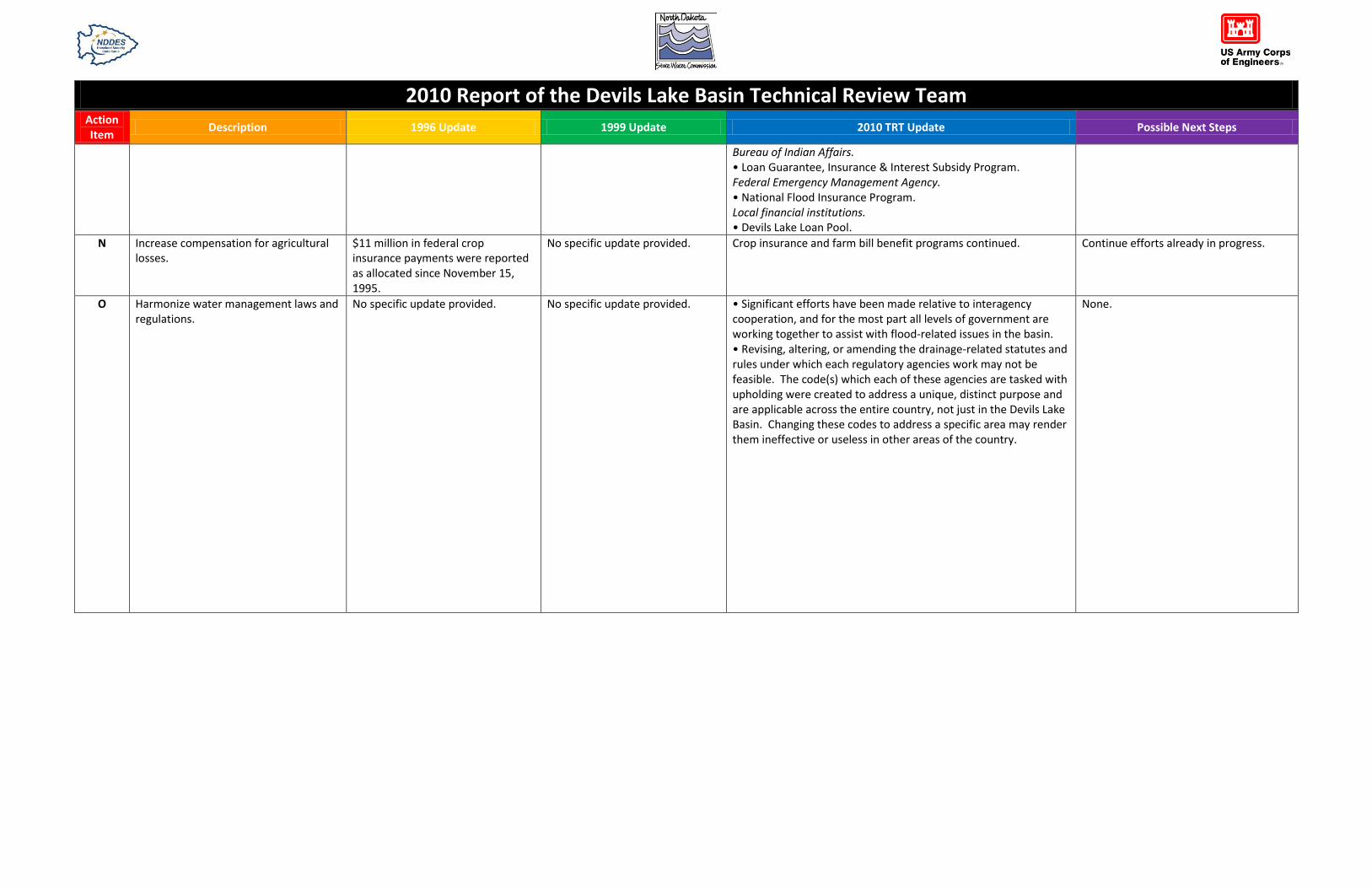
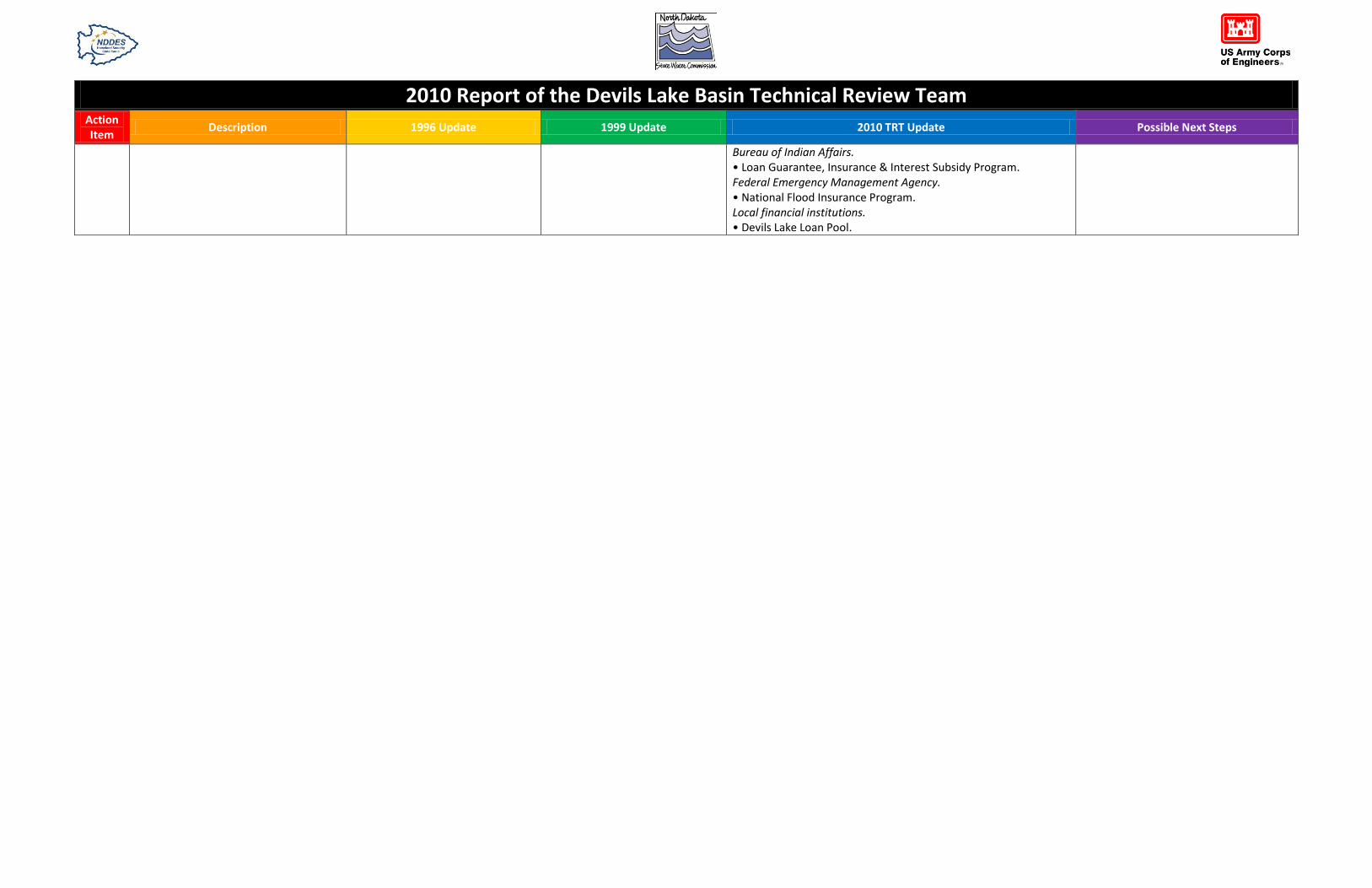
Bureau of Indian Affairs. • Loan Guarantee, Insurance & Interest Subsidy Program. Federal Emergency Management Agency. • National Flood Insurance Program. Local financial institutions. • Devils Lake Loan Pool.
N Increase compensation for agricultural losses.
$11 million in federal crop insurance payments were reported as allocated since November 15, 1995.
No specific update provided. Crop insurance and farm bill benefit programs continued. Continue efforts already in progress.
O Harmonize water management laws and regulations.
No specific update provided. No specific update provided. • Significant efforts have been made relative to interagency cooperation, and for the most part all levels of government are working together to assist with flood-related issues in the basin. • Revising, altering, or amending the drainage-related statutes and rules under which each regulatory agencies work may not be feasible. The code(s) which each of these agencies are tasked with upholding were created to address a unique, distinct purpose and are applicable across the entire country, not just in the Devils Lake Basin. Changing these codes to address a specific area may render them ineffective or useless in other areas of the country.
None.

2010 Report of the Devils Lake Basin Technical Review Team Action Item
Description 1996 Update 1999 Update 2010 TRT Update Possible Next Steps
P Conduct emergency planning for each additional foot of lake elevation.
No specific update provided. No specific update provided. • FEMA is currently developing a database, with geographic locations and pictures, of all structures in the Devils Lake Basin at 1460 ft MSL and below. • Urban Search and Rescue Grid Atlas' have been developed for communities around the lake, which depict structures threatened up to 1460 ft MSL. • Advanced emergency planning efforts occur on an annual basis, led by the ND Department of Emergency Services. Annual advanced planning takes into account lake elevations as part of the overall triggers for requesting state and federal support to the basin.
• Sustain advanced emergency planning efforts as the lake continues to rise. The National Weather Service stated on July 15, 2010 that the wet cycle is projected to possibly continue another 10 years, and such efforts will remain a necessity to ensure Federal, State, local, and tribal jurisdictions stay out front of the requirements curve. • Do not wait until a dry cycle begins to start projecting planning requirements for the eventual drop of lake levels in the long term. • Archive current emergency planning efforts for flooding for future generations to use when the lake rises again. • Plan and act knowing Devils Lake will always be in flux; stability will be the exception rather than the rule.
Q Enhance Recreation Opportunities. No specific update provided. No specific update provided. • North Dakota Tourism Division outdoor promotion efforts focus on the rich outdoor resources in the Devils Lake Area. • Tourism sold Devils Lake outdoor opportunities at consumer shows in Kansas City, Quad Cites, Minneapolis-St. Paul, Madison, Rockford, Omaha and Grand Rapids in 2010. • Tourism staff hosts numerous familiarization tours for outdoor media each year. • The Division also prints the ND Travel Guide and the ND Hunting and Fishing Guide annually which have dedicated sections on attractions, events, activities and accommodations in the Devils Lake region. • ND Tourism has partnered with numerous outdoor media to showcase these opportunities, most recently sponsoring Jason Mitchell Outdoors based in Devils Lake. • New outdoor television and print ads were recently shot in Devils Lake. ND Tourism’s outdoor advertising does not single out one activity or area, but shows excellent images of the outdoor resources found across the state. These ads run first quarter in Minneapolis, Milwaukee, Green Bay, and Madison. On-line advertising is also focused on the outdoors.
Continue efforts already in progress.

2010 Report of the Devils Lake Basin Technical Review Team Action Item
Description 1996 Update 1999 Update 2010 TRT Update Possible Next Steps
R Diversify the economic base of the Basin.
No specific update provided. No specific update provided. Current initiatives underway are: Forward Devils Lake Development Corporation. • Mini Grant Program. City of Devils Lake. • Lake Region Growth Fund. North Central Planning Council. • NCPC Revolving Loan Fund. • Community Development Loan Fund. • Micro Loan Program. North Dakota Department of Commerce. • Community Services Division. o Community Development Block Grant. • Economic Development & Finance Division. o North Dakota Development Fund. o Ag Products Utilization Commission. • Tourism Division. o Tourism Infrastructure Grant Program. Bank of North Dakota. • PACE Program. • MATCH Program. • Start-up Entrepreneur Program. North Dakota Public Finance Authority. • Capital Finance Program. • Industrial Development Bond Program. North Dakota Job Service. • ND New Jobs Training Program. • Workforce 20/20. Small Business Administration. • SBA 504. • SBA 7(a) Loan Program. • SBA Main Street Program. Economic Development Administration. • Public Works & Economic Development Program. • Economic Adjustment Assistance Program. USDA Rural Development. • Business & Industry Guaranteed Loans. • Intermediary Relending Program. •Rural Business Enterprise Grants. •Rural Economic Development Loan & Grant Program. •Community Facility Loans. •Community Facilities Guaranteed Loan Program. •Grants for Community Facilities.
Continue efforts already in progress.
2010 Report of the Devils Lake Basin Technical Review Team Action Item
Description 1996 Update 1999 Update 2010 TRT Update Possible Next Steps
Bureau of Indian Affairs. • Loan Guarantee, Insurance & Interest Subsidy Program. Federal Emergency Management Agency. • National Flood Insurance Program. Local financial institutions. • Devils Lake Loan Pool.

*Background information on the 10 affected NFIP communities, with historic and current mapping information.
By column:
1 – community;
2 - enrollment date into the NFIP Emergency phase (E) – temporary;
3 - conversion date to Regular phase (R) – permanent;
4 - date of the initial Flood Hazard Boundary Map (not based on a flood study);
5 - dates of successive Flood Insurance Rate Maps (based on flood study).
Community: NFIP (E) NFIP (R) FHBM 1st FIRM 2nd FIRM 3rd FIRM
Ramsey County: 1-31-95 5-02-95 NA 5-02-95 6-20-01 x
Devils Lake: 8-07-75 8-04-87 2-21-75 8-04-87 6-20-01 x
Church’s Ferry: 5-07-97 5-04-98 NA 12-20-00 6-20-01 x
Creel Township: 6-18-79 9-30-87 NA 9-30-87 6-20-01 x
Coulee Township: 5-04-79 5-15-84 NA 12-20-00 6-20-01 x
Benson County*: 1-31-95 5-02-95 NA 5-02-95 6-20-01 4-16-09
Minnewaukan: 4-24-95 5-04-98 1-17-75 12-20-00 6-20-01 4-16-09
Spirit Lake Tribe: 8-19-97 5-04-98 NA 2-20-00 6-20-01 4-16-09
Nelson County: 3-03-95 5-02-95 NA 5-02-95 2-18-09 x
Towner County: 5-08-97 5-04-98 NA 1-19-01 x x
*The Benson County FIRM was digitized on 4-16-09 with a Base Flood Elevation of 1450’ msl.