rendering maps with opengl - sotm-eu 2014sotm-eu.org/slides/79.pdf · rendering maps with opengl...
TRANSCRIPT

Rendering Maps with OpenGL
@kkaefer

Rendering mapson the device in the browser
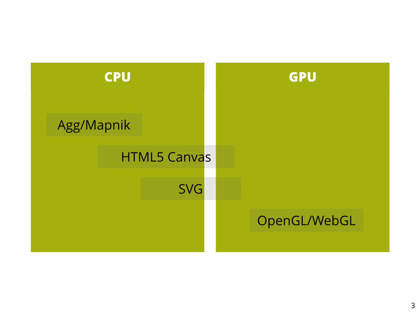
3
CPU GPU
SVG
HTML5 Canvas
Agg/Mapnik
OpenGL/WebGL

4

Canvas
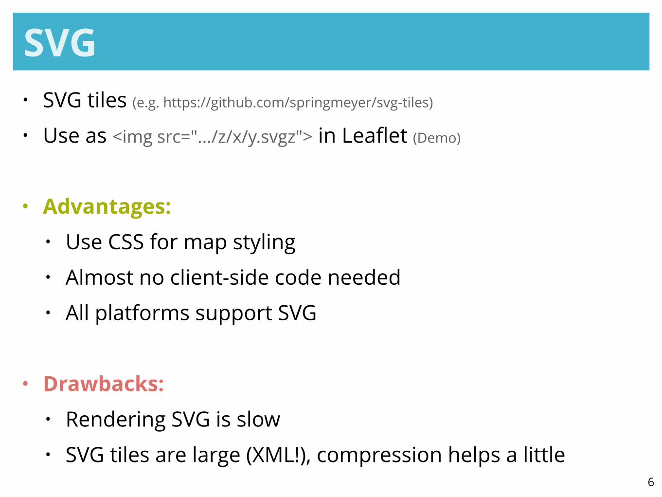
SVG• SVG tiles (e.g. https://github.com/springmeyer/svg-tiles) • Use as <img src=".../z/x/y.svgz"> in Leaflet (Demo)
!
• Advantages: • Use CSS for map styling • Almost no client-side code needed • All platforms support SVG
!
• Drawbacks: • Rendering SVG is slow • SVG tiles are large (XML!), compression helps a little
6

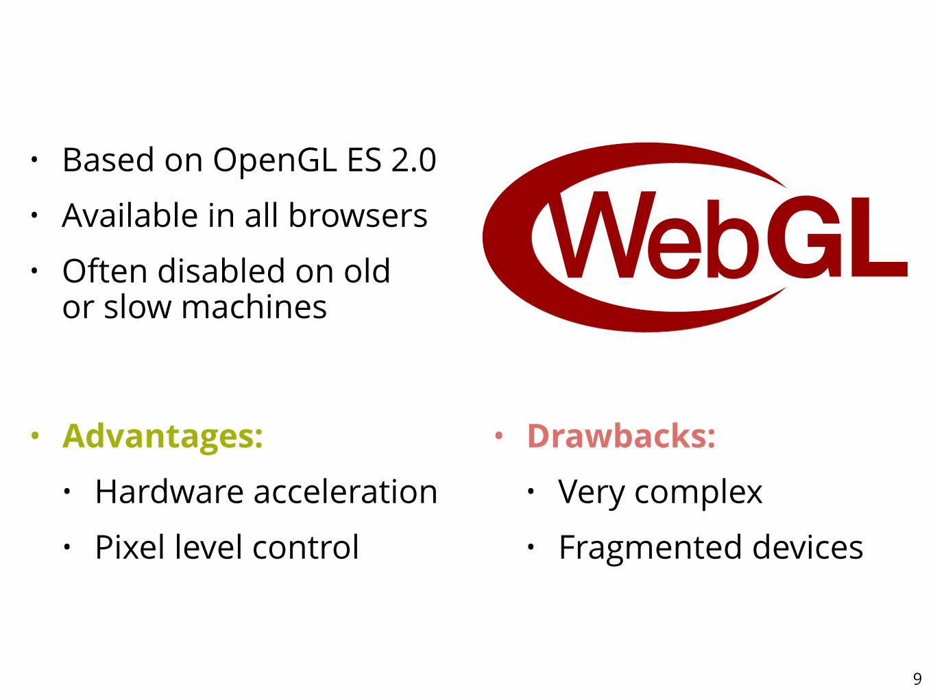
• Based on OpenGL ES 2.0 • Available in all browsers • Often disabled on old
or slow machines
9
• Advantages: • Hardware acceleration • Pixel level control
• Drawbacks: • Very complex • Fragmented devices
10
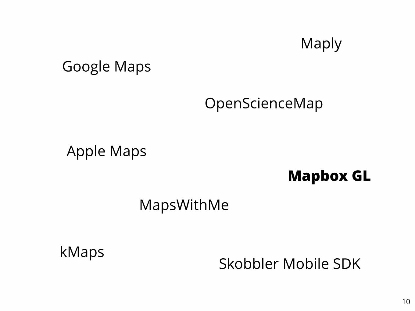
Google Maps
Apple Maps
OpenScienceMap
Skobbler Mobile SDK
MapsWithMe
Mapbox GL
kMaps
Maply

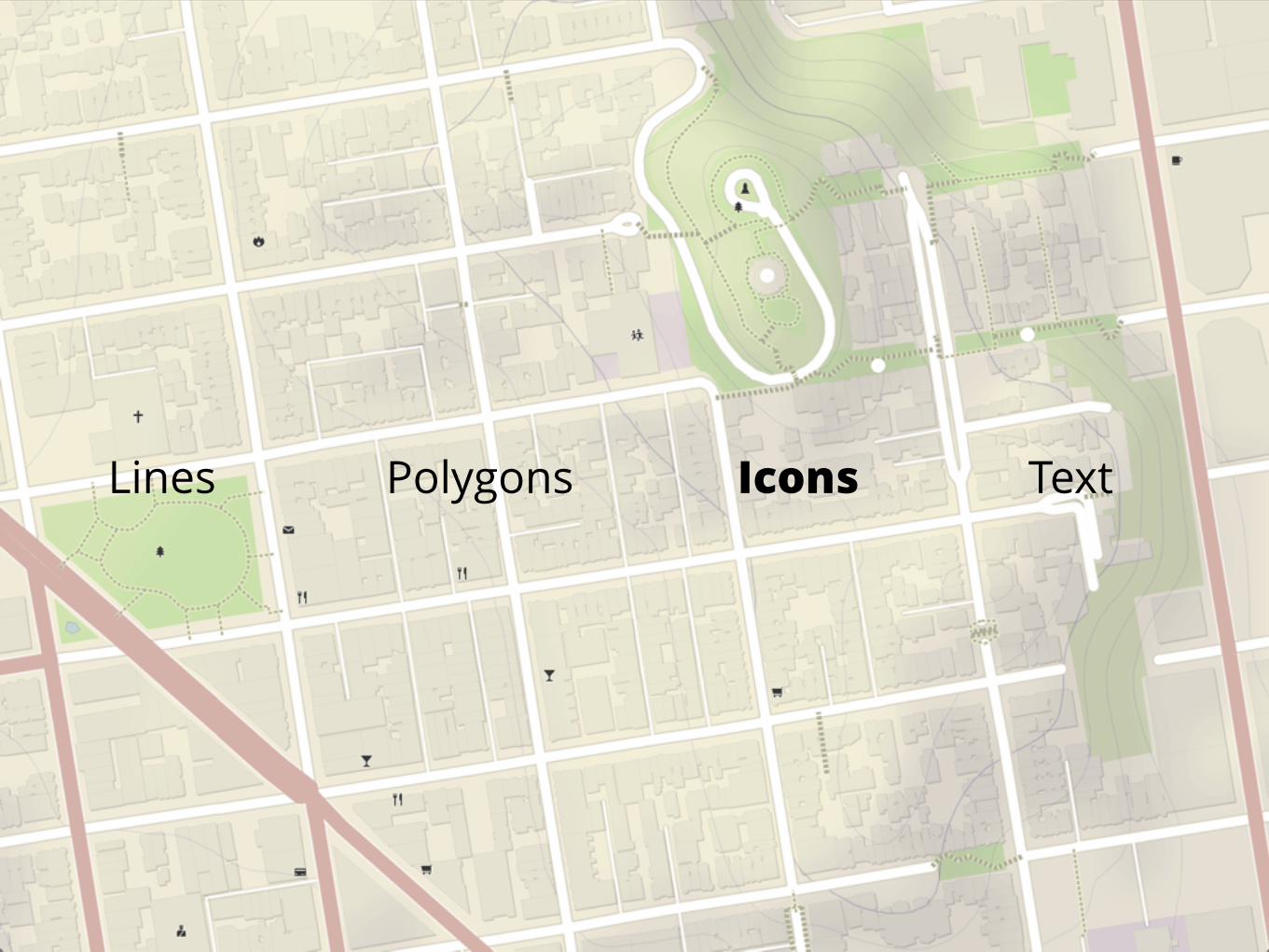
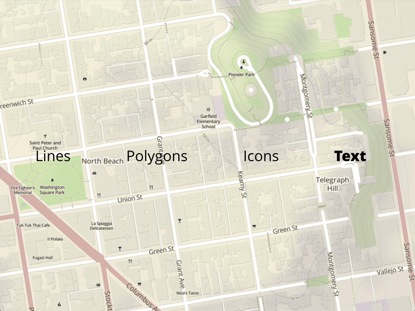
What is a map?
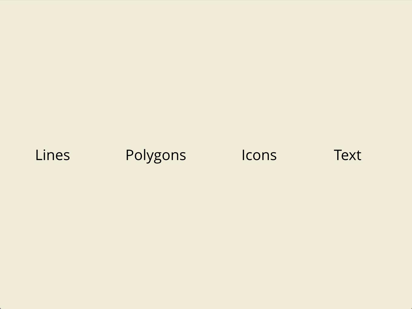
Lines Polygons Icons Text
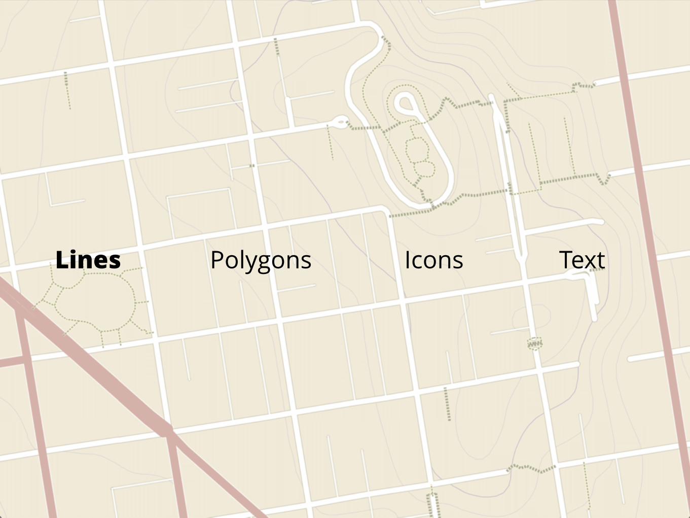
Lines Polygons Icons Text
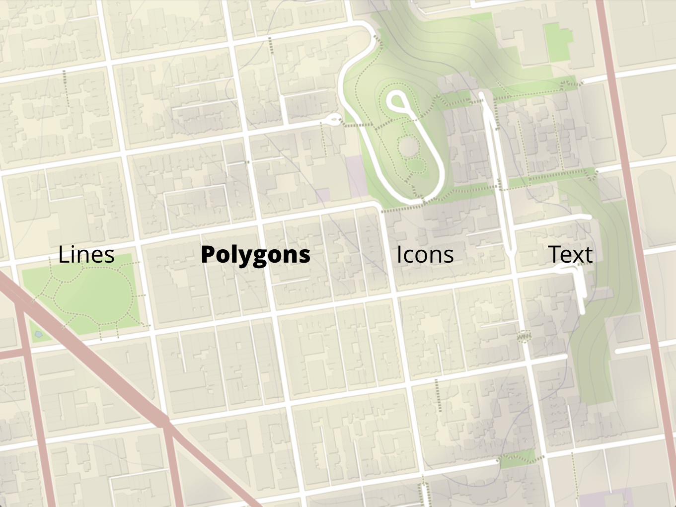
Lines Polygons Icons Text
Lines Polygons Icons Text
Lines Polygons Icons Text
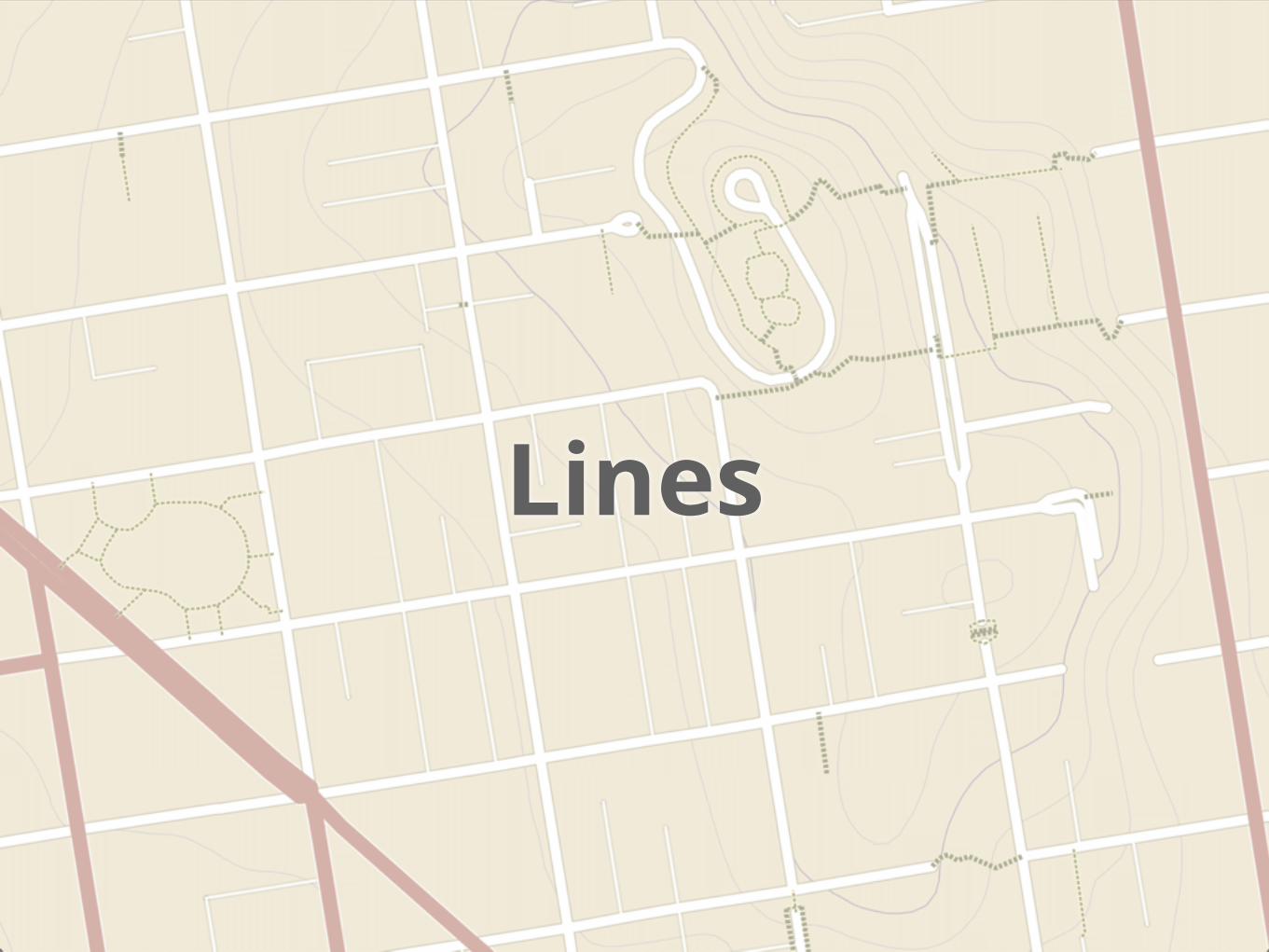
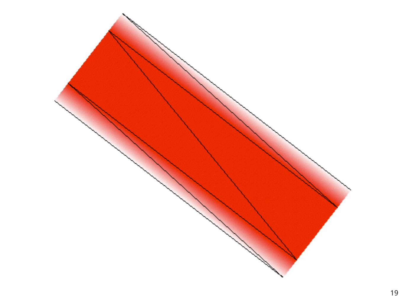
Lines
18
19
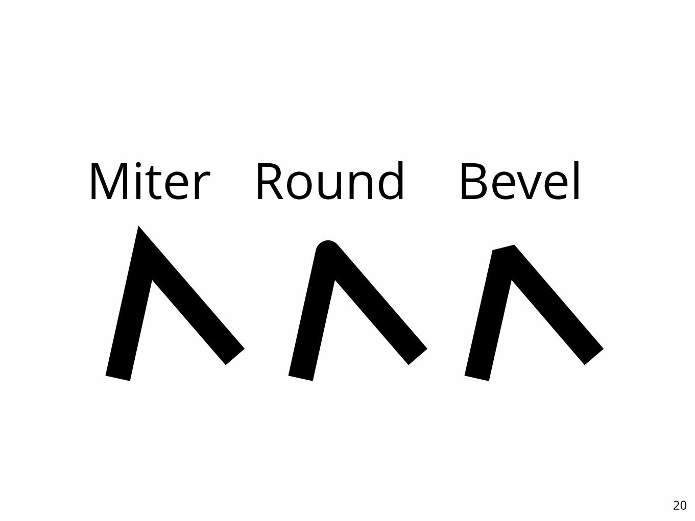
20
����� ��� ����

21
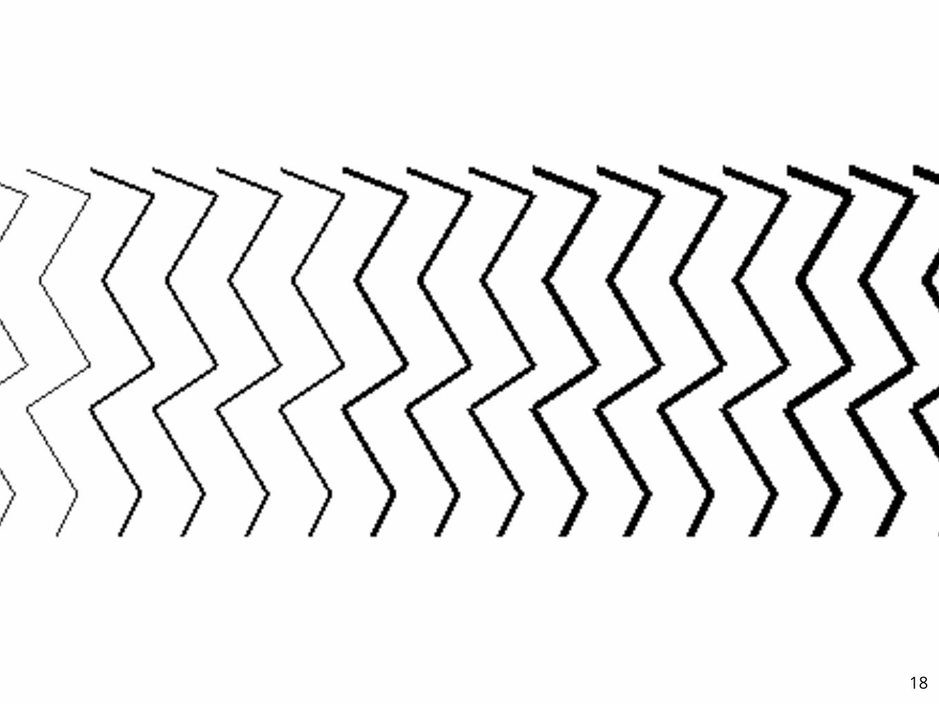
Read more onmapbox.com/blog/drawing-antialiased-lines
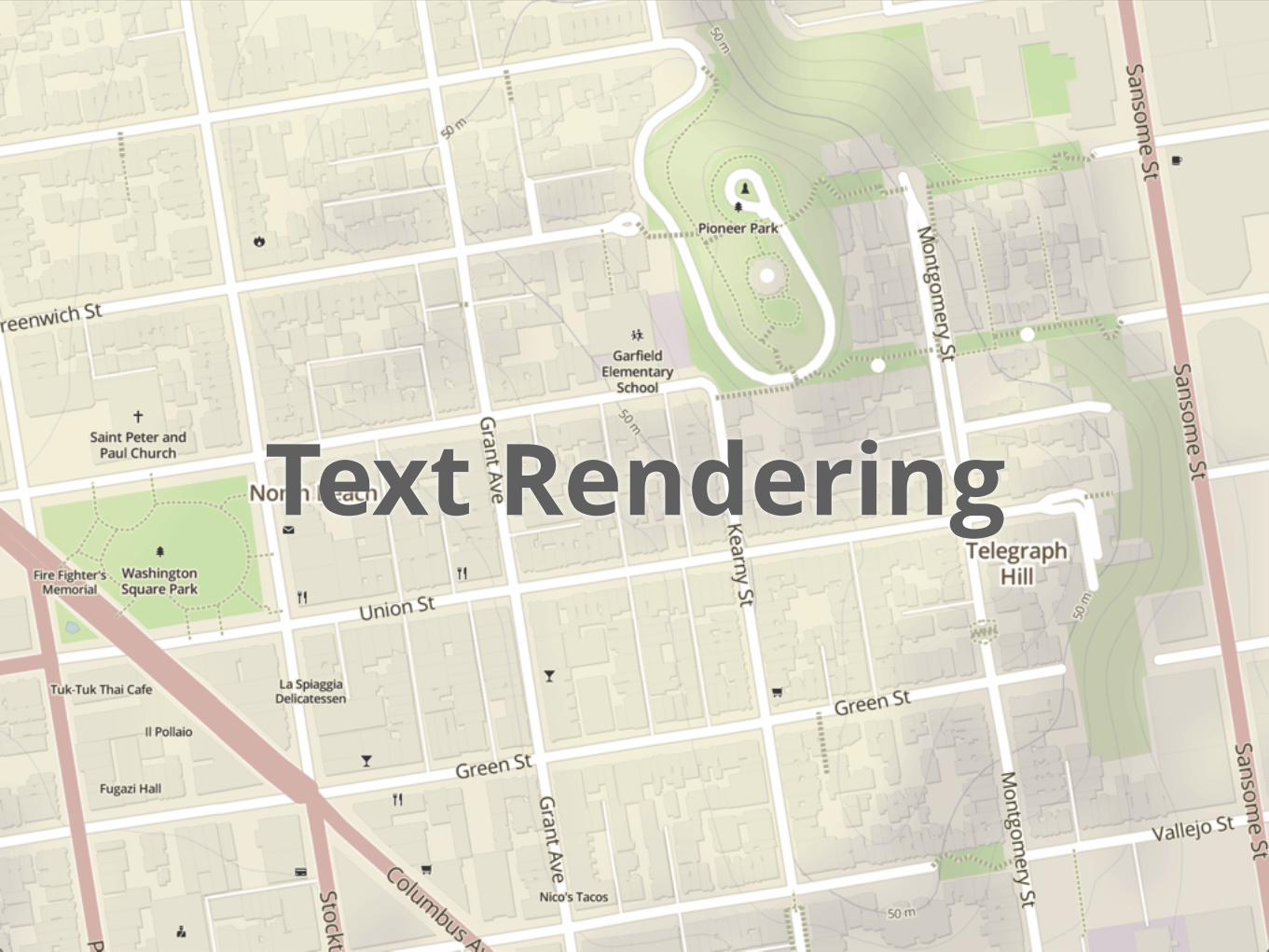
Text Rendering
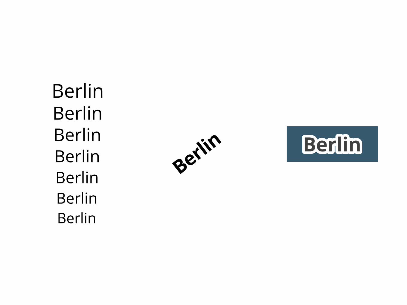
Berlin
Berlin
BerlinBerlinBerlinBerlinBerlin
Berlin ������������

Improved Alpha-Tested Magnification for Vector Textures and Special Effects
Chris Green⇤Valve
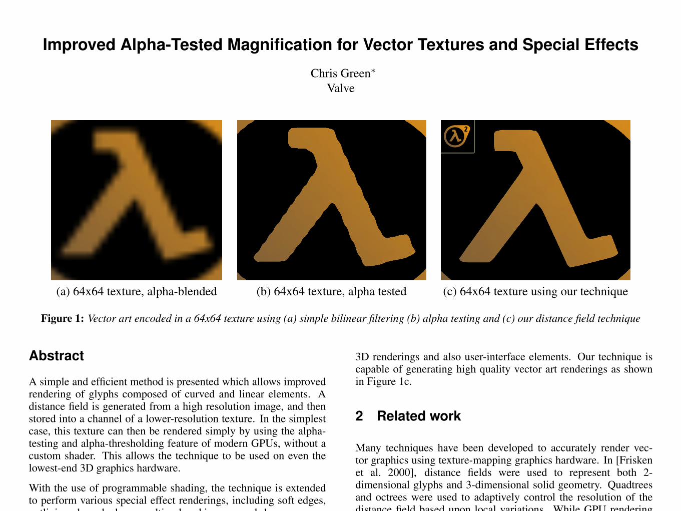
(a) 64x64 texture, alpha-blended (b) 64x64 texture, alpha tested (c) 64x64 texture using our technique
Figure 1: Vector art encoded in a 64x64 texture using (a) simple bilinear filtering (b) alpha testing and (c) our distance field technique
Abstract
A simple and efficient method is presented which allows improvedrendering of glyphs composed of curved and linear elements. Adistance field is generated from a high resolution image, and thenstored into a channel of a lower-resolution texture. In the simplestcase, this texture can then be rendered simply by using the alpha-testing and alpha-thresholding feature of modern GPUs, without acustom shader. This allows the technique to be used on even thelowest-end 3D graphics hardware.
With the use of programmable shading, the technique is extendedto perform various special effect renderings, including soft edges,outlining, drop shadows, multi-colored images, and sharp corners.
1 Introduction
For high quality real-time 3D rendering, it is critical that the limitedamount of memory available for the storage of texture maps be usedefficiently. In interactive applications such as computer games, theuser is often able to view texture mapped objects at a high levelof magnification, requiring that texture maps be stored at a highresolution so as to not become unpleasantly blurry, as shown inFigure 1a, when viewed from such perspectives.
When the texture maps are used to represent “line-art” images, suchas text, signs and UI elements, this can require the use of very highresolution texture maps in order to look acceptable, particularly athigh resolutions.
In addition to text and UI elements, this problem is also commonin alpha-tested image-based impostors for complicated objects suchas foliage. When textures with alpha channels derived from cover-age are magnified with hardware bilinear filtering, unpleasant “wig-gles” as seen in Figure 1b appear because the coverage function isnot linear.
In this chapter, we present a simple method to generate and ren-der alpha-tested texture maps in order to minimize the artifacts thatarise when such textures are heavily magnified. We will demon-strate several usage scenarios in a computer game context, both for
⇤e-mail: [email protected]
3D renderings and also user-interface elements. Our technique iscapable of generating high quality vector art renderings as shownin Figure 1c.
2 Related work
Many techniques have been developed to accurately render vec-tor graphics using texture-mapping graphics hardware. In [Friskenet al. 2000], distance fields were used to represent both 2-dimensional glyphs and 3-dimensional solid geometry. Quadtreesand octrees were used to adaptively control the resolution of thedistance field based upon local variations. While GPU renderingof such objects was not discussed, recent advances in the general-ity of GPU programming models would allow this method to beimplemented using DirectX10 [Blythe 2006].
In [Sen 2004] and [Tumblin and Choudhury 2004], texture mapsare augmented with additional data to control interpolation betweentexel samples so as to add sharp edges in a controllable fashion.Both line-art images and photographic textures containing hardedges were rendered directly on the GPU using their representa-tion.
In [Loop and Blinn 2005], implicit cubic curves were used to modelthe boundaries of glyphs, with the GPU used to render vector tex-tures with smooth resolution-independent curves.
In [Qin et al. 2006], a distance based representation is used, witha precomputed set of “features” influencing each Voronoi region.Given these features, a pixel shader is used to analytically computeexact distance values.
Alpha-testing, in which the alpha value output from the pixel shaderis thresholded so as to yield a binary on/off result, is widely usedin games to provide sharp edges in reconstructed textures. Unfortu-nately, because the images that are generally used as sources for thiscontain “coverage” information which is not properly reconstructedat the subtexel level by bilinear interpolation, unpleasant artifactsare usually seen for non-axis-aligned edges when these textures aremagnified.

R
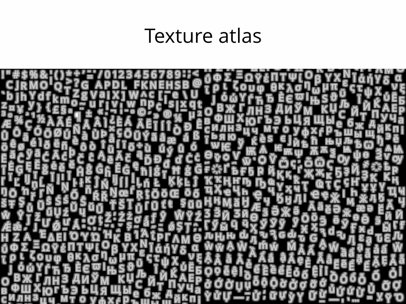
Texture atlas


Text Shaping
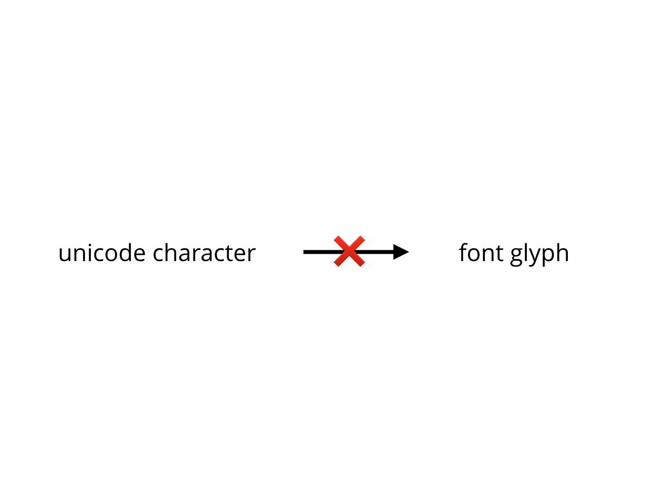
unicode character font glyph❌
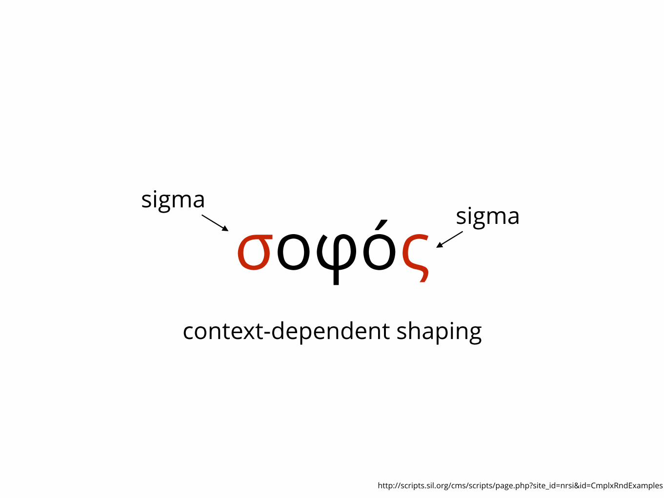
σοφóςsigma
sigma
context-dependent shaping
http://scripts.sil.org/cms/scripts/page.php?site_id=nrsi&id=CmplxRndExamples

Unshaped:
Shaped:

bidirectional text
http://scripts.sil.org/cms/scripts/page.php?site_id=nrsi&id=CmplxRndExamples

Stacked diacritic symbols

Label placement
No pops
If a label appears, it must never vanish when zooming in
Beem, Daiches, Yap. Dynamic Map Labeling. 2006.
No jumps
Labels may not change position when panning or zooming
Beem, Daiches, Yap. Dynamic Map Labeling. 2006.

No history
The labelling may not be dependent on navigation history
Beem, Daiches, Yap. Dynamic Map Labeling. 2006.

BEEN et al.: DYNAMIC MAP LABELING
querying—for example, for label filtering they build a range tree ateach level of detail.
The labeling problem has some similarity to the settlement selectionproblem [28, 26], which is to choose the towns and cities that willbe shown. Several heuristics for settlement selection are described in[28, 26], but no consideration is given to consistency during zooming.
Work on labeling of 3D illustrations [2] and labeling in virtual andaugmented reality systems [7, 3] also relates to our dynamic labelingproblem, in that they discuss some heuristics for improving the “framecoherence” or “temporal continuity” of the labeling.
We may note that map labeling is closely connected to labeling ofgraph drawings [16, 4].
Although the algorithmic literature on label selection as a stand-alone problem seems to be non-existent, there are several papers dis-cussing heuristics for selecting labels. E.g., Tatemura [24] discusses“dynamic label sampling” in the context of fisheye-view maps. Hedoes not require non-overlap among labels and/or features. The se-lection is based on considerations such as the avoidance of clutter,distance from area of interest, etc.
3 FRAMEWORK FOR FAST AND CONSISTENT LABELING
In this section we give an overview of our dynamic labeling approach;in Section 4 we formally define the problem and our solution.
We can think of static map labeling as being composed of two op-erations, which may be intertwined: selection and placement. Fromthe set of all possible labels, we need to first select a subset, and thenplace each label in the subset such that no two labels overlap. Placinga label means determining a size, orientation and location on the map.Now we need to think about what selection and placement mean in adynamic environment. While the static labeling problem is essentiallytwo-dimensional, the dynamic labeling problem requires a third di-mension. It might seem that time would be a natural third dimension,but such a labeling problem would be extremely hard to model in ameaningful way. Instead, we take scale as our third dimension. Underthis model, the dynamic selection problem is to determine at whichscales a label will be selected, and the dynamic placement problemis to determine a (static) placement for each scale at which a label isselected. Since this approach fixes a single static placement per labelper scale, it restricts the scope of our model to labels that don’t “slidearound” under panning.
Desideratum (D2) says that a label’s position and size should varycontinuously with the pan and zoom operations, and we have said thatin our model the placement must be a function of scale—i.e., it’s posi-tion is fixed under panning. Therefore, we can visualize each dynamicplacement in world coordinates as an extruded label shape, with thevertical dimension being scale. See Figure 3(a). Since we have not yetconsidered selection, we can imagine these extrusions as being definedfor all positive scales. In our implementation we use a simple form ofdynamic placements called invariant point placements, in which theextrusion is a cone. In this case, the label size in world coordinates isproportional to scale, which means the screen size of the label is in-variant under zooming. We say that such placements satisfy the labelsize invariance property. The dynamic placements in Figure 3 areinvariant point placements, with rectangular labels.
Desideratum (D1) says that a label should not appear, disappear,and reappear under monotonic zooming. This greatly simplifies thedynamic selection problem. It means that each label must be selectedprecisely within a single scale interval; we call the selected interval foreach label its active range: AL :=[sL
min,sLmax]. Under the strict interpre-
tation of (D1), a label may not disappear when zooming in. In thatcase we must have sL
min = 0. If we start with the extrusion defined bya label L and its dynamic placement, and restrict that extrusion to L’sactive range, we are left with a truncated extrusion. See Figure 3(b).We can ensure that no two labels will overlap at any scale if we doplacement and selection in such a way that no two truncated extrusionsoverlap. (More precisely, the interiors do not intersect; intersection atboundary points is allowed.)
Figure 3(b) also shows the outline of the view window cone. Ahorizontal slice of this graph, at a fixed scale, gives the 2D map that
(a) (b)
(c)
s = 2s = 1
scale
2
y
x
1
Fig. 3. (a) Dynamic placements for three labels, in world coordinates.These are invariant point placements that satisfy the label size invari-ance property—screen size is fixed, so size in world coordinates is pro-portional to scale. (b) The same dynamic placements, but truncated toactive ranges so that no two labels intersect at any scale. An outline ofthe view window cone is also shown. (c) Horizontal slices of the trun-cated placements at s = 1 and s = 2. The view area is shown in outline.
is specified by this dynamic labeling. Two such slices are shown inFigure 3(c). At scale s = 1 all three labels are active, but only thegold and red ones are inside the view area. At s = 2 the view areahas expanded (because of zooming out) to encompass all three labels,but the gold label is not active because of the conflict with the redone. As we zoom out from s = 1 to s = 2 (remember that we assumecontinuous zooming), the gray label slides into the view area, and allthree labels slide toward each other. At some scale between s = 1 ands = 2 the gold label disappears because of the conflict with the redone. Since these labels have the label size invariance property, theyget bigger in world coordinates as we zoom out, but they remain thesame size relative to the view area.
For a dynamic map, the need for interactive speed means that wemust introduce the filtering operation, in addition to selection andplacement. The number of labels in the entire map is much largerthan can be shown in any given view area, so we can often quickly re-move from consideration a large portion of the labels. We can filter onthe basis of geographic region, in which case we throw out any labelthat does not intersect the current view area. We can also filter on thebasis of scale—for example, if we are zoomed out far enough, we canthrow out all labels for small neighborhood streets.
As noted in Section 1, a natural first attempt at interactive dy-namic labeling would be to first filter the labels (on the basis of scaleand/or region), and then run a static placement algorithm on that muchsmaller subset. We believe that such an approach would not be fastenough for interaction. More importantly, it doesn’t seem possible tosatisfy our consistency desiderata with this approach. (See Figure 1.)Therefore, we propose an inversion of the normal order of doing theseoperations: place, then select, and finally filter. We achieve interac-tive speed by moving placement and selection into the preprocessingphase. No label conflict computations are performed in the interactionphase, as it amounts to retrieving a precomputed selection and place-ment of the labels.
Now we can describe our algorithmic framework:
Preprocessing phase
1. Determine a dynamic placement for each label. This is just astatic placement at each scale. In this step we consider each label
from: Beem, Daiches, Yap. Dynamic Map Labeling. 2006.

40
Thanks. Questions?