regional development issues: policy...
TRANSCRIPT
408
CHAPTER NINE
REGIONAL DEVELOPMENT ISSUES: POLICY PERSPECTIVES
Regional development planning as a theoretical entity requires being detached
from the economic development planning. The indicators uses for analysis development
status is neither micro nor macro differentiation however, its implication are within the
designated region, so demarcated to have unique development identity. Gujarat being a
Meso region of Western Region in India shares the regional characteristics of
neighbouring states, Maharashtra, Madhya Pradesh and Rajasthan Regional inequality
has been concern of the Gujarat state and country as a whole, but in implementation of
the development programs the regional backwardness is co-terminus with the economic
backwardness of the State and districts. The national governments and its planning
commission though concerned with imbalances in the development of states nearly
showed little interest towards preparation of the regional development plans.
Planning regions defined by the Town and Country Planning Organisation
(TCPO), the country divided into thirteen macro-regions, which are further subdivided
into 35 meso regions. The regional development policies for backward regional
development planning policies such as development plans and Industrial policy
Resolution is included since 1956. The state formations in India are based on the
linguistic characteristics rather than the economic, but Gujarat emerged as distinct
linguistic and economic entity in country. Within state the divisions are based on the
broad regional characteristics, such as Mainland, Saurashtra and Kachchh.
These planning regions reflect the scope of planning suited to the national level
planning agencies and decision makers. The departure from the centralised plan
framework towards the State independent thinking on the development functions have
been recent more so during the last two plan period in the 21st century. The State appears
to be partially deviated both politically and economically from the national policy
perspectives reflects in its approach to state policies where the State is looking at its

P a g e | 409
spatial advantages and potentials. The focus shifted from mere five-year plans to the State
lead policy events and marketability to the external investors without direct involvement
of the central agencies. Gujarat likewise the other developed state that has seen consistent
increment in the State domestic product and per capita income has seen comparing itself
with smaller nations and even aspiring to become an economic entity on its own. The
national agenda in future five year plans might provide continuity to the spatial
development strategy adopted by the Gujarat. The regional character of Gujarat in India
has begun to emerge as independent entity driven by market principles, which is result of
past policy and development decisions taken by the planning commission post 1990s.
Gujarat needs now to look towards its sub-region for the dispersal and spatial
spread of the development agenda, mostly distribution of the fruits of economic
development to the human development concerns in the 21st century. The issues and
concerns raised in earlier chapters regarding land, agriculture, sustainability of industrial
growth, urbanisation and environmental issues would be important subjects to be
considered for analysing and deriving the regional perspectives of development for
Gujarat.
The districts in the State are often regarded as regions indicating the gap between
theory of regional planning and actual practice, where administrative boundaries conflicts
with regional limits. The need for planning for regions arises because of widespread
development inequalities within state and districts. Since in practice, the regional
planning with in state is left to market forces all economic activities trends to get
concentrated in a few regions. Thus, widening of the regional disparity amongst its region
can be observed in the State.
Though country has been practicing distinct economic development policies,
whereby central and state government produces plan documents related to perspective,
five year and annual plans, there is inconsistency in approach towards the regional plans.
The backward areas until recently did not have distinct approach throughout the plan
periods. The policy shifts from community development program, agricultural extension
works, industrial location, tribal area plans and special component plans has not been
uniform. During different phases of planning, the thrust areas were altered, ignoring the
410
earlier ones. By and large, every new phase added new schemes over and above the
existing ones of the earlier Plans. Certain existing schemes were phased out in a planned
manner or dropped due to non-performance and lack of interest among the implementing
agencies.
The present chapter deals with the policy framework adopted by the State and its
continuity during different periods. The development planning framework of the State
prior to the pre-liberalisation period was mostly the extension of the Central schemes.
Latter, the State has emerged as a distinct political and structural entity with more
responsibility awarded to the State Planning Board to plan for the State. However, the
districts as planning units are yet to provide district specific development plan
documents. Districts have been functioning as simply allocating agencies of resources
and extending the plans prepared by the State Government. The spatial perspective in the
Plan documents (10th
and 11th
Plans) have recently emerged with specific programmes
implemented for coastal areas, tribal regions, industrial areas and other backward regions.
9.1 Regional Orientation of Development Planning in Gujarat
The development planning practiced in the country has not percolated at the
regional levels, the structure of planning mechanism in the State reflects though the
regional concern but administrative mechanism allows only the planning at district level.
The taluka (block) level plans are also an extension of the district plans. However, with
the decentralization the district planning committee has also been active in the planning
for the district with the help of state. The regional planning scenario has not progressed
beyond some specific projects, but in Gujarat even that projects specific regional plans
are non-existent. The plan mechanism deals with the backward areas it fails to demarcate
the regional limits and prepare the spatial or geographical plan. The taluka and district
plans are considered synonymous with the regional planning in country.
9.1.2 Decentralised Planning and its Assessment
The decentralised planning process was started in 1953 with launching of the
community development program and various initiatives since the first plan. The Balwant

P a g e | 411
Rai Mehta committee (1957) gave recommendation of planning from below. The
committee also suggested three tier Panchayati raj system viz., gram panchayat, block
and district. The Ashok Mehta and GVK Rao committee (year) also suggested similar
process for participatory development planning for involving people in development
process.
9.1.3 Assessment of requirement
Based on the discussion and observation on the visited panchayats, taluka and
districts offices in the State there are important elements required at the institutional level
to initiate the decentralised development planning. Some of them are under the process of
development at the different levels. In most cases the panchayat levels planning still
seems to be distant exercise. Following observation is made;
(a) The database which is basic requirement for the planning is not developed for
undertaking planning exercise. The data includes the information on the natural
resources, infrastructure (physical and social), agricultural and industrial
production, socio-economic condition of people etc. Information is available only
in pieces at the district and taluka level. It is grossly unavailable at the panchayat
level. With poor expertise available even at the taluka level, the planning for the
unit has been from top to bottom. On discussion regarding the policy directives
given by the Central and State agencies with the concerned officials, it was
revealed that, even though they are empowered, the lack of human resources and
capacity does not allow the comprehensive planning activities.
(b) Planning infrastructure in terms of adequate office, record room/data storage,
computerisation etc are partially available even at the district level it’s nearly
minimal at taluka and absent at the Panchayat level. The state is yet to build the
planning capacities at the grassroots level. The available infrastructure is not
enough to carry out meaningful planning exercise.
(c) Planning is specialised domain requires skilled work force at the district, taluka
and panchayat levels which is not available in the State. The administrative

412
officers at different levels are still allocating resources based on the arbitrary or
schematic arrangement done at the State level. Central government directs special
programs which is rendering the decentralised planning useless, or not worth an
attempt.
(i) Gram Panchayat (GP) as planning unit
With the 73rd
constitutional amendment (1992) which empowers the gram
panchayat for the planning at the gram panchayat, a new paradigm of planning has begun.
With this amendment, the gram panchayat are expected to make plans as per their local
resources, felt needs and undertake necessary programmes of direct importance to the
community and also to the individuals. The gram panchayats needs to undertake the
following;
(a) The assessment of the existing resources, needs and problems.
(b) Formulation of objectives and alternative status of development; and
(c) Designing suitable development programmes and projects to fulfil the desired
objectives of the plan.
(d) The GP have to be accountable only for the quality of the services expected by the
residents but also for satisfying the diverse needs of the various social groups or
community.
(ii) Taluka / Block as Planning Unit
The Taluka / Block were considered as primary development unit for the
community development till 73rd
and 74th
constitutional amendment. Taluka development
initiatives were enlarged to basic sectors and schemes were implemented through the
beneficiaries and villages are identified for the specific projects. These projects and
schemes implemented through taluka development officers who acted as nodal officers of
major central schemes. The assessment of the schemes effectiveness, outreach and impact
evaluated based on the block specific analysis by the central planning (evaluation)
agencies. The Taluka level planning has to undertake following;
P a g e | 413
(a) Integration of Panchayat level plans, in order to draw perspectives for the taluka,
including the urban as well as rural areas.
(b) Integration of urban and rural areas plan to enhance the integrity of taluka plan
with strong urban and rural integration.
(c) Facilitating rural development beyond villages with emphasis on the linking
villages with more emphasis on the service orientation of the panchayats.
(d) To aim towards increasing the earning potentials of the taluka by enhancing the
revenue sharing mechanism between the panchayats and reducing the
dependency on the State grants.
The emphasis on the taluka as development unit has been stressed recently on the
State government programs such, ‘aapno taluko – vibrant taluko’ i.e., emphasis on the
identifying the development gaps and promoting the programs of the government.
(iii) District as planning unit
The Gujarat is a pioneer State to implement the programme of Decentralised
District Planning in true sense. Under this programme, about 20 per cent of the grant of
the district level provision is put at the discretion of District Planning Boards to formulate
and implement development schemes of local importance. Under this scheme, from the
year 2002-03, every MLA can suggest works of Rs. 50 lakhs per year (Rs.30 lakh for the
year 2001-02) for his constituency.
Districts are now supposed to prepare the District Development Plan (DDP)
incorporating plans formulated at the GPs and blocks level. The plans are forwarded to
District Planning Unit (DPU). The departments such as irrigation, roads, forest,
agriculture etc supporting the districts also prepare their plan and forward it to DPU. The
plans are compiled by the concerned officials headed by the District Development Officer
(DDO) and submitted to Zilla (District) Panchayat (a body comprised of elected
representatives of Panchayats in district) for approval. Following can be assessed
important for district planning;

414
(a) Preparation of the DDP as per the provisions and procedures laid under
73rd
and 74th
Constitutional Amendment Act.
(b) Incorporating the model DDP guidelines and methodologies suggested by
the planning commission.
(c) Creation of the planning team and coordination between the taluka level
officials for integrated district development plan.
(d) Using the authority of the district collector and chief executive of the
urban local body for incorporating urban and rural areas plan in single
framework.
(e) Strengthening and training the DPU in preparation of the plan and
management.
Many schemes from State-District-Taluka and Panchayat is pending for approval,
state has replaced centre in many dimension. The state prepares and enforces specific
programs to the district and taluka level government with its own benchmarking. There is
shift of program focus from the central perspective to state level.
9.1.4 Urban Area Planning
Urbanisation process in the State in general has gained momentum over the recent
years due to excessive industrialisation in the major corridors and cities. The shift of the
growth towards the newer areas like coasts due to port development, SEZ lead
development near to small towns and villages, Special Investment Regions like Mundra-
Gandhidham (Kachchh), Dholera (Ahmedabad) and Dahej (Bharuch) etc., and investment
in infrastructure in existing cites. These activities would further enhance the urbanisation
rates in state and sooner than expected more than half of state’s population would be
living in urban areas. The following can be important assessment required for improving
the urban area planning in the State:

P a g e | 415
(a) The pressure on the urban land would be contributing towards the sprawl of
development towards the periphery and to the larger metropolitan centres,
ultimately subsuming the small and medium towns.
(b) The expansion of existing urban regions like Ahmedabad, Vadodara, Surat,
Gandhidham and Rajkot might also contribute towards the growth of economic
potentials as well as livelihoods of the sub-regions.
(c) The land management, transportation plan, infrastructure plan, renewal of old
city areas and housing strategies would be important for the organised growth of
not only for the metropolitan cities but also for the medium towns.
(d) The quality of life can be enhanced with sustainable use of natural resources, the
checks and balance can be developed to contribute towards the agricultural
economy of the immediate hinterland.
(e) The human resources development including the skill enhancement in the urban
areas would be essential in order to build the economic base of cities with new
industrialisation and economic activities.
(f) The urban management of the cities with more emphasis on the providing
efficient and maximum hours of services would be required along with the
reforms for improving the financial strengths of the municipalities.
(g) The linkages between municipalities and institutes or the technology suppliers
are important for preparing development plan.
(h) Successive use of natural resources have depleted the water resources, increased
risks from natural disasters and increase in pollutants from human activity has
affected the urban environment. Environment Management Plans with proper
risk assessment for the urban areas are important to prepare the city for any
disasters in addition to mitigate the impact of changing urban environs.
(i) Participatory and citizen centric policies and program would receive positive
inputs for development and infrastructure projects.
(j) There is substantial increase in the price of the land and has negative impact on
the development projects.
(k) Delays, lack of funding and inability of the private sector in participate for the
projects in urban areas impacts the development plan proposals.

416
(l) The minimum human development standards need to be maintained at least in
the urban areas. Thus an urban area planning could contribute towards the larger
spatial planning at the district and state level.
9.1.5 Industrial Area Planning
Gujarat Industrial Development Corporation (GIDC) since its inception has
planned and implemented industrial estates in majority development blocks or talukas of
the State. From the industrial estates of the late 1960s to the current Special Investment
Regions, land area under the industrial area planning in the State has expanded from 20
acres to 5,000 acres. The scale of industrial area has increased from earlier area plans
resulting in both positive and negative effects on the regions. As described earlier (see
chapter –Three) the important concern for the industrial areas are the utilization of land
and its impact on the environments. Efforts are required in order to assess the
environmental impact of industrialisation on the sub-regions of the State. The studies
done by Gujarat Ecology Commission (1998-2001) on the State of environment in
Gujarat though remains eluded from the public discussion have highlighted concerns now
expressed by Central Pollution Control Board (New Delhi) in its State of River Report
(2007-08). The alarming pollution levels have forced the State to restrict the promotion of
chemical industries further in some sub-regions such as Nandesri, Ankleshwar and Vapi.
The current proposal for the Special Investment Region (SIR) and Special Economic
Zones (SEZ) which is expected to utilize over 2.5 lakh hectares of land needs to focus
extensively on the Industrial Area Planning. More focus can be developing at least for
setting up of industries. The projects though have been initiated by Central Pollution
Control Board (CPCB) and now taken up by the Gujarat Pollution Control Board (GPCB)
needs to be passed on to the industrial decision makers. The vibrant Gujarat Summits (for
attracting investment) in future should take into account the sites found suitable for
industrialisation,
Excessive industrialisation in some of the regions like South and Central Gujarat can
be avoided in order to provide sustainable environment. The deterioration of land and
water quality needs to be arrested in order to improve the quality of water and make land
fit for cultivation. The current agrarian areas in regions need protection from

P a g e | 417
industrialisation and resultant urbanisation for the better ‘food security’ of the State. The
ecological damage along the coasts needs to be monitored with stringent implementation
of Coastal Regulated Zones (CRZ). The present implementation of Integrated Coastal
Zone Management programmes (ICZM) under Ministry of Environment and Forest,
Government of India in Kachchh, Bharuch and Vapi (South Gujarat) and Gulf of Cambay
(Central Gujarat) are expected to provide necessary protection.
Rehabilitation and protection of sensitive ecosystems is necessary along with
equitable development policies taking into account the needs of the local communities.
The need for sub-regional plan and agencies is to be earnestly addressed by the State
Government to provide planned development efforts. Industrial Areas in the State are the
major support not only to small and medium enterprises but also to large scale capital
intensive industries, but proper infrastructure key to environmental protection should be
in place. The regional plans should be taking into account the needs of industries and
local population in order to maintain the proper balance in natural resource. The scientific
management of the natural resources like river, lakes, forest, minerals and land is
essential requirement for sustainable industrial area planning.
The participation of communities and social impact assessment should be the key
component apart from the Environmental Impact Assessment of the Industrial Area
Planning. The efforts by the planning community especially at the industrial and regional
area levels should be properly addressed by the State policy makers.
9.1.6 Emerging Trends for Regional /Spatial Planning in Gujarat
The planning mechanisms are not only confined to the central and state planning
agencies it has been mostly extended to the local bodies. The role of urban local bodies is
enlarged given the increasing urbanisation levels with up to 42 per cent of population of
the State are living in Urban Areas. The spatial extent of the urban region is expected to
impact half of state’s geographical extent. Such as the impact of Greater Ahmedabad
Region (12,000 sq.km), Surat (1500 Sq.km), Vadodara (140 sq.km) etc would be larger
in context of spatial planning. The regional plans in the mainland Gujarat except eastern
hills is mostly thrusted through urban planning. The eastern hills now devoid of regional
plans should be preparing for the spatial sub-regional plans with more focus on the
418
natural resource management. The use of technologies like Remote Sensing and
Geographical Information System needs to be extended to such areas, beyond the
demonstration projects by the State or national space application agencies. The state
needs to be more systematic in their approach towards the sub-regional plans, adopting
some provisions from the Gujarat Town Planning and Valuation Act, 1976.
The analysis presented in earlier chapters presents peoples’ dissatisfaction and
negative impact of the regional development policies. While formulating regional
development policies, the regional concerns should therefore be considered. The regional
policy should be effective framework for the land management, resource management,
human resource development and economic growth. The habitat level concerns using the
technology and service based approach should be able to allow the decision making
process more participatory. The urban reform initiated through current schemes under
JnNURM (2007-2012) has provided ample scope for preparing such framework.
The consolidation of planning resources like Tribal Sub Plan (TSP), Backward Area
Grant Fund (BRGF), MNREGA, Drought Prone Area Development Program (DDAP),
Sagarkhedu, Vanbandhu Kalyan Yojna etc should be done while preparing the
framework for the regional plans.
There is a need to use the existing planning frameworks as well as the new ones in
order to bring synergy in the mechanism and public accountability of the system.
Democratic tools should be used to bring inclusive and participatory nature of planning.
The information dissemination and transparency in the decision making process would
yield the desired results in association with improvement in literacy levels and
penetration of telecommunication technologies in the State.
9.2 Decentralised Planning and Regional Plan
Efforts of the decentralised planning without adequate regional plan with district
as regional planning units are expected to yield poor development outcomes. The district
development plans (DDP) never took off beyond the sector specific allotment of
resources and schemes. The physical components, linkages between the rural –urban

P a g e | 419
areas are poorly evaluated and understood in order to develop the suitable DDP. Except
Kerala state no other state has made serious attempt in pursuing the desired objective
beyond setting up of institutional structure. Gujarat needs to adopt the model district
planning framework proposed by the planning commission through participatory
preparation of DDP.
Even though Article 40, Constitution of India, which reads,
“The state shall take steps to organise village panchayats and endow them with
such power and authority as may be necessary to enable them to function as units
of self-government.”
The community development projects (1952) as noted earlier, could not achieve
its targeted goal due to ineffective institutions at the village levels. The recent programme
implementation such as MNREGA provides opportunity for jobs as well as creation of
community assets.
Panchayats at district, intermediate and village levels are the principal authorities
for planning and implementation of MGNREGA under Section 13 of the Act. It is
notable that:
a) At least 50 per cent of MGNREGA funds are to be spent directly by the Gram
Panchayats (GPs) – in fact, generally GPs spend much more than 50 per cent of
the funds,
b) Gram Sabhas (GSs) are to recommend specific projects to the GPs and conduct
social audit of MGNREGA works,
c) District Programme Coordinators and Programme Officers are to assist District
and Intermediate Panchayats in discharging their functions respectively.
These features of MGNREGA offer a unique opportunity to strengthen and enable
PRIs, particularly the GPs and GSs. The rejuvenated and enabled PRIs, in turn, can
become powerful instruments in making MGNREGA a much better success. It is
420
generally seen that states with vibrant and optimally sized Panchayats with requisite
manpower have implemented MGNREGA better.399
The strengthening of Panchayats also calls for directive guidance for planned
efforts and regional perspectives regarding the consolidation of resources and
management of resources needs to be evolved through the district plans. There is wide
misunderstanding on the effectiveness of such schemes in the absence of planning at the
grassroots. The capacity building in rural and urban areas are required in order to enable
participatory and grass root development initiatives.
9.2.1 Port based Development
The State has 1600 Km. long coastline, representing a third of the nation’s water
front. The State has 40 minor and intermediate ports geographically dispersed across
South Gujarat (13 ports), Saurashtra (23 ports) and Kachchh region (4 ports). One of the
major ports of India under the administrative control of the Central Government, Kandla,
is also located in the State.
The ports of Gujarat have been developed by the Gujarat Maritime Boards
(GMB), which plans for the development of ports for its services to hinterland, mainly
central and north India. The vision 2020 by the GMB for the ports is to enable the State
to retain its position as the leading maritime state in the country by handling around 40
per cent of the country’s cargo, capturing at least 10 per cent of value addition to exports
at the ports and capturing the highest share of high value cargo such as liquid cargo,
LNG, POL Products and containers.400 The development is mainly targeted through
encouragement and development of private ports, joint sector ports, state public ports,
captive jetties and private jetties.
The port led development also means that the State has planned mega industrial
development along the Gujarat coast along with providing road and rail infrastructure
connectivity to the ports. The State is expected to have high cargo potential because of its
locational advantage and emerge as the key service provider. The State since 1995, has an
399
Govt. of India (2011): Road Map to Panchayati Raj (2011-16): An All India Perspective, Ministry of
Panchayati Raj, New Delhi, PDF. 400
Dash, H. K. (2004): “Port Led Development in Gujarat, Gujarat Maritime Board”. Gandhinagar, online
ppt. from www.gmb.org.
P a g e | 421
effective port development policy which is being used for public-private sector
participation by bringing investors and creating a market driven port sector.
Although the regional linkages towards coastal development are limited to
providing employment, the indirect benefits are expected to be high. The negative
impacts on the environment though estimated to be severe, are still to be assessed for the
coastal areas. The activities which are likely to be stimulated along with the development
of ports are development of core industries (steel, chemicals etc.), power projects (based
on imported coal and gas), petrochemicals (imported crude), cement plants, production of
capital goods (through Special Economic Zones), Ship-Building, Fisheries etcetera.
The development of infrastructure like road and rail might also have positive
impact on the economy of South Gujarat, Saurashtra and Kachchh. The value addition in
goods and capital investment in the industries would also benefit the State. Although
employment potential in the region is going to be high, lack of skill and training among
the local population might dampen the prospects. The port led economic growth might
lead to exclusive development of some sections of the society leaving the vast backward
communities unaffected. For example, development at Mundra, Dahej and Hazira has
economically benefitted mainly the land holding and other castes.401
The port led development is expected to provide revenue resources to the State by
development of ancillary industries and secondary service providers. The ports also
would lead to its contribution towards central and state taxes – Excise, Value Added Tax,
and Custom.
9.2.2 Tourism based Development
The archaeological and religious sites in the State have been attracting tourists both
from India and abroad. There is also appreciation in the tourism activities along the
coastal areas, water reservoirs (such as Narmada) and forest retreats etcetera due to
development of the sites. The Government of Gujarat initiated tourism mainly associated
with business and religious travellers to the State. The development efforts are mainly for
the development of key infrastructure at the site, however, the integrated approach as
regards to the economic benefits to the regions are missing. The localised impact of the
401
See Lobo and Kumar (2009)

422
tourism industry is being confined to businesses located at the site. The organisation of
melas or cultural gatherings does benefit the locals for a limited period in a year.
The states like Goa has benefited from tourism since 1960s with the development of
beaches and facilities. These have enhanced the flow of tourists and sustained the local
economy. But, it also damages the coastal environment without effective management
system of solid and liquid wastes. Although, at present, the tourists prefer the coasts of
Daman and Diu, instead of the beaches of Gujarat such that of Mandvi and Somanth
etcetera, the sites located along the coasts of the State need to be developed with due
consideration of not only of impact on economy but also on the environment.
The religious tourism has developed due to emphasis by the State on the
development of sites such as Dwarka, Somnath, Ambaji, Pavagadh and Dakor etcetera.
The plans, mostly physical land use plans, aim at providing physical amenities to the
visitors. But in a strict tourist sense, these sites do not encourage the visitors to stay there
longer than a few days in a year. The tourism based development planning needs to
identify the regions particularly in the hills in order to integrate the development efforts
so as to percolate the benefits to rural and hilly areas.
The urban areas also act as large revenue generators particularly for small and
medium business. The events organised in the urban centres of the State attract the
travellers, who prefer to stay for more days, at times for two weeks during the Navratri
and Uttarayan festivals in the months of October-November and January respectively.
9.2.3 Industrial Area Planning
The development of the Special Investment Region (SIR) and Special Economic
Zone (SEZ) in the State is going to impact all the regions of the State. The extent of the
SEZ ranges from 10 hectares to 5000 hectares or more offers a chance to integrate the
plans with regional characteristics of the areas. The proposals for the SEZ so far have
been detached from the region, and it is treated as per the legislation a separate
administrative entity. On the one hand SEZ does not comply with the regional framework
of development and on the other, the proposed Special Investment regions in the State
(See Chapter 4) also draws attention towards the regional planning issues.

P a g e | 423
9.3 Tribal Plans – Scope for Regional Plans
The development needs of Scheduled Tribes and Scheduled Castes are being met
through the mechanism of Tribal Area Sub-Plan and Special Component Plan. A State
level Planning Board has been setup for the planning of Tribal Area Sub-Plan at the State
level under the Chairmanship of Hon’ble Chief Minister of the State. A district level Jilla
Adijati Vikas Mandal has been constituted for the formulation of the scheme,
implementation and co-ordination of outlay to be allocated at the district level. The State
Government has increased per centage of job reservation for Tribals from 14 per cent to
15 per cent. The State Government has decided to earmark 17.57 per cent of the outlay of
the State Annual Development Plan every year for the Tribal Area Sub-Plan. More efforts
are required to address of land alienation not only due to pressure of urbanisation and
industrialisation but also protection of habitats and livelihoods of scheduled tribes. The
implementation of Forest Rights Acts in its totality along with granting the tribes the
development opportunity would achieve the State level integration plans.
9.4 Community Perspectives of Development Planning
During course of research, the investigation on the development changes
perceived by the target population over the years due to government programs and
schemes. The few projects and selected area study was done in various parts of state. The
objective was to seek answer to the questions such as whether there is any development
change in their social lives and in what way the development has affected the rural
masses in Gujarat. The author would like to present the areas of improvement as well as
no change and deterioration mostly based on the discussion and examples from the field
research in various parts of state.
(a) Among the Project affected People of Sardar Sarovar Dam.
To ascertain the status of the Sardar Sarovar oustees resettled in various sites a
study was carried out by a researcher (May –July 2009) from Center for the Study of
Regional Development (CSRD), JNU, New Delhi402. The author had accompanied the
field team to the sites selected for the research. Apart from the household schedule based
402
Field notes prepared while investigating the villages resettled by SSP for Dr. Sushil Dalal, CSRD, JNU
424
study of the ousted households, Participatory Rural Appraisal (PRA) was conducted in
the study villages and the results were presented in the study. During the study, following
observations were made by the present author which are relevant to this study;
- The ousted/resettled population has been provided with better opportunities in
comparison to the host population of the rehabilitated villages.
- The improved amenities have been provided to the oustees, but their
relationships with the host population has been formal rather than social.
- Regional adaptation of people resettled was poor for example; people who
were resettled in South Gujarat remained better connected with natural
resources than those resettled in Central Gujarat.
- The poverty ratios in some of the host villages of the resettlement sites were
high and development issue based contrasts were observed across the society.
- The land rights of the resettled people were protected whereas the similar
tribes and communities in the host villages were mostly landless labourers.
(b) Response of Project Displaced People – Various Projects
A study was conducted by the Centre for Culture and Development, Vadodara, on
the development induced displacement in Gujarat.403 The study involved field assessment
of over 124 project affected villages and over 1,800 households. The analysis and
findings were reported in the year 2007. Apart from other aspects, the study schedule
contained certain specific questions pertaining to the changes over the last decade. The
findings are as under;
- Project affected people are never classified as ‘displaced’ though most of
them would have lost their land and habitat.
- The lands lost were compensated with cash award as per the provisions of the
Land Acquisition Act, which were not sufficient to sustain after a decade, thus
rendering the families dependent upon the casual labour market.
403
Author was involved in the study as Associate Project Director (2004-2007)

P a g e | 425
- The project authorities or the government agencies never came to assess the
situation of the oustees once resettled, as was the case of Ukai and Madhuban
Dam oustees, thus allowing them to live in a distressed situation.
- The rehabilitation of the land holders were never done as per the norms
although most of them were provided community facilities.
- The social and economic status of the communities like Scheduled Tribes,
Scheduled Castes and Below Poverty Line group’s etcetera were not
considered while acquiring the land. It was the value of land which was the
only consideration while awarding compensation, thus placing the oustees in a
disadvantageous position.
- There is no restriction on the amount of land which can be taken from the
villages for a development project. Given the situation the villagers have lost
more than 50 per cent of their agricultural land resulting in loss of livelihood.
(c) Salt Workers in Bhavnagar
The investigation were done into the development concerns for the salt workers (also
traditionally known as Agarias), where the State contributes over 70 per cent of the
production in the country. The site located in Bhavnagar district was selected for the
review of their development status and changes. The study conducted mainly for the
Masters thesis in Urban Planning404, advised by author. The major findings based on field
investigation reveals following;
The study reveals that 48 per cent where the migrants and 52 per cent were local.
Only 32 per cent Agarias were aware about their identity cards issued from the Gujarat
Shram Yogi Kalyan Board.
Education facility: The Agarias from nearby district migrate to the salt fields for 8-9
months; children are pushed out of the school for major part of the year. The illiteracy
level is quite high among the Agarias. Among the population studied about 49 per cent
404
Raval, Bhavna (2012): Socially Inclusive Development Strategy for Salt Producing Region of
Bhavnagar District, Unpublished Dissertation, (cited with author’s permission), Bhaikaka Centre for
Human Settlement, V.V. Nagar.
426
male and 75 per cent female were found illiterate. The fields lack education facilities for
the childrens of Agarias resulting in poor ability of the households from move away from
present working conditions.
Health facility: Availability of health facility in all salt fields is low and the
survey shows that 56.5% of Agariyas (salt workers) were having health problems. The
skin ulcer (surveyed area shows 35%) and the eye problem are major health problems
among the Agariyas due to exposure to harsh climate. The blood pressure and the urinary
sodium excretion which are due to prolonged exposure to salt. The medical van visits the
fields regularly but the provision of medicines are limited for the common diseases. The
medical emergency during the night are difficult to attend due to location of salt fields
20-25 km. away from Government hospital. The malnutrition among the children is high
due to poor diet and its supplements.
Housing: In the survey area 63% houses are provided by the salt industry and
30% are under state governments programs. The survey shows that 53% of houses are
kutcha house where as the 42% were semi-pucca house. The houses were not provided
with sanitation facility despite the model design under the government schemes.
Institutional finance and security: The survey shows that the 50 per cent
Agariyas are Below Poverty Line (BPL), they are economically weak and unable to
finance their production themselves which pushes them in a spiraling debt cycle. There is
disparity of wages for the Agariyas working in different type of salt fields; they get Rs.
34-70 per tonne where as the salt owner sells at the rate of Rs. 350-400 per tonne. The
salt pan owners with land from 100 to 500 acres prefer to hire workers through labour
contractors or ‘Mukadam’.
The Mukadam gets a commission of almost Rs. 100-200 per labourer. The salary
of the Mukadam is 15,000-20,000 per month. The Agariya takes the money in the form of
advance around 20,000-30,000 in the beginning for the production and also in the middle

P a g e | 427
of the season through the Mukadam. The accounts are settled at the end of the season but
many a times the debts are not repaid and they fall prey to greedy traders.
Insurance: The entire surveyed household was not aware about any insurance
schemes as well as they were not getting any benefits or social security from the salt field
owners.
Dysfunctional Schemes: The state government claims that it has provided the
various schemes like 45 Salt Workers Welfare Centres’ and almost 50 Balvadis405 near
the temporary residence of Agariyas , but it is inadequate in the study area. Field
observations cite poor functioning of these special centres.
(d) Urban Slum Dwellers in Surat and Vadodara
The development projects in the urban areas have often affected the slum dwellers in
most of the metropolitan cities in the State. The author have been associated with two
such studies406 which also throws light on the development prospects of slum dwellers
and their appreciation of development efforts. The arguments placed for the betterment of
people by their representative’s calls for serious concerns;
- Rights of slum dwellers – the governments does not have specific guidelines
even though the Government of India is signatory to UN Habitat charters for
protection of tenure rights.
- Housing for the poor is never addressed at the right time and supply was never
enough for the people who intend to purchase the houses.
- Cost of living in slums are not low, they have high cost of living given the
health, education and occupation implications.
405
Balvadi,- Pre-School or nursery centre for children below school going age, often associated by Food
and Nutrition program initiated by Government of India and implemented by the State government. 406
A study of Bapunagar Slums (Surat) for Community Initiatives for Resettlement Plan (2009) and
Memorandum for resettlement and compensation for Slums in Sayajigunj (2008), though in both the cases
the local body had gone ahead as per there plans and people had to follow the instruction from the
administration to leave the site for the development projects. The civil rights groups were helpless and
withdrew the protest subsequently against the political pressure. (Names of organisation and persons
involved are withheld by author) This information is based on field notes during 2008-09 at Vadodara and
Surat.

428
- Since the land was not owned by slum dwellers the land owners either private
or government does not bother to protect their right even after staying beyond
20 years.
- The informal employment of the slum dwellers does not provide enough
opportunity to progress and sustain livelihood resulting in vicious cycle of
poverty.
- The local administration on the pressure of international and national agencies
do provide basic amenities, health care and education in situ which creates a
false sense of ownership which people in general could not understand on the
event of takeover of land by respective agencies.
- Political parties and leaders exploit the situation have promised security of
tenure and does not stand behind once they are in critical needs given the
political situation of the State.
- The polarisation of poor on the income, caste and communal lines have
created huge gap amongst the people to come together to fight for their rights.
- The middle income group and others often use their services but does not
provide enough support for their basic needs. There is greater class divide
often depicts the twin face of society.
- The youth living in slums are not often provided with the opportunity even
though the Non-government agencies are providing services they are not
enough to cater most of families living in slums.
- Slum dwellers know it’s difficult to fight with government agencies and
expect their voice to be heard at suitable government departments, which they
think is not being done.
(e) Among the farmers in Mainland Gujarat
The mainland Gujarat from the North, Central and South Gujarat plains are the major
beneficiaries of the irrigation facilities developed since its inception. The plains have
played important role in maintaining the agricultural growth of the State. The travels in
the Mehsana, Mansa, Kheda, Anand, Vadodara, Jambusar, Bharuch, Olpad, Navsari and
Valsad areas for seeking the answers were made during different period of time. The field
notes and observation are here presented collectively which might capture the changing

P a g e | 429
development dynamics in mainland Gujarat. The changing caste and class characteristics
might also be responsible for emergence of present status.407 The following are the major
arguments related to regional development perspectives;
- Land holding communities have improved their earnings due to access to
water and finance made available by government agencies and financial
institutions.
- Farm Mechanisation increased during last two decade due to diversion of farm
labourers to other sectors of economy (mostly industries and urban areas).
- Changing cropping pattern from the food crops to cash crops and plantation
have lead to major change in earning potential of farm sector.
- Inputs form the agricultural universities and research stations during last 50
years have been positive in improving the seed quality, crop types and inputs.
- Irrigation facilities from multiple schemes and later inter-linking of rivers408
by the State also helped in improving the agricultural output.
- Farm electrification in the mainland has helped exploiting the ground water
sources, which helped the rural hinterland to grow beyond the canal
catchments mainly in North Gujarat. The 24 hours electricity supply in most
of mainland Gujarat had further enhanced the exploitation of ground water.
- The emergence of cooperative movements led by dairy, and cash crops (cotton
and Tobacco) have helped in sustaining the crisis during the intermediate
periods such as Drought and floods.
(f) Villagers affected by Mining
The mining areas in Gujarat mainly related to lignite, stone quarry, calcite, agate etc are
located in Panandro (Kachchh), Chotaudaipur (Vadodara), parts of Narmada, Bharuch,
Surat and Valsad district. Most of the mining is done through open cast mining. The
issues concerning the impact in the mining areas and villages are discussed during the
407
Author is thankful to the discussions and answers provided on the related questions by the author with
Dr. Lancy Lobo (Director, CCD Vadodara), Prof. Biswaroop Das (CSS Surat), Prof. A. M. Shah (Ex
Professor of Sociology, Delhi School of Economics, DU), Dr. Jayesh Shah (CCD, Vadodara), Mr. Falgun
Gajjar (Amrit Gajjar & Associates, Ahmedabad) and others. It often takes multiple opinions into
consideration may not be complementary to one another. The conclusions of discussion is drawn by the
author. 408
See Sujlam-Suflam Scheme, Government of Gujarat.

430
field visits from the labourers and villagers.409 Most of the mines are leased to the private
parties by the Gujarat Mineral Development Corporation (GMDC). The scope for
reclaimation was studied in this context the major findings are as under;
- Open cast mining in state uses machinery and transports the mining materials
to the concerned storage areas. The areas acquired for mining by the small and
medium miners often left unattended after extraction of resources.
- Even where GMDC is directly involved in mining the quality of water in the
vicinity up to 5 kms radius of mining areas are not fit for drinking and other
domestic uses. Even in mining areas have polluted the rivers which are not fit
for the domestic animals and aquatic life.
- The villagers are often resettled with minimum amenities have to depend on
the project authorities for the water supplies.
- The mining areas in the State such as Panandro (lignite) (Kachchh district) has
caused serious health hazard to vicinity (about 15-20 villages) raising various
human rights issues.410
- In Amod and others villages in Jhagadia taluka (Bharuch district) the road
infrastructure is deteriorated due to constant movement of the heavy vehicles,
the villagers are not able to grow crops even after irrigation due to poor
quality of soil due to increased soil pollution and suspended particles.
- The areas near the limestone mines in Porbandar, Junagadh and Jamnagar the
dust from the plants and quarry has affected the crop cultivation and poses
serious health hazards to the people.
(g) Opportunities for People in Sanand – Viramgam (Ahmedabad District)
After declaration and setting up of the automobile factory by the leading car
maker in Sanand, the Government of Gujarat has setup increased facilities into its
neighbourhood. The Special Investment Region (SIR) and estates by the Gujarat
Industrial Development Corporation (GIDC) has affected the land uses in about fifty
409
Kumar, Shashikant (2007): “Reclamation of Mining Areas and its Environmental Impacts”,
Unpublished Paper presented in a seminar at BCHS, APIED. 410
This was earlier confirmed in a study by Ranjan, Prem (1996), Human Rights Issues: Panandro Mines,
Unpublished Masters Thesis, School of Planning, CEPT (Ahmedabad)
P a g e | 431
villages in Ahmedabad district. The impact of the changing land use was studied
during a field study.411 Following are the major observation;
- The land holding community got good value for the land sold and acquired for
the industrial areas.
- The value of the land near to the factory areas have increased and led to
abandonment of the cropping due to prospects of land conversion from
agriculture to non agricultural uses.
- The investment by the State governments during last 30 years on the various
irrigation schemes could not be realised due to change in land uses.
- The socio-economic development of villagers in the region was low including
the lack of literacy and infrastructure making them un-prepared for the
employment opportunities provided by the automobile sector.
- The people quick to invest in the properties in the Ahmedabad city, thereby
mostly the youngsters migrated with their families.
- The traditional farm labourer’s community about 60 per cent of the population
are marginalised due to sudden change in the land uses.
- Though the youth were encouraged by the State government to undertake
training in the factories and industrial training institute the most of working
age groups above 25 years to 58 years have to adopt the informal employment
or work as casual labourers.
- Employment of women in the factory sector have improved in the nearby the
Changodar (Bavla Taluka) have improved.
- Housing condition of casual labourers, and informal workers has not
improved and most of industries are not provided industrial housing.
- There is growth of farm houses and mega housing schemes targeted towards
the high income group (due to its location in outskirts of the Ahmedabad
Municipal Corporation).
- The pace of urban sprawl has increased with over 5000 hectare land has been
converted to non-agricultural uses during last five years.
411
Study conducted for preparing Regional Development Plan along with students of Masters of Urban
Planning, Bhaikaka Centre for Human Settlement, APIED, V.V. Nagar, Unpublished report.

432
- The region was known for its own brand of Wheat (Bal) and Maize is now
limited to Dholka Taluka which is also under pressure from urbanisation.
- The land acquisition for the roads and Metro railway (proposed from
Ahmedabad-Dholera) is further going to utilize the land in the region.
- There is pressure on the water resources, the surface water sources like ponds
and rivers are increasingly under threat for pollution, the wet land
(Nalsarovar) in the region has recorded reduction in migratory bird
population.
(h) People benefited by Watershed Projects
The community based development of watershed projects mostly initiated in mid
1990s in various parts of the State gained momentum through state initiatives in 2002-03
onwards. The watershed development project by the various NGOs concentrated in hilly
regions and dry areas of state. The author have evaluated watershed schemes in villages
of Umarpada and Dediapada in Surat (by the NGO) and Tharad and Vav taluka in
Banaskantha district (under District Rural Development Agency, Banaskantha) .412
Following are the major findings;
- Watersheds are selected after the baseline studies conducted on the
household’s socio-economic characteristics.
- The major objectives were to improve the livelihood of the people by
enhancing the availability of water and enhance the water table in the target
villages.
- Community involvement was done for the planning and implementation of the
watershed schemes.
- Structures were constructed as per the pre-conceived ideas such as
embankment – Gabion structure, bunds, etc. micro structures were erected on
the site to tap the excess runoff.
412
Evaluation of Watershed in Umarpada and Dediapada taluka was done for Samaj Kalyan Kendra,
Dediapada in 2007 and water shed in Tharad and Vav taluka was done in 2008. The findings are abridged
here to point out the impact of such schemes including the gaps. Author is thankful to the Fr. Obery
De’Suza, Project Director at Samaj Kalyan Kendra, Dr. Lancy Lobo (Centre for Culture and Development,
Vadodara) and Ms. Khyati Desai (MUP student, BCHS, V.V. Nagar) for their effective support for the
study. The findings are solely noted by the author for this study.

P a g e | 433
- Watershed projects by the NGO also involved the other field activities like
laying field channels, levelling of the fields (using manual labourers),
providing improved seeds and plants.
- The formation of women self help groups (SHG) was done mainly in the
watershed projects by the NGOs, however in the villages under the DRDA
scheme the village level committees were formed.
- Common uses of the water were more encouraged under the DRDA schemes
leading to social forestry and plantation works.
- In all the cases the livelihood of the people did improve in terms of enhanced
agricultural production, but could not sustain beyond the project period.
- Most of the watershed projects lack proper capacity building for the village
communities leading to poor maintenance of infrastructure created under the
projects.
The Gujarat state has about three lakh such micro water structures mostly constructed
under the schemes for improvement of water table in the difficult terrains. The impacts of
the projects are good but temporary in nature given the project model and lack of
capacity building within the village community. Though intention of the project is well
received its longevity and impacts are short lived due to poor planning and
implementation.
(i) Youth Looking for employment in North Gujarat
The improvement of the literacy levels in the State during the last two decades have
resulted in more expectation from the youth for gainful employment. The north Gujarat
during last two decade has more literate youth seeking jobs than before. The investments
by the industries (in Kadi, Kalol, Mehsana and Gandhinagar) have raised hope for the
youth for such employment. A study was conducted by the author for feasibility of
technical institution in the region.413 The findings are presented here in the light of the
regional aspirations and expectations of the people.
413
Kumar, Shashikant (2012): “Technical Feasibility for Technical Community College”, Unpublished
Report, Centre for Culture and Development, Vadodara. Conclusions are not cited from the report, rather
reproduced from the field notes during the study. The author is thankful social workers in North Gujarat for
collective inputs during the discussion.

434
- Training requirements have increased among the village youth including the
girls requiring employment.
- The industry at present train youth at their own place but does not want to
spend on training (formal) of its employees due to uncertainty of youth stay in
job.
- The institute providing training to the youth are not as per the requirement of
the industries they are often not ready to take floor of factory due to poor
understanding.
- Youth are mostly interested in working in large cities where there investment
in training can be properly rewarded with good salaries. The region does not
offer enough employment to recover high cost of training.
- Villagers mostly the women and girls though want training but cannot move
out of village (social reasons) render them jobless and marginal employment.
- Most of the women want the employment near to their villages or safe
working environment for them.
- The villages in the region have been selling land for the land non agricultural
purposes have surplus income to support the studies of the youth but are not
capable for providing employment.
- Most of the industries located in the region are capital intensive and
manpower intensive industries are few.
- The youth are engaged in the informal employment with little job security
making them restless to move to large cities with high incomes.
- Lack of basic training in sciences and English makes them at disadvantageous
position when in competition with urban youth from large cities such as
Ahmedabad and Mehsana.
(j) Peoples reaction to urbanisation and Industrialisation in Mundra (Kachchh)
The Mundra taluka (Kachchh) district have attracted large scale investment in medium
port, special economic zones, power plant, residential township, private airport, etc by a
corporate group. Thus Mundra from being a small fishing town has now been converted

P a g e | 435
into busy port area. The investment by the industries led to inflow of migrants and
thereby activities expanding to neighbouring villages. The author was able to interact
with the fishermen’s from the villages and land holding community during the site visits
as well as a meeting conducted at Ahmedabad.414 Following concerns are expressed;
- Mundra Port in Kachchh established by Adani Group as the ‘Gujarat Adani
Port Limited in 1998. Subsequently Mundra Special Economic Zone was
incorporated in 2003 and Merged with GAPL in 2006. The combined
company was renamed ‘Mundra Port and Special Economic Zone Limited’.
- The Mundra region is more fragile, where about 2000 ha of forest land were
diverted and cleared to set up a solar salt works/salt washers and desalination
plant and subsequently for the change of land use to Mundra SEZ.
- It is alleged that, the entire process is carried out without proper
environmental clearance or social impact assessment.
- The activities have affected the livelihood of rural people; specifically the
dalits and Muslims are thrown out of their traditional fishing occupation.
- Communities dependent upon the production of coals from the scrub forest
cannot use the resources because of destruction by industries.
- The fishing communities have reported loss of production of fishes closer to
coast and creek due to constant dredging activities.
- Public hearing for the project took place after sanctioning and implementation
of the project.
- About 1400 ha of land was lost from 14 villages, Kutch Nav Nirman Abhiyan
in 2010 reported loss of livelihood amongst the traditional communities
including the agriculturists, horticulturists and animal herders.
9.5 Climate Change Perspectives and Regional Development
Any future development strategy should encompass the climate change concerns
which on the one hand about reducing the Green House Gas (GHG) emission while
reduction in poverty level on another. The country level strategy adopted by India, also
414
Site Visits, August 2010 and meeting with Macchimar Adhikar Sangh was done January 2012

436
shows this concern when it wants to develop the economy and also does not exceed per
capita GHG emissions of the developed countries in future.415
“India has already declared that even as it pursues its social and
economic development objectives, it will not allow its per capita GHG emissions
to exceed the average per capita emissions of the developed countries.”416
A series of mitigation efforts would be required at the country as well as state level,
though the State government has established Department of Climate Change (2007-08),
one of first state government in the country to take action. The threat posed to state has
been high due to its physiographic features, including 1600 km sea coasts, arid-semi arid
north Gujarat and forested eastern hilly regions.
9.5.1 Climate Change and Gujarat
Gujarat also is predicted to be affected by changes in the oceanic weather systems
particularly in monsoon systems. The impacts of climate change on the State are already
manifested in the recent decades in the form of occurrence of unpredictable and increased
frequency and intensity of drought, flood and change of seasons.
Global action on the climate change talks of effective measures at the local
level417 in 1992 by the UN for its member countries. India being one of the important
members is signatory for taking steps towards mitigating the climate change.
Gujarat is one of the major contributors of the industrial development has one of
highest emission of harmful gases in country. It has in past four decades emerged as the
chemical hub of country, attracting huge investments and industries in its regions. It is
estimated by author that Gujarat emitted 465 MT (metric tonnes) of Carbon dioxide is
generated annually in Gujarat as per the present energy production of 9288 MW (mega
watt) in the State (2004). The state consumed 10605 MW of total energy till 2004-05418.
In year 2005 it was estimated that 57 per cent of energy is produced for the industrial
sector, 24 agricultural and 11 per cent domestics and others. Thus emission of Green
415
Govt. of India (2009): Road to Copenhagen: India’s Position on Climate Change, Public Diplomacy
Division, Ministry of External Affairs, PDF, accessed from www.meaindia.nic.in on 16.03.2009. 416
Ibid, p.3 417
See provisions of Agenda 21, Rio Summit Declaration, 1992 418
Calculated on the basis of, 1 Kwh energy generated produces two kilograms of Carbon Dioxide.
P a g e | 437
House Gases (GHG) the energy sector contributes more in Gujarat fuelled by high
industrial growth. The effects of climate changes in Gujarat can be explained in terms of
changes in agricultural production, floods, drought, and coastal topography.
It is estimated that Agriculture will be worst affected in the coastal regions of
Gujarat, where agriculturally fertile areas are vulnerable to inundation and salinity
ingress. Standing crops in coastal regions along Arabian Sea are likely to be damaged due
to increased cyclonic activity. The coastal areas of Gujarat face a serious risk from sea
level rise, which could flood land (including agricultural land), and cause damage to
coastal infrastructure and properties.
Gujarat has already on the verge of serious Geoclimatic crises which is
manifestation of disturbance and breakdown of natural and anthropologic system. The
Gujarat Ecology Commission (agency by Government of Gujarat) during its State of
Environment reports studied during year 1994-2000 analyzed various aspects of physical
changes in the State. The fluvial erosion has increased in the North Gujarat and
Saurashtra; aridity increase in North West Gujarat and North Saurashtra districts, ground
water salinity ingress increased in coastal districts particularly Junagadh, Porbandar,
Jamnagar and Kachchh and high soil salinity along the Rann of Kachchh affecting
districts of Surendranagar, Patan, Banaskantha and Mehsana. Gujarat in next decades
needs to deal with drought, floods (river and sea water inundation) and extreme
temperature.
The State has serious threat of natural disasters in next 50 years (2050-70) mostly
related to coastal changes due to climate change phenomena. The coastal vulnerability is
assessed particularly to draw some strategies for regional development in the coastal
areas. Following are some of the scenarios of Coastal Vulnerability.
The vulnerability graph along the coastal districts of the State depicts that Surat
and Valsad district is most vulnerable given the length of coast and population density. In
the Saurashtra region, Jamnagar and Junagadh (inclusive of Porbandar) district can be
most vulnerable to the sea water changes. This vulnerability is further going to increase
in next 100 year given population rise from present 5.6 million (2006) to 5.9 Million

438
(2011), 6.6 Million (2021), 10.0 Million (2041), 17.8 Million (2061) and 36 Million
(2091). In the coastal districts population would be 3.8 Million (2021), 9.6 (2061) and
19.3 Million (2091) persons. Increased urbanization and industrialization along the coasts
especially in Valsad, Surat, Bhavnagar, Junagadh and Jamnagar makes them vulnerable
to sea water rise. The resultant urbanization and economic activities along the coast
would also have negative impact on the coastal ecosystem and surface water channels.
More analysis at micro level is required in order to have location specific mitigation plan
for the upcoming natural disasters.419
Figure 9.1: Vulnerability Change in Gujarat Coast (1991-2001)
9.5.2 Vulnerability risk of Coast to Storm Events
The above vulnerability profile of the coastline can also be seen in the backdrop
of the trend and pattern of cyclonic storm events across the coastline, which may pose
risk to the human population, economic systems, infrastructure and ecosystems. It can be
seen that the risk of occurrence of storms itself is much smaller on the South-West coast,
which has a high coastal vulnerability (IMD 1979). More or less similar observations can
be drawn with respect to land falls, as land falls are only a proportion of the cyclonic
storm occurrences.
419
Kumar, Shashikant, (2009): “Towards Spatial Prediction Model: A Case Study of Gujarat”, A
unpublished paper presented at National Research Convention, Punjab University, Organised by
Association of Indian University, Chandhigarh.
0.000
5.000
10.000
15.000
20.000
25.000
30.000
35.000
40.000
Gu
jara
t
Kac
hh
Raj
kot
Jam
nag
ar
Jun
agar
h
Am
reli
Bh
avn
agar
Ah
med
abad
Kh
eda
Vad
od
ora
Bh
aru
ch
Sura
t
Val
sad
Vulnerability01
Vulnerability91

P a g e | 439
Figure 9.2: Population Density within and outside 10m Coastal zone.
9.5.3 Vulnerability of Climate Change
The vulnerability index, measured here, tries to capture a more comprehensive
scale of vulnerability. This is done by including many indicators that serve as proxies to
look at different aspects of vulnerability. In other words, we assume that vulnerability can
arise out of a variety of factors. In particular, we look at four different sources of
vulnerability. This includes the climatic factors, demographic factors, agricultural factors
and occupational factors that are trivial in determining the overall vulnerability of an
area. The idea is to prepare an index to map the vulnerability among the various coastal
districts of the Gujarat and rank the districts in terms of vulnerability.
Surat
Rajkot
Porbandar
Vadodara Jamnagar
Bharuch
Ahmadabad
Bhavnagar
Gandhidham
Dwarka
Veraval

440
Figure 9.3: Factors of Vulnerability
Vulnerability Analysis
Tata Energy Research Institute (TERI) and Canadian research agencies jointly
conducted Vulnerability of districts in India and generated map outputs. Looking into the
method adopted as learning / training point for the Spatial Prediction Model (SPM) for
Climate Change. It is based on the Vulnerability Measures420
Where, VI = F(eX + sN + aC)
Climate Change vulnerability is function of Exposure (eX), Sensitivity (sN)
and Adaptive Capacity (aC)
Vulnerability Index (VI) is based on these factorized analyses of relevant
variables.
Indicators are compiled, analyzed, scaled, weighted and mapped using GIS
system.
420
Based on TERI-IPCC adopted Method for Vulnerability, 2001, 2008

P a g e | 441
Figure 9.4: Elements of Vulnerability Profile421
Based on the reported results the vulnerability of the Gujarat state is worked out by the
author422 for the adaptive capacity.
Summary of Vulnerability by District
The vulnerability analysis shows the State’s biophysical, social and technological
vulnerability due to climate change and globalisation. The elements of the vulnerability
are derived mainly from the status report prepared by TERI (2008). The maps are derived
from the results presented for the country by the research groups, however, there can be
more micro analysis which has not been attempted in the present research. The objective
was to understand these vulnerabilities in order to prepare the regional development
perspectives for the State.
421
Pachori, R. K. (2003): Coping with Global Change: Vulnerability and Adaptation in Indian Agriculture,
Monograph, PDF, TERI, New Delhi. 422
Kumar, Shashikant (2010): “Spatial Prediction Model for Vegetation and Hydrological Changes: A
Geographical Perspective of Climate Change”, a paper presented at National Seminar on Climate Change:
Issues and Consequences held at The M.S. University of Baroda, 22-23 Oct (2010): Unpublished.

442
Figure 9.5: Biophysical Vulnerability
Biophysical Vulnerability
Biophysical factors that influence agricultural production include soil conditions and
groundwater availability. It is assumed that areas with more productive soil and more
groundwater available for agriculture will be more adaptable to adverse climatic
condition
Social Vulnerability
The social factors that influence adaptive capacity comprise indicators representing the
per centage of workers employed in agriculture, the per centage of landless labourers in
the agricultural workforce, human capital (as represented by literacy levels), gender
discrimination (as measured by excess girl child mortality), and child mortality and
fertility (as measured by female literacy rates).
Urban
District
High
Medium
Low
Lowest

P a g e | 443
Figure 9.6: Social Vulnerability
Technological Vulnerability
Technological Factors affecting adaptation includes extent of areas under Irrigation and
Infrastructure Development Index (physical & social) for the district. Low area under
irrigation and poor infrastructure development would make the areas susceptible to the
climate change.
Urban
District
Highest
High
Lowest
Medium

444
Figure 9.7: Technological Vulnerability
Figure 9.8: Adaptive Capacity of State
Urban
District
Highes
t Low
Lowest
Medium
High
Highest
Low
Medium
Urban
District

P a g e | 445
Adaptive Capacity: BioPhysical, Social and Technological Vulnerability is equally
weighted (averaged) to produce adaptive capacity of districts. The adaptive capacity
index was included in a more comprehensive climate change vulnerability profile, which
included a climate sensitivity index as defined by dryness and monsoon dependency.
Based on a 0.5° × 0.5° gridded dataset for 1961–90 (CRU,University of East Anglia in
UK (New, Hulme, and Jones 1999).
The sensitivity index was recalculated using the output from the HadRM2 downscaled
general circulation model423 to show potential shifts in regional climate sensitivity
resulting from climate change exposure.424 The resulting climate vulnerability map
illustrates the spatial distribution of vulnerability as reworked for the Gujarat state.
Figure 9.9: Climate Vulnerability map of the State
Impact of Globalisation
In addition to above vulnerability the State is also subject to intense changes due
to globalisation. The TERI has also worked out the scenarios for the country; the
423
Turnpenny, Rossley, Hulme, et al. 2002 424
O’Brien, Leichenko, Kelkar, et al. Forthcoming
High
Highest
Urban District

446
adoption for the same is done for the Gujarat State. Globalization of Agriculture is
mainly considered for this variable for analysis. As estimated by TERI study the factors
affected globalization of Agriculture are:
• Export Sensitivity
• Import Sensitivity
• Analyzed with Adaptive Capacity and Distance from International port.
• Changing Crop production conditions associated with economic
globalisation.
Figure 9.10: Vulnerability of Globalisation in Gujarat
With the above analysis it can be asserted that Gujarat faces high agricultural
globalization changes (irrigation, technology etc). Highest changes were observed in
Banaskantha and Panchmahals regions. Double exposure was observed under the TERI
study for India reworked for Gujarat. Gujarat has more than 15 districts falling under the
double exposed (Climate Vulnerability and Globalisation of agriculture
High
Highest
Low
Lowest
Medium
Urban District
Urban
District

P a g e | 447
9.5.4 Conceptualization of Climate Change and Development Relationships
National mission adopted by India425, i.e. National Mission for adopting strategic
knowledge for climate change its required to understand the socio-economic impact of
the climate change including impact on health, demography, migration patterns and
livelihoods of coastal communities. Among the few guiding principles for National
Action plan for Climate change includes, (a) Protecting the poor and vulnerable sections
of society through an inclusive and sustainable development strategy, sensitive to climate
change. (b) Achieving national growth objectives through a qualitative change in
direction that enhances ecological sustainability, leading to further mitigation of
greenhouse gas emissions.
Figure 9.11: Vulnerability to Climate Change and Globalisation
425
Govt. of India (2010): National Action Plan on Climate Change, Prime Ministers Council on Climate
Change, PDF, www.nic.in
448
9.5.5 Spatial relationships – Regional Scale
The idea is to allow regional investments based on the clean energy, locating
projects on the areas having least development leading to low carbon emission. The State
has very high investment in the South Gujarat region along the coasts might also
represents high carbon emissions due to location of metropolitan cities, port activities,
industrial areas etc. The dispersal of the activities is essential in order to have
sustainable industrial development, having low impact carbon emissions. The impact of
climate change in agricultural output needs to be understood from the impact on
irrigation, food production, energy and disaster mitigation.
It is estimated that most of the districts in the State would be prone to climate
change disasters in coming decades ranging from extreme events like, floods and drought
leading severe stress on the settlements. The climate induced displacement is expected to
be on rise in addition to the already environmental stressed regions like eastern hills of
the State. It is estimated that there would be crisis in the Luni and Sabarmati basin
leading to water shortage in coming five decades, where as Narmada and Tapti faces no
such crises426. It is also expected that the sea water intrusion is further going to impact the
coastal districts. The Global report indicates a loss of 10-40 per cent of agricultural
production by the year 2100.
9.6 Impacts on Regional Development
Some Projections of Climate Change over India for the 21st Century427
Some modelling and other studies have projected the following changes due
to increase in atmospheric GHG concentrations arising from increased global
anthropogenic emissions:
Annual mean surface temperature rise by the end of century, ranging from 3
to 5° C under A2 scenario and 2.5 to 4° C under B2 scenario of IPCC, with warm-
ing more pronounced in the northern parts of India, from simulations by Indian
426
Ibid, p. 15, Impact on Water Resources. 427
Ibid, p. 14

P a g e | 449
Institute of Tropical Meteorology (IITM), Pune.
Indian summer monsoon (ISM) is a manifestation of complex interactions between
land, ocean and atmosphere. The simulation of ISM's mean pattern as well as
variability on interannual and intraseasonal scales has been a challenging ongoing
problem. Some simulations by IITM, Pune, have indicated that summer monsoon
intensity may increase beginning from 2040 and by 10% by 2100 under A2 scenario
of IPCC.
Changes in frequency and/ or magnitude of extreme temperature and
precipitation events. Some results show that fine-scale snow albedo influence the
response of both hot and cold events and that peak increase in extreme hot events
are amplified by surface moisture feedbacks.
Spatial Prediction Model (SPM): A Conceptual Description
Through research on the Spatial Prediction Model due to climate change the public
and government of the region can be sensitized to action that is needed for adaptation to
the impacts of climate change and appropriate mitigation measures. The present
description for the spatial prediction model428 (a concept by author) is intended for
explaining the phenomenon. The detail analysis for the same is not attempted in the
present research.
428
Spatial Prediction Model: It is model for estimating the risk levels on physical resources and economic
growth due to climate change events and human activity induced changes. The conceptual model is
developed by the author for the future research which would be important to prepare the sustainable
regional development plan. The model has been presented at the zonal and national level annual research
convention at The M.S. University of Baroda (Western Zone) and The Punjab University at Chandhigarh
(National Research Convention) during 2009-10. An event organized annually by Association of Indian
Universities, New Delhi (INDIA).

450
Figure 9.12: Conceptual Model Spatial Prediction
About the Spatial Prediction
Spatial prediction, in general, is any prediction method that incorporates spatial
dependence. The spatial prediction is supposed to encompass the geographical space in
the prediction of climate change scenarios, impacts and mitigation. The Models
conceptualized for the regional and micro assessment of climate change phenomenon.
The spatial prediction model emanates from the climate change scenarios as documented
by the Intergovernmental Panel on Climate change (IPCC) at the World, Continent and
regional levels. These scenarios are accepted as the baseline information for the climate
analysis. The Spatial Prediction of the scenarios using the Satellite Imageries,

P a g e | 451
Topography, Physiographical, land use etc information and maps for regional and local
scenarios.
Estimating the Risk Levels in model
• Four Scenarios of Risk estimated for the model
– Low Risk
– Moderate Risk
– High Risk
– Mitigated Risk
• Temporal Climate Predictions would have impacts on the economic growth
projects for the sector 5 -15% by Taluka/District.
• Model needs to be set based on the sector/scenarios to predict the impact in
economic terms / real life value terms
9.6.1 Agricultural Changes
The estimate changes in agricultural production are due to extreme temperature
and precipitation variation across the State. The changing water regime due to increase
and decrease in water balance in various river basins in the State is likely to impact the
crop production. The shortage is predicted in Luni and Sabarmati Basin affecting the
water balance in Kachchh and North Gujarat (Banaskantha, Mehsana, Patan and
Surendranagar). Similar changes might also affect water in Mahi, Narmada and Tapti
basin. The irrigation dependent agriculture mainly in the mainland Gujarat is likely to be
more affected due to such events. The impacts on the various crops are being studied at
the national level such as studies by Indian Agricultural Research Institute (IARI)
predicting reduction in Rabi crop. Though studies specific to the State is yet to be
undertaken there is likelihood of impact as predicted by the national studies.
9.6.2 Natural Disasters
The increased frequency of natural disasters such as floods and drought during the
last fifty years in country and state shows the impact of climate change. The
industrialised and urbanised regions of the State would not be free from these disasters,

452
the cities like Ahmedabad, Surat and Vadodara has faced the flooding at least twice in a
decade. The considerable loss of life and property is result of lack of preparedness and
management of such disasters. The regions near to semi-arid areas like Kachchh and
North Gujarat faces severity of drought due to changing climate regime (El-Niño and El-
Nina).
The predicted sea water rise would also add to vulnerability of coastal regions and
the disaster mitigation strategies. Considerably investment is being done at the coastal
districts and would increase more in future require a detail inventory of vulnerability. The
preparedness has increased due to active intervention from the central and state agencies
like the National Disaster Management Authority and Gujarat State Disaster Management
Authority.
9.6.3 Coastal Urbanisation
The highly populated areas in low elevation zones (such as in case of coastal
areas) needs to be prepared for the adaptation and mitigation for such disasters. The
coastal cities need to have strategies for the tackling the flooding and resultants impact on
the human and natural ecosystems. Gujarat has large number of cities located near to
coastal areas which needs to be planned while considering the changes in coastal
climates. The cities like Jamnagar, Surat, Bhavnagar, Vapi, Dahej, Bharuch etc which are
located near to the coast needs to adhere to the Coastal Regulation Zone lines and look
towards the protection of mangroves and creeks. The development of port cities in the
State is being planned with increased investment in key infrastructure which needs to be
protected against the upcoming calamities. The disaster preparedness of these cities
should be planned in order to sustain the cities for its economic potentialities and
sustainability.
9.7 Need for climate Sensitive Regional Planning in Gujarat
As study by Gupta (2005) points out that ‘The impact of vulnerability is not only
decided by the extent of climate change but also by the robustness of the developmental
process in the economy. The quality of development would provide an insurance against

P a g e | 453
the impact of climate change and increase adaptive capacity. India has realized that
more rigour in efforts today might avoid its reduction commitment in the next
commitment period of the Kyoto Protocol and it has therefore initiated domestic efforts
for enhancing adaptive capacity and mitigating GHG emissions. However, there is a long
way to go to achieve the desired results.’429
The regional development strategies is present times cannot be devoid from the
recent climate change studies and its results. There is scope for the development planning
to be much more sensitive towards the extreme events which might break the efforts of
the governments for achieving the desired goals.
9.7.1 Scope for Adaptation
The regions across the State would be able to adapt to the changing climate
phenomenon including the changes in cropping pattern and water cycle. The increasing
or decreasing amount of precipitation should be coupled with intensive program by the
authorities for the utilization of water resources. The monitoring of the changing
agricultural systems and interventions by the scientific communities for the protection of
crops against the pests and insects emerging due to climate change is required.
Economic changes resulting due ecological changes mostly affecting the forest
communities and agriculturists might also influence the migration pattern leading to
adoption of sensitive policy measures in regions. For example, in the State of Gujarat,
only 2000 villages experienced drought in 1961, but by 1988, over 145,00 villages were
affected430.
Adaptation needs vary across geographical scales (local, national, regional,
global), temporal scales (coping with current impacts versus preparing for long-term
change), and must be addressed within complex and uncertain conditions. Responding to
this process hence calls for interdisciplinary and multiple expertise – i.e., bringing
together researchers and practitioners in climatology, geography, ecology, economics,
429
Gupta, Vijaya (2005): “Climate Change and Domestic Mitigation Efforts”, EPW, XL (10), , p.987 430
Tompkins, Heather (2002): “Climate Change and Extreme Weather Events: Is there a Connection?”,
PDF Document by Cicerone, International Institute of Sustainable Development (IISD).www.cicero.uio.no

454
management of natural resources, public health, disaster risk reduction, planning and
community development.
The regional development strategies should look into the risks involved in
extreme events such as drought and floods. The authorities should take precautionary
measures to anticipate, prevent or minimises the human and other property losses mostly
to facilitate the adaptation to climate changes. The adaptation policies if required can be
streamlined with development and poverty reduction strategies such as in case of
protecting settlements against the sea water intrusion, fighting water scarcity with micro
irrigation projects and providing employment opportunities on the event of drought or
floods.
9.7.2 Scope for Mitigation
The climate change efforts so far has been linked to serious mitigation strategies
at Global and national levels, including reduction in emission of Green house gases and
adoption of clean technology. Gujarat being part of wider national strategies is expected
to contribute towards adoption of national policies such as reduction in Vehicular
Pollution, encouraging bio-fuels, enhancing forest areas and encouraging renewal sources
of energy. Though the State has adopted the policies there is lacuna in monitoring the
environmental status due to lack of technical infrastructure and efforts at the local level.
Major hindrance is presented by the industries not been able to utilize the clean
technologies due to technological and financial constraints. The regions like Naroda,
Vatva, Nandesri, Ankleshwar, Vapi and Morbi being industrial areas are very low on
adopting the measures required for the reduction in emission of Green House gases. The
efforts by the cities in reducing vehicular pollution are linked to their serious efforts in
checking the emissions within the prescribed limits.
9.8 Spatial Development Issues in Gujarat
To bring out the importance of the regional development strategies within the existing
development policies it would be wise to orient the development towards the spatial
development planning. Spatial development planning and policies would be answer to the
present understanding of planning mechanism at the centre and state. Regional
P a g e | 455
development planning has been adopted mostly in terms of macroeconomic policies
eventually practiced as scheme based approach of development of spaces.
Spatial development policies need to promote sustainable development of the Gujarat
through a balanced spatial structure. For spatial planning three policy guidelines for the
spatial development of the State can be attempted;
a) development of a balanced and polycentric urban system and a new urban-rural
relationship;
b) securing parity of access to infrastructure and knowledge; and
c) sustainable development, prudent management and protection of nature
Policy aimed exclusively at balancing the regions might lead to weakening
economically stronger regions and, simultaneously, increasing the dependency of
backward regions. Economic development alone would favour an increase of regional
disparities. An overemphasis on protection or preservation of spatial structures, on the
other hand, bears the risk of stagnation since it might slow down modernisation trends.
Determining the emphasis to be accorded to the objectives and their interrelationship
according to the local situation is the only possible way of achieving balanced and
sustainable development in the Gujarat.
9.8.1 Change towards the Urban Systems in Gujarat
Gujarat is characterised by a high level of urbanisation and strong regional
variations. Nevertheless, only around a third of the urban population lives in major
metropolises. In contrast to neighbouring state, spatial settlement patterns in the Gujarat
are characterised by rural areas that are densely populated. About a third of the urban
population lives in small and medium-sized cities outside the large metropolitan
agglomerations.
The decentralized history of Gujarat characterized by development regions, such
as Saurashtra and Kachchh experienced development of districts and subsequent
investments that has favoured the emergence of a strong polycentric urban system. A
complex web of large, medium-sized and smaller cities has arisen, which in large parts of

456
Gujarat form the basis for urbanized spatial structures even in agricultural areas.
Technological, political, social and economic changes have an impact on the urban
system - on its functions and on the spatial context.
(a) Change towards the economic Opportunities
Competition between the cities and the regions for investment is increasing, and
for some, the maintenance or reestablishment of competitiveness is a major and important
challenge. With the emergence of existing and proposed SEZs and SIRs in the State,
many cities mainly metropolitan areas will have to develop new economic potential. The
earlier and existing industrialised cities such as Ahmedabad, Surat and Vadodara in
Central Gujarat must continue their process of economic modernisation.
Cities and regions which depend much heavily on a single economic sector, such
as administration, market, industrial centre, tourism or port functions, must try to widen
their economic base. Some cities in rural or peripheral regions will find it difficult to
secure and develop their economic base. Even in peripheral regions, however, there are
cities which are certainly sufficiently strong and attractive to pull in investment for
themselves and their surrounding areas.
Cities which assume special gateway functions can, in particular, exploit their
peripheral position to a very positive effect. Cities and regions which know how to
exploit their own economic opportunities and potential do not do so at the cost of others
but, on the contrary, can strengthen the nationwide competitive position of the Gujarat
state. In this sense, competition is very positive. It is important, however, that
competition between cities, regions and districts is socially inclusive and environmentally
responsible. Unconditional competition and investment policies of contemporary Gujarat
state which is for “using all available means”, will damage cities and regions in the
medium term and will not contribute to the sustainable development of India
(b) Continuing Urban Sprawl
Due to increase in the number of households, migration and average per capita
residential space, the demand for residential accommodation and building land in major
urban areas continues to rise. As a result of urban renewal schemes initiated in 2007 and

P a g e | 457
investment in infrastructure, in major cities in of the State, new housing provisions are
being made in the existing residential areas or on new sites. In many cases, this was done
in a planned and orderly fashion, but sometimes it was relatively uncontrolled.
Uncontrolled growth results in increased levels of private transport; increased energy
consumption; increased infrastructure and services costs; and negative effects on the
quality of the rural hinterland and the environment. In addition, increasing prosperity in
metropolitan areas in the State has fuelled the demand for second homes with the result
that many towns located on the outskirts can now be described as “weekend towns”.
(c) Increasing Social Segregation in Cities
Growing differences in income and lifestyles are reflected in different needs in
terms of housing and residential location in the large cities as well as other class I cities
of the State and there are different possibilities for satisfying these needs. Living
conditions in core city areas of large metropolitan cities are often considered unsuitable
for the needs of children. As per the present dominant city structure in the State, for
families with children, the areas outside the city core and suburban areas offer a better
quality of life and the ‘dream houses’ are offered there because of the large price
difference. Many middle-to-high income families therefore, move out of the city. Poorer
families and migrants are concentrated in the inner city and on large public sector
housing projects. Other central residential areas in Ahmedabad, Vadodara and Surat now
attract young people and students, while others attract higher-income and two-income
families.431
Social disintegration or segregation is not a problem in itself. However, where
economic disadvantage, unemployment and social stigmatization come together in areas
which in addition are often characterised by regional and community differences. Such a
social situation demand high integration efforts from their inhabitants where the risk of
social exclusion and polarisation is reinforced. It is necessary to incorporate social
inclusiveness in city development programmes and address these problems not only
because they are widespread in our cities but also because they underline the importance
431
Shashikant Kumar (2010): Social Polarization and City Structure in Gujarat, unpublished research
document (mimeo).
458
of the social dimension in the sustainable development of urban areas in Gujarat. In order
to find a suitable solution to the problem of poverty, social exclusion and slums or
ghettos, it is particularly important to reduce long-term unemployment in large
metropolitan cities in the State. After the recent reforms due to Central schemes, some
cities have successfully attempted to do so with development of poor city areas.
(d) Improving quality of life and environment in Urban Areas
The urban reforms in the State, particularly after a string of urban development
projects since 2005, the quality of life in the urban areas are expanded to have improved
in terms of infrastructure. There are persisting areas of concern such as, the access and
poor sanitation in the cities. Since the last two decades, cities in Gujarat have introduced
measures to combat environmental problems such as noise, air and water pollution, traffic
congestion, waste production and excessive water consumption. However, the quality of
the environment is still in need of further improvement in many city areas.
In addition, urban development measures have often diminished the historic fabric
of many cities and eroded their identity. The erstwhile city roads are converted to have
more widened transportation options depriving them of well-lined trees and green cover.
The expansion of the road (wall to wall) in some of cities has also affected movement of
pedestrians and non-motorised vehicle. This not only has a negative effect on the quality
of life and the health of the city dwellers but also would have an economic impact in
future such as loss of attractiveness and reduced investment, employment and municipal
financial resources.
9.8.2 Changing Role and Function of Rural Gujarat
As a regional policy, it is important to relook rural areas differently as an entity. The
traditional and popular notion of segregating the rural and urban areas based on economic
activities and thereby resulting in heavy investment in the key infrastructure has
weakened its links with the immediate rural hinterland. The following section provides
perspectives for the rural areas as a part of urban continuum.

P a g e | 459
(a) Increasing Interdependence of Rural –Urban Areas
The future of many rural areas is becoming increasingly related to the
development of urban settlements in traditionally rural regions. Towns and cities for rural
regions are an integral component in rural development. It is essential to ensure that town
and country can formulate and successfully implement regional development concepts in
partnership based collaboration. However, the rural-urban relationship in densely
populated regions differs from that in sparsely populated regions. In densely populated
regions, the areas with rural characteristics are under substantial urbanisation pressure,
with all the side effects of increased density, including the negative ones.
These include pollution of soil and water, fragmentation of open areas and the
loss of rural character. Some traditional rural functions such as extensive agriculture,
forestry, nature conservation and development, for example, are highly dependent on a
high degree of continuous open countryside. A key function of spatial development is,
therefore, to achieve a better balance between urban development and protection of the
open countryside. Urban and rural areas are closely interconnected, especially in highly
developed regions. Rural areas benefit from the cultural activities of cities, while the
cities benefit from the leisure and recreation value of rural areas. Town and country are,
therefore, partners rather than competitors. The State needs to reinsert this in their district
development perspectives and regional centers.
(b) Distinct Development Trends in Rural Areas
A major contributor to the cultural, natural and topographical diversity in Gujarat
is its rural areas. From policy perspective it is necessary to recognize that the functions of
the villages in the urban hinterland are not just as suburban trading area of the cities, and
they are dependent on just agriculture or tourism. It involves more than ensuring food
production and resource conservation. On the contrary, rural development in the State
involves a wide variety of spatial trends, schemes and influencing factors. Many rural
areas in Gujarat have successfully passed through the process of modernization with
improved access to road, electricity and other amenities. Some even have industrial
investments and have independently developed. In the realisation of the goals for spatial
460
development in Gujarat, not only the large cities and urban regions but also the rural
areas are very important. The exception to this can be found in the tribal regions, where
urbanisation has been the minimum.
Achievement of a decentralised polycentric settlement structure will be greatly
assisted if the socio-economic function of rural areas can be stabilised, established and
secured over the long term. The possibility of access to infrastructure and knowledge is a
key factor. With good infrastructure facilities and adequate access to information, rural
areas would display potential in terms of economic attractiveness and diversification.
Rural areas are also especially important for the development of the natural and cultural
heritage for the State.
In backward regions of the State, agriculture as a source of income is still very
important, but is with a relatively poor competitive position. Diversification, plurality of
activity and securing alternative sources of income are goals which are hard to achieve
without assistance and the exchange of experience. We must wait to see how far the new
information and communication technologies can promote decentralized development in
rural areas. There are some promising approaches, e.g. in Saurashtra and Kachchh, where
small and medium sized enterprises in rural areas have obtained access to information
and communication technologies with Government support and have the capacity to tap
the global market.
(c) Shifts in Agriculture and Emerging land uses
The gradual reform of agriculture in the face of liberalization, cuts in public
spending, subsidy and environmental considerations are set to continue. According to
estimates, between 30 to 80 per cent of agricultural land might be taken over by non-
agricultural activities. The leading position of agriculture as the basis for regional
development, economy and employment will, however, continue in some of the regions.
Certain parts of Gujarat across the sub-regions can remain competitive through
increased intensification of agriculture. This can be supported by production methods,
which lead, in an extreme form, to an agriculture based on logistics and the application of
technology rather than understanding of an area’s natural capacity. While this approach
raises productivity (at least in the short term) and increases the competitiveness of the
P a g e | 461
Gujarat’s agriculture and agro-based industry, it can have negative effects; such as,
decline employment opportunities, rise in the pollution levels, reduction in biodiversity
and landscapes becoming increasingly standardized or mono-cultured. With absence of
suitable land reform measures and presence of a large number of small-medium size
farmers, the sustainability of technology is also doubtful given the high cost of inputs.
The underdeveloped agricultural markets and linkages in the backward regions of the
State would put immense pressure on the current cropping areas.
Marginalisation occurs when farming ceases to be economically viable.
Marginalisation can have a positive impact on the environment and the landscape by
opening up the possibility of other forms of land use such as horticulture and forestry.
The small and medium farmers in the rich agricultural regions of the State are shifting
towards the timber and horticulture related plantation activities. On the other hand, there
are negative aspects including the possible exodus of workers from the agricultural
sector; increased risk of soil erosion and deterioration in the quality of the rural environs.
Marginalisation therefore, could undermine the basis of regional economies, for instance
in the Central and South Gujarat. Even though the region has been moving towards
intensive agriculture, there are a high per centage of people living Below Poverty Line
(BPL).
The changes in agriculture, underline the diversity of rural developments, which
can provide more opportunities than risks to Gujarat’s regions. Intensification opens up
possibilities for investment and leaves space for other activities. Diversification can lead
to incomes that are less dependent on subsidies and open up new opportunities for nature
conservation and land use protection and alternative sources of income. Marginalisation
and intensification may, in some areas, improve the prospects for afforestation and green
cover as evident from the increased vegetation presence in Central Gujarat.
(d) Emerging rural-urban linkages
Since fifty per cent of the people in Gujarat are expected to live in the urban
areas, almost all the regions are going to be highly urbanised. The regional development
perspectives require addressing the immediate rural-urban linkages to sustain the rural
economies. The poor rural-urban linkages emerge due to weak development of integrated

462
policies towards urbanisation, agriculture and employment. The urban centric policy
focuses more on the serving people living in the urban areas and providing employment
opportunities within and nearer to the urban areas.
There is a need to understand and develop the urban markets which would also
cater to the requirements of the immediate rural hinterland. In the absence of which, there
would be increased rural-urban migration and mobility within the region. The outward
movement of capital and investment from the urban areas into the rural hinterland at
present has weak linkages with demands, skill and labour available in the rural areas.
This also results in loss of livelihood for the poor such as landless and agricultural
labourers. The cities like Ahmedabad, Surat, Vadodara, Rajkot etcetera need to consider
the rural hinterlands not just as areas but as areas of economic entities which, given the
opportunity, can help in the sustenance of urban economy.
9.8.3 Role of Transport and Communication Networks
The present transport routes and networks, such as Expressway, National and
State Highway etcetera and communication infrastructure originated predominantly in a
National context. India invested heavily on the National as well as State Roads under the
various programmes. The State Government has also nurtured the linkages, which is
evident in many parts of the State. Future transport and infrastructure policy of the State
should be framed taking into account of its overall planning objectives and in
collaboration with the urban and district administrations. Such a thoughtful transport and
infrastructure policy would have positive impact on important aspects such as,
liberalization, increased efficiency, environmental friendliness and integration of sub-
networks from urban to rural hinterlands.
(a) Integration of the Border areas
The state has large extent of its areas having coastline and its share of
international border with the neighbouring country. Many settlements on the coasts and
border need to be integrated in order to facilitate the development. The transportation
network in the border areas of the State especially in the North Gujarat and Kachchh
needs to be improved to boost the economic development. The dry land areas in the semi-
P a g e | 463
arid North Gujarat especially the Danta-Deesa-Tharad-Patan region could not develop
due to lack of interlinkages.
The state through its coastal areas is now aiming at the economic development of
hinterland specially the large urban areas is not only focused in South and Central Gujarat
but also in Saurashtra and Kachchh. A sub regional perspective can be developed linking
the rural economies of coasts to the hinterland towards the urban continuum. The coastal
city development and integration with immediate rural hinterland for economic base
would provide sustainable development directions.
(b) Increasing Traffic and Congestion along major corridors
Increases in transport flows have been most pronounced in those parts of the
Gujarat which already experience the greatest amount of congestion along major
corridors. Many additional bottlenecks have, therefore, arisen in the transport network,
particularly in the urban regions and high-density areas, with hindrances to both
passenger and freight transport and both short-distance and long-distance movements.
Congestion costs time and money and impairs the quality of life and environmental
conditions. Congestion in major transport corridors such as the Ahmedabad-Rajkot,
Ahmedabad-Bhavnagar in Saurashtra and Palanpur - Kachchh corridors or at crossing
points into neighbouring states i.e. Maharashtra and Rajasthan. Though a major
expansion of National Highway and Expressway is under completion in the State,
secondary roads and perspective corridor development plan needs to be developed as per
the future demands to address the multi-model transport and subsequent shifts.
The improvement of accessibility does not guarantee in itself further economic
development in backward area like in Eastern Hilly region or coastal areas; suitable
regional development strategies must also be in place to support this. Improved
accessibility will expand the hinterlands of the economically stronger areas. The
metropolitan cities like Ahmedabad, Surat, Vadodara, Rajkot and Jamnagar can
contribute to for development of respective hinterlands. The newly accessible economies
in developing regions will have to compete against the large firms and the competitive
services in these economically developed regions. Competition may well benefit the

464
stronger regions more than the newly accessible weaker ones. Improvements in
accessibility need to be considered along with other sectoral policies and integrated
strategies.
(c) Concentration and Development of Corridors
Infrastructure networks often have the effect of strengthening the functions of
existing industrial areas like proposed Special Economic Zones (SEZ), Special
Investment Regions (SIR) and Industrial port towns. Large networks bring the danger of
reinforcing concentration leading to urbanisation, as investors may be discouraged to
settle in backward regions which are poorly linked to major networks. For this reason,
“development corridors” are increasingly emerging in all regions of Gujarat. These
corridors, which are developing particularly in relatively urbanised areas, are often
interspersed with district boundaries, and therefore require an integrated spatial planning
approach that also goes beyond purely state and national policies. Current investment
trend post Vibrant Gujarat meets and market oriented approach seems to be leading to a
further increase in passenger as well as cargo traffic in all regions of state thus might lead
to congestion of the transport terminals (air, road and rail) in future.
In Saurashtra there is a concentration of sea ports which account for most of
Gujarat’s international sea links. The functional hinterlands of these ports cover
practically the whole of the Gujarat territory and overlap considerably. These ports
mostly now developed through public private partnership or through private investment
in future would have strong competition with each other and would improve their
individual positions through its commercial offering like in Dahej, Hazira, Mundra,
Okha, Sikka, Vadinar etc. A greater degree of co-operation amongst these ports could
bring spatial and environmental benefits to the State.
Many ports existing as well proposed in the coastal Saurashtra region do not have the
favourable hinterland connection enjoyed by the ports in Kachchh, so their chance of
becoming intercontinental transport nodes tends to be small. These ports, however, play
an important role in their regional economies and many of them can improve their
potential as short sea shipping ports. The development of ports along other parts of India,
P a g e | 465
Middle East, North Africa and South Asia could further enhance their economic function
as gateways to Gujarat and India stimulating development in the hinterland of these ports.
This could have a major impact on spatial development in Gujarat. Greater use of
maritime transport would also ease the burden on land transport in state. The geophysical
position of the “Saurashtra peninsula” could be better exploited in this way.
(d) Disparity and diffusion of Innovation and Knowledge (Internet/SatCom)
A phenomenon with a potentially enormous spatial impact is that of telematics.
The combination of new radio and television technologies, cable technology and a policy
of liberalisation offer new potential services such as tele-education, tele-medicine, tele-
working and tele-conferencing. These “electronic marketplaces” theoretically allow
people and enterprises to become less location-based in their behaviour. The resultant
opportunities for more remote areas may be very significant, provided the skills exist to
take advantage of these opportunities. Further development of these “infostructures” and
telecommunications is potentially an important force for closer integration and the
promotion of enhanced competitiveness for the cities and regions of the Gujarat. The
impact of “infostructures” on spatial development cannot yet be forecast in detail. It
would seem that they will supplement conventional infrastructures rather than replace
them and they can support and reinforce each other. Regions that have excellent access to
“infostructures” and traditional infrastructure networks are therefore at an advantage.
Since 1999-2000 rise of internet era, a substantial proportion of the regions state
has efficient systems, although organisational improvements may also be needed to
ensure that the benefits of the investment feed through into more competitive call
charges. Knowledge, education and training are becoming an ever more important
foundation stone for economic participation and success. Regions with limited or
unsatisfactory access to information and knowledge, because of a lack of further
education, research and training facilities, are likely to have problems in maintaining
quality population and, in particular, getting people with higher education and more
advanced skills attached to the region. This could reinforce population movements to
areas that are already well endowed with infrastructure, increasing pressures on these

466
areas while reducing the prospects for better living standards in economically weaker
regions.
9.8.4 Environmental Concerns and Issues for Regional Approach
Gujarat coasts with their great diversity of sensitive biotopes are of major
importance for human living space, for tourism and transport, for industry and energy
production and for agriculture and fishing. They are generally threatened by rapid
urbanization and industrialisation, mass tourism, the excessive use of fertilizers in fields
and pollution at different levels.
On the other hand, the eastern hilly regions in state provide habitats for wild
animals and plants and are the source of water. They are not only important natural areas,
but also a significant economic and living areas for Scheduled Tribes (ST) specially the
Primitive Tribal Groups (PTGs) in Gujarat. Hilly regions along the ‘Golden Corridors’ in
Gujarat are in many cases threatened by growing mass tourism, dams and new transport
routes and by overgrazing, erosion and non-cultivation.
Water bodies such as Mud-flats, rivers and lakes have vital ecological functions
and are unique repositories for archaeological finds. The number, size and territorial
integrity of mud-flats along the coastal areas are being severely reduced through
drainage, cultivation, sinking of the ground water level, reduced water flow and new
transit routes. Rivers are being straightened, their flood patterns are being restricted and
dams are being built. Forests, as the “green lungs” of state, contribute to the conservation
of water and land resources. They are also an important habitat for flora and fauna and
provide recreation areas for people. The main hazards for the forests and vegetation near
the human settlements mostly after expansion of the urban areas would be air pollution,
insect and fungus infestation and degradation of species quantity and quality.
Soils are the basis of life and provide living space for people, animals and plants
and are therefore an essential component in the natural balance. The richness of different
soil types in Gujarat is explained on the one hand by the diversity of natural factors, but
at the same time it provides for distinct regional identification. Soil is decomposition and
neutralisation medium for the natural material cycles, and almost all food for people,

P a g e | 467
animals and plants relies on the fertility of the earth. The diversity of soil types and their
natural functions are, however, greatly threatened by human activity in many areas.
Moreover, climate is a part of the environment, of the natural resources, suffering
more than ever from the negative impacts of human activities. Increases of harmful gases
are responsible for the greenhouse effect, caused by humans; modify temperature and the
distribution of rainfall. This leads to shifts of arable areas, endangers flora growth and
increases both periodicity and intensity of bad weather.
The main types of endangered area, such as coastal areas, mountain ranges, mud-
flats, reservoirs, and forest, are at great risk throughout the whole of Gujarat. Following
outcome and regional environmental characteristics emerges resulting in
(a) Loss of coastal ecosystem
There is reported loss of the coastal ecosystem in most of the developed areas of the
State, excepting in the areas where intensive National and State level programmes for
conservation of coastal areas have been initiated. The loss of mangroves and vital species
along the coastal areas and ecological diversity was reported by the Gujarat Ecology
Commission (2000).432
The study on soil erosion by ISRO-MoEF (2010)433
along the
coastal areas, reports on heavy erosion near the ports and urbanised areas in addition to
the irrigated regions. Human activity along the Gulf of Kachchh and Gulf of Khambhat
(Cambay) has increased the vulnerability of the coastal areas by damaging the immediate
coastal areas.
Unless specific coastal perspectives are developed for the regional environmental
management along with economic potential, the damage would continue, given the
pressure of industrialisation along the coasts. The increase in pollution load along the
coastal areas of mainland Gujarat from Anand-Vadodara to Bharuch-Vapi continues
unchecked which draws attention towards preventing the successive damages to the
ecosystem.
432
Sengupta, R and Deshmukhe, G (2000): Coastal and Maritime Environments of Gujarat: Ecology and
Economics; Gujarat Ecology Commission; Vadodara 433
ISRO-MoEF, (2010): National Assessment of Shoreline Changes: Gujarat Report, PDF, National
Centre for Sustainable Coastal Management (NCSCM) website: www.ncscm.org, August 2010
468
(b) Water Security
Even with the functioning of the two recent large projects, i.e. Narmada Canal and
Sujalam Suflam Yojna, water scarcity and resultant dependency of the regions in North
Gujarat, Saurashtra and Kachchh would persist. The depletion of ground water, salinity
ingress and increased fluoride content in water would all contribute to threaten the
availability of portable water and water for irrigation. The energisation policy with
electrification of the farms increases the regional imbalances in the ground water sources
and encourages continued drawl of water for water intensive agriculture. Depletion of
ground water cannot be arrested without addressing the critical areas with more talukas
adding up to the dark zones.434
The eastern and southern hilly regions of the State, despite nearness to the water
resources, could not be catered through sufficient water supply schemes. The water
unavailability for even drinking purposes in the region has added to their poor
development. The agricultural performances along with development of dairy farming in
the region would be affected due to lack of water for irrigation and animals. The recent
water supply schemes would be insufficient to cater to the development needs of the hilly
regions.
(c) Pollution
As discussed in the earlier chapters, Gujarat emerges as the chemical hub for the
country with poor record and performance for the development with insufficient pollution
control measures. There are more than 200 industrial complexes in the Golden Corridor.
The Golden Corridor has rapidly developed as an industrial belt stretching from Vapi at
the southern end of Gujarat to Mehsana in the north for about 290 kilometres. Most of the
companies in the Golden Corridor are domestic, but recently foreign companies have also
started their factories in the region.
If adequate safety practices are not introduced, then the Golden Corridor is a
“Disaster Corridor” in the making, and may result a tragedy similar to chemical disaster
in Bhopal (1984). Routine toxic emissions and haphazard waste disposal practices at
434
Dark zones means areas not fit for withdrawal of ground water and permission for deep bore wells
cannot be granted. Such zones are demarcated by the government where corrective measures are required
to recharge the underground aquifers.

P a g e | 469
Ankleshwar, Nandesri, Vapi and other chemical centers are contaminating the
environment and taking a toll on the health of the residents for generations to come. The
Golden Corridor is well on its way to becoming a toxic zone with serious environmental
and human impacts. Regional environment in the State is being forfeited for the sake of
industrialization, chemical consumption and to retain its competitive position in global
chemical markets. The recent report (reference) on the effectiveness of the Common
Effluent Treatment Plants (CETP) across the Golden Corridor calls for suitable plan to
phase out or manage the hazardous industries. The development of mostly hazardous and
polluting industries along the coasts and Kachchh could cause irreparable damage to the
ecology. The concern of the State should to prepare plans to maintain the ecological
balance within its regions.
(d) Natural Disasters
The state is prone to natural disasters like Flood, Cyclone and Earthquake, the
vulnerability has been assessed both by the national and state level disaster management
agencies. Enough needs to be taken to prepare the disaster prone regions for such
disasters. The Gujarat State Disaster Management Agency (GSDMA) did prepare the risk
assessment documents for the major disasters for the State. State coordination has
improved, mostly using the traditional methods and legislative frameworks. The regional
preparedness has been low due to lack of manpower, training and equipment required to
handle such disasters in future. The state and its administration need to prepare the
citizens for the averting such disasters as well as training professionals.
9.9 Approach towards the Delineation of Sub Regions (Regional Typologies)
The Geographical Analysis presents new regional typologies that can be delineated
for the State. The notion of developed and non developed region seems to be misnomer in
the geographical parlances; the development debate should include the geographical
status of region in their perspective of the development plans. The proposed classification
though not new, here emphasizes the role of physical and economic characteristics
determining the dominant activity region, which needs to emphasize in the macro and
meso planning framework i.e. at the National, State and district planning. At the micro
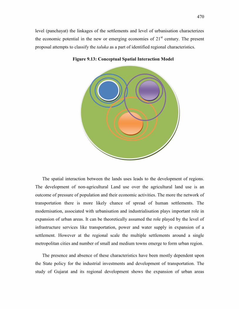
470
level (panchayat) the linkages of the settlements and level of urbanisation characterizes
the economic potential in the new or emerging economies of 21st century. The present
proposal attempts to classify the taluka as a part of identified regional characteristics.
Figure 9.13: Conceptual Spatial Interaction Model
The spatial interaction between the lands uses leads to the development of regions.
The development of non-agricultural Land use over the agricultural land use is an
outcome of pressure of population and their economic activities. The more the network of
transportation there is more likely chance of spread of human settlements. The
modernisation, associated with urbanisation and industrialisation plays important role in
expansion of urban areas. It can be theoretically assumed the role played by the level of
infrastructure services like transportation, power and water supply in expansion of a
settlement. However at the regional scale the multiple settlements around a single
metropolitan cities and number of small and medium towns emerge to form urban region.
The presence and absence of these characteristics have been mostly dependent upon
the State policy for the industrial investments and development of transportation. The
study of Gujarat and its regional development shows the expansion of urban areas

P a g e | 471
sufficiently associated with the transportation and industrial investment. If this is the
spatial development model emerged during last 50 years than how regional planning
framework can be adopted.
The following section attempts to discussion on the conceptual preposition for
regional perspectives based on outcome of the analysis using the spatial correlation
methods.
9.9.1 New Assumptions for Regional Development Perspectives
a) Greater the emphasis on the agricultural regions, greater would be the
control over unabated urbanisation and Industrialisation
b) Greater the emphasis on urbanization, lesser would be the development of
agriculture in the hinterlands and growth of manufacturing industries.
c) Greater the emphasis on industrial development, lesser would be the
growth of agriculture and urbanisation
d) Macro regional characteristics emanate out of the combined land
utilisation pattern by the three major typologies
9.9.2 Role of Transportation (Intra-Regional Movement)
The development of transportation within the region would promote the connectivity
to the settlements, facilitating the Intra-Regional movement of the good, services and
manpower. These have been provided during the various plan periods wherein about 90
per cent of the settlements in Gujarat state have access roads.
Though the connectivity has promoted the movement of agricultural produce to the
nearest collection centres or town, there are smaller settlements or non-agrarian villages
wherein the roads have provided access of the nearest town. The more goods and services
from the nearest towns have been able to reach the villages. The distance between the
town and villages, status of the town and economic base of the town, would be
responsible for the development of the region.

472
Emergence of Transportation (Trans-Regional Phenomenon)
The increased presence of the transportation network connecting regions of country,
mainly port, rail, road, and air connectivity has resulted in movement of goods and
passengers across the country. The development of regions as the transfer stations or
intermediate transit points has emerged, historically as well as recently. The proposed
Western Freight Corridors by Indian Railway (Delhi-Mumbai about 570 kms in Gujarat),
private port development in Gujarat serving to Western and Northern India and increased
traffic on the airports, would all result in expansion of transport nodes. The proposed
activity nodes in all these projects in the State are going to emerge as industrial as well as
urbanisation hub. It might change the regional characters of North Gujarat, Saurashtra
and Kachchh. An effective regional planning mechanism should be evolved not only to
take care of investment but also impact on the rural livelihoods and employment pattern.
There would be lot of pressure on agricultural and vacant lands to be utilized for the
purposes and would affect the urbanisation pattern in the State.
9.9.3 Classification of Spatial Regions by Activities
The regional classification of the space based on the broad category of land utilization
for development involves contextual changes based on frequency and quantum of its
change over the previous use. The development perspectives of regions based on land use
change can be classified as under;
(a) No Change Region
Due to emergence of the environmental and regulatory frameworks for the protection
of natural resources the land use of certain areas cannot be changed except minor changes
for providing access. The areas under the water bodies such as river, lakes, ponds, dam
reservoir etc. cannot be altered for the development of human settlements. Similarly the
large areas of forest reserves, wetlands and protected areas (defence/electrical
installations etc) as declared under the statuary provisions cannot be altered. The spatial
perspectives or plan should not alter the uses of such land which are required for
protections.

P a g e | 473
(b) Agriculture or Transition Region
Over the periods the agricultural lands have remained unprotected from the changes
due to industrialization and urbanisation. A large tract of areas under agriculture exists on
the fringes of urban and industrial areas which are subject to change for economic
growth. The agricultural uses may be termed as ‘transition’ use, that are prone to
development changes, resulting in certain development taluka / blocks losing more than
70-80 per cent land to urbanisation. The rate of conversion of these transition lands for
the non-agricultural land should determine the sprawl pattern of the large urban
agglomerations.
These agricultural regions need protection in order to ensure food security of the
future population. A lot of plan expenditure has been incurred on the development of
agriculture sector, by investing in irrigation network, levelling of soil, development of
water resources etc thus requiring protection. The agriculture development policies of the
State should also encompass the areas needed for the cultivation of various crops
including food, cereals, cash crops and plantation. The fertile tract with multiple cropping
needs protection from the urbanisation and industrialization.
In addition, in a sub-region within the large urban complex with high agricultural
potential needs protection so as to be utilized for cropping. Thus, important for ensuring
food supply for the future populations in the region.
(c) Urban Region
The emergence of large urban areas beyond its historical limits have to led to
expansion of fringes and in some case led to development of multi-core cities. There is
distinct development and expansion of these city cores due to subsequent land utilization
is promoted through development plans (by urban development authorities). During the
next 50 years the State might have large urban agglomerations such as Ahmedabad
(12,000 Sq.km), Vadodara 1500 sq.km, Surat 2500 Sq.km, Rajkot 500 Sq.km, Bharuch
200 Sq.km) etc. These large urban tracts would have transportation networks connecting
all the multiple cores and residential zones ferrying people through mass transport
systems.

474
The specific development plans for these urban regions are within the existing
framework of land use planning done under the Gujarat Town Planning and Valuation
Act, 1976., Gujarat Township Act, Special Investment Regions, Special Economic Zones
etc. Thus urban regions have statuary provisions for their protection and planning leading
to organized development in future.
Urban Region cannot be revert back to agriculture dominated region thereby needs
careful planning for protection of natural areas including water bodies, forest areas and
wild life reserves. Large urban areas would also reject harmful manufacturing industries,
leading to movement of people in new areas.
(d) Investment or Industrial regions
The manufacturing sector has been contributing towards 30 per cent of Gujarat’s
State Domestic Product. From being started as small scale units with a few large public
sector projects in the 1960s to the present large corporate investments, the spatial
requirements of industrial units have changed leading to expansion of land requirements.
The concept of special investment regions and special economic zones has emerged after
2004 due to economic compulsions of planning in India. The State has existing and
proposed over 90 special economic zones and 13 special investment regions where land
areas utilized by SEZs range from 10 acres to 5,000 acres, whereas up to 1,000 sq.kms. of
land is proposed to be utilized for a Special Investment Region. The need for the
industrial area planning has attained importance given the logistics requirements and
facilities to be provided for sustained development.
But it can also be assessed that these investment regions and economic zones would
have adverse impact on the environment and human health. Specific planning provisions
would be required in order to provide adequate protection against the negative impact of
the industrial activities in the region.
Such areas require constant monitoring of air, water and land pollution levels, and
zoning of areas suitable for industries needs to be carried out in order to offer land to
industries. Industries also tend to provide employment to at least a quarter of the skilled
manpower in urban areas; thereby linkages with existing urban areas tend to be

P a g e | 475
important. Export possessing zones may have specialized products and processes
requiring specific spatial planning for the investment regions.
9.9.4 Proposed Scalar Regional Development Model
The aim for presenting the Regional Development Model is to adopt the systems
approach in maintaining Settlement Hierarchy and Usage
Assumptions:
(a) No distinction between rural and urban settlements.
(b) Hierarchy of settlement to be maintained as per the land use desired
(c) Transformation for settlements takes place from agricultural to Industrial/Service
based societies, thus affecting the land utilization.
The models presented below represents the transformation of settlements from
agrarian to industrial –urbanised places. It may be rural-urban, urban to urban and small
size city to large metropolitan areas. Transects are estimated based on the criteria evolved
from the present urban development practices in India. However, user can place the
various model diagrams in groups or combinations of models to visualize the regional
develop characters. The cluster based development approach can also adopt the model
provided land suitability analysis and data is made available for selection of appropriate
diagram.

476
Figure 9.14: Transect Model of Urban Region
Transecting
Urban areas tend to expand to its rural hinterland from a small town to metropolitan city
given its expansion in manufacturing base, later the manufacturing may shift to
periphery. Thus conversion of region of rural region to an urban region, changes the
spatial characteristics from individual settlements to combined urban space. The size of
urban region demarcates the development potentials and investments in the region.
Scalar Settlement (Development Stage) Typologies in region:
(a) Rural Settlement (more primary economic activities)
(b) Small and Medium Town
(c) Metropolitan Areas or Class-I towns
(d) A Large Urban Agglomeration or Planned Urban Area

P a g e | 477
Figure 9.15: Scalar Settlement (Development Stage) Typologies in region.
Spatial classification of settlements based on its development characteristics
provides an opportunity to understand urbanisation and industrialisation in the region.
The following figure attempts scale the regional planning based on the spatial
characteristics. The regional plan based on the above spatial characteristics of settlement
can be prepared for future to manage the land. Land utilization would become important
component not only for the urban areas but also its hinterland.
A B
C D
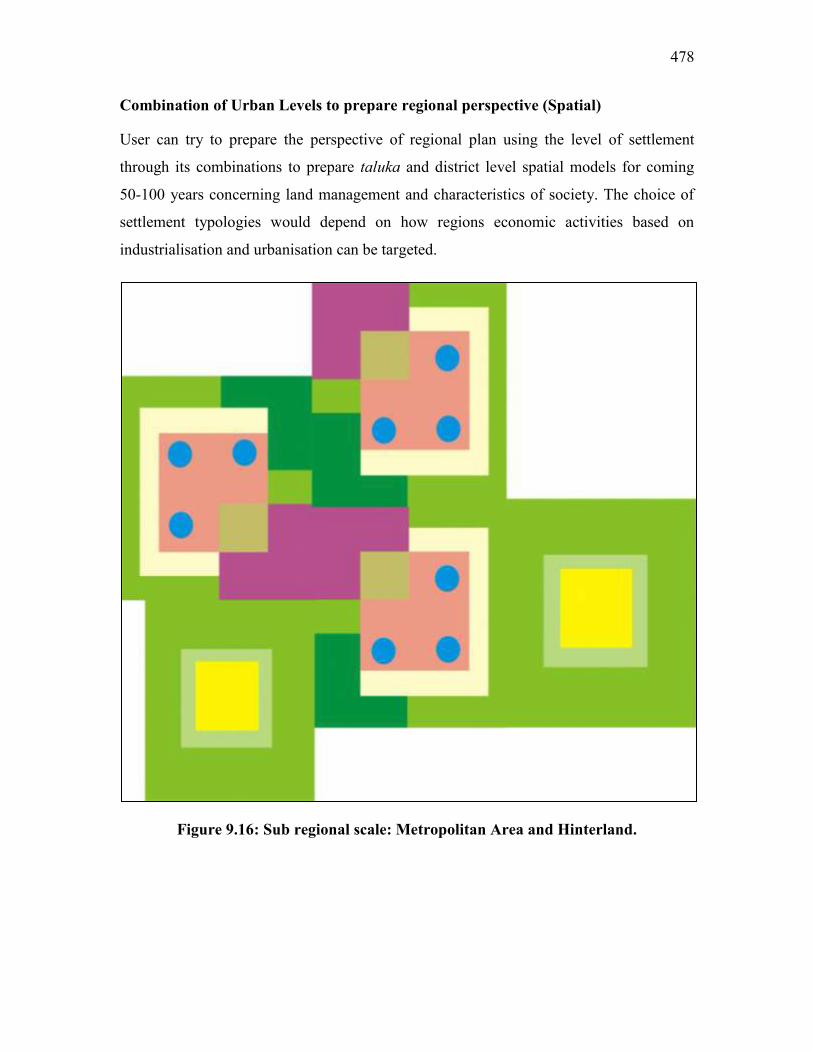
478
Combination of Urban Levels to prepare regional perspective (Spatial)
User can try to prepare the perspective of regional plan using the level of settlement
through its combinations to prepare taluka and district level spatial models for coming
50-100 years concerning land management and characteristics of society. The choice of
settlement typologies would depend on how regions economic activities based on
industrialisation and urbanisation can be targeted.
Figure 9.16: Sub regional scale: Metropolitan Area and Hinterland.

P a g e | 479
Figure: 9.17: Regional Scale Model: Metropolitan areas interspersed with rural
hinterland.

480
9.10 Geographical / Regional Development Matrix (Dominant Characteristics)
Following section provides for the dominant characteristics of development leading to
development dynamics of state and country in general. However, much of the thoughts
mentioned can be useful for development perspectives for the region, these are general
observations.
(a) Socio-Political Changes in Gujarat
The regions development aspirations are influenced by the social actions of dominant
castes, mainly Patidars435 in Central and North Gujarat, Rajputs in Saurashtra, leading
tribal groups like the Choudharies and the Patidars in South Gujarat and Kacchi Patels in
Kachchh. These elite groups dominated the aspects of development as well as politics of
the respective regions till 1980s. Later on, the numerically dominating backward castes
and tribes started influencing the politics of the State, resulting in the violent reactions of
the elite castes. As Atul Kohli (2009)436 points out,
‘The major target of the insurrections is the State itself. It is important to
emphasize that the importance of the State for opposing groups is not primarily the
policies the State pursues but rather the symbolism of power and, more important,
the economic resources the State controls. As an articulate participant to Gujarat
Politics put, it ‘If you are not with the ruling party today, chances are life will be
difficult’. The state is everywhere. Life chances are influenced by the State. If you
don’t have access to the State, life is difficult.’ (p.314)
The numerically significant regions and communities have responded to the
development policies of the elites after 1980s. Those living in Saurashtra and South
Gujarat challenged the political dominance of Central and North Gujarat. In response, the
development violence persists on North and Central Gujarat, which seek to corner the
development funds in a reaction to growing development of the backward regions. The
suppressive policies in eastern hills dominated Gujarat politics until the early 2000s and
with the enactment of the Forest Rights Act, the assertions of the tribal rights on
435
Patidars, a term used for the main land holding and farming community in central Gujarat often for the
Patel’s of central Gujarat. Similarly the term Choudharis are used for such communities in South Gujarat. 436
Kohli, Atul (2009): “Democracy and Development in India: From Socialism to Pro-Business”, Reprint
from ‘Growing Turmoil in an ‘Advanced State: Gujarat’ in Atul Kohli, Democracy and Discontent: India’s
Growing Crisis and Governability, Cambridge University Press, New York, pp. 238-66
P a g e | 481
development is established. Later, the State was forced to invest in these regions in order
to gain the political power as well as access to the natural resources.
It can be summarized that concern for backward area development in the State
policies and programmes do not make enough impact on the ground. Its often observed
for the politicians that ‘What goes on is get into power, amass wealth, keep talking about
welfare of the poor and backward areas and find the ways to win the next elections.’ The
ground reality of development as community leaders but it’s also equally true for political
parties.
(b) Spatial Fix: A Geographical Construct for Development
The problem of uneven growth and inequality is discussed in the literature published
as far back as 1821 with publication of Hegels, Philosophy of Right (1821), Von Thunen,
The Isolated State (1826), Karl Marx, Capital (1875) and Critique of Hagels Philosophy
of Right (1970), David Harvey, Radical Geography (1977) and Limits to Capital (1982).
Spatial Fix is term used by Karl Marx for Outer Transformation of Space in
contradiction to Inner Transformation of Society, where the earlier represents the
expansion of capitalism, through imperialism, colonialism and geographical expansion
while the later represents ultimate dissolution of inner contradiction of society to achieve
ideal state.437
In present context the development contradiction in the country and state is often
reviewed and current approach (in 11th
and 12th
Plan) is aiming for ‘inclusive growth’. It
appears that the development strategies based on growth of Gross Domestic Product
(GDP) is inspired by Harrod-Domar model438 is moving towards Spatial Fix i.e. more
aggressive market based economy. It is this reality for developing countries like India the
Statement, there is no hidden hand in capitalist mode of development carried forward by
market based economies holds true against the belief of classical economist Adam Smith.
437
Harvey, David (2009): “The Spatial Fix – Hegel, Von Thunen and Karl Marx”, Lecture at John
Hopkins University, PDF. 438
Harrod- Domar Model basically delivers on present GDP based growth in country and state ‘where GDP
growth is proportional to the share of investment spending in GDP’.
482
The ‘inclusive growth’ principle adheres more towards ‘spatial fix’ i.e. development
transformation of outer spaces.
During the early 18th century the idea of ‘Imperialism’ was mooted to resolve this
inner contradiction is society as David Harvey suggests was mooted by Hagel (1821) in
his works. Later Von Thunen (1826), in his construct of ‘Ideal State’ tries to accept the
social reality and resolves by creating ‘Isolated State’. He presented details about spatial
ordering of agricultural production. In part two of The Isolated State (1850), ‘Von
Thunen’s enquiry undergoes a profound change, the two parts of The Isolated State
exhibit certain continuities. The ideal construct of the isolated state is preserved, for
example, but is used in Part 2 as a tool to investigate how social stability, continuity and
harmony can be maintained in a civil society increasingly threatened by the social
disorders stemming from rising class antagonisms and mass poverty.’439
To simplify the concept the nature of Spatial Fix is opposed to the idea of socialist
society as propounded by Marx, Lenin and others which primarily deals with the
removing the inner contradiction in society. The neo-classical economists led by Alfred
Marshall as per David Harvey had abandoned the ‘spatial fix’ a part of political economy.
As he mentions,
‘Economics, as Walter Isard was later to complain, thereafter abandoned all
serious consideration of space and accepted Marshall’s dictum that “the
influence of time” is “more fundamental than that of space.” But elimination
of the spatial fix from consideration was also crucial to dismantling
traditional political economy. Spatial relations became the exclusive preserve
of political theory, which severed all direct connection with the day-to-day
realities of the circulation of capital and its contradictions, and substituted an
organicist theory of the State (caught in a struggle for survival, needing
lebensraum, etc.) and associated doctrines of manifest destiny, white man’s
burden, racist superiority, and the like.’440
As per understanding of the Marxists thought, there is unification of capitalist
exploitation and spatial fix as David Harvey explains the contradiction as,
439
Op.Cit. Harvey David (2002) 440
Ibid, p.9

P a g e | 483
‘Centers exploit peripheries, the metropolis exploits its hinterland, the first
world subjugates and mercilessly exploits the third, and so on. Class struggle
within a particular civil society is reconstituted as the struggle of peripheral
social formations against some central source of oppression. The country
revolts against the city, the periphery against the center, the third world
against the first.’
These phenomenon as explained are part of spatial fix nurtured through the
capitalist system now transformed from market based economy to globalisation. Location
and spatial aspects were neglected over the years by the economists leading to lack of
development studies. The development of macro-economic theories and emergence of
national concerns led to serious thinking towards spatial development. The independence
of countries from their erstwhile colonial masters urged them towards growth of nations;
thereby the development thinking emerged. The emergence of regional economics was
due to importance of economic analysis and thoughts for spatial development strategies.
The market based economists and socialist developmental theorists adopted the
strategies suitable for their political economy. Thus the formation of two development
blocks in world economy i.e. capitalist and socialist. The capital based development
imagined conditions of perfect competition and perfect mobility of factors of production,
where factor prices in all regions would be equalised. Whereas, the socialist based
development thought favoured about planned intervention to understand interdependence
of regional economies and provide for the development of backward regions by
institutionalising the investment and role of the State in production and distribution.
The failure or collapse of the communist’s regime in former USSR led to setback
to the socialist model of development and resulted in further aggressive movement of
capital through globalisation has set into the world economic system. Thus it can be said,
‘Spatial Fix’ as endorsed and propounded by Karl Marx tends to continue and enforce the
dominance of capital on the outer space. Even though there is mix planning approach
recently in countries like China and India the social inequality persists amongst world
regions and also within the countries.
484
(c) Measurement of Development and Regional Development
As the dominance of economists has grown within development thought, of the
measures were used for conducting macro-economic studies. The numerous indicators
developed in the early 1980s led to quantification of development by the World forums,
initially looking at the poverty levels by measuring the per capita income and growth of
Gross Domestic Product (GDP). The Gini Coefficient and Lorenz Curve were important
tools to measure development and inequality in the regions.
The development of Physical Quality of Life Index (PQLI) for measuring a
country’s provision of basic amenities such as health, nutrition as well as education was
proposed by M.D. Morris in 1979. He used this measure for the upper 40 per cent of the
population. He constructed PQLI measure in terms of three indicators, like (a) Longevity,
as measured by Life Expectancy at Birth, (b) Infant Mortality at age one and (c) adult
literacy. Since 1991 United Nations Development Programme (UNDP) has started
measurement of Human Development Index for the World and has also presented annual
reports for different countries. Later, since 1997, the Human Poverty Index (HPI) is also
being presented for the countries for material standard of living including the purchasing
power parity (in US$) and real Gross National Product per capita. The relative
deprivation of countries within certain development blocks is represented in HPI, where
income and poverty in certain societies poses strain on relatively poor person in the form
of social exclusion.441
Regional development on the other hand, has a wide variety of indicators which
includes geographical and physiographical characteristics, physical availability of
amenities, nature of agriculture, employment in sectors, concentration of backward
communities’ etcetera. The planning framework tends to assume that overall economic
growth would automatically lead to the development of backward areas and regional
imbalances that might get accentuated on the account of the operations of planning
process could be rectified with help of instruments such as industrialisation, provision of
education and training, providing physical infrastructure etcetera.
441
Pal, Saroj (2005): Lexicon on Geography of Development, Concept Publication, New Delhi, pp. 17-24.
P a g e | 485
The identification of backward areas in India by various committees instituted by
the planning commission could have help in reducing the backwardness in some of the
poor states. In terms of per centage of backward districts, the State like Gujarat and West
Bengal had more backward districts than Jammu and Kashmir, Orissa, Bihar, Assam and
Rajasthan. Since certain programmes like industrialisation required certain minimum
basic facilities as a result most of the investments by the industries were limited to the
developed areas. In Gujarat state regional investment for the industries were concentrated
in the backward areas of developed districts.
Gujarat achieved sectoral and temporal integration of the planned intervention
from the initial plan to the present. Thus, resulting in the growth of the sectors and
enhancing of funds over the years. What may be missed is ‘spatial integration’ i.e.
linkages between the spaces that constitute an area. This is similar to linkages amongst
the activities ensuring development of economic sectors and leading to overall growth,
the spatial linkages within the region might result in balanced growth of region. The
approach would require the identification of spatial characteristics of the region by its
dominant land uses and integrated with other similar or varied land uses to achieve the
planning goals.
9.11 Conclusion
The regional planning perspective presented here draws the points from the
theoretical debate ranging from the development concerns expressed at global,
national and state level. The future of strategies for regional development for the State
should be looking into the suitable planning units within districts, or start a special
area approach as in case with investment regions and special economic zones. The
concerns of people related to land losses, damages to environment, dispossession due
to development and development of backward communities needs to be stressed. The
findings related to climate change and impact on the State should be understood from
the perspective of vulnerability of regions. The development targets and investment in
the vulnerable regions needs have addition mitigation measures and increased
adaptation capacity. The urban-rural framework needs to be re looked in terms of
reducing the development divide by emphasising on the need for the investment in

486
infrastructure. The urban areas across the regions should contribute towards the
development of rural hinterland and spatially interlinked to achieve the development
goals. The backward areas need urbanisation strategies so as to trigger the economic
as well as human development.
The classification of region based on the dominant land use needs to
understand from the perspective of spatial integration. The recognition of areas
specific for certain land uses particularly agricultural areas would result in sustainable
development as well as protection of natural resources. The nature of development by
the dominance of the capital needs to be understood from its exploitative tendencies, a
progress towards the inner development of societies should be emerging goals. The
regional development shall have to integrate the spatial units within its area for
planning, rather than merely concentrating on the investment in sectors.

P a g e | 487
CHAPTER TEN
SUMMERY, SCOPE AND PERSPECTIVES OF REGIONAL
DEVELOPMENT PLANNING IN GUJARAT
At the outset of the study, it was hypothesised that,
“The development dynamics and dimensions within districts/regions are different
depending upon the location, natural resources and population composition, and need
special attention in relation to inter-regional and intra-regional socio-economic and
political forces”
The hypothesis was found to be true after having a critical analysis of the
development processes, causative phenomena and impacts across the various regions of
Gujarat. The appraisal of key sectors like, agriculture and industry indicates that these
sectors have led to multi-dimensional outcome in the economy of the State. The planning
mechanism understood mainly through the study of documents related to National
Development Council, revealed the process of planning. The field investigations for the
purpose of this research as well as during the period (2005-2012) also led to the
understanding of the processes, efforts and outcomes of the State Government efforts. It
was also found that there are several note worthy studies conducted on development-
induced displacement, changing forest characteristics, deliberations by the National
Development Council and events that happened post 2002.
The research would have been completed well in time given the nature of
investigation. But due to frequent policy changes and transition of the State from welfare
to capitalist oriented framework led to delay in analysis and presentation of the results.
Although the above hypothesis has not been tested using specific parameters and
statistical tools, and more reliance has been laid on descriptive, logical and exploratory
methods, it stands the scrutiny and corroborates with the reality. The study should also
stand tested on the fundamental principles of conducting geographical studies particularly
in Human Geography.

488
This chapter is an attempt to summarize and conclude the study. The regional
development planning strategies for the State is discussed by linking the perspectives of
development in general and regional development in particular.
The Gujarat state by itself presented a case study of intense development changes
and issues mainly concerned with urbanisation, industrialization and resource
exploitation. In the process, the State could achieve its growth targets, but it also
alienated large masses in the backward regions and the backward communities in
developed areas including the urban areas. The resource exploitation, including the
spatial localization of industries, has resulted in negative impacts of the environment of
different regions. This has had serious negative impact on the quality of water, not only
for drinking purposes but also for irrigation, affecting the areas under agriculture. The
development induced displacements over the years has resulted in large dispossession of
people and communities affecting their abilities to come forward to enjoy the fruits of
economic growth.
The nature of development in the State brought out through the geographical
analysis of its spatial development characteristics indicates that several distortions have
been introduced in the process. On the basis of the study on Gujarat’s Development
Model (post-2002), the following political - economic explanations emerge.
(a) India’s National development efforts emerged from the strategies and
policies effectively planned during the various plan periods. Gujarat,
like all other state of the country, has been provided with the plan
direction and funding from the Ist plan to the XII
th Plan period. The
funds were released according to agreed framework set up by the
Planning Commission.
(b) The State was early to adopt industrialization strategies encouraging
small and medium enterprises through industrial estates. This boosted
the industrial climate of the State with concentration of industries
subsequently nearer to urban areas.
P a g e | 489
(c) Industrialisation and urbanisation in the State are strongly related to
each other due to their spatial co-existence in all the regions. The
major economic change in the mainland Gujarat till the 1990s, in
Saurashtra after the 1990s and in Kachchh post 2001, resulted in an
increase in the per capita income of the State.
(d) Migration to the metropolitan cities continues unabated, contributing
to sprawl of cities like, Ahmedabad, Surat, Vadodara and Rajkot. The
de-urbanisation of small and medium towns was also the result of lack
of investment in their infrastructure as well as strong ‘pull factor’ of
large cities.
(e) The location of industries and its growth has also affected the quality
of water and land in the State, thereby making much of mainland
Gujarat not fit for further industrial investment.
(f) The mega water resource projects like Dharoi, Ukai, Damanganga,
Karjan Mahi and Narmada, have led to the creation of vast reservoir
and canal networks inducing agricultural changes in North, Central
and South Gujarat plains. But it has also alienated and displaced the
backward communities like dalits and tribes from the land which was
crucial for their livelihoods.
(g) Aggressive mining policies have lead to the development of the
mineral sector, particularly oil exploration and lignite in the State, but
have also lead to the destruction of several habitats in the mining
areas.
(h) Post 2001, the State adopted a distinct model, often named after the
current Chief Minister, and kind of politics practiced by the party in
power. On the one hand, during 1990-2001, Gujarat had been termed
as ‘Hindutva’ laboratory by the social analysts, opposition parties and
others, but on the other hand, during 2002-2012, Gujarat presented
distinct development strategies.

490
(i) The so called ‘Hindutva’ politics has lead to social transformation in
Gujarat, particularly localized in the plains of North and Central
Gujarat. The polarization of society on the lines of communities, i.e.
caste and religion, had major impacts on the urban areas. The
continuity of the policies of the State is more towards assertion of
these ideologies through the development programmes.442
(j) Globalisation of Gujarat was basically as a result of aggressive
economic policies and changes in the administration of development
programmes. The State has been initiating special institutions, like
corporate companies, trusts and societies, all owned by the State
institutions. The objective has been to manage the State affairs not
only through Government Departments but also through these new
Organisations.
(k) Post 2002, the Gujarat state had strengthened the corporate formation
of many companies and institutions such as, split of electricity boards
into five different companies (GETCO, UGVCL, MGVCL, SGVCL,
PGVCL), Gujarat State Petrochemical Limited, (GSPCL), Gujarat
Green Revolution Company Ltd (GGR), Gujarat State Non-Resident
Gujarati Foundation (NGT), D-SAG, etc. Thus, increasing the State
capital and forging state capitalism as policy directional change.
(l) These companies and societies are formed to streamline the State
investment in the sectors which were opened for private investment
after the liberalisation of the economy post 1991.
Thus, it can be said that,
442
Section (h) and (i) have not been discussed in the report,Details are available from the works done the
Achyut Yagnik and Suchitra Seth, Lancy Lobo, Ghanshyam Shah, and Arvind M Shah during various
studies conducted on the social changes in Gujarat during period 1990 to 2012.
P a g e | 491
“India had adopted a mixed economy, whereas there are two states, West Bengal
and Kerala, which had earlier adopted separate development models, based on the
socialist framework (also termed leftist), whereas post 2002, the Gujarat state has
adopted the capitalist model, a perspective different from the National planning
perspective. The aggressive nature of the capitalist perspective of the State is being
presented during the various investment summits (Vibrant Gujarat) organized since
2003”.
Regional development planning mostly concerns itself with equitable distribution
of resources, and for the purpose, the State agencies provide with appropriate policy
framework/formulate appropriate strategies for the development of the constituent units
of the region. The following strategies may be of crucial significance in the context of
regional development planning in the State.
a) Regions delimited on the basis of their regional characteristics and provided
with specific institutions for focused attention for their development should
not be limited only to the backward areas but also should incorporate
protection of communities in these regions.
b) The concept of the agricultural region (may be part of a larger region) may
serve the purpose to protect the agricultural areas for ensuring food
security.443
c) The industrial regions, on the other hand, might strengthen the economic
investment climate in the State, but would also be crucial for reducing the
negative externalities.
d) The transitional zones, as discussed earlier (see chapter Nine), are the areas
left for spatial planning, may not be being used for any specific purpose, but
are likely to get urbanised given the pressure of population and development.
443
Also termed as Green Economic Zone (GEZ) by a development activist Bhasha Research Center
Vadodara (2010).

492
How to address the development concerns of the backward areas, lagging or poor
regions and other regions? It is easier to announce the institutions to begin the regional
development planning but most important would be to discuss the concepts, issues and
concerns so required not only for proposed institutional mechanism but also for adoption
in the present planning mechanism. The conclusions and findings though have been also
presented in earlier chapters, it is equally important to relate them with the regional
concepts which can be adopted. The following sections present such explanations, not
necessarily as an outcome of this research but a collective presentation of the efforts
required for general development strategy and also supporting the backward regions.
A. Nature of Regional Development and Potentials
There is a need to develop a coordinated regional development strategy for the
backward regions, at least for the following reasons.
a) Evidence that there are strong “neighbourhood effects”, as explained in
subsequent section that, in the backward talukas or regions drag down the
growth of the State. As a result, these low growth regions tend to get
clustered and ‘divided’ from the rest of the Gujarat economy.
b) The low growth regions of the State have strong growth potential. These
are densely populated regions like the Eastern Hills, Saurashtra and North
Gujarat, with a large potential market, along with mineral and natural
resources. Developing these resources is important not only for the
talukas or sub-regions but also for overall growth of the State. The
regions located between sea ports and urban centers have good potential
for growth.
c) Growth in the backward regions is required for further development of the
State. The spill over effects of lower growth in the backward regions will
also affect growth of the rest of Gujarat.

P a g e | 493
Scope for Regional Development
a) The priority in a regional development strategy should be to address the
dependence of the backward regions on agriculture and other primary
occupations with low and subsistence production, which is a constraint on the
growth of the these regions.
The challenge for primarily agricultural economies in backward areas such as,
northern dry lands, Eastern Hills and Coastal Saurashtra, will be to plan for transition
towards more diversified and more productive manufacturing and services sectors. But,
such a transition would require growth in agricultural productivity as a precondition to
build the base for economic diversification and urban development.
b) The ‘agriculture-first’ strategy will need to be complemented with rural-urban
linkages and urban development focusing on small and medium towns which
are interlinked closely to the rural economy.
Investment in urban infrastructure and services are required in the small and
medium towns (market towns) located in backward talukas. Over the medium term, the
priority can be to support the growth of the larger towns in the backward regions.
Specific urbanisation and development schemes are required for long term intervention
for growth of urban centers.
c) Agricultural growth, urban development and rural-urban linkages in the
backward regions are constrained particularly, by poor ‘local infrastructure’
and ‘resource utilisation.’
Regional planning should consider expansion of road networks that link villages
with State and National Highways and market towns, and improving connectivity
between market towns and other towns. In addition, financial inclusion of poor and

494
backward communities needs to be addressed in this respect for increasing their access to
credit and power.
d) While the backward talukas and regions like Eastern Hills, Dangs, northern
dry lands (Banaskantha, Sabarkantha) lag behind in most human development
indicators which affect long-term growth prospects, the underlying constraint
that needs to be addressed is social development.
Greater investments in human capital and improvements in service delivery, where
the human development performance is poor, are required to be improved. The most
important social development in such regions can be taken up by prioritizing: female
literacy, work participation and empowerment by providing quality infrastructure;
targeted sub-regional development programmes for ‘No Change’ regions like forests,
subsistence agriculture regions and other regions; to improve infrastructure and economic
opportunities for tribal, minority and some pockets of Scheduled Caste communities;
promoting ‘inclusive development’; implementation of 73rd
and 74th
constitutional
amendments; and community participation in planning process.
e) Finally, growth and development in the backward regions are constrained by
the lower development expenditures and weak institutions.
Public investments for well over two decades in infrastructure and social
development on a per capita basis have been one-third to one-half of those in the
developed talukas. Increasing planned investment in a sustainable manner to bridge these
investment gaps will be important for the growth of such areas. But equally important
will be, increasing the efficiency and effectiveness of public spending by strengthening
institutions and incentives to deliver development outcomes. On its part, the special area
planning approach can be adopted for the sub-region and introduce spatial and
community based targeted programmes to increase expenditure. The sustained efforts by
formation of Regional Development Authority which can be provided funds from the
State Plans, conditional on improvements in results (outputs and outcomes), better

P a g e | 495
financial management and accountability, and monitoring and evaluation of development
outcomes.
This study, thus, identifies regional development strategy built around
policies that are good for both the development of the less developed regions and for
overall development of the State. That is, these policies are more specific to the
geographical nature of the State and distribution of communities would place a greater
focus on regional and state specific development. These focuses on and addressing key
issues: adverse effects on urbanisation and industrial backward Areas; the comparative
advantages of the backwards regions in agriculture and development towns located in
region, agro-based, labour intensive industries; support for infrastructure; critical human
and social development that addresses exclusion, and; targeted investments of public
expenditures alongside capacity building for the communities. Further, Regional
development policy should aim to achieve greater equity in welfare for the population of
different regions rather than equality of economic activity in all regions.
A regional development authority may be set up to design and coordinate the
implementation of the regional development plan. Such an authority, comprising the
State government, district and taluka level officials and peoples’ representatives could
help to: (i) strengthen the Nation’s and the State’s focus on regional development and
coordinate regional infrastructure investments to redistribute according to spatial
requirements; (ii) coordinate fiscal, industrial and regulatory policies by providing
competing and excessive fiscal, credit, regulatory and incentives for investments; and (iii)
design targeted area and conditional transfer programmes using both Central and state
resources aimed at improving human development indicators for depressed communities
including females, tribal’s, dalits, other backward castes and minorities.
The next section, Section B, presents the key findings about the regions; Section
C summarizes the findings on the constraints they face in raising growth and
development.
B. Key Findings – Spatial Diversity, Geography and Migration Trends
There is considerable diversity within the lagging regions/
496
Five different types of lagging regions can be identified, the last of which actually
lies in the urbanized regions: (i) the densely populated Northern dry lands and Eastern
Hills which are constrained by water and thus lacks agricultural development; (ii) the
urbanized and industrial Backward Areas – urbanised districts of Ahmedabad and
Gandhinagar in North, Anand-Vadodara in Central, Bharuch-Ankleshwar, Surat-Navsari
and Valsad-Vapi in South Gujarat have more industrial investment and public
expenditure but have poor human development performance particularly in the lagging
talukas of these regions. Saurashtra and Kachchh, where human development indicators
are better, perform poorly in infrastructure investments in urban areas with exception to
some pockets in Jamnagar, Rajkot and Bhavnagar; (iii) the poorer, sparsely populated
districts with a significant share of tribal population and other backward communities that
are clustered around coastal areas of the main land, Saurashtra and Kachchh; in the
Eastern hills starting from Northern hilly regions, Panchmahal and Dahod, parts of
Vadodara, Narmada, parts of Bharuch, Tapi, parts of Navsari, Valsad and The Dangs; (iv)
the hilly regions, along with conflict with forest department and dispossession due to
development projects, are marked with short supply of arable land, except in the hilly
regions in Central Gujarat; and (v) 50 per cent poor talukas in the developed districts,
extending from North to South specifically in Mehsana, Ahmedabad, Anand, Vadodara,
Bharuch and Surat districts. Significantly, this last group borders the lagging talukas of
the State.
Most of the backward regions have access to natural resources. The backward
regions face one disadvantage in connectivity, except for coastal areas, they are all
landlocked. However, most parts of the backward regions, except for the arid regions in
North Gujarat, are well endowed with natural resources, especially water, fertile soil,
forests, and minerals. Bharuch and Kachchh districts have most of the mineral reserves in
the State. These areas alone have large share of inland oil exploration (Bharuch), lignite,
limestones, and 90 per cent of the chrome deposits of the State. Approximately around 25
per cent of all mineral resources are concentrated in Kachchh. Virtually all of the State’s
petroleum prospects are located in the backward regions. These ‘lagging regions’ are
P a g e | 497
thus, well endowed with what economic geographers444
(Krugman, 2006445
) call ‘first
nature geography.’
At the same time, the lagging regions are clearly poorer in ‘second nature
geography,’ that is, infrastructure and human development. While, overall highway
development and road density have improved considerably in the backward regions since
the 1980s, they have consistently lagged behind the developed talukas in terms of
villages having access to paved roads (67 % in the backwards talukas as against 95 % in
the developed talukas), power (70 % as against 98.5%), and credit (per capita credit is
about one-fifth that of the richer districts). There is a perceptible difference in the
availability of infrastructure: districts with better infrastructure in the 1980s experienced
relatively faster growth during the 1990s. Village access to paved roads and rural-urban
connectivity were particularly important for generating growth in agricultural
productivity and non-farm employment, and in supporting urban development. The
evidence also suggests that infrastructure availability, particularly of power, is one of the
most important factors determining industry location. A survey in 2004 revealed that
talukas in the backward regions, mostly in Central Gujarat, to be among the worst in the
State in the utilization of incentives, power and credit facilities. Backward areas, thus,
can be regarded as key constraints to growth.
Intra-regional differences in infrastructure and human development are also
strikingly higher in the poor regions of the State. The poorer and backward regions
also have their own backward talukas and villages. This is seen in the significantly higher
clustering of infrastructure and development indicators at the district levels but poorer
than state level average. The variation in education, health and infrastructural
development, in the backward talukas across districts, can be as much as 2 to 3 times
higher than in the developed talukas. Further, while inter-regional inequality has fallen
dramatically for some indicators (such as access to power) over the past three decades, it
has widened for other indicators (such as access to health, markets, roads and educational
facilities).
444
Advantage of first nature geography simply means that being close to rivers, coasts, ports, forests etc.
some regions may benefit from natural endowments through specialization in certain type of activities like
fishing , growing crops and forestry. 445
Paul, Krugman (2006): First Nature, Second Nature, and Metropolitan Location, Journal of Regional
Science, XXXIII (2), pp. 129-144

498
The inter-regional migration rates have declined in Gujarat, indicating
reduction in labour mobility due to emergence of regional urbanised areas and
industrial activities. While there is some long-term migration out of the backward
regions such as from North Gujarat, Eastern hilly region, coasts and parts of Saurashtra,
in the 2001 census, there is limited inter-district migration, and rural to rural and rural to
urban migration was largely intra-district migration in the region. Net outward migration
was highest from backward regions. Male migrants came mostly from rural areas, and 60
per cent reported that they had moved for work and permanent employment-related
reasons.
Overall, however, factors such as the large and fast growing populations of the
region, cultural impediments to migration, the lack of sufficient jobs in urban areas as
indicated by low and even declining real urban casual wages, and the relatively low
casual wage differentials across regions (20 to 30%) suggest that long term economic
migration cannot be the main instrument for solving the problems of the poorer regions of
the State. The economic and human development of these regions, mainly in the small
and medium towns and its rural hinterland, remained poor, indicating concentration of
development activities in the large cities.
Migration, especially seasonal migration, however, could help people in the
tribal regions to move out of the clutches of poverty. Such seasonal and often
circulatory migration of labour for employment is an important component of the
livelihood strategies of people living in rural areas, especially those living in the
backward regions of the State. Such migration is often a vital source of cash for
households particularly those from the tribal areas of the Eastern Hills. At the same time,
the extremely poor in rural areas do not take advantage of migration opportunities. A
minimum level of assets is required to make the investment for migration – money for
travel, purchasing supplies to take to the destination and leaving enough for the
household left behind to survive. In addition, with few safety nets to fall back on,
migrants are a very vulnerable group. Interventions that would address these issues will
be needed to help the poorest to take advantage of migration opportunities. This is
especially important given that migration can be important for livelihoods in the sparsely

P a g e | 499
populated areas around Saurashtra, Northern dry lands, coastal areas and Eastern Hilly
regions.
C. National and State Planning, Constraints to Development and Policy
Implications
The potential for development and population growth in backward regions
in the State suggests that the regional development strategy should emphasize
‘providing employment to the people’. It is important to keep in mind two key lessons
of National Development Planning for formulating such a strategy. First, investments and
incentives for regional development should target the constraints requiring minimum
administrative changes associated with such strategies. Planning Commission’s
experience from National Planning suggests that broad fiscal incentives, such as tax
breaks or subsidies, have modest effects on influencing regional growth or on the location
of firms in backward areas (see industrial policies chapter four). While they may affect
investors’ location decisions when the incentives are large enough, they have not
guaranteed that the resulting investments have broader multiplier effects on the regional
economy or that such effects will be sustained. Even a specific intervention, such as
providing infrastructure, needs to be well targeted; in the case of roads, for instance,
evidence suggests, major inter-regional road connectivity investments had significant
productivity impacts on existing industries but their effect on inducing industrialization in
backward regions was limited. In some cases, inter-regional infrastructure improvements,
without complementary investments in local infrastructure and public services, may in
fact, worsen the performance of backward regions by exposing small local producers to
larger outside firms and reducing manufacturing in the regions. Offsetting such problems
will require investments in improving local infrastructure and investment climate.
Similarly, investments in power and telecommunications will have an impact only if they
address more basic binding constraints such as property rights, and law and order.
Policy interventions need to be based on the region’s strengths and
comparative advantages. Both, the principles and theories in economic geography and
regional development, suggest that economic activity locates where there are large and
growing markets, the presence of suppliers and services, and lower costs. The efforts by

500
Central and State Governments to alter the location of economic activity against these
factors may be costly, both in terms of budgets and efficiency of the regional economy.
The evidence also suggests that any single solution, of either promoting capital flows to
backward regions (as in case of past development programmes) or stimulating mobility of
people out of poor areas (by development of growth poles/centres), is unlikely to deliver
the desired results. Though Gujarat has moved from cluster based industrial development
to mega industrial regions, it may result in good capital investment but at the cost of
raising regional inequality. What might be required is a regional development strategy
that combines improvements in service delivery, local amenities, and a supply of factors
and management that take advantage of the characteristics of the region and address its
key constraints.
In the case of the backward regions, five main constraints will need to be
addressed: (i) clustering and strong neighbourhood effects, through which the low
growth of the backward areas lowers the growth of its ‘neighbours’ and the region as a
whole (for example in the developed districts, the presence of backward talukas); (ii) the
dependence of backward and poor economies on less productive agriculture such as in
the tribal regions which are associated with low growth of non-farm jobs and urban
development; (iii) infrastructure, financial development and regulatory weaknesses; (iv)
low levels of human and social development; and (v) the complementary challenges of
low investment rates and weak institutions. These are discussed below.
Addressing Clustering and Neighbourhood Effects…
Regional clustering of outcomes – as depicted by spatial distribution data --
is evident in a variety of dimensions: in income levels, in the diversification of the
economy, in the development of facilities, and in human development and service
delivery indicators. Consequentially the following pattern emerges: (a) poverty is
clustered in the backward regions, often in contiguous locations; close to 80 per cent of
the poorest districts, measured by consumption of households, are located in the
backward regions; (b) except for part of South Gujarat and Saurashtra, the backward
regions are not industrialised; (c) facilities development, such as paved road connectivity,

P a g e | 501
power connections, and postal communications etcetera, are similarly clustered, with the
poor regions lagging behind; (d) key human development indicators, such as high infant
mortality rates, low female literacy and female work participation rates, which represent
the effects of both household incomes and policies, are also significantly clustered in the
backward regions; (e) the clustering is even stronger at the sub-regional level.
Clustering leads to neighbourhood effects which, in turn, again reinforce
clustering, leading to a vicious cycle of development. This means that the slower
development of talukas and districts, particularly in the backward areas, acts as a drag on
the growth of neighbouring regions through spill over effects. The evidence of the
neighbourhood effect also comes from other sources: (a) the positive effect of
infrastructure in neighbouring districts leading to higher agricultural productivity, more
non-farm jobs and urban development in a particular district; and (b) the significant and
higher impact of infrastructure variables in the backward areas. This means that the high
inequality within the backward talukas is itself an important factor in constraining the
region’s development. It also means that the slower growth in the poor regions has
spillovers, adversely affecting the growth of the neighbouring regions and the State’s
overall growth. As it was seen in Vadodara, Bharuch and Surat districts which has
considerable tribal dominated talukas having poor growth affecting overall performance
of the district, thus requiring further division of the district to form new districts, namely,
Narmada and Tapi during the last decade and further new subdivisions proposed Aravalli
(Sabarkantha), Mahi (Vadodara) and Girnar (Junagadh).
The significance of clustering and neighbourhood effects on growth and
development highlight the importance of developing a coordinated strategy for
regional development. A regional development body, such as an Area Development
Authority, set up by the State could be one of the options. The regional authority must
identify the dominant activities for the overall comprehensive management of agriculture,
industrialization and urbanisation. The regions can be classified as sub-regions of the
main regions by clubbing the talukas with their dominant characteristics. Such authorities
can be based on following the proposed sub-regions:
Agricultural areas of Northern Plains, Ahmedabad Urban Region, Forested -
Northern Hills, Dry-Semi-Arid Regions of North Gujarat, Eastern Tribal regions, Central

502
Gujarat – Agricultural areas of Anand, Kheda and Vadodara, Industrial Areas of
Vadodara, Vadodara Urban Region, Agricultural areas of South Gujarat Plains, Coastal
areas of South Gujarat,
Industrial Areas of South Gujarat (Bharuch – Ankleshwar and Vapi-Valsad),
Surat Urban Region, Forested Areas of Navsari, Valsad and The Dangs, Kachchh coastal
areas, Urban Complex – Gandhidham, Mundra, Anjar, Bhuj Urban Region, Industrial
Areas of Jamnagar, Rajkot Urban Region, Agriculture belts in Jamnagar –Rajkot,
Bhavnagar and Amreli – Agriculture areas,
Forested regions of Junagadh, Coastal areas of Saurashtra, Agriculture regions of
Surendranagar-Ahmedabad, Eco-sensitive Zones around Rann of Kachchh, Wetland
areas in Saurashtra and Gulf Regions of Anand, Bhavnagar and Bharuch (encompassing
Kalpsar project region).
Such an authority could address the following: (i) strengthening the focus on
problems of the areas by developing a regional strategy that recognizes the inter-
dependence of development issues among these regions, and the need to address the
lagging districts through regional and state level programmes and without only depending
on Central Government programmes; (ii) coordinating infrastructure investment
requirements to avoid duplication and congestion in some areas and underdevelopment in
other areas; this would specifically ensure that the taluka development plans being
prepared are coordinated and consistent; (iii) coordinating fiscal and regulatory policies
to avoid ‘race to the bottom’ by excessively competitive fiscal and tax concessions; (iv)
coordinating and harmonizing regulatory policies so that industry has equal opportunities
across regions; and (v) designing and implementing capacity building, institutional
development in financial management, public investment programmes, urban
management, knowledge and technology dissemination. At this juncture, it would be
important to have a division of responsibility among the regions in establishing centers of
excellence and training in these areas to take advantage of economies of scale. Another
alternative could be to have a machanism to address the development of the lagging
regions in the State Planning Board or District Planning Committees which would be
important for a regional development strategy.
P a g e | 503
Stimulating Agricultural Productivity Growth…As the Starting Point….
The economy in backward areas is characterized by large shares of low
productivity and volatile agriculture, and low shares of urbanization and
manufacturing. However, raising agricultural productivity is likely to be the cornerstone
of the lagging regions’ growth strategy for several reasons: (a) the decline of productivity
growth and empirical work suggest that it was the differences in agricultural productivity
growth in the 1980s that led to divergence in per-capita incomes in the first instance; (b)
the availability of water, rainfall and good soil in most of the South Gujarat region and in
parts of the hilly regions, is conducive to raising agricultural productivity and
horticulture; (c) the lower crop productivity in the poor areas compared to other regions
(40 % in the case of food grains), despite their natural advantages, suggests that with the
right technology, productivity in such areas can be increased significantly; and (d)
productivity growth in agriculture, which constitutes a large share of the economies and
employment in the backward regions, would result in sustained increase in income for the
majority of the population and promote economic diversification.
The support for an agriculture-first strategy also comes from analyzing the
sources of per capita income growth across the State. There were differences in the
growth of labour productivity in agriculture in the 1980s and later in services, between
the backward areas and other districts of Gujarat.
The agriculture-first strategy for the agricultural regions and backward
areas in Eastern Hills could provide Gujarat with a sustainable development
strategy. Sustaining the growth of food grain production, based on growth in yields in
the traditional granaries of Central Gujarat, Northern Plains and the plains of South
Gujarat, which are dependent on the incentives provided by power and water subsidies
and high priced procurement, may be unsustainable for fiscal reasons. Water logging in
Central Plains and a drop in ground water levels in North Gujarat like Ahmedabad,
Mehsana, Patan and Banaskantha, may also lead to long term soil degradation causing
long term harm to the environment, and reducing the returns in cereal production.
Increasing yields in the agricultural regions to meet the State’s cereal needs thus makes
good regional economic strategy. This could be done by shifting large parts of the
Minimum Support Price-based procurement of crops to the low income regions but

504
without providing farmers with high unsustainable subsidies for power, fertilizer, water,
and procurement.
The other areas where action is needed are:
a) Realizing the untapped irrigation potential of the tribal and hilly areas by
insisting on micro-irrigation schemes. Less than 10 per cent of the agricultural
land is irrigated in most low-income and eastern districts, despite considerable
untapped irrigation potential. A combination of approaches to rehabilitating
and investing in surface irrigation will be needed, with minor and medium
irrigation schemes to be maintained by Water Users’ Associations (WUA) and
incentives for cost recovery and credit facilities to farmers for using more
ground water.
b) Improving access to production and marketing information in the backward
talukas. Despite significant State Government expenditure on agricultural
extension, a few farmers have access to Government extension services.
Institutional innovations will be needed, such as spreading the new
decentralized farmer-driven private partnership based approach.
c) Making land markets more efficient: This could enable consolidation through
leasing and developing contract markets for land use. Land surveys need to be
improved. Maps of agricultural lands at the village level would be required.
Excessive land utilization by the industries and urbanisation needs to be
monitored by ensuring the high yielding areas to have low probability for non-
agricultural activities. The land alienation amongst the small and medium
farmers and tribal’s needs to be arrested by improving state land management.
The regional plans should ensure the suitable compensation and rehabilitation
package in all these cases with high social impacts.
d) For the development of facilities for marketing, storing and cold-chains. These
will help bring about investment in food processing and other labour-intensive
manufacturing activities.
e) Improving connectivity with markets. On an average, a wholesale market in a
low income state services 30,500 hectares of cropped area, compared to a
wholesale market in the middle and high income states which services 17,000

P a g e | 505
to 22,000 hectares. The backward talukas have 40 per cent of the area and
about 45 per cent of the population of the State, but paradoxically have low
share of the total road length.
….Complemented by Urban Development and…
Increasing agricultural productivity in the backward regions will need to be
complemented with policies that support urban development along three lines: (a)
development of small market towns for agricultural marketing which can also host small-
scale manufacturing clusters; (b) development of medium-size towns which can provide
agglomeration and scale advantages to draw in services; and (c) development of urban
management capacity to support urban development.
Three specific interventions will be needed for developing markets and small
towns. First, local roads need expansion and improvement to make it easier to link
neighbouring towns to rural areas. Second, empirical evidence suggests that the provision
of primary schools, electricity and paved roads is positively related with market
development. Finally, the development of small market towns will be facilitated by the
growth of small industry clusters, an area where the backward talukas are currently
lagging.
In the medium-term, a broader strategy for urban development, aimed at the
larger towns (more than 1,00,000 persons each), will also be important, considering
that Gujarat’s growth since the 1990s has been mostly urban-based and larger
towns provide more agglomeration benefits of a diversified economy. Overall, poorer
regions are at a disadvantage here. The urbanization rate in the backward talukas, on an
average, has been low (5- 20 % of the population) compared to the developed district (40-
70 %). Lower urban development in the most of backward talukas, in turn, is linked to
significantly lower public and private investment rates compared to the developed
industrial and urban regions.
Improving city level infrastructure and service delivery are crucial for
attracting private investment; this will require a significant ramping up of local
infrastructure. The new investment areas in the State i.e. proposed Special Economic
Zones and Special Investment Regions lack local expenditure. The regional infrastructure

506
status is lower than already developed regions of mainland Gujarat. Improving service
delivery and infrastructure complemented by better expenditure management in the new
investment regions. Increasing transfer for the development expenditure by the State to
small and medium towns in the short run is likely to stimulate economic benefits, access
to infrastructure and willingness of citizens to pay for services via direct user charges (as
citizens of towns see visible improvements in service performance). This would, in turn,
stimulate new economic activity – thereby increasing the tax base of the towns.
In the medium-term, it will be necessary for the State to decentralize functions
to Urban Local Bodies (ULBs) and increase their own revenues, in order to improve
services and increase accountability. In practice, service delivery arrangements for the
small and medium towns are mostly centralized. Decentralization in urban management
will bring decision-making over the type, quality and cost of services to be provided
physically closer to citizens. This is particularly necessary in the case of the talukas
where distances between district headquarters and towns are large, and where urban
mobility is high, based on geography, ethnicity or other factors. Enhancing self-revenues
of towns would be important for increasing accountability. This will require using a
combination of new valuation methods and enhanced administrative capacity. If an area-
based system is adopted, as is used now in some of the larger urban local bodies in the
country, then a method of updating the guidance values on a regular basis is necessary. A
method to update information on new constructions or major renovations or urban sub-
divisions will need to be put in place. But, implementing such revenue measures in small
and medium towns would require political will and significant investments in enhancing
administrative capacities
….Developing Infrastructure and Increasing Access to Credit…
Five of six development indicators are related to infrastructure which is
required to improve and helps the backward regions to grow and develop. These are:
village access to paved roads that connect villages to towns and highways, and access to
credit and power. The most important factor is village access to paved roads. Analysis
suggests that the road density in the regions across the State has improved and have
improved access to paved roads. The availability of power and road has significantly
P a g e | 507
contributed in improving agricultural productivity, non-farm employment and
urbanization in the region. But, as observed in geographical analysis that even after
improving connectivity in tribal regions and dry areas, these areas did not have the
desired impact without being complemented with employment opportunity and
urbanisation.
The second important factor behind lower growth in the backward areas is
credit constraints. Investment and per capita credit flow in the backward areas is poor
than what is available in developed regions. While most banks in the backward areas use
the same lending methods for small business financing as they do for large corporations,
they do not have the necessary credit information on small and medium enterprise (SME)
to assess credit risks. Also, small firms often find it difficult to provide collaterals against
loans. Problems in using land as collateral (due to legal constraints, lack of updated land
records and titles), non-recognition by lenders of other types of collaterals, difficulty in
collateral enforcement and loan recovery, and a bankruptcy framework that does not
allow for the easy exit of troubled firms, further drive up the risks of defaults. In this
context, it becomes important for governments to help the financial sector invest in
gathering credit rating information to lower credit risks for lending to SMEs.
…..Supported by Investment in Human and Social Development…
As a group, the backward regions in the State perform poorly on Human
Development Indicators basically pertaining to health, nutrition, and education. The
worse indicators in the backward regions like Northern Dry lands, North and Eastern hills
and parts of Saurashtra and Kachchh are closely related to lower growth of household
income and consumption. The differences in human development are particularly marked
in the areas of health outcomes and gender differences, key indicators of social
development. The strategy for the regional development authorities should be to monitor
the progress of the HDI by integrating the efforts and providing for specific target
communities and areas. The need based planning efforts, through access to facilities,
special schemes for migrant families for accessing social benefits, and micro planning
should help in improving the HDI.

508
Improving the service delivery in backward areas depends on key factors:
These are; (a) access to social infrastructure; (b) quality and efficient service delivery;
and (c) accountability and responsibility of administration. Access to basic infrastructure
and facilities is important for improving human development: for example, the
availability of primary health centers makes a statistically significant and favourable
impact on health outcomes such as infant mortality rate, awareness about health issues,
sex ratio, total fertility rate (TFR), antenatal check-up, efforts for reducing anaemia and
institutional delivery etcetera. Funding and facilities for the backward regions are not
sufficient: the evidence suggests that poor service delivery adversely affects human
development outcomes in the backward areas. Low immunization coverage and teacher
absenteeism are much more significant problems in the backward areas. Service delivery
in health, education, road transport and water supply in the backward areas is rated as the
worst in Gujarat.
The underlying factor behind lower human development and poor service
delivery in the backward areas and lack of progress in social development in tribal
areas needs improvement. Measured in terms of female empowerment, social inclusion
and ‘decentralization’, the backward areas lag behind in all these aspects of social
development. Lower female empowerment in the backward areas - as indicated by
several factors such as gender inequality in adult literacy, female participation and female
infanticide, adversely affects health indicators such as fertility, birth, infant mortality and
child vaccination rates. It also impacts educational indicators such as adult female
literacy, gross primary enrolment and gender inequality in basic education, even after
accounting for other indicators. Thus, women empowerment is not only an important
development goal in itself, but will also be instrumental in achieving other Millennium
Development Goals (MDG) targets for the region.
Some of the backward regions (North Gujarat, Saurashtra and Kachchh)
and the tribal regions are characterized by the presence of significant backward
communities and tribal populations. Significant per centage of tribal population in the
State live in the backward areas, while the Scheduled Caste (SC) population is more
evenly spread nearer to the urban areas. The field evidence and case studies presented in
earlier chapters also suggests that not only the Scheduled Tribes (ST) have lower access
P a g e | 509
to assets such as education and land, but they also get lower returns on the assets they
have, even after accounting for the quality of these assets and the skill attainment levels
of the tribal’s. The poverty amongst the tribes is due to policy discrimination and lack of
access to resources that might help to increase their economic profile. The poverty results
in reduction in the school enrolments not only amongst the tribal’s but also among the
dalit households. The tribal regions are relatively by-passed by the otherwise improved
policy environments in the State. The poor presence of social infrastructure other than
those by the Government is also an indicator of poor potentials. As a result, there is poor
development of health and education facilities in the regions.
Regional Development agencies can address lack of social development by
empowering the excluded groups (such as primitive tribal groups, backwards tribes)
and by targeting services to the other backward communities. The State has pursued
active policies of reserving seats in local and state legislatures, employment in
government and semi government organisation for OBC, SC and ST has helped in
improvement of human development in mainland Gujarat and of residents in urban areas.
The community based targets for the programmes could also be strengthened by making
benefits provided to communities in other social protection programmes partly
conditional on improvements in human development indicators.
Decentralization efforts in the backward regions are required to strengthen
social development. The social mobilization of population towards the Panchayati Raj
institutions and community organizations such as self-help groups, and social
organisation are required at community level. Studies in different parts of the State for
evaluating the central and state programmes/schemes has also helped in improvement in
service delivery, enhancing the chances of the communities moving out of poverty and
access to schools and heath care. The policies adopted, such as Right to Information,
Right to Education and Recognition of Land Rights etcetera, should help in promoting
transparency in government functioning, public awareness and ensuring that the
government is held accountable. The NGOs and community based organisations should
be participating in preparation of such plans for the socio-economic benefit of the region,
as well as to carry out independent third-party audit and monitoring of the quality of
services being provided.

510
Fiscal and Financing Development ….
The Union and State Government can direct more plan transfers to the
regions and their regional authorities. The State can achieve this by providing
performance-based transfers to eligible regions, based on their meeting agreed target
improvements in high priority areas such as health and education outcomes for their
regions. Such an arrangement would have the following key elements: agreed targets
would be on objectively measurable improvement in a small set of results indicators for
service delivery outputs. The threshold for determining which regions should be focused
depends on the assessment on vulnerability of the communities and thereafter designing
of programmes and achievement of goals.
Overall, however, strengthening development finance and related systems in
the backward areas will be the key to increasing expenditure for development
programmes. Increased public spending in the lagging regions is often constrained by
the absorbing capacity of the talukas’ development agencies. In fact, the infusion of more
financial resources into a weak governance and low accountability environment can lead
to lower efficiency in public spending and high leakages, especially in an environment
where other income-earning opportunities are low. Thus, increased spending will have to
go hand in hand with better resource management. These efforts should include work on
improving expenditure planning, execution, accounting and transparency, and involve the
private sector, civil societies and communities as important partners in this endeavour.
Concurrently, there is a need to introduce technical improvements in budgeting,
execution, procurement, accounting, control and transparency, and monitoring and
oversight arrangements. Ultimately, improving the functioning of public financial
management will require backward regions to address the fragmentation in their systems
for planning, spending, and accounting in the use of public money. The regions thus
identified would require leadership and additional support from the State Government in
this endeavour.
A reorientation of the public agencies, towards greater focus on results, is
needed. While this is a gradual process, key elements of such a system would be:
enhanced accountability, including of agency managers, for delivery of results (outputs)
produced by the agency compared to agreed targets; increased managerial flexibility,

P a g e | 511
notably in the use of staff and other inputs, to produce the agreed results; strengthened
monitoring and evaluation systems, reoriented towards measuring results as opposed to
currently measuring compliance and activity implementation. Strengthening financial
management will also be a key element here.
Institutional structure…
To this end, the State Government can consider introducing a planning
mechanism, financial management reform along with a technical assistance window by
encouraging regional authority and regulatory mechanism, similar to the Urban
Development Authorities, Special Economic Zones and Special Investment regions.
The inability to maintain law and order, avoid conflict and provide timely
justice are other examples of fundamental institutional failures in the lagging
regions in particular. These conflicts (such as in tribal areas and urban communities),
combined with the economic underdevelopment of clearly marked ethnic groups such as
certain tribal groups, are also sustaining social conflicts (caste or communal). All these
suggest that, pursuing development and economic growth, resolving conflict, and
improving governance will have to go hand in hand.
The key underlying question is: how good governance and institutions can be
fostered in the poor and backward regions? The relationship between political
institutions and growth in the backward regions of the State is complex. A large body of
research suggests that citizens try to be aware of the Government’s performance when it
votes, beyond caste or other identities. This demand for good governance and awareness
about the Government’s performance at the local, regional and state government levels
will need to be supported by promoting the social monitoring and transparent
dissemination of information on the performance of governments, to influence election
outcomes. This will create incentives for the political process to improve development
outcomes.
To conclude there has been an attempt to present the case for the preparation of
regional development plans within the existing framework. The present research thus
completed the process of understanding development in Gujarat since first plan in 1951.
Though the study was initially limited to year 2002 was extended so as to include the

512
development changes till present. However, study remains inconclusive on the specific
development strategy for the regions of state. General theoretical arguments has been
arranged so as to conduct the further research on the subject. Many perspectives like
Spatial Prediction Model, Regional Scalar Model and Specific Sub-divisions based on
dominant land uses would require research efforts in future. The author hopes to have
opened many issues for discussion for the scholars in Geography, Economics, Regional
and Urban Planning to undertake further research.
Limitations of the Study
The study was conducted based on the field observation and investigation was
mostly based on discussions with the stakeholders. No formal structured interviews were
conducted to test the hypothesis. The scope of work was limited to Gujarat state hence,
the comments on the National planning mechanism, can be derived on the basis of the
investigation in study areas. The study did not incorporate the sector specific analysis of
the development efforts at the national or state and was limited to geographical approach
limiting to development analysis from the secondary data related to outcome. The study
due to its macro and temporal nature is limited to provide the policy directions based on
the taluka and district level data. The state level institutions and programs were not
evaluated by the author using distinct statistical methods, rather a field investigation into
the people’s perceptions were studied.