rammt/cira tropical cyclone overview the dvorak technique introduction visible technique ir...
TRANSCRIPT
RAMMT/CIRA
Tropical Cyclone OverviewTHE DVORAK TECHNIQUE
• Introduction• Visible Technique• IR Technique• Strengths and Weaknesses• Lab Exercise: Visible Pattern Classification
RAMMT/CIRA
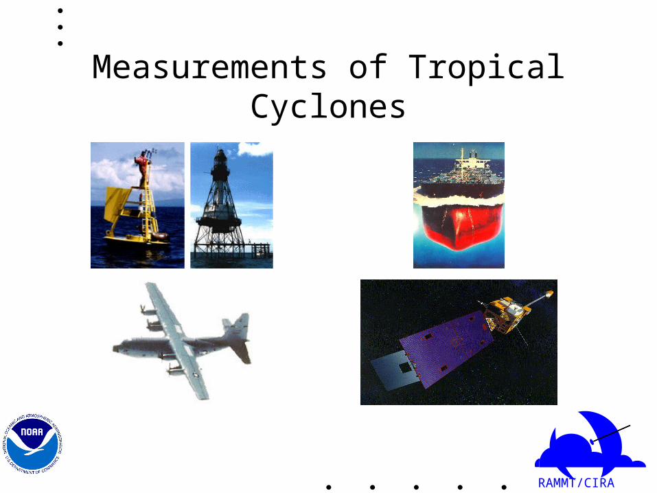
Measurements of Tropical Cyclones
RAMMT/CIRA
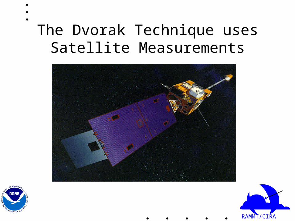
The Dvorak Technique uses Satellite Measurements

RAMMT/CIRA
Most Tropical Cyclone Basins Do Not Have Aircraft Reconnaissance Data
RAMMT/CIRA
Technique Reference
NOAA Technical Report NESDIS 11
Tropical Cyclone Intensity Analysis Using Satellite Data
Vernon F. Dvorak
Satellite Applications Laboratory
Washington, D.C.
September 1984 (Reprinted October 1985)
RAMMT/CIRA
Overview of the Dvorak Technique
• Visible and Infrared Technique• Simplified Visible Technique given here (See
Technical Report for full details)• Uses patterns and measurements as seen on
satellite imagery to assign a number (T number) representative of the cyclone’s strength.
• The T number scale runs from 0 to 8 in increments of 0.5.

RAMMT/CIRA
Overview of the Dvorak Technique Cont’d
• In the following examples, only the Data T Number (DT) will be calculated, the final (official) T number assigned to a tropical cyclone includes further considerations.
• DT computations familiarize one to various tropical cyclone patterns.

RAMMT/CIRA
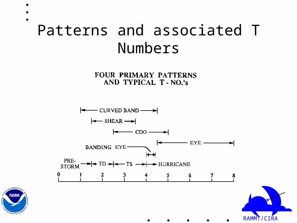
Four Basic Patterns
• Curved Band Pattern• Shear Pattern• Central Dense Overcast (CDO) Pattern• Eye Pattern

RAMMT/CIRA
Four Basic Patterns
• Pattern is not always obvious• System may move from one pattern to another
RAMMT/CIRA
Patterns and associated T Numbers

RAMMT/CIRA
Empirical relationship between T number and wind speed
RAMMT/CIRA
Finding the Cloud System Center (CSC)
• First step in the Dvorak technique• From Dvorak (1985):
“The cloud system center is defined as the focal point of all the curved lines or bands of the cloud system. It can also be thought of as the point toward which the curved lines merge or spiral.”
• Several situations
RAMMT/CIRA
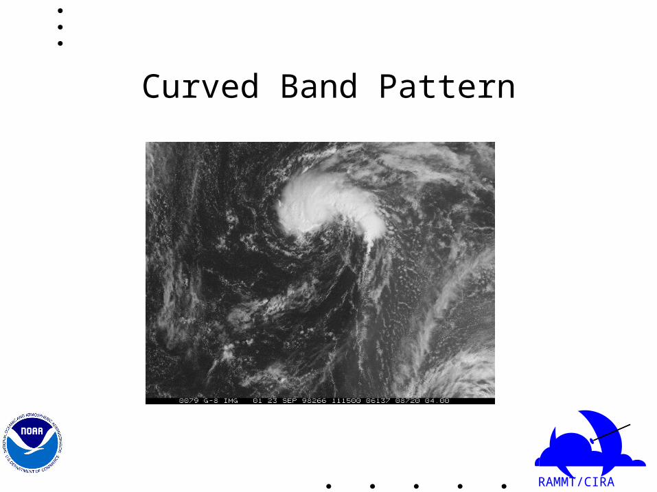
Curved Band Pattern
RAMMT/CIRA
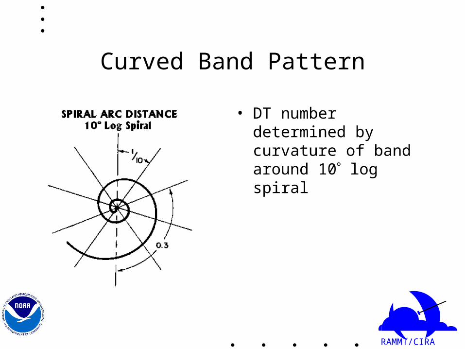
Curved Band Pattern
• DT number determined by curvature of band around 10 log spiral

RAMMT/CIRA
Curved Band Pattern Cont’d
1.0 to 2.0 2.5 3.0 3.5 4.0 4.5
DT Number
RAMMT/CIRA
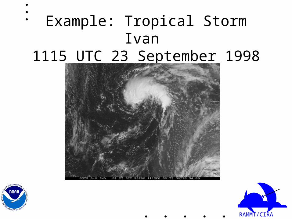
Example: Tropical Storm Ivan 1115 UTC 23 September 1998

RAMMT/CIRA
Example: Curved Band

RAMMT/CIRA
Curved Band Pattern
• Tropical Storm Ivan curves 0.7 around log 10 spiral. This corresponds to DT=3

RAMMT/CIRA
Shear Pattern
RAMMT/CIRA
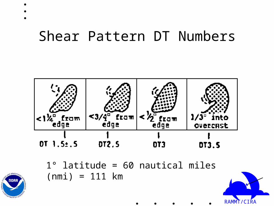
Shear Pattern DT Numbers
1° latitude = 60 nautical miles (nmi) = 111 km
RAMMT/CIRA
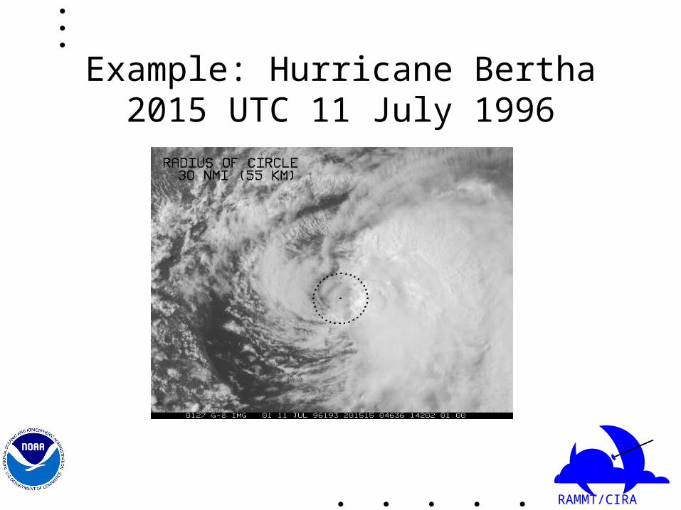
Example: Hurricane Bertha 2015 UTC 11 July 1996

RAMMT/CIRA
Hurricane Bertha Cont’d
RAMMT/CIRA
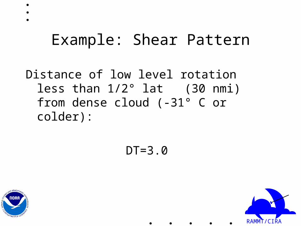
Example: Shear Pattern
Distance of low level rotation less than 1/2° lat (30 nmi) from dense cloud (-31° C or colder):
DT=3.0

RAMMT/CIRA
T Numbers for Weakening Systems
• T numbers decrease before cyclone’s winds• Current intensity (CI) number represents
strength of weakening system and is larger than T number.

RAMMT/CIRA
Central Dense Overcast (CDO)

RAMMT/CIRA
CDO
• No eye• DT number determined by CF+BF=DT
– CF=CENTRAL FEATURE– BF=BANDING FEATURE– DT=DATA T NUMBER

RAMMT/CIRA
Example: Hurricane Georges 1545 UTC 21 September 1998
RAMMT/CIRA
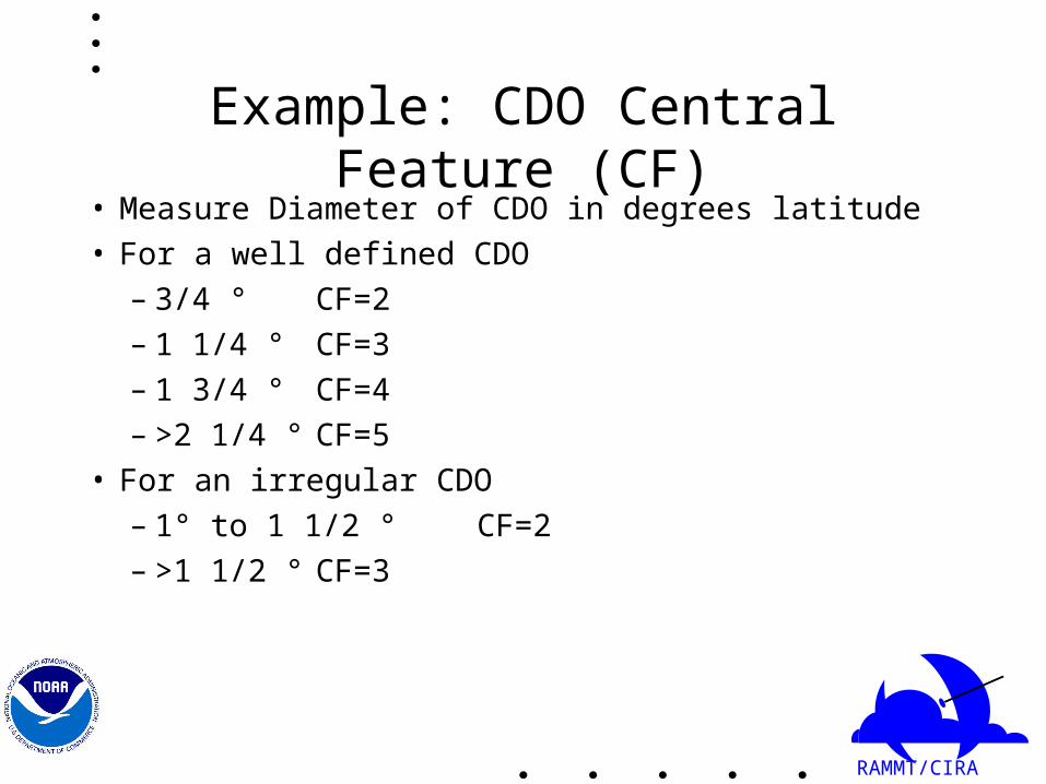
Example: CDO Central Feature (CF)• Measure Diameter of CDO in degrees latitude
• For a well defined CDO
– 3/4 ° CF=2
– 1 1/4 ° CF=3
– 1 3/4 ° CF=4
– >2 1/4 ° CF=5
• For an irregular CDO
– 1° to 1 1/2 ° CF=2
– >1 1/2 ° CF=3
RAMMT/CIRA
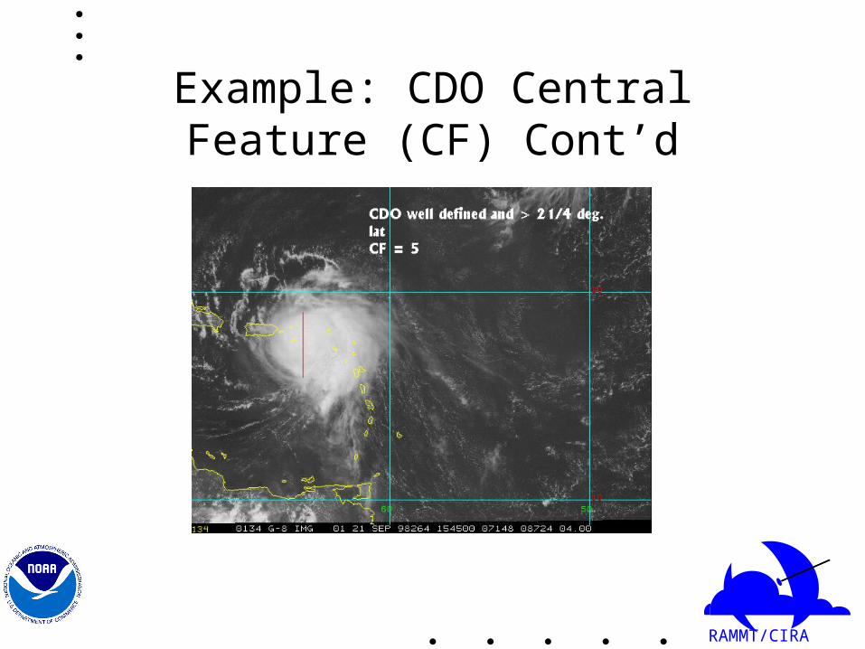
Example: CDO Central Feature (CF) Cont’d
RAMMT/CIRA
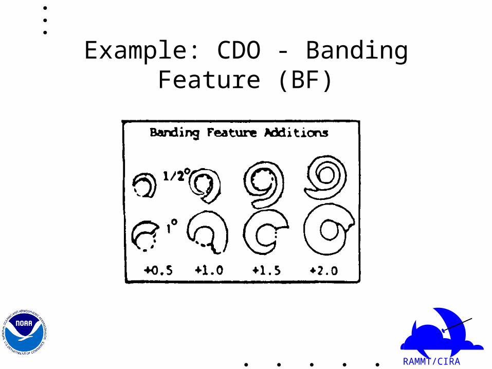
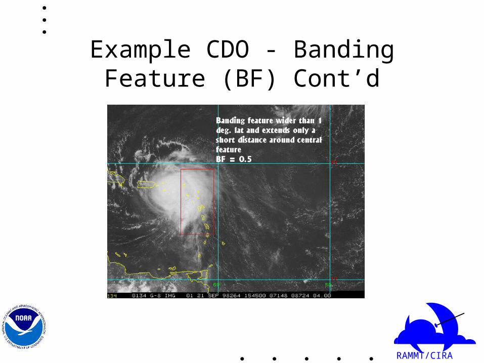
Example: CDO - Banding Feature (BF)
RAMMT/CIRA
Example CDO - Banding Feature (BF) Cont’d
RAMMT/CIRA
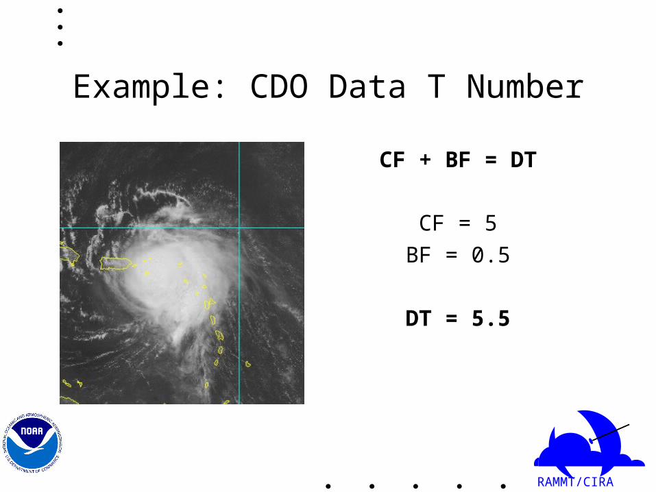
Example: CDO Data T Number
CF + BF = DT
CF = 5
BF = 0.5
DT = 5.5

RAMMT/CIRA
Eye Pattern

RAMMT/CIRA
Eye Pattern
• DT number determined by CF+BF=DT– CF=CENTRAL FEATURE– BF=BANDING FEATURE– DT=DATA T NUMBER

RAMMT/CIRA
Example: Hurricane Georges 1945 UTC 18 September 1998

RAMMT/CIRA
Example: Eye - Central Feature (CF)• CF=E-number+Eye Adjustment• E-number a measure of the hurricane’s radius in
degrees latitude– 1/4° E-no.=3– 1/2° E-no.=4– 3/4° E-no.=5– 1° E-no.=6– >1° E-no.=7
RAMMT/CIRA
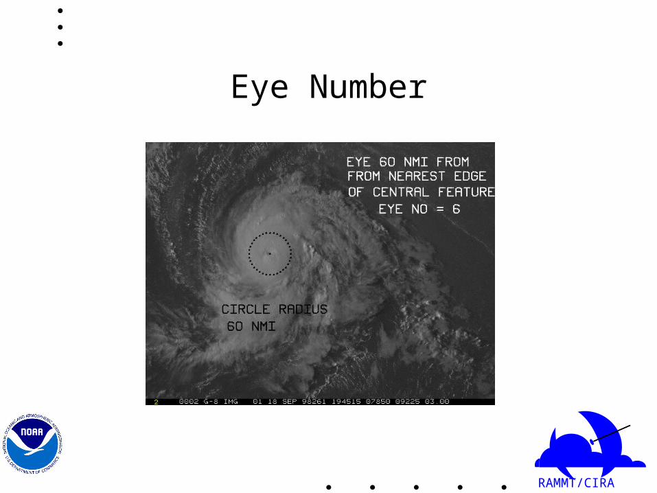
Eye Number

RAMMT/CIRA
Eye - Central Feature Cont’d
• Eye adjustment1. Poorly defined or ragged eyes: Subtract 0.5 for
E-no. 4.5 and 1 for E-no. 5.2. Large eyes: Limit T-no. to T6 for round, well
defined eyes, and to T5 for large ragged eyes.3. For MET 6, 0.5 or 1 may be added to DT for
well defined eye in smooth CDO when DT < MET.
Note: MET is Model-Estimated T, which is extrapolated from previous
Dvorak estimate

RAMMT/CIRA
Eye Adjustment
RAMMT/CIRA
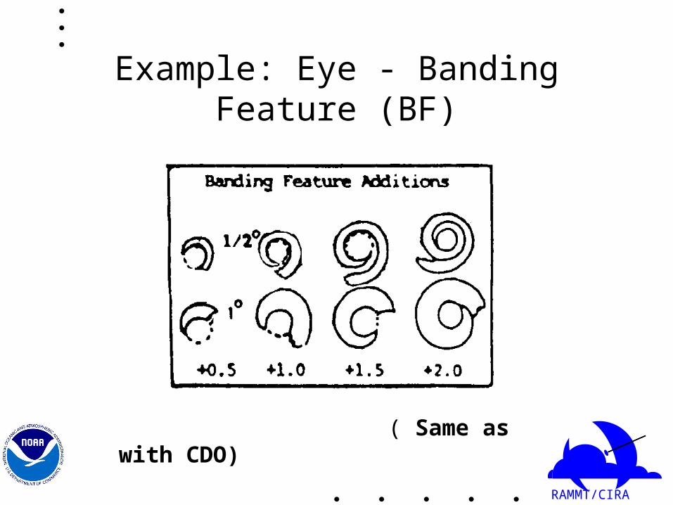
Example: Eye - Banding Feature (BF)
( Same as with CDO)

RAMMT/CIRA
Banding Feature (BF)

RAMMT/CIRA
Data T Number
CF + BF = DT
CF = 6 - 1 = 5
BF = 0.5
DT = 5.5
RAMMT/CIRA
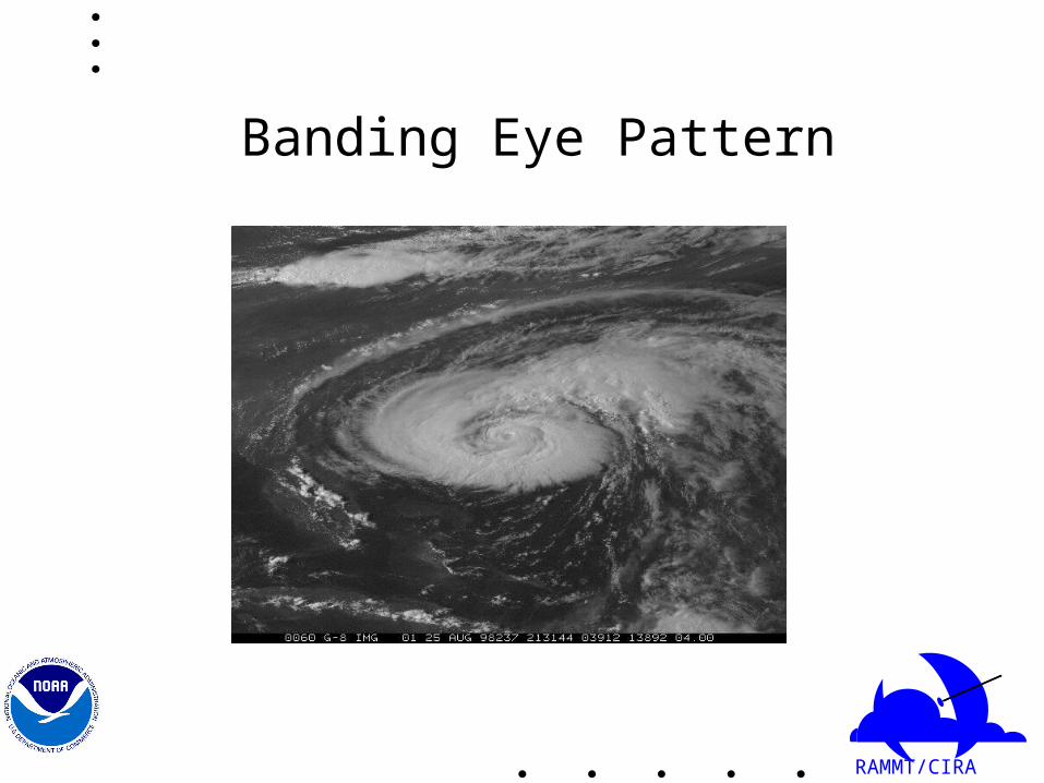
Banding Eye Pattern

RAMMT/CIRA
Banding Eye Pattern
• DT number determined by CF+BF=DT– CF=CENTRAL FEATURE– BF=BANDING FEATURE– DT=DATA T NUMBER
RAMMT/CIRA
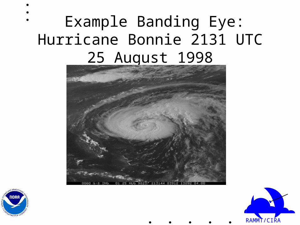
Example Banding Eye: Hurricane Bonnie 2131 UTC 25 August 1998
RAMMT/CIRA
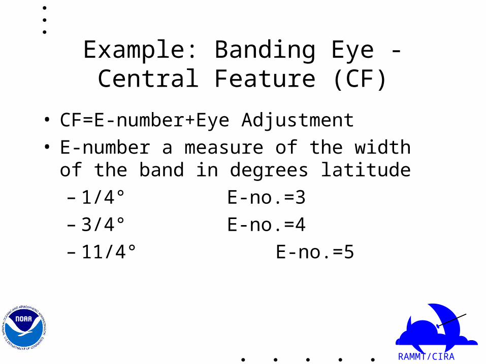
Example: Banding Eye - Central Feature (CF)
• CF=E-number+Eye Adjustment• E-number a measure of the width of the band in
degrees latitude– 1/4° E-no.=3– 3/4° E-no.=4– 11/4° E-no.=5

RAMMT/CIRA
Banding Width

RAMMT/CIRA
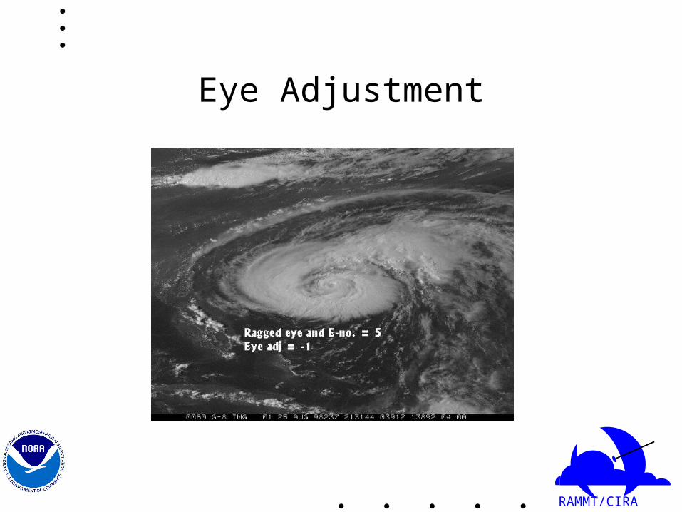
Eye - Central Feature Cont’d
• Eye adjustment1. Poorly defined or ragged eyes: Subtract 0.5 for
E-no. 4.5 and 1 for E-no. 5.2. Large eyes: Limit T-no. to T6 for round, well
defined eyes, and to T5 for large ragged eyes.3. For MET 6, 0.5 or 1 may be added to DT for
well defined eye in smooth CDO when DT < MET.
RAMMT/CIRA
Eye Adjustment
RAMMT/CIRA
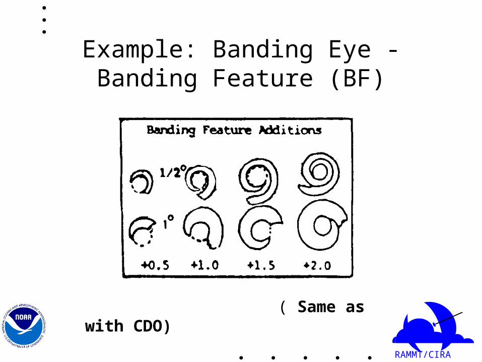
Example: Banding Eye - Banding Feature (BF)
( Same as with CDO)

RAMMT/CIRA
Banding Feature (BF)

RAMMT/CIRA
Data T Number
CF + BF = DT
CF = 5 - 1 = 4
BF = 2.0
DT = 6.0

RAMMT/CIRA
Infrared (IR) Technique
• Can be used during night as well as during day• At times more objective than visible technique

RAMMT/CIRA

RAMMT/CIRA
Example Digital IR: Hurricane Erika 1515 UTC 8 September 1997
• Warmest eye pixel 16 °C
• Warmest pixel 30 nmi (55 km) from center -57 °C
• Nomogram gives Eye no. =5.8 or close to 6

RAMMT/CIRA

RAMMT/CIRA

RAMMT/CIRA
Dvorak Analysis of TC Intensity
• Strengths– Consistent, relatively simple approach to a difficult task– Time proven, the primary technique for more than 15 year– Valid for all geographic regions– Patterns based on cloud response to vorticity– Highly reproducible– Better validation and confidence for the more intense storms
• Weaknesses– Some aspects are too subjective– Subceptible to large errors in weaker systems T-number < 4– “spin down” times are too uniform– poor intensity estimates of very small storms “midgets” at night– Does not account for subtropical or extratropical transition– Does not compensate for large translation speeds (left to the forecaster)– Training and experience are very important because of the subjective nature of the method.

RAMMT/CIRA
Improvements to the Dvorak Technique
• Make the method more objective by using computer resources and digital data.– Objective version of IR technique developed by Chris
Velden, U. Wisconsin• Formalize methods to compensate for known
weaknesses• Improvement of the CI rules, using observed decay rates
from aircraft.• Incorporation of other routinely available satellite
products (SSMI, AMSU, POES)

RAMMT/CIRA
Summaryof Lesson 2• The Dvorak technique uses patterns and measurements from
satellite imagery to estimate the strength of a tropical cyclone.• Four basic types
– Curved band pattern– Shear pattern– CDO pattern– Eye pattern
• Banded eye
• IR and visible techniques • Objective version of IR technique developed by U. Wisconsin