r d gl en wod av u -t . e l · gl en wod av u -t . alexander drive master plan ... so please check...
TRANSCRIPT

ACC BLVD
ANDR
EWS C
HAPE
L RD
ARCO CORPORATE DR
MT HE
RMAN
RD
BRIER LEAF LN
GLENWOOD AVE
COZA
RT R
D
APPLEBROOK TER
SILVERTHREAD LN
VIEWP
OINT
CIR
POOLE
R AVE
COUR
TNEY
ESTA
TES D
R
BRIER CREEK PKWY
SHEL
TER
CVSPUNGOLD ST
T W ALEXANDER DRT W ALEXANDER DR
GLENWOOD AVE
ACC BLVD
GLENWOOD AVE
ACC BLVD
ACC BLVDGLENWOOD AVE
BRIER LEAF L
N
Zoning:CAC:DrainageBasin:Acreage:
TD, CUD W/PDDNorthwestLittle Briar8.05
Number of Lots:Planner:Phone:Applicant Contact:Phone:
0James Marapoti(919) 516-2642Eden Land Corp.(919) 706-0550
GLENWOOD AVENUE-T.W.ALEXANDER DRIVE MASTER PLAN
AMENDMENTMP-3-2012
0 590 1,180 1,770 2,360295Feet ±
i-;> 3
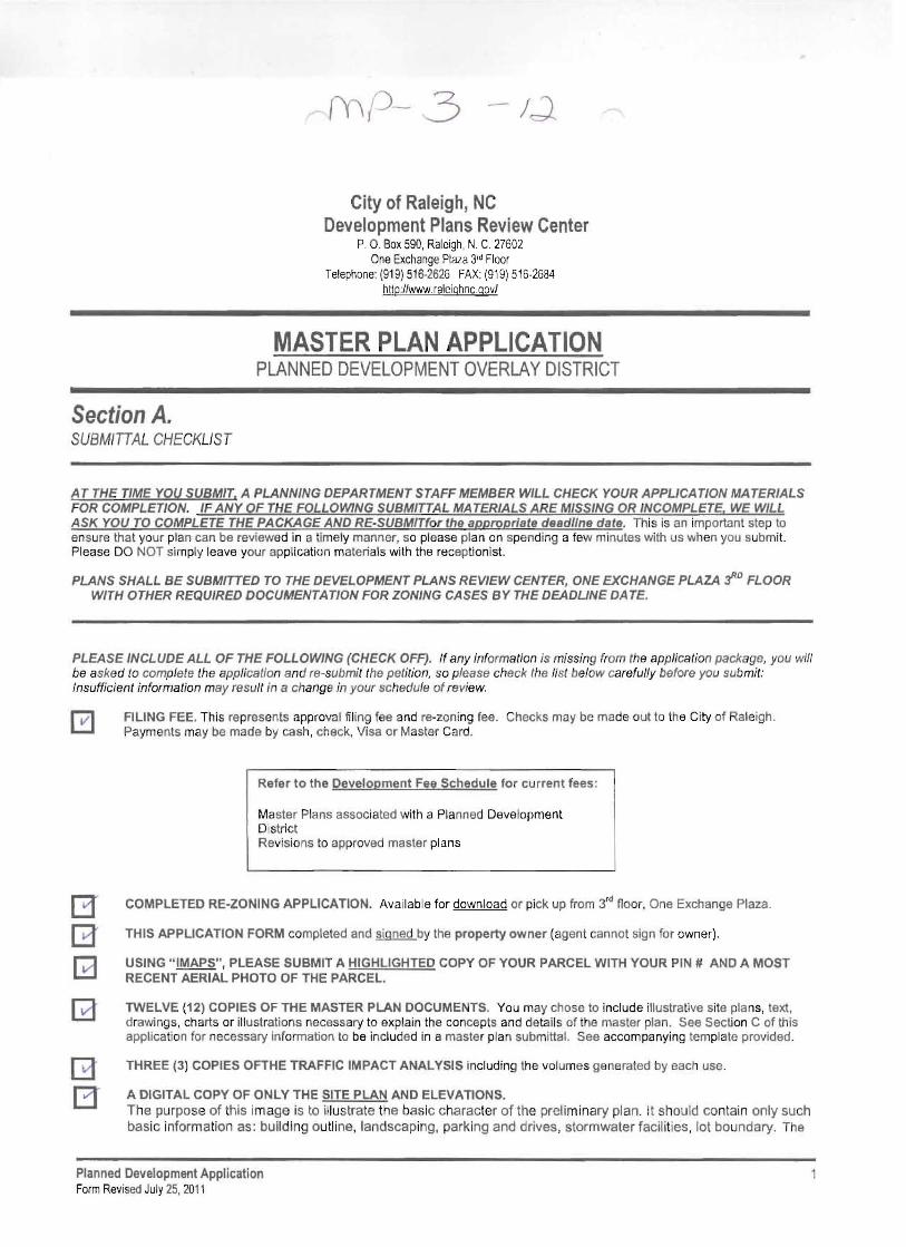
City of Raleigh, NC Development Plans Review Center
P, 0 , Box 590, Raleigh , N, C, 27602 One Exchange Plaza 3'dFloor
Telephone: (91 9)516-2626 FAX:(919) 516-2684 hltp:llwww.raleighnc.gov/
MASTER PLAN APPLICATION PLANNED DEVELOPMENT OVERLAY DISTRICT
Section A. SUBMITTAL CHECKLIST
AT THE TIME YOU SUBMIT, A PLANNING DEPARTMENT STAFF MEMBER WILL CHECK YOUR APPLICATION MATERIALS FOR COMPLETION. IF ANY OF THE FOLLOWING SUBMITTAL MATERIALS ARE MISSING OR INCOMPLETE, WE WILL ASK YOU TO COMPLETE THE PACKAGE AND RE·SUBMITfor the appropriate deadline date. This is an important step to ensure that your plan can be reviewed in a timely manner , so please plan on spending a few minutes with us when you submit. Please DO NOT simply leave your application materials with the receptionist.
PLANS SHALL BE SUBMITTED TO THE DEVELOPMENT PLANS REVIEW CENTER, ONE EXCHANGE PLAZA J"D FLOOR WITH OTHER REQUIRED DOCUMENTATION FOR ZONING CASES BY THE DEADLINE DATE.
PLEASE INCLUDE ALL OF THE FOLLOWING (CHECK OFF). If any information is missing from the application package, you will be asked to complete the application and re-submit the petition, so please check the list below carefully before you submit: Insufficient information may result in a change in your schedule of review.
FILING FEE. This represents approval filing fee and re-zoning fee. Checks may be made out to the City of Raleigh. Payments may be made by cash, check, Visa or Master Card.
Refer to the Development Fee Sched ule fo r current fees:
Master Plans associated with a Planned Development District Revisions to approved master plans
COMPLETED RE-ZONING APPLICATION. Available for download or pick up from 3'd floor, One Exchange Plaza.
THIS APPLICATION FORM completed and signed by the property owner (agent cannot sign for owner),
USING "IMAPS", PLEASE SUBMIT A HIGHLIGHTED COPY OF YOUR PARCEL WITH YOUR PIN # AND A MOST RECENT AERIAL PHOTO OF THE PARCEL.
TWELVE (12) COPIES OF THE MASTER PLAN DOCUMENTS, You may chose to include illustrative site plans, text, drawings, charts or illustrations necessary to explain the concepts and details of the master plan. See Section C of this application for necessary information to be included in a master plan submittal. See accompany ing template provided.
B THREE (3) COPIES OFTHE TRAFFIC IMPACT ANALYSIS including the volumes generated by each use.
A DIGITAL COpy OF ONLY THE SITE PLAN AND ELEVATIONS. T he purpo se of this im ag e is to illus trate the basic c haracter of the preli m inary plan. It should co nta in only such basic information as : buil ding outline , landscaping, parking and drives, stormwater facili t ies , lot bo undary. The
Planned Development Application FormRevisedJuly25, 2011
13

digftal image should be provided In the form of pdf on a CD. If the plan was not digitally created, provide an 8 W' x 11" reduction of the plan.
Label the CD with the plan name, case file number, and indicate how many times the plan has been resubmitted for review.
NOTEIII A FINAL DIGITAL OR REDUCED COPY OF THE PLAN IS TO BE SUBMITTED TO THE COORDINATING PLANNER ONCE ALL STAFF REVIEW COMMENTS HAVE BEE N APPROVED, It should contain only such bas ic inform ation as : bu ild ing outline , land sca ping, parking and dri ves , st or mwater facil itie s, lot bo undary . The digita l image should be saved In any of the following formats, listed in order of preference: .jP9, .gif, .pdf , on a CD. If the plan was not digitally created. provide an 8 y," x 11" reduction of the plan.
PLANNED DEVELOPMENT APPROVAL PROCESS:
The master plan will be reviewed by administrative staff, and comments will be sent to the applicant. At the point at which the Planning Director determines that the maste r plan submittal requirements are complete and adequate to properly review the proposal, a public hearing will be authorized on the request for re-zonlng to Planned Development Overlay District. After the public hearing, the Master Plan and re-zoni ng request are referred to Planning Commission for a recommendation, and on to City Council for final considera tion.
Section B. SUMMARY INFORMATION- (SHOWON MASTER PLAN)
ALL PLANS REQUIRE THE FOLLOWING INFORMATION ON THE FRONT COVER OF THE DRAWING SETS : DEVELOPMENT NAME: Glenwood Avenue-T.W. Alexander Drive Master Plan Amendment
LOCATION: T.W. Alexander Drive/ACC Blvd.
WAKE COUNTY PROPERTY IDENTIFICATION # (PIN) wIth property map _ 0768498705
EXISTING ZONING DISTRICT(s): CUD TO, POD Overlay PROPOSEDZONINGDlSTRICT(s): CUD TO, POD Overlav (Amended) INSIDE CITY LIMITS? Yes _
CLIENT (Owner or Developer):
Name(s) SLF Ruby Jones, LLC
Address: 5949 Sherry Lane, Suite 1750 Dallas, Texas 75225 Telephone: N/A FAX: N/A E-Mail Address: [email protected]
CONSULTANT (Person to contact regard ing questions or revisions to the plan):
Name(s) Edens Land Corp Attn .- Jarred Edens. P.E.
Addres s: 2144 Page Road Suite 204 Durham, N.C. 27703 Telephone: (919) 706-0550 FAX: NlA E-Mail Address:ia rrod .ed en s~eden sland . com TOTAL SITE ACRES: _ ) • 0 S
RESIDENTIAL ACRES : _ Total residential units _ Single-family lots _
MUlti-family units '7"""""Group housing units
- - - - - - - - - - -_
Condominium units
Planned Development Application Form Revised July 25, 2011
2

INSTITUTIONAL ACRES:
OFFICE ACRES:
INDUSTRIAL ACRES:
RETAIL ACRES: _ --"
% OF SITE THIS CONSTITUTES RECREATION ACRES: OPEN SPACE ACRES:
% OF SITE IT CON STITUTES TREE CON SERVATION ACRES: % OF SITE IT CON STUTUES
Congregate Care equivalent dwelling units, _ Average res idential dens ity _
Maximum res identiaI den sity _:--:----:-----:---:---:---=-~:__Proposed min imum lot size for detached single family residential if requesting lots less than 5000 sq. ft. _ provide findings in accordance with 10-2057
BUilding Sq , Ft.
_
_
_
_ _
_ _
Building Sq. Ft. _
Building Sq. Ft.
Building Sq . Ft. ? 0-+ o v D
_
_
Building Sq. ft. Not-far-profit com mon area: Greenway (ded icated sq. ft.)
acreage _ Other public open spa ce
_ _ _
_
OWNER'S SIGNATURE:
In filing this plan as the property owner(s), I/we do hereby agree and firmly bind ourselves, my/our heirs, executors, administrators, successors and assigns jo intly and severally to construct all improvements and make all dedications as shown on this proposed master plan as approved by the City,
I hereby doslgnate ~A 12.l<d::J £.~N<' [DC-tV-s' LAND Cof.! ~ to serv e as my agent regarding this application, to receive end respond to adminis trative comments, to resu bmit plans on my behalf and 10 represent me In any pubfic meeting regarding this appfication.
Date: -=+ -=0 /' . Signed :~~ Printed ~' - ' , t: F vJ' ,Owner 'name -rV\ \ . Ie. ,951 lA ~
> ~~;;;;;;;;;;;;;;;;;;;;;;;;;;;;;;;;;;;;;;;;;;;;;;;;;;;;;;;;;;;;;;;;;;;;;;;;;;;;;;;;;;;;;;;;;;;;;;;;;;;;;;;;;;;;;;;;--------------
Section C. DATA FOR MASTER PLANDOCUMENTS PLEASE INCLUDE ALL OF THE FOLLOWING (CHECK OFF)
D (a) Sheet size.
(1) Plan-view draw ings for the ma ster plan shall be drawn on one of three (3) standard sheet sizes. These are: - e ighteen (18) by twenty-four (24) inches; - twe nty-fou r (24) by thirty-six (36) inches ; - thirty (30) by forty -two (42) inches;
(2) Other supporting documentation may be submitted on 8 1/2" x 11" sheets, 11,. x 17" sheets or 8 1/2" x 14" sheets.
D (b) Key Information.
(1) A vicin ity sketch or key map at a scale of not more than one thousand (1000) feet to the inch, showing the pos ition of the subdivision with its relation to surround ing streets and properties, and oriented in the same dire ction as the rema inder of the preli minary sub division plan;
(2) True north arrow , with north being at the top of the map; (3) Scale of the map usin g engineer's scale (1"=10', 1"=50', etc .) and date of preparation, including all revision dates;
Planned Development Application Fonn ReviSedJuly 25, 2011
3

D (c) Summary Infonnation .
(1) The name of the development, name of the owner and agent, name, address and telephone number and fax number of the designer who prepared the plan;
(2) All information included in Section B. of this application; (3) For properties in a conditional use zoning district, list of zoning conditions should appear on the plan; (4) Proposed heights and setbacks.
D (d) Property Information .
(1) Boundary lines of the proposed development; (2) Existing easements including width dimensions and book and page references; (3) Property to be dedicated for public use, such as proposed easements, rights-of-way; or greenway, including acres, square
feet and dimensions; (4) Street right-of-way lines and other property lines, drawn to scale; (5) Zoning district boundary lines; (6) Adjoining properties, land uses and owners names; (7) Existing wooded areas, streams and lakes;
• D (e) Transportation Infonn ation. - t--1/..A ~ ~ ~~ c;J,~-iJ Mf- I-ro tb("o~Wl!
(1) Preliminary circulation plan showing existing and proposed driveway and access point limitations, exist ing and proposed major streets, new and widened rights-of-way within and adjacent to the site;
(2) Traffic Impact Analysis including volumes generated and impact on surrounding intersections; (3) Information on how the layout of land uses and facilities encourages tran sit and pedestrian access; (4) Cross-sections of proposed streets to serve the property covered by the Master Plan , including specifications for all cross
sections that involve alternative designs not included in the City's current development regul ations;
(f) Land Use I Phasing I Open Space Information . .-sr;£ ftL60 ) fr~(fJ ~ I: Hr -I - 00 t>~,JT
(1) Proposed uses including locations and amounts, and a detailed list of uses allowed within each land use cat egory specified. This plan should show a mixture of uses to provide convenient arrangements of complementary land uses, such as office, day care and residential;
(2) Existing and proposed greenways, parks and open space, including designs for screening and buffering of conflicting land uses;
(3) Maximum scale, floor area ratio, building lot coverage, impervious surface limitations or other proposed limitations on area and bulk;
(4) Phasing of development, including covenants, assessments and other applicable restrictions, showing a generalized subdivision scheme;
(5) Mec hanisms for monitoring the construction of the land uses shown on the master plan, in order to assure that comm unity facilities are completed and land use requirements are met;
(6) Mechanisms for providing a unified approach to landscaping parking, driveways, drainage, sedimentation control a:x' pedestrian circulation;
(7) Maximum heights of buildings by land use category and a schedule of minimum yard setbacks by land use area in the Master Plan;
(8) Location of outdoor uses such as display areas, landfills, cemeteries, quarries, mines, outdoor storage yards, chemical or petroleum refineries, "ready-mixed" concrete production, asphalt plants, community water and wastewater treatments tanks and facilities;
• D (9 ) Alternative Designs and Revisions . - !'l/!> j ~ .Afl'J2oVG-P CJ:!SE il: t1P- I .. 00 t>ocul"'Pl1S
(1) Information to support any requested alte rnative design • parking reductions • street cross sections • SIGNAGE • LANDSCAPING • LOT SIZES 10-2057
(2) The proposed type, nature and extent of revisions that will be approved by the City staff subsequent to the approval of the Master Plan;
• D (h) Utility I Stonn water Informa tion.
Planned Development Application Form Revised Julv 25, 2011
4

(1) W ater and sew er plan fo r all uses pro posed in the Master Plan, including location of ex isting and proposed sewer and water mai ns. Inc lude estimate of avera ge dai ly sewage flow dem and for ea ch phase;
(2) Proposed stormwater manag ement scheme , showing gen eral methods of retaining or conveying stormwater throughout the site , an d any adjoining off-site facilities, as well as prop osed drainage eas ement s in their genera l locat ion ;
(3) Regulatory flood pron e area elevations;
. 0 (i) Speci al Inform ation. -
(1) In all Special Highway Overlay Dist ricts , protective yar d areas along majo r access corridors and principal arterials, and distance from interchang e if along a side street;
(2) In Reservoir Watershed Protecti on Areas , watercourse buffer area s as require d in §1 0-3052(b), square foot amou nt of existing and proposed impervious surface area per lot, estimated amo unt of impervious surface area of proposed public and private streets and public improve ments, the location of and areas serv ed by facilities used to retain the first one-half (1/2) inch of storm water as required in §1 0-3052(a), the allocation of impervious surface limitations to lots;
(3) In cluster unit dev elopments , calculati ons for density transfers among different phases and from rights-of-wa y, bu ildin g envelopes and maintenan ce easement s when the development is to be approved with minimum setback less than five (5) feet ;
(5) In Metro Park Protection Ove rlay Dis tr icts, watercourse buffe r area s, impe rvio us surface calcu lations, tree inventory if imperv ious surface area exc eeds 30%, park buffer yards ;
(6) Phasing pla n, if the con stru ct ion of public improveme nts an d/or the record ing of lots is to be phased; (7) In Mobil e Home zoning districts , an evac uation plan is to be filed with the W ak e Coun ty Office of Emerg ency Preparedness
for all mobile home parks located with in floodprone areas; (8) Any other information that may be req uested by the revi ewing authori ty.
, 0 U) Tree Conservation Plan, if applicable, (Refer to TC·07-04 Tree Conservation Ordinance) - N/Aj 5e.E. fm(N t:t'J M"~'Wf- f'<..h.) CA'!:e ~ Hf' ~ ., - OJ ~~ .
(1) (Sheet 1) Requires a separate Tree Conservation Map with all proposed tree conservation are as (T CA's), see Section 102082.14);
(2) Label Primary and Secon dary Tre e Conservation Areas utili zing the "Standardized Designation For Tree Co nservation Areas" list.
(3) (Sheet 2) Show ex isting and propo sed grades, combining an accurate loc ation of tree protection fen ce, also show acreage ca lculations of tree conse rvation areas as listed in Tree Conservation Data Sheet.
(4) Completed Tree Conservation Dat a Sheet; (5) (Sheet(s) 3+) For the Seco ndary Tree Co nservation Areas incl ude the following ;
a. Photo panoramic panel of prop ose d secondary TCA 's . Each photo to repre sent 50 linear feet of tree conservat ion are a. Inclu de (2 copies).
b. Ce rtified tree cover report with description of each 50' of TCA . (2 copies) . c. Most rec en t ae rial photo.
• o (k) Urban Design Guidelines for Mixed-Use Neighborhood and Village Centers checklist (NEW) Indicates the quidelines and principles that will be adhered to and the extent to which specified apply to the "key elements" described in the Urban Design Guidelines for Mixed-Use Neighborhood and Village Centers . Use accompanying checklist provided. N/A
~ (I) Below , provide a description of how your plan conforms to the guidelines of the Comprehensive Plan, including information such as Planning District, Small Area Plan, Corridor Plan, oversized focus area , PBOD , focus area and recommended use(s) for the property .
This is an amendment to the approve d Glenwood Ave ./T. W. A lexander Drive Master Plan POD ove rlay case# MP- I-00 and the current CUD TO zoning distr ict . The rezoning district class ification is also not changing but is adding 2 conditions to the parce l tract to be developed. The plan conforms to the guide lines of the Co mprehensive Plan and its recommended uses .
Planned Development Application FormRevisedJulv 25. 2011
5

LAND USE SUMMARY
PDDOPEN SPACE,
BUFFERS, FLOOD PLAIN NET USABLE NUMBER OF SQUARE BUILDING DENSITY
TRACT LAND USE CLASSIFICATION ACREAGE & WETLANDS ACREAGE ROOMS/UNITS FOOTAGE HEIGHT (DU/AC)
RESIDENTIAL
62 HIGH DENSITY RESIDENTIAL 38.51 4.04 34.47 630 100 FT 18.36
9 HIGH DENSITY RESIDENTIAL/OFFICE 8.36 1.45 6.91 160 (100,000 ALT.) 300 FT 19.14
63 MATURE LIVING/CONGREGATE CARE 8.00 0.66 7.34 226 200 FT 28.25
54.87 6.15 48.72 1016
122** MEDIUM DENSITY RESIDENTIAL (8.54) (0.47) (8.07) (112) (45 FT) (13.88)
(63.41) (6.62) (56.79) (1128)
INSTITUTION/CIVIC
55 DAYCARE 5.17 2.77 2.40 9,800 75 FT
56 DAYCARE 7.13 3.17 3.96 16,000 75 FT
12.30 5.94 6.36 25,800
OFFICE
51 OFFICE 8.22 2.25 6.97 84,750 100 FT
52 OFFICE 2.19 1.05 1.14 20,250 75 FT
53 OFFICE 7.17 1.74 5.43 59,000 100 FT
54 OFFICE 4.21 1.28 2.93 18,500 75 FT
7 OFFICE 28.10 4.82 23.28 (420 ALT.) 315,000 300 FT
8 OFFICE 6.45 1.90 4.55 73,000 300 FT
111 OFFICE (HOSPITAL) 12.28 3.87 8.41 133,000 300 FT
112 OFFICE 6.21 1.24 4.97 110,000 300 FT
121 OFFICE OR BUSINESS HOTEL 7.64 3.09 4.55 (150 ALT.) 46,200 300 FT
13 OFFICE 7.74 0.70 7.04 101,000 300 FT
90.21 21.94 70.27 1,075,700
COMMERCIAL
1 RETAIL 6.65 3.16 3.49 150 75 FT
10* HOTEL/RETAIL 14.03 3.22 10.81 22,000 60FT
14 VILLAGE RETAIL 9.71 0.00 9.71 84,800 60 FT
122** RETAIL 8.54 0.47 8.07 90,000 60 FT
38.93 6.85 32.08 196,800
SC CUDCOMMERCIAL
2 RETAIL 18.84 3.21 15.63 110,600 75 FT
3 HOTEL/RETAIL 8.02 0.00 8.02 100 47,500 75 FT
4 COMMERCIAL 46.95 3.11 43.84 524,000 75 FT
61 TOWNHOMES 6.19 0.00 6.19 45 50 FT
80.00 6.32 73.68 145 682,100 7.27
PROJECT
PDD TOTALS 196.31 40.88 155.43
SC CUD TOTALS 80.00 6.32 73.68
STREET RIGHTS-OF-WAY 32.03
GROSS PROJECT AREA 308.34
*NOTES: 1) PARCEL 10 MAY BE A MIXED USE ITE AND BE DEVELOPED WITH 12,000 SF RETAIL AND 72 DWELLING UNITS OR DEVELOPED WITH 12,000 SF
RETAIL AND 32,000 SF OFFICE. 2) PARCEL 122 MAY BE DEVELOPED AS MEDIUM DENSITY RESIDENTIAL USES OR AS RETAIL USES. THE SUMMARY CHART
REFLECTS THE TOTAL FOR EACH TYPE OF USE ON TRACT 122 DEPENDING ON THE OPTION SELECTED BY THE DEVELOPER.

T. W. ALEXANDER DRIVE
(120' PUBLIC R/W)
FUTURE ACC BLVD EXTENSION
(60' PUBLIC R/W) T. W. ALEXANDER DRIVE(120' PUBLIC R/W)
BRIE
R CR
EEK
PARK
WAY
(120
' PUB
LIC
R/W
)
RETAIL OR MEDIUMDENSITY RESIDENTIAL USES
FUTURE T. W. ALEXANDER DRIVE EXTENSION
(120' PUBLIC R/W)
FUTU
RE COLLECTO
R ROAD
(68' PUBLIC R/W
)
13
8112
111
121
9
122
RALEIGH, NORTH CAROLINA JULY 20, 2012
7700 BRIER CREEK PARKWAY
TRACT 122 - MASTER PLAN
EDENSLAND CORP
ENGINEERING · DEVELOPMENT2144 PAGE ROAD - SUITE 204 · DURHAM, NC 27703
WWW.EDENSLAND.COM · PH: (919) 706-0550
E L C
VICINITY MAP
ANDREWS CHAPEL RD
US HWY 70
T.W. ALEXANDER DR
ACC BLVD
BRIE
R CR
EEK
PKW
Y
CO
UR
TNEY
EST
ATE
S D
R
T.W. ALEXANDER DR
TRACT 122
NOTES
122