quanta uav - sbg-systems.com · quanta uav the quanta uav seriesis a powerful and easy ins+gnss...
TRANSCRIPT
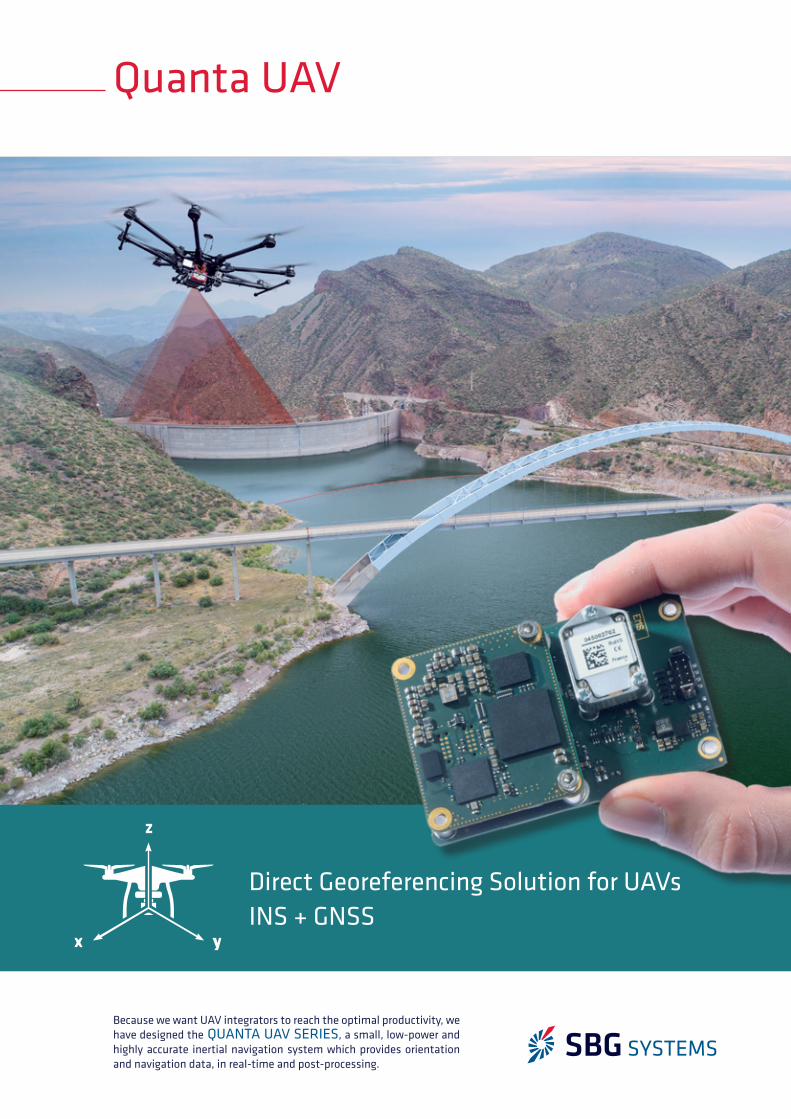
Quanta UAV
Because we want UAV integrators to reach the optimal productivity, we have designed the QUANTA UAV SERIES, a small, low-power and highly accurate inertial navigation system which provides orientation and navigation data, in real-time and post-processing.
x y
z
Direct Georeferencing Solution for UAVsINS + GNSS
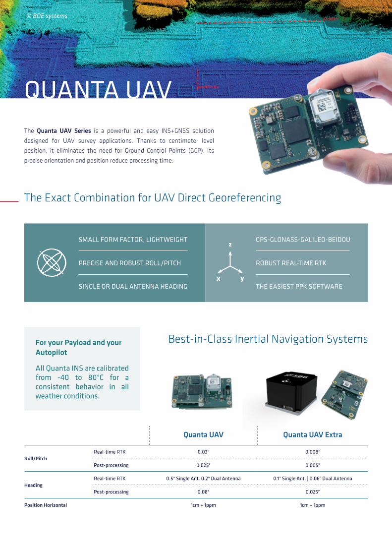
QUANTA UAVThe Quanta UAV Series is a powerful and easy INS+GNSS solution
designed for UAV survey applications. Thanks to centimeter level
position, it eliminates the need for Ground Control Points (GCP). Its
precise orientation and position reduce processing time.
The Exact Combination for UAV Direct Georeferencing
Quanta UAV Quanta UAV Extra
Roll/PitchReal-time RTK 0.03° 0.008°
Post-processing 0.025° 0.005°
HeadingReal-time RTK 0.5° Single Ant. 0.2° Dual Antenna 0.1° Single Ant. | 0.06° Dual Antenna
Post-processing 0.08° 0.025°
Position Horizontal 1cm + 1ppm 1cm + 1ppm
SMALL FORM FACTOR, LIGHTWEIGHT
PRECISE AND ROBUST ROLL/PITCH
SINGLE OR DUAL ANTENNA HEADING
GPS-GLONASS-GALILEO-BEIDOU
ROBUST REAL-TIME RTK
THE EASIEST PPK SOFTWARE
Best-in-Class Inertial Navigation SystemsFor your Payload and your Autopilot
All Quanta INS are calibrated from -40 to 80°C for a consistent behavior in all weather conditions.
x y
z
© BOE systems
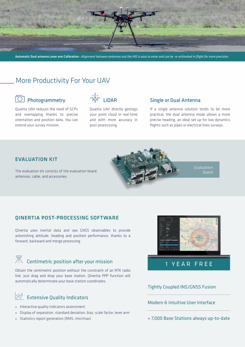
Qinertia uses inertial data and raw GNSS observables to provide astonishing attitude, heading and position performance, thanks to a forward, backward and merge processing.
QINERTIA POST-PROCESSING SOFTWARE
EVALUATION KIT
» Interactive quality indicators assessment
» Display of separation, standard deviation, bias, scale factor, lever arm
» Statistics report generation (RMS, min/max)
The evaluation kit consists of the evaluation board, antennas, cable, and accessories.
Obtain the centimetric position without the constraint of an RTK radio link. Just drag and drop your base station, Qinertia PPP function will automatically determinate your base station coordinates.
Extensive Quality Indicators
Centimetric position after your mission
More Productivity For Your UAV
Evaluation board
If a single antenna solution tends to be more practical, the dual antenna mode allows a more precise heading, an ideal set up for low dynamics flights such as pipes or electrical lines surveys.
Single or Dual Antenna
Automatic Dual antenna Lever arm Calibration : Alignment between antennas and the INS is easy to enter and can be re-estimated in flight for more precision.
Quanta UAV directly geotags your point cloud in real-time and with more accuracy in post-processsing.
LiDAR
Quanta UAV reduces the need of GCPs and overlapping thanks to precise orientation and position data. You can extend your survey mission.
Photogrammetry
Tightly Coupled INS/GNSS Fusion
Modern & Intuitive User Interface
+ 7,000 Base Stations always up-to-date
1 Y E A R F R E E

RMS values for typical survey trajectories.Performance may be affected by atmospheric conditions, signal multipath, and satellite geometry. All specifications subject to change without notice.
V1.0
– A
pril
– Al
l rig
hts
rese
rved
© 2
019
SBG
Syst
ems
SBG Systems EMEA (Headquarters) Phone: +33 1 80 88 45 00 E-mail: [email protected] www.sbg-systems.com
SBG Systems North America Phone: +1 (773) 754 3272 E-mail: [email protected]
Specifications
All parameters apply from -40° to 85°C temperature range, unless otherwise stated. Full specifications can be found in the Quanta Hardware Manual available upon request.
WE SIMPLIFY YOUR INTEGRATION
Temperature -40 to 85 °C / -40 to 185 °F
MTBF (computed) 50,000 hours
Operating vibrations 8 g RMS (20 Hz to 2 kHz per MIL-STD-810G)
Humidity 95% non condensing
ENVIRONMENTAL
Model Quanta UAV Quanta UAV Extra
Weight 76 g 345 g
Dimensions (L x W x H)
51.5 x 78.75 x 20 mm
GNSS+Processing: 51.5 x 78.75 x 20 mm IMU : 83.5 x 72.5 x 50 mm
Consumption < 3.5 W < 5.5 W
Supply 3.3 to 5 VDC 3.3 to 5 VDC
PHYSICAL CHARACTERISTICSAiding (input) GNSS, RTCM
Protocols NMEA, ASCII, Binary
Output rate 0.1 to 200 Hz
Logging Capacity 8 GB or 48 h @ 200 Hz
Ethernet Full Duplex (10/100 base-T)
Serial 5x TTL UART ports
CAN 1 CAN 2.0 A/B bus up to 1 Mbit/s
Pulses Inputs: PPS, Event marker up to 1 kHz
Outputs: SyncOut, Trigger, PPS
5 inputs / 2 outputs
Connectors 44 pin contacts, 1.27 mm pitch, SMD
INTERFACE
Free Technical Support | Unlimited Firmware Updates | 2-year Warranty
INTUITIVE WEB INTERFACEConnect your sensor and configure it throughout the intuitive web interface.
3D VIEWThe 3D View helps you to check your mechanical installation, especially your sensor position, your alignments, and levers arms.
Preliminary