pym puzzler -- astoria or flavel?
TRANSCRIPT
1
Presenting THE NEW!
P.Y.M.™ PUZZLER for October 9, 2011
PIERRE BLEAUDRY, Editor with Mary (nee Merry-merry) Baker
ASTORIA OR FLAVEL ?
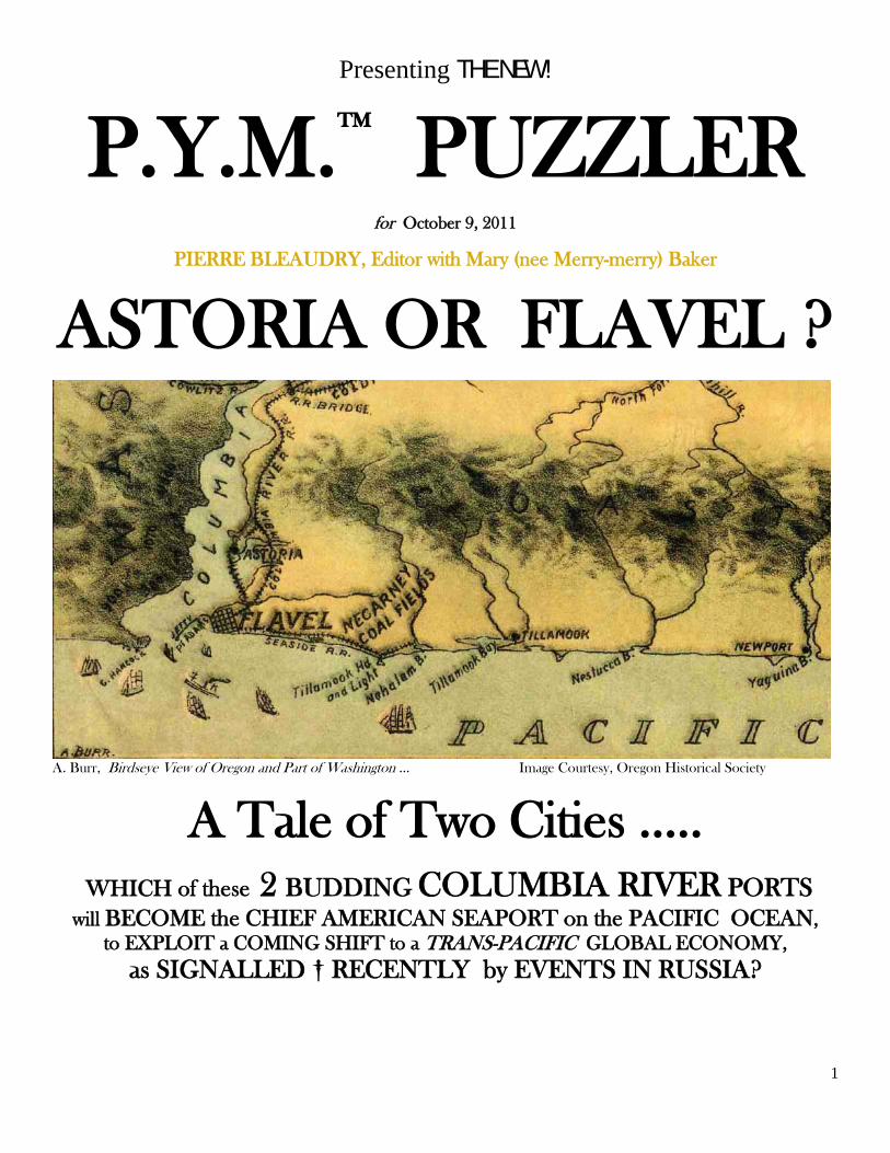
A. Burr, Birdseye View of Oregon and Part of Washington … Image Courtesy, Oregon Historical Society
A Tale of Two Cities ….. WHICH of these 2 BUDDING COLUMBIA RIVER PORTS
will BECOME the CHIEF AMERICAN SEAPORT on the PACIFIC OCEAN, to EXPLOIT a COMING SHIFT to a TRANS-PACIFIC GLOBAL ECONOMY,
as SIGNALLED † RECENTLY by EVENTS IN RUSSIA?
2
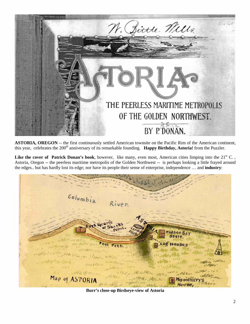
ASTORIA, OREGON -- the first continuously settled American townsite on the Pacific Rim of the American continent, this year, celebrates the 200th anniversary of its remarkable founding. Happy Birthday, Astoria! from the Puzzler.
Like the cover of Patrick Donan’s book, however, like many, even most, American cities limping into the 21st C. , Astoria, Oregon -- the peerless maritime metropolis of the Golden Northwest -- is perhaps looking a little frayed around the edges.. but has hardly lost its edge; nor have its people their sense of enterprise, independence … and industry:
Burr’s close-up Birdseye-view of Astoria
3
19th Century municipal developments in Clatsop County (Oregon) and their accompanying promotional initiatives – including literature like Patrick Donan’s book, reflect the intellectual vision, and the commercial aspirations, of the developers behind them: wild visions of the future, of trackless and unrelenting wilderness tamed, or frontiers explored and occupied by little humans -- sometimes barefoot, sometimes in shoes -- then settled as stages for advancement by other humans to yet further frontiers. Some of these visions were rapidly and successfully transmuted into reality, as in the case of Lewis & Clark, who brought their vision for building a monumental salt cairn on the Clatsop County coast, to imposing reality. And other visions for the development of Clatsop County communities, such as the vision of New York fur-trading magnate, John Jacob Astor, for his eponymous Astoria, blossomed into youthful realities. And yet, when you survey the landscape at the mouth of the Columbia river, it seems almost as if Astoria -- 200 years old this year -- has little more than a toehold on the wild Oregon coast. And, as for Donan’s “Peerless maritime metropolis?” Well, maybe….
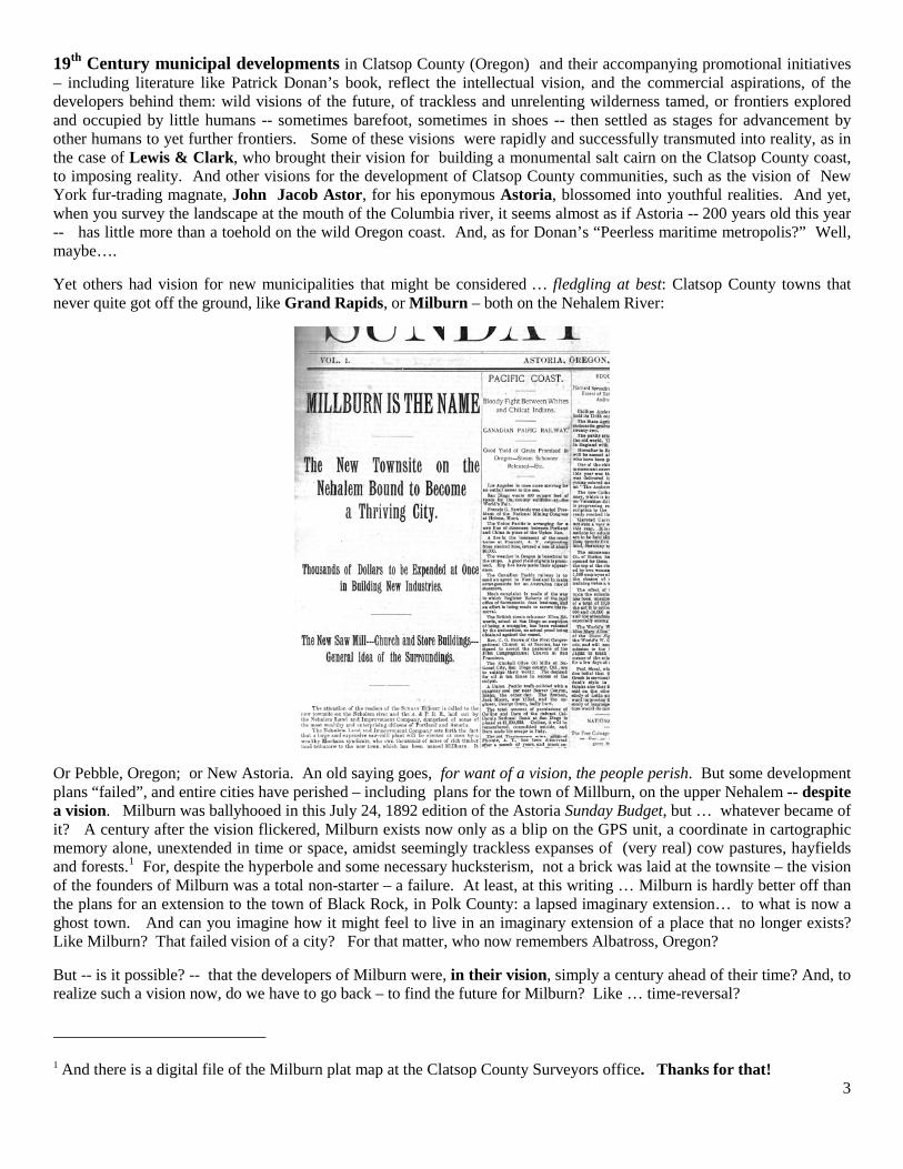
Yet others had vision for new municipalities that might be considered … fledgling at best: Clatsop County towns that never quite got off the ground, like Grand Rapids, or Milburn – both on the Nehalem River:
Or Pebble, Oregon; or New Astoria. An old saying goes, for want of a vision, the people perish. But some development plans “failed”, and entire cities have perished – including plans for the town of Millburn, on the upper Nehalem -- despite a vision. Milburn was ballyhooed in this July 24, 1892 edition of the Astoria Sunday Budget, but … whatever became of it? A century after the vision flickered, Milburn exists now only as a blip on the GPS unit, a coordinate in cartographic memory alone, unextended in time or space, amidst seemingly trackless expanses of (very real) cow pastures, hayfields and forests.1
But -- is it possible? -- that the developers of Milburn were, in their vision, simply a century ahead of their time? And, to realize such a vision now, do we have to go back – to find the future for Milburn? Like … time-reversal?
For, despite the hyperbole and some necessary hucksterism, not a brick was laid at the townsite – the vision of the founders of Milburn was a total non-starter – a failure. At least, at this writing … Milburn is hardly better off than the plans for an extension to the town of Black Rock, in Polk County: a lapsed imaginary extension… to what is now a ghost town. And can you imagine how it might feel to live in an imaginary extension of a place that no longer exists? Like Milburn? That failed vision of a city? For that matter, who now remembers Albatross, Oregon?
1 And there is a digital file of the Milburn plat map at the Clatsop County Surveyors office. Thanks for that!
4
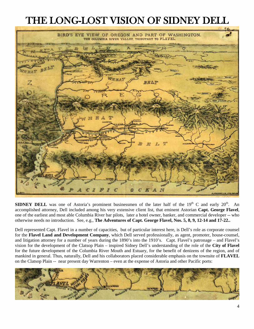
THE LONG-LOST VISION OF SIDNEY DELL
SIDNEY DELL was one of Astoria’s prominent businessmen of the later half of the 19th C and early 20th. An accomplished attorney, Dell included among his very extensive client list, that eminent Astorian Capt. George Flavel, one of the earliest and most able Columbia River bar pilots, later a hotel owner, banker, and commercial developer -- who otherwise needs no introduction. See, e.g., The Adventures of Capt. George Flavel, Nos. 5, 8, 9, 12-14 and 17-22..
Dell represented Capt. Flavel in a number of capacities, but of particular interest here, is Dell’s role as corporate counsel for the Flavel Land and Development Company, which Dell served professionally, as agent, promoter, house-counsel, and litigation attorney for a number of years during the 1890’s into the 1910’s. Capt. Flavel’s patronage – and Flavel’s vision for the development of the Clatsop Plain – inspired Sidney Dell’s understanding of the role of the City of Flavel for the future development of the Columbia River Mouth and Estuary, for the benefit of denizens of the region, and of mankind in general. Thus, naturally, Dell and his collaborators placed considerable emphasis on the townsite of FLAVEL on the Clatsop Plain -- near present day Warrenton – even at the expense of Astoria and other Pacific ports:
5
Dell acted as counsel for the FL & D Co. inter alia, in Flavel Land & Development Co vs. F. P. Leinenweber and the City of Warrenton, (Clatsop Co. 1915): an important case in the history of municipal development of the Clatsop Plain, that was eventually argued before the Oregon Supreme Court. But not, that is, before Sidney Dell had fully restated Capt. Flavel’s position in the pages of the Astoria papers, and – looking a little desperate -- by mailing circulars around to his neighbors in Astoria. See, Oregon State Archives, S. Ct. No. 8903, File No. 2810 (68 A-3; Container 213; Exhibit B).
Dell also represented the FL & D Co. in other areas of their enterprise: his role as advocate in the courts was extended to include “direct marketing” public and promotional activities on behalf of the FL & D Co. -- for he was employed in writing of a small treatise entitled ASTORIA AND FLAVEL, The Chief Seaport [sic] of the Columbia River Watershed (1893). 2
Dell’s book has all the appearance of a standard piece of municipal promotional writing, like Donan’s — but on closer examination, it is an unusually competent bit of promotional literature: well written, well researched, substantiated by expert testimony: such that it may one day do its author proud, and revive the name of Dell, as a most important 19th C. Astorian author.
Indeed, the book might have become a best-seller (of sorts) in its time, but the Astoria Chamber of Commerce in niggling over textual details, eventually bogged themselves down, and thereafter declined to endorse the book, or pay for its publication and circulation. ( Caveat ??) The book therefore was only printed in limited circulation – in a few scattered sample copies. Dell notes in a postscript, the nearly tragic consequences of their dithering:
“After the sketch was issued and electrotyped, and offer was made them [the Astoria Chamber of Commerce] by the author, to let them have, at less than actual cost, 1750 copies, to be stamped by the Chamber and sent with their compliments to the Eastern financial centers. Thereupon, confronted with a condition and not a theory, and insisting upon hurtful trifles, they because of this failure to amend [Dell’s text] required a withdrawal of their support of that which is admitted to be the only clear and complete statement of the facts ever published of this (their own) grandest of seaport situations.” 2 Although Mr. Dell has long since “crossed the bar” himself, and his copyright expired, it is important to relay, that on the title page of ASTORIA AND FLAVEL, The Chief Seaport of the Columbia River Watershed (1893) Dell added the invitation: THE PRESS OF THIS WATERSHED WILL PLEASE MAKE EXTRACTS. We have responded. Presumably Dell would have encouraged the same policy as to Burr’s “Birdseye View of Oregon …” map, which is liberally snapped here, for illustration.
6
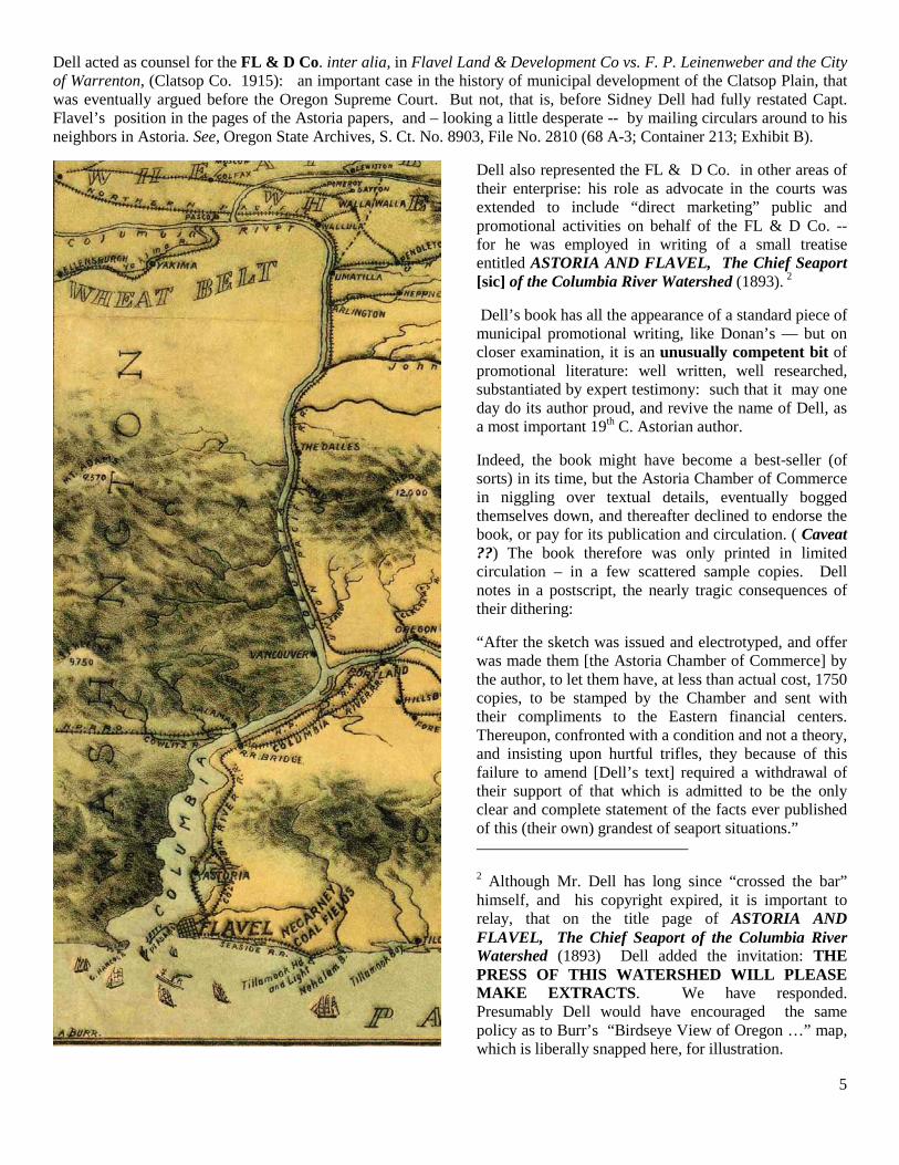
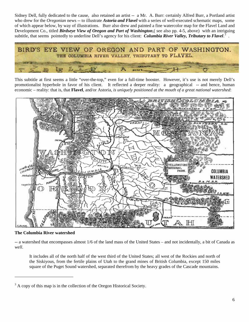
Sidney Dell, fully dedicated to the cause, also retained an artist -- a Mr. A. Burr: certainly Alfred Burr, a Portland artist who drew for the Oregonian news -- to illustrate Astoria and Flavel with a series of well-executed schematic maps, some of which appear below, by way of illustrations. Burr also drew and painted a fine watercolor map for the Flavel Land and Development Co., titled Birdseye View of Oregon and Part of Washington,( see also pp. 4-5, above) with an intriguing subtitle, that seems pointedly to underline Dell’s agency for his client: Columbia River Valley, Tributary to Flavel.3 .
This subtitle at first seems a little “over-the-top,” even for a full-time booster. However, it’s use is not merely Dell’s promotionalist hyperbole in favor of his client. It reflected a deeper reality: a geographical -- and hence, human economic – reality: that is, that Flavel, and/or Astoria, is uniquely positioned at the mouth of a great national watershed:
The Columbia River watershed
-- a watershed that encompasses almost 1/6 of the land mass of the United States – and not incidentally, a bit of Canada as well.
It includes all of the north half of the west third of the United States; all west of the Rockies and north of the Siskiyous, from the fertile plains of Utah to the grand mines of British Columbia, except 150 miles square of the Puget Sound watershed, separated therefrom by the heavy grades of the Cascade mountains.
3 A copy of this map is in the collection of the Oregon Historical Society.
7
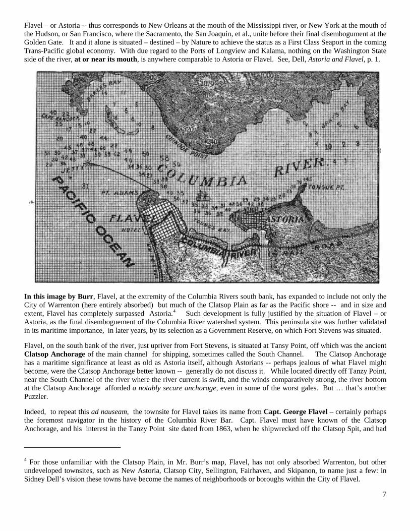
Flavel – or Astoria -- thus corresponds to New Orleans at the mouth of the Mississippi river, or New York at the mouth of the Hudson, or San Francisco, where the Sacramento, the San Joaquin, et al., unite before their final disembogument at the Golden Gate. It and it alone is situated – destined – by Nature to achieve the status as a First Class Seaport in the coming Trans-Pacific global economy. With due regard to the Ports of Longview and Kalama, nothing on the Washington State side of the river, at or near its mouth, is anywhere comparable to Astoria or Flavel. See, Dell, Astoria and Flavel, p. 1.
In this image by Burr, Flavel, at the extremity of the Columbia Rivers south bank, has expanded to include not only the City of Warrenton (here entirely absorbed) but much of the Clatsop Plain as far as the Pacific shore -- and in size and extent, Flavel has completely surpassed Astoria.4
Flavel, on the south bank of the river, just upriver from Fort Stevens, is situated at Tansy Point, off which was the ancient Clatsop Anchorage of the main channel for shipping, sometimes called the South Channel. The Clatsop Anchorage has a maritime significance at least as old as Astoria itself, although Astorians -- perhaps jealous of what Flavel might become, were the Clatsop Anchorage better known -- generally do not discuss it. While located directly off Tanzy Point, near the South Channel of the river where the river current is swift, and the winds comparatively strong, the river bottom at the Clatsop Anchorage afforded a notably secure anchorage, even in some of the worst gales. But … that’s another Puzzler.
Such development is fully justified by the situation of Flavel – or Astoria, as the final disemboguement of the Columbia River watershed system. This peninsula site was further validated in its maritime importance, in later years, by its selection as a Government Reserve, on which Fort Stevens was situated.
Indeed, to repeat this ad nauseam, the townsite for Flavel takes its name from Capt. George Flavel – certainly perhaps the foremost navigator in the history of the Columbia River Bar. Capt. Flavel must have known of the Clatsop Anchorage, and his interest in the Tanzy Point site dated from 1863, when he shipwrecked off the Clatsop Spit, and had
4 For those unfamiliar with the Clatsop Plain, in Mr. Burr’s map, Flavel, has not only absorbed Warrenton, but other undeveloped townsites, such as New Astoria, Clatsop City, Sellington, Fairhaven, and Skipanon, to name just a few: in Sidney Dell’s vision these towns have become the names of neighborhoods or boroughs within the City of Flavel.
8
to make his way back to Astoria “overland”.5
THE PORT OF ASTORIA currently operates three piers – one largely for the docking of cruise vessels; another for commercial fishing vessels; and a third for boat haul out. See,
Thereafter, he visited the area a half dozen times before he determined to purchase it, presumably recognizing it as a prime location for commercial riparian development. He then bought it, named it after himself, and sued everybody who lived there to hold on to it. That’s where Sidney Dell came in.
http://www.portofastoria.com. At this rate of development, although Astoria yet retains a slim edge, Flavel, with its comparable advantages spurred by the vision of Sidney Dell, and with the added benefit of the Clatsop Anchorage, could soon catch up.
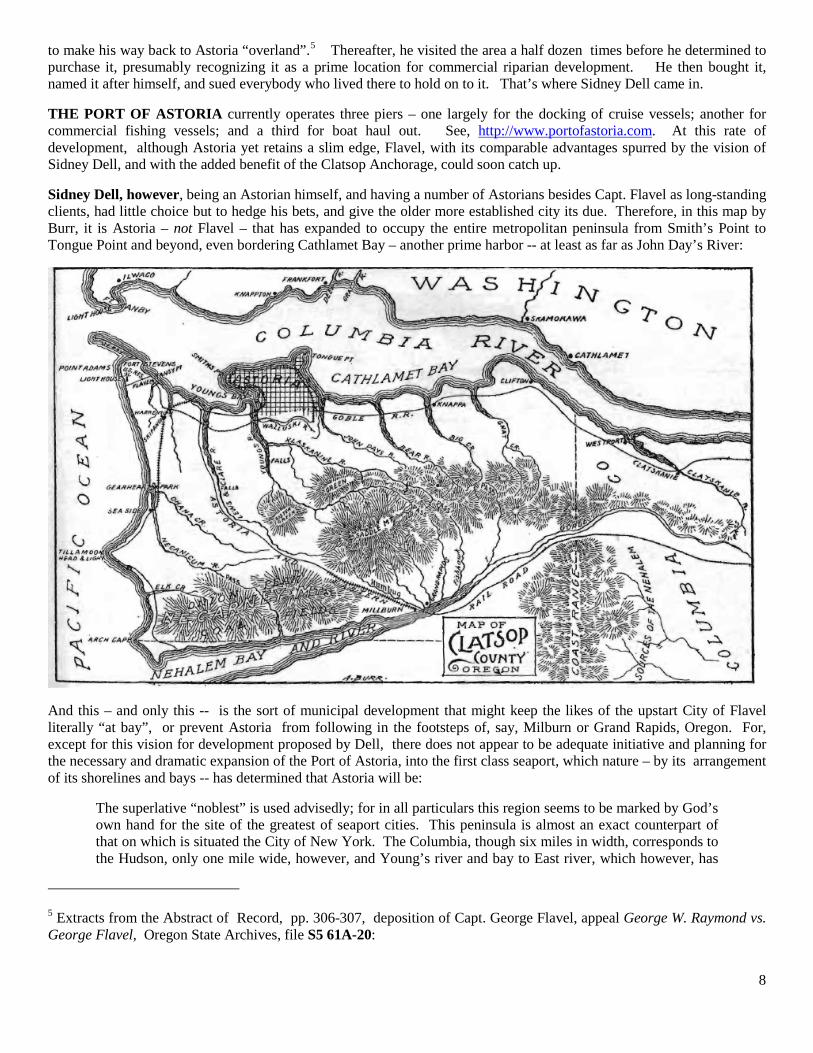
Sidney Dell, however, being an Astorian himself, and having a number of Astorians besides Capt. Flavel as long-standing clients, had little choice but to hedge his bets, and give the older more established city its due. Therefore, in this map by Burr, it is Astoria – not Flavel – that has expanded to occupy the entire metropolitan peninsula from Smith’s Point to Tongue Point and beyond, even bordering Cathlamet Bay – another prime harbor -- at least as far as John Day’s River:
And this – and only this -- is the sort of municipal development that might keep the likes of the upstart City of Flavel literally “at bay”, or prevent Astoria from following in the footsteps of, say, Milburn or Grand Rapids, Oregon. For, except for this vision for development proposed by Dell, there does not appear to be adequate initiative and planning for the necessary and dramatic expansion of the Port of Astoria, into the first class seaport, which nature – by its arrangement of its shorelines and bays -- has determined that Astoria will be:
The superlative “noblest” is used advisedly; for in all particulars this region seems to be marked by God’s own hand for the site of the greatest of seaport cities. This peninsula is almost an exact counterpart of that on which is situated the City of New York. The Columbia, though six miles in width, corresponds to the Hudson, only one mile wide, however, and Young’s river and bay to East river, which however, has
5 Extracts from the Abstract of Record, pp. 306-307, deposition of Capt. George Flavel, appeal George W. Raymond vs. George Flavel, Oregon State Archives, file S5 61A-20:
9
an extra outlet at Long Island Sound, though the Lewis and Clark [river] more than counterbalances that advantage. The chief differences (all in Astoria’s favor,) are: (1) that the New York peninsula runs north and south, with the course of the Hudson, while Astoria’s peninsula runs east and west with the course of the Columbia on the great lines of travel and commerce of the world! (2.) the lower end of the New York peninsula is flat, while the Astoria peninsula is high , and affords ample dirt for filling in its bay down to its bulk head line under its recent seawall charter, and at the same time affords scope for the finest graded and drained seaport city in the world…..
Or else, Flavel:
The South side of the Columbia, in Clatsop county, though somewhat hilly, by reason of the vast number of its streams, is flat land, as compared with the high and rocky land on the north side; and its facility of access over the low Nehalem hills and along the sea coast, south to California, and southeast to the Willamette valley, and east, taken with its grand bays and harbor, marks it as the only great natural site for the seaport of the mighty Columbia, and its thousand valleys great and small. Sea coast lines from San Francisco, and from the Willamette valley and the southeast, even if a preferable point were on the north side, could not, with advantage, cross over wide bays. Tanzy Point, and south side of Young’s Bay, corresponding to Brooklyn, are important parts of this great seaport site. They can furnish railway yards equal to those on the Jersey shore, opposite New York, and are part of the great plan of nature to fix a seaport on a grand scale at this point, for the Columbia watershed.
Archibald A. Schenk, principal assistant engineer of the N.Y. Central railroad during the late 19th C., submitted a professional analysis for publication in the Astorian of January 27, 1891 – over 120 years ago -- highlighting the necessary, and inevitable, role of Astoria as a deep-water seaport, opining that it even must supplant Portland:
“The arranging of the harbor lines and the bill to be presented to the legislature for seawall construction, as referred to in the Astorian of January 11th,are two of the most important steps in advance Astoria has yet taken . Track room for the storage of cars, (loaded and empty,) and angle of approach, are together the measure of the seaport. There may be deep water and room for a thousand ships, still the business may be limited b y the land facilities. The possibility of building long piers at right angles to the channel is where Astoria is strong as contrasted with Portland. No port with such a long pier system is impossible is likely to be a port of first importance, and Portland will feel this before many years. Such piers as are customary in large seaports would reach nearly across the Willamette River at Portland. Hence, Portland’s shoreline, being available only for ships lying parallel with the stream, will be quickly used up and really amounts to but a small fraction of what ordinary seaports require. * * *
“The long pier system for use in connection with railways requires also turning room for trains back from the piers, about 350 feet, say, or a total of 800 to 1,1000 feet. Hence the difficulty of Portland’s becoming an extensive seaport.
Etc. As important as has become the Port of Portland as a deep water port for ocean shipping, nevertheless, being 80 miles upriver, it is intrinsically inefficient, and according to Sidney Dell and experts he cited, such as Schenk, its inland location makes Portland only a third class port, and destined to remain one. Portland’s forte will be as a manufacturing center, and as a rail and air transit hub for the larger Columbia river region. Astoria may soon surpass it. See, Dell, ASTORIA AND FLAVEL, The Chief Seaport [sic] of the Columbia River Watershed (1893). Astoria and Flavel alone in the Columbia River Watershed, have the makings of a First Class seaport. As Dell observed, if the Astoria Chamber of Commerce does not completely muff things again, after 100 years, Flavel, or after 200 years, Astoria “… is about to achieve greatness only through her own overmastering destiny.” For one of these two cities, with the latest developments in Russia, the future has arrived ….
But, then, the Puzzler remains – which one? ASTORIA OR FLAVEL ? Which of these 2 budding seaports will become the chief American seaport on the Pacific Ocean, to exploit the coming shift to a trans-pacific global economy, as signaled recently by events in Russia?
Sidney Dell offers an answer: New Astoria is among the names of the future, hidden with the City of Flavel.
10
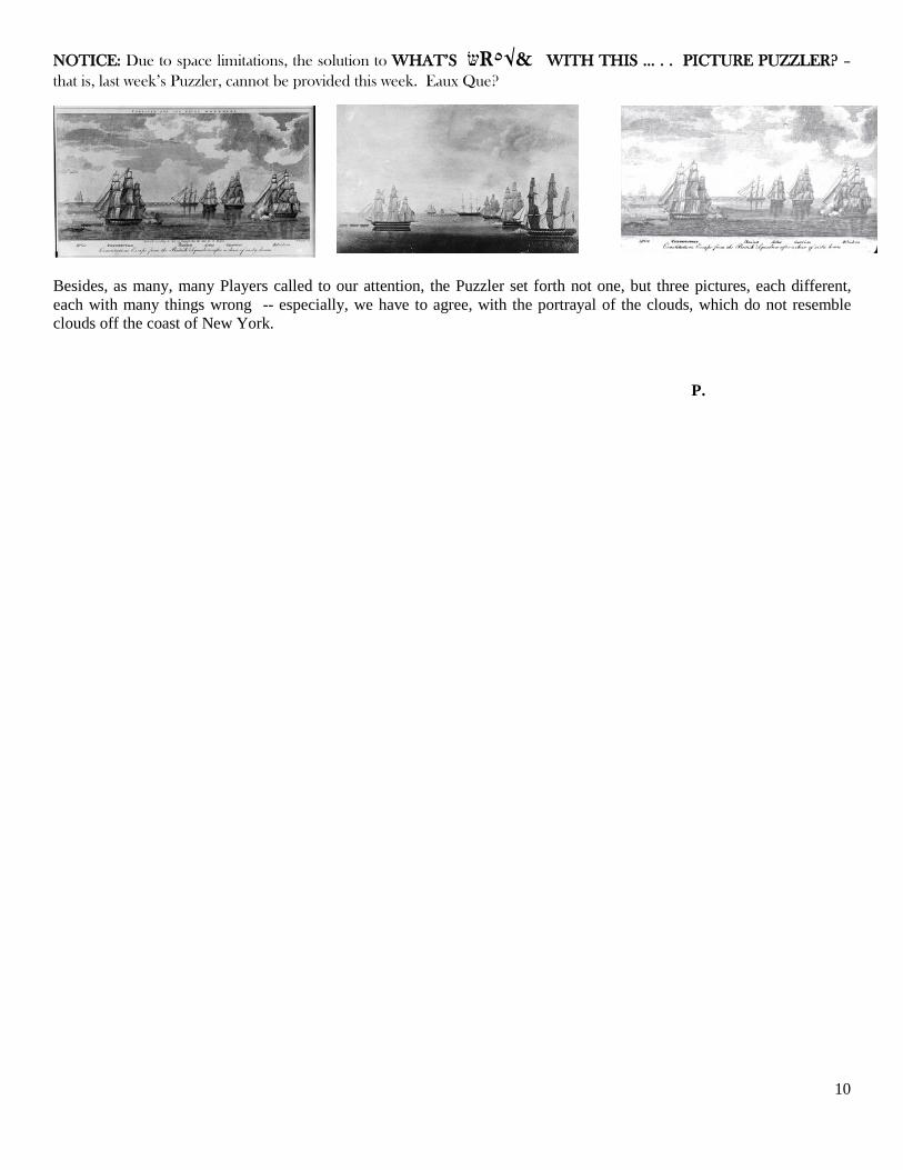
NOTICE: Due to space limitations, the solution to WHAT’S שR٥√& WITH THIS … . . PICTURE PUZZLER? – that is, last week’s Puzzler, cannot be provided this week. Eaux Que?
Besides, as many, many Players called to our attention, the Puzzler set forth not one, but three pictures, each different, each with many things wrong -- especially, we have to agree, with the portrayal of the clouds, which do not resemble clouds off the coast of New York.
P.