public hearing: figure “8” island - united states army
TRANSCRIPT

BUILDING STRONG®
Website:
http://www.saw.usace.army.mil/Missions/Regulatory
PermitProgram/MajorProjects
Public Hearing: Figure “8” Island
Shoreline Management Project
U.S. Army Corps of Engineers
POC: Mr. Mickey Sugg
Wilmington Regulatory Field Office
69 Darlington Avenue, Wilmington NC
28403
(910) 251-4811, or

Tools Used to Evaluate Alternatives
• Geomorphic analysis of Rich Inlet and adjacent
shorelines (by Dr. William Cleary – Sub Appendix A
in SEIS)
• Numerical Models:
Primary – Delft3D
Secondary - GENESIS

Geomorphic Analysis
Rich Inlet & Adjacent Shorelines (Dr. William Cleary Report – Sub Appendix A in SEIS)

Shoreline Transects (Dr. William Cleary Report – Sub Appendix A in SEIS)

Figure Eight Island 1938-2007 Shorelines (Dr. William Cleary Report – Sub Appendix A in SEIS)

Hutaff Island 1938-2007 Shorelines (Dr. William Cleary Report – Sub Appendix A in SEIS)

Channel Orientation versus Shoreline Change Northern 4,000 feet Figure Eight Island

Maximum Recession at North End

Rich Inlet September 2007

Rich Inlet October 2010

Rich Inlet January 2013

Rich Inlet October 2014

Terminal Groin Alternatives Evaluated

Alternative 2 – No New Action Delft3D Model - Initial Condition
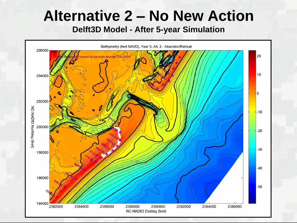
Alternative 2 – No New Action Delft3D Model - After 5-year Simulation
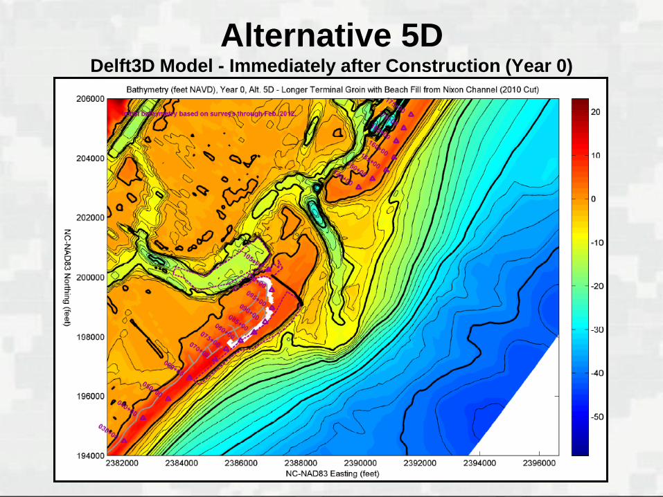
Alternative 5D Delft3D Model - Immediately after Construction (Year 0)

Alternative 5D Delft3D Model - 5-Years after Construction

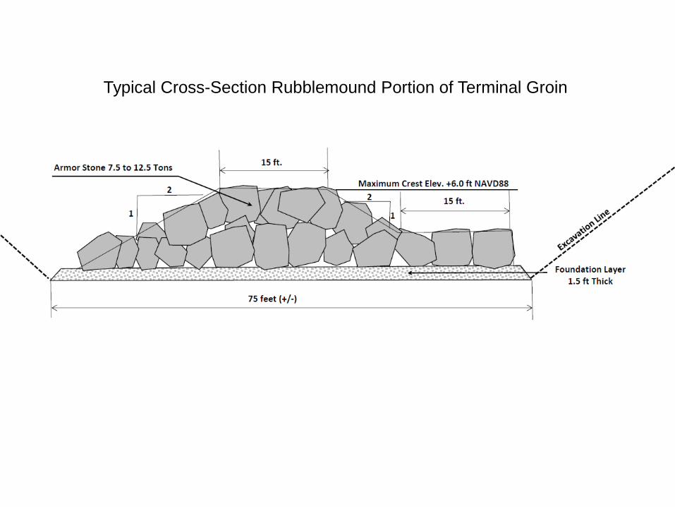
Typical Cross-Section Rubblemound Portion of Terminal Groin

Construction Methodology Bald Head Island Example
Trench
Foundation Mat

Construction Methodology Bald Head Island Example
Foundation Mat
Temp Offloading Pier
Approximately 60 – 70 feet

Construction
Methodology Bald Head Island
Example
Completed
Section

Figure Eight
Island
Terminal Groin
Construction
Corridor

COMMENTS