protecting atoll habitability, land and infrastructure in ... · protecting atoll habitability,...
TRANSCRIPT

Secretariat of the Pacific Community
Government of the Republic of the Marshall Islands (RMI)
GLOBAL CLIMATE CHANGE ALLIANCE: PACIFIC SMALL ISLAN D STATES
PROJECT DESIGN DOCUMENT
Protecting atoll habitability, land and infrastruct ure in Ailinglaplap, Marshall Islands
Project Summary
The overall objective of the Euro 0.5 million project is to “Improve resilience to coastal climate change impacts”. Its purpose is to increase the capacity of Republic of Marshall Islands (RMI) stakeholders to plan and implement effective coastal protection measures that reduce vulnerability to climate change. It will do this by contributing towards the following outcomes: (i) securing access between islands for the community and for economic activities; (ii) reducing the risk of major coastal erosion at the site; and (iii) improving the strategic capacity of key RMI stakeholders to plan for coastal change in the context of climate change.
The Government of RMI and communities will be provided with financial and technical assistance, staff support, equipment and training opportunities so that the coastal erosion concerns of an outer island community at Woja, on Ailinglaplap, can be addressed, through design and construction of a raised, armoured causeway across the most severely eroding section of the island.
While directly addressing the problems faced by the Woja community, this project is also intended to be a learning exercise, which can improve the capacity of other stakeholders in RMI to plan, design, implement and monitor coastal protection measures. Climate change, and in particular sea level rise, is projected to intensify the effects of storm surge events, and increase the frequency of inundation, and given RMI’s geographical nature it is very likely that coastal protection measures will be an important part of their response.
The project’s key result areas (KRA) are:
(i) Increased awareness in the local community about strategies for integrated coastal management in the context of climate change, including “soft” engineering approaches;
(ii) Coastal adaptation measure(s) identified, designed and constructed for a vulnerable community at Woja, Ailinglaplap
(iii) Key stakeholders in Marshall Islands engaged in the preparation of planning guidelines on improved coastal management practices that increase resilience to climate change impacts
The implementation period of this project will commence on the date of signature of this project design document and end on 30 June 2015. It will be implemented by the Ministry of Public Works, coordinated by the Office of Environmental Planning and Policy Coordination (OEPPC).
The project is consistent with the RMI National Climate Change Policy Framework (2011); RMI’s Joint National Action Plan (JNAP) for Climate Change Adaptation and Disaster Risk Management; and the Strategic Development Plan Framework 2003-2018 (Vision 2018).

Map of the Republic of Marshall Islands (RMI)

Table of Contents
Signature page .................................................................................................................... 4
1. INTRODUCTION ............................................................................................................ 5
Background ........................................ .......................................................................... 6
Sources of vulnerability and climate change project ions for RMI ............................ 6
Rationale for this project ........................ ..................................................................... 7
Consistency with RMI’s climate change adaptation pr iorities ................................ 14
2. PROJECT SELECTION PROCESS ............................................................................. 16
February – May 2012: Review of background informati on ...................................... 16
3. DETAILED PROJECT DESCRIPTION ......................................................................... 18
Overall objective ................................. ....................................................................... 18
Project purpose ................................... ....................................................................... 18
Key result areas and activities ................... ............................................................... 18
Project Log Frame ................................. ..................................................................... 21
4. PROJECT BUDGET .................................................................................................... 24
Payment Schedule (Euros) .......................... ..................... Error! Bookmark not defined.
Payment schedule (USD) ............................ ............................................................... 25
5. PROJECT SCHEDULE ............................................................................................... 26
6. INSTITUTIONAL ARRANGEMENTS ........................................................................... 28
Project Oversight Committee ....................... ............................................................. 28
Reporting ......................................... ........................................................................... 28
Day to Day Implementation of the Project .......... ...................................................... 28
7. RISK MANAGEMENT AND EXIT STRATEGY ............................................................. 29
Risk Management ................................... .................................................................... 29
Exit Strategy ..................................... .......................................................................... 30
Annex 1. QUARTERLY REPORTING TEMPLATE ....................................................... 31

4
Signature page
5
1. INTRODUCTION The Global Climate Change Alliance: Pacific Small Island States (GCCA: PSIS) project is a four-year project funded by the European Union and executed by the Secretariat of the Pacific Community (SPC). The overall objective of the GCCA: PSIS project is to support the governments of nine smaller Pacific Island States, namely Cook Islands, Federated States of Micronesia, Kiribati, Republic of the Marshall Islands, Nauru, Niue, Palau, Tonga and Tuvalu, in their efforts to tackle the adverse effects of climate change. The purpose of the project is to promote long-term strategies and approaches to adaptation planning and pave the way for more effective and coordinated aid delivery to address climate change at the national and regional level.
The GCCA: PSIS project is implemented by SPC as part of its ‘whole of organization approach’ and is one of the activities contributing to the SPC Climate Change Engagement Strategy. The four key result areas (KRA) of the GCCA: PSIS project are:
• KRA 1: Climate change mainstreamed into national and/or sector response strategies.
• KRA 2: Countries better equipped to access climate change funds through different financing modalities
• KRA 3: National climate change adaptation projects implemented.
• KRA 4: Streamlined technical assistance that supports national adaptation responses delivered by regional organizations in a collaborative manner
The Republic of the Marshall Islands (RMI) has identified coastal protection as the focus for its climate change adaptation project to be implemented under the GCCA: PSIS project. The atolls of RMI are typically less than three metres above sea level at their highest point, and much of the settlement and activity is even lower. This means the country is already highly susceptible to inundation during storm events and is also vulnerable to coastal erosion, risks that are projected to significantly increase as a result of sea-level rise triggered by climate change. The government of RMI has already highlighted, in various policies, strategies and reports (described in more detail below), that improved coastal management and protection are important national priorities, including for combating the effects of climate change. The 2008 Coastal Management Framework identifies various ways in which land management practices – particularly in urban areas, but also in rural communities – have degraded RMI’s coastline and, with it, the capacity to buffer erosion and inundation. It states: “Recognizing that global sea-level rise is beyond the control of the RMI government, action must be taken immediately to halt the human-induced damage to the shoreline”. The Joint National Action Plan for Climate Change Adaptation and Disaster Risk Management 2014-2018 (JNAP) includes among its priorities both reducing vulnerability to coastal hazards, and moving towards more integrated development planning that takes account of future climate scenarios, and these are also priorities emphasised in the Disaster Risk Management National Action Plan (DRM NAP).
There is therefore an urgent need in RMI to build capacity to be able to undertake coastal protection measures, and to better plan future development in a way that improves rather than undermines the resilience of communities to coastal risks, particularly as these will intensify as a result of climate change.
This project design document (PDD) outlines the overall objective, purpose, key result areas and activities that comprise the project. The project design follows the logical framework approach. This first section of the PDD outlines the background of the project, its rationale and related projects. Section two describes how the project was identified. The third section describes the project’s overall objectives, purpose, key result areas and activities using a logical framework approach, while the fourth and fifth sections of the document provide a
6
schedule and budget for the project activities. Institutional arrangements and risk management and exit strategies are the content of sections six and seven respectively.
Background
RMI is a small country of 29 atolls and 5 coral islands comprised of about 180 square kilometres in land area spread over an expanse of ocean in the North Pacific of more than 4600 square kilometres (spread across an expanse of around 2 million square kilometres in economic zone). The atolls consist of, in total, around 1225 low lying islands. Most of these are low-lying, with very few places higher than three metres above sea level.
Almost 70% of the population of around 55,000 are concentrated in urban centres on Kwajalein (Ebeye) and Majuro atolls. The subsistence economy still plays an important part in people’s livelihoods, especially outside urban areas. In terms of income-generating activities, copra, coconut oil and fish (particularly yellowfin tuna) are the main sources of revenue. In terms of formal employment, nearly half of the salaried workforce is employed in the public sector. Unemployment rates are high, especially among women. This narrow range of employment and income streams makes RMI economically vulnerable to changes in the country’s physical environment, including those related to climate change.
Sources of vulnerability and climate change project ions for RMI
The JNAP sets out the risk background for RMI, describing the hazards and vulnerabilities it faces as being linked to both “physical and social characteristics of its islands and people, in addition to ongoing unsustainable development practices”. Drivers of vulnerability are highlighted as including:
• Rapid population growth and over-population in urban centres • Low elevation and small atoll islands • Unsustainable development • Localized pollution (including contamination of water supply), poor waste
management and sanitation and environmental degradation • Climate change impacts including accelerated sea level rise • Limited resources (particularly food, water and fuel) • Limited economic potential due to small size and remoteness • High exposure to external market shocks (demonstrated by the State of Economic
Emergency declared in 2008 following unprecedented increases in costs of imported food and fuel)
• Sparse and scattered nature of islands and atolls, making communication and transportation to outer islands more difficult
• Outbreaks of disease via contamination of water is not uncommon – an issue that is exacerbated by the high population densities of the urban centres.
In terms of natural hazards, the JNAP identifies tropical storms, sea swells and droughts as most significant, along with tsunamis.
The impacts of longer term climate change are very likely to make addressing these development challenges even more critical, and more difficult. The main driver of year-to-year variability in climate is the El Niño Southern Oscillation (ENSO), along with variations in the behaviour of the Inter Tropical Convergence Zone (ITCZ) and Western Pacific Monsoon.1 As the impacts of climate change continue to grow, direct changes to RMI’s biophysical environment are projected to include sea level rise and increased storm surges, changes in typhoon formation, changes in precipitation patterns, higher air and ocean temperatures, and increasing ocean acidification. These changes will place greater stress
1 Australian Bureau of Meteorology and CSIRO, 2011.

7
on, for example, the quality and quantity of water resources, on fisheries resources, on agricultural production, and on coastal zones and settlements.
RMI is particularly vulnerable to sea level rise. Sea level rise projections for RMI for 2055 show an increase of 11-30 cm over the 1990 values for the high emissions scenario (these values are sourced from Australian Bureau of Meteorology and CSIRO, 2011, which used the models from the Intergovernmental Panel on Climate Change (IPCC) 4th Assessment Report (2007). However, the 5th Assessment Report of the IPCC provides an even more serious picture with a projected global sea level rise of between 0.52 to 0.98 m by 2100. This is the worst case scenario considered by the IPCC (Representative Concentration Pathway 8.5). Recognising that nearly all of the land in RMI consists of low-lying, fragile, narrow atolls which already experience inundation during high tides and storms, this scenario has serious implications for RMI. Furthermore, according to the Coastal Management Framework 2008 most atolls are undergoing active erosion. Sea-level rise will increase the frequency and severity of inundation events, and may leave some areas permanently underwater. Further, as the frequency of inundation increases so too does the likelihood of saltwater intrusion of the groundwater lenses.
Given RMI’s nutrient-poor soils and limited land for agricultural production, as well as the lack of domestic fossil energy reserves, the country imports nearly all basic necessities, and is therefore dependent on international markets for food and energy resources. This has significant implications for their economic capacity and for food and energy security. As highlighted in Vision 2018 and also in the JNAP, it is therefore important to be aware of, and plan for, both direct and indirect effects that could undermine the country’s development.
Rationale for this project
As described above, RMI’s geography makes it highly susceptible to coastal risks such as erosion and inundation, risks that are anticipated to increase as a result of climate change. For communities, these risks have the potential to translate into land and habitat loss where homes are damaged by flood waters or become uninhabitable as a result of erosion; into economic losses including damage to crops; and into cultural losses (for example, cemeteries are frequently damaged during inundation events). In the case where communities become separated as a result of erosion of islands and causeways, this may restrict access to essential services such as health centres.
Coastal protection measures are thus likely to play an important role in future RMI efforts to build resilience to climate change. Integrated coastal management is a framework encompassing a multidisciplinary and iterative process for sustainable management of marine, coastal and terrestrial components of coastal regions. It seeks to balance competing socio-cultural and economic goals and objectives with the imperatives of conservation of coastal assets and the coastal environment. Coastal protection lies within the framework of integrated coastal management.

8
Photo: The thin strip of Majuro atoll, bounded by la goon on one side and ocean on the other, shows the typical exposure of communities across RMI to inund ation and erosion
Coastal protection measures at Ailinglaplap
In October 2010 the Cabinet endorsed the RMI Climate Change Roadmap, and government agencies were asked to submit climate change projects for prioritization. The Ministry of Public Works presented infrastructure improvement needs, costs and location maps for shoreline protection and rehabilitation of roads, causeways and airstrips on six atolls. The total cost for nine priority projects was USD81.09 million. Two of these priority projects were in Ailinglaplap: USD9.45 million for the Airok-Jabwan-Buoj roads and causeway; and USD1.26 million for the ocean and lagoon side of the Woja road and causeway.
The government of RMI selected the Woja road and causeway project as the focus for the GCCA: PSIS project, based on an OEPPC vulnerability survey (which included consultation with the local community) indicating the area is undergoing active erosion and which could divide the islands, thereby impacting copra production, access to schools and health services for the community. The Woja site was also considered most likely to be financially viable to tackle with the budget available under the GCCA: PSIS project.
Ailinglaplap atoll has a semi-continuous reef rim enclosing a lagoon, and is made up of a series of vegetated reef islands located on the reef rim. Five of these islands contain villages, and the population of Ailinglaplap is around 1,700 people (based on 2011 census).
The OEPPC conducted a vulnerability survey in January-February 2013, and consulted with the communities who were concerned that the erosion is most severe near the narrow central part of the island where it could divide the island into two separate islands thereby impacting copra production as well as access to the school, dispensary and other community services.
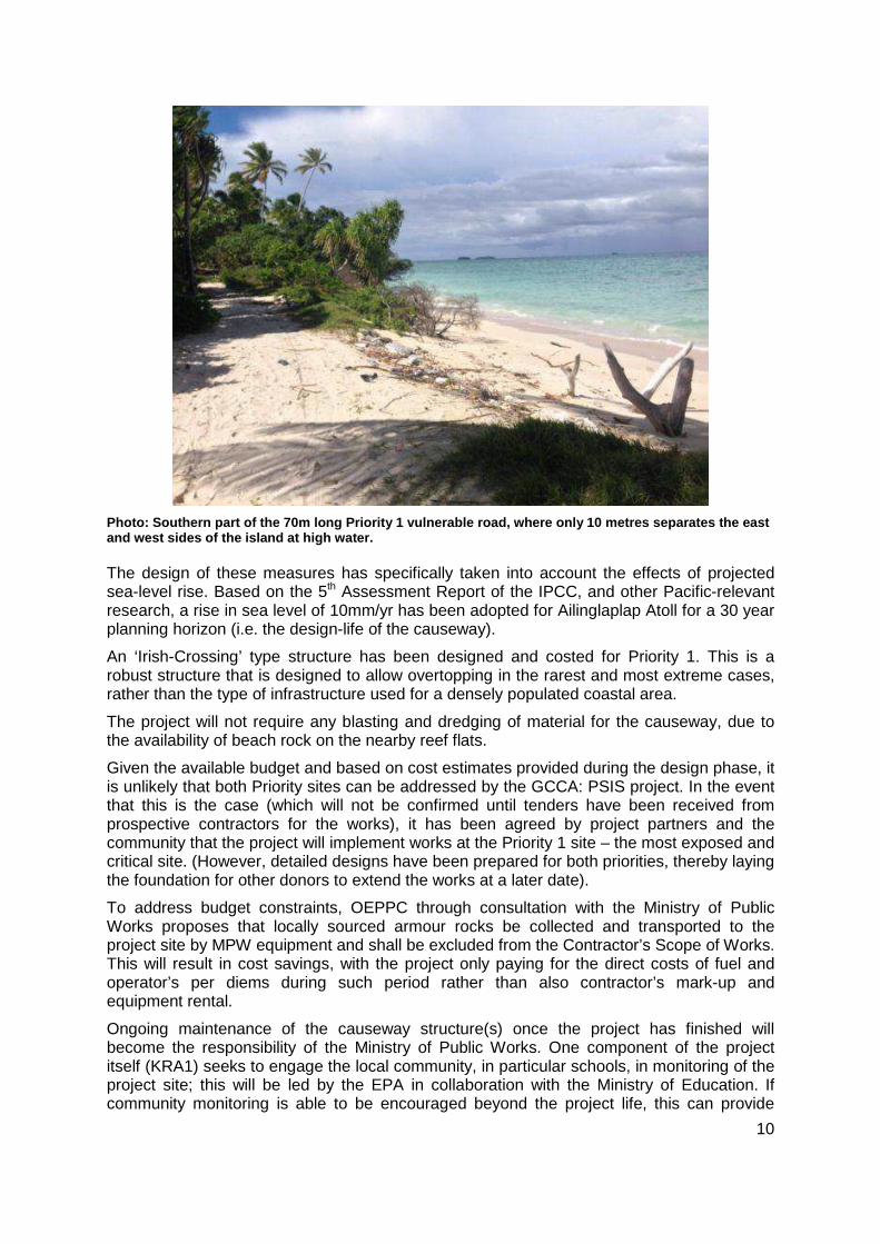
Between October 2013 and March 2014 a feasibility and design project was conducted by eCoast Marine Consulting and Research. This study deemed it probable the two parts of the island will become permanently separated in future if no intervention is undertaken. The critical coastal stretch has been divided into two priorities. The Priority 1 site measures 70m in length. It is the narrowest part and consists of a low 10m wide sand ridge separating the

9
lagoon side from the ocean side of the island. The Priority 2 site, to the north, is 150 m long and 40 m wide. Although it is inundated by seawater for about 2 hours either side of high tide, it is more stable than the Priority 1 site.
Figure: Two priority sites identified at Woja
The first stage of this project, already completed in order to prepare this project document, involved a detailed engineering survey of the Woja sites by an expert consultant (eCoast Marine Consulting and Research), assessment of intervention options, and preparation of detailed designs for an effective, affordable measure to reduce erosion and maintain community access. The result is the following proposed strategy for addressing the two priority sites:
• At the Priority 1 site, a 70m long rock-armoured causeway is proposed. This will be 3m in elevation (above lowest astronomical tide), and is designed to be passable in all but the most extreme overtopping events. The new causeway road will be set some 15-20 m to the west of the existing low sand ridge to provide an additional erosion buffer on the eastern side where the erosion is more severe.
• At the Priority 2 site, it is proposed to raise and armour a 150m long section of the existing roadway. Since erosion is less active in this area, the armouring units can be smaller, and the road does not need lifting to the same degree as in the Priority 1 site.
Around both sites, the local community will be invited to work with government to plant locally-suited vegetation (for example, mangroves and Kone trees), to help reduce the effects of erosion.
10
Photo: Southern part of the 70m long Priority 1 vulner able road, where only 10 metres separates the east and west sides of the island at high water.
The design of these measures has specifically taken into account the effects of projected sea-level rise. Based on the 5th Assessment Report of the IPCC, and other Pacific-relevant research, a rise in sea level of 10mm/yr has been adopted for Ailinglaplap Atoll for a 30 year planning horizon (i.e. the design-life of the causeway).
An ‘Irish-Crossing’ type structure has been designed and costed for Priority 1. This is a robust structure that is designed to allow overtopping in the rarest and most extreme cases, rather than the type of infrastructure used for a densely populated coastal area.
The project will not require any blasting and dredging of material for the causeway, due to the availability of beach rock on the nearby reef flats.
Given the available budget and based on cost estimates provided during the design phase, it is unlikely that both Priority sites can be addressed by the GCCA: PSIS project. In the event that this is the case (which will not be confirmed until tenders have been received from prospective contractors for the works), it has been agreed by project partners and the community that the project will implement works at the Priority 1 site – the most exposed and critical site. (However, detailed designs have been prepared for both priorities, thereby laying the foundation for other donors to extend the works at a later date).
To address budget constraints, OEPPC through consultation with the Ministry of Public Works proposes that locally sourced armour rocks be collected and transported to the project site by MPW equipment and shall be excluded from the Contractor’s Scope of Works. This will result in cost savings, with the project only paying for the direct costs of fuel and operator’s per diems during such period rather than also contractor’s mark-up and equipment rental.
Ongoing maintenance of the causeway structure(s) once the project has finished will become the responsibility of the Ministry of Public Works. One component of the project itself (KRA1) seeks to engage the local community, in particular schools, in monitoring of the project site; this will be led by the EPA in collaboration with the Ministry of Education. If community monitoring is able to be encouraged beyond the project life, this can provide

11
useful information to Public Works for instance on the stability and functioning of the causeway.
Photo: A resident wades through the inundated road a t the Priority 2 site during high tide
Monitoring and maintenance program
All coastal structures require maintenance. In the Woja case it is expected that maintenance will fall into two categories:
1. Local small-scale maintenance of the road surface – Heavy rain and/or over-topping during extreme events will likely damage the road surface. It is expected that the local community will be able to maintain the road surface by filling any depressions.
2. Heavy machinery maintenance of the causeway structure – There is the potential for larger scale damage to the structures (e.g. undermining of the toe, displacement of rock armour, etc.) following a very extreme event (e.g. a typhoon passing right over the site), or through chronic deterioration..
Once completed, the project will collect data in order to monitor and assess both the shoreline and the integrity of the causeway structure. Data collected will include beach profiles, photographs, and field notes. The initial beach profiles, site photographs and field notes in the consultant’s feasibility study will be used as the baseline data for assessing changes. A monitoring and evaluation framework has been prepared by the engineering consultant, and will be overseen by Public Works. It covers the construction of the coastal protection works and suggests monitoring over at least a 3 year post-construction period. It is expected that monitoring will be carried out at regular intervals by local volunteers and government representatives when they are visiting Woja Island.
Any large scale maintenance requirements identified by the monitoring will be reported to the government department responsible for the structure’s maintenance (i.e. the Ministry of Public Works).

12
Community engagement
Coastal protection measures typically involve physical changes to a community’s land and coastal features. Community involvement in decision making about coastal protection is therefore essential. Community engagement has already been important in progressing to the stage of having a detailed design proposal for the two sites. Several visits to Woja by the project team – including Office of Environmental Planning and Policy Coordination (OEPPC), Public Works, Environment Protection Authority and SPC, amongst others – have involved the community in consultation. This has enhanced understanding of how the priority sites have changed over time and how this has impacted the community. In addition, it has been important to share information about the expected life span for coastal protection measures. As the coordinator of these activities, OEPPC indicates the community is fully supportive of the proposed activities.
As the project is implemented, the community will also be brought into the project in a number of other ways, focused on building awareness and capacity at the local level in Woja about their role in coastal protection. Through awareness and education activities, the project aims to build community capacity to implement practical, local coastal conservation measures such as coastal planting. Over the longer term these will improve the health of the local resource base, and in doing so improve community resilience to future stresses (including climate change).
Need to build capacity for assessment, design and i mplementation of coastal protection projects in RMI
As a demonstration project, the Woja causeway project will add considerable value to future efforts in RMI to protect coastal areas from erosion and inundation. Problems with previous high-profile projects in RMI (such as the causeway at Ebeye) suggest that capacity building across government will be a valuable outcome.
The 2008 Disaster Risk Management National Action Plan (DRM NAP) highlights that “construction of poorly-designed causeways to link islands within an atoll chain upsets the natural flow of sediments and is another cause of coastal erosion”. It is thus imperative that coastal protection measures are designed within a framework of integrated coastal management and this contribute to the wise use and management of the coast.
Using lessons from the Woja activities, this project therefore intends to prepare a guideline documenting best practices for coastal infrastructure projects in RMI. The guideline will cover issues including technical and social aspects of the design process, environmental impact assessment and compliance, monitoring procedures, dredging practices where aggregate is needed (e.g. for causeway armouring, fill, road surfaces), and community engagement practices. It will also identify key policies and plans in RMI that relate to coastal management. It is intended to be a “one stop shop” for future projects to refer to, as well as provide clarity across the RMI government on expected process and outcomes.
Need for improved guidance and regulation on approp riate land use planning and construction
At present there are no building codes or settlement planning guidelines in use by RMI for ensuring new development is appropriately designed, sited and constructed. This means development proceeds in a largely ad hoc manner, which creates problems particularly over the longer term. For instance, houses may be built over sensitive groundwater lenses, or in zones that are highly susceptible to inundation. The projections of sea level rise as a result of climate change mean it will become increasingly important that new buildings and other construction (e.g. infrastructure projects) are “climate-proofed”, i.e. designed to accommodate anticipated future conditions.

13
There is a desire among RMI government stakeholders to put in place more effective controls to ensure future development is more sensitive and more sustainable than what has occurred in the past. At the April 2014 meeting of the Cartagena Dialogue in Majuro, President Loeak announced that no new public buildings in RMI will be built without taking into consideration the future impacts of climate change, indicating high-level political commitment already exists. Staff from Public Works, the Environment Protection Authority (EPA) and the Emergency Coordination Office have also stressed the value of such controls.
A proposed planning process which includes regulatory measures ties in with other RMI needs and priorities:
• The DRM NAP states that “until recently, development in the coastal zone has been largely unregulated. A renewed emphasis on enforcing Environmental Impact Assessment regulations as well as new revised Coastal Management Regulations will hopefully begin to put in place the conditions for a more sustainable management of the RMI’s fragile coastline. Inadequate management of rapid urbanization has led to densely populated and poorly planned settlements, often containing structurally deficient buildings” which increase risks associated with health problems, fires, and access during emergencies. The development of building codes is also identified as a priority in the draft JNAP.
• RMI is currently preparing an Inundation Response Plan, following recent king tide flooding (March 2014), which it is understood will flag the need for building regulations as a risk reduction measure against future events.
• Building codes are suggested in the National Energy Policy (Annex 1), as a tool for ensuring new buildings are more energy efficient and hence contributing to energy security objectives. A submission from WUTMI suggests introduction of construction/renovation guidelines which focus on energy efficiency (Recommendations in Annex).
Introducing land use controls and regulations is not straightforward in RMI. Land tenure and land management decisions are complex, due to the fact that local land owners have considerable power over decisions. This makes it difficult to introduce and implement a national “top down” regulatory framework such as a new national building code, because without the buy-in of local governments and local land owners it will be not be effectively operationalised.
This is a point raised in the DRM NAP, which links the country’s ad hoc coastal zone development with the observation that RMI’s complex land tenure system has limited government’s ability to regulate development. “Government itself owns very little land and most land is leased from land-owners (Iroij, Alap and Rijerbal). Given the shortage of land in the RMI it is perhaps not surprising that ownership of land is considered sacrosanct. Land-owners wield tremendous power and influence making it difficult for agencies tasked with land management to apply planning and environmental management regulations. Thus it is critical that land-owners be brought on board in order to better manage the scarce and fragile land resources of the Marshall Islands”.
Therefore, it is imperative that the process of developing coastal planning guidelines and regulations fully engages – and is supported by – traditional land owners, since their support is critical for successful uptake and implementation.
Given the above, the GCCA: PSIS project intends to provide support to the government of RMI to initiate a process of knowledge gathering and stakeholder engagement about improved coastal planning and building practices. This is a first step towards a framework for more sustainable coastal development. The aims are to:

14
(i) articulate the gaps in current practices and options for addressing coastal planning in Small Island Developing States these (including a review of international practices and assessment of how these might be refined for suitability in the RMI context),
(ii) bring a wide range of stakeholders, including local land owners and chiefs, into the process of improving coastal planning and building practices, to encourage greater understanding of its importance and ownership over any final product, and
(iii) prepare a detailed action plan and project proposal that can be used by RMI to solicit donor funding to develop the necessary regulations (e.g. building codes).
A key output will be the preparation of an action plan for implementation of the study’s recommendations. Implementation of the action plan will be beyond the timeframe of the GCCA: PSIS project. The scope of this work is to include all new developments, including residential buildings and public infrastructure.
Consistency with RMI’s climate change adaptation pr iorities
Addressing the vulnerability of coastal development in RMI to risks such as erosion and inundation, which are likely to be exacerbated as a result of climate change, is consistently highlighted by the government as a priority action.
RMI’s draft Joint National Action Plan for Climate Change Adaptation and Disaster Risk Management 2014-2018 (JNAP) identifies that “sea level rise and associated impacts such as coastal erosion and inundation threatens infrastructure of RMI’s low lying atolls and islands. An increase in frequency and/or intensity of tropical storms or typhoons also poses a risk to infrastructure, much of which is built with little/no regard for construction standards” (p16). Of the JNAP’s six priority goals, two in particular relate to improving coastal zone management:
• Goal 5 (Enhanced local livelihoods and community resilience) lists “reduced vulnerability to coastal hazards” as a key outcome.
• Goal 6 (Integrated approach to development planning including consideration of climate change and disaster risks) highlights the following key outcomes: (i) All land-use policies and settlement planning processes reflect DRM/CCA, (ii) RMI has an updated building code for disaster and climate-proofing that is backed by appropriate legislations, (iii) Improved national and local capacity to undertake vulnerability and adaptation assessments and planning, and (iv) Key stakeholders are integrated into the planning and implementation of adaptation programmes at all levels.
Similarly, the 2010 National Climate Change Policy Framework (NCCPF), which preceded the JNAP, identified “Land and coastal management” among its nine national priority areas.
The 2008 Disaster Risk Management National Action Plan (DRM NAP) highlights the problems arising from poorly planned and constructed coastal developments. It articulates the goals of “Sustainable development of coastal zone” including reduced vulnerability to coastal hazards (Goal 6) and “Improved understanding of the linkages between zoning, building codes and vulnerability to disasters” including that decision-makers and the public are more receptive to the need for adequate zoning and building codes as a tool for reducing vulnerability (Goal 8).
One of the ten national development themes identified in the National Strategic Plan 2014-2016 (NSP) is “mitigating the impacts of climate change and creating awareness of the importance of environmental assets through community, national, regional and international approaches”, where the priorities are coastal, land and marine security. The NSP also stresses the importance of climate-proofing of future development. Similarly, the

15
predecessor strategy, Vision 2018: Strategic Development Plan Framework 2003-2018, highlights threats to RMI from sea level rise and from poorly implemented development. It states as an imperative the facilitation of “safe residential houses and commercial buildings” and encouragement of physical planning and zoning, through development of a Building Code that will be implemented in consultation with landowners. It also identifies the need for education programs to increase community understanding of the effects of climate change, including sea level rise, on atoll environments. Further, Vision 2018 flags that emphasis should be placed on development challenges in outer islands, in view of a disparity between rural and urban communities in terms of access to resources. Finally, it also highlights the importance of agricultural production to RMI’s resilience, and the need to support copra production (including transportation and market access). These are all features relevant to the project at Woja.
Related Projects
• Ministry of Public Works survey of vulnerable coastal sites. In response to a request from the Chief Secretary’s Office in October 2010, the Ministry of Public Works undertook a survey of coastal sites in RMI that are vulnerable to erosion. Locations prioritised for shoreline rehabilitation include the following:
Majuro Atoll – Ocean Side from SDA to MIHS/Road PII Dredging to Peace Park/ Laura Beach
Ailinglaplap Atoll – Woja Road (Picnic Area) & Aerok-Buoj-Jabwan Road
Jaluit Atoll – Road from Airstrip to Jaluit Island
Arno Atoll – Tinak Airstrip
Ebon Atoll – Ebon Airstrip
Ailuk Atoll – Lagoon Side
• US Coastal Community Adaptation Project (C-CAP), 2013-2017. This project aims to build the resiliency of vulnerable coastal communities in the Pacific region to withstand more intense and frequent weather events and ecosystem degradation in the short-term, and sea level rise in the long-term. The project has three components: (1) rehabilitating or constructing new, small-scale community infrastructure; (2) building capacity for community engagement for disaster prevention and preparedness; and (3) integrating climate resilient policies and practices into long-term land use plans and building standards. Responsible Agencies USAID Implementing Organization: Development Alternatives, Inc. (DAI), University of the South Pacific (USP); Kramer Ausenco Papua New Guinea Limited, RMI OEPPC.
• Micronesia Challenge: Sustainable Finance Systems for Island Protected Area Management. Sub-regional initiative focused on using traditional knowledge and ecosystem strategies to conserve vulnerable coastal land resources. Goals are to effectively conserve at least 30% of near shore resources and 20% of terrestrial resources by 2020. Incorporated climate change adaptation strategies in "Reimaanlok: Looking to the Future" national conservation area plan 2008.
• The Reimaanlok Process 2010 – 2020. Reimaanlok, meaning “looking to the future”, is a conservation area planning framework which is used throughout the Marshall Islands to guide the process of creating effective community-based conservation areas. This helps to promote sustainable resource use, protect biodiversity, address the effects of climate change and sea level rise, and ensure the future availability of natural resources for future generations. This work builds upon RMI’s commitment through the Micronesia Challenge.

16
• Strengthening Coastal and Marine resources management in the Coral Triangle of the Pacific (Phase 2), funded by ADB. Provides technical assistance with a focus on ensuring food security for people in Pacific CTI countries, by increasing the resilience of coastal and marine ecosystems. It aims to support the introduction of more effective management of coastal and marine resources, especially those associated with coral ecosystems, to build their resilience in a period of increased threats arising from human induced and climate change impacts.
2. PROJECT SELECTION PROCESS This section provides a timeline of planning activities to date, which describes how coastal protection on Ailinglaplap was selected as the focus of this project. Activities to date are listed below in chronological order.
February – May 2012: Review of background informati on
A literature review was conducted of the projects, programmes and activities relating to climate change that were ongoing or recently implemented in the country. Information from the review was compiled into the first version of the RMI Climate Change Profile and was published online; it was subsequently updated in 2013 and is available on line at http://www.spc.int/en/our-work/climate-change/gcca.html. The document provided a useful background for initial identification of a possible focus area for the adaptation project in RMI.
July – December 2012: Consultations to choose the sector
Following a presentation on the project to the National Climate Change Committee (NC3) in July 2012, a small working group was set up including OEPPC, MOFA, EPA, Ministry of Internal Affairs and Ministry of Resources and Development to develop a set of options for the GCCA: PSIS project in RMI. The sectors initially being considered were coastal management, freshwater and food security.
During a follow-up visit in November 2012 a multi sectoral stakeholder meeting was held involving all key government agencies as well as several individual meeting with sectors and ideas were developed for advancing a climate change adaptation in the water sector.
January – May 2013: Selection of the coastal sector and preparation of a concept note
During a mission to RMI in January, the Chief Secretary indicated that the RMI Government had decided that the water and sanitation sector was sufficiently covered by other partners, and the GCCA: PSIS project represented an opportunity to provide some seed funding to address the issue of coastal erosion in the outer islands. The 2010 survey of vulnerable coastal infrastructure undertaken by the Ministry of Public Works was used as the basis for selecting Ailinglaplap.
In February a team from OEPPC visited Ailinglaplap to conduct a vulnerability study and consult with stakeholders and identified Woja as the preferred site.
A visit to Ailinglaplap was arranged for May 2013. This was to involve members of the project team, a coastal expert from SPC’s Applied Geosciences and Technology Division (AGTD), and representatives from OEPPC, EPA and Ministry of Public Works. The objective of the mission was to conduct a rapid expert assessment of the coastal erosion in Woja Islands. However, unfortunately this mission had to be cancelled due to the fact that an official state of emergency was declared in RMI in May 2013 as a result of a serious drought.
August 2013 – Submission of Concept Note
A project Concept Note was prepared and accepted in August 2013. Arrangements were also made to recruit a coastal engineering firm to carry out a feasibility and design study for the site in Woja Islands; eCoast Marine and Consulting were contracted to carry out the work

17
and a visit to Woja was scheduled for November. (Unfortunately the rescheduling of the visit was not convenient for the SPC-AGTD expert, so the visit had to go ahead without this input).
September 2013 – March 2014 – Engineering review of site and preparation of feasibility and design study for climate change adaptation project
A site visit to Ailinglaplap was undertaken in November 2013, involving eCoast, GCCA: PSIS team, representatives from the RMI government (OEPPC, Internal Affairs (Survey team), EPA and PWD), and a Sea Grant representative from College of the Marshall Islands. During the visit the Iroij and the community were involved in consultations, including current challenges they face with inundation and erosion. During the visit a potential borrow area for the rock armouring was identified, and land and marine surveys were conducted.
A draft feasibility and pre-design report was circulated to RMI stakeholders in December 2013, and a workshop was held in Majuro in February 2014 to discuss the options and to clarify the steps required in order for the project to be implemented. The workshop was convened by OEPPC and attended by staff from the EPA, Public Works, MIMRA, Finance, Foreign Affairs, College of the Marshall Islands, USP, in addition to SPC and the eCoast consultant. Several attendees are also participants in the Coastal Management Advisory Committee (CMAC), which plays an important role in information sharing and coordination on coastal and environmental issues within RMI. A series of meetings with individual departments was also held around the same time, including with EPA and PWD. During these meetings it was agreed that a project engineer would be hired to drive the project and work with PWD as site manager during implementation.
Based on feedback from stakeholders received during the workshop, eCoast prepared a feasibility and final design report (including engineering drawings) detailing the proposed way forward for the project.
March 2014 – Further community consultation in Woja
Community representatives were unable to attend the February workshop in Majuro due to logistical issues. Thus a follow-up consultation mission was undertaken in early March 2014 during which staff from OEPPC, EPA and PWD visited Woja, to review the site, and discuss proposed options and constraints with the community. This mission also formalised land owner support for the project, in the form of letters of agreement from the relevant land owners.
April - May 2014 – Submission of Earthmoving Permit to commence environmental assessment process
Earlier meetings between SPC, PWD, EPA and OEPPC had clarified the EPA’s requirements for environmental assessment. Submission of the final feasibility study enabled the process to be triggered by submission of an Earthmoving Application by PWD and OEPPC.

18
3. DETAILED PROJECT DESCRIPTION
This section outlines the overall objective, purpose and key result areas (KRAs), as well as the logical framework that is used to monitor progress.
Overall objective
The overall objective of the project is to “Improve resilience to coastal climate change impacts in RMI”. Through the development of an Action plan for improved coastal planning and building practices, an important foundation will have been laid for adapting to the impacts of climate change, in particular rising sea levels. The project will directly benefit the community living on Woja Island, Ailinglaplap, where coastal processes are eroding the island and if unchecked are likely to divide the island into two separate parts, while also indirectly benefiting wider coastal protection activities across RMI.
Project purpose
The project purpose is to increase the capacity of RMI stakeholders to plan and implement effective coastal protection measures that reduce vulnerability to climate change. The lessons learnt from implementing the coastal protection project in Ailinglaplap will be compiled into a Best Practice Guideline and shared widely within RMI. Subsequent and future projects will benefit from this process guideline which will clearly document all the necessary steps from conceptualisation, research and knowledge gathering, feasibility, pre-design, compliance with government regulations, design, implementation and monitoring and evaluation. All of these steps have to be supported by an ongoing programme of widespread consultation.
Key result areas and activities
KRA 1 – Increased awareness in local communities on Ailinglaplap about strategies for integrated coastal management.
This component will target the communities of Ailinglaplap, and comprise the following key activities.
1.1 Community training on Ailinglaplap, focused on environmental and coastal management (EPA and Ministry of Education to lead). Awareness and education activities will focus on different target groups including communities, local government, schools, youth and church groups. The awareness and education materials will include preparation of information brochures and pamphlets, school programmes that include monitoring and stewardship of the coastal zone, radio/television broadcasts, and community billboards. As a component of this, communities will be involved in vegetation planting. Led by EPA, the community will be engaged in planting of selected species that are suitable for coastal protection in the vicinity of the Woja site. Efforts will be made to use food trees, where suitable
1.2 Together with EPA and Ministry of Education engage schools in Ailinglaplap in using the site identified in KRA 2 as a Living Laboratory.
The EPA and the Ministry of Education will involve schools in the observation and monitoring of the site at Woja Island and use its potential to serve as a Living Laboratory.

19
Key Result Area 2 – Coastal adaptation measures ide ntified, designed and constructed for a vulnerable coastal community, Woj a, in Ailinglaplap
This component involves the following activities (note that activities 2.1 to 2.3 have already been completed in order to prepare this document, however are included here since they are important contributions to the overall project and significant activities in their own right):
2.1 Prepare detailed design and costing for protection of the vulnerable coastal site in Woja Island and prepare a monitoring plan (Completed). A detailed design and indicative costing of the coastal protection measures has been prepared, discussed, reviewed and agreed by all stakeholders. A coastal engineering firm, eCoast Marine Consulting and Research from New Zealand, was contracted to provide the design and costing for coastal protection measures for Woja. The work was completed over the period October 2013 to February 2014, including a field visit to the Woja site in November 2013. This activity was funded under the GCCA: PSIS project’s short term technical assistance budget.
2.2 Engage key stakeholders in the selection of the final design (Completed). Detailed design and costing are provided in the document titled “Woja Causeway Project: Coastal Processes and Feasibility Study”, which was presented to key stakeholders and discussed at the Stakeholder Design and Costing workshop, 26 February 2014 in Majuro and to the Woja community in early March 2014. Based on this report and the discussions, the most appropriate coastal protection measures were identified. This activity was funded under the GCCA: PSIS project’s short term technical assistance budget line.
2.3 Submit Construction applications as required by government e.g. Environmental assessment process. The EPA has undertaken a preliminary environmental assessment (PEA), based on the above feasibility study and proposed designs, and on a Marine Survey completed by staff from Sea Grant (University of Hawaii) in conjunction with the EPA, as part of the GCCA:PSIS field visit to Woja site in November 2013..
2.4 Provision of relevant technical expertise to strengthen the capacity of Public Works to implement the project (Public Works to lead). Public Works has insufficient human capacity to take on oversight of this project, therefore the GCCA: PSIS project will provide funds for the hiring of a project engineer, to be based in PWD for the duration of the project and whose role is to oversee the project on-the-ground pre, during and after construction. Any spare capacity of the engineer will be available to the PWD to support other coastal projects in RMI, within the duration of the contract.
2.5 Contract a construction company to implement site works (Public Works to lead). PWD will prepare tender documents and undertake a tendering process for the engagement of a contractor to implement the coastal protection works. The tendering process will follow RMI government procurement policy, and engineering specifications for the coastal protection measures are provided in the detailed design and costing document prepared by eCoast Marine Consulting and Research. SPC will provide oversight and contribute to the review panel.
2.6 Implement the selected coastal protection measure(s) described in Section 1 (Public Works to lead). The above contractor will implement the site works, under oversight from Public Works. This activity includes mobilisation and demobilisation of all equipment and personnel needed to undertake site works.
2.7 Monitor and evaluate integrity and effectiveness of the measure above (Public Works and EPA to lead). A monitoring programme will be designed to evaluate the integrity and effectiveness of the coastal protection measure. This includes shoreline monitoring and structural integrity monitoring, beach profiles and photographs supported by regular site visit field notes.

20
Key Result Area 3 – Engagement of key stakeholders in the Marshall Isla nds in the development of improved building practices to incre ase resilience to climate change impacts
This component will involve the following activities:
3.1 Prepare and disseminate a Best Practices guideline on the processes applied in this project, to guide future coastal protection interventions in the Marshall Islands (especially the outer atolls), and share with key partners. Building on the process followed by this project for the Woja coastal protection measures, the project will document procedures in the form of a “best practice” guideline that can be used by RMI in future to plan, design, implement and monitor coastal protection interventions.
3.2 Facilitate a process of knowledge gathering and stakeholder engagement about improved coastal planning and building practices and prepare a report and an action plan for future work. This activity has a number of sub-actions as follows:
• Review and assess existing practices, including any published studies and ongoing research relating to coastal planning and building practices in RMI and other Pacific islands. This includes, but is not limited to, integrated coastal management, land-use planning, coastal erosion and its mitigation, permitting processes for new development, environmental impact assessment, and how all of these may be impacted by climate change. Its purpose is to articulate the gap between current practices and what is needed to ensure appropriate, sustainable development.
• Hold extensive consultations with key stakeholders, including but not limited to customary leaders, land owners, government agencies, private sector and the general public to discuss the Gaps and Needs Analysis.
• Identify key steps to achieve improved coastal planning and building practices and prepare an Action plan for achieving these in RMI over a five year period.

Project Log Frame
Protecting atoll habitability, land and infrastruct ure in Ailinglaplap, Marshall Islands
Description Verifiable Indicators Verification Sources Assumptions Activities
Overall Objective: Improved resilience to coastal climate change impacts in RMI
• Action plan for improved coastal planning and building practices, prepared with input from all key stakeholders by 09/2015.
• Project reports from lead agencies for community engagement activities (EPA and Ministry of Education)
• Best practices guideline
• Final report into improved coastal planning and building practices
•
Purpose: Increase capacity of RMI stakeholders to plan and implement effective coastal protection measures that reduce vulnerability to climate change
• Best Practices guideline to support future coastal protection interventions in RMI, shared with key stakeholders by 06/2015.
• Best practices guideline
• Annual reports, work plans for OEPPC and PW
• Project reports • Documents (progress
reports, sign-off documents) from the Contractor
• Basic logistics: materials, transport available within project timeframe
• Delivery and implementation not affected by an extreme weather event or natural hazard e.g. typhoon, tsunami, drought, heavy rain event
Key Result Area 1 Increased awareness in local communities on Ailinglaplap about strategies for integrated coastal management.
• Schedule of education and awareness activities prepared by 09/2014.
• At least four education and awareness activities conducted by 06/2015.
• Annual reports, work plans, for Government agencies, including EPA
• Public awareness and education materials.
• Reports on training
• Schools and communities receptive to participate in the trainings and awareness raising
1.1 Community training on Ailinglaplap, focused on environmental and coastal management (EPA and Ministry of Education to lead).
1.2. Together with EPA and

22
Protecting atoll habitability, land and infrastruct ure in Ailinglaplap, Marshall Islands
Description Verifiable Indicators Verification Sources Assumptions Activities
activities. and in vegetation planting initiatives
• Nursery stock available for planting
Ministry of Education engage schools in Ailinglaplap in using the site identified in KRA 2 as a Living Laboratory.
Key Result Area 2 Coastal protection measures identified, designed and constructed for a vulnerable island community at Woja, Ailinglaplap
• Minimum 2 community consultations conducted to provide input to project design by 06/2014
• Coastal protection measures selected, designed and costed by 06/2014
• One coastal protection measure completed and in place by 06/2015
• Monitoring plan developed for project site and discussed with PWD and the community by 06/2015
• Final Feasibility and Design Report (eCoast)
• Stakeholder workshop report
• Approved Project Design Document
• Signed employment contract for project engineer
• Tender Documents
• Contract with selected Contractor and schedule for implementation
• Site engineer’s final closure report, including sign-off of construction works
• Monitoring plan agreed between key stakeholders
• Suitable civil engineer available for timely recruitment.
• Sufficient time to fully comply with government procedures and permitting
• Natural hazards (e.g. drought, very heavy rain, typhoon or tsunami) do not significantly impact the construction schedule.
2.1 Prepare detailed design and costing for protection of the vulnerable coastal site in Woja Island and prepare a monitoring plan (Completed)
2.2 Engage key stakeholders in the selection of the final design (Completed)
2.3 Submit Construction applications as required by government e.g. Environmental assessment process
2.4 Provision of relevant technical expertise (civil engineer) to strengthen the capacity of Public Works to implement the project (Public Works to lead)
2.5 Contract a construction company to implement site works (Public Works to lead)
2.6 Implement the selected coastal protection measure(s) (Public Works to lead)
2.7 Monitor and evaluate integrity and effectiveness of the measure above (Public Works

23
Protecting atoll habitability, land and infrastruct ure in Ailinglaplap, Marshall Islands
Description Verifiable Indicators Verification Sources Assumptions Activities
and EPA to lead)
Key Result Area 3 Engagement of key stakeholders in the Marshall Islands in the development of improved building practices to increase resilience to climate change impacts
• Best practice guideline developed and published by 09/2015.
• Minimum 4 community consultations conducted to discuss improving coastal planning and building practices by 03/2015
• Report on stakeholder engagement and study into improved coastal planning and building practices by 06/2015
• Best practice guideline
• Contract for consultant to prepare study on relevant issues for improvement of coastal planning and building practices
• Stakeholder workshop reports documenting issues raised
• Consultant’s feasibility study report
• Consultant available to undertake the feasibility study for improved building practices in the time available
• Buy-in from all stakeholders including customary leaders, communities, land owners, government, private sector and general public.
3.1 Prepare a Best Practices guideline on the processes applied in this project, to guide future coastal protection interventions in the Marshall Islands (especially the outer atolls), and share with key partners.
3.2 Facilitate a process of knowledge gathering and stakeholder engagement about improved coastal planning and building practices and prepare a report and an action plan for future work.
Means
Technical assistance
Information sharing systems
Missions to countries
Meetings and consultations
Training activities
Construction of coastal infrastructure
Media coverage
Reporting and evaluation
Indicative costs
€0.5 million
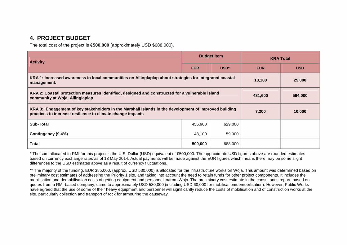
4. PROJECT BUDGET The total cost of the project is €500,000 (approximately USD $688,000).
Activity Budget item
KRA Total
EUR USD* EUR USD
KRA 1: Increased awareness in local communities on Ailinglaplap about strategies for integrated coasta l management.
18,100 25,000
KRA 2: Coastal protection measures identified, desi gned and constructed for a vulnerable island community at Woja, Ailinglaplap
431,600 594,000
KRA 3: Engagement of key stakeholders in the Marshall Isla nds in the development of improved building practices to increase resilience to climate change impacts 7,200 10,000
Sub-Total 456,900 629,000
Contingency (9.4%) 43,100 59,000
Total 500,000 688,000
* The sum allocated to RMI for this project is the U.S. Dollar (USD) equivalent of €500,000. The approximate USD figures above are rounded estimates based on currency exchange rates as of 13 May 2014. Actual payments will be made against the EUR figures which means there may be some slight differences to the USD estimates above as a result of currency fluctuations.
** The majority of the funding, EUR 385,000, (approx. USD 530,000) is allocated for the infrastructure works on Woja. This amount was determined based on preliminary cost estimates of addressing the Priority 1 site, and taking into account the need to retain funds for other project components. It includes the mobilisation and demobilisation costs of getting equipment and personnel to/from Woja. The preliminary cost estimate in the consultant’s report, based on quotes from a RMI-based company, came to approximately USD 580,000 (including USD 60,000 for mobilisation/demobilisation). However, Public Works have agreed that the use of some of their heavy equipment and personnel will significantly reduce the costs of mobilisation and of construction works at the site, particularly collection and transport of rock for armouring the causeway.

Payment
Payments shall be made into the Government’s account, and all payments will be made in USD, the currency of RMI.
The funds for this project will be provided in three tranches. Payment of each tranche can be requested once 80% of previous tranches have been acquitted.
Reimbursements of funds shall only be made on receipt of the proper acquittal of the funds already advanced. Acquittals must be supported by copies of all receipts. Copies of all substantiating documents relating to each financial transaction shall form part of the quarterly acquittal.
Annual government audits will be sufficient unless any accounting or financial problems emerge. Any interest accruing from the advances paid by SPC shall be considered as income for the purpose of operating this project. It may be used to cover eligible costs of the operation.
The Government shall oversee accurate and regular records and accounts of the implementation of the operation. Financial transactions and financial statements shall be subject to the internal and external-auditing procedures laid down in the financial regulations, rules and directives of SPC.
Fixed Assets: All fixed assets purchased by the project (equipment) will remain the property of SPC until the closure of the project. On closure of the project the assets will be officially handed over by SPC to the respective stakeholders in the country. An asset register of all assets purchased should be kept in the office of the Government.

5. PROJECT SCHEDULE
Key Result Areas/Activities
2014 2015 1Q Jan
2Q April
3Q July
4Q Oct
1Q Jan
2Q April
3Q July
4Q Oct
KRA1 : Increased awareness in local communities on Ailingl aplap about strategies for integrated coastal management.
1.1 Community training on Ailinglaplap, focused on environmental and coastal management (EPA and Ministry of Education to lead).
1.2. Together with EPA and Ministry of Education engage schools in Ailinglaplap in using the site identified in KRA 2 as a Living Laboratory.
KRA 2: Coastal protection measures identified, designed an d constructed for a vulnerable island community at Woja, Ailinglaplap
2.1 Prepare detailed design and costing for protection of the vulnerable coastal site in Woja Island and prepare a monitoring plan (Completed)
2.2 Engage key stakeholders in the selection of the final design (Completed)
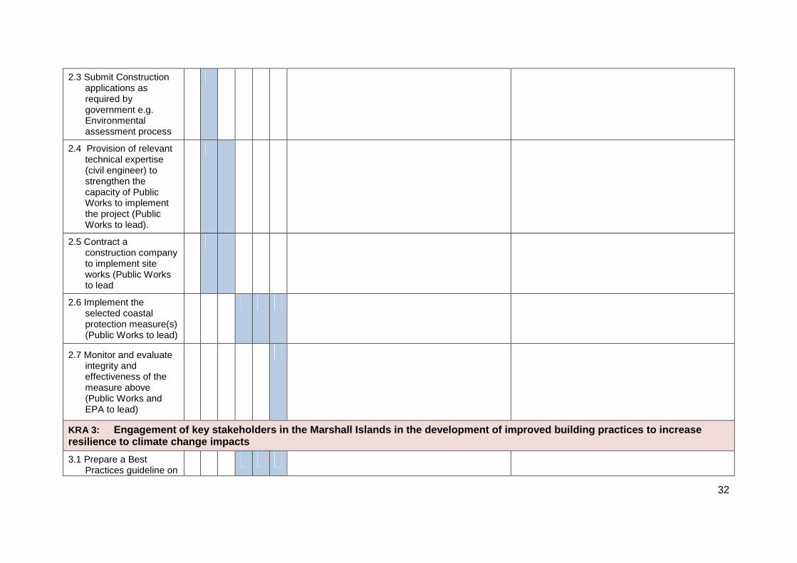
2.3 Submit Construction applications as required by government e.g. Environmental assessment process
2.4 Provision of relevant technical expertise (civil engineer) to strengthen the capacity of Public Works to implement the project (Public Works to lead).
2.5 Contract a construction company to implement site
27
works (Public Works to lead)
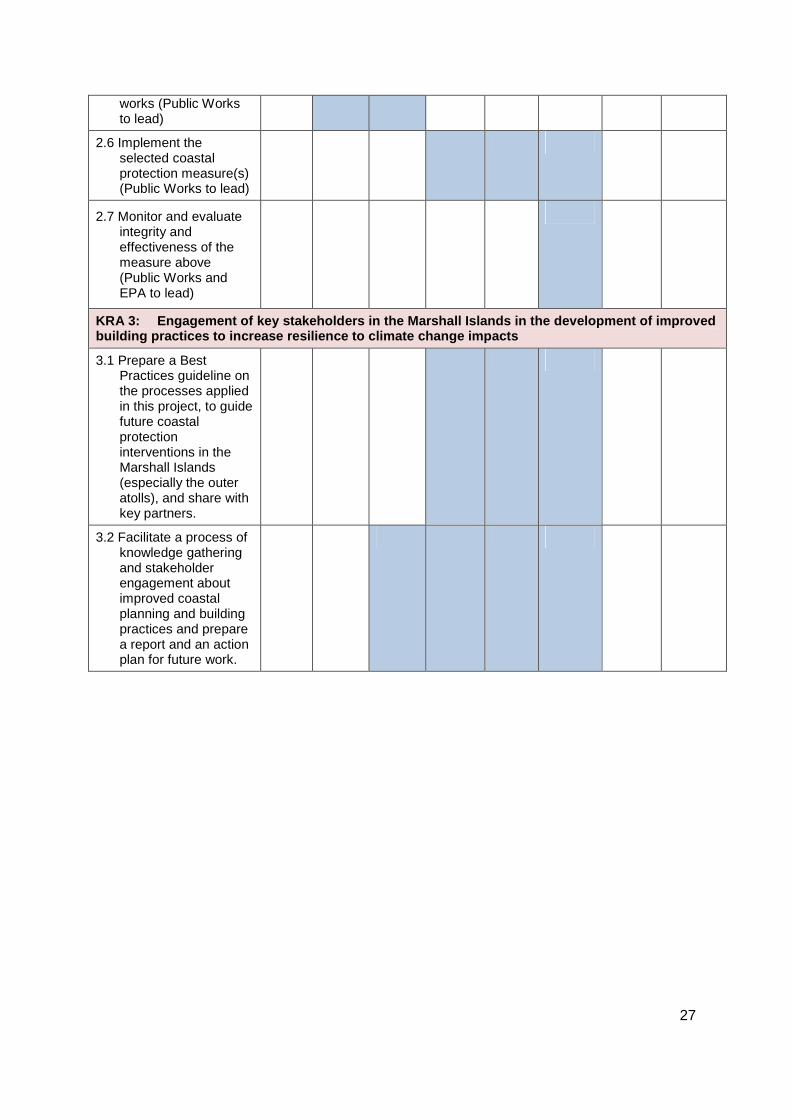
2.6 Implement the selected coastal protection measure(s) (Public Works to lead)
2.7 Monitor and evaluate integrity and effectiveness of the measure above (Public Works and EPA to lead)
KRA 3: Engagement of key stakeholders in the Marshall Isla nds in the development of improved building practices to increase resilience to climat e change impacts
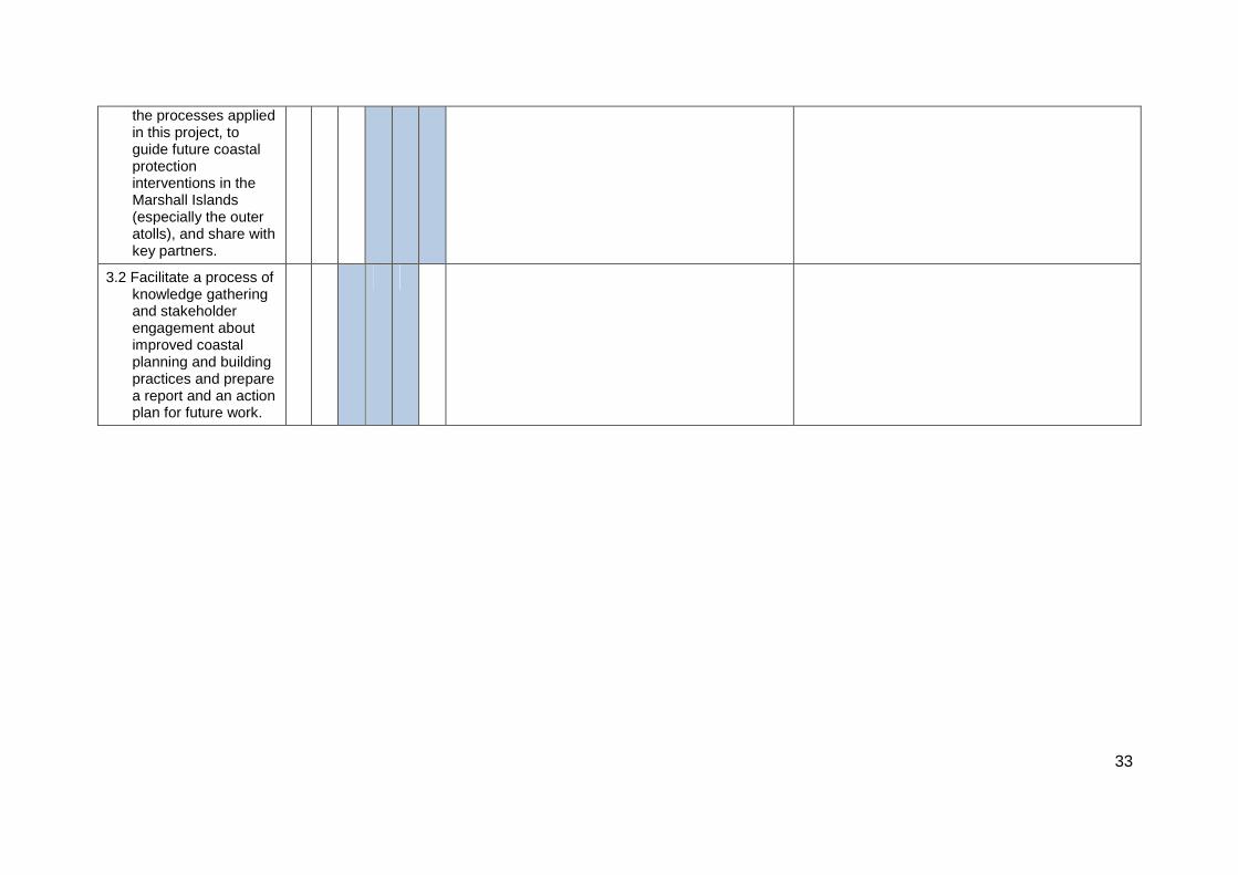
3.1 Prepare a Best Practices guideline on the processes applied in this project, to guide future coastal protection interventions in the Marshall Islands (especially the outer atolls), and share with key partners.
3.2 Facilitate a process of knowledge gathering and stakeholder engagement about improved coastal planning and building practices and prepare a report and an action plan for future work.

28
6. INSTITUTIONAL ARRANGEMENTS
Implementation of this project will be the joint responsibility of OEPPC and MPW, and in close collaboration with the EPA.
The GCCA: PSIS project is being implemented under the ambit of the Letter of Agreement signed on 30th January 2013 by SPC and the Government of RMI. Signatories to the Letter of Agreement were: Dr Jimmie Rodgers, Director General, Secretariat of the Pacific Community; Mr Casten Nemra, Chief Secretary; Mr Alfred Alfred, Secretary, Ministry of Finance; Ms Kino Kabua, Secretary, Ministry of Foreign Affairs; Mr Bruce Kijiner, Director, Office of Environmental Planning and Policy Coordination.
Project Oversight Committee
RMI has a National Climate Change Committee, consisting of department heads and chaired by the Chief Secretary. The OEPPC should report to this committee at least on a quarterly basis, providing an update on progress with the project and raising any concerns or problems that have been encountered (particularly where these relate to government stakeholders whose cooperation and activity is essential for successfully implementing the various components of the project). The committee is then requested to provide advice on how such problems might be overcome.
In addition, an informal Coastal Management Advisory Committee (CMAC) exists, and is an active forum for exchange and information sharing, as well as for seeking synergies between different activities that are going on simultaneously. Though meetings of the CMAC are voluntary, they are regularly attended by representatives from many different departments and non-government organisations. The project’s national coordinator, based at OEPPC, will report regularly to the CMAC on progress, and seek their guidance as necessary on addressing any problems or delays that may occur throughout the project.
Reporting
The GCCA: PSIS National Coordinator will be responsible for providing quarterly narrative and financial progress reports to the GCCA: PSIS project secretariat at SPC in Suva. A template for the quarterly narrative report is presented as Annex 1 and a template for financial reporting will be prepared once the project design document is signed.
Day to Day Implementation of the Project
The GCCA: PSIS National Coordinator currently situated in OEPPC will have responsibility for overall coordination of the GCCA: PSIS project, including regular financial and narrative reporting to RMI government and to SPC as required. The National Coordinator is also responsible for day-to-day management of implementation of KRA1 and KRA3. The National Coordinator reports to the Director, OEPPC.
The Project Management Unit at Public Works will have primary responsibility for management of activities in KRA2, relating to implementation of the coastal infrastructure works at Woja. PMU will liaise closely with the National Coordinator at OEPPC during this process, and with the EPA and other stakeholders as necessary.
In addition to undertaking the environmental assessment as part of the Woja causeway project (KRA2), the EPA will also play a leading role in implementing the components of KRA1. They will work together with the Ministry of Education, as appropriate, to design and deliver locally suitable training and awareness raising activities, and to undertake vegetation planting at the project site.
29
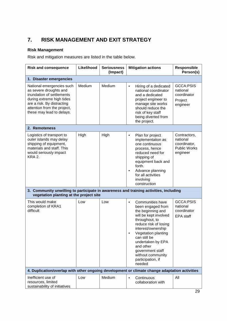
7. RISK MANAGEMENT AND EXIT STRATEGY
Risk Management
Risk and mitigation measures are listed in the table below. Risk and consequence Likelihood Seriousness
(Impact) Mitigation actions Responsible
Person(s)
1. Disaster emergencies
National emergencies such as severe droughts and inundation of settlements during extreme high tides are a risk. By distracting attention from the project, these may lead to delays.
Medium
Medium • Hiring of a dedicated national coordinator and a dedicated project engineer to manage site works should reduce the risk of key staff being diverted from the project.
GCCA:PSIS national coordinator
Project engineer
2. Remoteness
Logistics of transport to outer islands may delay shipping of equipment, materials and staff. This would seriously impact KRA 2.
High High • Plan for project implementation as one continuous process, hence reduced need for shipping of equipment back and forth.
• Advance planning for all activities involving construction
Contractors, national coordinator, Public Works engineer
3. Community unwilling to participate in awareness and training activities, including vegetation planting at the project site
This would make completion of KRA1 difficult
Low Low • Communities have been engaged from the beginning and will be kept involved throughout, to reduce risk of losing interest/ownership
• Vegetation planting can still be undertaken by EPA and other government staff without community participation, if needed
GCCA:PSIS national coordinator
EPA staff
4. Duplication/overlap with other ongoing developme nt or climate change adaptation activities
Inefficient use of resources, limited sustainability of initiatives
Low Medium • Continuous collaboration with
All

30
Risk and consequence Likelihood Seriousness (Impact)
Mitigation actions Responsible Person(s)
beyond project life other partners and sound project design
• Ensure project activities and results are shared widely with climate change funding partners
5. Staff turnover and loss of institutional memory
Critical staff leaving could delay implementation and also be a loss of capacity for future activities to build on this project.
Medium Medium • Staff motivation • Documentation and
record keeping for handover.
• Flexibility with the project budget should it become necessary to hire additional staff to implement this project
• Allocation of responsibilities across different departments/offices, to ensure continuity
GCCA:PSIS national coordinator
Public Works
EPA staff
SPC
Exit Strategy
This project is deliberately designed as a learning exercise, and has several components that are intended to make use of the lessons learned during planning, design and implementation to support future efforts in RMI to address the impacts of coastal hazards and climate change. Specifically:
• Community training and awareness raising (KRA1), including involvement in vegetation planting activities, will build the capacity of the local community to play an active role in managing coastal resources;
• The distillation of the process and lessons learned into a best practice guideline for RMI will enable learning to be shared across government and with other communities;
A monitoring strategy for the coastal protection measure(s) will be implemented, to monitor their integrity over time and their impact, if any, on the surrounding environment including the effects of erosion.
Consultation, development of a study and an Action plan for improved coastal planning and building practices, including climate proofing, will, if successfully taken up and implemented, have long lasting benefits in terms of adapting to climate change and reducing vulnerability to coastal hazards and reducing economic and human losses. It will support institutional change in RMI, in the form of improved settlement planning and development. The project makes a meaningful contribution towards this end.
Furthermore, the preparation of a guideline for implementing coastal protection measures in RMI, and the detailed design and costing for the Priority 2 site at Woja, will provide a foundation for other development partners and recently started climate change adaptation projects to build on the foundations already laid.

ANNEX 1. QUARTERLY REPORTING TEMPLATE
Project Activities 2014 2015
Progress in Quarter X and any problems encountered Actions planned for Quarter X+1 1
Q 2Q
3Q
4Q
1Q
2Q
KRA1: Increased awareness in local communities on Ailingl aplap about strategies for integrated coastal manag ement.
1.1 Community training on Ailinglaplap, focused on environmental and coastal management (EPA and Ministry of Education to lead).
1.2. Together with EPA and Ministry of Education engage schools in Ailinglaplap in using the site identified in KRA 2 as a Living Laboratory.
KRA 2: Coastal protection measures identified, designed and constructed for a vulnerable island community a t Woja, Ailinglaplap
2.1 Prepare detailed design and costing for protection of the vulnerable coastal site in Woja Island and prepare a monitoring plan (Completed)
2.2 Engage key stakeholders in the selection of the final design (Completed)
32
2.3 Submit Construction applications as required by government e.g. Environmental assessment process
2.4 Provision of relevant technical expertise (civil engineer) to strengthen the capacity of Public Works to implement the project (Public Works to lead).
2.5 Contract a construction company to implement site works (Public Works to lead
2.6 Implement the selected coastal protection measure(s) (Public Works to lead)
2.7 Monitor and evaluate integrity and effectiveness of the measure above (Public Works and EPA to lead)
KRA 3: Engagement of key stakeholders in the Marshall I slands in the development of improved building prac tices to increase resilience to climate change impacts
3.1 Prepare a Best Practices guideline on
33
the processes applied in this project, to guide future coastal protection interventions in the Marshall Islands (especially the outer atolls), and share with key partners.
3.2 Facilitate a process of knowledge gathering and stakeholder engagement about improved coastal planning and building practices and prepare a report and an action plan for future work.