proposed plan for the cleanup of the kenilworth park
TRANSCRIPT

Proposed Plan for Cleanup of the
Kenilworth Park Landfill Site
NOVEMBER 2020
Kenilworth Park Landfill Site
National Capital Parks-EastWashington, DC

Mark Your Calendar
Public Comment PeriodNovember 12, 2020–February 10, 2021
Submit CommentsThe National Park Service (NPS) will accept comments on the Proposed Plan and supporting documents during the public comment period. Submit comments to NPS by mail, email, or voicemail:
Mail: VHB Metro DC, LLCAttn: KPL Proposed Plan Public Comment1001 G Street NW, Suite 1125 Washington, DC 20001
Email: [email protected]: (202) 360-2578
Attend the Public MeetingWednesday, November 18, 2020 6:30–8pm
NPS will hold a virtual public meeting to discuss the Preferred Alternative and the other alternatives evaluated in the 2020 Feasibility Study Addendum Report. Oral and written comments and questions will be accepted during the meeting. The meeting can be attended online:
Zoom Linkhttps://vhb.zoom.us/j/96305594573?pwd=ejdyWld 0STRaVWphc1hRL2JiSDNWUT09If prompted:Webinar ID: 963 0559 4573Passcode: 052877
By Telephone(301) 715-8592 Webinar ID: 963 0559 4573Passcode: 052877
Location of Information Repository:This Proposed Plan is based on site-related documents contained in the Administrative Record file, which provides important background and site investigation information. A compact disk containing the Administrative Record file may be obtained by contacting the NPS CERCLA Project Manager, Donna Davies, or viewed at the Information Repository location provided below.
Request electronic copy from:
Donna Davies, NPS CERCLA Project ManagerPhone: (202) 359-3234Email: [email protected]
DC Library SystemBenning (Dorothy I. Height) Neighborhood Library3935 Benning Road NE
Phone: (202) 281-2583Email: [email protected]://www.dclibrary.org/benningMon–Fri: 11am–7pm (closed 2pm–3pm for sanitizing)
For questions or further information, please contact:
Donna DaviesNPS CERCLA Project Manager(202) [email protected]
1 Mark Your Calendar
Proposed Plan for Cleanup of the Kenilworth Park Landfill SiteProposed Plan for Cleanup of the Kenilworth Park Landfill Site

IntroductionThe National Park Service (NPS) invites the public to review and comment on this Proposed Plan for cleanup at the Kenilworth Park Landfill Site (“the Site”), located within Anacostia Park, a unit of National Capital Parks—East (NACE) in Washington, D.C. (“the District”).
NPS is issuing this Proposed Plan as the lead agency for Comprehensive Environmental Response, Compensation, and Liability Act (CERCLA) activities at the Site. In consultation with the District’s Department of Energy and Environment (DOEE), the support agency, NPS will select a final remedy after reviewing and considering information submitted during the public comment period.
The Proposed Plan presents the Preferred Alternative for remedial action at the Site, the rationale for the preference, and summaries of other alternatives that were evaluated.
The September 2020 Feasibility Study (FS) Addendum report provides details on the five alternatives NPS evaluated to clean up the Site. After consideration of the evaluation criteria, NPS proposed alternative 3 as the Preferred Alternative. Alternative 3 calls for covering existing surface soils with 12 inches of clean soil within areas reserved for organized sport, recreation and community activities. The new fill soil would include 6 inches of clean topsoil to support healthy vegetation. Alternative 3 will be protective of human health and the environment, meet applicable or relevant and appropriate requirements (ARARs), be cost effective, and be effective in the long term. A detailed evaluation of the alternatives is presented in the September 2020 Feasibility Study Addendum Report. NPS may modify the Preferred Alternative or select another cleanup alternative identified in this Proposed Plan after consideration of the public comments and any new information received.
Please see the Glossary for definitions of Terms shown in bold lettering
NPS is issuing this Proposed Plan as part of its public participation responsibilities under CERCLA §117(a) and the National Oil and Hazardous Substances Pollution Contingency Plan (NCP) §300.430(f)(3). The Proposed Plan summarizes the Remedial Investigation/Feasibility Study (RI/FS) reports and other documents contained in the Administrative Record file for this Site. Public participation is an important element of cleanup plan development, and NPS encourages the public to review these documents to gain a more comprehensive understanding of CERCLA activities at the Site.
A-8
Kenilworth Park Landfill Site, 1970
CERCLA Public Involvement Requirements
» Prepare and distribute a Proposed Plan for publiccomment
» Provide notice of public comment period and public meeting
» Collect public comments on the Proposed Plan
» Outline the final agency-approved remedialaction and responses to public comments in theRecord of Decision (ROD) Document
2 Introduction
Proposed Plan for Cleanup of the Kenilworth Park Landfill SiteProposed Plan for Cleanup of the Kenilworth Park Landfill Site
Site Background
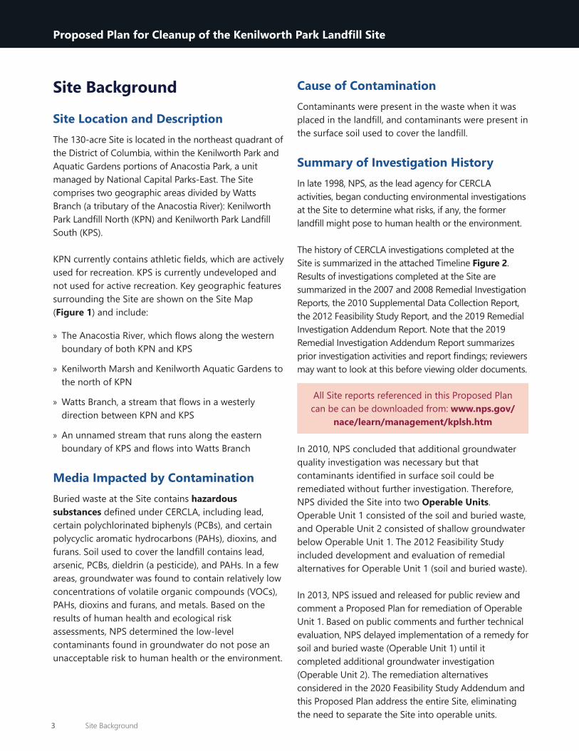
Site Location and DescriptionThe 130-acre Site is located in the northeast quadrant of the District of Columbia, within the Kenilworth Park and Aquatic Gardens portions of Anacostia Park, a unit managed by National Capital Parks-East. The Site comprises two geographic areas divided by Watts Branch (a tributary of the Anacostia River): Kenilworth Park Landfill North (KPN) and Kenilworth Park Landfill South (KPS).
KPN currently contains athletic fields, which are actively used for recreation. KPS is currently undeveloped and not used for active recreation. Key geographic features surrounding the Site are shown on the Site Map (Figure 1) and include:
» The Anacostia River, which flows along the western boundary of both KPN and KPS
» Kenilworth Marsh and Kenilworth Aquatic Gardens to the north of KPN
» Watts Branch, a stream that flows in a westerly direction between KPN and KPS
» An unnamed stream that runs along the eastern boundary of KPS and flows into Watts Branch
Media Impacted by ContaminationBuried waste at the Site contains hazardous substances defined under CERCLA, including lead, certain polychlorinated biphenyls (PCBs), and certain polycyclic aromatic hydrocarbons (PAHs), dioxins, and furans. Soil used to cover the landfill contains lead, arsenic, PCBs, dieldrin (a pesticide), and PAHs. In a few areas, groundwater was found to contain relatively low concentrations of volatile organic compounds (VOCs), PAHs, dioxins and furans, and metals. Based on the results of human health and ecological risk assessments, NPS determined the low-level contaminants found in groundwater do not pose an unacceptable risk to human health or the environment.
Cause of ContaminationContaminants were present in the waste when it was placed in the landfill, and contaminants were present in the surface soil used to cover the landfill.
Summary of Investigation HistoryIn late 1998, NPS, as the lead agency for CERCLA activities, began conducting environmental investigations at the Site to determine what risks, if any, the former landfill might pose to human health or the environment.
The history of CERCLA investigations completed at the Site is summarized in the attached Timeline Figure 2. Results of investigations completed at the Site are summarized in the 2007 and 2008 Remedial Investigation Reports, the 2010 Supplemental Data Collection Report, the 2012 Feasibility Study Report, and the 2019 Remedial Investigation Addendum Report. Note that the 2019 Remedial Investigation Addendum Report summarizes prior investigation activities and report findings; reviewers may want to look at this before viewing older documents.
In 2010, NPS concluded that additional groundwater quality investigation was necessary but that contaminants identified in surface soil could be remediated without further investigation. Therefore, NPS divided the Site into two Operable Units. Operable Unit 1 consisted of the soil and buried waste, and Operable Unit 2 consisted of shallow groundwater below Operable Unit 1. The 2012 Feasibility Study included development and evaluation of remedial alternatives for Operable Unit 1 (soil and buried waste).
In 2013, NPS issued and released for public review and comment a Proposed Plan for remediation of Operable Unit 1. Based on public comments and further technical evaluation, NPS delayed implementation of a remedy for soil and buried waste (Operable Unit 1) until it completed additional groundwater investigation (Operable Unit 2). The remediation alternatives considered in the 2020 Feasibility Study Addendum and this Proposed Plan address the entire Site, eliminating the need to separate the Site into operable units.
All Site reports referenced in this Proposed Plan can be can be downloaded from: www.nps.gov/
nace/learn/management/kplsh.htm
3 Site Background
Proposed Plan for Cleanup of the Kenilworth Park Landfill Site

Proposed Plan for Cleanup of theKenilworth Park Landfill Site Washington, D.C.
FIGURE 1
Site Map

Proposed Plan for Cleanup of theKenilworth Park Landfill Site Washington, D.C.
FIGURE 2
Site Investigations History

Proposed Plan for Cleanup of theKenilworth Park Landfill Site Washington, D.C.
FIGURE 2
Site Investigations History

Public Involvement ActivitiesNPS first published a Community Involvement Plan (CIP) in 2008. The CIP, prepared in accordance with CERCLA and the NCP, serves as a guide for NPS to engage and inform community members, environmental groups, government officials, the media, and other interested parties in the environmental investigation and cleanup activities at the Site. The CIP is considered a “living document” and has been updated twice since 2008: once in 2013 with the release of the 2013 Proposed Plan and a second time to coincide with the release of this Proposed Plan.
NPS accepted public comments on the 2013 Proposed Plan from March 5 through May 6, 2013. On April 11, 2013, NPS held a public meeting to explain this plan. Comments from the meeting and the public comment period were added to the Administrative Record File. More recently, NPS held an informational public meeting on October 17, 2018, to provide an update on the status of the Site and investigations completed since the 2013 Proposed Plan was released.
NPS has been a regular and active participant at the Leadership Council for a Cleaner Anacostia River meetings and presented interim findings of the remedial investigation addendum activities to that group in June 2018. Outside the established comment periods or public meetings, NPS also responds to questions and concerns raised by the public or the media.
Public Involvement Resources
» Visit https://www.nps.gov/nace/learn/management/kplsh.htm to see a full copy of the CIP
» See Appendix F of the CIP for Community Update/Fact Sheets since 2010
» Spring 2010 » March 2011 » August 2013 » December 2013 » December 2016
» August 2017 » October 2018 » March 2020 » October 2020
Site Characteristics
Current and Future Land UseKPN is currently used for recreational purposes. The eastern area of KPN is occupied by a football field, running track, tennis courts, unused basketball courts, and the remnants of the Kenilworth-Parkside Recreation Center facility, including a swimming pool and paved areas. Northern and eastern areas of KPN are mowed regularly and occupied by several athletic fields. The paved Anacostia Riverwalk Trail runs across the northern section of the former landfill. Undeveloped wooded areas are present between the developed/mowed areas of KPN and the Anacostia River, Watts Branch and Kenilworth Marsh. Visitors walk and ride bikes in KPN and use the athletic facilities. There are multiple informal trails that lead from KPN to the Anacostia River. Congress has directed NPS to transfer administrative jurisdiction over KPN to the District “for the provision of public recreational facilities, open space, or public outdoor recreational opportunities” (PL 108-335 § 334). Development of formal plans by the District’s Department of Parks and Recreation (DPR) for future use of KPN are anticipated after the transfer is complete.
KPS remains undeveloped and is administratively closed. The ground surface is densely vegetated with meadows, trees, and woody shrubs, providing stable and valuable wildlife habitat. An unmaintained asphalt road runs through the middle of the former landfill. In accordance with the NPS Anacostia Park Management Plan (NPS, 2017), KPS will be managed for “natural resources recreation” and no active recreational facilities will be developed (e.g., sports fields, playgrounds, picnic areas). “Passive” recreational uses, such as walking, bird-watching, biking, etc. will be permitted. The only development planned for KPS is an extension of the Anacostia Riverwalk Trail, which will run along the top of the landfill slope closest to the river across Watts Branch and connect with existing and future trail segments in KPN.
7 Site Characteristics
Proposed Plan for Cleanup of the Kenilworth Park Landfill Site

History of Operations and Closure ActivitiesThe District operated a landfill at the Site from 1942 to 1970. Before landfill operation began, the Site consisted of low-lying wet areas and recreational lakes, which were developed/excavated by the US Army Corps of Engineers in the 1930s. These areas were filled with waste during landfill operations.
Waste disposed in the landfill included ash from District municipal solid waste incinerators, municipal and other solid waste that was burned openly and buried on Site, and—from 1968 to 1970—raw municipal solid waste that was buried without burning. Construction demolition debris and commercial waste were also disposed during operation of the landfill. Clay-rich soil was used to cover and encapsulate the landfills after they were closed in 1970, and the land was redeveloped with sports fields, trails, and picnic areas.
Nearly 30 years after the landfill closed, approximately 10 to 30 feet of soil and demolition debris fill was placed over KPS with the intention of creating space for more sports fields. Engineering design plans from 1996 show space designated for future ultimate frisbee and soccer fields. The filling was discontinued before the fields were completed; in 2002, surface debris such as concrete, asphalt, and rebar that posed physical hazards to visitors was removed from KPS. NPS then constructed drainage
ditches, berms, and sediment ponds to stabilize and revegetate the Site, protecting against surface erosion. Conditions at KPS are favorable to wildlife today, due to these improvements.
Nature and Extent of ContaminationContaminated media at the Site consist of buried waste and the soil used to cover it after landfill closure. NPS defined the limits of landfill waste based on electromagnetic surveys—instruments used to detect buried metallic objects—historical aerial photographs, and changes in topography (see Figure 1 Site Map on page 4).
Site Contaminants that Pose a Potential Threat The Remedial Investigations and supplemental data collection efforts identified the chemicals, concentrations, and locations of contamination at the Site. Contaminants that were identified and evaluated at the Site include metals, pesticides, VOCs, PAHs, PCBs, and methane gas. VOCs are organic chemicals that disperse to the air at normal temperatures; PAHs consist of a list of compounds generated primarily from the burning of fuels; and PCBs were widely used as coolants in electrical equipment until they were banned from use in the United States in 1979. Methane (or landfill gas) is a colorless, odorless, flammable gas generated in landfills as a byproduct of the decomposition of organic matter such as yard waste, food waste, and paper. In addition to the chemical contaminants detected, one unexploded ordnance (UXO) was found within the landfill material during installation of a sprinkler system for the football field.
Surface SoilPAHs, PCBs, lead and arsenic were measured in some surface soil samples at levels that may pose unacceptable human health risk under certain conditions (see Summary of Site Risks below).
8 Site Characteristics
Proposed Plan for Cleanup of the Kenilworth Park Landfill Site

Subsurface Soil and Landfill MaterialPAHs, PCBs, and lead were measured in some subsurface soil and landfill waste samples. Lead was found in waste material samples at levels that may cause unacceptable risks to construction workers (see Summary of Site Risks below). One UXO was discovered during installation of the sprinkler system for the football field. Although the Site was not a former UXO disposal site, precautions are necessary to screen for UXOs prior to excavation.
GroundwaterGroundwater at or near the Site is not a source of drinking water and is not expected to be a drinking water source in the future; therefore, human exposure associated with drinking groundwater from the site is not a concern.
VOCs, PAHs, and iron have been identified in Site groundwater that discharges to the Anacostia River, Watts Branch, and the Kenilworth Marsh. In most groundwater sampling locations, VOCs and PAHs were detected below the lowest ecological screening values, which are more stringent than drinking water standards. Except for dissolved iron, the risk assessment concluded that where organic and inorganic constituents are present in groundwater
above screening levels, they do not pose an unacceptable risk to human health or the environment. Iron in the Anacostia River has been studied for the Anacostia River Sediment Project and did not exceed human health or ecological risk criteria. Potential ecological risk caused by contributions of iron from Site groundwater discharging to the River are considered inconsequential.
Groundwater quality investigations undertaken at the site since 2013 are summarized in the text, tables and figures included in the 2019 RI Addendum Report.
Surface WaterAlthough contaminants were detected in samples from Watts Branch and the Anacostia River, those contaminants do not appear to be attributable to the Site. Contaminants in surface waters in the vicinity of the Site appear to come primarily from urban stormwater discharges and tidal influences.
SedimentsSediment samples were collected from the Anacostia River, Kenilworth Marsh, and Watts Branch. PAHs, PCBs, and lead were reported in some of the samples; however, there is no apparent trend in the concentrations to indicate that these contaminants
9 Site Characteristics
Proposed Plan for Cleanup of the Kenilworth Park Landfill Site

originated from the Site or that a migration pathway exists between the Site and adjacent sediments. Similar to surface water, urban stormwater discharges and tidal effects are the predominant factors that influence sediment quality near the Site.
Landfill GasConsistent with recommendations by the Agency for Toxic Substances and Disease Registry, supplemental sampling was performed at and near the Site in 2008 and 2009 to assess Site-related methane issues. Results of subsurface soil gas sampling at the Site indicate the presence of methane in certain areas in the landfill waste materials.
Methane was not detected in indoor air in the former Kenilworth-Parkside Recreation Center, nor was it detected in school yard soils behind the Thomas Elementary School.
Summary of Site RisksAs part of the Remedial Investigations, NPS conducted baseline risk assessments to determine the potential current and future risks that contaminants might pose to human health and the environment. The results of the risk assessments are presented below.
Human Health RisksNPS conducted human health risk assessments (HHRAs) to evaluate the risks to visitors and workers from exposure to contaminants at the Site. HHRAs evaluate the increased risks of developing cancer or other adverse health effects as a result of exposure to specific contaminants in specific concentrations.
As shown on the conceptual site model (Figure 3), adult and child visitors, as well as construction workers, could be exposed to contaminants in Site soils through skin contact, ingestion, or inhalation. Therefore, these were the routes of potential exposure evaluated in the Site HHRAs.
The HHRAs concluded that there is a slightly increased risk of cancer for Site visitors primarily from ingestion of surface soil containing PCBs, PAHs, dieldrin (a pesticide), and arsenic. The HHRAs concluded that the Site does not present an unacceptable risk of cancer to construction workers.
The HHRAs completed in 2007 and 2008 found that Site visitors do not have an increased risk of non-cancer-related illnesses from exposure to Site
Excess Cancer Risk is the additional risk of cancer from exposure to a contaminant beyond an individual’s risk of cancer from everyday life. Excess cancer risk is described in terms of the probability that an exposed individual will develop cancer because of that exposure by age 70. In general, the U.S. Environmental Protection Agency (EPA) considers excess cancer risks that are below about 1 chance in 1,000,000 to be so small as to be negligible, and risks above 1 in 10,000 to be sufficiently large that some sort of remediation is desirable. The NCP states that risks between 1 in 1,000,000 and 1 in 10,000 are generally deemed to be acceptable but may need to be addressed based on site-specific factors.
10 Summary of Site Risks
Proposed Plan for Cleanup of the Kenilworth Park Landfill Site

Proposed Plan for Cleanup of theKenilworth Park Landfill Site Washington, D.C.
FIGURE 3
Conceptual Site Model

contaminants. However, recent guidance for safe lead exposure levels led NPS to update the preliminary remediation goals to protect visitors and workers from potential exposure to lead in surface soil.
To determine possible risks posed by methane gas emitting or migrating from the Site, NPS collected samples from within the Site boundary and adjacent locations including from the school yard behind the Thomas Elementary School and from inside the Kenilworth Community Center prior to it being demolished. Based on findings of these investigations NPS concluded that methane does not pose a risk to adjacent locations or park visitors; however, methane may pose a safety risk for workers involved in activities that disturb subsurface soil or waste. The HHRAs found no risk to humans from Site-related contaminants in either surface water or groundwater.
Ecological RisksNPS completed ecological risk assessments to evaluate potential risk associated with Site contaminants to terrestrial and aquatic ecological receptors. No unacceptable risk due to exposure to Site contaminants was identified to either terrestrial or aquatic organisms.
Risk ConclusionsThe Site poses a slightly increased potential cancer risk and non-cancer risk to visitors who engage in activities where they are more likely to come into contact with Site soil, such as participating in, or spectating at, organized sporting events and, in doing so, may ingest soil containing PAHs, PCBs, pesticides, and metals.
The Site poses an increased non-cancer health risk to construction and utility workers who, without taking appropriate protective measures (dust control, personal protective equipment, decontamination, landfill gas monitoring), may be exposed to lead-containing soil and waste or explosive landfill gases during excavation within the landfill limits.
The human health and ecological risks posed by a site generally determine whether a remedial action is warranted. NPS identified no unacceptable risk to ecological receptors posed by the Site.
NPS proposed the Preferred Alternative identified in this Proposed Plan to address the unacceptable risk NPS concluded the Site poses to active recreational users and workers. NPS concluded that the Preferred Alternative identified in this Proposed Plan is necessary to protect public health, welfare, and the environment from risks associated with releases of hazardous substances into the environment at the Site.
Remedial Action ObjectivesThe Remedial Action Objectives (RAOs) used to develop and evaluate the remedial alternatives include:
» Reducing or eliminating carcinogenic and non-carcinogenic risks associated with surface soil contamination
» Reducing or eliminating non-carcinogenic risk associated with lead in surface and subsurface soil/buried waste
» Reducing or eliminating risks associated with methane gas and UXOs
Several RAOs associated with cleaning up CERCLA Municipal Landfill Sites like Kenilworth focus on containment. These RAOs were either addressed when the Site was originally closed or have been deemed unnecessary based on the remedial investigation data. (See the October 2020 Feasibility Study Addendum Report for summaries of the CERCLA Municipal Landfill Site RAOs.)
Unacceptable Cancer Risk. The NCP identifies the excess cancer risk of 1 in 1,000,000 as the “point of departure” for selecting remediation goals for alternatives when Applicable or Relevant and Appropriate Requirements (ARARs) are not available or are not sufficiently protective. Although the NCP defines excess cancer risk between 1 in 10,000 and 1 in 1,000,000 as a range of acceptable risk, NPS identified no rationale supporting a higher target risk level than the point of departure. Therefore, Preliminary Remediation Goals were developed based on a target acceptable risk of 1 in 1,000,000.
12 Remedial Action Objectives
Proposed Plan for Cleanup of the Kenilworth Park Landfill Site

stormwater runoff, and limits the potential for surface soil erosion. Although additional maintenance and grading has been required at times, the original containment approach yielded stable containment of the waste.
Estimated Construction Timeframe: N/A— no construction is included in this alternative.
Estimated Time to Achieve RAOs: N/A— this alternative would not achieve RAOs.
Without institutional controls, the excess cancer risk and estimated blood lead levels associated with the organized sport and recreation/community activities and special events land use scenario would exceed the target risk levels adopted by NPS for this Site. Therefore, the no action alternative is not acceptable.
ALTERNATIVE 2: Limited Action/Institutional ControlsUnder Alternative 2, the existing landfill waste containment measures (soil cover and vegetation) would remain in place, and institutional controls would be used to restrict and/or manage future activities that might otherwise result in human health risks or hazards.
ALTERNATIVE 1 Feasibility-Level Costs
Capital $0 Annual Operation & Maintenance
$0
Periodic $30,000 every 5 years (Years 5–30)Net Present Worth $170,000
Institutional controls are administrative and/or legal instruments that reduce the potential for human exposure to contamination by establishing appropriate land or resource use. Both CERCLA and the NCP support the use of institutional controls as part of the remedial alternative at sites if necessary, to protect human health (CERCLA § 121(d); NCP § 300.430(a); EPA, 2000). To comply with the Organic Act of 1916, NPS does not accept institutional controls that would impair the intended use of the park. For example, NPS would not allow permanent fencing or restrictive signage as an alternative to removal, containment, or treatment of contamination.
Summary of AlternativesNPS evaluated the five alternatives listed below in the October 2020 Feasibility Study Addendum Report. Details on each of these alternatives is provided in the following pages.
ALTERNATIVE 1:
No Action, the NCP requires that a No Action alternative be evaluated for all CERCLA response action sites.
ALTERNATIVE 2:
Limited Action, consisting of implementation of institutional controls only
ALTERNATIVE 3:
Selective Placement of Clean Fill Barriers & Institutional Controls (NPS Preferred Alternative)
ALTERNATIVE 4:
Site-wide Clean Soil Barrier & Institutional Controls
ALTERNATIVE 5:
Landfill Removal & Revegetation
NPS identified no unacceptable risk to ecological receptors; therefore, the measures described in the following alternatives were selected to protect against potential human exposure to Site contaminants.
ALTERNATIVE 1: No ActionUnder the No Action alternative, contaminated soils and landfill waste materials would be left in place with no treatment or controls to prevent human exposure. This alternative serves as a baseline for comparison with the other remedial alternatives. Note that the soil cover placed over the landfill at the time of closure has provided an effective waste containment measure (engineering control) that separates the waste from potential exposure at the surface, is sloped to promote
13 Summary of Alternatives
Proposed Plan for Cleanup of the Kenilworth Park Landfill Site

The institutional controls would be established to:
» Monitor and maintain existing containment measures in good condition
» Prevent exposure to remaining subsurface hazards (e.g., contaminated soil, buried waste, unexploded ordnance, or explosive landfill gas)
» Limit future land use (i.e., prohibit future development for residential use)
The intended post-transfer use of KPN by the District would also be restricted and would likely preclude the intended use for organized sports, recreation, community activities, or special events.
Estimated Construction Timeframe: N/A— no construction is included in this alternative.
Estimated Time to Achieve RAOs: Less than 1 year
Alternative 2 would require land use restrictions that conflict with the intended future use of the park; therefore, it is not compliant with the nonimpairment requirement established by the Organic Act and the General Authorities Act. Like Alternative 1, Alternative 2 was retained for the analysis to provide context.
ALTERNATIVE 3: Selective Placement of Clean Fill Barriers & Institutional Controls (NPS Preferred Alternative)Alternative 3 would involve the placement of clean soil barriers in areas of the Site reserved for organized sport, recreation, community activities, and special events. NPS would construct a clean soil barrier of a geotextile fabric overlain by 1 foot of clean soil (6 inches of common fill and 6 inches of topsoil). The Anacostia Riverwalk Trail and other official trails would
ALTERNATIVE 2 Feasibility-Level Costs
Capital $86,000 Annual Operation & Maintenance
$25,000/yr (5 years)
Periodic $50,000 (Year 5), plus$30,000 every 5 years (Years 10–30+)
Net Present Worth $400,000
be paved with asphalt or covered with imported clean gravel. Under this alternative, NPS estimates soil barriers would be installed over approximately 60 acres of KPN, as shown on Figure 4.
Alternative 3 uses institutional controls to restrict and/or manage future activities that might otherwise result in health risks or hazards. These restrictions would prohibit future residential development over the former landfill areas, prohibit construction of higher intensity visitor use areas within KPS without the installation of clean fill barriers, and require precautionary planning and safety measures for proposed excavation activities. The proposed institutional controls would not impair the intended future use of the park.
Estimated Construction Timeframe: Less than 1 year.
Estimated Time to Achieve RAOs: 1 to 2 years.
Alternative 3 is the Preferred Alternative because it achieves the RAOs, meets the required threshold criteria, and is a best fit with the balancing criteria (see evaluation criteria summarized on page 19), including cost.
ALTERNATIVE 4: Site-wide Clean Soil Barrier & Institutional ControlsThis alternative would include installation of a soil barrier to prevent human exposure to contaminated surficial soils. The barrier would extend across most of KPN and KPS. Steep slopes along the Anacostia River and adjacent to the Kenilworth Marsh, as well as ecologically sensitive areas generally located within the floodway and near the shoreline, would be left undisturbed to limit the potential for future erosion/sediment transport and associated impacts to the Anacostia River, Kenilworth Marsh, and Watts Branch.
ALTERNATIVE 3 Feasibility-Level Costs
Capital $7,500,000 Annual Operation & Maintenance
$68,000 to $43,000/yr (30+ years)
Periodic $50,000 (Year 5), plus$30,000 every 5 years (Years 10–30+)
Net Present Worth $9,000,000
14 Summary of Alternatives
Proposed Plan for Cleanup of the Kenilworth Park Landfill Site

KenilworthPark North
(KPN)
Deane Avenue<< Watts Branch
Jay St NEHayes St NE
Mayfair Terrace
<< An
acostia
River
KenilworthPark South
(KPS)
<< Watts Branch
KENILWORTH
EASTLAND GARDENSMAYFAIR
Futur
e Anac
ostia R
iverw
alkTra
il (AR
T)
Parkin
g Lot
Existing Sports
Field
Existi
ng Spo
rtsFie
ld
Existing Sports
Field
FormerKenilworth
ParksideRecreation
Center
Existing Sports Fields
Anacost ia Riverwalk Trail (ART)
Proposed ArboretumPedestrian Bridge
Futur
e Rive
rside
Foot
Path
Future Alignment of AnacostiaRiverwalk TrailResource Management AreaTransfer Boundary5 ft Contour (USACE 2000)1 ft Contour (USACE 2000)
Stream ChannelKPN and KPS Landfill Boundaries
Water Access
Key Elements Of Remedial Alternative 3Area of Minor GradingSoil BarrierConfirmatory Soil Sampling (Recent Fill Area)Access Road/Trail Resurfacing
")Confirmatory Soil Vapor Monitoring Location(actual locations may differ)
Notes:1. The approximate future alignments of theART were copied from the December 2011Environmental Assessment, AnacostiaRiverwalk Trail, Section 3 Realignment.
Proposed Plan for Cleanup of theKenilworth Park Landfill Site Washington, D.C.
FIGURE 4
Remedial Alternative 3 -Selective Placement OfClean Soil Barriers
Source Info: Ecology and Environment, 2003 and2007; Aerial imagery from ESRI and DC GIS, 2017.
i 0 400 800200 Feet
\\vhb
\gis\
proj\M
ontpe
lier\5
8345
.11 N
PS Ke
nilwo
rth La
ndfill
\gis\F
S_Add
endu
m\VH
B_MX
Ds\Fi
gure
10 Al
t 3 Li
mited
Actio
n.mxd

These areas, which represent a small portion of the total land area of the covered landfills, are heavily vegetated with mature bushes and trees and are not conducive to active recreation. As shown on Figure 5, the soil barrier is estimated to cover approximately 117 acres.
Alternative 4 uses institutional controls to restrict and/or manage future activities that might otherwise result in health risks or hazards. These restrictions would prohibit future residential development over the former landfill areas and require precautionary planning and safety measures for excavation activities. The proposed institutional controls would not impair the intended future use of the park.
Estimated Construction Timeframe: About 1 year.
Estimated Time to Achieve RAOs: 1 to 2 years.
Alternative 4 achieves the RAOs, meets the required threshold criteria, and generally meets the balancing criteria. Placing a soil barrier over most of KPS, however, would erase nearly 20 years of revegetation that has generated new wildlife habitat valued by NPS. Considering that the Anacostia Park Management Plan calls for maintaining KPS as a natural resource recreation zone, and that no unacceptable human health or ecological risk was identified for the current and intended future land use, providing a clean soil barrier in this area would provide no added value to the park resource. Alternative 4 would detract from the current natural resource value of the park until a similar level of revegetation is attained and would cost significantly more than Alternative 3.
ALTERNATIVE 4 Feasibility-Level Costs
Capital $15,000,000 Annual Operation & Maintenance
$130,000 to $83,000/yr (30+ years)
Periodic $50,000 (Year 5), plus$30,000 every 5 years (Years 10–30+)
Net Present Worth $18,000,000
ALTERNATIVE 5: Landfill Removal & Shoreline StabilizationAlternative 5 involves removal and off-Site disposal of all waste materials and previously placed cover soils and reestablishes the grades and wetlands habitat that existed before the landfills were developed. Based on review of historical topographic maps and aerial photography, as well as subsurface boring data collected during the remedial investigation, NPS estimates this would involve the excavation and removal of approximately 4.3 million cubic yards (6.5 million tons) of waste, cover, and fill materials from the Site. The aerial extent of wetlands re-vegetation is estimated to be approximately 150 acres (see Figure 6). Over a half-mile of living shoreline would be reestablished to stabilize the shoreline and protect the tidal wetland area.
Because this alternative involves complete removal of contaminated soil and municipal waste/incinerator ash, institutional controls and long-term monitoring would not be required.
Estimated Construction Timeframe: About 10 years or more.
Estimated Time to Achieve RAOs: 15 years or more.
Alternative 5 would meet the RAOs and the threshold criteria; however, in the short-term, implementation of this remedy would impact existing habitat and render the park unusable until the removal and revegetation activities are complete. The RAOs can be met with alternatives at a substantially lower cost; therefore, Alternative 5 is not preferred. Alternative 4 may provide long-term ecological and flood resiliency benefits; however, these are not the criteria used for selection of CERCLA remedies.
ALTERNATIVE 5 Feasibility-Level Costs
Capital $610,000,000 Annual Operation & Maintenance
$350,000/yr (5 years)
Periodic $0
Net Present Worth $620,000,000
16 Summary of Alternatives
Proposed Plan for Cleanup of the Kenilworth Park Landfill Site

")
")
")
")
")")")
")
")
")
")
")
")
")
")
KenilworthPark North
(KPN)
Deane Avenue<< Watts Branch
Jay St NEHayes St NE
Mayfair Terrace
<< An
acostia
River
KenilworthPark South
(KPS)
<< Watts Branch
KENILWORTH
EASTLAND GARDENSMAYFAIR
Futur
e Anac
ostia R
iverw
alkTra
il (AR
T)
Parkin
g Lot
FormerKenilworth
ParksideRecreation
Center
Existing Sports
Field
Existi
ng Spo
rtsFie
ld
Existing Sports
Field
Existing Sports Fields
Proposed ArboretumPedestrian Bridge
Anacost ia Riverwalk Trail (ART)
Futur
e Rive
rside
Foot
Path
Minneso
ta Ave N
E
HWY 295/
Kenilworth
Ave NE
Future Alignment of Anacostia Riverwalk5 ft Contour (USACE 2000)1 ft Contour (USACE 2000)Stream ChannelKPN and KPS Landfill Boundaries
Water Access
Key Elements Of Remedial Alternative 4Soil Barrier (with Pre-Excavation)Soil Barrier (without Pre-Excavation)Confirmatory Soil Sampling (Recent FillArea)
Area of Minor GradingAccess Road/Trail Resurfacing
")Proposed Soil Vapor Monitoring Location(actual locations may differ)
Proposed Plan for Cleanup of theKenilworth Park Landfill Site Washington, D.C.
FIGURE 5
Remedial Alternative 4 -Site-wide Clean Soil Barrier
Source Info: Ecology and Environment, 2003 and2007; Aerial imagery from ESRI and DC GIS, 2017.
i 0 400 800200 Feet
\\vhb
\gis\
proj\M
ontpe
lier\5
8345
.11 N
PS Ke
nilwo
rth La
ndfill
\gis\F
S_Add
endu
m\VH
B_MX
Ds\Pr
opos
ed Pl
an Fi
gure
5 Alt 4
Soil C
ap - D
ermal
Cove
r.mxd
Notes:1. The approximate future alignments of theART were copied from the December 2011Environmental Assessment, AnacostiaRiverwalk Trail, Section 3 Realignment.

KenilworthPark North
(KPN)
Deane Avenue<< Watts Branch
Jay St NEHayes St NE
Mayfair Terrace
<< An
acostia
River
KenilworthPark South
(KPS)
<< Watts Branch
KENILWORTH
EASTLAND GARDENSMAYFAIR
Parkin
g Lot
FormerKenilworth
ParksideRecreation
Center
Existing Sports
Field
Existi
ng Spo
rtsFie
ld
Existing Sports
Field
Existing Sports Fields
Minneso
ta Ave N
E
HWY 295/
Kenilworth
Ave NE
5 ft Contour (USACE 2000)1 ft Contour (USACE 2000)Stream ChannelKPN and KPS Landfill Boundaries
Key Elements Of Remedial Alternative 5Area of Excavation
Proposed Plan for Cleanup of theKenilworth Park Landfill Site Washington, D.C.
FIGURE 6
Remedial Alternative 5 -Landfill Removal &Shoreline Stabilization
Source Info: Ecology and Environment, 2003 and2007; Aerial imagery from ESRI and DC GIS, 2017.
i 0 400 800200 Feet
\\vhb
\gis\
proj\M
ontpe
lier\5
8345
.11 N
PS Ke
nilwo
rth La
ndfill
\gis\F
S_Add
endu
m\VH
B_MX
Ds\Fi
gure
12 Al
t 5 La
ndfill
Remo
val.m
xd
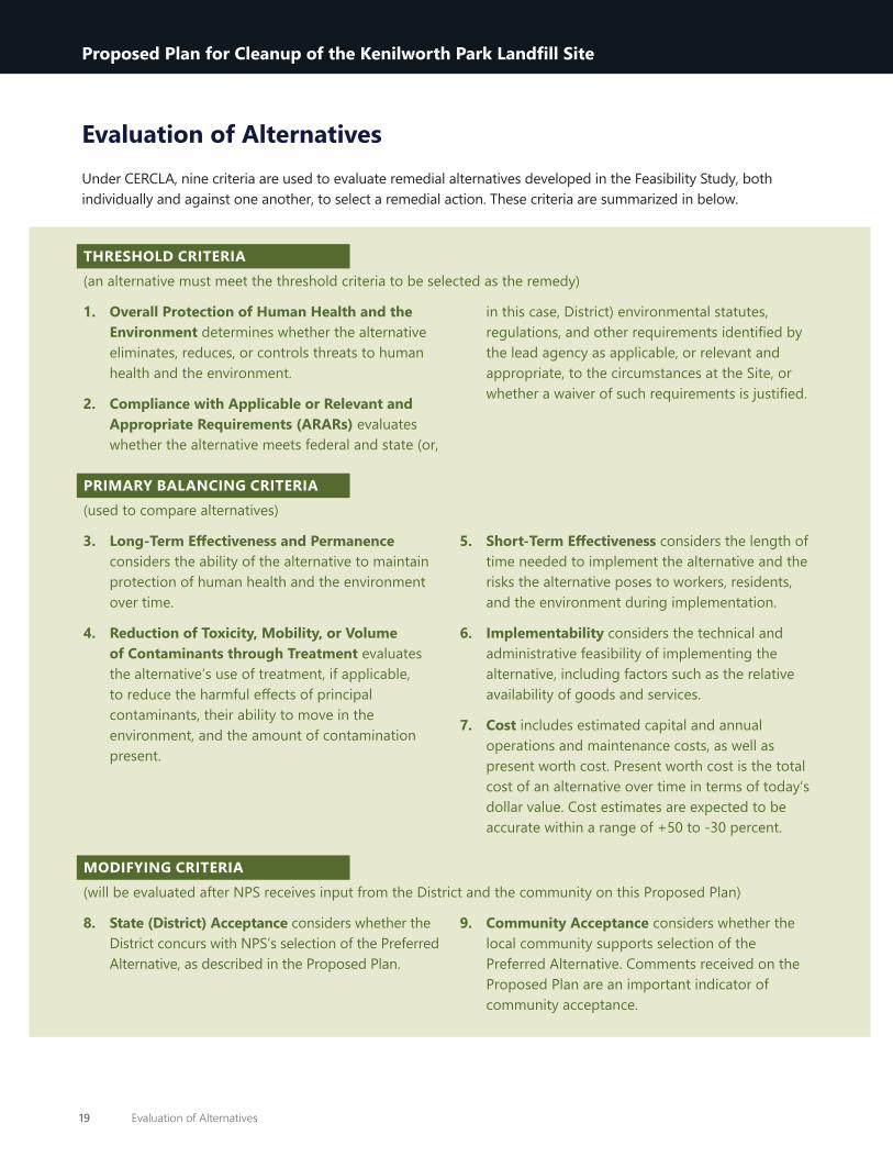
Evaluation of AlternativesUnder CERCLA, nine criteria are used to evaluate remedial alternatives developed in the Feasibility Study, both individually and against one another, to select a remedial action. These criteria are summarized in below.
THRESHOLD CRITERIA (an alternative must meet the threshold criteria to be selected as the remedy)
1. Overall Protection of Human Health and the Environment determines whether the alternative eliminates, reduces, or controls threats to human health and the environment.
2. Compliance with Applicable or Relevant and Appropriate Requirements (ARARs) evaluates whether the alternative meets federal and state (or,
in this case, District) environmental statutes, regulations, and other requirements identified by the lead agency as applicable, or relevant and appropriate, to the circumstances at the Site, or whether a waiver of such requirements is justified.
PRIMARY BALANCING CRITERIA (used to compare alternatives)
3. Long-Term Effectiveness and Permanence considers the ability of the alternative to maintain protection of human health and the environment over time.
4. Reduction of Toxicity, Mobility, or Volume of Contaminants through Treatment evaluates the alternative’s use of treatment, if applicable, to reduce the harmful effects of principal contaminants, their ability to move in the environment, and the amount of contamination present.
5. Short-Term Effectiveness considers the length of time needed to implement the alternative and the risks the alternative poses to workers, residents, and the environment during implementation.
6. Implementability considers the technical and administrative feasibility of implementing the alternative, including factors such as the relative availability of goods and services.
7. Cost includes estimated capital and annual operations and maintenance costs, as well as present worth cost. Present worth cost is the total cost of an alternative over time in terms of today’s dollar value. Cost estimates are expected to be accurate within a range of +50 to -30 percent.
MODIFYING CRITERIA (will be evaluated after NPS receives input from the District and the community on this Proposed Plan)
8. State (District) Acceptance considers whether the District concurs with NPS’s selection of the Preferred Alternative, as described in the Proposed Plan.
9. Community Acceptance considers whether the local community supports selection of the Preferred Alternative. Comments received on the Proposed Plan are an important indicator of community acceptance.
19 Evaluation of Alternatives
Proposed Plan for Cleanup of the Kenilworth Park Landfill Site

Table 1 provides a summary of the alternatives analysis relative to threshold and balancing criteria. The Alternatives are presented side-by-side for each criterion so that they can be readily compared against one another. The table cells are color coded to convey whether a given criterion has been met. Red shading indicates a threshold criterion is not met; orange shading indicates when non-cost balancing criterion is not met, and green shading indicates when non-cost criteria are met. Cost cells are shaded orange if the alternative does not comply with section 300.430(f)(1)(ii)(D) of the NCP that indicates a selected remedy must be “cost-effective,” which means that “its costs are proportional to its overall effectiveness.” The public is also referred to Table 7 of the FS Addendum, which provides a more detailed comparison of the alternatives.
Preferred AlternativeNPS has proposed Alternative 3, Selective Placement of Clean Fill Barriers & Institutional Controls, as the Preferred Alternative. NPS recommends this alternative because it will achieve substantial risk reduction using a containment strategy focused on the areas with greatest potential exposure risks, supplemented with institutional controls. This combination of response actions is expected to allow the Site to be used as intended, while reducing risk sooner and at a lower cost than the other alternatives.
Based on information currently available, NPS believes the Preferred Alternative meets the threshold criteria and provides the best balance of tradeoffs among the other alternatives with respect to the balancing criteria. NPS expects the Preferred Alternative to satisfy the following statutory requirements of CERCLA §121(b):
» Protect human health and the environment
» Comply with ARARs
» Be cost-effective
» Use permanent solutions to the extent practicable
Evaluation Criteria Alternative 1 Alternative 2 Alternative 3 Alternative 4 Alternative 5Overall protection of human health and the environment
Not Protective Protective Protective Protective Protective
Compliance with ARARs Not Compliant Not Compliant Compliant Compliant Compliant
Long-term effectiveness and permanence Less Effective Less Effective More Effective More Effective More Effective
Reduction of toxicity, mobility, or volume through treatment
Not Applicable Not Applicable Not Applicable Not Applicable Not Applicable
Short-term effectiveness More Effective More Effective More Effective Less Effective Less Effective
Implementability Not Applicable Implementable Implementable Implementable Implementable
Capital Cost $0 $86,000 $7,500,000 $15,000,000 $610,000,000
Net Present Worth (2020 dollars) $170,000 $400,000 $9,000,000 $18,000,000 $620,000,000
Time to Achieve RAOs Not Applicable Less than 1 year 1 to 2 years 1 to 2 years 15 years or
more
Table 1. Summary of Remedial Alternatives
20 Preferred Alternative
Proposed Plan for Cleanup of the Kenilworth Park Landfill Site

Community ParticipationCommunity participation is important to the CERCLA decision-making process. NPS shares information regarding the Site cleanup through the Kenilworth Park Landfill Site web page, public meetings, the Administrative Record file for the Site, and press releases and announcements published in the local newspapers. To learn more about the CERCLA activities at the Site, review the Site Administrative Record file, which contains the detailed information that forms the basis for selecting the Preferred Alternative presented in this Proposed Plan. A compact disk containing the Administrative Record file, including copies of the Site reports referenced in this plan, may be obtained by contacting the NPS CERCLA Project Manager, Donna Davies, or viewed at the Information Repository location provided below (check for changes in open hours that may be affected by response to the COVID-19 pandemic):
Key documents from the Administrative Record file are also available at the project website: https://www.nps.gov/anac/learn/management/kpls.htm.
DC Library SystemBenning (Dorothy I. Height) Neighborhood Library3935 Benning Road NE
Phone: (202) 281-2583Email: [email protected] https://www.dclibrary.org/benning
Monday to Friday: 11:00 AM–7:00 PMSaturday, Sunday: Closed
How to Submit CommentsThe Public Comment Period gives the public an opportunity to weigh in on the process of evaluating cleanup alternatives for the Kenilworth Park Landfill Site. From November 12, 2020, to February 10, 2021 NPS will accept comments by mail, email, or voicemail on the Proposed Plan and supporting documents:
Mail: VHB Metro DC, LLCAttn: KPL Proposed Plan Public Comment1001 G Street NW, Suite 1125 Washington, DC 20001
Email: [email protected]: (202) 360-2578
A virtual public meeting on November 18, 2020 will give the public an opportunity to provide comments and ask questions regarding the Proposed Plan and to learn more about the Preferred Alternative, as well as the other alternatives evaluated in the Feasibility Study.
Community Acceptance & Final DecisionNPS encourages your participation in the remedy selection process and will fully consider public comments received during the public comment period before selecting a remedial action for the Site. Substantive comments received during the public comment period will be addressed in a Responsiveness Summary, which will be part of the Record of Decision documenting the final selection of the Site remedial action.
For questions or further information, please contact:
Donna DaviesNPS CERCLA Project Manager(202) [email protected]
21 Community Participation
Proposed Plan for Cleanup of the Kenilworth Park Landfill Site

GlossaryDefinitions for CERCLA-related words found throughout the Proposed Plan are provided below.
Administrative Record: A file that contains all information considered or relied upon by the lead agency to make its decision on the selection of a response action under CERCLA.
Applicable or Relevant and Appropriate Requirements (ARARs): The federal and state environmental cleanup standards and other substantive requirements that a selected remedy must meet.
Comprehensive Environmental Response, Compensation, and Liability Act (CERCLA): A federal law, commonly known as “Superfund,” which Congress enacted in 1980 and amended in 1986 and 2002. The law provides broad federal authority to respond directly to releases or threatened releases of hazardous substances that may endanger public health or welfare or the environment; establishes the categories of persons who are liable for such releases; and outlines a framework for investigating and responding to releases and threatened releases of hazardous substances where the lead agency determines it is necessary. CERCLA generally authorizes three types of cleanup actions: emergency response actions, removal actions, and remedial actions.
Cleanup: Used in this document to describe actions taken to address a release or threat of a release of hazardous substances, pursuant to CERCLA, that could affect public health or welfare or the environment. The word “cleanup” is sometimes used interchangeably with the terms remedial action, removal action, response action, remedy, remediation, or corrective action.
Community Involvement Plan (CIP): A plan that explains how NPS intends to enable meaningful community involvement throughout the cleanup process by specifying planned community involvement activities to address community needs, concerns, and expectations identified through community interviews and other means.
Ecological Receptors: Any living organisms, other than humans, that could be negatively affected by constituents of potential concern or constituents of concern. Ecological receptors include both plants and animals.
Feasibility Study (FS): A CERCLA term for the development and detailed analysis of cleanup alternatives for a contaminated site that will be addressed by a remedial action. The feasibility study follows the remedial investigation.
Hazardous Substances: Any one of the more than 800 substances defined under CERCLA and the NCP as potentially posing a threat to human health or the environment. Hazardous substances include materials defined as ignitable, corrosive, reactive, or toxic under the Resource Conservation and Recovery Act (RCRA), as well as additional substances listed under the Clean Water Act and hazardous air pollutants listed under the Clean Air Act.
Human Health Risk Assessment: A human health risk assessment estimates the likelihood of health problems occurring due to the presence of constituents of concern if no cleanup action is taken at a site. These health problems include cancer risks (carcinogenic) and non-cancer risks (non-carcinogenic).
Information Repository: A location open to members of the general public where a collection of documents (including the administrative record file) relevant to a particular CERCLA Site is made available for public review and copying.
Lead Agency: The government agency with the primary authority to investigate, plan and implement a response action under CERCLA and the NCP at a particular site.
National Oil and Hazardous Substances Pollution Contingency Plan (NCP): More commonly called the National Contingency Plan or NCP, it is the federal government’s regulatory blueprint for responding to both oil spills and releases and threatened releases of hazardous substances. The NCP is the result of our country’s efforts to develop a national response
i Glossary
Proposed Plan for Cleanup of the Kenilworth Park Landfill SiteProposed Plan for Cleanup of the Kenilworth Park Landfill Site

capability and promote overall coordination among the hierarchy of responders and contingency plans. The regulations, published at 40 C.F.R. Part 300, detail how CERCLA is to be implemented.
Operable Unit: A defined part of a site response that is managed separately from other parts of the response action. An operable unit is most commonly defined by geographic location, but it can also be defined by environmental media (e.g., water or air), a specific site problem, the phase of an action, or a set of actions performed at the same time on different parts of a site. At this Site, OU1 comprises surface soils and subsurface soils including buried waste in the KPN and KPS landfills; OU2 is the shallow groundwater underlying OU1.
Preferred Alternative: The cleanup alternative proposed for a contaminated site. Selection is based on the best protection of human health and the environment, achievement of RAOs, compliance with applicable laws, and performance against other CERCLA evaluation criteria.
Preliminary Remediation Goals: A site-specific chemical concentration determined to protect human health and the environment that must be met by a cleanup plan. The final remediation goal is presented in the Decision Document.
Proposed Plan: A document summarizing the cleanup alternatives analyzed in the feasibility study that also describes the lead agency’s preferred alternative. This document is made available for public review and comment.
Public Comment Period: A period during which the public can formally review and comment on various documents and proposed response actions.
Record of Decision: The official decision document determining the remediation goals and remedial action selected for cleanup. The Record of Decision is the culmination of the remedial investigation, feasibility study, and proposed plan processes. The document includes a comprehensive background about the site and prior response activities, as well as the responsiveness summary, which provides the lead
agency’s responses to the significant comments received during the public comment period on the proposed plan.
Remedial Action: A term used to refer to longer-term cleanup actions to address the release or threatened release of hazardous substances typically at larger, more complex CERCLA sites. Under CERCLA, the term refers to the entire process of the remedial investigation, feasibility study, proposed plan, Record of Decision, cleanup, monitoring, and even enforcement; but sometimes it is used to describe just the cleanup phase of the longer-term cleanup action.
Remedial Investigation (RI): The comprehensive study of a contaminated site conducted as part of a remedial action. This investigation includes the collection of data and other information necessary to fully characterize the nature and extent of contamination at the site, and to assess the extent to which the site contamination presents potential risks to human health or welfare or the environment. When the investigation is completed, it is documented in a remedial investigation report. The remedial investigation informs the feasibility study.
Remedial Action Objectives (RAOs): Site-specific goal for protecting human health and the environment. Remedial Action Objectives guide the development of cleanup options and must be met by any cleanup plan selected for a site. Remedial action objectives also assist in achieving an acceptable level of protection for human health and the environment.
Responsiveness Summary: Document summarizing the significant comments received during a public comment period and documenting the lead agency’s responses to the comments.
Site: The Kenilworth Park Landfill which comprises the area contaminated or potentially contaminated by a release or threatened release of hazardous substances. The Site occupies approximately 130 acres of land and is located adjacent to the Anacostia River and Kenilworth Marsh. The Site consists of two landfill areas referred to as Kenilworth Park North (KPN; approximately 80 acres) and Kenilworth Park South (KPS; approximately 50 acres). KPN and KPS are separated by Watts Branch, a tributary to the Anacostia River.
ii Glossary
Proposed Plan for Cleanup of the Kenilworth Park Landfill Site