proposed city of olympia artesian ell background
TRANSCRIPT

PROPOSED CITY OF OLYMPIA ARTESIAN WELL BACKGROUND INFORMATION ON
GROUNDWATER FLOW AND QUALITY IN DOWNTOWN OLYMPIA
REPORT PREPARED IN RESPONSE TO
WELL SITE PERMIT DENIAL BY THURSTON COUNTY HEALTH DEPARTMENT
Prepared for:
Friends of the Artesians Dr. James Ingersoll Project Coordinator 1026 State Ave. NE Olympia, WA 98506
Prepared by:
Pacific Groundwater Group 1627 Linwood Ave. S.W.
Tumwater, Washington 98512 360.570.8244
www.pgwg.com
June 2005 Project JW0503
8/8/2005 i
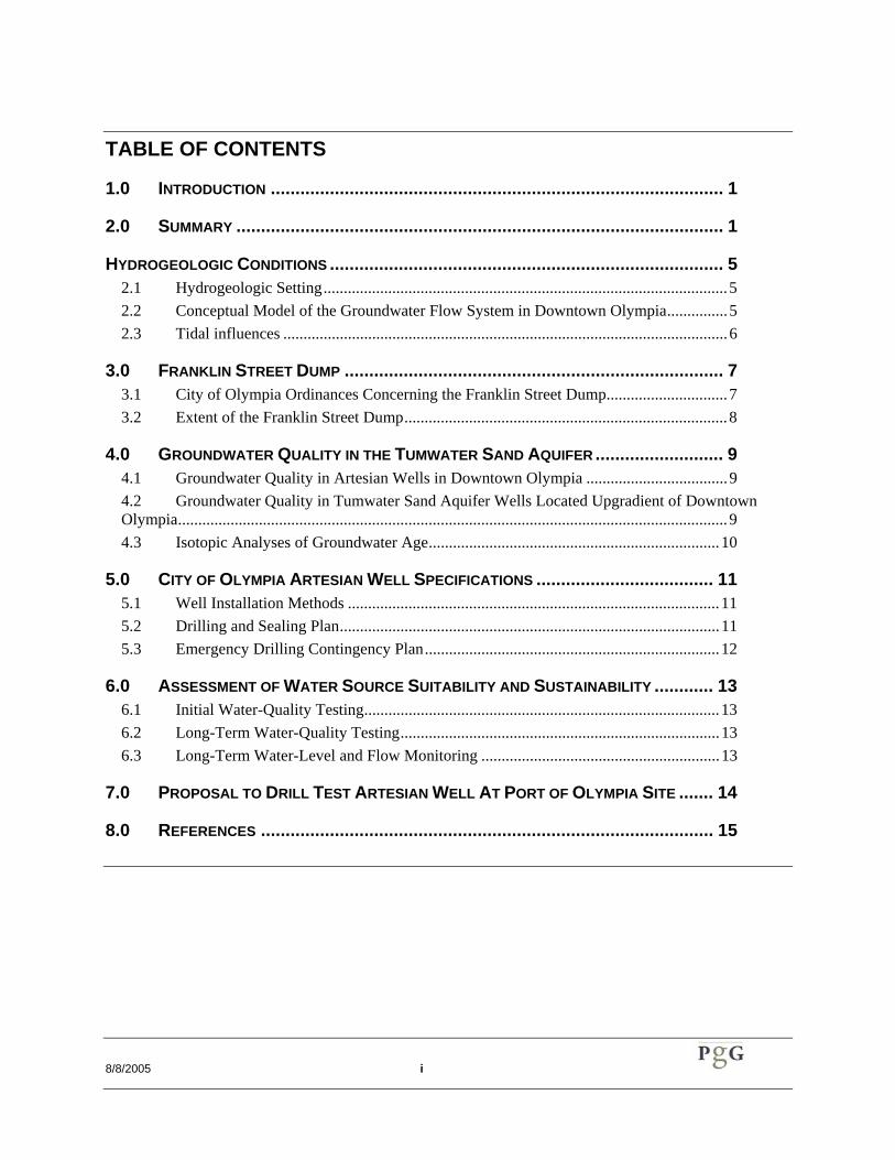
TABLE OF CONTENTS
1.0 INTRODUCTION ............................................................................................ 1
2.0 SUMMARY ................................................................................................... 1
HYDROGEOLOGIC CONDITIONS ................................................................................ 5 2.1 Hydrogeologic Setting....................................................................................................5 2.2 Conceptual Model of the Groundwater Flow System in Downtown Olympia...............5 2.3 Tidal influences ..............................................................................................................6
3.0 FRANKLIN STREET DUMP ............................................................................. 7 3.1 City of Olympia Ordinances Concerning the Franklin Street Dump..............................7 3.2 Extent of the Franklin Street Dump................................................................................8
4.0 GROUNDWATER QUALITY IN THE TUMWATER SAND AQUIFER .......................... 9 4.1 Groundwater Quality in Artesian Wells in Downtown Olympia ...................................9 4.2 Groundwater Quality in Tumwater Sand Aquifer Wells Located Upgradient of Downtown Olympia........................................................................................................................................9 4.3 Isotopic Analyses of Groundwater Age........................................................................10
5.0 CITY OF OLYMPIA ARTESIAN WELL SPECIFICATIONS .................................... 11 5.1 Well Installation Methods ............................................................................................11 5.2 Drilling and Sealing Plan..............................................................................................11 5.3 Emergency Drilling Contingency Plan.........................................................................12
6.0 ASSESSMENT OF WATER SOURCE SUITABILITY AND SUSTAINABILITY ............ 13 6.1 Initial Water-Quality Testing........................................................................................13 6.2 Long-Term Water-Quality Testing...............................................................................13 6.3 Long-Term Water-Level and Flow Monitoring ...........................................................13
7.0 PROPOSAL TO DRILL TEST ARTESIAN WELL AT PORT OF OLYMPIA SITE ....... 14
8.0 REFERENCES ............................................................................................ 15

8/8/2005 ii
LIST OF TABLES
Table 1. Water Quality Testing Results for Flowing Artesian Wells in Downtown Olympia.
Table 2. Tritium and Carbon-14 Age Dating of Groundwater from the Tumwater Sand Aquifer.
LIST OF FIGURES
Figure 1. 2003 Orthophoto of Proposed Well Site and Future Port of Olympia Buildings & Parking
Figure 2. Groundwater Contamination Sites in Downtown Olympia
Figure 3. Surficial Geology, Aquitard Thickness, and Depth to Artesian Aquifer
Figure 4. Historic Extent of Franklin Street Dump
Figure 5. Artesian Wells And Springs In Downtown Olympia In 1994
Figure 6. Groundwater Flow Patterns and the Freshwater-Saltwater Transition Zone in An Idealized Coastal Aquifer
Figure 7. Schematic Diagram of Proposed Well Sealing.
LIST OF APPENDICES
Appendix A. Selected Well Logs
Appendix B. Historical Aerial Photographs of the Franklin Street Dump and Vicinity
8/8/2005 iii
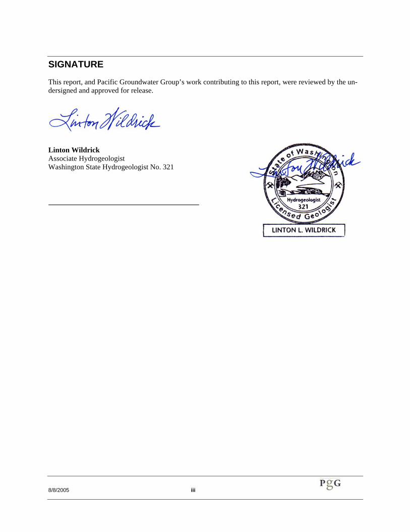
SIGNATURE
This report, and Pacific Groundwater Group’s work contributing to this report, were reviewed by the un-dersigned and approved for release.
Linton Wildrick Associate Hydrogeologist Washington State Hydrogeologist No. 321

8/8/2005 1
1.0 Introduction For over ten years, a local citizens’ group called Friends of Artesians (FOA) has worked to protect Olympia’s distinctive heritage of having a public, accessible, free-flowing arte-sian well. Their efforts have been supported by people from all walks of life, including various civic, cultural, and political leaders, and the local media.
As a result of FOA’s sustained efforts, ar-rangements have been made to install and test a well at the site is shown in Figure 1. The well will be owned and managed by the City of Olympia, and will be drilled at a site provided by the Port of Olympia Board of Commission-ers.
The well will be drilled by Arcadia Drilling of Shelton, Washington. Pacific Groundwater Group will log the well and assist Arcadia with well design. Friends of Artesians (FOA) will provide funds to cover expenses. It is hoped that construction can begin sometime during 2005.
An application for well site inspection and ap-proval was submitted to Thurston County on August 12, 2004. An application for a prelimi-nary permit to drill the well was submitted to the Washington Department of Ecology It is our understanding that Ecology intends to wait for the County’s well-site approval before issu-ing a preliminary permit to drill and test the artesian well.
The initial well-site application to Thurston County was denied on September 14, 2004, by the Environmental Health Section of Thurston County’s Public Health and Social Services Department. FOA appealed the denial on Sep-tember 23, 2004.
This report was prepared in support of FOA’s appeal of Thurston County’s denial of their well-site application for the Port of Olympia site. It is intended for submittal to the Thurston County Health Department. This report was prepared for the sole use of Friends of Arte-sians.
Our professional services were performed, our findings obtained, and our report prepared in accordance with generally accepted hydro-geologic practices. This warranty is in lieu of all other warranties, either express or implied.
2.0 Summary This report evaluates identified contamination sites, geologic and hydrogeologic conditions, and the nature of the groundwater flow system near the proposed City of Olympia artesian well site.
This report also directly addresses the concerns stated in Thurston County’s denial of the well site permit application by the FOA. Details of the evaluation may be found throughout the report. Information about the hydrogeology, history of artesian wells, groundwater quality, abandoned solid-waste dumps, and contamina-tion sites throughout downtown Olympia were compiled and reviewed.
The target aquifer of the new City of Olympia artesian well on Port of Olympia property is the Tumwater Sand unit of the Vashon reces-sional outwash formation. A thick aquitard overlies the artesian aquifer and provides water quality protection for the aquifer. Natural slow upward flow of groundwater from the artesian aquifer through the aquitard toward the surface also protects the groundwater. Available wa-ter-level measurements for the area are not sufficient to ensure accurate interpretation of groundwater flow directions; however, the flow direction throughout the former tideflat area is likely to be toward the nearest saltwater shoreline.
The following points respond to the specific reasons stated by Thurston County for the well site denial and are numbered accordingly:
1. The aquitard and upward flow of groundwater in the area will prevent contamination from reaching the arte-sian aquifer. Therefore, a 1,000 foot setback from the contamination sites is not necessary.

8/8/2005 2
The abandoned Franklin Street dump lies 200 feet west of the proposed arte-sian well site. The dump was created during the 1920s and was abandoned in the middle 1950s. During its use, the dump expanded northward about 100 yards but did not grow wider. The Warehouse One contamination site, located approximately 900 feet from the proposed well site, was a Port of Olympia parking lot and vehicle ser-vicing site. Total petroleum hydrocar-bons (TPH) were detected in soils at the site; however, Thurston County assigned it a Site Hazard Assessment Rank of 5, indicating a very low po-tential hazard to public health.
Results of many groundwater quality analyses (repeated over many years) for existing artesian wells in down-town Olympia provide further evi-dence that the aquitard and upward groundwater flow have prevented con-tamination of the artesian aquifer. These wells lie within a few hundred feet of known contamination sites. The water quality analyses indicate that the water quality of the artesian aquifer has been consistently excellent for decades, with no evidence of man-made contamination.
2. Surface water near the area of the pro-posed well site cannot reach the arte-sian aquifer for the same reasons that contamination cannot descend into the artesian aquifer: the presence of the aquitard, and the upward groundwater flow from the artesian aquifer. The storm water pond that is located less than 50 feet from the proposed well site is excavated into compacted, fine-grained dredged silts and fine sands that are relatively impermeable. Any surface water entering the pond that manages to infiltrate into the upper unconfined aquifer will not be able to penetrate downward through the aqui-tard or move down the borehole due to the extensive double sealing proposed
for the well construction. Therefore, a 100-foot setback from the pond is not necessary.
3. A stormwater pipeline near the pro-posed well site poses no threat to the well for the reasons stated in points 1 and 2, above. Therefore, a 100-foot setback from the pipe is not necessary.
4. A 48-inch sewage outfall pipe located approximately 160 feet from the pro-posed wells sites poses no threat to the well for the reasons stated in points 1 and 2, above, even in the event that the pipe ruptures. Therefore, a 100-foot setback from the pipe is not necessary.
5. The existence of an aquitard of sub-stantial thickness and low permeability is evidenced by dozens of drillers’ logs for wells near the proposed well site and throughout downtown Olympia. Therefore, the proposed well sealing into the aquitard will be effective.
We realize that not all of Thurston County’s concerns about the suitability of the proposed artesian well site can be answered from pres-ently available information, as presented above. The final test of the suitability of the site for a public supply well can only be ac-complished with a test well. Therefore, the FOA requests a well-site application for a test well at the Port of Olympia site. A licensed driller will install the artesian well with state-of-the-art methods that will protect the well’s water quality, the aquifer, and future water supplies from the Tumwater Sand aquifer. If the test well results are favorable, the well will become the new water-supply well. If not, it will be properly abandoned.
8/8/2005 3
PREVIOUS GROUNDWATER INVESTIGATIONS
A variety of reports have been written about groundwater investigations in downtown Olympia. A few of these were obtained and reviewed for information on the regional arte-sian aquifer. Some reports are related to inves-tigations of small-scale sites of contamination, or suspected contamination, usually covering a few acres. Figure 2 shows the known or sus-pected contamination sites in downtown Olympia. Selected reports of contamination include those by AGI Technologies (1999), Fluor-Daniel GTI (1998), and Shannon and Wilson (1997).
Other reports of investigation in downtown Olympia concerned the Diamond Parking Lot artesian well (Romero, 1997), seismic hazards (Washington Public Power Supply System, 1974), and foundation design (Dames and Moore, date unknown; Giles Engineering As-sociates, 1998; Rittenhouse-Zeman, 1990).
Most of the monitoring wells for these studies were drilled to sample shallow soils and groundwater. The reports for the Diamond Parking Lot (Romero, 1997), East Bay Marina (Dames and Moore, date unknown), LOTT Nitrogen Removal Facilities (Rittenhouse-Zeman & Associates, 1990), and Washington Public Power Supply System (1974) involved drilling or logging of a few deeper wells that penetrated to the artesian aquifer.
Brief descriptions of these and other pertinent previous investigations are presented in the following paragraphs, in order by date of re-port publication.
Selected well logs from these investigations and from the Department of Ecology’s on-line well log database are provided in Appendix A.
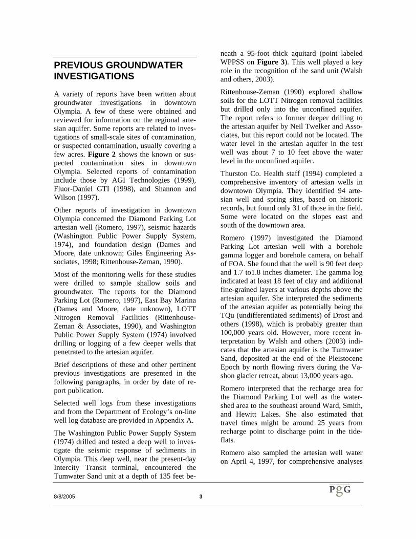
The Washington Public Power Supply System (1974) drilled and tested a deep well to inves-tigate the seismic response of sediments in Olympia. This deep well, near the present-day Intercity Transit terminal, encountered the Tumwater Sand unit at a depth of 135 feet be-
neath a 95-foot thick aquitard (point labeled WPPSS on Figure 3). This well played a key role in the recognition of the sand unit (Walsh and others, 2003).
Rittenhouse-Zeman (1990) explored shallow soils for the LOTT Nitrogen removal facilities but drilled only into the unconfined aquifer. The report refers to former deeper drilling to the artesian aquifer by Neil Twelker and Asso-ciates, but this report could not be located. The water level in the artesian aquifer in the test well was about 7 to 10 feet above the water level in the unconfined aquifer.
Thurston Co. Health staff (1994) completed a comprehensive inventory of artesian wells in downtown Olympia. They identified 94 arte-sian well and spring sites, based on historic records, but found only 31 of those in the field. Some were located on the slopes east and south of the downtown area.
Romero (1997) investigated the Diamond Parking Lot artesian well with a borehole gamma logger and borehole camera, on behalf of FOA. She found that the well is 90 feet deep and 1.7 to1.8 inches diameter. The gamma log indicated at least 18 feet of clay and additional fine-grained layers at various depths above the artesian aquifer. She interpreted the sediments of the artesian aquifer as potentially being the TQu (undifferentiated sediments) of Drost and others (1998), which is probably greater than 100,000 years old. However, more recent in-terpretation by Walsh and others (2003) indi-cates that the artesian aquifer is the Tumwater Sand, deposited at the end of the Pleistocene Epoch by north flowing rivers during the Va-shon glacier retreat, about 13,000 years ago.
Romero interpreted that the recharge area for the Diamond Parking Lot well as the water-shed area to the southeast around Ward, Smith, and Hewitt Lakes. She also estimated that travel times might be around 25 years from recharge point to discharge point in the tide-flats.
Romero also sampled the artesian well water on April 4, 1997, for comprehensive analyses

8/8/2005 4
(Table 1). The water quality was excellent and no contaminants were found.
Shannon and Wilson (1997) investigated con-tamination at the Heritage Park site near the east shore of Capitol Lake (see HP point in Figure 3).
Fluor-Daniel GTI (1998) investigated the “Cascade Pole hotspot” at the northern end of the downtown Olympia peninsula, with the goal of testing the integrity of the underlying aquitard. None of the wells drilled there were more than 40 feet deep. The deepest monitor-ing well went less than 30 feet below the mean-lower-low-water (MLLW) tide level. The well encountered a confined aquifer be-neath a 20-foot thick aquitard, but penetrated only two feet into the aquifer (see point labeled Cascade Pole on Figure 3). Based on the aqui-tard thickness and depth to the artesian aquifer in other wells nearby, it is unlikely that the hot spot monitoring wells penetrated the full thick-ness of the aquitard and didn’t reach the Tum-water sand unit1. In other places, the aquitard is much thicker than at the hot spot. For example, it is 95-feet thick near the Sound Transit sta-tion on State Street and 60 to 100 feet thick at East Bay (Figure 3). Logs for these wells also revealed that some sand facies within the aqui-tard were up to 17-feet thick, casting further doubt that the regional artesian aquifer was penetrated.
Giles Engineering (1998) drilled test wells for the Senior Housing Project at the former Yard-birds site along Capital Way (see point labeled SH, Figure 3). None of these wells penetrated completely through the aquitard above the ar-tesian aquifer.
Drost and others (1998) investigated ground-water throughout northern Thurston County. 1 Instead, it appears that they stopped drilling in a relatively thin sand facies within the generally silty/clayey aquitard unit. The slight water-level difference (a few tenths of a foot) between this fa-cies and the uppermost sandy zone is not indicative of a substantial aquitard thickness. Also, the high variability in grain size over short distances sug-gests that the various facies are lenses of limited horizontal extent.
Their groundwater level maps indicate that groundwater flows toward Budd Inlet from the surrounding hills.
Robinson and Noble (1999) conducted a sur-vey of artesian wells in downtown Olympia for the LOTT Wastewater Alliance. Their goal was to identify artesian wells and quantify their water discharges, assess the fate of the water, and recommend management of wells in relation to the sewer system. Friends of the Artesians volunteers assisted with the field-work. This investigation found 16 wells and 3 springs. They interpreted that the artesian wells tap Qva and Qpkg (pre-Kitsap), QTu, based on well depths and general known thickness of units. As stated above, the artesian aquifer is now interpreted as the Tumwater Sand unit that was deposited by north flowing rivers dur-ing the Vashon glacier retreat. The well-known public well in the Diamond Parking lot was not discussed.
Dames and Moore (1980s, date unknown) drilled test wells in anticipation of construction of the East Bay Marina (see EB points, Figure 3). This investigation pre-dated the filling of the bay around the Franklin Street dump, in-cluding the proposed artesian well site. Some of the wells were drilled from a barge in the bay. The wells reveal that the aquitard above the artesian aquifer is at least 46 feet thick.
Only a few of these investigations involved groundwater-level measurements and only one published the water-level elevations referenced to sea level. Therefore, it is not possible to cre-ate a water-level contour map for the artesian aquifer and to interpret the details of ground-water flow directions in downtown Olympia. This is not a critical aspect.

8/8/2005 5
Hydrogeologic Condi-tions The following assessment of hydrogeologic conditions is based on published reports and maps and on well-log interpretation. The re-ports and well logs were obtained from the Department of Ecology, the LOTT Wastewater Partnership, Friends of Artesians, and the Port of Olympia.
2.1 Hydrogeologic Setting
The proposed well site occupies a man-made peninsula at the southern end of Budd Inlet. Much of the peninsula once was a tideflat be-tween the mouths of Moxlie Creek and the Deschutes River. The original shape of the peninsula can be seen on Figure 3; the extent of the Qgos unit represents the original penin-sula. The artificial fill (unit Qf) has long pro-vided space for lumber and marine-related in-dustries and port operations. The fill thickness ranges from about 5 to 10 feet.
Much of the flat-lying parts of downtown Olympia were once part of the big tideflat be-tween the mouths of Moxlie Creek and the Deschutes River. Despite the fill, pavement, and buildings that overlie much of the old tide-flat, deep groundwater from under the sur-rounding hills continues to flow upward to the bays.
The fill overlies fine-grained lake sediments (unit Qgof) that were transported to the bay by streams related to the receding Vashon Glacier, about 12,000 years ago, and more recently by Moxlie Creek and the Deschutes River. This unit consists of interbedded silty sand, silt, clayey silt, and clay, with silt and clay pre-dominating. The known thickness of this unit ranges from 45 to 95 feet (see well labels in Figure 3; data from WPPSS, 1974; Ritten-house-Zeman, 1990; AGI Technologies, 1995; Shannon and Wilson, 1996; Romero, 1997; Giles Engineering, 1998). Because of the pre-dominant silt and clay particle sizes, unit Qgof has relatively low permeability and is classi-
fied as an aquitard. This aquitard is responsible for creating the well-known artesian aquifer of downtown Olympia. We did not find any well logs that indicate this unit to be missing in the area.
Beneath the aquitard is unit Qgos, with more than 400 feet of fine- to medium-grained sand and minor silt. This unit has relatively high permeability and is the artesian aquifer and the target for the proposed well. The sands also were deposited by streams related to the reced-ing and melting Vashon glacier. The unit was recently identified and mapped as the “Tum-water sand” by geologists at the Washington Division of Geology and Earth Resources (Walsh and others, 2003).
2.2 Conceptual Model of the Groundwater Flow Sys-tem in Downtown Olym-pia
Hundreds of years ago, fresh water infiltrated into soils on the surrounding glaciated uplands around downtown Olympia, percolated down into the Tumwater Sand unit, and began flow-ing toward Budd Inlet under the force of grav-ity. Some of the groundwater now wells up along the Deschutes River and Moxlie Creek, serving to maintain their baseflow. A greater portion of the groundwater flows on toward Budd Inlet and reaches depths of up to hun-dreds of feet below sea level. Beneath the bay, the water flows back up toward the surface to ultimately discharge into the salt water.
Due to the higher density of marine saltwater, fresh groundwater tends to discharge in a nar-row zone along beach areas (see Figure 6; from Alley, and others, 1999). However, the fine-grained lacustrine silt and clay aquitard that overlies the Tumwater Sand, throughout at least the southern end of the inlet, serves to retard the upward flow of groundwater from the deeper sediments, probably causing it to discharge farther from the mouth of the river and creek than would occur without the aqui-tard. Nonetheless, the groundwater eventually
8/8/2005 6
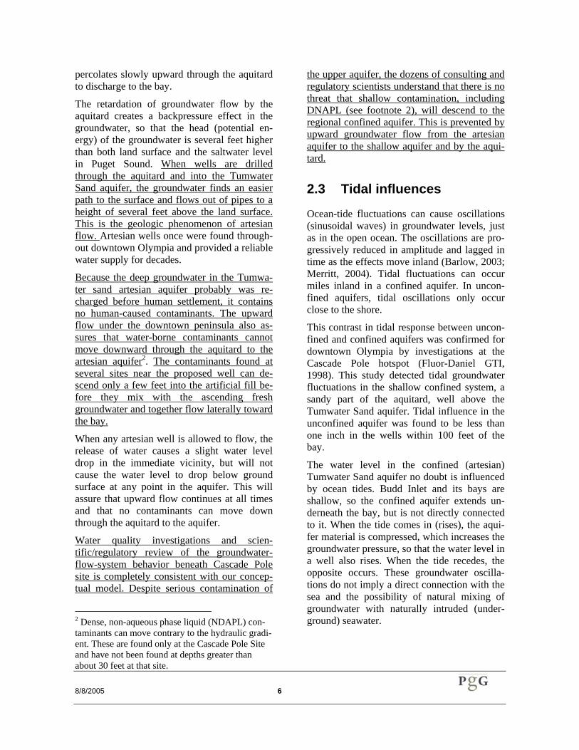
percolates slowly upward through the aquitard to discharge to the bay.
The retardation of groundwater flow by the aquitard creates a backpressure effect in the groundwater, so that the head (potential en-ergy) of the groundwater is several feet higher than both land surface and the saltwater level in Puget Sound. When wells are drilled through the aquitard and into the Tumwater Sand aquifer, the groundwater finds an easier path to the surface and flows out of pipes to a height of several feet above the land surface. This is the geologic phenomenon of artesian flow. Artesian wells once were found through-out downtown Olympia and provided a reliable water supply for decades.
Because the deep groundwater in the Tumwa-ter sand artesian aquifer probably was re-charged before human settlement, it contains no human-caused contaminants. The upward flow under the downtown peninsula also as-sures that water-borne contaminants cannot move downward through the aquitard to the artesian aquifer2. The contaminants found at several sites near the proposed well can de-scend only a few feet into the artificial fill be-fore they mix with the ascending fresh groundwater and together flow laterally toward the bay.
When any artesian well is allowed to flow, the release of water causes a slight water level drop in the immediate vicinity, but will not cause the water level to drop below ground surface at any point in the aquifer. This will assure that upward flow continues at all times and that no contaminants can move down through the aquitard to the aquifer.
Water quality investigations and scien-tific/regulatory review of the groundwater-flow-system behavior beneath Cascade Pole site is completely consistent with our concep-tual model. Despite serious contamination of
2 Dense, non-aqueous phase liquid (NDAPL) con-taminants can move contrary to the hydraulic gradi-ent. These are found only at the Cascade Pole Site and have not been found at depths greater than about 30 feet at that site.
the upper aquifer, the dozens of consulting and regulatory scientists understand that there is no threat that shallow contamination, including DNAPL (see footnote 2), will descend to the regional confined aquifer. This is prevented by upward groundwater flow from the artesian aquifer to the shallow aquifer and by the aqui-tard.
2.3 Tidal influences
Ocean-tide fluctuations can cause oscillations (sinusoidal waves) in groundwater levels, just as in the open ocean. The oscillations are pro-gressively reduced in amplitude and lagged in time as the effects move inland (Barlow, 2003; Merritt, 2004). Tidal fluctuations can occur miles inland in a confined aquifer. In uncon-fined aquifers, tidal oscillations only occur close to the shore.
This contrast in tidal response between uncon-fined and confined aquifers was confirmed for downtown Olympia by investigations at the Cascade Pole hotspot (Fluor-Daniel GTI, 1998). This study detected tidal groundwater fluctuations in the shallow confined system, a sandy part of the aquitard, well above the Tumwater Sand aquifer. Tidal influence in the unconfined aquifer was found to be less than one inch in the wells within 100 feet of the bay.
The water level in the confined (artesian) Tumwater Sand aquifer no doubt is influenced by ocean tides. Budd Inlet and its bays are shallow, so the confined aquifer extends un-derneath the bay, but is not directly connected to it. When the tide comes in (rises), the aqui-fer material is compressed, which increases the groundwater pressure, so that the water level in a well also rises. When the tide recedes, the opposite occurs. These groundwater oscilla-tions do not imply a direct connection with the sea and the possibility of natural mixing of groundwater with naturally intruded (under-ground) seawater.
8/8/2005 7
3.0 Franklin Street Dump
A small public garbage dump was operated in the City of Olympia from 1925 (and perhaps earlier) to 1955. Berg (date unknown) reported that the dump was operated by burning what-ever garbage was combustible, and that any-thing metallic or fixable was removed by free-lance scavengers. In this manner, not much garbage was left to accumulate. The area has since been covered with soil and paved.
The bays around the abandoned dump were filled in 1982 in preparation for construction of the East Bay Marina (personal communication Eric Egge, Port of Olympia Engineer, 2005). By this time, the dump had been closed for nearly 30 years. The artificial fill was dredged from East Bay and probably consists of silty sand and minor wood waste from the old log-handling operations.
3.1 City of Olympia Ordi-nances Concerning the Franklin Street Dump
Staff at the City of Olympia provided copies of several ordinances or resolutions that reference the Franklin Street Dump and garbage han-dling in the City.
The oldest document is a hand-written resolu-tion from 1899 that designates perhaps the first City dump, as follows (in part): “… a proper place where dirt and garbage may be depos-ited… the most suitable place within reach is at a point 150 yards north from the present north end of the long wharf… Resolved that the Street Commissioner be appointed, and he is hereby instructed to construct an apron or incline driveway from the decking at the north end of said wharf down to the surface of the dredged material … so that teams hauling re-fuse may be able to drive from the wharf… Farther (sic), that he clear away the dirt and garbage now deposited on and along side of the wharf lowering it so that it will be over-
flowed by the tide, ...” This may or may not be the Franklin Street dump.
On November 16, 1915, City Ordinance 1424 referred to the “City Dump at the North end of Main Street…,” which apparently had been established earlier. We do not know whether Main St. and the current Franklin St. are the same.
On March 2, 1920, City Ordinance 1631 cre-ated the office of City garbage collector to su-pervise and control the dump and established the City dump at “…the north end of Franklin street at or about its intersection with C street and north thereof ...” Each load cost 25 cents to dump. This is the first direct reference to Franklin Street as the dumpsite.
On August 4, 1925, City Ordinance 1908 de-clared “… a public emergency exists, requiring that the City garbage dump be enlarged in the interest of the health of the community. That the construction of an enlargement to the City garbage dump by the driving of piling and ty-ing boom sticks thereto ...”
City Ordinance 2064 (date unknown) declared that the garbage was to be classified as Class “A” garbage, comprising food related garbage, and class “B” garbage, consisting of broken things, lawn trimmings, cardboard, soil, street sweepings, ashes, etc.
Finally, on September 13, 1955, City Ordi-nance 2916 declared that new land must be secured for dumping garbage, and set aside $2,000 for the land purchase. This action may have signaled the end of the Franklin St. dump, though it is not specifically mentioned.
In summary, the City ordinances suggest that the Franklin Street dump was created between 1915 and 1920 and was abandoned around 1955.
8/8/2005 8
3.2 Extent of the Franklin Street Dump
A map and two orthophotographs were ob-tained that indicate the size and extent of the Franklin Street dump.
The 1924 Sanborn Fire insurance map shows a drawing of the dump. This is reproduced in Figure 4.
Two aerial photographs (orthophotos) taken by the Dept. of Transportation in 1936 and 1951 show the dump and other land uses around the northern end of Franklin Street. Both ortho-photos show the dump to be a narrow penin-sula - slightly wider than the current paved width of Franklin Street - that jutted into East Bay. The extent of the dump in these orthopho-tos is shown in Figure 4. Saltwater surrounds the dump on three sides. Logs and log rafts around the dump indicate that the adjacent bays around the dump were used by the nearby lumber mill and may have been dredged occa-sionally for shallow-draft boat or barge access. The dump peninsula changed little in width from 1924 to 1951, but lengthened northward about 300 feet.
Very little is known about how the dump was operated. A description of the dump (unpub-lished paper, Sammy Berg, Thurston County) stated that the garbage was burned and that salvage was allowed. The photographic evi-dence suggests that not much noncombustible material accumulated at the dump, as evi-denced by the limited growth in dump size. Certainly, the tides would have flushed away ashes and things that floated. It appears that the total volume of the dump was relatively small by modern standards and that salvagers re-moved most of the non-combustibles that were dumped.
Rittenhouse-Zeman and Associates (1990) re-ported that fill debris was encountered in four test borings along the east side of Franklin Street between B and D Avenues. The debris was described as wood, bricks, glass, shells, and organics; the shells and organics may have
been in the original tideflat soils. No hazardous debris was noted.
Lastly, based on the very small tidal influences in the unconfined aquifer, described above, we believe that tidal fluctuations are not disturbing the contents of the Franklin Street dump, which is more than 500 feet from the bay (Figure 4).

8/8/2005 9
4.0 Groundwater Qual-ity in the Tumwater Sand Aquifer
Groundwater from a number of artesian wells in downtown Olympia has been sampled and analyzed for various water-quality parameters. The drinking water wells have received the most attention. A few municipal wells for the City of Tumwater also appear to withdraw from the Tumwater sand aquifer, including those at the Palermo well field on the west edge of the Deschutes Valley and a City of Tumwater test well east of Tumwater Falls.
4.1 Groundwater Quality in Artesian Wells in Down-town Olympia
Figure 5 indicates where artesian wells and natural springs were known to exist in 1994 (Berg, 1994). Since then, a number of the wells have been abandoned or destroyed. In 1999, Robinson and Noble surveyed the remaining wells in order to estimate groundwater inflow into the LOTT Partnership’s sewer lines, be-cause the water from many of the old wells was routed to storm sewers. They found seven wells that were providing water to the public and twelve wells that were discharging into storm drains or sewers. At least three of these wells continue to be used for drinking water, including those at the Diamond Parking lot, King Solomon’s Reef Restaurant, and the Spar Restaurant (points DP, KSRR, and SR in Fig-ure 3).
Table 1 shows the results of groundwater qual-ity analyses in several artesian wells in down-town Olympia during the period 1983 through 2004. Analyses included volatile organic com-pounds, herbicides, and pesticides. None of these compounds have ever been detected in the artesian wells. Nitrate concentrations have never exceeded 0.5 mg/l and do not indicate a trend toward increasing concentrations. Inor-ganic compounds, including heavy metals, also
were analyzed; none has concentrations of concern that indicate approaching contamina-tion. Chloride concentrations have been less than 10 mg/l and do not indicate seawater in-trusion.
Rittenhouse-Zeman and Associates (1990) sampled groundwater from the unconfined aq-uifer along LOTT’s outfall alignment that par-allels the Marine Drive Realignment. The analyses indicate that the state and federal maximum contaminant limits (MCL) were not exceeded in any sample. One of these wells was located within fifty feet of the proposed artesian well on Port property.
4.2 Groundwater Quality in Tumwater Sand Aquifer Wells Located Upgradient of Downtown Olympia
The long-term prospects for the purity of the drinking water from the artesian aquifer may be best reflected in the water quality of upgra-dient wells. Several wells owned by the City of Tumwater at the Tumwater Valley Municipal Golf Course and at the Palermo Wellfield (Robinson & Noble, 1982) draw from the Tumwater Sand aquifer. The wells have been sampled routinely for many years and the wa-ter quality has remained high.
The City of Tumwater also drilled a test well near the Olympia High School in northeastern Tumwater (Golder Associates, 2000) that en-countered the Tumwater Sand aquifer. The groundwater quality in this well is excellent.

8/8/2005 10
4.3 Isotopic Analyses of Groundwater Age
To test the long-term potential that anthropo-genic contamination in the Tumwater Sand aquifer would reach downtown Olympia and the proposed artesian well site, PGG sampled the Diamond Parking Lot and Spar Restaurant wells on March 17, 2005. The samples were sent to Geochron Laboratories in Cambridge, Massachusetts, for analyses of the radioactive tritium and carbon-14 isotope concentrations. The results are shown in Table 2. Both wells tap the Tumwater Sand aquifer, but the depth of the Spar Restaurant well is not known.
Tritium (3H) is a short-lived radioactive iso-tope of hydrogen that decays by beta particle emission to stable helium (3He). The decay has a half-life of 12.43 years. Precipitation always contains some detectable tritium that originates from lightning flashes. Tritium also was pro-duced by atmospheric nuclear bomb testing that peaked around 1960. Tritium concentra-tion is reported in Tritium Units (TU), where one TU equals one tritium atom in 1018 atoms of hydrogen.
Carbon-14 (14C) is a radioactive isotope of car-bon and is continuously produced in the upper atmosphere by the interaction of cosmic ray neutrons with nitrogen gas (14N). The newly formed 14C rapidly oxidizes to carbon dioxide that is taken up by plants during photosynthe-sis and also mixes with carbon dioxide in wa-ter bodies. Once an organism dies, the 14C gradually is lost by radioactive disintegration back to 14N.
Tritium was not detected (less than detection limit) in either groundwater sample (Table 2). This indicates that the groundwater was re-charged before the bomb-testing period (about 45 to 55 years ago). Given an isotopic half-life of 12.84 years, the usual small amount of trit-ium in precipitation due to lighting disinte-grates to undetectable concentrations in 4 to 6 half-lives, or 50 to 75 years. Therefore, the tritium results for the groundwater samples
indicate that the groundwater is more than 75 years old.
Carbon-14 results (Table 2) indicate that the groundwater in the Tumwater Sand aquifer was recharged by precipitation long before European settlement of the Pacific Northwest. Therefore, the groundwater is unlikely to con-tain human-created contaminants.
The carbon-14 ages for the two samples are different by a factor of two. This is not un-usual, because groundwater moves along a variety of flow lines from particular recharge locations to particular discharge locations. The distance from the recharge location and rate of movement will determine the age of ground-water at a particular point along a flow path. Water from different flow paths tend to mix near discharge areas, so it is not surprising that adjacent “packets” of water may have different average ages.
These results indicate that the groundwater from the proposed artesian well will be old, and not result from recent or local groundwater recharge that could be contaminated by indus-trial-age pollutants.
Table 2. Tritium and Carbon-14 Age Dating of Groundwater from the Tumwater Sand Aquifer.
Well Tritium (TU)
Carbon-14
( 14C years be-fore present) 1
Diamond Parking Lot
< 0.09 1,650 ± 402
Spar Restaurant < 0.09 3,330 ± 503 1Carbon-14 ages referenced to 1950, so 50 years were added to obtain years before present. 2 Diamond Parking well: 14C = 81.95 ± 0.43 % of modern (1950) 14C activity (13C corrected). 3 Spar Restaurant well: 14C = 66.45 ± 0.44 % of modern (1950) 14C activity (13C corrected).

8/8/2005 11
5.0 City of Olympia Ar-tesian Well Speci-fications
The flowing artesian well will be drilled by the cable-tool method. The final borehole will be cased with 6-inch diameter steel casing, from the surface to the screen, and the annulus will be sealed in several stages. The lower part of the borehole will be cased with a stainless steel, wire-wrapped, telescoping screen to pro-vide for efficient groundwater inflow. A sur-face seal, of neat cement or bentonite slurry, will surround the casing from the surface to a depth of at least 20 feet and at least 5 feet into the aquitard. Because of the artesian flow, spe-cial construction precautions will be followed to prevent upward flow around the outside of the casing (annulus).
5.1 Well Installation Methods
Well drilling and installation procedures will follow the rules of the Water Well Construc-tion Act (1971), Chapter 18.104 RCW, and the Minimum Standards for Construction and Maintenance of Wells, Chapter 173-160 Wash-ington Administrative Code. A licensed driller will be in charge of the drilling operation at all times. A licensed hydrogeologist will log the drill samples and assist the driller in the final well design.
WAC 173-160-251 sections 1-3 apply to the construction of artesian wells. The code states, in part, that “When flowing artesian conditions are known or suspected, the operator shall have a written sealing plan prepared prior to the initiation of construction.” The plan must include a description of the sealing material and methods that will be used, with one alter-nate construction method for sealing and an emergency contingency element to identify steps to be taken in the event that the flow cannot be controlled. The WAC requires that the well be constructed so that the flow of wa-ter is confined to the inside of the well. In
compliance with this Code, we submit the fol-lowing Sealing Plan.
5.2 Drilling and Sealing Plan
The six-inch diameter artesian well will be completed in a manner that will prevent water from moving up or down the annulus of the permanent well casing. Arcadia Drilling Com-pany will construct the well using a sealing plan that includes a double overlapping annu-lus seal, with placement of appropriate sealing materials at specific depths. Figure 7 shows a schematic of the well construction.
It is anticipated that the uppermost aquifer may contain minor contamination, so precautions will be taken to assure that no contamination is carried to lower hydrogeologic units. The cas-ing will be driven closely behind the drilling bit, and all cuttings will be bailed from the well as the casing is advanced. Cuttings from the upper 30 feet of the borehole will be placed in drums and taken to the Hawks Prairie trans-fer station for disposal.
• Phase One - Drill 12” diameter bore-hole and drive 12” casing to a depth of approximately 20 feet, or not less than 5-feet into the Budd Inlet tideflat depos-its (silts and clays), whichever is deeper. The drill bit will never advance more than two feet ahead of the lower end of the casing in this interval.
• Phase Two - Line the 12” casing with 8” casing, advance the borehole with an 8” bit, and drive 8” casing to no less than 8 feet into the densest part of the silts and clays of the Budd Inlet tideflat deposits. This interval is expected to extend to approximately 35 to 45 feet depth. The drill bit will never advance more than two feet ahead of the lower end of the casing in this interval. This depth is expected to be at least 20 feet below artificial fill or any remnants of the historic wood products operations that occurred in the former tideflat.

8/8/2005 12
• Phase Three - Line the 8” casing with 6” casing, advance the borehole with a 6” bit, and drive 6” casing to approxi-mately 5-feet below the bottom of the 8” casing. Next, set an inflatable packer at about the 35-foot depth in the 6” cas-ing. The packer will be inflated to 3500 PSI, and a 30% solids bentonite grout will be pumped at high pressure into the 6” casing below the packer. The grout will fill up the bottom of the 6” casing but then will rise up into the space be-tween the 8” and 6” casing, until grout comes up to the surface at the top of the well between the 6” and 8” casing. This seal will prevent upward flow around the outside of the casing and will be re-ferred to as the “artesian seal.” The aquitard is expected to be at least 45 feet thick, based on test borings in the vicinity. Figure 3 shows the minimum or confirmed aquitard thickness and depth to the artesian aquifer.
• Phase Four - The packer will be de-flated and removed, and the 6” borehole and casing will be advanced into the bottom of the Tumwater Sand unit, un-til suitable hydrostatic pressure is en-countered. This depth could vary from 100 to 200 feet below ground surface. The grout seal will be as necessary dur-ing this process. A suitable wire-wrapped stainless steel screen will be installed in the lower 10 feet of the borehole. Well development will com-mence and will continue until the well produces water essentially free of tur-bidity and sand. During construction, water will be allowed to flow from the well.
• Phase Five - When the well develop-ment is complete, and the well has been allowed to flow for at least three days, the top of the 6” casing will be sealed to stop artesian flow. The artesian seal will be considered satisfactory if the water level between the 12” and 8” cas-ing does not rise significantly when the flow ceases.
• Phase Six - Once the proper perform-ance of the artesian seal has been veri-fied, the 12” casing will be removed. While pulling this casing, the driller will simultaneously install neat cement grout in the annulus from the bottom up, using a tremmie pipe.
5.3 Emergency Drilling Con-tingency Plan
In the event that uncontrolled flow is indicated from either inside the casing or from the annu-lus the following steps will be taken:
• The well will be decommissioned. All reasonable efforts will be taken to limit any damage to the aquifer.
• The screen will be removed and if any open hole is left, sand and gravel simi-lar to the natural material will be placed in the bore to the point that the aquifer was encountered.
• Above the aquifer, bentonite slurry or neat cement will be placed in the bore-hole annulus as the casing is removed.
• Each casing string will be removed separately. As each is removed, the empty borehole will be filled to a point that is at the bottom of the next string of casing. The removal of the next string will not commence until it has been de-termined that the artesian flow is con-trolled or reduced to a point that makes continued decommissioning appropri-ate.
Uncontrolled flow would not result in cross-contamination of any confined aquifer zone, because the upward flow would be pristine groundwater from the lower zones. Any con-tamination that might be present in the upper-most aquifer cannot descend to the lower aqui-fer for the same reason.
8/8/2005 13
6.0 Assessment of Wa-ter Source Suitabil-ity and Sustainabil-ity
The quality of the groundwater from the new artesian well is likely to be satisfactory for a public drinking water supply. The water sys-tem would be owned and managed as a tran-sient, non-community well, but would not connected to any part of Olympia’s water sys-tem.
Friends of Artesians (FOA) will provide assur-ance of the water quality by conducting a se-ries of tests immediately after the well is drilled and at relatively close intervals during the first year of usage. After one year, consis-tent long-term testing will provide assurance of the continued safety of the water.
6.1 Initial Water-Quality Test-ing
As part of the water-system certification by the Dept. of Health, FOA will test the groundwater quality as required. After the well is completed, temporary plumbing would be installed to allow for sampling and other testing. These analyses will provide assurance that well drilling and installation did not in-troduce contaminants into the aquifer. Sam-ples will be collected by qualified City of Olympia staff. The sampling and analyses will be repeated quarterly for the first year after use of the well commences. Also, during the first year following the initial sampling, the City will sample the water monthly and have it analyzed for bacteria, nitrate concentration, and specific conductance. These are good general indicators of changes in water quality.
6.2 Long-Term Water-Quality Testing
After one year of sampling, water samples would be analyzed every three years for the same suite of analyses that will be used for the initial testing. This is standard procedure for City of Olympia water systems and provides adequate protection of drinking water supplies.
6.3 Long-Term Water-Level and Flow Monitoring
Monitoring of groundwater levels and flow can provide additional clues regarding the long-term sustainability of the groundwater flow (Alley, and others, 1999). It augments water-quality testing by providing another means to detect changes in the groundwater flow sys-tem. Because this is a flowing artesian well, any change in the static head will be reflected in a change in the open discharge rate. This might be caused by a drier climate or by exten-sive groundwater withdrawals from municipal wells in the uplands. Although both are unlikely to substantially affect the artesian aq-uifer in the coming decades, precautions will provide continuing assurance to well water users.
The FOA plans to share the continuing moni-toring results with visitors in order to promote public awareness of the need to protect and preserve groundwater.
The elevation of the wellhead will be profes-sionally surveyed and referenced to the City of Olympia’s elevation standard. A special fitting will be installed in the well casing that allows the water level (above ground surface) to be measured monthly with a simple pressure gauge or manometer. The full discharge rate of the well also will be measured occasionally during the water level monitoring.

8/8/2005 14
7.0 Proposal to Drill a Test Well At Port of Olympia Site
It is likely that not all of the County staff’s concerns about the suitability of the proposed artesian well site can be answered from pres-ently available information. The final test of the suitability of the site for a public supply well can only be accomplished with a test well. Therefore, the FOA and City request that they be allowed to drill a 6-inch diameter test well to the artesian aquifer.
The test well will be installed, sampled, and sealed in anticipation that it will become certi-ficated as a water supply source. Installation will follow the methods proposed above. Soils will be sampled during drilling. The water will be sampled for the analyses proposed above and flow rate and water level will be measured.
In the event that the test-well findings do not indicate a safe and sustainable drinking water supply, the well will be properly abandoned in accordance with the state’s well drilling rules. FOA will assume the full cost of drilling and testing, as well as the financial risk that the well may be abandoned.
8/8/2005 15
8.0 References AGI Technologies, 1999. Groundwater Moni-
toring Results, Olympia Transit Center, Olympia, Washington. AGI Project 15,942.002. Prepared for Intercity Transit, May.
Alley, W. M., and others, 1999. Sustainability of Ground-Water Resources. U. S. Geo-logical Survey Circular 1186, Denver, CO.
Barlow, P., 2003, Ground Water in Freshwa-ter-Saltwater Environments of the Atlantic Coast. U. S. Geological Survey, Circular 1262.
Berg, S. (data unknown) Unpublished descrip-tion of the Franklin Street dump. Thurston County Environmental Health staff notes.
Dames and Moore, (date unknown) Unpub-lished boring logs for Eastbay Marina in-vestigation. Prepared for Port of Olympia.
Drost, B. W., and others, 1998. Hydrology and Quality of Ground Water in Northern Thurston County, Washington. U. S. Geo-logical Survey, Water-Resources Investiga-tion Report 92-4109 (revised), Tacoma, Washington.
Fluor-Daniel GTI (1998) Hydrogeological Site Investigation, Port of Olympia. Project 105560, December.
Giles Engineering Associates, Inc. (1998) Ap-pendix C. Field Procedures and Exploration Logs. Main report title unknown. Various maps and well logs for Senior Housing pro-ject on Capital Way and “A” Avenue, Olympia, WA.
Golder Associates (2000) Completion Report, Northeast Exploration Area, City of Tum-water, Washington. Project 993-1410.900, Report TW-00-01, June.
Merritt, M. L., 2004. Estimating Hydraulic Properties of the Floridan Aquifer System by Analysis of Earth-Tide, Ocean-Tide, and Barometric Effects, Collier and Hendry Counties, Florida. U. S. Geological Survey,
Water-Resources Investigation Report 03-4267.
Rittenhouse-Zeman & Associates, 1990. Sub-surface Exploration and Geotechnical En-gineering Report, LOTT Nitrogen Removal Facilities, Olympia, Washington. Prepared for Parametrix, Inc., Report W-6405-1, April.
Robinson and Noble (1982) Palermo Well Field Expansion Project for the City of Tumwater. June.
Robinson and Noble (1999) Artesian Well Analysis, Technical Memorandum 1204, LOTT Wastewater Resource Management Plan, in association with Brown and Cald-well, March.
Romero, N. (1997) Report on the Hydro-geological Investigation Conducted at the Black Diamond Parking Lot Artesian Well. Prepared for Friends of the Artesians, Olympia, WA, September 10.
Shannon and Wilson, 1997. Heritage Park, Olympia, Washington, Summary Report in Support of VCP Application. Prepared for City of Olympia Parks Department.
Thurston County Environmental Health, 1994. Artesian Well Survey. Olympia, WA.
Walsh, T. J., Logan, R. L., Schasse, H. W., and Polenz, M., 2003. Geologic Map of the Tumwater 7.5-minute Quadrangle, Thurston County, Washington. Washington Div. of Geology and Earth Resources, Open File Report 2003-25, Olympia, WA.
Washington Dept. of Ecology, 2002. Seawater Intrusion in Washington. Publication 02-11-018. 2 p. brochure.
Washington Public Power Supply System, 1974. Analysis of accelograms recorded at Olympia, Washington. In Washington Pub-lic Power Supply System, WPPSS nuclear project no. 3 - Preliminary safety analysis report: WPPSS Docket no. 50-508, Pre-liminary Safety Analysis Report, Amend-ment 2, Appendix 2.5K, p. 2.5.K-1-K-25, 13 figures.
A-1
APPENDIX A SELECTED WELL LOGS
A-2
APPENDIX B HISTORICAL AERIAL PHOTOGRAPHS OF THE FRANKLIN STREET DUMP
AND VICINITY