programs and activities with potential crs ties - kamm · programs and activities with potential...
TRANSCRIPT
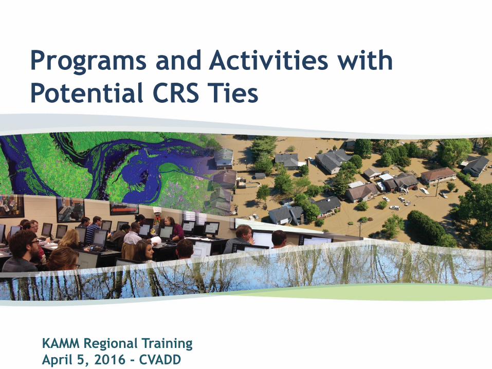
Programs and Activities with
Potential CRS Ties
KAMM Regional Training
April 5, 2016 - CVADD
The CRS Conundrum
Many activities being conducted by
communities are eligible for CRS credit
Documentation required
This presentation will focus on Storm Water
Management and Repetitive Loss Analysis
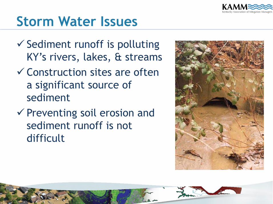
Storm Water Issues
Sediment runoff is polluting
KY’s rivers, lakes, & streams
Construction sites are often
a significant source of
sediment
Preventing soil erosion and
sediment runoff is not
difficult
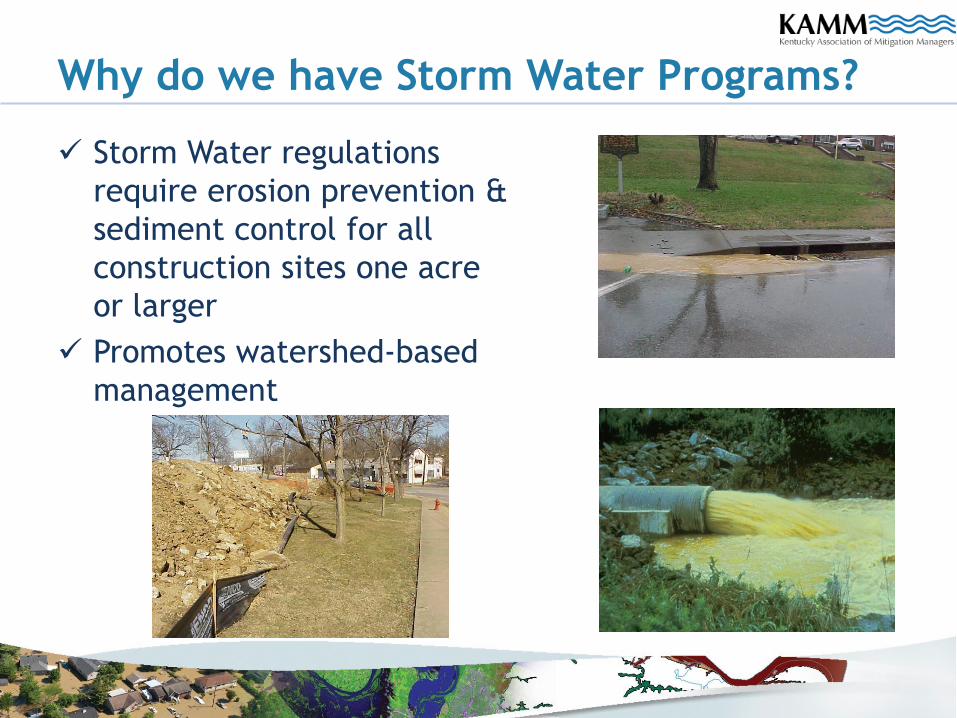
Why do we have Storm Water Programs?
Storm Water regulations
require erosion prevention &
sediment control for all
construction sites one acre
or larger
Promotes watershed-based
management
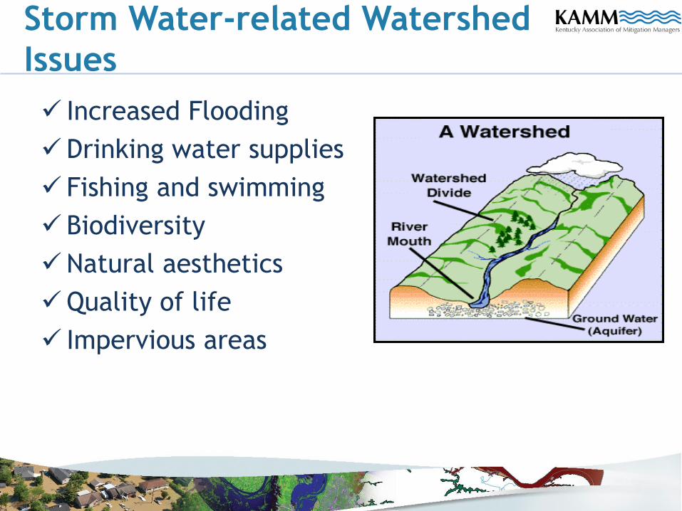
Storm Water-related Watershed
Issues
Increased Flooding
Drinking water supplies
Fishing and swimming
Biodiversity
Natural aesthetics
Quality of life
Impervious areas
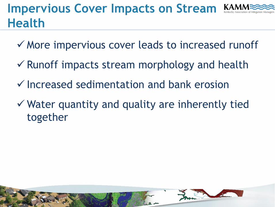
Impervious Cover Impacts on Stream
Health
More impervious cover leads to increased runoff
Runoff impacts stream morphology and health
Increased sedimentation and bank erosion
Water quantity and quality are inherently tied
together
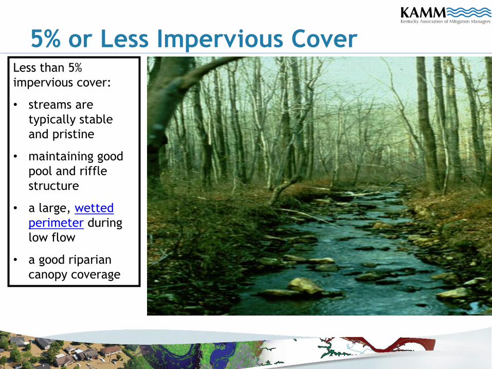
5% or Less Impervious CoverLess than 5%
impervious cover:
• streams are
typically stable
and pristine
• maintaining good
pool and riffle
structure
• a large, wetted
perimeter during
low flow
• a good riparian
canopy coverage
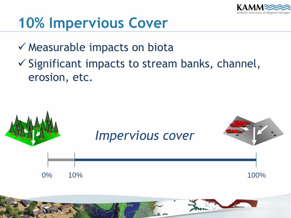
10% Impervious Cover
Measurable impacts on biota
Significant impacts to stream banks, channel,
erosion, etc.
Impervious cover
10% 100%0%
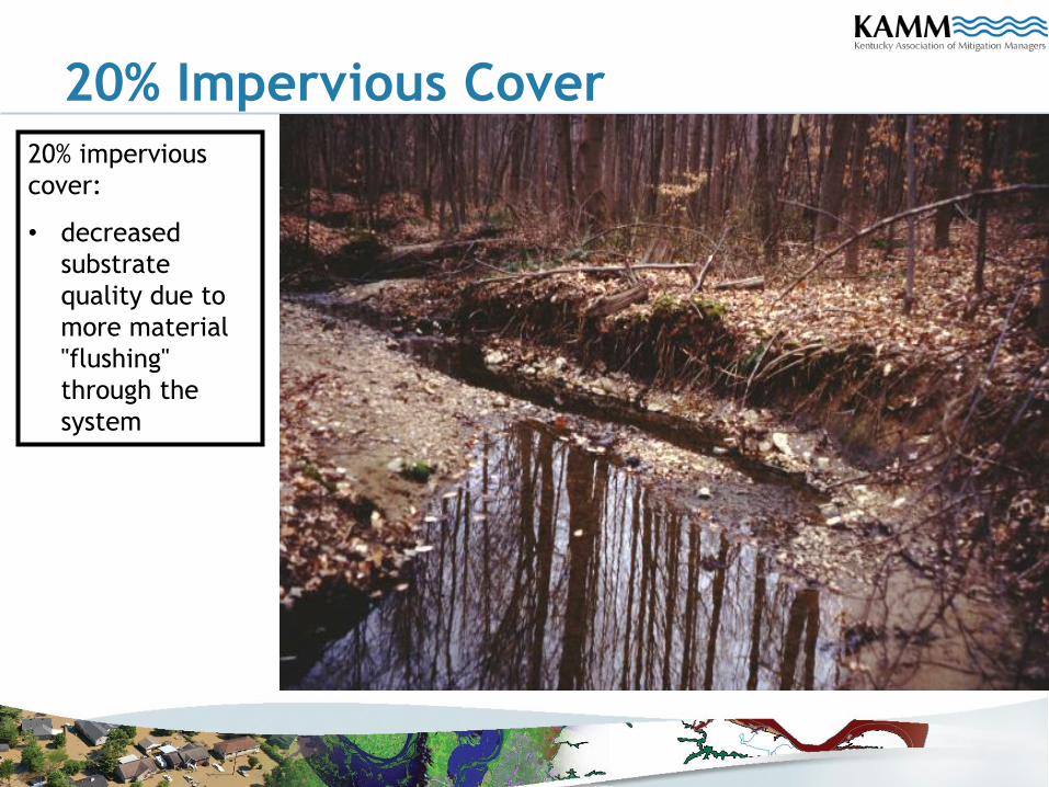
20% Impervious Cover
20% impervious
cover:
• decreased
substrate
quality due to
more material
"flushing"
through the
system
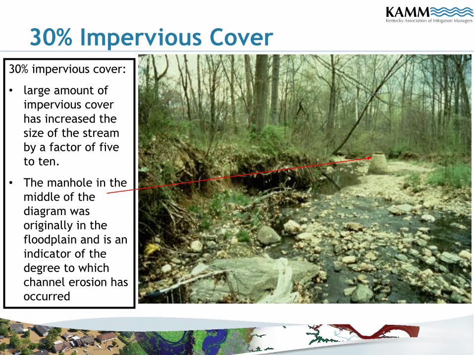
30% Impervious Cover30% impervious cover:
• large amount of
impervious cover
has increased the
size of the stream
by a factor of five
to ten.
• The manhole in the
middle of the
diagram was
originally in the
floodplain and is an
indicator of the
degree to which
channel erosion has
occurred

Storm Water Management and CRS
Activity 330 – Outreach Projects
Activity 450 – Storm Water Management
Max 755 total CRS points available
Crossover with MS4 programs
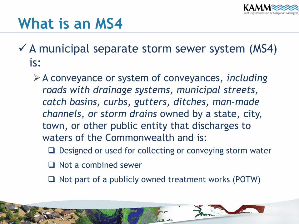
What is an MS4
A municipal separate storm sewer system (MS4)
is:
A conveyance or system of conveyances, including
roads with drainage systems, municipal streets,
catch basins, curbs, gutters, ditches, man-made
channels, or storm drains owned by a state, city,
town, or other public entity that discharges to
waters of the Commonwealth and is:
Designed or used for collecting or conveying storm water
Not a combined sewer
Not part of a publicly owned treatment works (POTW)
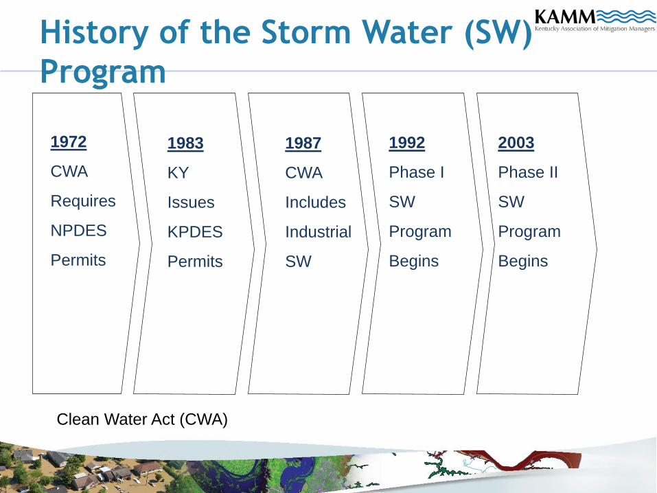
History of the Storm Water (SW)
Program
1972
CWA
Requires
NPDES
Permits
1983
KY
Issues
KPDES
Permits
1987
CWA
Includes
Industrial
SW
1992
Phase I
SW
Program
Begins
2003
Phase II
SW
Program
Begins
Clean Water Act (CWA)
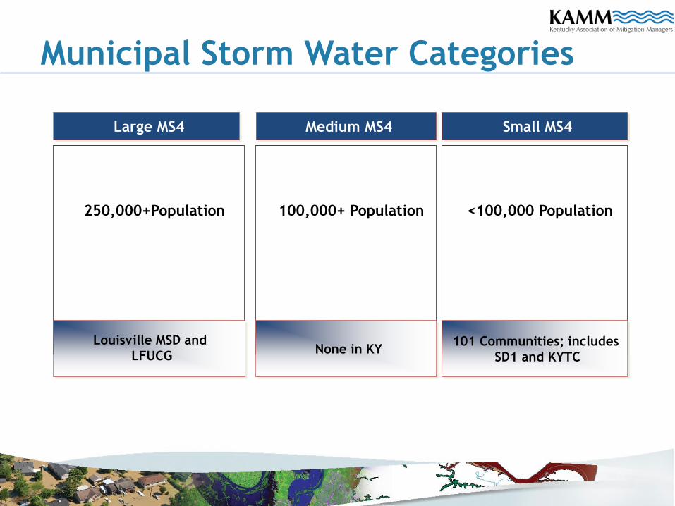
Municipal Storm Water Categories
Large MS4
250,000+Population
Medium MS4
100,000+ Population
Small MS4
<100,000 Population
Louisville MSD and
LFUCGNone in KY
101 Communities; includes
SD1 and KYTC
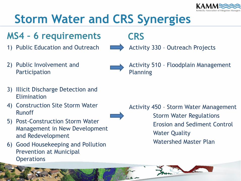
Storm Water and CRS Synergies
MS4 – 6 requirements1) Public Education and Outreach
2) Public Involvement and
Participation
3) Illicit Discharge Detection and
Elimination
4) Construction Site Storm Water
Runoff
5) Post-Construction Storm Water
Management in New Development
and Redevelopment
6) Good Housekeeping and Pollution
Prevention at Municipal
Operations
CRSActivity 330 – Outreach Projects
Activity 510 – Floodplain Management
Planning
Activity 450 – Storm Water Management
Storm Water Regulations
Erosion and Sediment Control
Water Quality
Watershed Master Plan
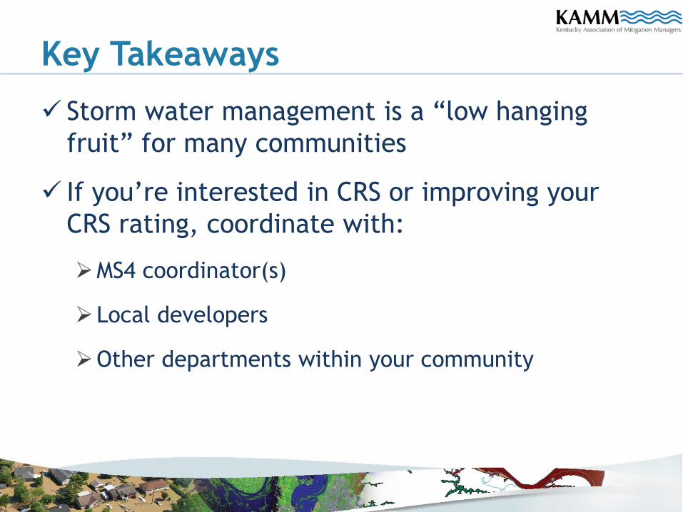
Key Takeaways
Storm water management is a “low hanging
fruit” for many communities
If you’re interested in CRS or improving your
CRS rating, coordinate with:
MS4 coordinator(s)
Local developers
Other departments within your community
Mapping Repetitive Loss Areas
for CRS
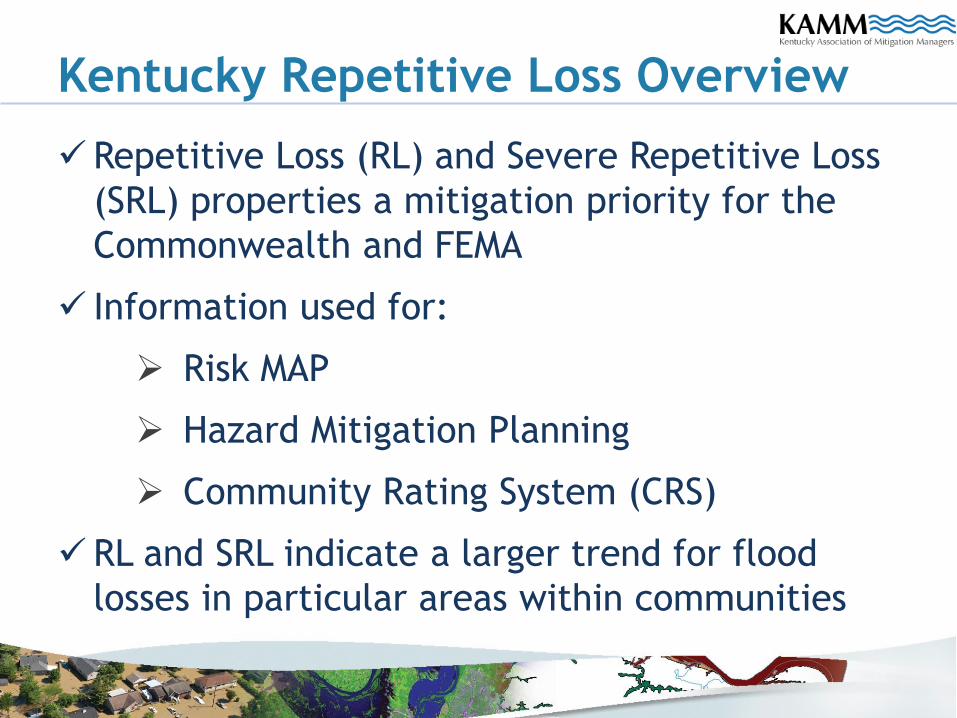
Kentucky Repetitive Loss Overview
Repetitive Loss (RL) and Severe Repetitive Loss
(SRL) properties a mitigation priority for the
Commonwealth and FEMA
Information used for:
Risk MAP
Hazard Mitigation Planning
Community Rating System (CRS)
RL and SRL indicate a larger trend for flood
losses in particular areas within communities
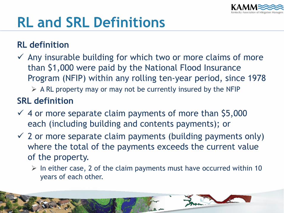
RL and SRL Definitions
RL definition
Any insurable building for which two or more claims of more
than $1,000 were paid by the National Flood Insurance
Program (NFIP) within any rolling ten-year period, since 1978
A RL property may or may not be currently insured by the NFIP
SRL definition
4 or more separate claim payments of more than $5,000
each (including building and contents payments); or
2 or more separate claim payments (building payments only)
where the total of the payments exceeds the current value
of the property.
In either case, 2 of the claim payments must have occurred within 10
years of each other.
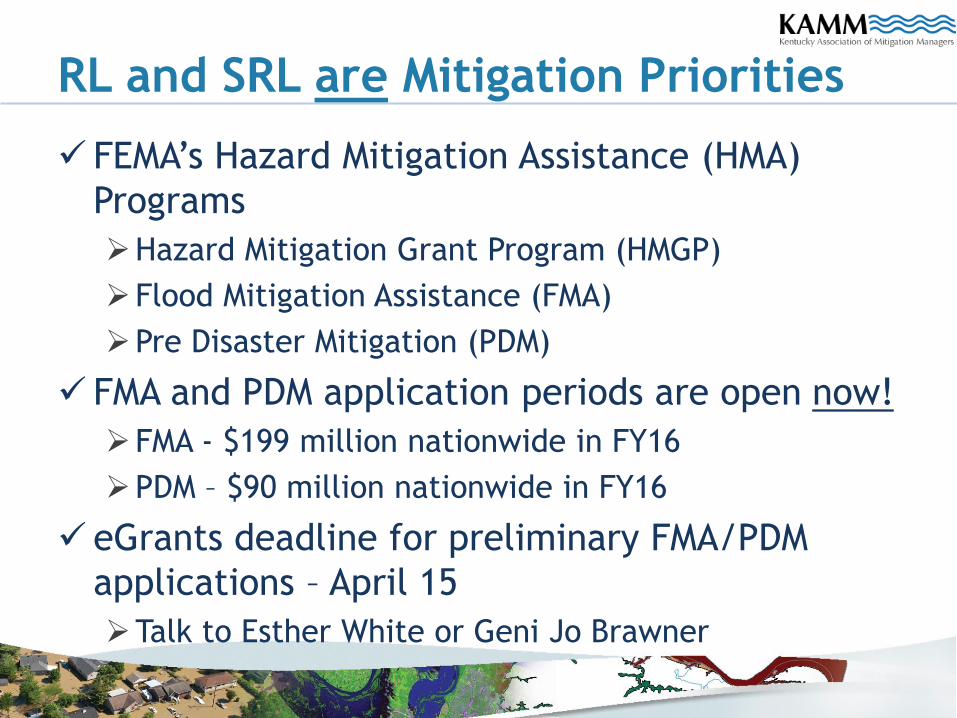
RL and SRL are Mitigation Priorities
FEMA’s Hazard Mitigation Assistance (HMA)
Programs
Hazard Mitigation Grant Program (HMGP)
Flood Mitigation Assistance (FMA)
Pre Disaster Mitigation (PDM)
FMA and PDM application periods are open now!
FMA - $199 million nationwide in FY16
PDM – $90 million nationwide in FY16
eGrants deadline for preliminary FMA/PDM
applications – April 15
Talk to Esther White or Geni Jo Brawner
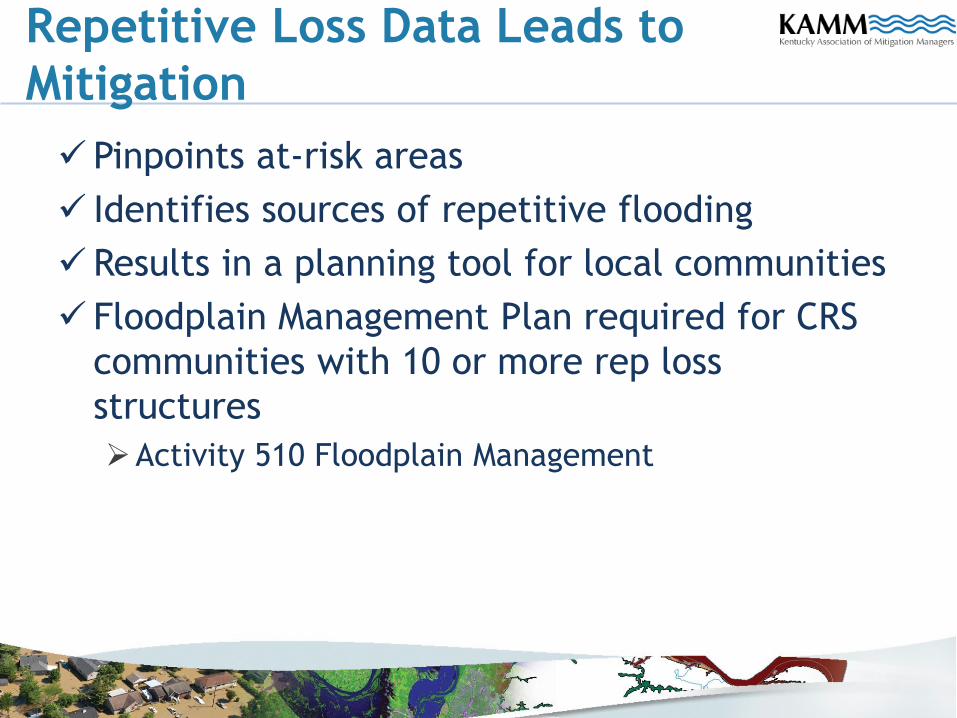
Repetitive Loss Data Leads to
Mitigation
Pinpoints at-risk areas
Identifies sources of repetitive flooding
Results in a planning tool for local communities
Floodplain Management Plan required for CRS
communities with 10 or more rep loss
structures
Activity 510 Floodplain Management
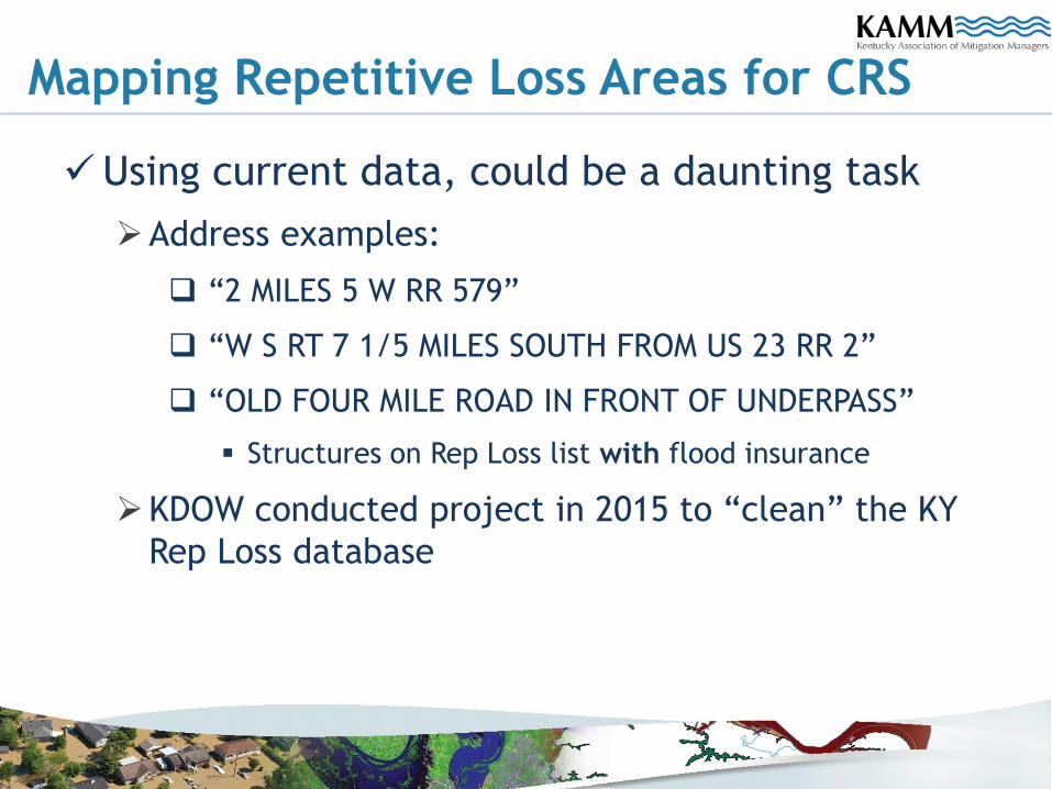
Mapping Repetitive Loss Areas for CRS
Using current data, could be a daunting task
Address examples:
“2 MILES 5 W RR 579”
“W S RT 7 1/5 MILES SOUTH FROM US 23 RR 2”
“OLD FOUR MILE ROAD IN FRONT OF UNDERPASS”
Structures on Rep Loss list with flood insurance
KDOW conducted project in 2015 to “clean” the KY
Rep Loss database
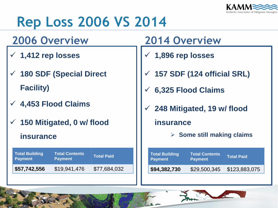
Rep Loss 2006 VS 2014
2006 Overview
1,412 rep losses
180 SDF (Special Direct
Facility)
4,453 Flood Claims
150 Mitigated, 0 w/ flood
insurance
2014 Overview
1,896 rep losses
157 SDF (124 official SRL)
6,325 Flood Claims
248 Mitigated, 19 w/ flood
insurance
Some still making claims
Total Building
Payment
Total Contents
PaymentTotal Paid
$57,742,556 $19,941,476 $77,684,032
Total Building
Payment
Total Contents
PaymentTotal Paid
$94,382,730 $29,500,345 $123,883,075
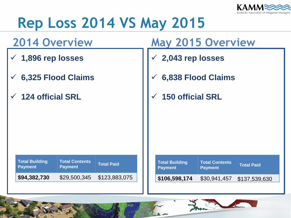
Rep Loss 2014 VS May 2015
2014 Overview
1,896 rep losses
6,325 Flood Claims
124 official SRL
May 2015 Overview
2,043 rep losses
6,838 Flood Claims
150 official SRL
Total Building
Payment
Total Contents
PaymentTotal Paid
$94,382,730 $29,500,345 $123,883,075
Total Building
Payment
Total Contents
PaymentTotal Paid
$106,598,174 $30,941,457 $137,539,630
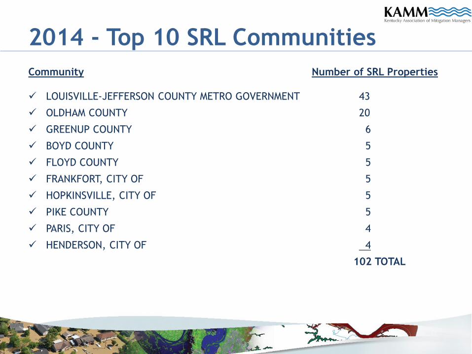
2014 - Top 10 SRL Communities
Community Number of SRL Properties
LOUISVILLE-JEFFERSON COUNTY METRO GOVERNMENT 43
OLDHAM COUNTY 20
GREENUP COUNTY 6
BOYD COUNTY 5
FLOYD COUNTY 5
FRANKFORT, CITY OF 5
HOPKINSVILLE, CITY OF 5
PIKE COUNTY 5
PARIS, CITY OF 4
HENDERSON, CITY OF 4
102 TOTAL
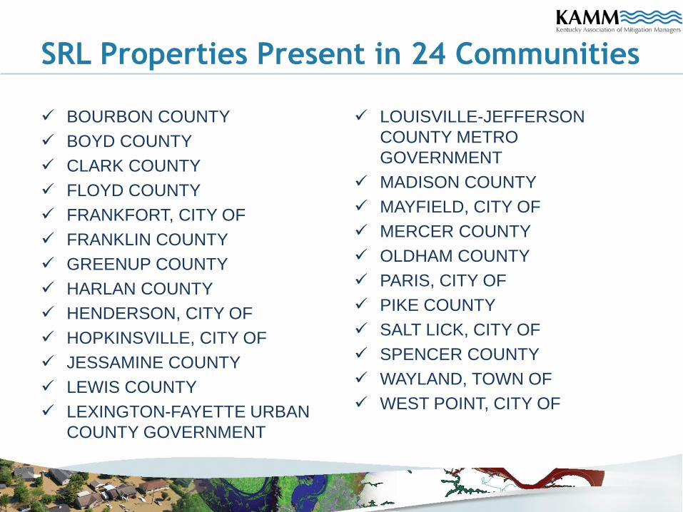
SRL Properties Present in 24 Communities
BOURBON COUNTY
BOYD COUNTY
CLARK COUNTY
FLOYD COUNTY
FRANKFORT, CITY OF
FRANKLIN COUNTY
GREENUP COUNTY
HARLAN COUNTY
HENDERSON, CITY OF
HOPKINSVILLE, CITY OF
JESSAMINE COUNTY
LEWIS COUNTY
LEXINGTON-FAYETTE URBAN
COUNTY GOVERNMENT
LOUISVILLE-JEFFERSON
COUNTY METRO
GOVERNMENT
MADISON COUNTY
MAYFIELD, CITY OF
MERCER COUNTY
OLDHAM COUNTY
PARIS, CITY OF
PIKE COUNTY
SALT LICK, CITY OF
SPENCER COUNTY
WAYLAND, TOWN OF
WEST POINT, CITY OF
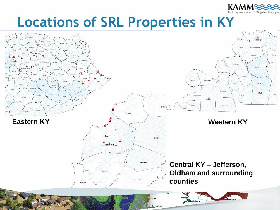
Locations of SRL Properties in KY
Eastern KY Western KY
Central KY – Jefferson,
Oldham and surrounding
counties
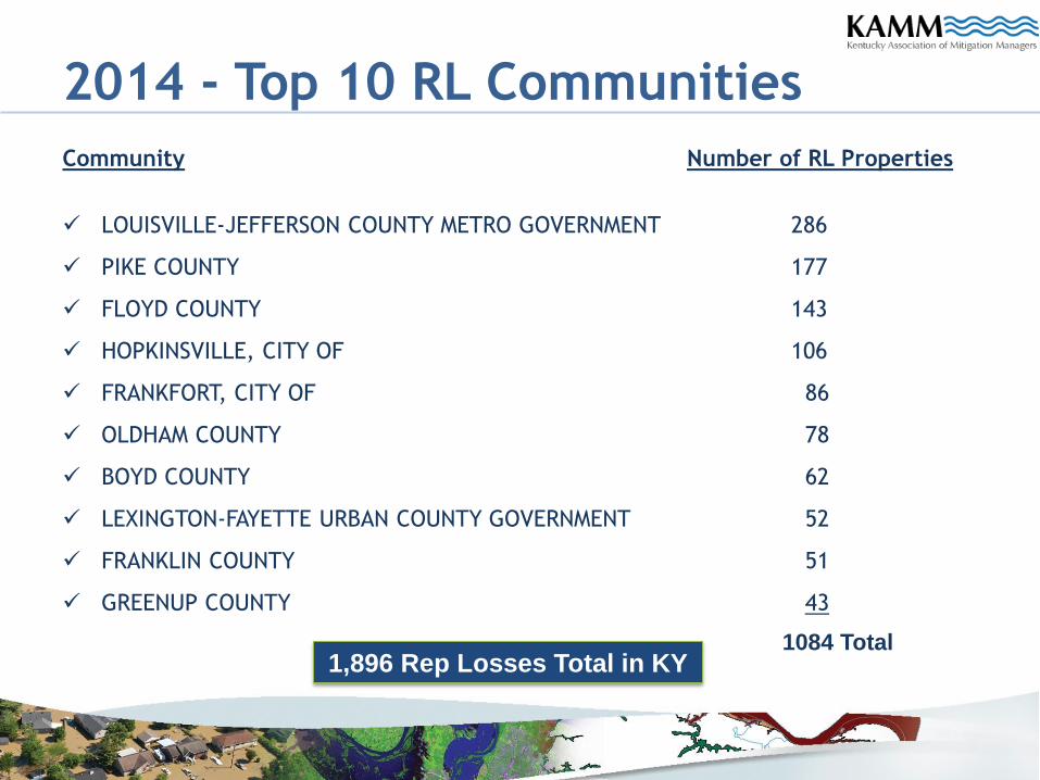
2014 - Top 10 RL Communities
Community Number of RL Properties
LOUISVILLE-JEFFERSON COUNTY METRO GOVERNMENT 286
PIKE COUNTY 177
FLOYD COUNTY 143
HOPKINSVILLE, CITY OF 106
FRANKFORT, CITY OF 86
OLDHAM COUNTY 78
BOYD COUNTY 62
LEXINGTON-FAYETTE URBAN COUNTY GOVERNMENT 52
FRANKLIN COUNTY 51
GREENUP COUNTY 43
1084 Total1,896 Rep Losses Total in KY
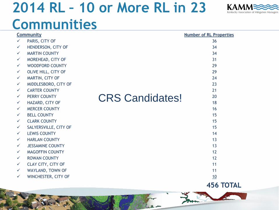
2014 RL – 10 or More RL in 23
CommunitiesCommunity Number of RL Properties
PARIS, CITY OF 36
HENDERSON, CITY OF 34
MARTIN COUNTY 34
MOREHEAD, CITY OF 31
WOODFORD COUNTY 29
OLIVE HILL, CITY OF 29
MARTIN, CITY OF 24
MIDDLESBORO, CITY OF 23
CARTER COUNTY 21
PERRY COUNTY 20
HAZARD, CITY OF 18
MERCER COUNTY 16
BELL COUNTY 15
CLARK COUNTY 15
SALYERSVILLE, CITY OF 15
LEWIS COUNTY 14
HARLAN COUNTY 13
JESSAMINE COUNTY 13
MAGOFFIN COUNTY 12
ROWAN COUNTY 12
CLAY CITY, CITY OF 11
WAYLAND, TOWN OF 11
WINCHESTER, CITY OF 10
456 TOTAL
CRS Candidates!
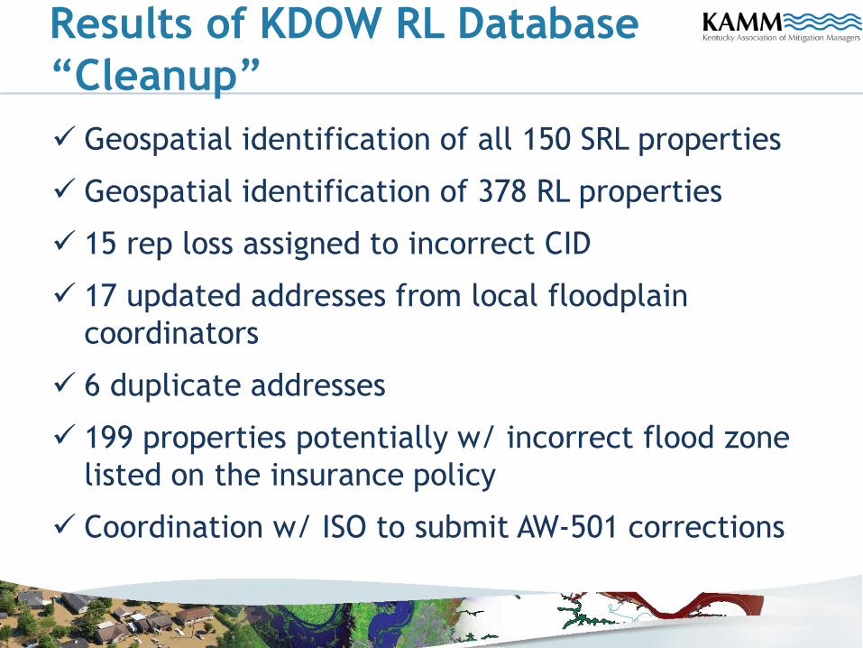
Results of KDOW RL Database
“Cleanup”
Geospatial identification of all 150 SRL properties
Geospatial identification of 378 RL properties
15 rep loss assigned to incorrect CID
17 updated addresses from local floodplain
coordinators
6 duplicate addresses
199 properties potentially w/ incorrect flood zone
listed on the insurance policy
Coordination w/ ISO to submit AW-501 corrections
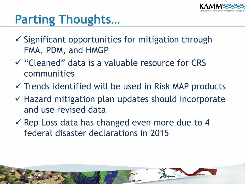
Parting Thoughts…
Significant opportunities for mitigation through
FMA, PDM, and HMGP
“Cleaned” data is a valuable resource for CRS
communities
Trends identified will be used in Risk MAP products
Hazard mitigation plan updates should incorporate
and use revised data
Rep Loss data has changed even more due to 4
federal disaster declarations in 2015
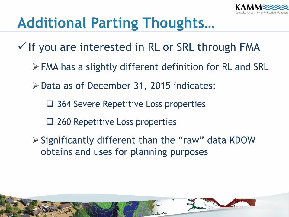
Additional Parting Thoughts…
If you are interested in RL or SRL through FMA
FMA has a slightly different definition for RL and SRL
Data as of December 31, 2015 indicates:
364 Severe Repetitive Loss properties
260 Repetitive Loss properties
Significantly different than the “raw” data KDOW
obtains and uses for planning purposes