proceedings of the - mining history
TRANSCRIPT

PROCEEDINGS
of the 24th ANNUAL CONFERENCE
Rivers of Gold
Cromwell, Otago Region, New Zealand 7-13 October 2018
Editors: Lloyd Carpenter and K.G. McQueen

24th Australasian Mining History Conference 2
7-13 October 2018, Cromwell, New Zealand
© Australasian Mining History Association, 2018 ISBN: 978-1-74088-484-6 Bibliographic reference: Carpenter L. and McQueen K.G., 2018. Rivers of Gold, Proceedings of the 24rh Annual Conference, AMHA, Cromwell 7-13 October 2018, Australasian Mining History Association, Perth. Review Panel Brian Hill Philip Hart Printed at Lincoln University, Christchurch, New Zealand. Front Cover Image: ‘Electric No. 2 Dredge on the Clutha River just below junction of the Kawarau and Clutha Rivers.’ ca. 1900, photograph by J. McEachen.

24th Australasian Mining History Conference 3
7-13 October 2018, Cromwell, New Zealand
Sponsor 24th Annual AMHA Conference

24th Australasian Mining History Conference 4
7-13 October 2018, Cromwell, New Zealand
Presidents Foreword
Rivers of Gold
On behalf of the AMHA Executive and Conference Organising Committee I welcome you to
Cromwell for the 24th Annual Conference of our Association. This will be the third conference
we have held in Aotearoa and I am sure it will be as interesting and rewarding as the previous
two.
The theme of this year’s conference is Rivers of Gold, most appropriate for the Otago
region of the South Island of New Zealand, where much alluvial gold has been extracted from
the modern and ancient rivers. Gold was known to exist in this area by the Maori and signs were
also seen by the early European settlers, but it was the discovery by Gabriel Read at Gabriel’s
Gully in May 1861 that sparked the first major gold rush in New Zealand. By the end of the year
there were 14,000 prospectors on the scene, many of them Australians from the earlier, and by
this time, subsiding rushes in New South Wales and Victoria. Following the rush, Dunedin
quickly, but briefly, became New Zealand’s largest city. Gold mining continues today, with most
recent production coming from the Macraes hard-rock deposit. Total gold production from the
Otago region is estimated at 265 tonnes.
Cromwell, the venue of our conference, was the second area of Otago to be rushed and
remains a substantial modern town, partly moved to higher ground when Lake Dunstan was
created. We look forward to experiencing Cromwellian hospitality and the mining heritage of the
town and environs as part of our extra-curricular activities. The conference organisers have also
organised tours to surrounding sites of mining interest including a full day pre-conference trip to
the Macraes operating gold mine and a post-conference trip to the Northburn - St Bathans Blue
Lake - Oturehua area. There will also be a host of shorter tours during the conference, to other
fascinating and informative mining history sites and museums.
Our annual conferences are only possible with the support and hard work of dedicated
individuals and groups. The Organising Committee, consisting of Lloyd Carpenter, Philip Hart
and Brian Hill have had the responsibility of planning and organising this conference over the
past two years. They have drawn together a program of 21 oral and poster presentations, the
majority related to gold mining and goldfield heritage, which promises to be both informative
and entertaining.
We also rely on the support and interest of the local community where we hold our
conferences, as well as many helpers behind the scene. Special thanks are due to Julie Ward of
Lincoln University for organisational assistance, Sheila Carpenter for catering and Bronwyn
Carpenter for general assistance. Mel Davies, our tireless Secretary-Treasurer, has provided his
usual support and advice. All these efforts and others from within the local Otago community are
greatly appreciated.
Our Keynote Speaker this year will be Dr Heather Bachop, formerly of Heritage New
Zealand and an expert on the history of the Cromwell area. We also thank her for this important
contribution.
I encourage you to enjoy the 24th AMHA conference.
Ken McQueen

24th Australasian Mining History Conference 5
7-13 October 2018, Cromwell, New Zealand
Conference Program Summary 7-13 October 2018
Day Times Activities and Locations
Sunday 10 am-5.30 pm Pre-conference trip (optional) to Gabriel’s Gully and the
historic gold town of Lawrence. Meet at Memorial Hall,
Cromwell.
Monday 8.30-9.30 am
10.00-4 pm
Registration at Cromwell Memorial Hall
Local field trip to Bendigo – Welshtown.
Matilda Track, Aurora-Longtown-Pengelly’s Track.
4.30-6.30 pm Advisory Committee Meeting
Tuesday 8.00-9.00 Registration at Cromwell Memorial Hall.
9.00-10 am Opening session
Keynote presentation.
10.00 am-5.00
pm
Presentations
Wednesday 9.00 am-2 pm Presentations
2.00 pm-6 pm Field trip to Gibbston-Arrowtown – Lakes District
Museum.
Thursday 9.00 am-1.00
pm
Presentations
2.00pm-4.00pm Local Field Trip to Clyde
Free walking tour of Clyde Historical Town (brochure
included).
Meet at the Dunstan Lodge 3pm for a wine-tasting, hosted
by Perseverance Wines
6.00 pm Conference Dinner Victoria Arms Hotel
Friday 9.15-11 am AMHA AGM
11.30 am –
1.00 pm
Presentations
1.30 pm- 5 pm Field trip to Bannockburn
Saturday 9.30 am Field trip (optional) to Northburn - St Bathans Blue Lake.
24th Australasian Mining History Conference 6
7-13 October 2018, Cromwell, New Zealand
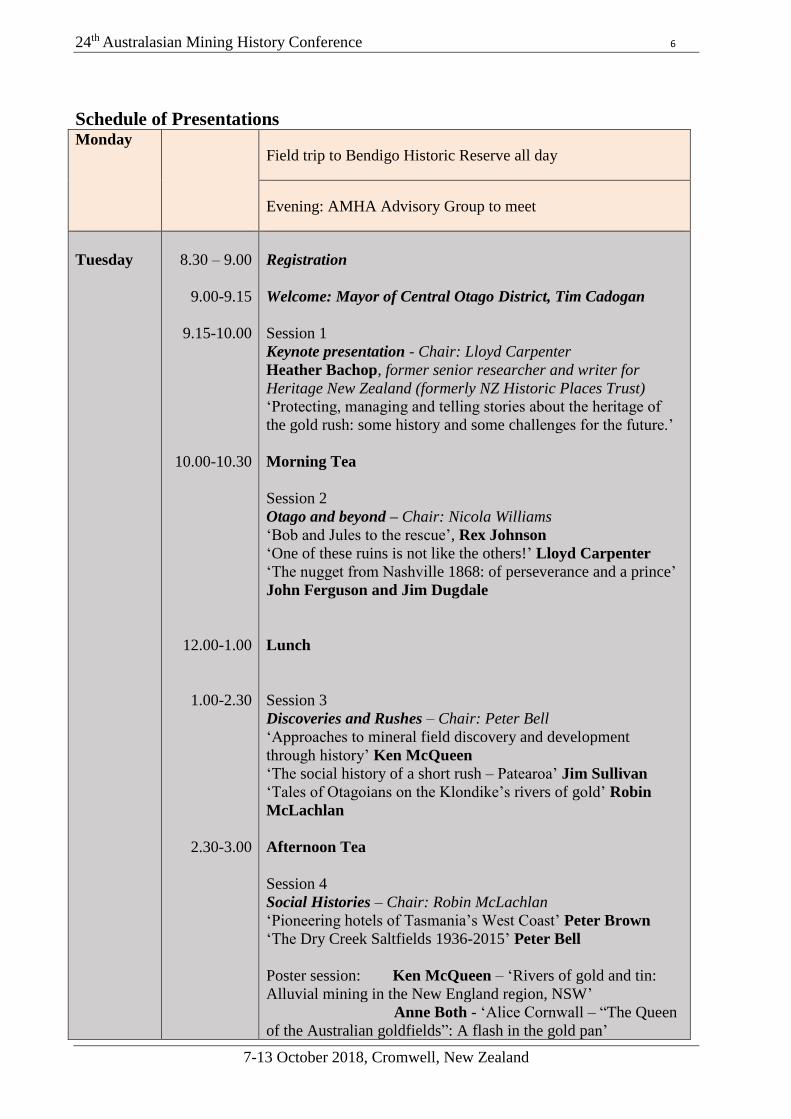
Schedule of Presentations Monday
Field trip to Bendigo Historic Reserve all day
Evening: AMHA Advisory Group to meet
Tuesday
8.30 – 9.00
9.00-9.15
9.15-10.00
10.00-10.30
12.00-1.00
1.00-2.30
2.30-3.00
Registration
Welcome: Mayor of Central Otago District, Tim Cadogan
Session 1
Keynote presentation - Chair: Lloyd Carpenter
Heather Bachop, former senior researcher and writer for
Heritage New Zealand (formerly NZ Historic Places Trust)
‘Protecting, managing and telling stories about the heritage of
the gold rush: some history and some challenges for the future.’
Morning Tea
Session 2
Otago and beyond – Chair: Nicola Williams
‘Bob and Jules to the rescue’, Rex Johnson
‘One of these ruins is not like the others!’ Lloyd Carpenter
‘The nugget from Nashville 1868: of perseverance and a prince’
John Ferguson and Jim Dugdale
Lunch
Session 3
Discoveries and Rushes – Chair: Peter Bell
‘Approaches to mineral field discovery and development
through history’ Ken McQueen
‘The social history of a short rush – Patearoa’ Jim Sullivan
‘Tales of Otagoians on the Klondike’s rivers of gold’ Robin
McLachlan
Afternoon Tea
Session 4
Social Histories – Chair: Robin McLachlan
‘Pioneering hotels of Tasmania’s West Coast’ Peter Brown
‘The Dry Creek Saltfields 1936-2015’ Peter Bell
Poster session: Ken McQueen – ‘Rivers of gold and tin:
Alluvial mining in the New England region, NSW’
Anne Both - ‘Alice Cornwall – “The Queen
of the Australian goldfields”: A flash in the gold pan’

24th Australasian Mining History Conference 7
7-13 October 2018, Cromwell, New Zealand
Wednesday
9.00-10.30
10.30-11.00
11.00-12.00
12.00-1.00
Session 5
Contrasting Experiences – Chair: Ruth Kerr
‘There’s Rust in Them Thar’ Hills’ Rex Johnson
‘Gold, the Great Leveller’ Megan Potiki
‘Two short stays in Old Cromwell: an intersection of hydro-
electric development and mining heritage’ Jim Enever
Morning Tea
Session 6
Chinese Miners – Chair: Nic Haygarth
‘A means to an end: Chinese mining technology on the southern
New Zealand goldfields’ Neville Ritchie
‘The decline of Chinese gold mining on the Turon goldfields,
New South Wales’ Juanita Kwok
Lunch
1-5.30
Field trip to Arrowtown via Cromwell Gorge Mining Centre
Thursday
9.00-11.00
11.00-11.30
11.30-1.00
1.00-2.00
Session 7
Dredging - Chair: Jim Enever
‘Chatto Creek Dredge’ Rex Johnson
‘John Barry, the capable New Zealander’ Gerald Hutton
‘Why Otago developed the bucket ladder gold dredge and not
California’ Nic MacArthur
‘Strakes and ladders: the interchange of bucket dredging people
and technology between New Zealand and Victoria, 1898-1928’
Matthew Churchward
Morning Tea
Session 8
Australia and Beyond – Chair Ross Both
‘The New Zealand Mine Plan Project’ John Taylor
‘Artist at the coal face: Perspectives on the Tasmanian mining
photos of H. J. King’ Nic Haygarth
‘The Golden Blocks Mine, West Wanganui Goldfield, NW
Nelson’ John Taylor
Lunch
2.00-4.00
Field trip to Clyde.
3.00 – 3.45 wine tasting in the Dunstan Lodge hosted by
Perseverance Wines
6.00 Meal (separate charge for this) Talk: ‘My Central: A 50 year

24th Australasian Mining History Conference 8
7-13 October 2018, Cromwell, New Zealand
affair with a goldfield’ Lloyd Carpenter
Friday
9.15-11.00
11.00-11.30
11.30-1.00
1.00-2.00
AMHA AGM
Morning Tea
Session 9 Micro-Histories, A mining Queen, and Five
Frontiersmen – Chair Philip Hart
‘The butcher, the baker and the candlestick maker: The varying
fortunes of goldfields merchants; Lloyd Carpenter
‘The archaeology of failure: Gold in North Devon (United
Kingdom) and the Argentine Smelter (Queensland)’ Peter
Claughton
‘The Gaffney brothers, building, supplying and hosting
Tasmania’s west coast mining fields’ Nic Haygarth
Lunch
2.00-4.00 Field trip to Bannockburn

24th Australasian Mining History Conference 9
7-13 October 2018, Cromwell, New Zealand
Australasian Mining History Association Conference – Excursion Details
Sunday, 7th October – Pre-conference optional trip
Tour to Gabriel’s Gully heritage area and site of the first main gold strike in Otago, 1861. We will also
visit Lawrence (near Gabriel’s) and the Lawrence Chinese Camp (host Adrienne Shaw, Chair of the
Lawrence Chinese Camp Trust). Meet at Cromwell Memorial Hall 9 a.m., ETA return 4:30 p.m. Lunch
provided. This is an extensive trip through the old mining areas of Alexandra, Fruitlands, Roxburgh,
Ettrick, and Miller’s Flat, which is set in some of the most beautiful landscape in New Zealand.
Monday, 8th October - Tour to Bendigo Historic Reserve.
Depart via bus to Bendigo Loop Road, where we will use minibuses to ferry conference delegates up to
Welshtown. We will complete the Matilda walking circuit, meeting back at Welshtown for lunch, then
complete the Aurora circuit after lunch, then using the minivans to ferry delegates back to Bendigo Loop
Road for collection on the main bus back to the Cromwell Memorial Hall. There is a Department of
Conservation ‘long drop’ toilet at Welshtown.
Good walking shoes, a sun hat, sunscreen and a water bottle are essential.
Wednesday, 10th October - Tour to Arrowtown and Arrowtown Chinese village via Cromwell Gorge
Goldfields Centre.
Departing Cromwell Memorial Hall at 1:30 p.m., returning to arrive at 6 p.m.
This trip takes us to a beautiful old goldfields town and tourist centre. There are plenty of opportunities
for gourmet coffee and eating experiences, encounters with heritage buildings and a fully restored
Chinese village. This is also a free panning area, so if anyone wants to try their luck, all gold pans are
available for hire. Bring insect repellent if you are going to do this.
Thursday, 11th October - Tour to Clyde historical town.
Departing Cromwell Memorial Hall at 1:30 p.m., returning 4:30 p.m. this delightful old town has missed
out on much of the redevelopment that has blighted other heritage regions in Central Otago. It offers a
range of buildings and a walking tour of this town is included in the conference publication.
Wine Tasting with Perseverance Wines (http://www.perseverance.co.nz/ ) in the Dunstan Lodge, Main
Street, Clyde. Your host is Jennie Hughes, owner of Perseverance Estate.
Friday, 12th October - Tour to Bannockburn Historical Reserve.
Departing Cromwell Memorial Hall at 1:30 p.m., returning 4:30 p.m. This is an area of extensive alluvial
mining, offering a vast and complex network of water races and old mine sites. Its elevated aspect allows
for magnificent views of the Clutha Basin. There are no toilet facilities in this reserve.
Good walking shoes, a sun hat, sunscreen and a water bottle are essential.
Saturday, 13th October – Post-conference optional trip tour around Central Otago.
Meet at Cromwell Memorial Hall 9 a.m. This day begins with a visit to the Northburn sluicings, the most
extensive and intact herringbone sluicing area in Australasia. This involves a walk of just over 1 km in
each direction. Good walking shoes, a sun hat, sunscreen and a water bottle are essential. We will then
drive past the Earnscleugh Dredge Tailings Historic Reserve, on our way through the old gold town of
Ophir thence to Beck’s, where we will visit the recently restored goldfields-era White Horse Hotel,
finishing at St Bathans, the site of a massive hydraulic elevation mining enterprise. Returning to
Cromwell Memorial Hall for 4 p.m.
Each of the sites we are visiting represent some of the most beautiful as well as some of the most historic
areas of Central Otago. You are therefore encouraged to bring the best cameras, tripods and any other
image-capturing accoutrements that will allow you to show others the details of your incredible stay in
Central Otago.
Central Otago, while very sunny, can equally turn very cold. You are advised to bring a good coat and
hat, to ensure that you are not caught out.

24th Australasian Mining History Conference 10
7-13 October 2018, Cromwell, New Zealand
Extended Abstracts

24th Australasian Mining History Conference 11
7-13 October 2018, Cromwell, New Zealand
‘The capable New Zealander’: Gerald Hutton
John Barry
24 Disraeli Street, Westport, New Zealand.
Gerald Hillsdon Hutton was a respected mining engineer with a lifetime of experience in dredge
design, construction, operation and management. Gerald was one of the dredging fraternity who
left the ‘cradle of gold dredging’ to work in, and promote, the development of the industry
overseas. At the time of his birth, in 1883, Dunedin was the hub of a booming engineering
industry. Among those enterprises was John McGregor’s Otago Foundry to which the young
Gerald Hutton was indentured in 1900. Upon completion of his apprenticeship and marine
engineer certification Gerald worked his passage to the United States.
With connections to the mining industry through his engineering training it is likely that Gerald
was given an introduction to Robert Postlethwaite, Superintendent of the Risdon Ironworks in
San Francisco, and recruited by that Company in 1897 for his New Zealand gold dredging
expertise. After two months in the Risdon machine shops Geraal was given the job of
dismantling a dredge located north of Anchorage and rebuilding it on the Solomon River, east of
Nome. As Alaskan representative of the Risdon Iron Works, he also supervised the construction
of three Risdon gold dredges on the Solomon River in 1910.
Gerald returned to Alaska for the 1912 season to install another Risdon machine on the
Kougarok River. north-north-east of Nome. The dredging potential of the area must have
impressed him for between 1912 and 1914 he and Claus Floden prospected holdings near the
mouth of Henry Creek with a view to installing a Union Construction Company dredge. Hutton’s
connection with the Union Construction Company was formalised in 1914 when he began a two-
year stint as a Company representative. From 1916 until his resignation to join the U S Army
engineers, Gerald was superintendent of the Valdor Dredging Company in California. After
discharge in 1919 Gerald became a staff engineer of the Metals Exploration Company and in this
role was connected with dredging operations in California and Nevada.
In 1928, a time of dramatic corporate and technical changes in the Malayan tin mining industry,
Gerald Hutton was appointed a member of the Board of Anglo-Malaya Tin Ltd. and Technical
Director of Anglo-Oriental (Malaya) Ltd. This position was the highlight of Gerald Hutton’s
career as he was eventually responsible for the technical management of twelve tin dredges.
About 1932 Gerald was transferred to Anglo-Oriental Mining Corporation head office in London
to assist in the investigation and management of Anglo-Orientals interests in British Guiana, the
Gold Coast, Nigeria and Australasia. In mid-1940 the Hutton family returned to San Francisco
where Gerald was employed by the Inspector of Naval Materials. So far, no details have surfaced
of Gerald’s post WW2 activities. Gerald Hutton died in Berkeley, California in 1965.
The author became interested in Gerald Hutton through references to his ability in Clark C.
Spense’s ‘The Northern Gold Fleet’. Information sources used in the compilation of this paper
include on-line mining journals, especially the Mining & Scientific Press and the Engineering
and Mining Journal and archival newspapers. The genealogical website Ancestry.com was also
useful. Assistance given by Nic McArthur, Damian Hynes and Gerald Hutton’s great-niece Judi
Quest is gratefully acknowledged.

24th Australasian Mining History Conference 12
7-13 October 2018, Cromwell, New Zealand
The Dry Creek Saltfields 1936-2015
Peter Bell
Flinders University, Adelaide, South Australia
Most people think of mining as digging holes in the ground, but it takes many other forms. One is
the extraction of minerals, principally sodium chloride, from seawater by evaporation. For nearly 80
years the coastal plain extending north from Adelaide was used for the manufacture of industrial salt
by solar evaporation of water from Gulf St Vincent, an era which has recently ended (Figures 1 and
2). Passers-by saw mounds of glittering white crystals in the distance, but otherwise the process was
unseen and little known to the public. As an industry, salt-harvesting was remarkably silent, still and
unobtrusive, but it made a major contribution to South Australia's industrial development, and to
national self-sufficiency in chemical manufacturing.
Source: South Australian Advertiser.
Figure 1: Location map of the Dry Creek
Saltfields in South Australia.
Figure 2: View of the Dry Creek Saltfields.

24th Australasian Mining History Conference 13
7-13 October 2018, Cromwell, New Zealand
Alice Cornwell – ‘The Queen of the Australian Goldfields’:
A flash in the gold pan
Anne Both
Burnside Historical Society
In nineteenth century Australia it was not usual for young women of talent to venture beyond the
confines of the domestic frontier into financial investment. There were exceptions however,
perhaps the most notable of these was the woman known in the press as ‘Princess Midas’ a
soubriquet derived from her success in investment and operation of the Sulky Gully Mine at
Creswick, Victoria (Figure 1).
Alice Ann Cornwell, born in England in 1852, spent her early life first in Australia and then New
Zealand. Her father George established himself as an engineering contractor. In 1869 the
Cornwell family returned to Australia taking up residence once more in Melbourne, where
George undertook large scale engineering projects, e.g. Jack’s Magazine, Hawthorn Railway
Bridge among others. Alice entered society and soon thereafter married John Whiteman MLA, a
man many years her senior. After a few years and the birth of one child they separated, and her
parents persuaded her to move to England to study music, and also to resume her maiden name.
In 1888 she returned to Melbourne to assist her father in his financial difficulties at the Sulky
Gully Mine Creswick, in which he had invested. Thus began her entry into the financial and
business world of mining. Although her chief influence was in mine investment through
acquisition of numerous leases, she extended her talents to machinery installation and the
purchase of patents. She also floated the British Australian Mining Investment Company on the
London Stock Exchange, as she said to “simplify mine investment “and to encourage investment
in Australian mines.1 Her interest in mining declined after the early 1890s with hints that all was
not as bright as previously reported in the Australian press. The ‘Flash in the Gold Pan’ shifted
her interests to dog and cat breeding in the United Kingdom where she remained until her death
in 1932.
Source: Sovereign Hill Gold Museum Collection.
1 Mining Intelligence Launceston Examiner Saturday 26 January 1889 p.6
Figure 1: Midas Co. Mine c.1889
(Formerly Sulky Gully Mine).

24th Australasian Mining History Conference 14
7-13 October 2018, Cromwell, New Zealand
Pioneering hotels of Tasmania’s West Coast
Peter Brown
PO Box 111, Broadmeadow, NSW, 2292, Australia
It’s natural wilderness that attracts 21st century tourists to Tasmania’s West Coast and earns it the
name the ‘Wild West’. However, in 1890s it was the behaviour of the people in its fledgling
communities that gave it that title.1 In an echo of the then recent American Wild West, the
people at the Tasmanian frontier were painted as rough and lawless.
Like other frontiers, pastural or mineral, Tasmania’s West Coast was remote from established
regions and their civilised values. It was easy to think that the men who communed so closely
with dirt and mud and too infrequently with soap and civilisation had abandoned many social
norms. They did like to drink, often to excess, and found company where they could, normally
in the hotels. However, the popular cliché of the energetic, young population, of mostly men,
was not well deserved.
At the heart of the mythology of the pioneering mining society are hotels. In every new town
like; Zeehan, Dundas, Remine, Queenstown and Strahan; they sprang up like mushrooms after
the frequent rains. Photos show imposing two storey buildings surrounded by forest, huts and
tents. Men crowd the verandahs and balconies.
They were popular but were these grand edifices an elaborate ploy by greedy publicans to seduce
prospectors, miners and idlers and separate them from their earnings? Many thought so.
To find out we follow the twin towns of Zeehan and Dundas over about ten years. In 1891
Zeehan was well on its way to success, only needing a railway to link its riches of lead and silver
to the world. Many said that Dundas would exceed its neighbour. By 1901, the mineral fields
were defined and calamites like wildfire and economic depression had been endured.
Like the miners, the pioneering publicans were attracted by the promise of rich rewards.
Generally, they did do very well in the brief period when the half-formed town was a poorly
served cluster of prospectors’ tents and huts. They had a substantial captive market of miners
who desperately needed food, shelter, liquor and social interaction. For the prospectors and
miners, the hotels were a small seed of civilisation in the wilderness. They were also a safe and
comfortable place for businessmen, speculators and investors who wanted some part of the
mineral booms.
Although the hoteliers were motivated by money they went well beyond purely financial
motivations. They nurtured their communities, encouraged social cohesion, provided charity and
looked to the greater needs of developing towns. Generally, publicans performed many civic
duties and helped turn their rough communities into civilised towns.
For many running a hotel was a vocation that they took from hotel to hotel, from town to town
and from mining field to mining field. The men and women who ran the pioneering hotels were
not greedy and exploitative, they were an essential part of their community.
1 Wilberton Willey, The Wild West of Tasmania, Evershed Brothers, Zeehan and Dundas, 1891.

24th Australasian Mining History Conference 15
7-13 October 2018, Cromwell, New Zealand
One of these ruins is not like the others
Lloyd Carpenter
Faculty of Environment, Society and Design, Lincoln University, New Zealand
The historic reserve at Bendigo is a spectacularly beautiful place of stone ruins, abandoned
cottages and mining machinery foundations scattered across a quintessential Central Otago
landscape of tussock grass and schist outcrops. The reserve’s dusty hills and gullies are
pockmarked by adits, prospecting shafts and mullock piles in mute testimony to the nineteenth
century miners’ pursuit of gold. It is a place with layers of mining history, featuring distinct
areas which reveal the progression from individual creek-bed miners to the sluicing syndicates of
the Aurora and Rise & Shine, the quartz men of the Cromwell, Reliance and Colclough
Companies and finally the Bendigo Gold Light Dredge of the 1930s.
Among the abandoned schist stone cottages, houses and huts is one atypical ruin, the remains of
what was obviously a very substantial house (Figure 1). Unlike other structures which have
given way, tumbling down under the assault of the extremes of the Bendigo climate, it shows
signs of being deliberately wrecked – and not by modern vandal visitors.
This house ruin is evidence of a bitter industrial conflict which tore the small Central Otago
community apart, featuring scenes reminiscent of the Highland Clearances with armed police,
the destruction of houses and the eviction of families. It was the first New Zealand dispute to
escalate into a site-wide strike and lock-out.
I will locate this exceptional ruin in the narrative of Bendigo, revealing it as the legacy of the
divisive events of 1881.
Figure 1. The atypical ruin at Bendigo, Central Otago.
Source: Photograph Lloyd Carpenter.

24th Australasian Mining History Conference 16
7-13 October 2018, Cromwell, New Zealand
The butcher, the baker, and the candlestick maker: The varying fortunes
of goldfields merchants
Lloyd Carpenter
Faculty of Environment, Society and Design, Lincoln University, New Zealand
The idea that goldfields merchants made huge profits during the rush era as a result of
monopolistic pricing, predatory behaviour, and exploitation of their miner clientele is a strangely
persistent one in popular culture and even in some academic thinking.
Using the experiences of a representative group of Central Otago hoteliers, grocers and local
goods manufacturers I will examine this in greater detail. Benjamin Naylor, a butcher and
farmer; Jesse Geer, a baker and restaurateur, and Charles Ziele, a storekeeper and candle
manufacturer, provide useful exemplar histories to test the theory.
I will discuss the commercial and/or mining background of merchants in the gold rush, their
money-lending and capital-raising work, their successes and failures in business and as investors,
and using their example, draw new conclusions about the commercial realities merchant life in
the depths of a gold rush.
Figure 1. Some relevant newspaper
clippings of the time.

24th Australasian Mining History Conference 17
7-13 October 2018, Cromwell, New Zealand
Strakes & ladders: The interchange of bucket dredging people and technology
between New Zealand & Victoria, 1898-1928
Matthew S. Churchward1
1Senior Curator, Engineering & Transport, Museums Victoria
The steam-powered bucketing dredging era of alluvial mining in Victoria began in 1898,
inspired by the emergence of the technology in New Zealand a decade earlier. By 1895 a
speculative dredging boom in Otago and Southland had firmly establishing the reputation of the
great southward flowing waterways of the Clutha and its tributaries as ‘Rivers of Gold’.
While capital and equipment were initially primarily sourced locally, Victorian dredging
companies relied from the outset on New Zealand dredge designs and the recruitment of skilled
New Zealand dredge masters, winch operators and dredge hands. Early experience showed that
equipment designed to operate in the deep fast-flowing rivers of central Otago was not entirely
suited to conditions in Victoria and
significant adaptations were required
before the industry achieved its first
success. Once dividends began to flow, a
speculative dredging boom also took hold
in Victoria, fed ironically by the inflow of
capital and cheap second-hand dredging
plant that became available following the
collapse of the New Zealand boom in
1903. At this point Isaac Stevenson,
partner in the Port Chalmers engineering
firm of Stevenson & Cook, emerged as a
key player shaping the industry in
Victoria and in 1908 formed a partnership
with Chas Ruwolt, of Wangaratta, to
again build dredges locally.
The relationship between the New Zealand and Victorian bucket dredging industries, was more
than a simple one-way flow of capital, technology and people.
Figure 2: Alluvial Mining Bucket Dredges in Victoria, 1898-
1928
Source: Victoria, Annual Report of Mines &
newspaper reports.
Figure 1: Erecting the Barwidgee Bucket Dredge, Myrtleford, Victoria,
circa 1905 S
ou
rce:
Bri
gh
t &
Dis
tric
t H
isto
rica
l S
oci
ety

24th Australasian Mining History Conference 18
7-13 October 2018, Cromwell, New Zealand
The archaeology of failure: Gold in North Wales and North Devon (United
Kingdom), and the Argentine Smelter (Queensland).
Peter Claughton
Department of History, University of Exeter, UK
This presentation will bring together some aspects of mining and ore processing archaeology
which highlight that it is not always the successful enterprises which leave their mark: there are
also the failures!
In the early 1850s, driven by the spectacular discoveries in California and south-eastern
Australia, there were searches made for gold across England and Wales and some viable deposits
were found, particularly in the area around the Mawddach estuary in north-west Wales. Those
discoveries then stimulated trials across north Wales, and parts of south-west England where
gold had been identified as early as the late 18th century. This in turn provided a market for gold
processing machinery - some of which failed to come up to expectation. Three sites, one in
North Wales and another two close to North Molton in North Devon, are examined for evidence
of gold processing and its failure to produce the expected results.
On a similar trend, the boom in silver production in eastern Australia in the 1880s stimulated
searches for that metal across both New South Wales and Queensland, with a range of smelting
processes being used to treat the ores on site. One of those sites, at Argentine in the hinterland to
Townsville, was a total failure. The initial firing of the smelter was abandoned, with the partially
smelted charge still remaining in the furnace. Using archaeo-metallurgical techniques, samples
of slag from that furnace have been examined to try and understand what went wrong and why
the attempt to smelt the ores at Argentine failed.

24th Australasian Mining History Conference 19
7-13 October 2018, Cromwell, New Zealand
Two short stays in Old Cromwell:
An intersection between hydro-electric development and mining heritage.
Jim Enever
CSIRO, retired
In the early 1980s, two hydro-electric projects were under construction or planned for the
Cromwell area with the potential to intersect with the mining heritage of the district. The
construction of the high dam on the Clutha River at Clyde, downstream of Cromwell, threatened
to flood an array of mining heritage sites along the banks of the Clutha and Kawarau Rivers, as
well as the historic gold mining town of Cromwell at their junction. By 1983, work on the dam
was underway when CSIRO was asked to make a geotechnical assessment of potential seismic
activity on a branch of the Dunstan Fault, which had been found to pass through the dam site.
The results of testing at the dam site ultimately contributed to the choice of an innovative design
for the structure to mitigate against the impact of any activity along the fault should this occur. In
anticipation of the filling of the dam, the NZ government instigated, in 1977, a comprehensive
archaeological study with the aim of surveying and assessing as many of the mining heritage
sites under risk of inundation as possible..1 The results of this survey have been used as input to
the preservation of Central Otago’s gold mining heritage.
In 1984, planning was underway for the ‘Kawarau Power Development’, aimed at diverting the
water of the free running Kawarau River through a tunnel to a power station located on the river
downstream of the tunnel, incidentally cutting off a major bend of the river. CSIRO was again
asked to contribute to the geotechnical investigation by conducting tests in a pilot adit, excavated
near the downstream end of the tunnel, results to be used as input to the final excavation design.
In the event, the project did not go ahead, due largely to public outcry at the prospect of
removing the flow from a significant section of the river. If the project had have gone ahead, it
would have mimicked past attempts to do the same thing, aimed at exposing the bed of the river
to allow recovery of the rich gold deposits thought to be present.2
1 Neville A. Ritchie, ‘The Clutha Archaeological Project, 1977-1987’, Summary Report, NZ Historic Places Trust. 2 James C. Parcell, ‘Heart of the Desert, Being the History of the Cromwell and Bannockburn Districts of Central
Otago’, Otago Centennial Historic Publications, 1951.
Figure 1: Location of the
Clyde Dam and proposed
diversion tunnel.

24th Australasian Mining History Conference 20
7-13 October 2018, Cromwell, New Zealand
The nugget from Nashville 1868: Of perseverance and a prince
John E. Ferguson1 and Jim S. Dugdale2
1 Glasshouse View Court, Buderim, Qld. 4556 2 Eel Creek Road, Gympie, Qld. 4580
On 6th February 1868, Valentine Curtis Brigg unearthed a gold nugget in Sailors Gully at
Nashville on the Gympie Creek Diggings (the young Mary River Goldfield), on a claim operated
by George Curtis.1 By 6th April 1868, the nugget had journeyed to Maryborough, Brisbane and
Sydney to be melted down at the Royal Sydney Mint. While referred to as ‘Gympie Creek’,
‘Monster’, ‘Curtis’, ‘Prince Alfred” and ‘Perseverance’ nugget, George Curtis is reported as
proposing the latter name.2 Nashville soon morphed into Gympie.
With a nett weight of 906 ozs., this nugget remains the largest found in Queensland.3 While no
formal description was made, nor any image yet found, press comments imply a size ranging
from 14x8 to 8x5x1 inches and an in-situ position close to a rocky surface. The current
terminology for this country rock is the Pengelly Siltstone, a graphitic siltstone of Permian age.4.
In close proximity to the discovery site, quartz reefs, e.g. the Lady Mary and Caledonia, yielded
bonanza grades of gold.
On about 18th March, 18685, the nugget was privately shown to the visiting Prince Alfred, Duke
of Edinburgh, in Sydney. This allows speculation that a Lord Newry, artist/photographer present
on the day6, may have recorded the event and an image of the nugget remains undiscovered.
The presentation will make some comparisons between features of some other nuggets and large
masses of gold.
1 Maryborough Chronicle, 8th February, 1868; Morning Bulletin, Rockhampton, 8th August, 1929; Record books
wrong, says man seeking name change for nugget, QGMJ, 10th April, 1993; Memoirs of a Queensland Pioneer,
Nugent Wade Brown, Mimeographed Brisbane, 1944, p 35-37. 2 Illustrated Sydney News, 20th April, 1868, p 356; and Maryborough Chronicle, 15th February, 1868. 3 Australia’s Large Nuggets, Gold and Civilization, 2001, p 31. 4 Stidolph P.A., Dugdale J.S..and von Gnielinski F., 2016. Stratigraphy, Structure and Gold Mineralisation in the
Gympie Group at Gympie, Queensland. Queensland Geological Record 2016/05. 5 The Sydney Empire, 19th March, 1868. 6 The Prince and the Assassin: Australia’s first Royal Tour and Portent of World Terror. Steve Harris, Melbourne
Books, 326pp., 2017.

24th Australasian Mining History Conference 21
7-13 October 2018, Cromwell, New Zealand
Artist at the coal face: Perspectives on the
Tasmanian mining photos of H. J. King
Nic Haygarth
Associate, University of Tasmania
Herbert John King (1892–1973) was such a lead-foot that he earned his first speeding caution as
a twelve-year-old—on a bicycle. The Launceston motorcycle mechanic was also crazy about
cameras. On a motorcycle trip through Tasmania’s north-eastern tin fields in 1914 King
catalogued the people and the technology, capturing the only known images of the Chinese tin-
mining village of Garibaldi, including perhaps the only photo of a Tasmanian joss-house in situ;
snapped the buddles in the Anchor tin mine plant; the monitors blasting the faces of the Briseis
mine; and found a bird’s eye view of the dredges working the Pioneer mine.
When King married in 1918, he chauffeured Lucy his bride across the state in the sidecar of his
Indian, using her as a human scale in his bush and mining field landscapes. When parenthood
limited his outings, in 1921 he abandoned the Indian motorbike and took to the skies with ex-
World-War-One daredevil pilot, Captain Fred Huxley. Now he could cover even more territory
much faster. Devising a specialty camera in order to complete the first aerial survey of an
Australian city, King shot hundreds of images from 1000 metres through a hole in the floor of
Huxley’s single-engined Sporting Farman bi-plane.
Today King’s glass plate negatives are being revealed in their full glory for the first time. For the
historian they freeze thousands of moments in time: molten slag spilling into banana carts from
the Mount Lyell converters, while skip tracks snake down into the Iron Blow; the Grubb Shaft
Engine House being devoured by the Tasmania gold mine at Beaconsfield; shale oil works
retorting on either side of the Mersey River; a Garratt locomotive hauling ore beneath
Montezuma Falls on the narrow-gauge North East Dundas Railway. Perhaps it took a petrol-head
to really infuse the visual record with the sounds and smells of the industrial frontier.
Figure 1: Joss house at Garibaldi, north-eastern Tasmania, 1914, by H.J. King.
Source: Queen Victoria Museum and
Art Gallery, Launceston.

24th Australasian Mining History Conference 22
7-13 October 2018, Cromwell, New Zealand
Frontiersmen five: The Gaffney brothers, building, supplying and hosting
Tasmania’s west coast mining fields
Nic Haygarth
Voluntary Associate, University of Tasmania
The five Gaffney brothers, James, John, Michael, Frank and Steve, were at the forefront of virtually
every mining settlement on Tasmania’s west coast in the pre-World-War-One era. Butchers,
drovers, storekeepers, hoteliers, builders, sawmillers, packers, farmers, plus freight, passenger, mail
and road contractors—they were jacks of all trades who almost rode in the prospector’s pocket.
Irish Catholic scions of the farming community of Deloraine, they had an uncanny ability to beat all
comers to the latest mining hotspot. Even the enticingly-named Moores Pimple had a pop-up
Michael Gaffney (1864–1934) store.1
The mantle of most enterprising brother belongs to either the first or the last. James Gaffney (1853–
1913) went from being a tin miner at Mount Bischoff to fronting—with Frank Harvey—the best-
known contracting firm on the west coast. They probably built as many hotels as they licensed.
Frank Gaffney (1867-1928) and business partner James Leach drove fat stock from north-western
Tasmania across the highlands and down the west coast to be butchered at Gormanston and Zeehan.
Later he was so dominant in Balfour’s commercial life that he fielded complaints of monopolisation
from customers and competitors alike.2 In truth he was just sharper than the rest.
Things didn’t always go to plan. Being ‘hands on’ could also be dangerous. In May 1913 Frank
Gaffney almost lost his life packing tin across a flooded river mouth, the non-swimmer surviving by
clutching the tail of his beloved horse Bluey, the only one of his three beasts to make it ashore.3
Steve Gaffney (1869–1940) was bankrupted while storekeeping at Queenstown and hotel keeping at
Linda—but bobbed up again at Williamsford and Balfour. 4 One of Steve’s creditors, James
Gaffney, almost sank with him even while serving as Legislative Council Member for Lyell.5
Worse yet, in 1887 the Supreme Court threw out James’ bid to snatch a share in the Mount Lyell
Iron Blow from a drunken James Crotty—depriving the eldest Gaffney of a fortune.6
It was not until 1924 that, with the departure of John Gaffney (1857–1927) from Strahan, the
brothers took their leave of the western frontier.7 Almost a century on, this paper traces the
Gaffneys’ careers, seeking the secrets of their dominance. It considers their operating methods both
individually and as a family unit, their achievements and the surviving physical legacy of their
careers.
1 ‘Mount Reid and King River gold-fields’, Launceston Examiner, 4 June 1892, p. 2. 2 See, for example, ‘Balfour Correspondent’, ‘Klondyke prices’, Circular Head Chronicle, 9 June 1909, p. 2. 3 ‘Tin miner’s narrow escape’, Mercury (Hobart), 31 May 1913, p. 4. 4 SC84/1/120 (Tasmanian Archive and Heritage Office),
https://librariestas.ent.sirsidynix.net.au/client/en_AU/all/search/results?qu=gaffney&qf=FORMAT_LINCTAS%09F
ormat%09Online%09Online, accessed 2 September 2018. 5 SC84/1/184 (Tasmanian Archive and Heritage Office),
https://librariestas.ent.sirsidynix.net.au/client/en_AU/all/search/results?qu=gaffney&qf=FORMAT_LINCTAS%09F
ormat%09Online%09Online&rw=12&isd=true#, accessed 2 September 2018. 6 ‘Courts: Supreme Court’, Daily Telegraph, 24 August 1887, p. 3. 7 ‘Men and women’, News (Hobart), 28 October 1924, p. 4.

24th Australasian Mining History Conference 23
7-13 October 2018, Cromwell, New Zealand
Otago Goldfields heritage in three short films
Rex Johnson
Heritage Enthusiast, Otago Goldfields Heritage Trust, Cromwell, NZ
This contribution will be in the form of some short films, highlighting different heritage aspects
of the Otago Goldfields. The plan is to view the films and viewed at different times during the
conference.
The Chatto Creek Dredge
After spending many years lying forgotten in the Manuherikia River, an Alexandra group
recovered much of the Chatto Creek dredge remains and shifted its wooden hull out of the river
onto the riverbank. In March 2013 the Otago Goldfields Heritage Trust arranged for all the
dredge remnants to be relocated into a heritage reserve created behind the Chatto Creek Tavern.
This presentation is based on a 15-minute movie which reviews the history of the dredge during
its epic move up the Manuherikia River, along the Otago Central Rail Trail, and into its last
resting place behind the tavern.
There's rust in them thar' hills
A hiker explores remote valleys near Macetown and locates some beautiful rusty goldfields
stamper batteries. In a burst of passion, the hiker aims to identify remnant parts and deduce the
workings or operations of the stampers and the mine sites. Four sites are visited and discussed.
Three of these sites are rarely visited by the public.
The hikers untrained interpretation efforts are shown in a 15-minute movie, in which the identity
and location of the sites is revealed.
Bob and Jules to the rescue
A somewhat 'shaggy dog yarn' perspective of Bob and Jules, the development of their joint
career and their impact on the Central Otago goldfields, and in particular, the Bendigo area.
This yarn is supported by a 6-minute movie of one aspect of their goldfields work, in which the
commonly known names of Bob and Jules is revealed.

24th Australasian Mining History Conference 24
7-13 October 2018, Cromwell, New Zealand
The decline of Chinese gold mining on the Turon goldfield, New South Wales
Juanita Kwok
School of Humanities and Social Sciences, Charles Sturt University, Bathurst, NSW
When the Sydney Morning Herald’s reporter visited the Turon River in 1865, he found a gold
mining population of at least 600 Europeans and 2000 Chinese who dominated the riverbed:
For a length of over 25 miles the bed of the river is now being worked at every spot that
offers the slightest prospect of success and for the greater part of the distance, more
particularly up the river from Sofala, it is completely seamed with races. In fact the whole
of the water of the river is entirely diverted from its bed, and you may cross it almost
anywhere bare-footed.1
By 1871 this had changed. When the English writer Anthony Trollope visited Australia in 1871
and toured the gold fields, he stopped at Sofala, which he described as ‘now a poor little town,
consisting of 644 inhabitants, of whom a considerable portion are Chinese…’2
Between 1861 and 1871, the population of the town of Sofala fell from 1,646 to 644 and the
number of Chinese males in the town fell from 642 to 81.3 The total population of the Sofala
Registry district declined from 4460 in 1861 to 2821 in 1871, but the Chinese population
declined at a much sharper rate from 1877 to 507.4
What caused the mining population, especially the Chinese miners, to leave the Turon between
1865 and 1871? In this paper, I consider various reasons for the departures, arguing that the
departures of alluvial miners, particularly Chinese miners, was chiefly due changes to gold field
regulations beginning with the Gold Fields Amendments Act 1866.
1 ‘Random Notes by a Wandering Reporter XXIV.’ Sydney Morning Herald, 30 September, 1865, viewed 13
August 2018, URL: https://trove.nla.gov.au/newspaper/article/31125454 2 Anthony Trollope, Trollope's Australia" A Selection from the Australian Passages in "Australia and New Zealand"
(Melbourne: Thomas Nelson, 1966; repr., 1966), 125. 3 New South Wales Government, Census of NSW 1861 - Nationality of the People, (Sydney: Historical Census and
Colonial Data Archive 1861), http://hccda.ada.edu.au/pages/NSW-1861-census-05_585; Census of NSW 1871 -
Nationality. 4 Census of NSW 1861 - Nationality of the People, (Sydney: Historical Census and Colonial Data Archive 1861),
http://hccda.ada.edu.au/pages/NSW-1861-census-05_118; Census of NSW 1871 - Nationality.

24th Australasian Mining History Conference 25
7-13 October 2018, Cromwell, New Zealand
Why Otago developed the bucket ladder gold dredge and not California
Nicol Allan MacArthur
Retired Mining Engineer and History Graduate, MAusIMM
54 Greenacres St., Dunedin, New Zealand 9014
The world’s first effective gold dredge appeared on the Clutha River in 1881 utilising steam
power and continuous bucketline digging. Enhancements for pond dredging and tailings stacking
maximised its capabilities, determining it as one of just seven ‘macro-inventions’ that
transformed nineteenth century mining into a bulk industrial activity. Known as ‘the New
Zealand gold dredge’ it rapidly found application worldwide. Why did this superior technology
emerge in isolated pastoral Otago and not in the industrialised United States, which contained
more and larger dredging resources?
Contiguity, claim ideology, and the nature of local expertise are revealed as diagnostic factors.
Otago’s dredging ground was concentrated along the Clutha River; occurred in politically small
claims; and practicably close, a cluster of shipbuilding and gold mining engineering facilities
around Dunedin provided uniquely appropriate services. The resulting several projects,
knowledge sharing, and cumulative operating experience led systematically from the spoon
dredge to the New Zealand gold dredge. America demonstrated the opposite: the dredging
ground occurred dispersed across the West in huge monopolistic claims; the engineering services
lay far distant in the industrial east; and favoured land earthmoving equipment. After starting two
decades before Otago, American developments proceeded sporadically and individualistically,
entering many blind alleys before adopting the bucket ladder dredge a decade after it emerged in
Otago.
More than explaining why the gold dredge emerged in Otago, these findings add a world-class
innovation to Otago’s industrial history. Of wider significance, the paper shows that a large
industrial base was not always necessary for significant technological innovation, and it
challenges narratives of American technological supremacy.
Figure 1: The Dunedin, the first fully engineered steam dredge in New Zealand.
Source:
Hocken Collection
University of Otago,

24th Australasian Mining History Conference 26
7-13 October 2018, Cromwell, New Zealand
Tales of the Otagonians on the Klondike’s rivers of gold
Robin McLachlan
Charles Sturt University, Bathurst, NSW, Australia
Otago was well represented in the Klondike Gold Rush of 1897-99, with Stampeders coming
from Dunedin on the coast through to Otago’s inland communities and gold fields. In this paper
we will accompany Otagonians to the Klondike and share their luck in the search for gold.
Through letters sent home to friends and family, together with New Zealand and Canadian
newspapers and archival records, we are able to recount their Klondike experiences in some
detail. A published diary offers an especially useful insight into the story of William Hiscock.1
William Hiscock and Bert Scheib will be our chief guides for the journey over the passes and
down the Yukon River, with flora and fauna observations offered en-route by Bill McCormack
(Otago Acclimatisation Society). Accounts of work and life on the Klondike will be provided by
several pens (or pencils if the weather is freezing). Only a few, William Pacey among them, will
find their golden reward, while many more will return home perhaps richer in experience but not
in pocket. Archie Christie though may have struck luck later with his “Klondyke Tea” venture in
hometown Gore. A handful will stay on to make a future life in Canada, happily so for Klondike
newlyweds John and Agnes Cormack. Alas, Canada will not offer a happy future for two of their
Otago compatriots. Herbert Herbert will have a tragic encounter with a one-legged Scotsman,
while the fate of James Johnson could have been taken from a Jack London story.
Collectively, the experiences of the Otago contingent offer a surprisingly comprehensive account
of the Klondike Gold Rush, while individually revealing the diversity of characters shaping the
history of both the Klondike and the wider Otago region in the late 19th century.
A list of Otagonians who took part in the Klondike rush
J. Boyle (Gore)
*Archibald Christie (Gore)
John Cormack (Roxburgh)
Ted Gauchet (Alexandra)
Bernard Ginsberg (Nenthorn)
Herbert G. Herbert (Dunedin)
Robert Hicks (Tuturau)
William Hiscock (Roxburgh)
James Johnson (Skippers)
Adam Jowitt (Clutha)
William McCormack (Tapanui)
*Jim McKenchie (Gore)
D. Miller (Queenstown)
William Pacey (Alexandra)
Albert Scheib (Cromwell)
*William Smaill (Gore)
Agnes Spiers (Roxburgh)
John Newton Storry (Lawrence)
M. Wood (Clyde) (*Went to the Atlin Rush, northern B.C., via the Klondike Trail, 1898)
1 Francis William Hiscock, A Kiwi in the Klondike: Memories from the Diaries of Francis
William Hiscock. Stella M. Hull, Waiuku, N.Z.,1993.

24th Australasian Mining History Conference 27
7-13 October 2018, Cromwell, New Zealand
Approaches to mineral field discovery and development through history
Ken McQueen
IAE, Faculty of Science and Technology, University of Canberra, ACT, 2601
Throughout mining history there have been various approaches to mineral discovery and mineral
field development. The different approaches reflect the evolution of economic, socio-political
and management structures, as well as changes in the science of ore discovery and mineral-
related technology. Common features can be recognised that allow these approaches to be
grouped into five key models. The models represent end members and elements of more than
one model appear in the history of some mineral fields. Historical development of the models
has not strictly followed a linear progression, although some have been more in vogue at
particular times. The five models can be summarised as follows.
1. The ‘Casino’ model. In this model discovery is by basic observation, guided by analogy with
known mineral deposits and environments. Development is typically small-scale, low-tech and
commonly reliant on perseverance or luck for success. There is little understanding or regard for
the environmental impact of mining. Examples include the alluvial gold rushes of the 19th
Century and modern artisanal mining in third world countries.
2. The ‘Emperor’s New Clothes’ model. This model is characterised by either fortuitous or
directed discovery, in some cases, needs-driven. Development is by a central authority with
crown or state funding. In some cases development and production are subsidised for strategic or
social purposes. There may be consideration of the environmental impact of mining through the
central authority. Examples include the mines of Laurion in ancient Greece, the crown-owned
silver mines of Kongsberg and state-operated mines in the former Soviet bloc.
3. The ‘Bootstrap’ model. Discovery in this model is typically by systematic prospecting of
new frontiers, as well as areas of known mineralisation. Discovery is followed by staged
development using funds generated from the resource itself, and often relying on early mining of
high-grade ore. Generally there is no, or limited, consideration of the environmental impact.
Examples include a number of mining fields developed in Australia during the 19th Century,
such as the Barrier Ranges silver-lead field and some gold and copper deposits.
4. The ‘Safari’ model. The Safari model features location planned discovery and development
by well established and capital funded groups, using scientific methods and knowledge of global
geology. The level of control on environmental impact is variable, depending on location and
local regulation. Examples include exploration and mine development by companies and
consortia in the 19th Century colonial era and during the 1960s mineral boom in Australia.
5. The ‘Sustainable Planet’ model. This model involves discovery within a global context
using rapidly evolving exploration technology, the exponential increase in Earth system
knowledge and digital data management methods. Development requires major and long-term
capital funding and is guided by a need for more sustainable resource use and social licence. The
model is characterised by an increasing level of government regulation, as well as public
awareness and scrutiny, particularly related to environmental impact. Examples include ‘big
mining’ by global companies, (e.g. BHP-Billiton, Riotinto, Vale), as well as the activities of
smaller players ‘below the radar’ in developing countries.
These models provide a framework for recognising and understanding different approaches to
mineral discovery and development that could better inform and clarify mining history.

24th Australasian Mining History Conference 28
7-13 October 2018, Cromwell, New Zealand
Rivers of gold and tin: Alluvial mining in the New England region, NSW
Ken McQueen
IAE, Faculty of Science and Technology, University of Canberra, ACT, 2601
The New England region of New South has been a significant producer of gold and tin,
particularly prior to 1914. Much of the gold and most of the tin has come from alluvial deposits
concentrated during weathering and extensive erosion of numerous, small or low-grade primary
deposits associated with the widespread granites of the region. The alluvial deposits were found
in the recent drainage, but also in buried deep leads. Production of alluvial gold exceeded 21.5
tonnes (691,120 ozs) and that of tin more than (as tin oxide concentrate) 200,000 tonnes.1
Gold discovery in New England was prompted by the first gold rushes to the Bathurst area of
central New South Wales in the autumn of 1851. Fearing loss of business from an exodus to
these diggings, reward committees were set up by local businessmen to promote the discovery of
gold in the Hunter River and New England areas. In September 1851 gold was discovered at
Swamp Oak Creek, tributary to the Peel River 24 km east of Tamworth. Subsequent discoveries
followed rapidly. The most important alluvial fields were along the Peel River and at Nundle and
Hanging Rock, at the Rocky River (Uralla) and on the Timbarra River (east of Tenterfield).
At Rocky River, early mining was along the course and tributaries of the river for 7.6 km, but in
1856 Thomas Jones, or possibly his wife, found the first gold-bearing deep lead beneath a basalt
hill east of the river. Other deep leads were found in the surrounding area, including at Mts
Welsh, Harris, Brisbane, Beef, Mutton and Marsh and at Tipperary Hill, Doherty Hill and
Sydney Flat. These deep leads in buried Tertiary valleys were richer than the recent alluvial
deposits, resulting in a major revival of the Rocky River field. In the period 1856-1860, 120,000
oz of gold were produced, mostly from deep lead mining. Near the end of 1856 the population of
the field peaked at 3,500, including 2,500 miners. From 1857, parties of Chinese miners began
arriving at Rocky River and they contributed significantly to later production.
The earliest discovery of tin in the New England region is shrouded in mystery. In 1873, James
Daw claimed he had found tin on a tributary of the Severn River in 1849. W.B. Clarke reported
the occurrence of alluvial tin with gemstones in the catchment of the Macintyre River during his
exploration of the northern goldfields in 1853. These and other early discoveries were not
followed up until 1871-1872 when large exploitable deposits of alluvial and reef tin were
discovered at Elsmore, Oban, Tingha, Vegetable Creek (Emmaville) and Stannifer in northern
New England, and at Stanthorpe across the present Queensland border. Cornelius McGlew was
instrumental in promoting the early discoveries at Elsmore and Stanthorpe. One of the most
important finds, made by Thomas Carlean a piano tuner, was at Vegetable Creek. Here early
mining was focussed on a shallow alluvial lead in the swampy valley, but later the famous
Vegetable Creek deep lead was discovered to the west, beneath basalt lava flows.
An interesting aspect of tin mining in New England was the involvement of large numbers of
Chinese miners, many of whom had previously worked on the alluvial goldfields. Between 1877
and 1890 more than 3,000 Chinese worked on the New England tin fields.
After 1900 many of the alluvial gold and tin fields were worked and re-worked by hydraulic and
bucket dredging, using technology first developed and perfected in the New Zealand goldfields.
1 References relevant to this article are listed in K.G. McQueen, 2018. Mining history of the New England Region
1:750 000 Scale Metallogenic Map. Geological Survey of New South Wales, Maitland, NSW, Australia.

24th Australasian Mining History Conference 29
7-13 October 2018, Cromwell, New Zealand
Gold, the great leveler
(He Iwi Tahi Tātou)
Megan. K. Pōtiki
School of Māori, Pacific and Indigenous Studies, Te Tumu, University of Otago, 362 Leith Street, Dunedin, 9016,
New Zealand
In 1863 my great great grandfather, Rāniera Ellison, found 300 ounces of gold on the Shotover
River. His dog had fallen in to the river and when he surfaced his coat revealed gold dust.1 By
night fall Raniera and his friend Hakaraia Haeroa uncovered a significant weight in gold.2
Consequently Māori Point in the Shotover River, Queenstown was named after Rāniera and this
event. Rāniera Ellison, was a halfe caste Māori male born in 1839 in Korohiwa, the Wellington
area. In an environment that was rapidly changing for the indigenous people of New Zealand, the
gold-find allowed Rāniera to forge a path of success for himself and his family. Infact Rāniera’s
instant wealth transfromed his life and his legacy lives on today within his Māori community,
Ōtākou.3
During the early years of European settlement, prior to the establishment of government, Maori
flourished in the free-trade environment. But in a climate where colonisation and Western
democracy had disenfranchised individual Māori from political power and the capital to
participate in the new economy goldmining offered a chance at economic success. It was an
opportunity that was not impeded by class, status or ethnicity. Goldmining allowed Māori an
equal footing with Europeans, free of restrictions and tarriffs.
Rāniera was not the only example of a Māori goldminer in this time period. In fact many Māori
enthusiastically took up the opportunity relishing the chance of finding their fortune. In fact there
are many accounts of Māori working in the goldfields. I will discuss Māori involvement in the
New Zealand goldrush and I will argue that Rāniera’s gold discovery was the most influential
factor in the Ellison family success. It enabled steady income, well maintained and productive
lands, good housing, great education and social mobility. All of this opportunity was far
reaching and inter-generational and was directly related to Rāniera’s gold.
1 Pers.com. Edward Ellison 2 Pyke, Vincent, Secretary of Gold Fields, Otago Daily Times, Report on the Gold Fields of Otago, Issue 572, 17,
https://paperspast.natlib.govt.nz/newspapers/ODT18631017.2.33?items_per_page=10&phrase=0&query=Maori+Po
int+Ellison&sort_by=byDA, 1863, 10 p. 3 Tipa, Rob, Fortune favours the brave, Te Karaka Magazine, Issue 78, 2015, pp 28-29. http://ngaitahu.iwi.nz/wp-
content/uploads/2015/10/TeKaraka67.pdf

24th Australasian Mining History Conference 30
7-13 October 2018, Cromwell, New Zealand
A means to an end: Chinese mining techniques and technology on the
southern goldfields of New Zealand
Neville A. Ritchie
Archaeologist, Dept of Conservation, Hamilton, New Zealand
This paper examines the factors that compelled many Chinese men in the nineteenth century to
forsake their homeland and try their hand on the goldfields around the Pacific Rim. It
backgrounds the legacy of knowledge about mining and water manipulation in China, and the
learnings and adaptations they quickly made to mine successfully. The main mining methods
areoutlined, and how they differed in some cases from the strategies employed by European
miners. The paper highlights the significant contribution and legacy of the Chinese miners in the
development, expansion and productivity of the historic southern goldfields of New Zealand.
Figure 1. Cromwell ‘Chinatown’, ca. 1908.
Figure 3. Another view of Cromwell ‘Chinatown’ ca. 1908.
Figure 2. Unknown Chinese miner,
Molyneux River ca. 1905.
Source: All photos
Ron Murray Collection,
Cromwell Museum.

24th Australasian Mining History Conference 31
7-13 October 2018, Cromwell, New Zealand
After the wash up: The legacy of the miners in a small town
Jim Sullivan
Broadcaster and Historian, Patearoa, Otago, New Zealand
For many remote corners of New Zealand the gold rush was not the first step in building a
thriving modern settlement, as happened at places like Bendigo or Queenstown. But, wherever
the miners gathered, something about them usually ensured that the rush became the site of a
township, which would far outlast the gold ‒ as long as the strike was in the right sort of place.
Some rushes to hard places left only ghost towns, like Macetown near Arrowtown, where only
the old school master’s house and bakehouse remain, or Hamiltons in Maniototo where there is
almost no remnant of the mining days, not even a ghost. Somewhere in between are places that
survived as small towns, in despite the gradual dwindling of the gold returns. One such is
Patearoa in Maniototo, sitting under the shelter of the Rock and Pillar Range. That Patearoa (then
called Sowburn) still thrives is largely due to that very shelter. In his first report on the Sowburn
gold field, Warden Charles Broad, while focussing on the likely amount of gold to be found,
ended with, ‘the Sowburn which, perhaps for climate, picturesque position, and facilities for
obtaining water, may compare favourably with any other gold field in the Province.’1
During the brief rush of 1863-64, Sowburn had conformed to the image of the hard-living gold
town with tented shelters, grog shanties and even the town’s one and only murder.2 But, once the
panning, cradling and, then, sluicing had won almost all of the easy gold, so pleasant was the
location that many of the 600 miners stayed on as permanent settlers. Cottages of sun-dried brick
sprang up and miners with extra abilities, such as Henry Scherp who had been a baker in the
household of Prince Albert. Henry built a bakehouse which still stands. George Simpson took up
his old trade of cobbling and carpenter William Chirnside added his skills to the building of the
township. Most of these men continued to work small claims, but when plots of arable land
became available in the 1880s the large sheep runs gave way to family farms. When Patearoa
Station was cut up in the early 1900s some gold miners became substantial land holders.
By the turn of the century, the rough and ready mining camp had become a small village with a
pub, shop, school, smithy, and later than some gold towns, a library and church. The legacy of
gold mining was not erased however. The town still had Chinese miners fossicking up the creek
and living in stone shelters, which can still be seen. Some old miners, missing out on marriage in
a region where women were scarce, lived out their days as hatters or just hard cases. Like ex-
convict Tom Lewis who lived, winter and summer, in a rock shelter by the side of the Sowburn,
and who amused the local lads by holding a live coal to light his pipe and who would show his
flogging scars to any interested visitor.
Fossickers still find gold in Patearoa, but the real legacies of the golden days are the farming
families who never forget that great-granddad was a miner. A display outside the Patearoa Hall
makes the point – beside a giant nozzle from the sluicing days is a plaque with a poem by David
McKee Wright who rose to be literary editor of the Sydney Bulletin but never wrote anything
better that his Patearoa poems:
‘You talk of the men who spoke and wrote, we give them their praises due,
And the men of the fleece and the axe the plough had a mighty work to do;
But the silent army of claim and mine were the meu who led the way.’
1 Otago Daily Times 6 September 1864 2 Jim Sullivan, Patearoa Papers Volume One The 1860s, Rock and Pillar Press, Patearoa 2014.

24th Australasian Mining History Conference 32
7-13 October 2018, Cromwell, New Zealand
The New Zealand Mine Plan Project
John Taylor
Subsurface Investigations and Mineral Resources Consultant Western Ventures (2013) Limited
22 Munson Street, Reefton, 7830, New Zealand
The Pike River Royal Commission found regulation of mine planning was lacking, with
insufficient focus on mine plan compliance and health and safety requirements. It recommended
that regulators collaborate to ensure that health and safety is considered as early as possible and
before permits are issued, and that the Crown Minerals regime should be changed to ensure that
health and safety is an integral part of permit allocation and monitoring.
Mine plans map the layout of an underground or opencast mine and are important deliverables
from the minerals industry. This ensures both operators and regulators have oversight of mining
activities ensuring that factors such as health and safety, environmental, and resource
optimisation are all taken into account when assessing annual reporting compliance or permit
applications.
In addition to current mine plans, historic plans from around New Zealand have been catalogued
from museums, libraries and private collections to be discoverable in a central repository. Mine
plans more than five years old and historic plans are available for the public to view and use.
“What we now have are robust standards for when mine plans are submitted, a repository for all
current plans and a catalogue of historical plans – and as a result much improved access to
important information for government agencies, local authorities, mine operators and the
public,” says Paul Hunt, Chief Inspector Extractives at WorkSafe’s High Hazards and Energy
Safety Unit.
For the last four years I have been flat out working for New Zealand Petroleum and Minerals
tracking down, cataloguing of all the remaining mine plans and mining-related plans of New
Zealand employing high resolution, colour lasing scanning of the best of these identified plans.
The website site has just gone live with 3500 plans and this will grow shortly to 6000 plans
(https://mineplans.nzpam.govt.nz)
This has a one-man effort (me!) over this four-year period and has involved visiting and
cataloguing the entire contents of all the museum /archives /libraries /private and company mine
plan collections throughout the whole of New Zealand. A different team were involved in setting
up the public-accessible website.
My work on this project has essentially been completed but it is expected that more people still
holding plans will make themselves known has the knowledge of the websites becomes better
known.

24th Australasian Mining History Conference 33
7-13 October 2018, Cromwell, New Zealand
Notes

24th Australasian Mining History Conference 34
7-13 October 2018, Cromwell, New Zealand
Field Trip Program
Field Trip Schedule 7-13 October 2018
Day Times Activities and Locations
Sunday 10 am-5.30 pm Pre-conference trip (optional) to Gabriel’s Gully and the
historic gold town of Lawrence. Meet at Memorial Hall,
Cromwell.
Monday 9.30 am – 4.00
pm
Local field trip to Bendigo – Welshtown.
Matilda Track, Aurora-Longtown-Pengelly’s Track.
Wednesday 2.00 - 6 pm Field trip to Gibbston-Arrowtown – Lakes District
Museum.
Thursday 2.00 - 4.00 pm Local Field Trip to Clyde
Free walking tour of Clyde Historical Town (brochure
included).
Meet at the Dunstan Lodge 3pm for a wine-tasting, hosted
by Perseverance Wines.
Friday 2.00 – 5.00 pm Field trip to Bannockburn.
Detailed Information
Saturday, October 6 (optional self-drive pre-conference tours):
Self-drive visits to areas of goldfields interest:
• Skippers Canyon jetboat trip https://www.skipperscanyonjet.co.nz/
• Bike sections of a bike trail! http://www.otagocentralrailtrail.co.nz/
• Clutha River jetboat cruises http://www.clutharivercruises.co.nz/
• Gabriel’s Gully Historic Reserve, Lawrence (also China Town Reserve)
• Museums worth visiting: Central Stories (Alexandra), Clyde, Naseby
• 4WD tour to Historic Macetown
https://www.nomadsafaris.co.nz/tours/gold-heritage-4wd/macetown
Sunday, October 7 (optional organised pre-conference tour):
tour of to Gabriel’s Gully and the historic gold town of Lawrence and heritage area (departure
from Cromwell; meet outside Memorial Hall 10am) which is a significant heritage opportunity.
Note: (1) there will be a separate cost for this trip (to be advised)
(2) strictly by advance booking, as we will need to make mini-bus transport arrangements.
Monday, October 8 (first official day of conference):
8.30 – 9.30am Meet at Cromwell Memorial Hall for registration, meet & greet.
10am depart via bus for walking tour of Bendigo Historic Reserve. 9.30am for 10am departure.
• We will use two mini-buses to ferry delegates from Bendigo Dredge ladder to Welshtown
car-park. Self-drive option available if this is wished.

24th Australasian Mining History Conference 35
7-13 October 2018, Cromwell, New Zealand
• The walking area is not particularly hard, but there are some reasonable distances to
cover. Good walking shoes strongly recommended.
• First walk 11am – 12.30 Matilda track, return to Welshtown carpark for lunch. Long-
drop DOC toilet available here only.
• Picnic lunch. (the less mobile may choose to return to Cromwell instead of the second
track. Please advise if you intend taking this option, as transport arrangements must be
made in advance).
• 1.15 – 3.15 pm Aurora/Logantown/Pengelly’s track, return to Welshtown carpark.
• Mini-bus ferry down to foot of hill. Bus 4pm back to Cromwell for a cuppa and catch-up
registrations.
Guide: Dr Lloyd Carpenter (Bendigo was the focus of his 2010-2013 PhD)
Wednesday, October 10:
9.00 am -2.00 pm presentations then bus tour for all delegates (note that the venue is not
available to us for Wednesday evening due to a regular booking).
Beginning at Cromwell, head west to the Goldfields Centre (guided tour, reconstructed Chinese
village, gold panning opportunity: admission charge included in conference fee), then via
Gibbston to Arrowtown and the Lakes District Museum, Chinese village and the Arrowtown
historic precinct. Return to venue for 6:00 p.m.
Friday, October 12:
9.00 am- 1.00 pm presentations
1.30 pm bus to Bannockburn Historical Reserve 2.00-4.00 pm Return to venue 4.30 pm (unless a
visit to the Bannockburn Hotel is desired on the way back…), Guide: Lloyd Carpenter
Venue for the week
(http://www.centralotagonz.com/cromwell-bannockburn/cromwell/community-
facilities/x,1,4133/cromwell-memorial-hall.html )
Saturday, October 13 (optional organised post-conference tour):
Meet at venue 9.30 am for 10 am departure via bus.
Beginning at Cromwell, we head east and north to Northburn herringbone tailings historic
reserve (this is a 1km each way walk), then back on the bus to goldfields Memorial, then
Earnscleugh dredge tailings historic reserve, Beck’s White Horse Hotel, Cambrian’s school,
finishing at the St Bathans Blue Lake and Vulcan hotel picnic lunch or buy lunch at the
Vulcan, returning via Golden Progress Reserve and the Hay’s Engineering works, Oturehua.
Back at the conference venue at 4pm.
Sunday, October 14 (optional self-drive post-conference tours):
Self-drive visits to areas of goldfields interest:
• Skippers Canyon jetboat trip https://www.skipperscanyonjet.co.nz/
• Bike sections of a bike trail! http://www.otagocentralrailtrail.co.nz/
• Clutha River jetboat cruises http://www.clutharivercruises.co.nz/
• Gabriel’s Gully Historic Reserve, Lawrence (also China Town Reserve)
• Museums worth visiting: Central Stories (Alexandra), Clyde, Naseby
• 4WD tour to Historic Macetown
https://www.nomadsafaris.co.nz/tours/gold-heritage-4wd/macetown/

24th Australasian Mining History Conference 36
7-13 October 2018, Cromwell, New Zealand
Site Locations
Figure 1: Map of the Otago Goldfields region, south island New Zealand.

24th Australasian Mining History Conference 37
7-13 October 2018, Cromwell, New Zealand
Site Descriptions
Gabriel’s Gully
Source: NZ Dept. of Conservation
From: https://www.doc.govt.nz/parks-and-recreation/places-to-go/otago/places/gabriels-gully-historic-reserve/
Gabriel Read’s discovery of gold in an Otago valley in 1861 changed the course of New Zealand
history. Gabriels Gully was the site of the first major gold find in Otago which led to the gold
rushes of the early 1860s which transformed the province, making it the wealthiest in New
Zealand. It triggered the country’s first major gold rush with a wave of prospectors descending
on the gold fields. The population of Dunedin rocketed and Otago was transformed into the
wealthiest province of New Zealand. The economic spin-off from gold mining was a massive
boost to the young New Zealand economy.
Read's gold discovery was just the tip of a vast gold deposit. There was so much gold and it ran
so deep that it took 70 years and a succession of more elaborate technologies to get to the bottom
of the deposit. The revolutionary Californian technique of hydraulic elevating was pioneered
here in 1879. Elevators working like giant vacuum cleaners sucked up the gold-bearing gravel
from underground forcing it up under high water pressure.
Gabriel Read's gold find 1861
Prospector Gabriel Read (1825-1894) found gold in the gully on 25 May 1861. Read was
equipped with a 'tin dish, a butcher's knife and a spade' digging in the creek bed. After working
through a metre of gravel Read reached soft slate, and in his well-known words 'saw the gold
shining like the stars in Orion on a dark frosty night.' This discovery changed the future of
Otago.
Early gold mining 1861-1862
Hundreds of people left their jobs and flocked to the gold field; 256 ships arrived at Port
Chalmers in 1861 carrying hopeful prospectors. There was a 100 km walk between Dunedin and
the Tuapeka gold fields in often harsh conditions carrying supplies.
Early photographs of Gabriel's Gully show a scattering of tents on the valley floor and the lower
slopes of the surrounding hills, with piles of stones from the individual workings like mole hills
across the valley floor. The first claims were 24 ft (8m) square, worked with a cradle or pan to
separate the gold from the wash dirt. The life of the alluvial gold miner is the stuff of national
imagination: their distinctive lifestyle based around chasing the illusive ore, working hard,
playing equally hard, with a sense of adventure, shaped the identity of Central Otago.
Gold returns from Lawrence (and this is not just the Gabriel's Gully field) were 171,038 ounces
in 1861 and 199,547 ounces in 1862, thereafter dropping away. As a consequence Otago became
the wealthiest and most populated province in the country.
Developing the gold mine
By 1863 this was no longer a field for individual miners as more elaborate technology was
required to extract the gold. Companies were formed and sluicing and later, blasting, became the
dominant method of mining. By 1865 there were 542 miles (872 km) of water races at the
Tuapeka goldfields.

24th Australasian Mining History Conference 38
7-13 October 2018, Cromwell, New Zealand
Mining using hydraulic elevating began at Gabriel's Gully in the 1880s enabling old tailings to
be reworked with a small labour force. Seven major companies were involved in the 1880s.
These ventures were combined into the Blue Spur and Gabriel's Gully Consolidated Company in
1888. This company operated until 1912 when it was finally wound up having won 51,500 oz
gold.
In 1911 the jubilee of Gabriel Read's discovery was celebrated with processions and a reunion of
the 280 surviving miners from 1861. Over 2500 people attended the festivities.
Later mining
There was some mining during the Depression years of the 1930s when individual miners
returned to the 1860s technology, mining with pick, shovel, pan and cradle. Mining finally ended
in that decade, making Gabriel's Gully and the associated Blue Spur the longest operative
goldfield in Otago.
Figure 2. Gabriels Gully and miners’ tents in 1861, view to the south.
Source: Otago Witness, 31 May 1921.

24th Australasian Mining History Conference 39
7-13 October 2018, Cromwell, New Zealand
Lawrence Chinese Camp
Helen McCracken, NZ Historic Places Trust,
from http://www.heritage.org.nz/the-list/details/7526
The site of the Chinese Camp at Lawrence has significant historical value. It represents an
essential aspect of Chinese experience of goldfield's life in Otago, providing insight into this
culturally important part of New Zealand history. Another important Chinese camp at Cromwell
was drowned by the hydro-lake, Lake Dunstan, created by the Clyde Dam, making this extant
site an even more important remnant of the past.
Chinese miners' lives in goldfields Otago has taken on an iconic status mainly associated with
the image of lone old men at the decline of the goldfields. The Chinese Camp site provides the
opportunity to interpret aspects of Chinese life as a community. The former hotel, associated
outbuilding and an already registered ex-Joss house in Lawrence are the only buildings left
associated with the site. The buildings and the archaeological remains provide insight into a
diversity of experience, from relatively wealthy (and accepted by Europeans) hotel owner Sam
Chiew Lain to the modest hut site remains in the township. The camp also provides a link with
stories about Chinese miners and connections between the camp and life on the surrounding
goldfields.
Archaeological Significance:
The former Chinese Empire Hotel and associated outbuilding are the only buildings left on the
site of the Camp. The hotel was designed by a prominent Dunedin architect and is a rare Otago
example of such a building built on this scale in a rural setting for a Chinese client. While it
is not outstanding architecturally, particularly given its later modification into a residential
building, its position in the Chinese Camp, and as a mixing place for the Chinese and European
clients, makes it significant. The camp's site on poor quality land on the outskirts of town makes
a significant statement about European attitudes to the Chinese miners during the goldrush
period. Its location has significance in the landscape of Lawrence as a whole (as a community
exiled from the township).
The site of the Lawrence Chinese Camp is highly archaeologically significant. According to SO
8034 there were around 32 small buildings of various types on site, as well as the hotel.
Archaeologically it appears to have never been ploughed or disturbed significantly. The major
areas of modern disturbance in the main "camp paddock" are outside the main camp area (judged
by using overlay of 1882 plan on archaeological plan). This is therefore a virtually complete and
intact archaeological site of an entire community. The value of this should not be underestimated
as it has enormous archaeological potential for research, interpretation and public interpretation.
Other Chinese settlements are known to have existed but many have been destroyed or damaged;
Arrowtown has been excavated and restored as a public park area; Cromwell was excavated
before destruction by the Clyde power scheme; Macraes has been covered by a road
embankment. Lawrence is both intact and highly accessible.
This historic area was registered under the Historic Places Act 1993.
Cultural Significance:
The Chinese Camp has significance as a largely Chinese community within the European
surrounds of Lawrence. It was a place where Chinese culture predominated, providing support
for the wider Chinese goldfields population in the vicinity. It is a place where Europeans largely
entered on Chinese terms and the history and images associated with it provide an interesting
insight into the relationships and attitudes between the two communities.

24th Australasian Mining History Conference 40
7-13 October 2018, Cromwell, New Zealand
Interpretation and research into the stories associated with the site would provide important
insight into this aspect of the social and cultural past, as well as an opportunity to help people to
understand the intersection between cultures in New Zealand's past and present.
Figures 3-4. Chinese Empire Hotel (above)
Chinese temple (left).
Source: Photographs Lloyd Carpenter
2017.
Figure 5. Chinese Township street scene 1921.
Source: ‘Gabriels Gully Gold Discovery Jubilee’
Otago Witness, 31 May 1921.

24th Australasian Mining History Conference 41
7-13 October 2018, Cromwell, New Zealand
Bendigo
Lloyd Carpenter (extracted from PhD thesis)
Bendigo is an abandoned mining town high on the tussock-covered hills fourteen miles (22.5
km) north of Cromwell administered by the New Zealand Department of Conservation. It offers
a quintessential Central Otago goldfields landscape of mining remains and schist cottage ruins.
Bendigo’s worth has less to do with its spectacular beauty, and more to do with its unique
location in time and place, as a player in the Central Otago gold rush and in its uniqueness in
being abandoned and left unmodified, protected under the strict code of New Zealand’s Historic
Places legislation. Bendigo played a key role in the Central Otago gold rush, yet it is a role
which has faded from the collective memory due to its isolation and dereliction prior to its
gazetting as an Historic Reserve under the status of ‘Protected Private Land’ in 1983 and its
move into the Crown estate under management by the Department of Conservation in 1994 by its
former owners. With the sesquicentennial of the gold rush celebrated in 2012, this well-
preserved area drew new attention from people interested in re-examining such sites as
representational of this remarkable chapter in New Zealand’s pioneering past.
The Central Otago rush began in August 1862 when the Californians Reilly and Hartley declared
a 87-pound gold find near modern Cromwell. It spread across the province rapidly and in late
1862 an old Maori greenstone trail over the Dunstan Range was used by miners heading for the
ferry at Albertown, on their journey to the rich Queenstown Lakes District, Cardrona and
Shotover areas. At the western end of this trail, just before it turned north to the ferry, the route
traversed a shallow basin-shaped valley. In this (initially) un-named spot, a few miners found
relatively sparse alluvial ground compared with the vast golden wealth elsewhere in the
province. After a few months of desultory, poorly-rewarded surface workings hampered by a
lack of water, they abandoned any attempt to develop the field until mid-1864, when sluicing
companies, the one kind of mining enterprise that can make poor ground pay, dug races to the
area and the increased water flow1 led to a resurgence of alluvial mining, with a population of
130 and the decision, presumably by veterans of the Victorian rush, to name the area ‘Bendigo
Gully’ after the iconic Australian site where many fortunes were made in the 1850s.2
Reports of quartz adhering to the gold found in the gully led miners to seek Bendigo’s reefs.
Quartz prospectors came and went, finding hints of auriferous stone but nothing to justify the
substantial expense of developing a mine. In June 1866, Thomas Logan and John William Jack)
Garrett, two men who had met while developing separate sluicing projects in the Kawarau Gorge
at Roaring Meg, found the outcrop of a reef overlooked by others seeking payable quartz at
Bendigo.3 As they began extracting stone to explore further, Logan and Garrett very quickly
discovered that enthusiasm and a promising find was insufficient to live on and their situation
was further complicated by the high cost of a quartz lease, which required a £20 deposit to
register it, an official survey and rent of £5 per acre per year. One indication of just how lean
things were, is shown by the fact that a Clyde hotelier had to sue Garrett for payment of the cost
1 The volume of water in Bendigo Creek was supplemented by the Rise and Shine sluicers, see Carpenter, L. (2012)
‘A 35 – Year Endeavour: Bendigo’s Rise and Shine Sluicing Syndicate’ in the Australasian Historical Archaeology
journal, Vol. 30, pp. 5-13. 2 Carpenter, L. (2013) ‘Lighting a gen'rous, manly flame: the nostalgia for “dear old Bendigo”’, Journal of
Australian Studies, Vol. 37, No. 1, pp. 76-95. 3 Carpenter, L. (2011) ‘Reviled in the record: Thomas Logan, and the origins of the Cromwell Mining Company,
Bendigo, Otago’, Journal of Australasian Mining History, Vol. 9, pp. 36-53.

24th Australasian Mining History Conference 42
7-13 October 2018, Cromwell, New Zealand
of his hotel stay when he went there to register the claim.1 In the end, this financial pressure sent
them looking for a third partner. They needed someone dependable, enterprising and most
importantly, solvent. Their good friend, the Danish entrepreneur and explorer George Magnus
Hassing, was too busy to join them but introduced them to another of his friends, Brian
‘Charcoal Joe’ Hebden, who paid £20 for his shareholding.
They spent eighteen months developing their claim with the help of Hebden, who supported
them by mining elsewhere. By early 1868, the stone coming out of the claim changed from
vaguely promising to clearly payable, so to meet the costs of a quartz stamper battery, water
rights, miners and road-building to fully develop their mine, Logan, Garrett and Hebden used
their gold-infused ore samples to persuade the prominent Cromwell hotelier, George Wellington
Goodger to join them.2
Canadian-born Goodger was the obvious man to approach. He had come to Cromwell in 1862 as
one of its first residents, where he traded in timber, worked as a builder, was the pioneer
dairyman in the region, dabbled in sluicing at Hartley’s Beach and mining at Quartz Reef Point
(in the Nil Desperandum dam-building project with Hebden) and in 1865 he built his Junction
Commercial Hotel. Goodger’s experience in Victoria and California meant he recognised the
richness of the stone Logan, Garrett and Hebden showed him so the foursome registered the
‘Cromwell Quartz Mining Company,’ purchased a quartz stamper and water wheel from a
defunct Hindon mining company and while they waited for it to be erected, raised over 500 tons
of stone, hired roadmen to blast out a three mile dray road from their claim on the hill down to
their battery site at the gorge mouth.
After six months of quiet success, a warden’s report broadcast their secret, declaring returns
exceeding three ounces of gold per ton with patches of over eight ounces, a remarkable
achievement blighted only by the death of Garrett in a riding accident. But it was clear to all that
for the first time in Otago, quartz mining could be very profitable and that this was a significant
turning point in Central Otago’s gold story, with previous efforts at Rough Ridge, Arrow,
Hindon, Macraes and Ida Valley each ending in disappointment, where ‘sure thing’ stone proved
to be quartz that could not be made to pay.3 These failures and consequent evaporation of
investor capital had led to the widespread perception that quartz mining was not worth the
financial risk, so with the news from Bendigo, quartz prospecting renewed in intensity across
Otago yielding new finds in Macetown, Shotover, on the Carrick Range, at Tuapeka and in the
locale of Logan and Garrett’s big find.4
The achievement of the Cromwell Quartz Mining Company meant that miners, prospectors,
investors and business owners crowded to Bendigo and the claims of over fifty companies5
covered the landscape by February 1870, prompting the development of two towns and attracting
a peak population of about five hundred. However, despite early – and in some cases, very rich –
promise, each of the other Bendigo mining companies came and went, along with their owners’
dreams and money and only the Cromwell Company stayed and paid dividends. Some, like the
Colclough, Aurora, Hit and Miss and Alta ventures, lasted up to six or seven years, each leaving
evidence of their passing, such as the ‘Hit and Miss’ road of 1875 and the Aurora open-cut of
1869-74, but no company came close to leaving a mark on Otago’s financial landscape like
Logan’s long-running mine.
1 Clyde Magistrate’s Court Judgement Book, Archives New Zealand Dunedin Office DADO Acc D557 138a.
2 Carpenter ‘Reviled in the record.’ 3 Dunstan Times, December 28, 1866 4 Otago Witness, June 26, 1869, p.15, April 23, 1870, p.11 5 Cromwell Argus, January 17, 1870

24th Australasian Mining History Conference 43
7-13 October 2018, Cromwell, New Zealand
The Cromwell Company mine proved to be the richest in nineteenth century Otago, and the
surviving pioneer shareholders sold out in the mid-1870s to become very wealthy men. It finally
closed in 1903 as the last English capital was exhausted, the last payable stone was raised and
the lowest levels were flooded.
There was a brief resurgence in the 1930s, with Government Unemployment Board-sponsored
projects like an adit to drain and open out the lowest part of the old mine, a new mine in the Rise
and Shine Basin and a dredge at the Bendigo Gorge mouth, but each was a financial failure,
yielding little gold to show for years of work and thousands of pounds spent.
Figure 6. Ruins of stone houses and Pisa Range in the background, Welshtown, Bendigo goldfield, Central Otago.
Source: Photograph © Lloyd Carpenter 2012.

24th Australasian Mining History Conference 44
7-13 October 2018, Cromwell, New Zealand
Gold panning at Goldfields Mining Centre “Where the Past & Present Meet”
A fascinating insight into New Zealand’s early history
From: https://www.goldfieldsmining.co.nz/
It was the lure of GOLD that brought the first settlers into Central Otago and paved the way for
today’s tourist towns of Queenstown and Wanaka. Today there are few reminders of this early
history. The Goldfields Mining Centre is a special place where visitors can gain an
appreciation of the life and working environment of those early miners who struggled against
the harsh and sometimes dangerous conditions along Central Otago’s famed Kawarau Gorge.
Located on the banks of the spectacular Kawarau River, the Goldfields Mining Centre is an
historic reserve which has been set aside by New Zealand’s Department of Conservation to
preserve an authentic mining site where gold has been mined for over 100 years and can still
be found in the rocks and gravels of this unique area.
Figure 7. Hydraulically driven,
operating stamp battery,
Goldfields Mining Centre,
Kawarau Gorge, Otago.
Source: Photograph Ken McQueen
2018.
Figure 8. Reconstructed Chinese
Village, Goldfields Mining Centre.
Source: Photograph © Lloyd Carpenter
2017.

24th Australasian Mining History Conference 45
7-13 October 2018, Cromwell, New Zealand
Arrowtown Chinese Settlement (1869) - Stranded in paradise?
Gavin McLean, from https://nzhistory.govt.nz/media/photo/arrowtown-chinese-settlement
In 1998 George Griffiths and Anthony Ritchie saluted 150 years of organised European
settlement in Otago with their musical pageant, From the southern marches. Just before the
curtain came down they had the ghost of goldfields balladeer Charles Thatcher musing about
modern Otago. ‘We don't eat proper porridge/Or haggises for tea’, this imitated ‘Inimitable’
sang, ‘it’s dimsims and chapatti/Our New Identity’ – a reference to the term that the Scots
Presbyterians used against others, especially English latecomers.
A hundred years ago many would have taken a dim view of the dim sims or anything Chinese.
The first ‘Celestials’ reached the goldfields in the mid-1860s, initially recruited by provincial
authorities. By 1876 4000 were picking over ground European miners had abandoned (not that
that stopped the latter from howling about race contagion). Almost entirely male (only nine of
the 5004 Chinese here in 1881 were women), these hardy, mainly Cantonese migrants built their
own isolated little communities. Few made enough money to return home triumphantly and most
died here old and persecuted. ‘There is about as much distinction between a European and a
Chinaman as that between a Chinaman and a monkey’, Premier Richard Seddon once said. A
discriminatory poll-tax was not abolished until 1944. It took until 2002 for the New Zealand
government to formally apologise to the Chinese community.
Central Otago had several Chinese settlements. Arrowtown’s was studied extensively by
archaeologists in the early 1980s and is the best memorial to these settlers. It is now a mixture of
stabilised hut ruins, reconstructions and restorations. The most prominent is what is now known
as Ah Lum’s Store, once one of several. Market gardener Wong Hop Lee built it about 1883. It
got its name from a later occupant, Ah Lum, who bought the building about 1909. It measures
just 7.5 by 4.8 m, with local schist providing the walls and floors and corrugated iron the roof.
Inside that tiny box, wooden partitions divided off five rooms. The store occupied half the space,
some of the goods hanging from the ceiling by hooks and wires. Behind were a bank/office,
kitchen and bedrooms, Ah Lum's protected by iron bars (he was also banker to the local Chinese
community). Ah Lum died in 1927, one of the last entrepreneurs of an ageing, dying goldfields
community.
Figure 9. Entrance to the Chinese
Settlement, Arrowtown, Otago
New Zealand.
Source: Photograph Ken McQueen
2018.

24th Australasian Mining History Conference 46
7-13 October 2018, Cromwell, New Zealand
St Bathans - Blue Lake and how the gold got there
University of Otago Geology Department
Geology by Dave Craw Presentation by Anna Craw
https://www.otago.ac.nz/geology/research/gold/gold-in-otago/blue-lake-gold.html
Blue Lake, at the foot of Mt St Bathans in Central Otago, is one of several important historical
gold mines in the area. Mt St Bathans is made up of 200 million year old greywacke and that
continues deep under the Blue Lake area. It is unusual to find gold associated with greywacke,
and it was a long and complicated geological journey that ended with the large concentrations of
gold where St Bathans town now stands. Figure 10. The man-made Blue Lake at St Bathans.
Gold typically occurs in quartz veins in
schist (see diagram below). Schist bedrock
and gold-bearing veins occur tens of
kilometres to the southwest of the St
Bathans area. Greywacke was faulted
against schist about 100 million years ago.
About 20 million years ago, erosion of
schist hills produced river sediments rich in
quartz pebbles. The quartz pebbles result
when the white quartz layers in schist break
up and become rounded during river
transport. Some of the quartz came from
gold-bearing veins, and the gold was
transported at the same time. The quartz pebbles and gold were transported northeast and
deposited on greywacke bedrock (Figure 11). Some greywacke pebbles entered this river, but not
resistant to abrasion like quartz, most of them ground away. Figure 11. Geological reconstruction of the Blue lake area at 20 million and 1o million years ago.
Ten million years ago, the quartz river sediments were buried by a large shallow lake, Lake Manuherikia, which
covered most of Central Otago (Figure 11). The lake sediments preserved leaves of the local vegetation (including
eucalyptus) and bones of animals such as lizards and small mammals. The lake sediments were, in turn, buried by
gravels from the mountains that we see today. These mountains began to rise about 5 million years ago. The
resultant greywacke gravels progressively filled the lake, on the margins of the mountains.

24th Australasian Mining History Conference 47
7-13 October 2018, Cromwell, New Zealand
Continued uplift caused tilting of the greywacke gravels, and the underlying quartz gravels and
mudstones. Even younger gravels, associated with modern rivers, deposited new gravels on top
of the older tilted sediments. Gold from the eroding quartz gravels accumulated at the boundary
(unconformity) between the
gravel sequences (so-called
“Maori Bottom” of the old
miners, Figure 12).
Figure 12. Tilted mudstone and
greywacke gravel (5 million years old)
with younger greywacke gravels on top.
Gold occurs at the boundary.
Figure 13. Blue Lake area at
1 thousand years ago.
Figure 14. Pink baked sediments and grey melted sediments.
As the mountain-building tilted the old river and lake sediments, it also affected the underlying
greywacke bedrock. In the St Bathans area, a greywacke ridge was pushed up along the Blue
Lake Fault which trends northwest from Oturehua. As that ridge was pushed up, the sediments
were tilted so that they now slope southwest on the St Bathans side, and slope northeast on the
other side, where Grey Lake is located (Figure 13).
The quartz gravels were eroded into younger river deposits as the ridge was pushed up. Gold in
the modern streams alerted the original prospectors to the deposit at St Bathans. Plant material
within the pile of quartz gravels had formed lignite during burial. When that lignite was exposed
during uplift, and subsequent mining, many lignite seams ignited and some burnt for many years,
baking the surrounding quartz sediments red and brown like bricks (as on the road down to Blue
Lake, Figure 14).

24th Australasian Mining History Conference 48
7-13 October 2018, Cromwell, New Zealand
The erosion surface where quartz gravels rest on bedrock (called an “unconformity” by
geologists, and a “bottom” by gold miners) is the most important geological feature in the story
of gold mining in the St Bathans area. The gold was concentrated near the bottom of the quartz
gravels at and near the greywacke erosion surface.
The gold miners followed this surface downwards from the greywacke ridge, sluicing the rest of
the quartz gravels and lake sediments out of the way (Figure 14). The greywacke surface is soft
because groundwater from the quartz gravels altered the greywacke to clay. Hence, some of the
greywacke was sluiced away as well. The miners followed the gold-bearing surface down the
slope until they couldn’t raise the gravel any more, and couldn’t drain the area. As soon as they
stopped mining, the hole filled in with water, and Blue Lake formed. An unknown amount of
gold-bearing gravel still exists beneath St Bathans town and the hills to the southwest. A mirror
image of this geological and mining situation occurred on the other side of the greywacke ridge,
to form Grey Lake (Figure 15). Figure 14. Blue Lane and exposed mining surface. Figure 15. Grey Lake from the northwest.
Figure 16. Hydraulic elevator, St Bathans, ca. 1890s. This elevator was used to pump gravels from the pit to a
higher level for processing and extraction of the gold. It operated until 1934.
Source: Alexander Turnbull Library.
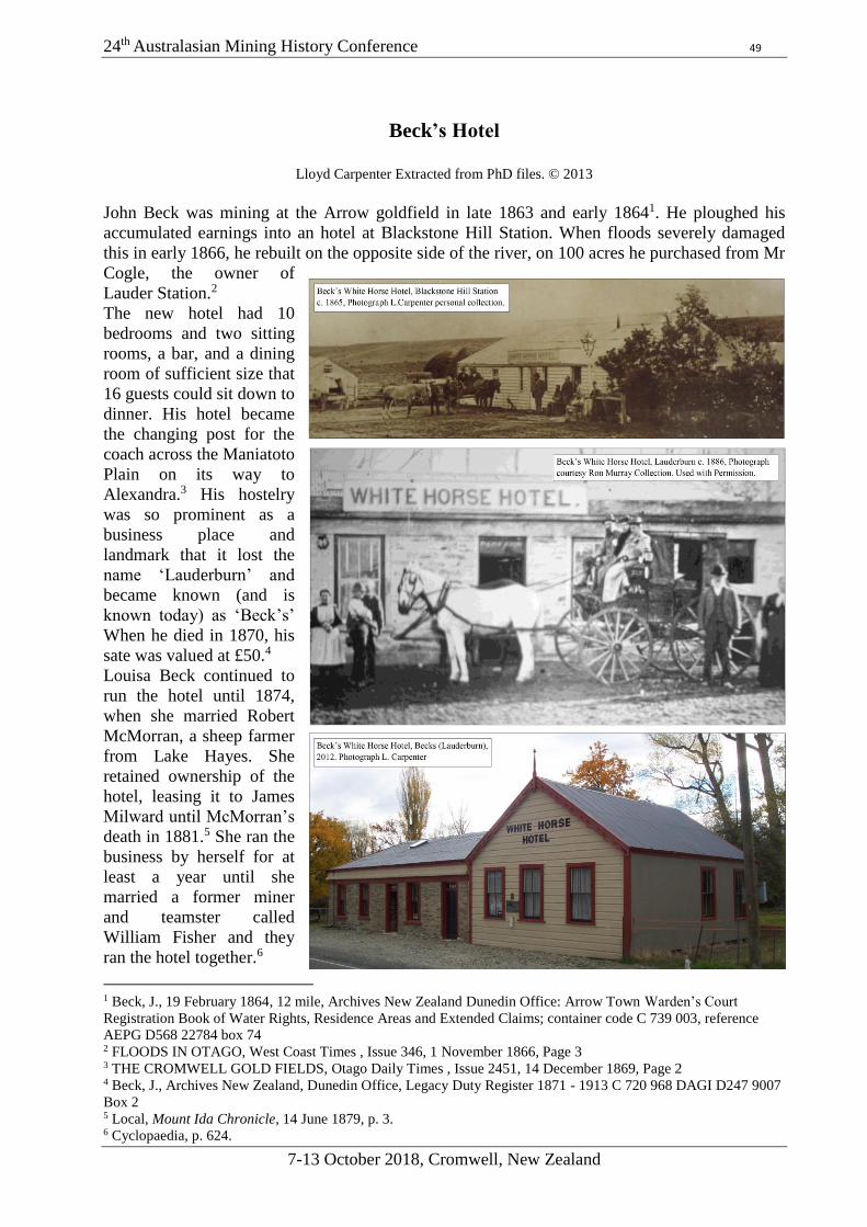
24th Australasian Mining History Conference 49
7-13 October 2018, Cromwell, New Zealand
Beck’s Hotel
Lloyd Carpenter Extracted from PhD files. © 2013
John Beck was mining at the Arrow goldfield in late 1863 and early 18641. He ploughed his
accumulated earnings into an hotel at Blackstone Hill Station. When floods severely damaged
this in early 1866, he rebuilt on the opposite side of the river, on 100 acres he purchased from Mr
Cogle, the owner of
Lauder Station.2
The new hotel had 10
bedrooms and two sitting
rooms, a bar, and a dining
room of sufficient size that
16 guests could sit down to
dinner. His hotel became
the changing post for the
coach across the Maniatoto
Plain on its way to
Alexandra.3 His hostelry
was so prominent as a
business place and
landmark that it lost the
name ‘Lauderburn’ and
became known (and is
known today) as ‘Beck’s’
When he died in 1870, his
sate was valued at £50.4
Louisa Beck continued to
run the hotel until 1874,
when she married Robert
McMorran, a sheep farmer
from Lake Hayes. She
retained ownership of the
hotel, leasing it to James
Milward until McMorran’s
death in 1881.5 She ran the
business by herself for at
least a year until she
married a former miner
and teamster called
William Fisher and they
ran the hotel together.6
1 Beck, J., 19 February 1864, 12 mile, Archives New Zealand Dunedin Office: Arrow Town Warden’s Court
Registration Book of Water Rights, Residence Areas and Extended Claims; container code C 739 003, reference
AEPG D568 22784 box 74 2 FLOODS IN OTAGO, West Coast Times , Issue 346, 1 November 1866, Page 3 3 THE CROMWELL GOLD FIELDS, Otago Daily Times , Issue 2451, 14 December 1869, Page 2 4 Beck, J., Archives New Zealand, Dunedin Office, Legacy Duty Register 1871 - 1913 C 720 968 DAGI D247 9007
Box 2 5 Local, Mount Ida Chronicle, 14 June 1879, p. 3. 6 Cyclopaedia, p. 624.

24th Australasian Mining History Conference 50
7-13 October 2018, Cromwell, New Zealand
Notes
24th Australasian Mining History Conference 51
7-13 October 2018, Cromwell, New Zealand
Author Index
John Barry
11
Peter Bell
12
Anne Both
13
Peter Brown
14
Lloyd Carpenter
15, 16
Matthew S. Churchward
17
Peter Claughton
18
Jim S. Dugdale
20
Jim Enever
19
John Ferguson
20
Nic Haygarth
21. 22
Rex Johnson
23
Juanita Kwok
24
Nicol A. MacArthur
25
Robin McLachlan
26
Ken McQueen
27, 28
Megan K. Pōtiki
29
Neville A. Ritchie
30
Jim Sullivan
31
John Taylor
32