presentation & action agenda item: 12 date: september 22, 2014
TRANSCRIPT

NCWD AGENDA INFORMATION FORM Action Presentation Presentation & Action Agenda Item: 12 Department: NCWD Staff Date: September 22, 2014 Contact: Darrell Lacy/Levi Kryder Phone: 775-727-7727
Continued from meeting of:
Return to: Levi Kryder Location: NWRPO Phone:
Action requested: (Include what, with whom, when, where, why, how much ($) and terms) For Possible Action -
1. Presentation by Jena Huntington (US Geological Survey) regarding a proposed study to characterize groundwater resources in Smoky Valley before hydraulic fracturing associated with recent oil & gas lease sales occurs.
2. Discussion, deliberation, possible decision and/or direction to staff regarding approval, rejection, or modification of the proposal.
Complete description of requested action: (Include, if applicable, background, impact, long-term commitment, existing water district policy, future goals, obtained by competitive bid, accountability measure Analysis of recent oil & gas lease sales on Bureau of Land Management lands in Smoky Valley shows that several of the leased parcels are adjacent to or near existing occupied private properties in the Valley. The leased parcels could potentially explored and developed for oil and gas, a process which could include hydraulic fracturing. The USGS is proposing a study (attached) to evaluate baseline groundwater levels and quality in the area, against which the effects of future hydraulic fracturing could be evaluated. Staff analysis: The proposed study has common objectives with the expansion of the Nye County Water District (NCWD) water level measurement program (evaluating water levels, determining hydraulic gradient and groundwater flow directions), and builds upon those objectives with analysis of groundwater quality and continued monitoring into the future. Tasks 1-1 and 1-2 of the work proposed by USGS could be conducted in conjunction with the expansion of the water level measurement program. Although USGS matching funds (as proposed) are less than 50% of the project cost, more matching funds may become available later in the fiscal year. Recommended motion: Direct staff to work with USGS to develop more detail for the proposal, including division of work between USGS and NCWD, refining or reducing costs, and development of a funding agreement between NCWD and USGS. _______________________________________________________________________________ Any information provided after the agenda is published or during the meeting of the Board will require you to provide 10 copies: one for each Board Member (7), two for NCWD Staff, one for the Public and one for the Water District Manager. Contracts or documents requiring signature must be submitted with three original copies. Expenditure Impact by FY(s): FY15 - $64,500 FY16 - $98,700 FY17 – $65,800 (As currently proposed)
No financial impact
Routing & Approval (Sign & Date) 1.WD Staff Date 3. WD Secy/Treas Date
2.WD Manager Date 4. County Date

Water District Governing Board Action Approved Disapproved Amended as follows: Date

Understanding water management challenges associated with hydraulic fracturing in Big Smoky Valley
By Jena Huntington
Background/Problem Statement Hydraulic fracturing is a method used to aid in the production of oil and natural gas by means of pressure injecting water, sand, and chemicals into a subsurface rock or sediment formation containing oil or gas. The water slurry under high pressure creates fractures in the rock and allows the oil or gas to flow back through the well to land surface for capture. The Chainman Shale and Pilot Shale formations in east-central Nevada and western Utah have recently been the target of energy companies for potential oil extraction by hydraulic fracturing. These shale formations are organic-rich, thick, regionally extensive, and described as some of the richest potential petroleum source beds in the eastern Great Basin (Sandberg and others, 1980). The Chainman lies above the Pilot Shale formation at varying depths below basin-fill deposits. The connectivity between these shale formations and the regional carbonate aquifer is unknown.
A recent land lease sale by the Bureau of Land Management in Big Smoky Valley between Austin and Tonopah in central Nevada (fig. 1) has peaked concerns among local residents as well as the general public regarding the possible effects of hydraulic fracturing on the limited water resources in the basin and the chemical quality of that resource. An updated delineation of the groundwater table, flow directions, and understanding of the water chemistry is warranted to document the natural groundwater conditions in Big Smoky Valley prior to the start of deep well drilling and hydraulic fracturing. This information will also serve as a foundational dataset to determine if hydraulic fracturing will affect the local water resources.

Figure 1. Map showing the location of BLM land parcel lease sales in Big Smoky Valley, central Nevada

Objectives This study will be divided into two phases. Phase 1 will be completed prior to any deep drilling or hydraulic fracturing. The primary objectives of this Phase 1 study include:
1-1. Describe the hydrogeologic setting of Big Smoky Valley;
1-2. Describe the groundwater flow potential within the alluvial aquifer in cooperation with the Nye County Water District (NCWD); and
1-3. Characterize the baseline geochemistry of the shallow groundwater prior to hydraulic fracturing.
Phase 2 will begin directly after deep drilling and hydraulic fracturing has occurred. At this time it is unknown when deep drilling and hydraulic fracturing will actually occur, therefore a more robust Phase 2 proposal will be required when this timeline information is available. The primary objective of the Phase 2 study will include:
2.1 Determine fate and transport of contaminants associated with hydraulic fracturing fluids in Big Smoky Valley
Approach Phase 1-1. An initial literature review will be done to gain an understanding of the general hydrogeology of Big Smoky Valley. This review will include characterizing the hydrogeology by describing the geology of the surrounding mountain blocks, the composition and thickness of the shallow alluvial aquifer (including confining units), and the fault locations. A summary of the water budgets and current groundwater allocations will be assembled to provide a sense of how much of the basin’s water resources are available for hydraulic fracturing.
Phase 1-2. Prior to any deep well drilling and hydraulic fracturing, the groundwater flow potential will be estimated within the alluvial aquifer. USGS will work with NCWD to collect water-level data from wells and springs across the valley. These data will be used to determine the current groundwater table, gradients, and directions of horizontal and vertical flow.
Phase 1-3. Prior to hydraulic fracturing, groundwater samples collected from wells in the vicinity of leased land parcels will be analyzed for a range of constituents to determine the baseline chemistry of the alluvial aquifer. Samples will be collected in the spring and fall seasons to help describe the seasonal variability in natural and anthropogenic chemical constituents. Understanding the baseline groundwater chemistry before hydraulic fracturing commences will be foundational in the later determination of potential contamination due to hydraulic fracturing and/or related activities. This proposal assumes that 12 well/springs will be sampled per sampling event. The list of chemical constituents to be analyzed is included in Appendix A.
Phase 2. After deep well(s) have been drilled and hydraulically fractured, the shallow aquifer will be monitored for potential effects of the fracturing and/or related activities to determine if any connection exists between the targeted oil-bearing formation and the shallow alluvial aquifer. This connection could occur from natural subsurface connectivity, poor well completion, and/or surface spills. The

groundwater table altitude will be monitored and the shallow aquifer sampled for changes in the previously sampled baseline chemistry constituents. In addition, samples will analyzed for key “fracking fluid indicator” chemicals. A portion of the injected fluids may stay in formation even after flowback is completed; therefore it is critical to establish an on-going water quality sampling program to monitor for fracking fluid indicator chemicals.
References Sandberg, C.A., Poole, F.G., and Gutschick, R.C., 1980, Devonian and Mississippian stratigraphy and
Conodont zonation of Pilot and Chainman Shales, Confusion Range, Utah, Paleozoic Paleogreography of the West-Central United States: Rocky Mountain Symposium 1, p. 71-79, available at http://archives.datapages.com/data/rocky_sepm/data/002/002001/71_rocky_mount20071.htm#bib19.
Phase 1 Schedule Period of performance is 3 years from receipt of funding with timeline shown below.
Task 2015 2016 2017
Q1 Q2 Q3 Q4 Q1 Q2 Q3 Q4 Q1 Q2 Q3 Q4
Hydrogeology
Literature review & data mining x x x x x x
Water budgets & allocation x x
Groundwater flow potential
Design groundwater level monitoring network
x x x
Measure groundwater level network x x x x x
Evaluate groundwater flow directions x x x
Aquifer testing x x
Baseline geochemistry
Evaluate existing ground-water quality data & design water quality sampling well network
x x
Sample for groundwater chemistry (Includes quality assurance samples)
x x
Characterize groundwater quality x x x
Report writing, reviews & publication x x x x x x
Quarterly progress reports x x x x x x x x x x x x

Phase 1 Budget A generalized cost description for the Phase 1, 3-year project beginning the first quarter of fiscal year
2015 is presented below.
Estimated Cost: 2015 2016 2017
Labor 103,900 141,400 101,800
Equipment/Supplies 3,800 6,300 1,000
Chemical analyses 1,300 18,400 -
Travel 4,100 6,900 1,800
Report Processing - - 10,700
Total 113,100 173,000 115,300
*Grand Total $401,400
*Rounded to the nearest hundred.
Proposed funding sources:
2015 2016 2017
NCWD $64,500 $98,700 $65,800
U.S. Geological Survey-Nevada Water Science Center $48,600 $74,300 $49,500
Total project funding $113,100 $173,000 $115,300

Appendix A
Chemical constituents to be analyzed
Group Analyte reporting limit unit
TE Aluminum 2.2 µg/L TE Antimony 0.027 µg/L TE Arsenic 0.1 µg/L
As speciation Arsenite (As-III) 0.2 µg/L As speciation Arsenate (As-V) 0.4 µg/L As speciation Dimethylarsinate 0.3 µg/L As speciation Monomethylarsonate 0.8 µg/L
TE Barium 0.25 µg/L TE Beryllium 0.02 µg/L TE Boron 5 µg/L TE Cadmium 0.03 µg/L TE Chromium 0.3 µg/L TE Cobalt 0.05 µg/L TE Copper 0.8 µg/L TE Lead 0.04 µg/L TE Lithium 0.22 µg/L TE Manganese 0.4 µg/L TE Molybdenum 0.05 µg/L TE Nickel 0.2 µg/L TE pH, laboratory 0.1 pH TE Selenium 0.05 µg/L TE Silver 0.02 µg/L TE Specific Conductance, laboratory 5 µS/cm TE Strontium 0.8 µg/L TE Thallium 0.03 µg/L TE Uranium, natural 0.014 µg/L TE Vanadium 0.08 µg/L TE Zinc 2 µg/L
Major ions Bromide 0.03 mg/L Major ions Calcium 0.022 mg/L Major ions Chloride 0.02 mg/L Major ions Fluoride 0.01 mg/L Major ions Iron 4 µg/L Major ions Magnesium 0.011 mg/L

Major ions Potassium 0.03 mg/L Major ions Total Dissovled Solids (TDS) 20 mg/L Major ions Silica 0.018 mg/L Major ions Sodium 0.06 mg/L Major ions Sulfate 0.02 mg/L
Nutrients-low level Ammonia as N 0.01 mg/L Nutrients-low level Nitrite 0.001 mg/L Nutrients-low level Nitrite + nitrate 0.01 mg/L Nutrients-low level Orthophosphate 0.004 mg/L Dissovled organic
carbon DOC 0.23 mg/L
Stable isotopes Deuterium 0.01 per mil
Stable isotopes Oxygen-18 0.01 per mil
Gas oxygenates & BTEX tert-Amyl alcohol 0.6 µg/L
Gas oxygenates & BTEX Methyl acetate 0.46 µg/L
Gas oxygenates & BTEX Acetone 1.6 µg/L
Gas oxygenates & BTEX Benzene 0.04 µg/L
Gas oxygenates & BTEX Ethylbenzene 0.032 µg/L
Gas oxygenates & BTEX Ethyl tert-butyl ether 0.046 µg/L
Gas oxygenates & BTEX Diisopropyl either 0.044 µg/L
Gas oxygenates & BTEX m- and p-Xylene 0.05 µg/L
Gas oxygenates & BTEX o-Xylene 0.028 µg/L
Gas oxygenates & BTEX tert-Butyl alcohol 0.8 µg/L
Gas oxygenates & BTEX Toluene 0.02 µg/L

UNDERSTANDING WATER MANAGEMENT CHALLENGES WITH HYDRAULIC FRACTURING IN BIG SMOKY VALLEY Jena Huntington Nye County Water District board meeting September 22, 2014
U.S. Department of the Interior U.S. Geological Survey Nevada Water Science Center
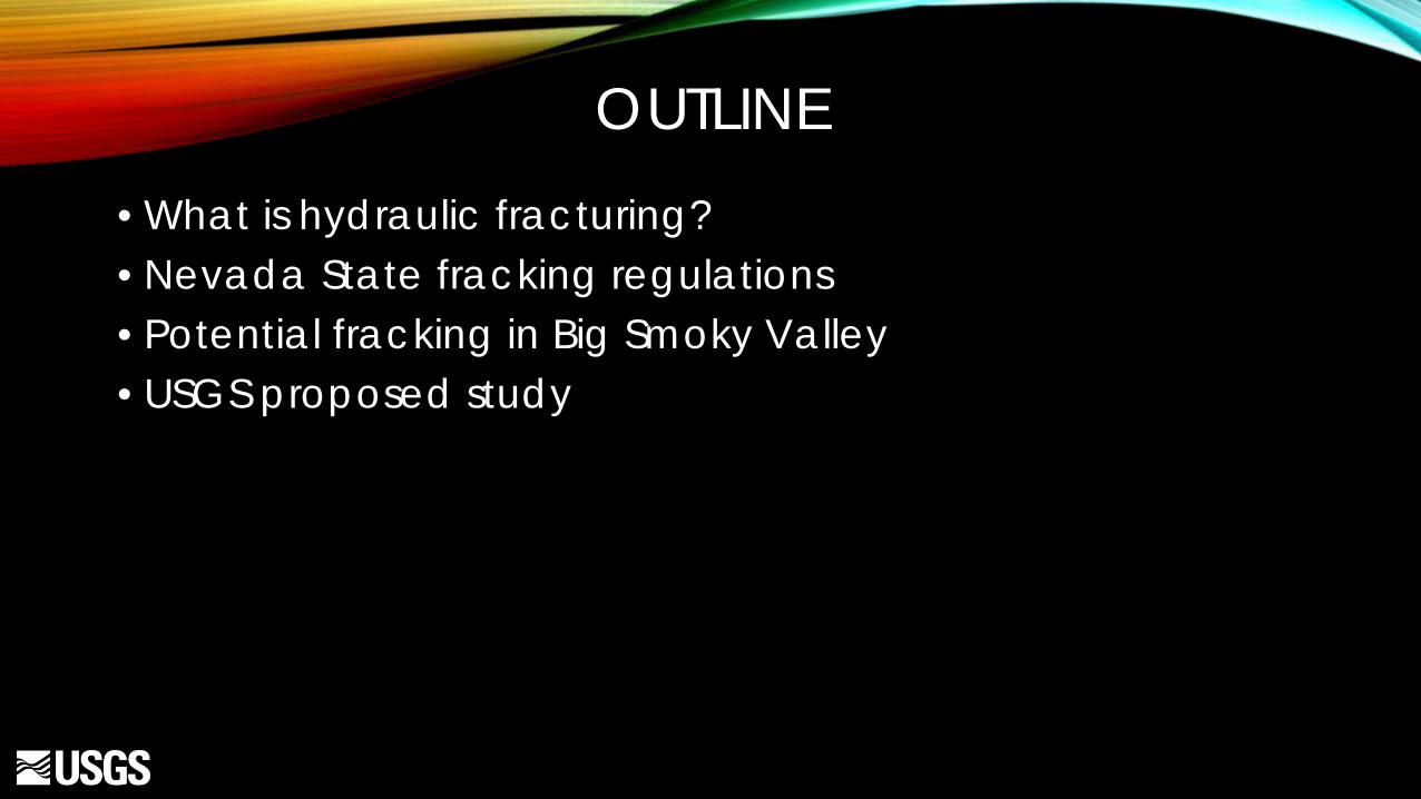
OUTLINE • What is hydraulic fracturing? • Nevada State fracking regulations • Potential fracking in Big Smoky Valley • USGS proposed study

WHAT IS HYDRAULIC FRACTURING? • A method used in association with deep drilling to aid in production of oil
and natural gas in deep shales that could otherwise not feasibly be produced by traditional drill & pump methods
• Used in United States since 1947
• Well drilled • Perforations created • HF completed in stages
• Liquid blend injected under extreme pressures
• Oil flows out

HF PROCESS & CHEMICAL BLEND • “Cocktail” mixed differently for each formation
type • Acids, disinfectants, scale inhibitors, iron control,
friction reducers, corrosion inhibitors, gelling agents, cross-linking agent
• All chemicals listed on www.fracfocusdata.org

NEVADA FRACKING REGULATIONS
• NRS 522; Written by NDOM with aid from NDEP and NDWR • Reviewed by Nevada Legislative Council Bureau • Adopted by CMR on August 28, 2014
• Emphasis on borehole and casing integrity
• Shallow aquifer monitoring:
• Pre-fracking baseline samples in up to FOUR wells within 1-mile radius • Resample 60-72 months post HF

HF IN BIG SMOKY VALLEY
• BLM land lease sale, July 2014 • Offered for lease
• 102 parcels • 174,021 acres
• Leased/Sold • 36 parcels sold • 48,947 acres sold
NCWD mission statement: “Provide, protect and preserve water resources in Nye County.”


USGS PROPOSED STUDY • 2 phases; Pre & Post HF
• Pre-HF Objectives
• 1-1. Describe the hydrogeologic setting of Big Smoky Valley
• 1-2. Describe the GW flow potential within the alluvial aquifer
• 1-3. Characterize the baseline geochemistry of the shallow GW prior to HF

USEFUL INFO FROM ENERGY COMPANY
• Can info sharing be required of energy company?
• Lithologic logs from deep fracturing wells • Water quality samples from deep wells, if
water present • End member comparison
Image from oakcliff.advocatemag.com

PHASE 1 BUDGET 2015 2016 2017
Labor $103,900 $141,400 $101,800 Equipment/Supplies $3,800 $6,300 $1,000 Chemical analyses $1,300 $18,400 n/a Travel $4,100 $6,900 $1,800 Report Processing -- -- $10,700 Annual total $113,100 $173,000 $115,300 Study Total $401,400
Based on sampling 12 wells in 2016 2015 2016 2017 NCWD $64,500 $98,700 $65,800 USGS $48,600 $74,300 $49,500 Total $113,100 $173,000 $115,300

PHASE 1 BUDGET 2015 2016 2017
Labor $103,900 $138,300 $99,500 Equipment/Supplies $3,800 $6,100 $1,000 Chemical analyses $1,300 $13,900 -- Travel $4,100 $4,500 $1,400 Report Processing -- -- $10,700 Annual total $113,100 $162,800 $112,600 Study Total $388,500
Based on sampling 8 wells in 2016 2015 2016 2017 NCWD $64,500 $92,800 $64,200 USGS $48,600 $70,000 $48,400 Total $113,100 $162,800 $112,600

QUESTIONS?
Image from www.fracfocus.org

PHASE 1 TIMELINE Task 2015 2016 2017
Q1 Q2 Q3 Q4 Q1 Q2 Q3 Q4 Q1 Q2 Q
3
Q
4 Hydrogeology
Literature review & data mining x x x x x x Water budgets & allocation x x
Groundwater flow potential Design groundwater level monitoring network x x x Measure groundwater level network x x x x x Evaluate groundwater flow directions x x x Aquifer testing x x
Baseline geochemistry Evaluate existing ground-water quality data & design water quality sampling well network
x x
Sample for groundwater chemistry (Includes quality assurance samples)
x x
Characterize groundwater quality x x x Report writing, reviews & publication x x x x x x Quarterly progress reports x x x x x x x x x x x x