preliminary information form (pif) for historic district …
TRANSCRIPT

Preliminary Information Form Revised January 2018
PRELIMINARY INFORMATION FORM (PIF) for HISTORIC DISTRICTS
Purpose of Evaluation Please use the following space to explain briefly why you are seeking an evaluation of this property.
The City of Charlottesville’s Comprehensive Plan recommended survey of the 10th and Page Neighborhood to provide needed documentation of resources, enabling the City and its residents to better understand the architectural and historic significance of the neighborhood and assist the City and community in future planning. Additionally, this survey supports the responsibilities of the Blue Ribbon Commission on Race, Memorials and Public Spaces to inventory places important to Charlottesville’s African American community. Residents have identified threats to the 10th and Page neighborhood including encroaching development and demolitions of existing structures. The purpose of this PIF is to propose the boundary of a potential NRHP historic district that would allow tax credits to encourage rehabilitation.
Are you interested in applying for State and/or Federal Rehabilitation Tax Credits? Yes _____ No _____
Are you interested in receiving more information about DHR’s easement program? Yes _____ No _____
1. General InformationDistrict name(s): ___10th and Page Historic District__ (104-5088)
Main Streets and/or Routes: _Southeast-northwest streets: Anderson Street, Gordon Avenue, Grady Avenue, Hardy Drive, Holly Drive, Latrobe Court, Morton Lane, Paoli Street, Page Street, Preston Avenue, Rosser Avenue, and West Street ; Northeast-southwest streets: 7th Street NW/Albemarle Street, 8th Street NW, 9th Street NW, 10th Street NW, 10 ½ Street NW, 11th Street NW, 12th Street NW, and 13th Street NW
City or Town: ___Charlottesville ____
Name of the Independent City or County where the property is located: Charlottesville__
2. Physical AspectsAcreage: ____________89.72 Acres_____________________
Setting (choose only one of the following): Urban __X__ Suburban _____ Town _____ Village _____ Hamlet _____ Rural_____
Briefly describe the district’s overall setting, including any notable landscape features:
The proposed 10th and Page Historic District is an approximately 90-acre, irregularly-shaped district, containing 434 properties located south of Preston Avenue and north of West Main Street in Charlottesville, Virginia. The proposed district features a grid-like pattern of streets, with wider streets running northeast-southwest, and narrower streets running northwest-southeast. The Norfolk-Southern railroad line runs along the eastern boundary of the proposed district, adjacent

Department of Historic Resources Preliminary Information Form 2 Rev. January 2018
4/7/2020
to 7th Street NW/Albemarle Street. The topography of the proposed historic district slopes down towards Page Street from the north, south, and west. It is generally one of the lowest points in the city, a common development trend among primarily African American and working-class neighborhoods in southern cities (Ueland and Warf 2006:73).
3. Architectural/Physical Description Architectural Style(s): _Vernacular; Craftsman; Italianate; Folk Victorian; Ranch; Raised Ranch; Minimal Traditional; Colonial Revival If any individual properties within the district were designed by an architect, landscape architect, engineer, or other professional, please list here: _ Jack Hicks (304 and 306 11th Street NW), Stanislaw Makielski (502 11th Street NW), H.D. Walker (400 and 404 10 ½ Street NW), Charles E. Coles & Sons (numerous buildings), William C. Harris (420 10 ½ Street NW)_ If any builders or developers are known, please list here: __John West, C.B. Eubank (351 11th Street NW), Charles L. Brooks (301-303 10 ½ Street NW), Charles H. Brown (properties at 12th Street NW and Rosser Avenue East), B.P. Chamberlain (308 11th Street NW), Reese M. Brown (515 11th Street NW), Ed Brownfield (334 10 ½ Street NW), Langston Wars (1120 Page Street)___ Date(s) of construction (can be approximate): __c. 1870-1970 Are there any known threats to this district? The community faces rising property taxes that threaten the affordability of the neighborhood. Many homes that were originally resident-owned are now rental properties. There is also significant pressure along both Preston Avenue and West Main Street to build larger, more expensive, multi-unit housing, as well as some pressure within the west end of the district to rent existing housing to University of Virginia students, thereby potentially displacing current 10th and Page residents. Because rehabilitations, demolitions, and new construction are not subject to design review, existing buildings and structures may be vulnerable. Older dwellings are potentially subject to demolition both by local non-profit housing organizations seeking to create new affordable housing units and by private developers wishing to provide larger and more expensive housing for buyers wishing to live near West Main Street and the University of Virginia. Narrative Description: In the space below, briefly describe the general characteristics of the entire historic district, such as building patterns, types, features, and the general architectural quality of the proposed district. Include prominent materials and noteworthy building details within the district, as well as typical updates, additions, remodelings, or other alterations that characterize the district. The 10th and Page neighborhood is composed primarily of single-family residences, most of which were constructed prior to 1929, with a few as early as the late 1800s. Other property types include commercial buildings and churches. Residences are one and two stories tall and vary considerably in footprint. The primary construction material in the proposed district is wood frame with lap siding; much of the original wood siding has been replaced or covered with vinyl siding, aluminum siding, hardy board siding, or stucco. There are also concrete block or brick buildings dotted throughout the community, used for both residential and non-residential properties. Residential roofs are generally gabled or hipped and either retain their original standing-seam metal covering, have newer standing-seam metal roofs, or have been replaced with asphalt shingles. Commercial buildings in the neighborhood generally have flat roofs. Foundations are typically minimally visible because most buildings were built on slabs. However, there are a few
Department of Historic Resources Preliminary Information Form 3 Rev. January 2018
4/7/2020
buildings that are built into sloping sites and, therefore, have partially raised basements. Most foundations are concrete, and many have stucco coverings. There are also a few buildings with exposed brick or stone foundations.
There is a medium degree of intact architectural detailing on the buildings within the proposed district. Most buildings have been re-sided. Almost all houses in the district have front porches. Many porches have original detailing still intact, including turned columns and railings, decorative bracketing, and gingerbread trim. Some porches have been dramatically changed, especially in the past 10 years, through reconstruction, remodeling, or enclosure. Many houses have had their original wood windows replaced with vinyl sash. Many windows still have their original shutters (if applicable). Many doors, some windows, and some porches have had metal or canvas awnings added above. The majority of houses were originally built with chimneys, which remain intact. However, some chimneys have been truncated at the roofline and/or re-sided. Many buildings have one or more additions on the rear elevations, ranging from one to multiple stories in height. Many properties also have secondary dwellings and/or sheds in the rear throughout the proposed district.
Most of the homes in the proposed 10th and Page Historic District are vernacular in style. Some older houses within the proposed district display some characteristics of the Folk Victorian and Italianate styles, but few houses are strong examples of either style (notably 718 West Street). These are intermixed with Craftsman, Ranch, Raised Ranch, and Minimal Traditional styles, and a Colonial Revival, especially in the post-1929 buildings that were surveyed. Some sections of the neighborhood have rows of buildings that were constructed with similar forms within a few years of one another. Along the southeast side of Page Street, there are multiple groupings of similarly designed buildings and at Latrobe Court, formerly Martin Court or Garden Court, the whole street was constructed at the same time with identical buildings (Sanborn Map Company 1929; Sanborn Map Company 1950).
Discuss the district’s general setting and/or streetscapes, including current property uses (and historic uses if different), such as industrial, residential, commercial, religious, etc. For rural historic districts, please include a description of land uses.
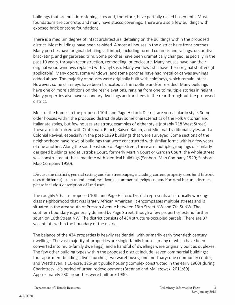
The roughly 90-acre proposed 10th and Page Historic District represents a historically working-class neighborhood that was largely African American. It encompasses multiple streets and is situated in the area south of Preston Avenue between 13th Street NW and 7th St NW. The southern boundary is generally defined by Page Street, though a few properties extend farther south on 10th Street NW. The district consists of 434 structure-occupied parcels. There are 37 vacant lots within the boundary of the district.
The balance of the 434 properties is heavily residential, with primarily early twentieth century dwellings. The vast majority of properties are single-family houses (many of which have been converted into multi-family dwellings), and a handful of dwellings were originally built as duplexes. The few other building types within the proposed district include: seven commercial buildings; four apartment buildings; five churches; two warehouses; one mortuary; one community center; and Westhaven, a 10-acre, 126-unit public housing complex constructed in the early 1960s during Charlottesville’s period of urban redevelopment (Brennan and Maliszewski 2011:89). Approximately 230 properties were built pre-1930.

Department of Historic Resources Preliminary Information Form 4 Rev. January 2018
4/7/2020
Concrete sidewalks run along both sides of most streets, and many yards have retaining walls and/or fences surrounding the property, as well as a large number of trees, bushes, and other forms of vegetation. Although the lot sizes vary somewhat in both size and shape throughout the district, the majority are long, thin, and rectangular; with the primary resources situated towards the front; and large backyards to the rear. The backyards of most lots also have accessory buildings, ranging in size from small garden sheds to full, two-story secondary dwellings. This neighborhood is one of the most densely packed areas of the City of Charlottesville and contains a large concentration of buildings constructed in the first quarter of the twentieth century (City of Charlottesville GIS Viewer 2020). There are a few locally designated properties within the proposed district, including: the Coca-Cola Bottling building (104-5621) at 134 10th Street NW and the Holy Temple Church (104-5920) on 212 Rosser Avenue East. There is also one VLR/NRHP-listed property: the Rock House/Charles B. Holt House (104-5098) at 1010 Preston Avenue. The neighborhood is bordered by additional notable sites, which are known for their associations with African American history in Charlottesville. Booker T. Washington Park (104-5276-0001), donated to the City of Charlottesville in 1925 by Paul Goodloe McIntire, was the first public space reserved for African Americans, as other parks in the City were designated for white residents only. Booker T. Washington Park is located on the north corner of Preston Avenue and 10th Street NW, to the north of the 10th and Page neighborhood (City of Charlottesville 2020a). Venable Elementary School, on 14th Street NW, is on the western boundary of the proposed district, though African American students were not allowed to attend until after court-enforced desegregation resulted in nine African American elementary students enrolling at Venable in 1959 (Cross-White 1998:118; Douglas 2013:32, 60-61). These sites created connections between the 10th and Page neighborhood and other African American neighborhoods in Charlottesville, including the Rose Hill neighborhood (104-5276) to the north, and Starr Hill neighborhood (104-5273) and Vinegar Hill neighborhood (non-extant) to the east-southeast. More recently, there has been development along the northern and southern boundaries of the district, closing in the community from both ends. This development includes mainly multi-family, large-scale, luxury residential development with commercial businesses beneath, along the business thoroughfares of West Main Street and Preston Avenue.
The 434 properties within the proposed 10th and Page Historic District are related to several thematic contexts identified by the Virginia Department of Historic Resources, including: Ethnic/Immigration Heritage, Architecture/Community Planning, Domestic, Religion, Social, Recreation/Arts, and Commerce/Trade.
4. District’s History and Significance In the space below, briefly describe the history of the district, such as when it was established, how it developed over time, and significant events, persons, and/or families associated with the property. Please list all sources of information used to research the history of the property. (It is not necessary to attach lengthy articles or family genealogies to this form.) Normally, only information contained on this form is forwarded to the State Review Board. If the district is important for its architecture, engineering, landscape architecture, or other aspects of design, please include a brief explanation of this aspect.

Department of Historic Resources Preliminary Information Form 5 Rev. January 2018
4/7/2020
Development of the Neighborhood, early 1800s to 1963 The neighborhood is named after the two main streets within the community, 10th Street NW, which runs generally northeast-southwest, and Page Street, which runs generally southeast-northwest, though the community wasn’t always known as “10th and Page” (Cross-White 1998:121; Department of Community Development 1990:57, 72). Like many neighborhoods in the City of Charlottesville, it is not known when locals officially began referring to the neighborhood by this name. Similar to other historically black neighborhoods in Charlottesville, such as Starr Hill, the 10th and Page neighborhood has undergone a series of developmental and residential changes, with some significant redevelopment within the last 20 years (Department of Community Development 1990:52-90; Saunders and Shackelford 1998:3). The neighborhood began to take shape in the early 1800s due to the construction of the University of Virginia (UVA), about one-half mile west of the present-day intersection of 10th Street NW and Page Street. Some houses for UVA faculty were built along Wertland Street, one block south of Page Street. As was common in pre-Emancipation Virginia, some of these professors’ households depended on the labor of enslaved individuals who lived in or near the faculty residences. With Page Street located directly downhill and to the north of the faculty houses, it became a neighborhood of many enslaved African Americans who worked for these professors – doing laundry, caring for children and animals, and performing other daily jobs (10th and Page Neighborhood Association 2019). As one of the lowest spots in the city, Page Street was considered undesirable residential real estate, as it flooded easily and had poor drainage. African Americans occupying the worst land in a city was a common practice throughout southern cities (Ueland and Warf 2006:73). After Emancipation, many African Americans remained working in these homes as household servants for their former enslavers and continued living near and around Page Street. This was one of the few employment options for the freed individuals who remained in their communities in post-Emancipation Virginia in the mid-1860s (Schmidt 2019; Claibourn 2012). Following Emancipation, the 10th and Page community really began to blossom. John West, a formerly enslaved man, played a large role in the development of 10th and Page as a growing African American community. West trained as a gentleman’s barber and began purchasing real estate in the City, particularly on Grady Avenue near Preston Avenue. Before his death in 1927, he subdivided much of his land and sold many lots to African American families (Cross-White 1998:62; PHA 2009:25-26). Although land transfer records on file at the Albemarle Charlottesville Historical Society were limited, area histories do not indicate that there was a predominant developer of this neighborhood, unlike other neighborhoods in Charlottesville. Instead, the neighborhood developed through smaller transfers of land. Other known landowners include William Jeffries, who sold lots to West; B.E. Jeffries; L.W. Cox; A.D. Cox; R.L. Anderson; and Mrs. Turner (Plat records on file at City of Charlottesville Neighborhood Development Services). The 10th and Page neighborhood is not well documented on historic maps of Charlottesville, in part because most of this area was located within Albemarle County until 1916. The 1877 Gray’s map of Charlottesville does not depict the site of the 10th and Page neighborhood (O.W. Gray & Son 1877). The 1893 Spooner map shows parts of 10th Street NW, Elsom Street (later Page Street), Paoli Street, Alfonsa/Alphonso Street (later 9th Street NW), Anderson Street, West Street, and 8th Street NW – portions of these streets fell within the city limits at that time (Spooner 1893; Shaw 1890). These same streets are also depicted on the 1896 Sanborn Map index, however,

Department of Historic Resources Preliminary Information Form 6 Rev. January 2018
4/7/2020
there are not detailed maps for these streets and the neighborhood is not called out specifically. Notably, 8th Street NW is called White Street, and 10th Street NW is also known as Jeffries, from the original lot purchaser’s name (Sanborn Map Company 1896; City of Charlottesville GIS Viewer 2020). The 1907 Sanborn Maps are the first to depict any buildings and structures in the 10th and Page neighborhood, however they only show the east corner of Page Street and Alfonso Street (9th Street NW) and Cox’s Row, located to the southeast of 10th Street NW and Page Street, which is no longer extant after being replaced by the Westhaven housing complex in 1963 (Sanborn Map Company 1907; Department of Community Development 1990:6). The 1913 Sanborn Maps show greater detail between Anderson Street and Preston Avenue, and between Alfonso Street (9th Street NW) and Albemarle Street. As of 1913, many of the lots had buildings on them, with the remaining open lots not yet divided (Sanborn Map Company 1913). Although the rest of the neighborhood is not depicted, it can be inferred that other streets experienced comparable rates of development based on development patterns in Charlottesville. The 1920 Sanborn Maps are the first to map the areas north of Wertland Street and west of 10th Street NW. By 1920, there were dwellings on roughly half of those lots. East of 10th Street NW, roughly two-thirds of the lots had dwellings (Sanborn Map Company 1920). Much development occurred between 1920 and 1929 to fill in the gaps (Sanborn Map Company 1929). By 1950, there were few vacant lots remaining in the neighborhood and industrial/commercial development had sprouted on Preston Avenue and the block of 10th Street NW north of West Main Street (Sanborn Map Company 1950).
The community was developed to be primarily residential and it remains that way today. The Louisa Railroad (later the Virginia Central and then the Chesapeake and Ohio [C&O]) reached Charlottesville by 1850, and was built to the south of West Main Street. The Southern Railroad (later Norfolk-Southern) appeared by 1863 to the east of what became 7th Street NW (IATH 2005). The 10th and Page area became home to many railroad employees of different races, due to its close proximity to these railroad lines (Gillikin 2018; Galvin n.d.; Trumbull 2017:114-115; PHA 2009:21-23). The City’s code beginning in 1912 specifically required African Americans to live in racially segregated blocks in the City, such as 10th and Page. City zoning ordinances had “explicitly racial exclusions,” which remained legal until 1917 (Matthew 2019:321). The City’s exclusionary zoning ordinances beginning in 1929 supported and reinforced segregationist housing policy and practice. This residential segregation was further fueled by racially restrictive covenants in the city’s housing deeds, which restricted home ownership elsewhere in Charlottesville (i.e. portions of North Downtown, Locust Grove, Belmont, Fry’s Spring, Jefferson Park Avenue, Johnson Village, Rugby Hills) to “persons of the Caucasian race” (Yager 2017). Such restrictions remained “constitutionally permissible” until 1948 (Matthew 2019:321). It is presumed that similar restrictions were also employed in Albemarle County through the early twentieth century. The neighborhood remained primarily African American throughout its history (City-data.com 2020; Data USA n.d.). From 1900-1930, African American businesses thrived in Charlottesville from Vinegar Hill down West Main Street and throughout the City (Cross-White 1998:56-63). During this time, the 10th and Page neighborhood grew immensely, with about 230 buildings (or 53 percent) from this period still extant today, most of which were built between 1920-1930. Because of segregation, African American children in the 10th and Page neighborhood attended the Jefferson School, located on 4th Street NW behind West Main Street and Vinegar Hill; and the Albemarle Training School (opened in the 1890s, closed in 1950), which was located near Rio Road near the Ivy Creek Reserve, but is no longer extant. Although Venable Elementary School (opened in 1925) was the

Department of Historic Resources Preliminary Information Form 7 Rev. January 2018
4/7/2020
closest school to 10th and Page, it was only for white students. The Jefferson School first opened in 1894 as an elementary school and expanded in 1926 to include a high school. In 1951, the Jefferson School reverted to an elementary school when Burley High School opened for African American students on Rose Hill Drive, to the north of 10th and Page (Cross-White 1998:118; Douglas 2013:63; Virginia Humanities 2020a; Virginia Humanities 2020b). A 1929 map of the City indicates where “colored families” primarily lived, confirming the historic makeup of the 10th and Page neighborhood (Cross-White 1998:121). This includes a large section bounded by 10th Street NW, Page Street, the west side of 13th Street NW, Cabell Avenue, and the north side of Preston Avenue. East of 10th Street NW, it includes north of Preston Avenue to Rose Hill Drive, and between Page Street and West Main Street all the way to Starr Hill. Additional areas south of West Main Street are also identified on the 1929 map. The areas north of Preston Avenue and west of Rose Hill Drive, in particular, were among several other neighborhoods available to African Americans. The distance from UVA and railroad terminals was often considered, since many African Americans in Charlottesville worked for these two large employers. Additionally, the 10th and Page neighborhood was home to many domestic servants and day laborers who often worked in nearby affluent neighborhoods such as Wertland and Rugby. This also applied to the historic neighborhood of Vinegar Hill to the east of 10th and Page – the center of African American social and commercial life, which was later destroyed in 1964 as the initial target of Charlottesville’s urban renewal (Cross-White 1998:56-63; PHA 2009:7, 10-11; Kalbian 2018). The area to the east of 10th Street NW, north of Page Street, south of Preston Avenue, and west of 7th Street NW/Albemarle Street was mostly white as of 1929, according to the 1929 map of the City (Cross-White 1998:121). It is differentiated from the rest of the district by larger lot sizes and dwelling sizes, on average. This area was occupied by working-class white Charlottesville residents (U.S. Census Bureau 1930). In general, the two sides did not mingle, except occasionally on Sunday morning at Trinity Episcopal Church (415 10th St NW), until after the process of desegregation began in Charlottesville in the 1950s (Cross-White 1998:70, 118). According to oral histories, there may have been a slow trickle of mixed residency beginning in the early 1940s (Department of Community Development 1990: 72). Trinity Episcopal Church was established in 1919 as a mission and held services in a building at the foot of Beck’s Hill. In 1939, the Diocese purchased a lot at the west corner of 10th Street NW and Grady Avenue, in the 10th and Page neighborhood, for Trinity Episcopal Church. The church building was built in 1910 in Palmyra, Virginia, and dismantled and moved to 10th and Grady for Trinity Episcopal Church in 1939. In 1974, Trinity Episcopal Church moved to a new building at the corner of 10th Street NW and Preston Avenue, which is outside the proposed district. This church always catered to the African American population in Charlottesville but did so while continuing to be a mixed congregation, as it still is today (Cross-White 1998:70; Trinity Episcopal Church 2020; Bibb 1981). This was especially impactful with its location in an area that bordered the white and African American sections of the 10th and Page neighborhood. This church helped to create a connection between the two sections of the neighborhood, which have become more deeply entwined over the years (Cross-White 1998:70; Department of Community Development 1990: 70-72). As of 1981, Pentecostal Assembly Church met at the 10th and Grady location (Bibb 1981). This building is not currently associated with an active congregation.
The attempts to desegregate Charlottesville public schools in the 1950s following Brown v. Board of Education were met with Massive Resistance – a policy adopted in 1956 by the Commonwealth

Department of Historic Resources Preliminary Information Form 8 Rev. January 2018
4/7/2020
of Virginia to block desegregation – and greatly impacted the thriving 10th and Page neighborhood (PHA 2009:10-11). In conjunction with issues related to racial integration, African American neighborhoods in Charlottesville became targets of urban renewal. This destruction occurred because the City and its consultants identified these areas as blighted. This action included the razing of African American neighborhoods at Vinegar Hill, Garrett Street, and, within 10th and Page, Cox’s Row. Cox’s Row, originally to the south of Page Street, east of 10th Street NW, and to the north of West Main Street, was a small development of 10 rental houses for railroad employees (Legal Aid Justice Center 2020). It featured rows of similar buildings, suggesting that they were built by a developer to be rented to working-class laborers (Cvillepedia 2017; 10th and Page Neighborhood Association 2019). Cox’s Row – identified as a blighted area – was razed to make way for the Westhaven public housing project in 1963 (Department of Development 1990:6, 72). Similarly, Vinegar Hill, located in the vicinity of 4th Street NW and Commerce Street, was demolished in 1964 under the guise of urban renewal – an attempt to change the image and racial distributions of Charlottesville (Saunders and Shackelford 1998:3). The 119 African American renters displaced from Vinegar Hill relocated to the low-income Westhaven housing project (Saunders and Shackelford 1998:4). Other Vinegar Hill residents moved to the 10th and Page neighborhood, as well as to other intact African American neighborhoods in Charlottesville (PHA 2009: 7-12; Saunders and Shackelford 1998:3-4). The Westhaven housing project has been blamed by residents throughout the broader 10th and Page Neighborhood, as well as by members of adjacent communities such as Starr Hill to the east, for many of the later drug and crime issues the community has faced (Department of Community Development 1990:6, 31-32, 57, 72). Significant Individuals and Community Values Some of the most important individuals in the Charlottesville African American community built houses for 10th and Page residents or lived in 10th and Page themselves. The aforementioned John West was one of the wealthiest people in the community. His practice of selling lots to African American families allowed them to obtain wealth and power in a time before Civil Rights (Cross-White 1998:62; PHA 2009:25-26). Similarly impactful, Charles E. Coles and Sons was a prominent African American construction company in operation until the Great Depression (Cross-White 1998:57). This company built many different houses throughout the 10th and Page community, particularly along 10th Street NW and 10 ½ Street NW, and some were occupied or rented out by members of their family until even the early 2000s (City of Charlottesville GIS Viewer 2020; Cross-White 1998:21-22; Preservation Piedmont 2004:39-40). Reverend Charles H. Brown built the Holy Temple Church of God the Christ at the corner of 12th Street NW and Rosser Avenue East and several houses to the north of the church. According to his daughter, he built the house at 706 12th Street NW to house their growing family; it was the first house Brown built in the neighborhood. He built several other houses on this block of 12th Street NW. Brown ultimately built 150 homes and buildings in Charlottesville from the 1950s-1970s, in addition to his pastoral ministry at Holy Temple. In particular, Brown sold or rented his houses to African American families whose housing options were limited by finances and socially enforced residential segregation. He frequently used concrete block in his construction because it was cost efficient and sturdy, and due to his connections with the Allied Concrete Block Company; concrete block was not widely used in residential buildings in Charlottesville prior. This made his buildings much more affordable (Brennan 2012:13-15).

Department of Historic Resources Preliminary Information Form 9 Rev. January 2018
4/7/2020
Rebecca McGinnis, a locally renowned teacher, had family members who lived at 313 10th Street NW (City of Charlottesville GIS Viewer 2020; Cross-White 1998: 13-15, 75-77; Preservation Piedmont 2004:39-40). The 10th and Page neighborhood was also home to several members of the African American clergy who were among the City’s Civil Rights leaders (Personal communication with Jeff Werner, Neighborhood Development Services, City of Charlottesville, December 2019). Reverend Edward D. McCreary of Ebenezer Baptist Church resided at 422 9th Street NW. Reverend Benjamin F. Bunn, founder of the local chapter of the NAACP, resided at 800 Anderson Street (Hill Directory Co. 1940; Hill Directory Co. 1950). Dr. R. A. Johnson founded Pilgrim Baptist Church and operated the Johnson Brothers Funeral Home with his two brothers at 203 8th Street NW (Knott and Thompson 2018). Noted Civil Rights activist Drewary Brown lived at 1201 Rosser Avenue East (Hill Directory Co. 1959). Given the size and history of the neighborhood, further research is needed to document additional names and stories of individuals significant within Charlottesville. Like many of the other African American neighborhoods in Charlottesville and other southern cities, 10th and Page was an extremely tight-knit group of people, who looked after each other’s children and personal well-being (Department of Community Development 1990:52-57). This is exemplified by John West’s determination to sell his lots to other African American community members and land-less laborers in order to improve upon their current conditions (Cross-White 1998:62; PHA 2009:25-26; Claibourn 2012). The opportunity to own land and their own homes was an immense step upwards on the social ladder for African Americans in Charlottesville. Additionally, there are many properties within the 10th and Page neighborhood that have been owned by multiple generations within the same family. Common family names seen in the property records include Banks, Brown, Bryant, Coles, Gilmer/Gilmore, Haden/Hayden, Harris, McPherson, and Tarry, among many others. Based on a close investigation of 10th, 10 ½, and 11th Streets NW, this neighborhood also exhibits a high rate of female property ownership, originally and subsequently. Many of the early owners were domestic servants or laundresses, who likely worked in close proximity to their homes. Finally, city tax records also reveal that several individuals owned multiple properties in the neighborhood, a practice that continues today (Neighborhood Development Services 2012-2016). 10th and Page Neighborhood, 1963 to present The destruction to the African American communities in the City caused by urban renewal in the 1960s was not just physical, but social and emotional (PHA 2009; Claibourn 2012). With the loss of the social and economic center of Vinegar Hill, and continued animosity between the City and African American residents, crime rates soared. This affected the social and economic balance of the African American community in Charlottesville, creating a separation of neighbors that had not existed before, and spurring a period of community decline (10th and Page Neighborhood Association 2019). Many of the most affluent African Americans left Charlottesville altogether, leaving other African American-owned businesses to decline (Department of Community Development 1990:57; PHA 2009:7, 10-14). This, together with the destruction of other communities such as Gospel Hill – located to the southwest of the 10th and Page Neighborhood and across West Main Street, where the UVA Hospital is today – led to an increased animosity between African American residents and the City government (PHA 2009:7, 10-14; Gillikin 2018; Galvin n.d).

Department of Historic Resources Preliminary Information Form 10 Rev. January 2018
4/7/2020
By the 1980s and 1990s, the crime rates in 10th and Page had risen considerably as had illegal drug trafficking. Homeownership declined and substandard rental housing rocketed, making it difficult for the community to band together and support one another. Despite this, many of the homes that are owned have been in the same family for generations. These families have watched as the welfare of the 10th and Page neighborhood has declined over time (PHA 2009:7-14; Department of Community Development 1990: 31-32, 72; Davis 2012). Starting in 1999, some leading members of the neighborhood and community came together to change their community. Rising rental prices and real estate taxes, from the flourishing Preston Avenue and West Main Street business districts as well as the University, made it increasingly difficult to sustain homeownership – and this continues to today (PHA 2009:2, 12-17, 27). These rising prices together with a history of drug abuse and other high crime problems have stirred the community to come together in an attempt to keep the houses they own – and the histories they know – in the families of the original owners. Neighborhood and City leaders, in partnership with the Piedmont Housing Alliance, initiated the 10th and Page Street Neighborhood Revitalization Initiative to rehabilitate abandoned homes or build new homes, in an effort to spur reinvestment and increase homeownership. When the program ended in 2006, 31 homes were completed for first-time homeowners, most of whom were non-white and of low-to-moderate income. This initiative helped stabilize the community and promote reinvestment (PHA 2009:4-5). The community remains primarily African American today, though the racial demographics began to change after desegregation (Data USA n.d.). The originally white section of the neighborhood, the area east of 10th Street NW and north of Page Street, slowly became primarily African American following the destruction of Vinegar Hill and the construction of the Westhaven housing project and remains so today (PHA 2009:10-14; Statistical Atlas 2016). Meanwhile, there has been an influx of student and young professional housing to the west of 10th Street NW, usually in the form of renting existing buildings, due to its proximity to UVA and the business districts of West Main Street and Preston Avenue. This influx has changed the demographics of the west side of the 10th and Page Neighborhood as some African Americans have been pushed elsewhere (Cross-White 1998:121; Data USA n.d.; Statistical Atlas 2016). This influx has also affected rental prices and availability within the area, as well as the feeling and association of the neighborhood itself, moving from a family-centered neighborhood to a more fractured community (PHA 2009:27). Key Community Institutions Although the neighborhood is primarily residential, there are a few organizations that are essential to the community’s history. The Holy Temple Church of God the Christ (built in 1947) is located at 212 Rosser Avenue East. The Zion Union Baptist Church, on Preston Avenue at the north end of the district, was originally located in Vinegar Hill. However, it was also demolished as part of urban renewal and the current church was built in 1965 (City of Charlottesville GIS Viewer 2020; Yager 2017). Pilgrim Baptist Church was established in 1965 at a former motor sales and service building at 211 Albemarle Street (Sanborn Map Company 1950). Trinity Episcopal Church was located at 415 10th Street NW between 1939 and 1974. Another historically African American church is located at 515 12th Street NW, which currently houses the Faith, Hope, and Love Church. Hope Community Center, on the west side of 11th Street NW, was founded by the Covenant Church of God, who purchased the building in 1998. This institution is committed to outreach and inner-city community development through a wide range of activities and support services (PHA 2009:50). There are only a few commercial properties within this neighborhood. Original commercial

Department of Historic Resources Preliminary Information Form 11 Rev. January 2018
4/7/2020
tenants include Motor Specialty Co Inc (auto parts) at 114-120 10th Street NW, Coca-Cola Bottling Works at 134 10th Street NW, Lindsay King Printing Corp at 202 10th Street NW, Dawson’s Cabinet Shop at 338 10th Street NW, and a grocery at 1207 Grady Avenue (Hill Directory Co. 1959). All of these properties remain commercial operations today. A handful of other properties in the proposed district have also been used commercially but are now residential.
Recommendation The 10th and Page Historic District is recommended potentially eligible for listing in the National Register of Historic Places (NRHP) under Criterion A in the area of Ethnic Heritage as an extant, primarily residential neighborhood associated with African Americans in Charlottesville. Its significance comes from its beginnings on Page Street as the home of enslaved domestic workers; through its development and prosperity in the early twentieth century; to its survival in the 1960s amidst urban renewal, which destroyed other African American neighborhoods in Charlottesville. The 10th and Page Historic District is also recommended potentially eligible under Criterion A in the area of Community Planning and Development as a neighborhood planned specifically for African Americans through the vision of John West and others as well as homeownership restrictions elsewhere in the City. It is an extant example of Charlottesville’s long legacy of residential segregation. Finally, the 10th and Page Historic District is recommended potentially eligible under Criterion A in the area of Social History for its association with African American and female homeownership and its association with working-class Charlottesville residents, including primarily African Americans as well as individuals of other ethnic backgrounds.
Initial research suggests that many prominent African American leaders in Charlottesville lived in this community. However, potential significance under NRHP Criterion B would be tied to individual properties and not the entire historic district. Therefore, this potential historic district is recommended not eligible under Criterion B.
Some properties within the 10th and Page neighborhood exhibit some character-defining features of various architectural styles, but most properties are vernacular, reflecting local architectural trends in the early to mid-twentieth century. Therefore, the 10th and Page Historic District is also recommended potentially eligible under Criterion C in the area of Architecture as a concentrated collection of early to mid-twentieth century vernacular architectural resources. Although several builders have been identified for individual properties within the district, there is not a single builder that is associated with the entire district. Therefore, the historic district does not have significance as the work of a master.
The recommended period of significance begins in 1870, which is the build year of the oldest extant property, and ends in 1970, which is the 50-year cutoff for NRHP eligibility and covers key events of the 1960s, including the construction of the Westhaven public housing project and its impact on the neighborhood. The proposed historic district includes 434 structure-occupied properties. Although most buildings have undergone some alterations, including replacement siding and windows, renovations and/or enclosure of their front porches, and later rear additions, the vast majority retain good or fair integrity. Through their forms and siting, the district can be seen as a cohesive whole. Therefore, this historic district retains sufficient integrity to convey its historical significance. Among the historic district’s 434 properties, 353 are contributing and 81 are non-contributing.

Department of Historic Resources Preliminary Information Form 12 Rev. January 2018
4/7/2020
The recommended boundary uses the 1929 map of where African Americans lived in the city, along with other oral histories taken from City residents, as its foundation (Cross-White 1998:32, 60-61, 118; Department of Community Development 1990:72, 89-90). However, the district’s significance also encompasses key events in the neighborhood’s history and changing demographics due to urban renewal in the early 1960s in Charlottesville, which affected every African American community within the City, including 10th and Page (PHA 2009:10-11). Therefore, the recommended boundary expands beyond the 1929 map to include associated properties through 1970. The proposed boundary is as follows: starting at the intersection of 10th Street NW and West Street, it includes the southwest parcels on West Street to 9th Street NW, from which point it then picks up the northeast parcels on West Street to Albemarle Street. At Albemarle Street, the boundary includes two parcels to the northeast of West Street: Pilgrim Baptist Church and the adjacent warehouse. The boundary then continues southwest, following Albemarle Street/7th Street NW, which also borders the railroad line, until the street intersects with the Westhaven Housing Complex. The boundary follows the south edge of the Westhaven complex until Holly Drive. From Holly Drive, it jogs southward to pick up two additional parcels on 10th Street NW. The boundary continues northward along 10th Street NW, including only the southeast parcels until Run Street, where it jogs westward to pick up the northwest parcels. The boundary then continues northwest to include both sides of Page Street until it reaches a dead end, after which it continues northeast, to include the Hope Community Center. It then turns northwest to include the northwest parcels on 12th Street NW. At the intersection with Gordon Avenue, it continues northwest, to pick up the northeast parcels on Gordon Avenue. One parcel in from 14th Street NW, the boundary continues north, stopping at the Oxford Hill Apartments to go southeast and then northeast along to Preston Avenue. The boundary continues southeast along Preston Avenue, just past the Rock House and then southwest and southeast to connect to 10th Street NW. The boundary continues southwest at 10th Street NW, to include the northwest parcels, and then meets back up with West Street.
Sources: 10th and Page Neighborhood Association 2019 10th and Page: Neighborhood Page, About Our Neighborhood. Electronic document, https://www.charlottesville.org/community/neighborhood-connection/10th-and-page, accessed February 13, 2020. Adel, Caris 2019 “Zoned Out: How Neighborhood Associations and Zoning Regulations Have Shaped Our City. C-Ville Magazine, Charlottesville, Virginia. Bibb 1981 “Architectural and Historic Survey: 415 Tenth Street NW.” On file at City of Charlottesville Neighborhood Development Services, Charlottesville, Virginia. Brennan, Eryn 2012 Religious Communities in Transition: Three African-American Churches in Preston Heights. On file at the City of Charlottesville Neighborhood Development Services, Charlottesville, Virginia.

Department of Historic Resources Preliminary Information Form 13 Rev. January 2018
4/7/2020
Brennan, Eryn S. and Margaret Maliszewski 2011 Images of Americca: Charlottesville. Arcadia Publishing, Charleston, South Carolina. City-Data.com 2020 City of Charlottesville. Electronic document, http://www.city-data.com/city/Charlottesville-Virginia.html, accessed March 16, 2020. City of Charlottesville 2020a History of Washington Park. Electronic document, https://www.charlottesville.org/departments-and-services/departments-h-z/parks-recreation/parks-trails/city-parks/parks-history/history-of-washington-park, accessed March 15, 2020. 2020b Benjamin Tonsler. Electronic document, https://www.charlottesville.org/departments-and-services/departments-h-z/parks-recreation/parks-trails/city-parks/tonsler-park/benjamin-tonsler, accessed February 13, 2020. City of Charlottesville GIS Viewer 2020 Property Records. Electronic document, http://gisweb.charlottesville.org/GisViewer/, accessed January 27, 2020. Claibourn, Michele P. 2012 Blacks in Virginia: Demographic Trends in Historical Context. Electronic document, https://demographics.coopercenter.org/sites/demographics/files/NC_Blacks-in-Virginia_4_30_12_r_0.pdf, accessed March 17, 2020.
Cross-White, Agnes 1998 Images of America: Charlottesville, an African-American Community. Arcadia Publishing, Charleston, South Carolina. Cvillepedia 2017 Cox’s Row. Electronic document, https://www.cvillepedia.org/Cox%27s_Row, accessed February 20, 2020. Data USA n.d. Charlottesville, VA. Electronic document, https://datausa.io/profile/geo/charlottesville-va/#demographics, accessed March 17, 2020. Davis, Megan E. 2012 Bike tour, talk explore past, promise of 10th and Page. Electronic document, https://www.dailyprogress.com/news/bike-tour-talk-explore-past-promise-of-th-and-page/article_56147484-a3e0-536f-8301-7f804a143d2b.html, accessed April 6, 2020. Department of Community Development 1990 From Porch Swings to Patios: An Oral History of Charlottesville Neighborhoods, 1914-1984. Department of Community Development, Charlottesville, Virginia.

Department of Historic Resources Preliminary Information Form 14 Rev. January 2018
4/7/2020
Douglas, Andrea 2013 Pride Overcomes Prejudice: A History of Charlottesville’s African American School. Jefferson School African American Heritage Center, Charlottesville, Virginia. Galvin, Kathleen M. n.d. Comprehensive Plans, Zoning, & Form Based Codes: What Are They? How do They Relate to Charlottesville? How do They Relate to Affordable Housing? Electronic document, https://www.charlottesville.org/home/showdocument?id=50972, accessed March 17, 2020. Gillikin, Matthew 2018 Charlottesville Land Use – A Brief History. Electronic document, https://www.realcentralva.com/2018/04/27/charlottesville-land-use-a-brief-history/, accessed March 17, 2020. Hill Directory Company 1931 Hill's Charlottesville (Albemarle County, Virginia) City Directory. Hill Directory Co., Inc., Publishers, Richmond, Virginia. 1940 Hill's Charlottesville (Albemarle County, Virginia) City Directory. Hill Directory Co., Inc., Publishers, Richmond, Virginia. 1950 Hill's Charlottesville (Albemarle County, Virginia) City Directory. Hill Directory Co., Inc., Publishers, Richmond, Virginia. 1959 Hill's Charlottesville (Albemarle County, Virginia) City Directory. Hill Directory Co., Inc., Publishers, Richmond, Virginia. Institute for Advanced Technology in the Humanities [IATH] 2005 Charlottesville: A Brief History. Electronic document, http://www2.iath.virginia.edu/schwartz/cville/cville.rr.html, accessed April 6, 2020. Kalbian, Maral S. 2018 Rose Hill Neighborhood Preliminary Information Form (PIF) for Historic Districts. Prepared for the City of Charlottesville. On file at the City of Charlottesville, Charlottesville, Virginia. Knott, Laura L., and Michelle Thompson 2018 10th & Page Neighborhood Park Site History. Prepared for Kennon Williams Landscape Studio and the City of Charlottesville. On file at City of Charlottesville Neighborhood Development Services, Charlottesville, Virginia. Legal Aid Justice Center 2020 Charles B Holt African American Heritage Path. Electronic document, https://www.justice4all.org/wp-content/uploads/2013/05/Rock-House-Brochure.pdf, accessed February 20, 2020.

Department of Historic Resources Preliminary Information Form 15 Rev. January 2018
4/7/2020
Matthew, Dayna Bowen 2019 On Charlottesville. Electronic document, https://www.virginialawreview.org/sites/virginialawreview.org/files/Matthew_Proof.pdf, accessed March 25, 2020. Neighborhood Development Services 2012-2016 The 10th and Page Historic Survey. On file at the City of Charlottesville Neighborhood Development Services, Charlottesville, Virginia. O.W. Gray & Son 1877 Gray’s New Map of Charlottesville, Albemarle County, Virginia. O.W. Gray & Son, Philadelphia, Pennsylvania. Piedmont Housing Alliance [PHA] 2009 Becoming the Future: 10th and Page. Piedmont Housing Alliance, Charlottesville, Virginia. Preservation Piedmont 2004 Jefferson School Oral History Project. Preservation Piedmont, Charlottesville, Virginia. Saunders, James Robert and Renae Nadine Shackelford 1998 Urban Renewal and the End of Black Culture in Charlottesville, Virginia: An Oral History of Vinegar Hill. McFarland & Company, Inc., Jefferson, North Carolina. Sanborn Map Company 1896 Fire Insurance Map of Charlottesville, Virginia. Sanborn Map Company, New York, New York. 1907 Fire Insurance Map of Charlottesville, Virginia. Sanborn Map Company, New York, New York. 1913 Fire Insurance Map of Charlottesville, Virginia. Sanborn Map Company, New York, New York. 1920 Fire Insurance Map of Charlottesville, Virginia. Sanborn Map Company, New York, New York. 1929 Fire Insurance Map of Charlottesville, Virginia. Sanborn Map Company, New York, New York. 1950 Fire Insurance Map of Charlottesville, Virginia. Sanborn Map Company, New York, New York. Schmidt, Ashley and Kirt von Daacke 2019 UVA and the History of Race: Blackface and the Rise of a Segregated Society. Electronic document, https://news.virginia.edu/content/uva-and-history-race-blackface-and-rise-segregated-society, accessed February 20, 2020. Shaw, R.E. 1890 Map of Property Owned or Controlled by the Charlottesville Land Co., Charlottesville, Va. Nov. 29th, 1890. On file at the Albert and Shirley Small Special Collections Library, Charlottesville, Virginia.

Department of Historic Resources Preliminary Information Form 16 Rev. January 2018
4/7/2020
Spooner, G.W. 1893 Map of Charlottesville. On file at the Albert and Shirley Small Special Collections Library, Charlottesville, Virginia. Statistical Atlas 2016 Race and Ethnicity in Charlottesville County, Virginia. Electronic document, https://statisticalatlas.com/block-group/Virginia/Charlottesville-City/000202-2/Race-and-Ethnicity, accessed March 17, 2020. Trinity Episcopal Church 2020 Our History. Electronic document, http://www.trinityepiscopalcville.org/about-us/our-history/, accessed February 20, 2020. Trumbull, Steve 2017 Charlottesville: Then & Now, A Collection of Photographs Chronicling Over a Century of Change in Charlottesville, VA. C’ville Images, Charlottesville, Virginia. Ueland, Jeff and Barney Warf 2006 “Racialized Topographies: Altitude and Race in Southern Cities.” Geographical Review, 96:1. https://www.jstor.org/stable/30034004, accessed February 21, 2020. United States Geological Survey [USGS] 2012 Historical Aerial Photograph, Charlottesville Independent City, Virginia. Electronic document, accessed on Google Earth, February 20, 2020. U.S. Census Bureau 1930 U.S. Census, Charlottesville, Virginia. U.S. Census Bureau, Washington, DC. Virginia Humanities 2020a Albemarle Training School. Electronic document, http://afrovirginia.org/items/show/12?tour=5&index=0, accessed April 6, 2020. 2020b Jefferson School. Electronic document, http://afrovirginia.org/items/show/226, accessed April 6, 2020. Werner, Jeffrey B. 2019 10th and Page Historic Survey, Charlottesville, Virginia: A Proposal to the Commonwealth of Virginia Department of Historic Resources 2019-2020 CLG Sub-grant Program. Virginia Department of Historic Resources. Electronic document, https://www.charlottesville.org/community/neighborhood-connection/10th-and-page, accessed February 13, 2020. Yager, Jordy 2017 A New Page: Longtime 10th and Page Residents are Seeing a Shift in the Neighborhood. Electronic document, https://www.c-ville.com/new-page-longtime-10th-page-residents-seeing-shift-neighborhood/, accessed March 19, 2020.


Proposed Historic District
Map Produced by 106 Group 3/18/2020Source: 106 Group
0 100 Meters
0 200 Feet [1:4,500
Service Layer Credits: Sources: Esri, HERE, Garmin, USGS, Intermap, INCREMENT P, NRCan, Esri Japan, METI, Esri China (Hong Kong), Esri Korea, Esri (Thailand), NGCC, (c) OpenStreetMap contributors, and the GIS User Community
Proposed 10th and Page Historic DistrictCity of Charlottesville, Virginia

PAGE STPAGE ST
GRADY AVEGRADY AVE
10TH
ST NW
10TH
ST NW
GRADY AVEGRADY AVE
CROSSOVER
CROSSOVER11T
H ST N
W11T
H ST N
W
ROSSER AVE EROSSER AVE E
PRESTON AVE
PRESTON AVE
MADISON AVE
MADISON AVE
15TH
ST NW
15TH
ST NW
LATROBE CTLATROBE CT
14TH
ST NW
14TH
ST NW
BOOKER ST
BOOKER ST
12TH
ST NW
12TH
ST NW
13TH
ST NW
13TH
ST NW
GORDON AVE
GORDON AVE
WEST STWEST ST
HENRY AVEHENRY AVE
CABE
LL AV
ECA
BELL
AVE
13TH
ST NW
13TH
ST NW
JOHN STJOHN ST
10 1/
2 ST N
W10
1/2 S
T NW
9TH ST N
W
9TH ST N
W
CHARLTON AVE
CHARLTON AVE
ANDERSON ST
ANDERSON ST
PRESTON AVE
PRESTON AVE
Proposed Historic District
Map Produced by 106 Group 3/18/2020Source: 106 Group; City of Charlottesville; Virginia Geographic Information Network
0 50 Meters
0 110 Feet [1:2,500
Service Layer Credits: Virginia Geographic Information Network (VGIN)
Proposed 10th and Page Historic DistrictCity of Charlottesville, Virginia

10 1/
2 ST N
W10
1/2 S
T NW
12TH
ST NW
12TH
ST NW
10TH
ST NW
10TH
ST NW
8TH
ST N
W8T
H ST
NW
ROSE HILL DR
ROSE HILL DR
11TH
ST NW
11TH
ST NW
PAGE STPAGE ST
BROWN STBROWN ST
CREA
M ST
CREA
M ST
BOOKERBOOKER
STST
LATROBE CTLATROBE CT
RUN STRUN ST
11TH S
T SW
11TH S
T SW
WERTLAND STWERTLAND ST
JOHN STJOHN ST
FOREST STFOREST ST
HOLLY
DRHO
LLY DR
PAGE STPAGE ST
10 1/
2 ST N
W10
1/2 S
T NW
PRESTON AVE
PRESTON AVEMORTON LNMORTON LN
W MAIN STW MAIN ST
ALBEMARLE ST
ALBEMARLE ST
7TH ST NW
7TH ST NW
PRESTON AVE
PRESTON AVE
WEST STWEST ST
DALE AVE
DALE AVE
ANDERSON ST
ANDERSON ST
ANDERSON ST
ANDERSON ST
9TH ST N
W
9TH ST N
W
PAOLI STPAOLI ST
HARDY DRHARDY DR
Proposed Historic District
Map Produced by 106 Group 3/18/2020Source: 106 Group; City of Charlottesville; Virginia Geographic Information Network
0 50 Meters
0 110 Feet [1:2,500
Service Layer Credits: Virginia Geographic Information Network (VGIN)
Proposed 10th and Page Historic DistrictCity of Charlottesville, Virginia