ppendix original comment letters -...
TRANSCRIPT

APPENDIX AORIGINAL COMMENT LETTERS


1
Terrence P Keelan
From: Ira Koslow [[email protected]]Sent: Monday, December 20, 2004 10:32 PMTo: [email protected]; [email protected]: Comment on DEIR No. ENV-2004-1407-EIR
comment on EIR.doc (28 KB)
December 20, 2004
To: Jimmy Liao, Project CoordinatorLos Angeles Department of City Planning 200 North Spring Street, Room 750Los Angeles, CA 90012
Timothy LindholmMetropolitan Transit AuthorityOne Gateway PlazaLos Angeles, CA 90012
From: Ira Koslow33 Park AvenueVenice, CA 90069
Re: Draft Impact Report No.: ENV-2004-1407-EIRPROJECT NAME: Sunset Avenue Project (Venice)
Dear Mr. Liao,
I have to strongly disagree with most of the conclusions of the EIR as summarized in the October 21, 2004 Notice of Completion and Availability ofDraft EIR No. ENV-2004-1407-EIR. Diluting the impact of this enormousgated community down to a problem of aesthetics is ridiculous. This summary completely ignores the long-term impact of 225 units plus 10,000 feet of commercial use space plus parking for 676 cars on acreage that currently supports 85 units on adjacent streets, on the traffic patterns and parking conditions in Venice. There are no major east/west thoroughfares now and with the proposed Pioneer bakery expansion on Rose Avenue, that street is going to be completely unavailable with the completion of that project. Did anyone bother to drive down Pacific Avenue after 3:30 p.m. on any day of the week? This new traffic jam caused by the spillover from Playa Vista was never clearly researched for that project and now traffic problems are being completely ignored again.
I will now go through my objections to the report itself:
Volume IPage 10 - E.1.a.2. âEUR" Aesthetic character âEUR" The main aspect that a gated community is being plopped down in an area of individual residences is completely ignored. Also RAD has already built aluminum looking monstrosities (excuse me âEUR" artists lofts) on Main Street south of Sunset. These buildings reflect sunlight with an awful glare and magnify greatly any sounds on the street. When a motorcycle passes, the noise is deafening. This lack of respect for the environment is appalling and to allow this type of construction, which is an assault on the senses, is inexcusable. The height requirements are in place for a very good reason especially on coastal areas. Rescinding these requirements will make for an awful skyline. We now can look from the beach to the mountains and this changewill do away with this outlook completely. To destroy our scenic views for the profit of afew is not aesthetically pleasing to the residents of Venice. The current bus yard has no pedestrian traffic allowed and all beach goers have to go around the bus yard to and from the beach. The residents of the gated community will be coming out their gates and walkingdown our streets. There is no community traffic allowed in the gated community. We will all have to walk around their community to go to Main Street as we do now. How about

2
mitigation that opens walk streets through the project so the community can share in the experience of their life style as they share in ours.
Pages 36-42 âEUR" Land Use âEUR" The Specific Plan adopted in Venice reduced the residential density on the North Beach area of Venice. This was done to increase access tothe beach area for residents of the entire city. This reduction in density was also a lifestyle decision of the community. To now allow RAD to more than triple the density and takeprofit from a decision made by the Venice community is deplorable. The formulas used in the report starting with some high figure of 171 units and then increasing by 10% and 25% to arrive at 231 units is a farce. The current adjacent walk-street housing count for an area slightly larger than the bus yard is 85 single-family dwellings. Adding 10,000 feet of commercial space and 600+ parking spots to the 231 units makes the conclusion of the report, that there is no significant land use problem, a farce.
Page 42 âEUR" Noise âEUR" You address only construction noise in the report. Once again the specifics of the RAD aesthetic are being ignored. Their structures on Main Street currently amplify the noise on the street to unbearable levels. Your report talks in the abstract, there is a specific model to look at on Main Street south of Sunset, on the eastside of the street. Pages 46-52 âEUR" Transportation and Circulation âEUR" The report completely ignores the increased traffic generated from the increased density of the land use. All of the mitigations deal with repainting intersections to allow for left turn lanes. What about the increase in general traffic that will back these left turn lanes into the general flowof traffic? There are no major east/west streets near the Sunset/Thornton/Main/Pacific rectangle. All the increased traffic will flow down Rose or Brooks, which are both narrow two lane streets. Adding a left and a right turn lane on Rose will have no mitigation of any traffic problem now encountered, or the drastic problem in the future when the PioneerBakery property is turned into a mini-mall with residential units. The EIR for that project will also be a developerâEUR(tm)s dream that ignores all the real problems by putting mitigations in place that look good on paper but are useless in real life. Anotherneglected problem is the traffic on Pacific that has recently turned into a nightmare withthe completion of Phase I of Playa Vista. After Sawtelle filled up, then Centinela filled up, then Lincoln filled up, Pacific became the last natural mitigation for the overflow. With the Sunset Avenue Project traffic added in, the situation will become impossible. It is practically impossible to make a southbound turn onto Pacific from Sunset now. Is it suggested that the egress on Sunset only be allowed to go north as well as the egress fromMain Street only allowed to go south. Who is going to enforce these rules? Are the police now going to waste their time on the traffic jams created by poor planning and over development? The left or right turn only signs are routinely disobeyed and the resulting horn honking is another noise problem ignored in the report. The only mitigation for this problem is to limit the project to the current density of thegiven acreage, 85 units with included walk streets and alley ingress and egress.
Page 53-56 âEUR" Parking âEUR" The parking that the project will provide for the residences and commercial space seems adequate but what of the street parking. The claim is that only 4 spaces will be lost on Rose Avenue. This does not take into account the lost spaces on Main Street on the west side of the street due to the ingress and egress from the project. Has the report looked at the driveways and entrance lanes necessary to keep traffic flowing smoothly. What of the spaces on Pacific? With the added traffic flow from Sunset and the newly reopened Thornton, are we guaranteed continued parking on Pacific from 8:00 p.m. to 8:00 a.m.? Will the developers demand an after the fact discontinuation of this free parking when they realize that their poor planning has wreaked havoc on the traffic flow into and out of their gated community.
I have lived in Venice for 35 years and lived in the same house on Park Avenue for 32 of those years in peaceful coexistence with the bus yard. I look at the Sunset Avenue Projectas an all out assault on my lifestyle and the lifestyle of all my neighbors in Venice. Thedevelopers have seen a Golden Goose here and are trying to take advantage of an environment that has been carefully created and maintained over the years by the Venice community. To place a 56-foot high gated community in the middle of this community is criminal. The fact that the MTA is willing to give this gift to a private development company does not mean that we have to idly stand by and let ourselves be ripped off of ourcommunity values. No amount of mitigation can make up for this type of loss.
Respectfully submitted,
3
Ira Koslow
P.S. I am a teacher at LACES, which is very near the proposed West Los Angeles Transit Facility, and I frequently travel on La Cienega Boulevard south of Venice. The traffic is so horrible on that street that I canâEUR(tm)t imagine anyone in his or her right mind putting a bus depot there. Whatever the report says and whatever mitigations are put in place, this is a horrible mistake that will make itself obvious if the project is approved.
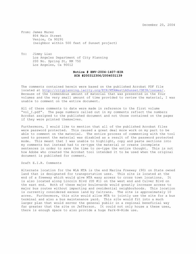
December 20, 2004 From: James Murez 804 Main Street Venice, Ca 90291 (neighbor within 500 feet of Sunset project) To: Jimmy Liao
Los Angeles Department of City Planning 200 No. Spring St, RM 750 Los Angeles, Ca 90012
Notice # ENV-2004-1407-EIR SCH #200312306/2004031139
The comments contained herein were based on the published Acrobat PDF file located at http://cityplanning.lacity.org/EIR/MTAWestLASunset/DEIR/issues/. Because of the tremendous amount of material that was presented in the four volumes and the very small amount of time provided to review the material, I was unable to comment on the entire document. All of these comments to date were made in reference to the first volume “vol_I.pdf”. The page numbers called out in my comments reflect the numbers Acrobat assigned to the published document and not those contained on the pages if they were printed themselves. Furthermore, I would like to mention that all of the published Acrobat files were password protected. This caused a great deal more work on my part to be able to comment on the material. The entire process of commenting with the tool used to present the material was disabled as a result of the password protected mode. This meant that I was unable to highlight, copy and paste sections into my comments but instead had to re-type the material or create incomplete sentences in order to save the time to re-type the entire thought. This is not how Adobe who created the Acrobat tool intended it to be used when the original document is published for comment. Draft E.I.R. Comments Alternate location for the WLA MTA is the end Marina Freeway (90) on State owned land that is designated for transportation uses. This site is located at the end of a freeway which would give MTA easy access to cross town locations. It is also located along Lincoln Blvd (US #1) on the west end and Culver Blvd on the east end. Both of these major boulevards would greatly increase access to major bus routes without impacting and residential neighborhoods. This location is currently considered excess land by Caltrans. The site is approximately 10 acres. Furthermore, this site would allow MTA to jointly use the site for a bus terminal and also a bus maintenance yard. This site would fit into a much larger plan that would server the general public in a regional beneficial way far greater that the site on Jefferson. It could not only house a these uses, there is enough space to also provide a huge Park-N-Ride use.

Finely, if these reasons are not compelling enough to use this alternate site, consider that the Exposistion Blvd right-of-way connects to Culver Blvd at Roberson Blvd and at this intersection the MTA is planning to build a light rail terminal. From that terminial it is only logical to connect the airport (Green Line) by traveling down Culver Blvd to Lincoln, past Marina Del Rey and Playa Vista and LAX. This alternate site would be exactly in the path of this route and therefore be a very logical location for a major MTA site. And if for no other reason, consider the cost impact to the MTA who could aquire this land from the State at a fraction of the cost of the Jefferson Blvd Site. 2. Alternate F. Pg 21 Assumes the entire site as commercial would result in a negative impact on the surrounding community and an increased traffic. This is not true but depends on the commercial use. Example, the site is zoned M1 and therefore could also house a boat yard which generates far less impact than any of the suggested uses. A boat yard just two blocks would meet coastal access needs. A multi-story parking garage with a recreational park on the top story and commercial shops on the Main Street side would also generate less daily traffic and provide far more coastal access. Further this alternate describes how it would not conform to surrounding uses nor maintain the historic character of the neighborhood. This could not be farther from the truth. This site as far back the as the 1800's has always been used for commercial uses and now proposing that it should become residential is changing the very zoning mix that makes Venice such a unique place. The properties along Sunset and Thornton have always been impacted by a commercial use on this site. Any new development should be sensitive to the residents on these two abutting streets. Having a commercial use on this site employs people. There are very few sites in Venice that have the ability to create subterranean parking and therefore accommodate commercial uses. 3. Alternate G. pg 23 Assumes the developer must make as much money as possible to make this project feasible. This is not true and very out of character for a public entity like the MTA who is a joint partner in this project. If at the end of the day both sites were created and no profit was generated other than serving the communities in which these projects exist, I for one would be much happier. 4. Of the alternates explore none for the Sunset project on pages 20 through 23, consider the existing uses along Main Street between Rose Ave. and Brooks. Although this developer has just completed a project directly across the street on Main St. called the Venice Art Lofts, this project was a CUP down zoning a M1 site to a mixed-use project which has only 3000 sq. ft. of commercial and 40+ residential units. The Art Lofts site is about 40,000 square feet. The prior use of this site before the Art Lofts project was a small movie production studio. Located at 615 Main St. which is also across the street and next door to the Art Lofts site, the same developer was recently permitted to down zone M1 to again all residential uses another site which is about 40,000 square feet. The prior business on this site was a lumber year and a parking lot. The combined reduction of commercial or light industrial uses in this area by this developer has been huge already. In just these two projects the commercial space along main street has decreased by 97.25 percent. If the reduction in commercial area from this project is considered in addition the total combined area from Rose to Brooks those numbers would be even greater.

The Venice Local Coastal Program, Land Use Plan (LUP) describes the project site as the North Venice Area (exhibit 2a). The LUP defines the entire area of Venice includes approximately 53 areas of industrial land. This site consists of 9.4% of the total in light industrial land Venice and reducing the zoning from M1 to R3 within the North Venice area will have a tremoundus effect on the overall land mix. This will also be very inconsistent with the guidelines of the LUP or the LA City General Plan. Preservation of existing industrial land uses and employment opportunities, appropriate use of railroad right-of-ways Section E on pg 24 Describes the west Los Angeles Transportation Facility. It is incorrectly described because it use is the same as that which is now in Venice which has long been referred to as the Bus Maintenance Yard. A transportation facility implies that it is a place of transportation where people can obtain a ride to another place. So unless I'm missing something big, this site is going to be closed to the general public and the only transportation use that is going to exist is when the bus drivers enter and exit the maintenance facility. It is a waste of resources to build a single use facility. A transportation facility should not be located in some remote location but rather in the hart of things. It should allow people to ride local forms of transportation to it where they can change to higher speed and less local forms of transportation. It should also provide a home where MTA workers can service the buses as needed. pg 25 heights must conform with the sight lines of the neighboring walk streets on Thornton and Sunset sides. The Pacific side of the project should conform with the height requirements of the Walk Streets between Sunset and Thornton on the west side of Pacific Ave. Any additional allowance in height should only be allowed to fall below the sightline from the opposite site of the street which a measurement is being taken from. This should include roof top patios, mechanical structures and roof top access points. There is a reference document included in the LUP that describes sightline and was the foundation on which the LUP based it guidelines. The concept of measuring the height of the buildings within this project from a datum point will be very unfair to all surrounding properties. Since the datum point describes one point within the entire project from which all height measurements are to be derived, the site topography is not being considered. Take forinstance, the intersection of Pacific Ave at Sunset Ave, it is nearly 10 feet higher than the corner of Thornton Ave at Main Street. In effect if this project is measured from just one datum point as described in this section then a building on Main at Thornton could be 40 feet in height if measured from the centerline of Main Street as all other projects are in Venice are required to do. It would be very inconsistent in Venice to allow a project that is 45 times the size of a normal lot (2700 sq. ft.) be considered in the same light when it comes determining which side of the site is considered the front and how this impacts the height and setback requirements. The intent of the LUP when it describes height with a flat roof vs. a varied roof line was concerned with line-of-site from the pedestrians point of view. This assumed the pedestrian would be standing on the street looking up at the roof. Side yard views were not considered because they were not visible from the street which is the publics perception point. Therefore on a project which is exposited to more

than one street along it sides; it only can be assumed that the front yard view shall apply along those sides that abut a street. Several items have been stated incorrectly including building heights. The LUP states and shows in it map Exhibit 19a Thornton is considered a Walk Street (also see pg 3-28 LUP, Policy II.C.7.). Therefore the height on this side of the project is limited to 28 feet. All other building heights are limited to 30 unless they have a varied roof line. The plan also makes it clear where the height will be measured from and it is not as stated in this DEIR. I think it is unfair to the community to think of this site as only having one street frontage and therefore having to only conform to setbacks and other regulations that apply to a normal (30' x 90') lot in Venice. Because this site impacts the four surrounding streets, is proposed for two hundred plus residences plus commercial, I feel it should be considered as fronting on all four of these streets. This would allow the project to respect neighboring properties and in some ways maintain the character of the existing scale. In contrast as the project is now proposed, it could clam that Sunset and Thornton are side yards and then install high fences, five foot setbacks, high limit of 35 feet or more and offer no entry ways into the units along these streets. In effect this would make these side streets into dark feeling alley like ways for the existing properties across the street. To further maintain the character of the abutting community entry points into and out of this project must be consistent with the surrounding properties. Without entries every thirty to sixty feet along the Sunset and Thornton sides, this project will in effect be a gated community sitting behind a solid wall (something that is not permitted in the LCP or LUP for commercial uses). The areas around the outside of the walls weather landscaped or not will be locations of little pedestrian traffic and therefore become neglected over time. The LUC and LCP both refer to ground floor entry points which must exist from the front of all projects. To comply with the intent of these documents this project must create ingress and egress points around the entire perimeter at intervals in scale with the properties across each of the four abutting streets. Pg 27 Views - this talks about private party views from level ground area and go on to state that is no impact on other properties in the area. This is not true. Since this project is asking for a height increase over what any other project can build with exceptions, all other projects will have their views encroached into. It will limit everyone else from having a roof top patio and being able to see the surrounding views weather they be the mountains or the ocean. It is not clear if the heights are absolutes or allows for mechanical and roof top access structures in addition to the height numbers called out. On two prior projects this developer has built across the street, they have shown on their plans maximum heights within the limits and then build roof top access houses that occupy more than 50 percent of the rooftop area. These additional structures completely block the view of the mountains from my building which complies to the 30 foot height limit. Pg 28 Illumination: This builder showed a model of the site where the exterior was covered with an metal siding and was described in the public meeting to be the same as the Art Lofts building across the street. Assuming they spoke the truth and showed correct information, than this material is very reflective to neighboring properties. My building is about five hundred away from the Art Lofts project and we see a very strong light source of light at night reflecting from that building to ours. The Art Lofts building has a very highly reflective building.
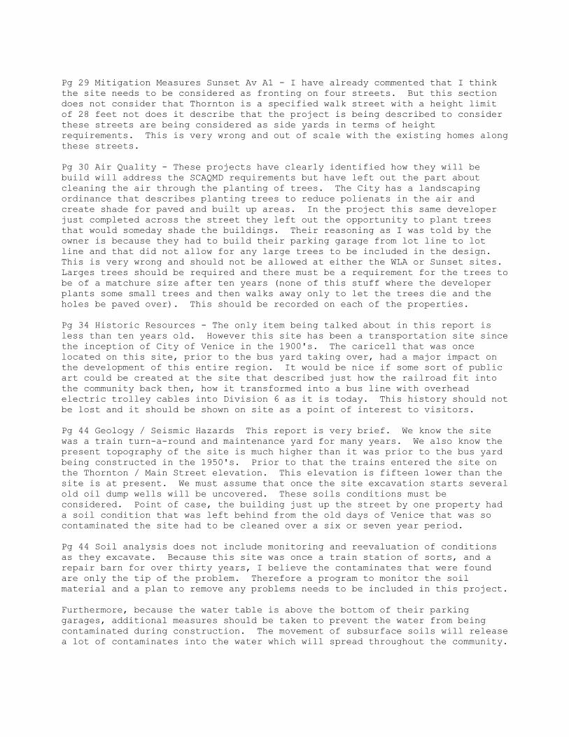
Pg 29 Mitigation Measures Sunset Av A1 - I have already commented that I think the site needs to be considered as fronting on four streets. But this section does not consider that Thornton is a specified walk street with a height limit of 28 feet not does it describe that the project is being described to consider these streets are being considered as side yards in terms of height requirements. This is very wrong and out of scale with the existing homes along these streets. Pg 30 Air Quality - These projects have clearly identified how they will be build will address the SCAQMD requirements but have left out the part about cleaning the air through the planting of trees. The City has a landscaping ordinance that describes planting trees to reduce polienats in the air and create shade for paved and built up areas. In the project this same developer just completed across the street they left out the opportunity to plant trees that would someday shade the buildings. Their reasoning as I was told by the owner is because they had to build their parking garage from lot line to lot line and that did not allow for any large trees to be included in the design. This is very wrong and should not be allowed at either the WLA or Sunset sites. Larges trees should be required and there must be a requirement for the trees to be of a matchure size after ten years (none of this stuff where the developer plants some small trees and then walks away only to let the trees die and the holes be paved over). This should be recorded on each of the properties. Pg 34 Historic Resources - The only item being talked about in this report is less than ten years old. However this site has been a transportation site since the inception of City of Venice in the 1900's. The caricell that was once located on this site, prior to the bus yard taking over, had a major impact on the development of this entire region. It would be nice if some sort of public art could be created at the site that described just how the railroad fit into the community back then, how it transformed into a bus line with overhead electric trolley cables into Division 6 as it is today. This history should not be lost and it should be shown on site as a point of interest to visitors. Pg 44 Geology / Seismic Hazards This report is very brief. We know the site was a train turn-a-round and maintenance yard for many years. We also know the present topography of the site is much higher than it was prior to the bus yard being constructed in the 1950's. Prior to that the trains entered the site on the Thornton / Main Street elevation. This elevation is fifteen lower than the site is at present. We must assume that once the site excavation starts several old oil dump wells will be uncovered. These soils conditions must be considered. Point of case, the building just up the street by one property had a soil condition that was left behind from the old days of Venice that was so contaminated the site had to be cleaned over a six or seven year period. Pg 44 Soil analysis does not include monitoring and reevaluation of conditions as they excavate. Because this site was once a train station of sorts, and a repair barn for over thirty years, I believe the contaminates that were found are only the tip of the problem. Therefore a program to monitor the soil material and a plan to remove any problems needs to be included in this project. Furthermore, because the water table is above the bottom of their parking garages, additional measures should be taken to prevent the water from being contaminated during construction. The movement of subsurface soils will release a lot of contaminates into the water which will spread throughout the community.

The polluted ground water will then spread to the trees and plants in the surrounding area, which will feed on this water. Although some of the trees may die from the contaminants the greater risk to the general public will be as these trees grow from this water they will carry the pollutants into their leaves. Then as the leaves drop to the ground the pollutants that have been buried for many years will exist on the surface where people and animals will come in contact with them. Pg 51 The LCP and LUP specify uses for this site but do not suggest the proportions of residential to commercial uses. These documents do suggest however that industrial zoned lots as this are very limited in the Venice area. Because this project is so heavily weighted as residential, I believe this is out of conformance with the intent of these documents. This site is very unique to Venice because of its size. To build it out as mostly residential the community is losing the chance to have more local business located here which translates into the loss of local jobs in the community. The net effect is more people having to commute longer distances to get to work which has an even greater effect on the environment and quality of life. Pg 54 Mitigating measures… This plan is assuming that the existing site complies by making statements like the new use would be no greater of an impact on the community than that which is present. This is flawed because the existing site has never complied with LA City zoning and building codes. If this site was to first comply and then the project impacts were compared the determinations of mitigating measures would be much different. It is wrong to base the findings on a use that does not comply at present. This is like enforcing traffic laws by the cars that exceed the speed limit! The coastal impacts of this project should not be based on what is being provided but rather that which is not talked about. Industrial/Commercial land near the ocean is very limited. Because of the size of this lot will accommodate the parking requirements of such uses (where most similar zoned lots in Venice can’t), the loss to the coastal access will stem from lack of visitor servicing uses that this project has incorporated into it’s design. Other ground floor uses that require a lot of this size to exist include a grocery store, entertainment center, retail stores or a hotel. Pg 55 The statement that reads, “It would not alter any land use patterns in the area” is just a plain lie. The site is being converted from a industrial bus yard to a mostly residential project. This has a huge effect on land use patterns and must be considered on a community wide level. This site accounts for over 9.4% of the industrial land in Venice. Pg 58 H.1 The allowed hours of operation seems to always be an issue with some contractors. It needs to be made clear that equipment and trucks that arrive at the site one hour or two before or after these limits are creating an impact on the community and are a breach of this EIR. This should also extend to the workers who arrive or leave the site early or late when parked through the neighborhood. These impacts are very real and must not be allowed to exist. Pg 60 Truck loads per day is scheduled to be 100 as stated. Based on the start time of 7AM and an end time of 6PM that gives the developer 11 hours per day to run the 100 trips. When converted into trips per hour that comes out to 9.n trips or put another was about one round trip every six minutes. Keeping in

mind each of these trips is an in and out of one truck that means that about every 3 minutes another truck is going to pass my home. This rate exceeds the traffic flow during many hours of the day that is described as their work schedule. This will mean that several trucks per hour will be waiting in traffic if the scheduled described will be maintained. This will have a huge impact on all traveled streets. Without knowing the exact amount the 100 trucks per day will carry, I can only guess at the period of time it will take the developer to move the 125,000 cubic yards of dirt. But based on what I know about dump trucks I will take a guess that these trucks (without over loading the local streets from weight or size) can carry 12 yards per trip. In doing the math assuming all goes as planed, the excavation period will last for 10,416 trips or 104 week days (20 weeks). Although this number on paper may not seem like much, to have these double trailer trucks driving back and forth for nearly a half year does create a very large short-term impact. When the accumulated effect of this with the trucks that will be waiting in traffic on the 3 minute interval occurs the impact will be even greater. Therefore the trips per day should be greatly reduced (perhaps to 35 during non peek hours) even though it will mean it takes longer to dig the hole. Pg 63,64 Mitigating measures… Workers must park at remote sites and should not be allowed to enter the job site by other than the remote shuttle which will only service the remote parking lot. This is the only way to control the construction workers from parking in the neighborhood and removing the limited public parking that exists today. Furthermore no barricades, construction fences or other means of street closures should be allowed that remove street parking from Main Street or Pacific Ave. In the event that new curbs, gutters and sidewalks are to be created along these streets, the work done here must try to limit any required inconveniences to the local community. This work should only be allowed to start once the underground parking structures are complete and could be offered as temporary replacement parking. Parking in the North Venice area is very limited and every public parking space is always utilized. Pg 64 2.I.2 Right turn restriction will only cause people to break the law or make U-turns at the next possible interesection. Going south from the project the next place to turn-a-round will be a U-turn at Brooks Ave which would cause traffic problems for the cars turning north from Abbot Kinney to Main Street or a left turn into the private driveway of 796 Main St. and then backing out onto Main. There is no other logical way for cars to leave the property exiting on Main. This option will cause lots of problems and should not be considered. Adding a traffic light at Thornton Ave would make a lot more sense since it would also provide for pedestrian crossing. The light would need to be timed with Brooks and Rose. Pg 64 2.I.3 Re-striping Rose causing the loss of 4 public parking spaces should not be allowed. If this project is going to remove public parking than it needs to be scaled back to reduce the impact or it needs to create additional parking on Sunset or Thornton Ave. to replace that which they are removing. Under no circumstances should re-striping be permitted if any loss of parking will occur.
Pg 64 2.I.4 For reasons given above no parking should be allowed to be removed. Furthermore, the re-striping of sound bound traffic to provide a left and right dedicated turn lanes will cause the street to lose one of the two existing south bound traffic lanes. This will cause many traffic problems and cause more traffic onto neighboring residential streets. The corner of Sunset and Main should be required to have a traffic light installed. A controlled crosswalk is very needed at this intersection since the next crossing point is very far away and because Sunset is a through street to the Oakwood neighborhood where a lot of pedestrians come from that travel to the beach. In prior years an underground tunnel existed at this intersection. The tunnel allowed the hundreds of beach traveler’s safe passage without having to stop traffic on Main Street. In the early 1990’s the tunnel was closed on both ends because homeless had made it to dirty and the City did not want to maintain it any longer. This intersection if equipped with a traffic light control would not only allow safer access to this site and provide safer travels to coastal visitors, it would also create a traffic break that could be tied into migrating the right turn only item called out in 2.I.2 above. Pg 65 2.I.5 This flashing light will not solve cross traffic problems that already exist. Furthermore, it will not improve the egress from the project exit on Sunset for cars that want to travel northbound on Main St. Pg 68 J.1 This measure assumes there is a parking lot one block north of the project site that is not in use at present. This is a false assumption. The lot is owned by the City and is used at night by local residents and during the day by beach visitors and for overflow street parking and for the local businesses on Main and on Rose. Furthermore, by allowing the construction workers to arrive to the jobsite on foot, the contractor has no way to ensure the workers did not take street parking. The project should not allow any worker to arrive on foot. The only way for workers that don’t park on site to arrive should be by contractor sponsored shuttle. The parking lots for the shuttle should be located outside the beach impact area at a remote lot east of Lincoln Blvd. No exception to this recommendation should be permitted. This should not preclude onsite parking within the property lines of this project. Pg 121 talks about the Goal 2 Chapter 3… What the writer has left out is the accumulation effect that this developer has brought to the area. This will their third project on this block. The first project was building that is now called Art Lofts which took an industrial site that was used as a movie studio for nearly thirty years and down zoned it to 44 artist-in-residences. The second project is scheduled to begin any day now. It is also across the street from the existing MTA site. It is a one acre M1 and C2 zoned lot that up to a few years ago was a lumber yard and then a parking lot. The project that is being built on this lot is again 35 (or 38) condos. Now comes the MTA Division 6 site. It is zoned M1 and could support commercial uses but again the site is being down zoned to build more residential units for the most part. This is not following the intent of the Goal 2 nor the General Plan Framework. We do not want our commercial areas turned into high priced condos. The ratio of commercial to residential is very out of balance given what has been done and that which is being proposed here.

Pg 123, 10.F.3.a Describes the height limits of the LCP however stop short to describe how to interpret them when the project fronts on all sides nor does the writer describe where the property line of the internal Condos will be considered. Since the internal buildings are all condos and each owner will have title to their portion of the overall project then it seems to me that those boundaries should apply to the height and setback laws as well. To think that a project of this size should be allowed to call Thornton Ave (which in the LUP is described as a Walk Street) a side yard and therefore exceed the height of the front yard maximum by over fifteen feet is outrageous. Let me also point out that the height limit does not prevent roof top access structures and as anyone can now see the project across the street that this developer just completed (Art Lofts) has not one roof top structure that everyone can use but one for every unit which has effectively added another entire story to their building. Also these rooftop structures are a lot larger than is required to bring a stairway to the roof. None of this is described in the DEIR and should not be allowed. The maximum height limit described in this document should include everything including all mechanical and roof access structures.
------- General comments ------ The project site needs to be considered to have four fronts with respect to setbacks and any conditions that should apply to a property frontage. To consider this project as having just front, two sides and one rear is just not right. No other site in Venice comes even close to the size of this lot. To allow this project to have the side height exceed that which would be allowed across the street on Pacific, Sunset or Thornton where front heights must be preserved is totally wrong and out of character with the neighborhood. It does not conform to the current zoning codes (“Q” conditions) and should not be allow to move forward until those conditions are first met (at least on paper). The existing conditions require the site to provide 75 parking spaces to the general public. These would be considered replacement spaces at the present time by the coastal commission and would be required in addition to the parking being offered at present. No mention is made about under grounding overhead power and communication services. The power service to the MTA lot was increased about ten fold a little over a year ago. The lager service required three very large transformers be located on Thornton Ave. The service was so large that many new poles had to be installed along Electric Ave. all the way back to Venice Blvd. This service upgrade impacted many properties with the new bigger and more frequent power poles. Since the proposed use will not need this tremendous service (described by one DWP supervisor as enough electricity to power a small city), the contractor should not only locate these transformers inside the underground area of their site, I think the poles that are no longer going to be required for the MTA power plant should be removed or the service put underground all the way back to Venice Blvd. The artist rendering of the project (figure II-7) is looking at the south east corner where Thornton intersects to Main Street. Also located at this intersection and not shown in the drawing is a electrical service box that is part of the Thornton Ave Storm Water Pumping Station. The drawing nor any of the text describes what will become of this service nor how it will receive it’s electrical power once the project is constructed.

Given the eight months the developer had to prepare this document using several teams of writers, it seems unfair to not extend a longer period of time for the community to respond. What a way to spend the pre-holiday season! I just wonder who is going to read any of the comments prior to next year.
####