power delivery & markets distribution advisory council february 13, 2007 storm modeling
Post on 18-Dec-2015
213 views
TRANSCRIPT
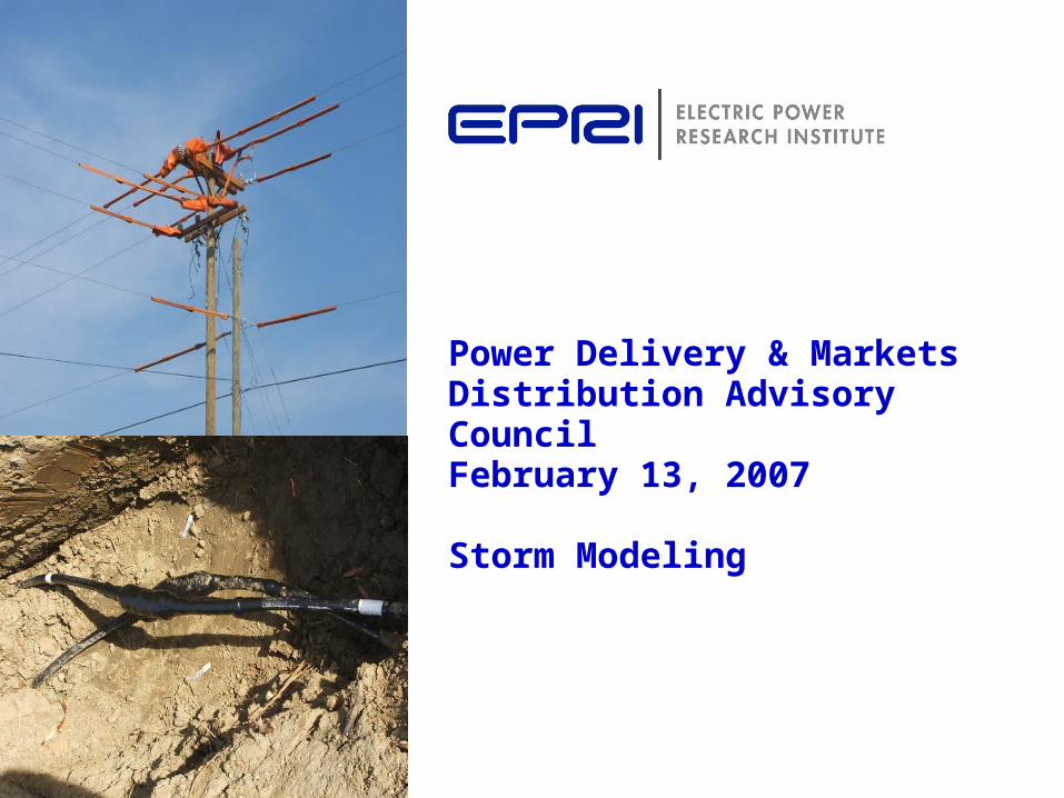
Power Delivery & MarketsDistribution Advisory CouncilFebruary 13, 2007
Storm Modeling
2© 2005 Electric Power Research Institute, Inc. All rights reserved.
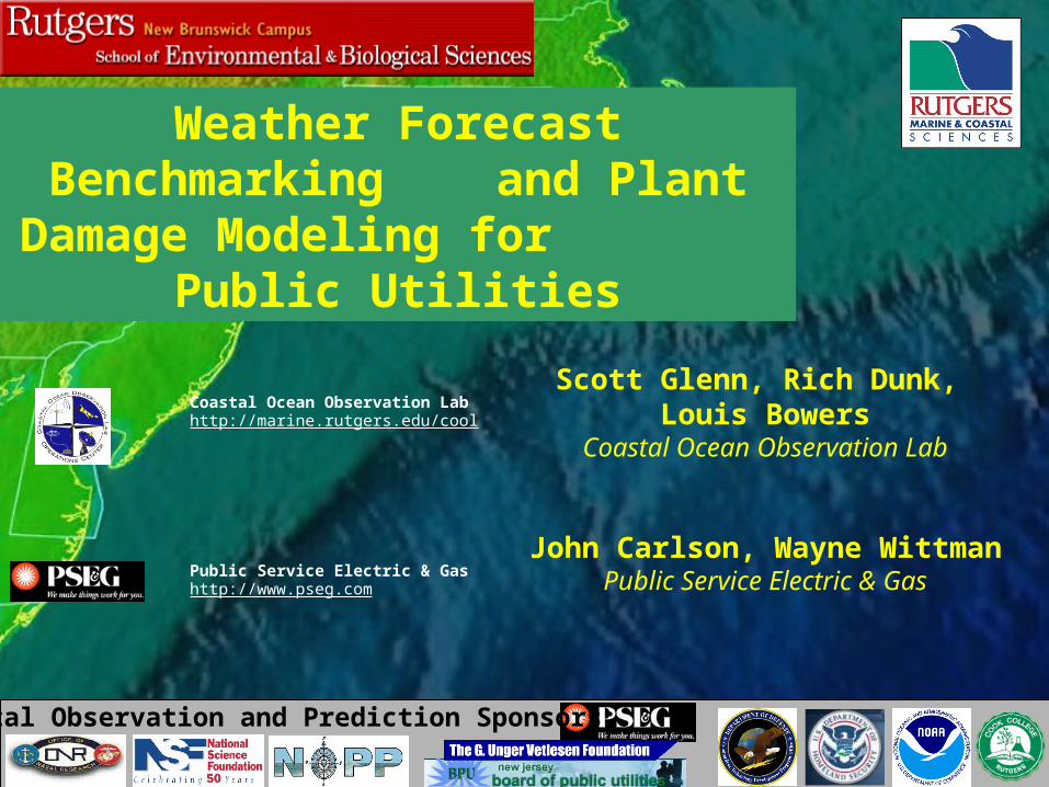
Coastal Ocean Observation Lab http://marine.rutgers.edu/cool
Scott Glenn, Rich Dunk, Louis Bowers
Coastal Ocean Observation Lab
Coastal Observation and Prediction Sponsors:
Weather Forecast Benchmarking and Plant Damage Modeling for
Public Utilities
Public Service Electric & Gas http://www.pseg.com
John Carlson, Wayne WittmanPublic Service Electric & Gas
3© 2005 Electric Power Research Institute, Inc. All rights reserved.
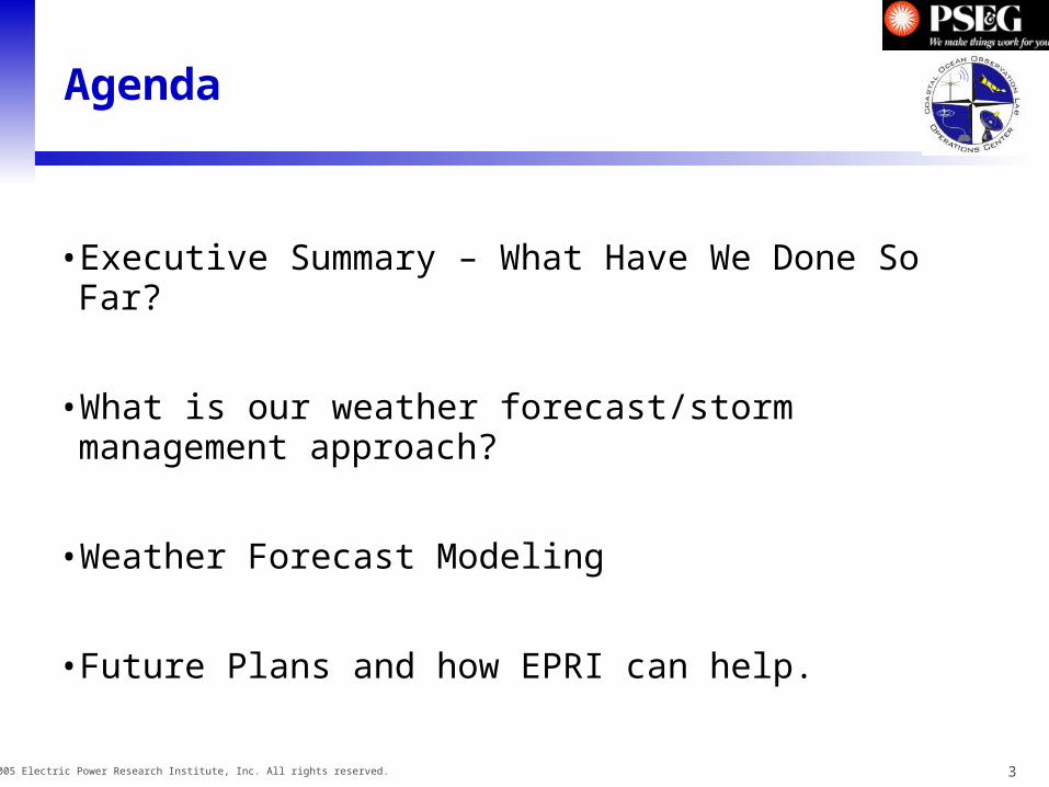
Agenda
• Executive Summary – What Have We Done So Far?
• What is our weather forecast/storm management approach?
• Weather Forecast Modeling
• Future Plans and how EPRI can help.
4© 2005 Electric Power Research Institute, Inc. All rights reserved.
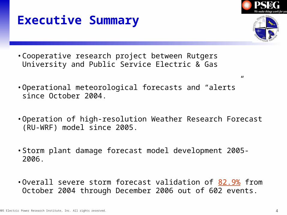
Executive Summary
• Cooperative research project between Rutgers University and Public Service Electric & Gas
• Operational meteorological forecasts and “alerts” since October 2004.
• Operation of high-resolution Weather Research Forecast (RU-WRF) model since 2005.
• Storm plant damage forecast model development 2005-2006.
• Overall severe storm forecast validation of 82.9% from October 2004 through December 2006 out of 602 events.
5© 2005 Electric Power Research Institute, Inc. All rights reserved.
Tasks
• RU-WRF model operation
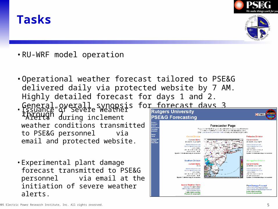
• Operational weather forecast tailored to PSE&G delivered daily via protected website by 7 AM. Highly detailed forecast for days 1 and 2. General overall synopsis for forecast days 3 through 7.
• Issuance of Severe Weather “Alerts” during inclement weather conditions transmitted to PSE&G personnel via email and protected website.
• Experimental plant damage forecast transmitted to PSE&G personnel via email at the initiation of severe weather alerts.

6© 2005 Electric Power Research Institute, Inc. All rights reserved.
Rutgers Weather Forecast Process
• Forecasts issued by Senior Meteorologist and upper-level undergraduate students.
• Model has state-of-the-art physics and microphysics packages, high-resolution sea surface temperatures (SST), and local mesoscale meteorological observations.
• Forecasters use RU-WRF model in combination with various other forecast models, analyses, ocean products, etc. to formulate forecast.
7© 2005 Electric Power Research Institute, Inc. All rights reserved.
Student Teaching Teams
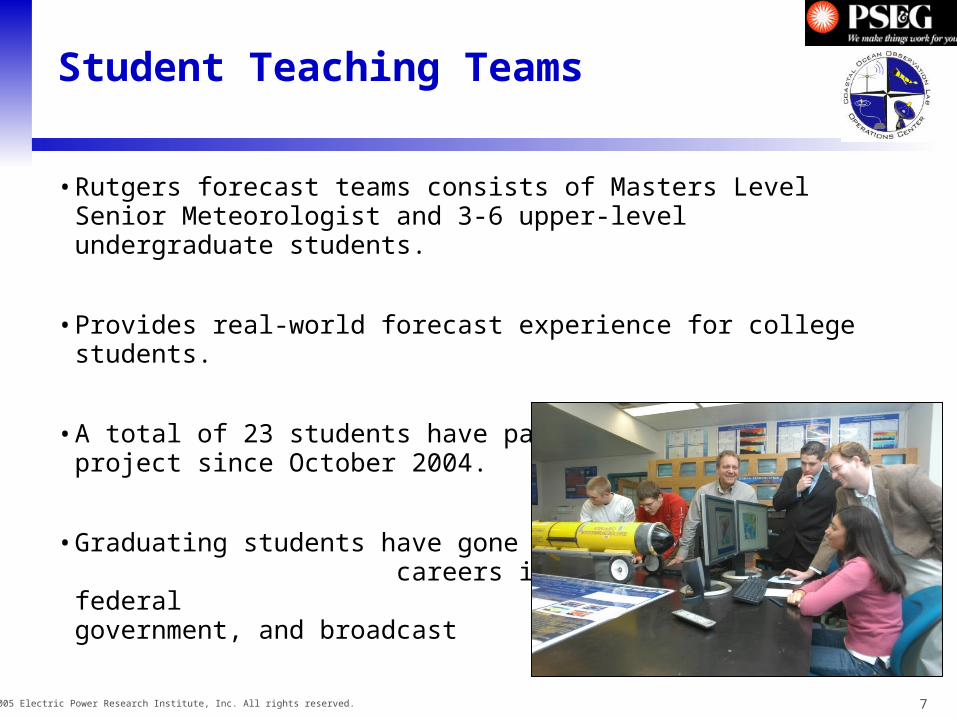
• Rutgers forecast teams consists of Masters Level Senior Meteorologist and 3-6 upper-level undergraduate students.
• Provides real-world forecast experience for college students.
• A total of 23 students have participated in the project since October 2004.
• Graduating students have gone on to careers in private sector, federal government, and broadcast meteorology.

8© 2005 Electric Power Research Institute, Inc. All rights reserved.
Modeling Introduction
• WRF: Weather Research Forecast– Run 3x daily– Duration out 24 to 120 hours
• Climatological “Model”– Statistical correction to WRF
model data using observations.
• Plant Damage Model– Prognostic equations to predict PSE&G
equipment loss during severe weather events. Equations developed using historical damage reports and archived meteorological observations. Input to model is RU-WRF forecast severe storm parameters.
9© 2005 Electric Power Research Institute, Inc. All rights reserved.
Alert Criteria
• Severe Thunderstorms Possible– Severe thunderstorms are expected within the first forecast period or are presently occurring.
• Heavy Rainfall Alert– Heavy rainfall amounts or rates are expected or occurring.
• Significant Wet Snowfall Accumulations– Greater than 3 inches of wet snow is expected to fall, and stick, especially on branches and power lines.
Significant Dry Snowfall Accumulations– Greater than 5 inches of dry snow is expected to fall.
Significant Icing Alert– Non-trivial accumulation of freezing rain is expected, or greater than 0.1 inches of sleet.
• Excessive Heat Alert– Air temperatures and/or heat indices exceed 90° F for a period greater than 3 hours, or if temperatures and/or heat
indices max at or above 95° F for any length of time. •
Excessive Cold Alert– Air temperatures go below 15° F for a period greater than 3 hours, or if temperatures go below 10° F for any length of
time. Also used when wind chills go below 0° F for any extended period of time. •
Excessive Wind Alert– Sustained winds exceed 25 MPH for a period greater than 3 hours, or if wind gusts above 30 MPH at any time.
• Frequent Lightning Strikes Possible– Frequent cloud-to-ground lightning is possible during the next 12 to 24 hour period.
10© 2005 Electric Power Research Institute, Inc. All rights reserved.
Verification
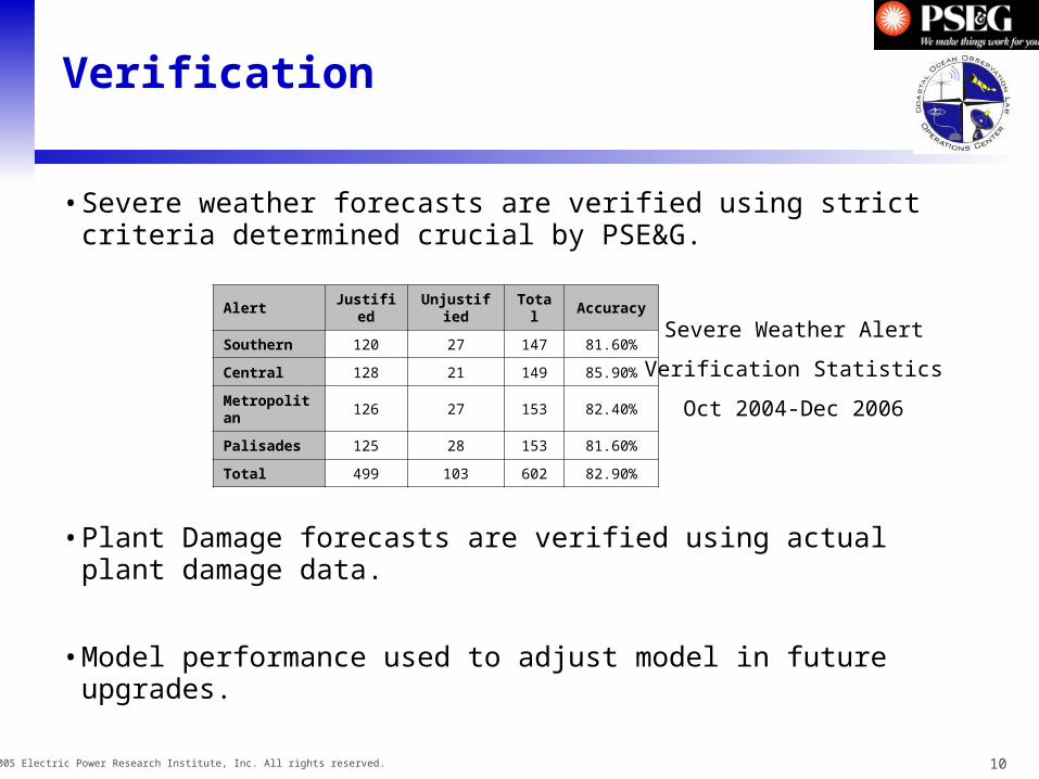
• Severe weather forecasts are verified using strict criteria determined crucial by PSE&G.
• Plant Damage forecasts are verified using actual plant damage data.
• Model performance used to adjust model in future upgrades.
Alert Justified Unjustified Total Accuracy
Southern 120 27 147 81.60%
Central 128 21 149 85.90%
Metropolitan 126 27 153 82.40%
Palisades 125 28 153 81.60%
Total 499 103 602 82.90%
Severe Weather Alert
Verification Statistics
Oct 2004-Dec 2006
11© 2005 Electric Power Research Institute, Inc. All rights reserved.
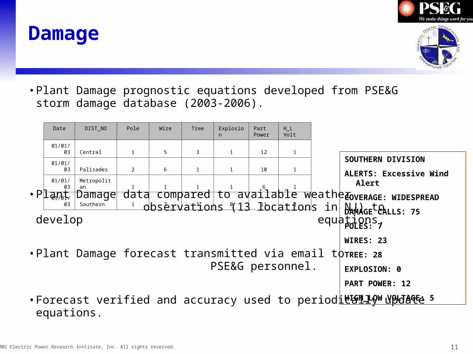
Damage
• Plant Damage prognostic equations developed from PSE&G storm damage database (2003-2006).
• Plant Damage data compared to available weather observations (13 locations in NJ) to develop equations.
• Plant Damage forecast transmitted via email to PSE&G personnel.
• Forecast verified and accuracy used to periodically update equations.
Date DIST_NO Pole Wire Tree Explosion Part Power
H_L Volt
01/01/03 Central 1 5 3 1 12 1
01/01/03 Palisades 2 6 1 1 10 1
01/01/03 Metropolitan 1 1 1 1 6 1
01/01/03 Southern 1 7 1 0 11 0
SOUTHERN DIVISION
ALERTS: Excessive Wind Alert
COVERAGE: WIDESPREAD
DAMAGE CALLS: 75
POLES: 7
WIRES: 23
TREE: 28
EXPLOSION: 0
PART POWER: 12
HIGH_LOW VOLTAGE: 5
12© 2005 Electric Power Research Institute, Inc. All rights reserved.
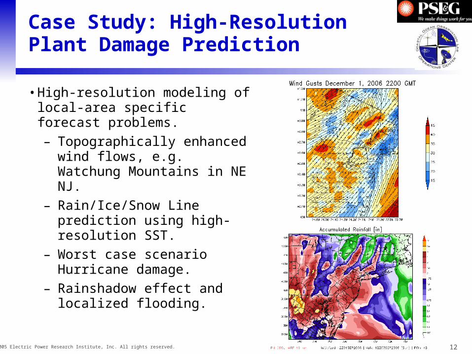
Case Study: High-Resolution Plant Damage Prediction
• High-resolution modeling of local-area specific forecast problems.
– Topographically enhanced wind flows, e.g. Watchung Mountains in NE NJ.
– Rain/Ice/Snow Line prediction using high-resolution SST.
– Worst case scenario Hurricane damage.
– Rainshadow effect and localized flooding.
13© 2005 Electric Power Research Institute, Inc. All rights reserved.
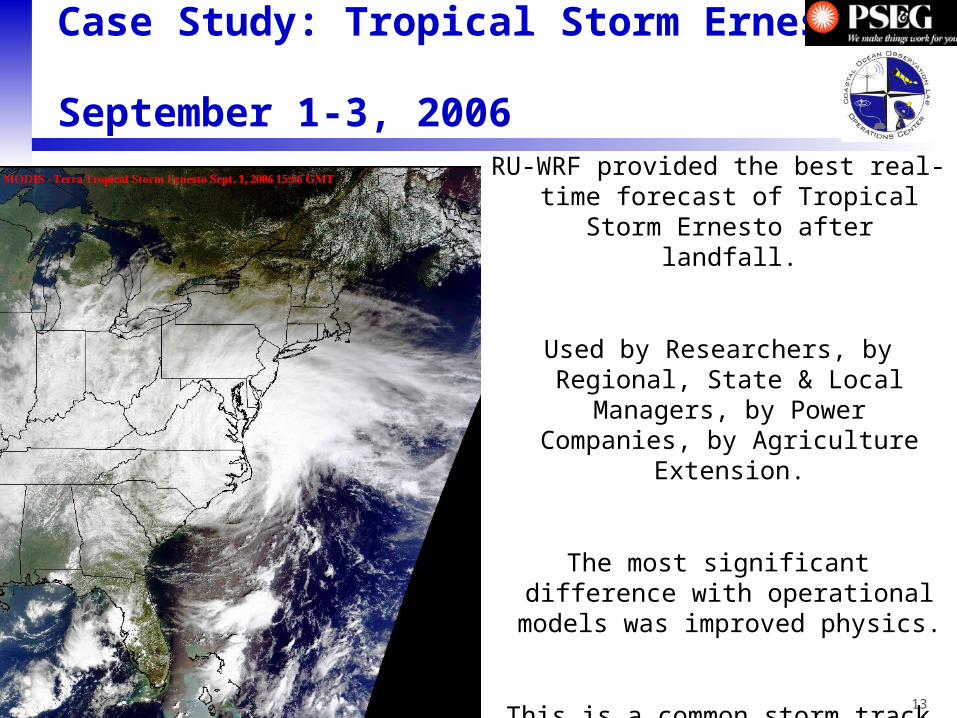
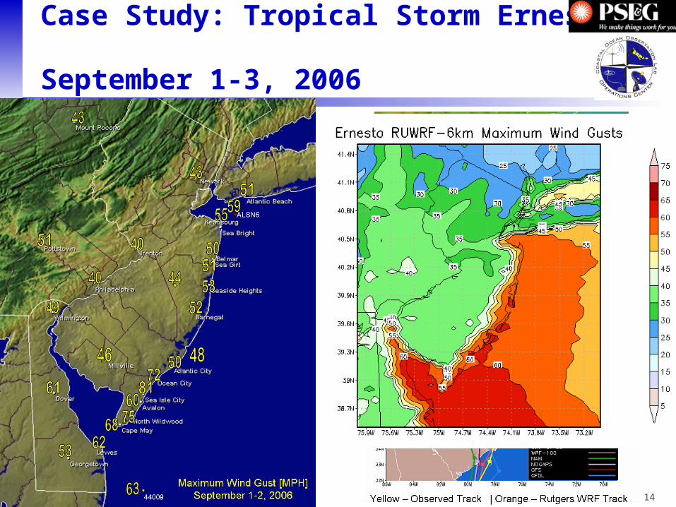
Case Study: Tropical Storm Ernesto September 1-3, 2006
RU-WRF provided the best real-time forecast of Tropical Storm Ernesto
after landfall.
Used by Researchers, by Regional, State & Local Managers, by Power
Companies, by Agriculture Extension.
The most significant difference with operational models was improved
physics.
This is a common storm track for the Mid-Atlantic States.
14© 2005 Electric Power Research Institute, Inc. All rights reserved.
Case Study: Tropical Storm Ernesto September 1-3, 2006

15© 2005 Electric Power Research Institute, Inc. All rights reserved.
Limitations
• There is no such thing as a perfect forecast.
• Plant Damage model effectiveness tied to availability of relevant data and model verification.
• Small-scale phenomena still not well simulated by weather forecast models, e.g. isolated summertime severe thunderstorms.
• Rare and extreme events may not be well forecast by plant damage model equations.
16© 2005 Electric Power Research Institute, Inc. All rights reserved.
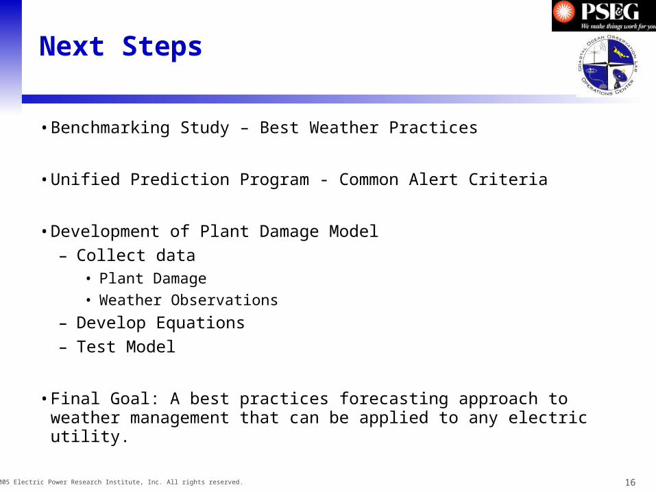
Next Steps
• Benchmarking Study – Best Weather Practices
• Unified Prediction Program - Common Alert Criteria
• Development of Plant Damage Model
– Collect data• Plant Damage
• Weather Observations
– Develop Equations
– Test Model
• Final Goal: A best practices forecasting approach to weather management that can be applied to any electric utility.
17© 2005 Electric Power Research Institute, Inc. All rights reserved.
End