potential of uav for field sensing advanced remote sensinghonda/textbooks/advrs/uav_class.pdf ·...
TRANSCRIPT

\
HONDA Kiyoshi Int’l Digital Earth Applied Science Research Center (IDEAS)
Chubu University [email protected]
Potential of UAV for field sensing!!
Advanced Remote Sensing�
UAV ( Unmanned Aerial Vehicle ) became realistic sensor platform for agriculture
Monitoring of rice field at Aichi Irrigation Command Area in Handa City�

]
! Unmanned Air Vehicle(UAV) or System(UAS) ! Long history of no-pilot aircraft development ! From Military to Civil Applications ! Recent Development
! Sophisticated sensor fusion control ! Autopilot ! Low-Cost ! 3D solution – software
! Great potential for application ! Utilizing UAV as a sensor platform ! Fixed Wing – Rotor Type ! 100g to several 10 kg payload
UAV Overview
! Civil application ! Reconnaissance, Security ! Surveying – topographic ! Scientific monitoring – Air Pollution… ! Agriculture - Pesticide application, Monitoring ! Video shooting ! Logistics – Pizza, DHL, medicine ! Disaster – Nuclear power plant, volcanic eruption… ! Etc.
UAV Applications

! Multi-scale RS ! Filling Gap between Satellite-Aircraft
and Ground Sensors/Measurement ! Satellite – Global –> several 100sq.km ! Aircraft – several 100sq.m - several
10 sq.km ! UAV – 10 sq.km – 0.1 sq.km
! Of course depends of capability of platform
! Flying below cloud level – ! Meter ( rota) to 300m or higher
! Mobility – Just fly ( small UAV) ! Very high resolution 10 cm – mm ! Low-cost ! Multi-stereo-image -> 3D
UAV as a remote sensing platform
! Limitation ! Flying duration ! Coverage ! Payload ! Legal regulation ! Limited sensor weight
HPC (GPGPU, Cluster, GRID)
Scenario Simulation
Satellite RS
Modeling on Big Data for Scenario Simulation
Sensor Network
ZReal Time Update
Cloud & Data Integration
Model Calibration
Comparison of Satellite LAI and Simulated LAI
0
1
2
3
4
5
0 30 60 90 120 150 180 210 240 270 300 330 360
DOY
LAI
LAI_satLAI_sim
UAV
Agri. Machines, Application records
Yield, Soil, etc.
Weather
Crop Model
Decision Making

_
! Small and Low-Cost Sensors ! New Field Platforms ! Mobile Internet ! Real-time field information from anywhere ! Environment, Disaster, Agriculture, Logistics, etc. ! Monitoring Panel, Early Warning, Simulation
+ Mobile Internet
Low Cost Sensor CO2: SenseAir
Field Platform FieldServer: NARC
Ubiquitous Field Sensor Network
Ubiquitous Field Sensor Network
Field Sensor Application Sensor Back-end Cloud Service
cloudSense Sensor Back-end Cloud Service
Based on Int’l Standard
Low Cost Implementation/Operation and Interoperability
cloudSense

The system is used in Japan
Cooperative with Dr.Nagai, University of Tokyo, Japan
Utilizing UAV as a real-time Sensor Network Node
Information while flying to rescue team
cloudSense�
! senseFly ( Switzerland ) ! autoPilot ! Payload 150grams ! Georeference Mosaic
Service ! 100-130Euro/sq.km
! DEM Service ! 400-520Euro/sq.km
! Option to Change Camera to Arm7 Linux
! Approx. 10,000USD ! Video (0:40)
Sensefly - swinglet

a
Agriculture Project In Obihiro Flying Under Cloud
Usual RGB image

b
NIR Image
Resolution from 100m altitude

c
Flight Planning Deciding Area, Resolution, Overlap
Flight Monitoring, Actual Flight Pat, Offload many photos

d
Data Processing Image Matching, External Orientation, Dense Matching, 3D Reconstruction, Projection, Mosaic
Proprietary – Pix4Mapper, etc.
Free – SfM, etc.
Structure from Motion (SfM)
Ortho-mosaicing
Mosaic and Publishing
\[
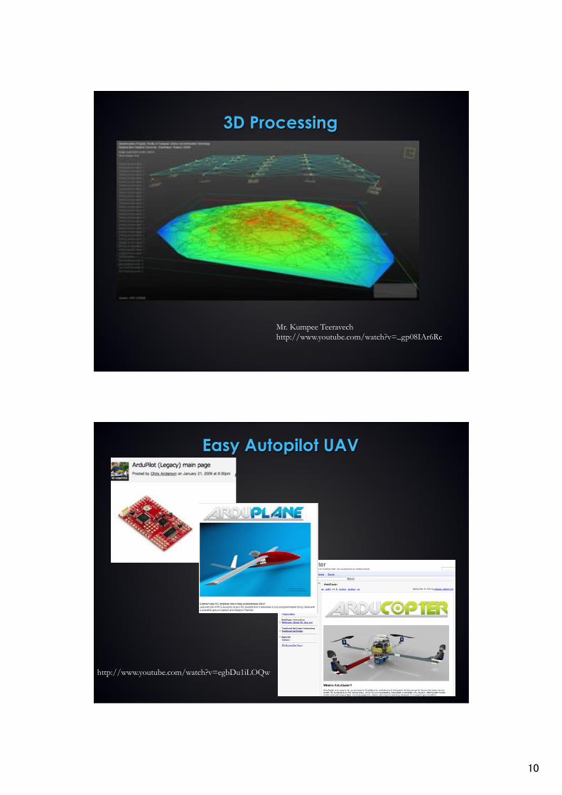
3D Processing
Mr. Kumpee Teeravech http://www.youtube.com/watch?v=_gp08IAr6Rc�
Easy Autopilot UAV
http://www.youtube.com/watch?v=egbDu1iLOQw�

\\
! HiSystems (Gemany ) ! half autonomous flight ! Set waypoints ! Payload 0.8-1kg ! Video
Mikrokopter
! Microdrones(Gemany ) ! autonomous flight ! MD4-200
! 200g payload
! MD4-1000 ! 1,200g payload
! Video (1:55)
Microdrones

\]
! $�;��~�����(Japan )
! autonomous flight ! Generation of DEM ! Video
Falcon-PARS
! Long-range UAV ! 1,400km ! Video
FUJI-IMVAC
D>OU1400km
http://www.youtube.com/watch?feature=player_embedded&v=usRJ9eqpOx4#t=255�

\
Field Touch Overview�
" Higher Yield " Better Quality " Land Management " Cost reduction " Risk Management " Inherit/Sharing Farming Skill
Crop, Land, Weather Monitoring�
Farm log / SNS�
Scenario Simulation�
Precision Farming
Satellite / Aircraft / UAV observation�
Field Sensor Network�
Application�
Cloud based Data source�
Native or OGC API�
Real Time and spatial information for decision making�
Own or External sensing devices�
An information platform to provide useful information on crop cultivation to farmers and other stakeholders�
Fieldtouch Agri. Info Service
! Development led by IHI. Chubu U provides sensor cloud, simulation and UAV technology
! Support Precision Farming using Satellite RS, Sensor Network, Simulation Technologies
! Currently serving to 120 Farmers in Hokkaido/Japan
! Going to be world wide
High-Resolution Satellite RS updated every two weeks. Monitor spatial variability of growth in fields to adjust fertilizer. Airborne and UAV images will be integrated in 2013.�
Real time weather, soil moisture, photos, Processed as a convenient form such as temp accumulation graphs. Heavy access from farmers every morning. cloudSense provides data via SOS, enabling quick adding/modification of sensor nodes
Agricultural treatment history�

\_
Copyright © 2013 IHI Corporation All Rights Reserved.� ^[�Copyright © 2013 IHI Corporation All Rights Reserved.� ^[�
Cessna 9.9km2(4720m×2115m) 10�50km2 / flight 1�5m Various type of sensors
Sensefly SwingletCam/ eBee 1�10km2 / flight 5�10cm resolution Super high reso, easy depoloyment
RapidEye 3,500km2 6.5m resolution 2 – 3 image/month distribution
Satellite B, G, R, RE, NIR
Aircraft Hyper Spectral / NIR
Camera�
UAV RGB/NIRGB Camera�
Multi-scale Remote Sensing �
Swinglet CAM�
UAV : Obihiro : 2013-08-02
NIR (8cm) 38 images VIR (8cm) 39 images

\
UAV : Obihiro : 2013-08-02
NIR G B
R G B
NDVI = NIR− REDNIR+ RED
DN value
DN value
UAV-RapidEye NDVI Comparison
RapidEye (6.5m) UAV (8cm)
Overall Tendency is satisfactory, however variability in a farm is influenced by mosaicing, e.g. different RGB, NIRGB camera position, different exposure, different location in images ( vignetting )�

\a
Ikemori-NDVI
R-NDVI
G-NDVI B-NDVI
• Similar results for flight-2 and flight-4
G/B from VIS
G/B from NIR
Generating topographic data from UAV images to understand the angulations of famr lands. Higher places are always dry and growth of crops is not better. UAV8�lx3Y���{7&f��tN�{),
Yk�'puknv�6moko7Av#kg

\b
Precision Farming� fertilizer application map based on NDVI from satellites�
GPS Controlled fertilizer applicator�
Continuous monitoring by satellite NDVI�
As one of Agricultural Robots
T. FUKATSU, NARO, /1�H+C�hJSPS;:M�E((B)24780252i�
From: Parrot SA http://www.parrot.com/usa/ces/�

\c
Nuclear waste contamination monitoring Rotor Type Great freedom in flying paths and payload sensors, But not a long flight range
Fixed wing type Long range but vertical photos�
• Becoming rapidly popular in various application fields • Several cm ground resolution with grate mobility • Mosaicing and 3D re-constrution • Flexible sensor configuration ( 100g to several kg ) • Under cloud flight is possible
Visible and Near Infrared Camera�
Video Behind
Geiger Counter�
De-contaminated Forest (Numeri, Fukushima)
Link to mosaic�http://tesla2.isc.chubu.ac.jp/uavmosaics/iitate.html�
Decontaminated Forest�
3D Model�

\d
De-contaminated Forest (Numeri, Fukushima)
WF��pt42��t <K5 Volume measurement of contaminated soil in Sugaya, Fukushima
Link to Report�
Pyramid Identification Numbering
RGB
Sample Data & Total Volume
Pyramid No. Volume (m3)
1 324.73 15 2,415.58
30 147.92
Total Volume
25,134.86
����� 3D K5
DSM extraction using RGBeas reference
Flight 17 Nov 2013�
��}~�
�����*�q9���
3D Model�
Link to Mosaic�
����� Movie

][
WF��ptUAVswz=�?R Radiation Measurement at Sugaya, Fukushima by UAV
?RKtGPSLS����fUAVt�s-P�q� GPS�UAVt�Qs-P�qt�����
GPS record from the geiger counter ( unstable ) was matched with a GPS set on the UAV�
Video of KML Kumpee�
KML�
You tube�
uSv/h�
I��.mk�������pY?Rg���|�ptXG���������u�VrtpB�XGt"Jjyg?RK���u��0T �rtpTime ��{!@%g
West pyramids show higher radiation. Auto flight to fix the course is required. Time lag of the observation to be considered.�
Summary�
! High potential as sensing platforms ! New applications
! Agriculture ! Field Survey�! Security ! Logistics ! Disaster
! Keep updated