portugal and spain iberian peninsula sessions 1 and 2 civilization exists by geologic consent,...
TRANSCRIPT

Portugal and Spain
Iberian Peninsula
Sessions 1 and 2
Civilization exists by geologic consent, subject to change without notice. Will Durant
University of Texas, Life Long Learning SAGE: Winter 2011
Vagabonds tramping geologyin Iberia, France, UK, & Germany Don Beaumont, Sandi Phillips, & Rocky Romero

Portugal and Spain
Iberian Peninsula
Sessions 1 and 2
Civilization exists by geologic consent, subject to change without notice. Will Durant
Senior University Georgetown Winter 2011
Vagabonds tramping geology Don Beaumont, Sandi Phillips, & Rocky Romero

Senior University Travels
GEOLOGY WITH DON BEAUMONT Thursday, March 10, 2011
8 a.m. - 5:30 p.m.
Tracing the 65 million year old Balcones Fault and 100 million year old Edwards Limestone Aquifer from Georgetown to Austin,Texas
Join us as we follow the Balcones Fault and Edwards Aquifer from the Georgetown Airport where the fault begins and shallow water wells can be drilled to the Edwards limestone. Then we visit the Buie Ranch where we learn how unpredictable drilling for water can be. At nearby Berry Springs Park we will explore one of five major
Edwards springs that attracted early settlers to the Georgetown area. Driving south on IH-35 we will learn why Inner Space Cavern and the Texas Crushed Stone
Quarry are located here and what caused the prominent ridge on which LaFrontera shopping mall is built. Driving down Route 1 we will follow the fault to its greatest
vertical displacement at Mount Bonnell. Then it is lunch at the Oasis Restaurant on the upthrown side of the fault followed by a river cruise viewing the river gorge
landscape created by the fault.
$78 per person I ncludes motor coach, lunch, boat, ref reshments, all gratuities,
Hosted by Babs Cape Class has priority for reservations through February 4;
Open to membership February 5 EMAI L: [email protected] checks to POB 488, 78627
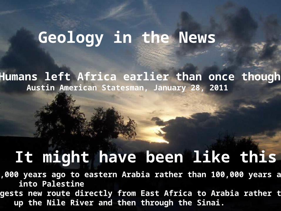
Geology in the News
Humans left Africa earlier than once thought Austin American Statesman, January 28, 2011
125,000 years ago to eastern Arabia rather than 100,000 years ago into Palestine
Suggests new route directly from East Africa to Arabia rather thanup the Nile River and then through the Sinai.
It might have been like this

Now to BP and Arctic Russia

BP to spend billions exploring for oil & gas in the Kara Sea of Arctic Russia
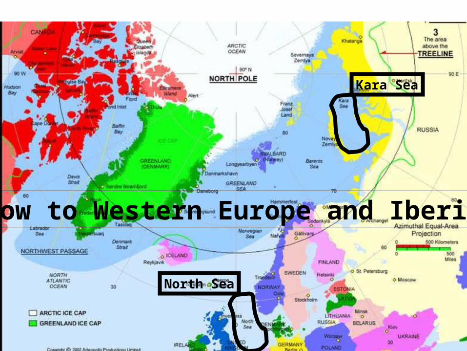
Kara Sea
North Sea
Now to Western Europe and Iberia
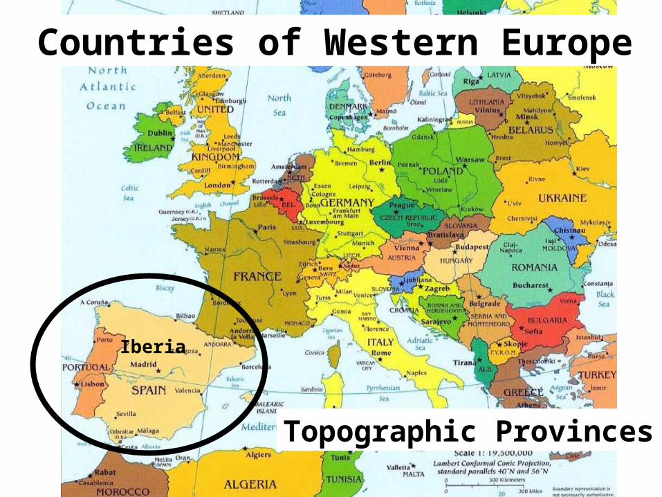
Countries of Western Europe
Iberia
Topographic Provinces

Topographic ProvincesMountains, Plateaus, and River Low Lands
Geologic Map of Western Europe
Colors relate provinces of the same age

Geologic MapColors show rocks of different:
1. ages2. types
What are the earth’s rock types?
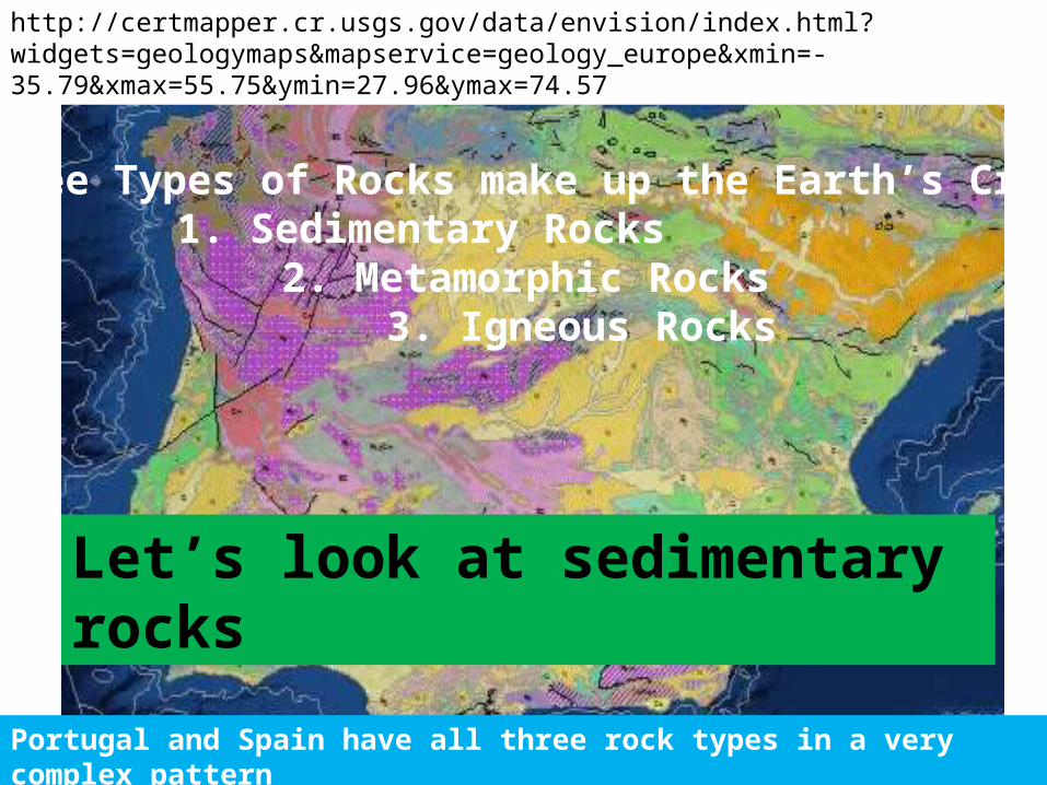
http://certmapper.cr.usgs.gov/data/envision/index.html?widgets=geologymaps&mapservice=geology_europe&xmin=-35.79&xmax=55.75&ymin=27.96&ymax=74.57
Three Types of Rocks make up the Earth’s Crust 1. Sedimentary Rocks
2. Metamorphic Rocks3. Igneous Rocks
Portugal and Spain have all three rock types in a very complex pattern
Let’s look at sedimentary rocks
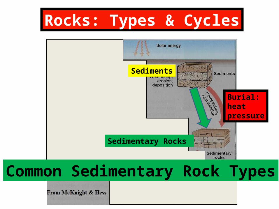
Rocks: Types & Cycles
Sedimentary Rocks
Burial: heatpressure
Common Sedimentary Rock Types
Sediments
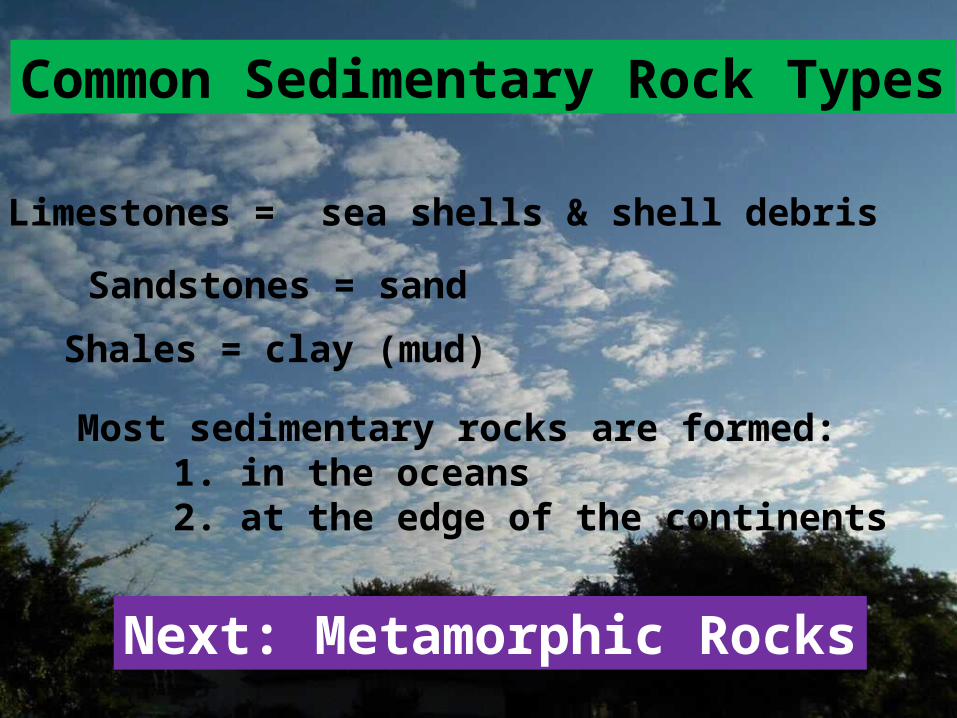
Common Sedimentary Rock Types
Limestones = sea shells & shell debris
Sandstones = sand
Shales = clay (mud)
Next: Metamorphic Rocks
Most sedimentary rocks are formed: 1. in the oceans 2. at the edge of the continents
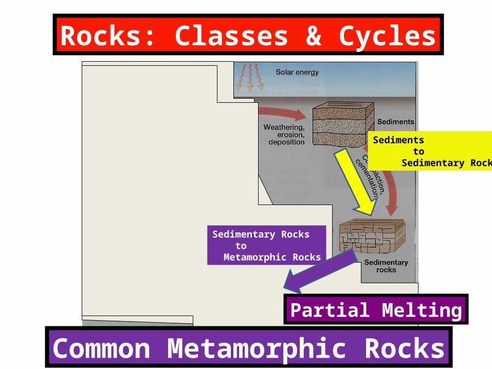
Rocks: Classes & Cycles
Sediments to Sedimentary Rocks
Sedimentary Rocks to Metamorphic Rocks
Partial Melting
Common Metamorphic Rocks

Common Metamorphic Rocks
Limestone: partially melted = marblemarble
Sandstone: partially melted = quartzitequartzite
Shale: partial melting = = slateslate
Shale & Sand partial melting = schist = gneissschist = gneiss
Finally, igneous rocks

Rocks: Classes & Cycles
Sedimentary Rocks to Metamorphic Rocks
Metamorphic Rocks to Igneous Rocks
At the surface molten Lava
At depth molten MagmasComplete
Melting

Igneous Activity
Volcanic: At or near the surface of the earth
Plutonic: Well below the surface of the earth (visible by deep erosion)
Now, at quick look at volcanic igneous rocks

From meltedoceanic crustor shales
Igneous Rocks Volcanoes
Dark color HeavyNo “grains”
Light colorMedium weight No “grains”
From melted continental Crust or sandstone & shale
Basalt Rhyolite
Next: the Plutonic Igneous rocks

Plutonic (deeply buried) Igneous Rocks
Mantle rockOriginal rock below the earth’s crust
Original Continental Crust or melted sandstone & shale
GabbroGranite
Putting it all together; our solid earth

The Earth’sRocky Crust
ContinentalGranite: 20 to50 miles thick
OceanicBasalt5 miles thick
The Solid Earth The Rocky Igneous Crust
5 to 50 miles thick

The Solid EarthContinentalGranite
OceanicBasalt
The Mantle
Composed of rock called gabbro
Where are sedimentary rocks created?

Continent beingDestroyed byWeathering &Erosion
Rivers move the Continental Debris to the Continental MarginsWhere it is accumulates as layers of sediments
Sediments (sands, muds, & shells) are buried and squeezed into Sedimentary Rocks
Sedimentary RocksWhere are they formed?
Modern sediments of Iberia

Where & how are sedimentary rocks converted to metamorphic rocks?
Modern sediments of Iberia
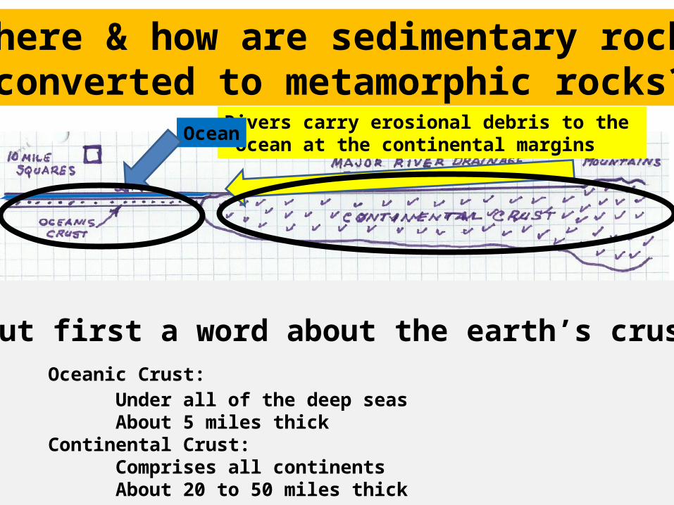
Rivers carry erosional debris to the ocean at the continental margins
Ocean
But first a word about the earth’s crustOceanic Crust:
Under all of the deep seasAbout 5 miles thick
Continental Crust: Comprises all continentsAbout 20 to 50 miles thick
Where & how are sedimentary rocks converted to metamorphic rocks?
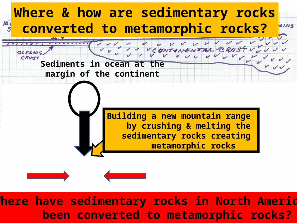
Where & how are sedimentary rocks converted to metamorphic rocks?
Sediments in ocean at the margin of the continent
Where have sedimentary rocks in North America been converted to metamorphic rocks?
Building a new mountain range by crushing & melting the sedimentary rocks creating metamorphic rocks
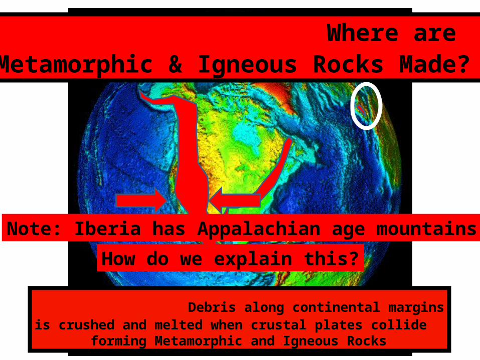
Where are Metamorphic & Igneous Rocks Made?
Debris along continental marginsis crushed and melted when crustal plates collide forming Metamorphic and Igneous Rocks
Note: Iberia has Appalachian age mountains!
How do we explain this?
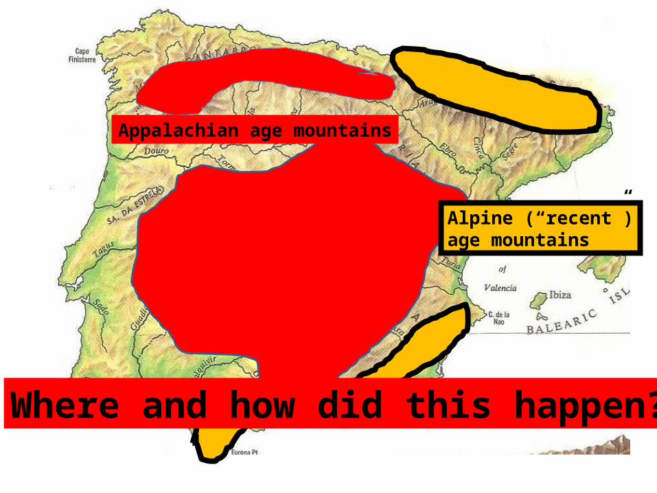
Where and how did this happen?
Appalachian age mountains
Alpine (“recent”)age mountains
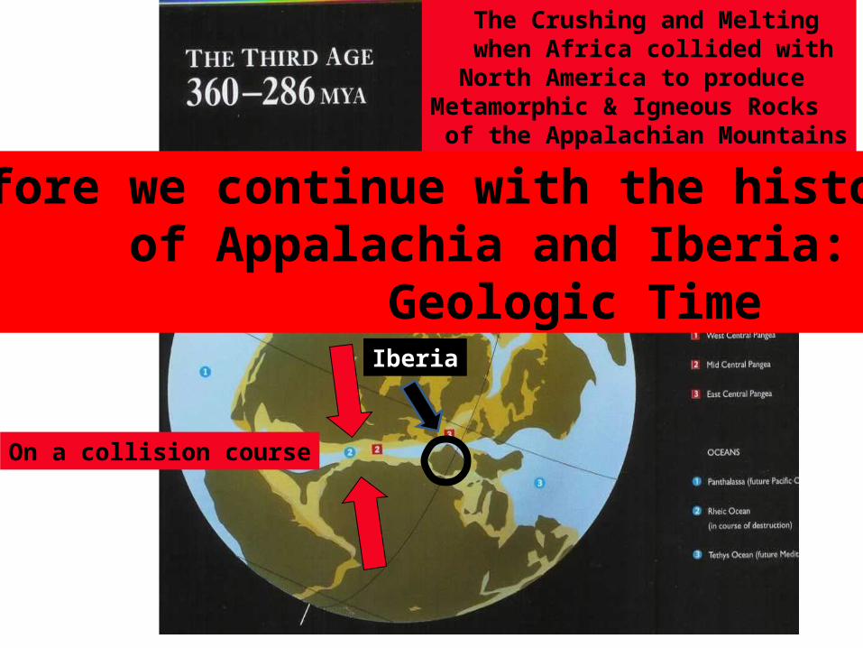
The Crushing and Melting when Africa collided with North America to produceMetamorphic & Igneous Rocks of the Appalachian Mountains
On a collision course
Iberia
Before we continue with the history of Appalachia and Iberia: Geologic Time
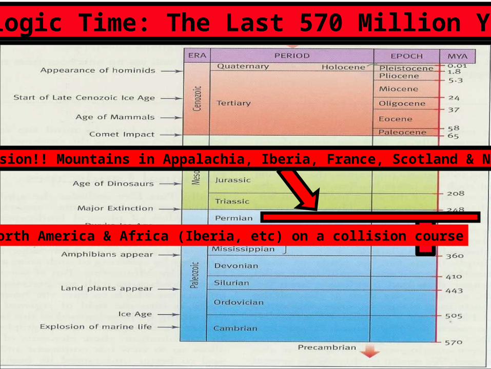
Geologic Time: The Last 570 Million Years
Last slideNorth America & Africa (Iberia, etc) on a collision course
Collision!! Mountains in Appalachia, Iberia, France, Scotland & Norway

The Crushing and Melting when Africa collided with North America creating Metamorphic & Igneous rocks in Appalachia, Iberia, France, Scotland & Norway
Crunch!!!!
Mountain ranges created by collision of earth plates

Crust broken into PLATES
Plates move (drift) slowly colliding & shearing each other
North American Plate
African Plate
Eurasian Plate
Plate motion: Continental Drift

Continental (plate) Drift
Appalachian Mountains
South America, Florida, Africa & SW Europe
North America & NW Europe
Super continentPangaea
Focusing on western Europe

Continental (plate) Drift
Iber
ia, F
ranc
e &
Ger
man
yEuropean “Appalachians”
Modern WorldMountain Ranges From Blakey

Modern WorldMountain Ranges From Blakey
North Atlantic: Close Up
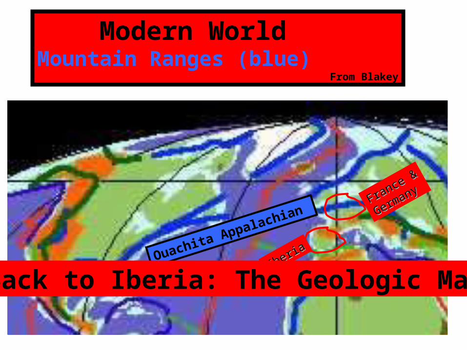
Modern WorldMountain Ranges (blue) From Blakey
Ouachita Appalachian France &France &
Germany
Germany
IberiaIberia
Back to Iberia: The Geologic Map
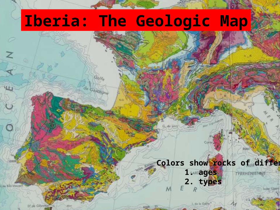
Colors show rocks of different:1. ages2. types
Iberia: The Geologic Map

Colors show rocks of different:1. ages2. types
Weathering & Erosion of different rocksproduces different topographies & soils
Different topographies & soils determine where humans live and flourish
Iberia: The Geologic Map
This map shows the present day rock surface produced by the weathering & erosion of the complex continental crust of Iberia
Why is this important?

Weathering & ErosionTopography and Soils

Geologic MapRock Types at the surface
Natural Resources Map Farming & Mining (Ores)
Proposition: Rocks of different types weather & erodeproducing different soils that determine type of agriculture
Weathering and Erosion also exposesdifferent ores at or near the surface
Why are ore occurrences important?
Human history has been shaped by the possession of ore deposits
Beaumont, Univ Penn SPP paper 203, 2010
The mineral resources of Iberia
