portland, maine 04104-3553 3 prioritization 10 ... · colored tarps used to cover plant...
TRANSCRIPT
SPRING 2016
Photo by Rich Antinarelli
Portland Water District ● 225 Douglass Street ● Portland, Maine 04104-3553 ● 207.761.8310 ● www.pwd.org
Continued on page 2
7 WatershedPrioritization3 10 Year
Anniversary 8Sebago Lakescaping5Events
2016 6What’s Making Waves?4Rain
Gardens
Sebago Lake Milfoil Action CooperativeBy Nate Whalen
Can milfoil be eliminated in Sebago Lake? With the cooperation of homeowners, local town governments, and lake protection groups such as the Maine Volunteer Lake Monitoring Program (VLMP), the Lakes Environmental Association, Raymond Waterways Protective Association, the Portland Water District (PWD) and the Maine Department of Environmental Protection working together as the Sebago Lake Milfoil Action Cooperative, the answer is it’s possible. Variableleafmilfoilwasfirstdiscovered in Sebago Lake in the early 1970s. This aquatic plant is not native to New England and is considered “invasive” because it lacks natural enemies to keep its growth in check, allowing it to out-compete other aquatic plants. Variable leaf milfoil forms a dense canopy of growth at the water’s surface,makingswimming,fishing,andboatingdifficult.Sincetheplantcan spread through fragmentation, every time a boat propeller goes through a patch of milfoil, the plants are chopped up and hundreds of tiny
fragments are set adrift to possibly infest new lakeshore areas. The good news is that much of the lake shore around Sebago Lake is rocky and sandy, which is not ideal for aquatic vegetation. Milfoil prefers back water coves that have soft mucky bottoms. The bad news is that some of these backwater places on Sebago Lake are already heavily infested with milfoil. Sebago Cove in Naples, the canals in Bayview Estates in Raymond, the Northwest River outlet in Sebago, and the Sticky River in Standish are some of the most infested
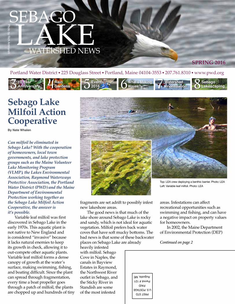
Top: LEA crew deploying a benthic barrier. Photo: LEALeft: Variable leaf milfoil. Photo: LEA
areas. Infestations can affect recreational opportunities such as swimmingandfishing,andcanhavea negative impact on property values for homeowners. In 2002, the Maine Department of Environmental Protection (DEP)

2
Nate Whalen is a water resources specialist at the Portland Water District. He can be reached at [email protected]
created a “milfoil sticker” program to help fund early detection and mitigation efforts across the state. The milfoil sticker adds an additional $10 fee to a Maine resident boat registration. In 2014, a Raymond resident with property on Sebago Lake named Dianne Potvin lobbied the Maine legislature for more money tofightthemilfoilbattleinlakeswithexisting infestations. As a result of her advocacy, recent legislation allocated a larger portion of the milfoil sticker revenue to removal of invasive plants. With this new funding source, the Sebago Lake Milfoil Action Cooperative (the Cooperative) was created to take action. Past success provides optimistic outlook Working as part of the Cooperative, the Lakes Environmental Associa-tion’s Milfoil Control Team made significantprogressharvestingmilfoilin three locations on Sebago Lake in 2015. They worked around Frye Island in the Long Beach Marina, Quail Circle Marina, and Moose Cove for eight days with a Diver-Assisted Suction Harvester boat (see photo) andremoved185twenty-fivepoundbags of milfoil. They worked in Pick-erel Cove in Windham for four days, removing 72 bags, and in Lake Se-bago Estates in Naples for two days, removing 20 bags. According to the end-of-year report to the DEP, each oftheselocationswas“sufficientlymitigated, with additional monitoring and maintenance control warranted.” These locations will be checked for any signs of regrowth this year. We are excited to have the LEA milfoil team working on Sebago Lake again this coming summer, likely spending most of their time in Sebago Cove as it is the most heavily infested area of the lake. The only approved methods for removing aquatic invasive plants are manual harvesting by DEP-certifieddiversandtheuseofbenthicbarriers. Benthic barriers are dark colored tarps used to cover plant infestations and smother the plants
by blocking sunlight. While hand-pulling, deployment of benthic barriers, and using specialized equipment to suction harvest the plants can be fairly expensive, these methods have proven to be extremely effective. After using the methods over several years, the Lakes Environmental Association successfully eliminated the milfoil infestation on the Songo River and in Brandy Pond. The use of chemical herbicides is prohibited in Maine lakes and ponds unless the application is approved and overseen by the State. From a drinking water standpoint, the use of herbicides might be the biggest threat that variable leaf milfoil poses to the lake. The Portland Water District provides an average of 22 million gallons of drinking water each day to about 200,000 customers in Greater Portland. The long term effects on humans of herbicide application in a drinking water supply is unknown and the mere possibility of herbicides ever being used on Sebago Lake is concerning. That is why the Portland Water District plays an active role in supporting manual and mechanical means of controlling milfoil on Sebago.
Every summer PWD hires a boat launch attendant that inspects boats and trailers as they enter and leave Sebago Lake at the Standish Boat Launch. Preventing boaters from unknowingly carrying hitchhiking invasive plants into Sebago Lake or transferring plants from Sebago Lake to other lakes is key to keeping milfoil and other invasive plants from spreading. PWD also provides technical assistance and grant funding for milfoil removal projects.Removing milfoil is a time-consuming and labor intensive process but by working together as a cooperative, milfoil elimination in Sebago is possible.
Top: Milfoil removal. Photo: LEA
Bottom left: Variable milfoil.Photo: LEA
Bottom right: LEA diver removing milfoil.Photo: LEA
33
Continued on page 4
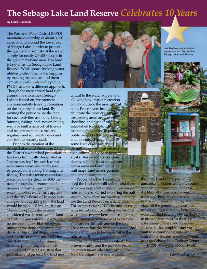
The Portland Water District (PWD) maintains ownership of about 3,000 acres of land around the lower bay of Sebago Lake in order to protect the quality and security of the water supply for nearly 200,000 people in the greater Portland area. This land is known as the Sebago Lake Land Reserve. While some drinking water utilities protect their water supplies by making the land around them completely off-limits to the public, PWD has taken a different approach. Though the most critical land right around the shoreline of Sebago Lake is fenced off, we promote environmentally friendly recreation on the majority of our land. By inviting the public to use the land for such activities as hiking, biking, hunting,fishing,andsnowmobiling,we have built a network of friends and neighbors that use the land regularly and act as extra eyes and ears for our security staff. Prior to the creation of the Sebago Lake Land Reserve in 2005, the District’s watershed protection land was technically designated as “no trespassing” by state law but some areas were historically used by people for walking, hunting and fishing.Therulesforaccessandusewere not always clear. By 2005 the need for increased protection of our nation’s infrastructure, including water supplies, was clearly apparent and the PWD Board of Trustees was charged with deciding how the land would be managed into the future. One of the options the trustees considered was to fence off the land completely and enforce the existing no trespassing law like some water utilities have done and continue to do.Aftersignificantdeliberationand a series of public meetings, the boarddecidedtofindabalancebetween prohibiting any and all activity, and creating a system that prioritizes and protects the land most
critical to the water supply and allowing low-impact recreation on land outside the most critical zone. Fences were installed to delineate the most critical no trespassing areas around the shoreline, and a set of rules was established for public use of the remaining areas. To make public access to the land simple and non-intrusive, yet maintain some level of accountability, a permitting system was created that utilized self-service permit kiosks. Ten permit kiosks were deployed in the most convenient accessareasandoutfittedwithtrail maps, land access permits, and other information. People who had historically used the land were still able to, and those who previously felt unsafe or unclear on rules for access started exploring the trail system. Now there are many people who use the Land Reserve on a daily basis. ThisisbeneficialtoPWDbecauseevenwith security staff patrolling year-round, we can’t be everywhere at once and our land reserve patrons serve as extra eyes and ears on the trails and on the lake. They appreciate the ability to use the land and want others to be respectful of the rules as well. The Land Reserve’s popularity has grown steadily and the past few years have seen many other improvements. New trail signs have been installed in
the Otter Ponds area, providing guidance to visitors using the spider-web-like trail system in that area. Additionally, previously overgrown trails have been rehabilitated to usable conditions - offering new views of the ponds and more area to explore. Last year new benches were installed in a few key locations to provide rest areas for those on adventures on the Land Reserve. Also, a hillside amphitheater was built to accommodate outdoor educational lessons and other events near the Sebago Lake Ecology Center. In 2016 the wetland boardwalk
Left: PWD security staff with equestrians who frequent the Sebago Lake Land Reserve.
The Sebago Lake Land Reserve Celebrates 10 YearsBy Laurel Jackson

4
Continued from page 3
Laurel Jackson is a water resources specialist at the Portland Water District. She can be reached at [email protected]
willbefixedandwilloffervisitorsaunique opportunity to observe wet-lands plants and animals up close. Trail Day, the 4th annual Land Reserve celebration, will take place on Septem-ber 17th. A GPS-enabled mobile Land
Rain Gardens: Lessons learned from the PWD rain gardenBy Kirsten Ness
Rain gardens are attractive and functional landscaped areas that are designed to capture and filter stormwater from roofs, driveways, and other hard surfaces. They collect water in bowl-shaped vegetated areas and allow it to slowly soak into the ground. This reduces the potential for erosion and minimizes the amount of pollutants flowing from your lawn into our streams and lakes.
Kirsten Ness is a water resources specialist at the Portland Water District. She can be reached at [email protected]
PWD’S RAIN GARDEN STORY:PWD installed a rain garden in 2005 at the Sebago Lake Ecology Center to filterroofrunofffromthebuildingandas a demonstration garden for visitors. We planted the garden with native plants and followed the recommended design for a rain garden, placing wet loving plants in the middle and those that tolerate drier conditions on the edge. A few years after the installation, however, most of the wet loving plants were dying off. The reason for this was the well drained nature of our soil. Our rain garden is so well drained that it only holds water for a few minutes after a rain storm, which is not enough moisture for wet loving plants such ascardinalflowerorLabradorteatosurvive. In 2012, we re-designed and re-planted the garden with plants that do well in dry soil conditions. The good news is that the new plants are thriving and the garden still collects
Reserve map is currently being developed to help guide visitors while they are ex-ploring. By encouraging respectful use of theland,PWDanditscustomersbenefitfrom having friends who help protect the lake and keep it clean.
water and allows it to soak into the ground. We learned that dry soil conditions don’t mean you can’t have a rain garden – you just have to choose different plants!
KNOW YOUR SOIL!Dig a large hole where you want to placeyourraingarden,fillitwithwater,and see how quickly it drains. If the water drains quickly, it is unlikely that your garden will support wet loving plants. If it drains over the course of 1-2 days, your site will likely support wet loving plants in the low spot of the garden. If it does not drain within 48 hours, the site is unfortunately not appropriate for a rain garden.
Please visit https://www.pwd.org/sites/default/files/rain_garden.pdf to view PWD’s Rain Gardens Fact Sheet and learn how to plan and install a rain garden. Happy planting!
Upcoming Events
5
Your water – to know it is to love it! Each May PWD joins other water organizations across the country to celebrate Drinking Water Week. This year, we’ll host four free events to inspire and educate our customers, neighbors, and partners about the vital role water plays in our lives. Monday, May 2 @ 6:00-7:00 p.m., Portland “The Extraordinary Lives of Owls” Experts from Wind over Wings will discuss the remarkable abilities of New England’s owls, and introduce three live owls, including a Saw-whet Owl (New England’s smallest owl), Great Horned owls (New England’s largest), and the elusive Eastern Screen Owl.
Tuesday, May 3 @ 6:00-7:30 p.m., Standish “Discover the Sebago Lake Land Reserve” Come see why these 1700 acres are visited by 25,000 people each year. A brief presentation on the Land Reserve’s history and purpose will be followed by a trip to a visitor kiosk and short hike.
Wednesday, May 4 @ 5:30-7:30 p.m., Standish “Tour of the Sebago Lake Water Treatment Facility” View recent upgrades to the facility and learn how both ozone and ultraviolet light are used to treat 21 million gallons of water each day. Scien-tists will also describe water quality tests that are done to ensure proper facility performance.
Friday, May 6 @ 5:00-7:00 p.m., Standish “Earth Jams Concert &Springtime Hike” Bring a picnic and enjoy a family concert on our outdoor amphitheater at 6:00. Award-winning singer/songwriter Matt Loosigian will perform engaging environmental songs. Before the show, join our educators for a springtime hike at 5:15, or explore on your own.
Looking ahead – summer & fall Summer and fall are prime times to explore Sebago Lake and its watershed, as well as learn how to protect it. Read below about some of our initiatives already in the works. Like us on Facebook or join our email list to keep current on other offerings. Email [email protected] to sign up.
Standish Summer Spectacular PWD has served as one of the sponsors of this event for several years, hosting a table at the deli-cious and eclectic Taste of Maine. We’ll see you there on Thursday, June 23!
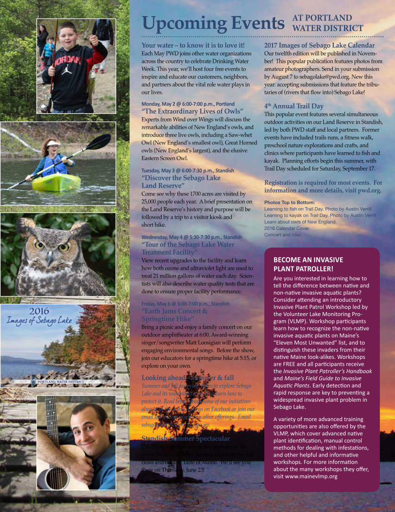
2017 Images of Sebago Lake Calendar Our twelfth edition will be published in Novem-ber! This popular publication features photos from amateur photographers. Send in your submission by August 7 to [email protected]. New this year: accepting submissions that feature the tribu-tariesof(riversthatflowinto)SebagoLake!
4th Annual Trail Day This popular event features several simultaneous outdoor activities on our Land Reserve in Standish, led by both PWD staff and local partners. Former eventshaveincludedtrailsruns,afitnesswalk,preschool nature explorations and crafts, and clinicswhereparticipantshavelearnedtofishandkayak. Planning efforts begin this summer, with Trail Day scheduled for Saturday, September 17.
Registration is required for most events. For information and more details, visit pwd.org.
Photos Top to Bottom:Learning to fish on Trail Day. Photo by Austin VerrillLearning to kayak on Trail Day. Photo by Austin VerrillLearn about owls of New England.2016 Calendar Cover.Concert and hike.
AT PORTLAND WATER DISTRICT
BECOME AN INVASIVE PLANT PATROLLER!Are you interested in learning how to tell the difference between native and non-native invasive aquatic plants? Consider attending an introductory Invasive Plant Patrol Workshop led by the Volunteer Lake Monitoring Pro-gram (VLMP). Workshop participants learn how to recognize the non-native invasive aquatic plants on Maine’s “Eleven Most Unwanted” list, and to distinguish these invaders from their native Maine look-alikes. Workshops are FREE and all participants receive the Invasive Plant Patroller’s Handbook and Maine’s Field Guide to Invasive Aquatic Plants. Early detection and rapid response are key to preventing a widespread invasive plant problem in Sebago Lake.
A variety of more advanced training opportunities are also offered by the VLMP, which cover advanced native plant identification, manual control methods for dealing with infestations, and other helpful and informative workshops. For more information about the many workshops they offer, visit www.mainevlmp.org
6
What’s Making WavesAround Sebago Lake
UMASS SEBAGO LAKE RESEARCH PROJECTThis summer Dr. Isla Castañeda, an as-sistant professor from the University of Massachusetts, will head up a new study of the lake using chemical compounds naturally found in the water and bottom sediment of Sebago Lake. Dr. Castañeda has received grant funding to conduct re-search on these compounds because they are very stable over time and can be used to help characterize changes in the earth’s climate over thousands of years. Because they have only recently been discovered, there is much more to learn about these molecules such as how, where, and why they are produced and how many years ago each of the different types of mol-ecules were found. The three-year project will begin in the summer of 2016 and the results of the study will give greater insight into Sebago Lake’s natural history.
PROCTOR POND AND WHITNEY POND CONSERVATION PROJECTS In 2015 the Portland Water District ap-proved contributions to two land con-servation projects in the Sebago Lake Watershed. The Whitney Pond project will conserve 70 acres of land in Stone-ham and the Proctor Pond project will conserve 54 acres in Albany Township. The Greater Lovell Land Trust will retain ownership of both pieces of land and the land will be accessible to the public for traditional low-impact uses. The Portland Water District (PWD) contributed a total of $46,000 towards the conservation of 124 acres of watershed land. That repre-sents about $370 per acre of forest, wet-lands, wildlife habitat, and most impor-
tantly, natural water treatment. Since 2006, PWD has contributed $450,000 towards the conservation of nearly 4,000 acres of land in the Sebago Lake watershed. Because forests provide natural water treatment, this invest-mentbenefitsboththewatershedresidentsand the water quality of Sebago Lake.
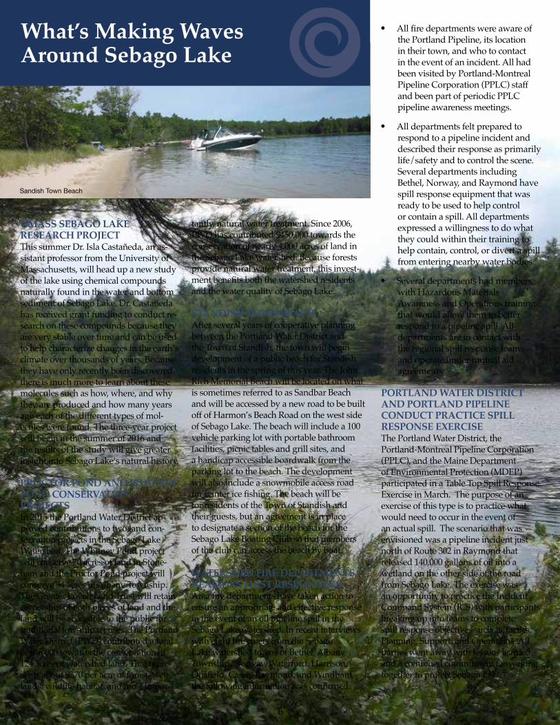
STANDISH TOWN BEACHAfter several years of cooperative planning between the Portland Water District and the Town of Standish, the town will begin development of a public beach for Standish residents in the spring of this year. The John Rich Memorial Beach will be located on what is sometimes referred to as Sandbar Beach and will be accessed by a new road to be built off of Harmon’s Beach Road on the west side of Sebago Lake. The beach will include a 100 vehicle parking lot with portable bathroom facilities, picnic tables and grill sites, and a handicap accessible boardwalk from the parking lot to the beach. The development will also include a snowmobile access road forwintericefishing.Thebeachwillbefor residents of the Town of Standish and their guests, but an agreement is in place to designate a section of the beach for the Sebago Lake Boating Club so that members of the club can access the beach by boat.
WATERSHED FIRE DEPARTMENTS READY AS FIRST RESPONDERSAreafiredepartmentshavetakenactiontoensure an appropriate and effective response in the event of an oil pipeline spill in the Sebago Lake watershed. In recent interviews witheightfirechiefsfromtheSebagoLake watershed towns of Bethel, Albany Township, Norway, Waterford, Harrison, Otisfield,Casco,Raymond,andWindham,thefollowinginformationwasconfirmed.
Sandish Town Beach
● Allfiredepartmentswereawareofthe Portland Pipeline, its location in their town, and who to contact in the event of an incident. All had been visited by Portland-Montreal Pipeline Corporation (PPLC) staff and been part of periodic PPLC pipeline awareness meetings.
● All departments felt prepared to respond to a pipeline incident and described their response as primarily life/safety and to control the scene. Several departments including Bethel, Norway, and Raymond have spill response equipment that was ready to be used to help control or contain a spill. All departments expressed a willingness to do what they could within their training to help contain, control, or divert a spill from entering nearby water bodies.
● Several departments had members with Hazardous Materials Awareness and Operations training that would allow them to better respond to a pipeline spill. All departments are in contact with the regional spill response teams and operate under mutual aid agreements.
PORTLAND WATER DISTRICT AND PORTLAND PIPELINE CONDUCT PRACTICE SPILL RESPONSE EXERCISEThe Portland Water District, the Portland-Montreal Pipeline Corporation (PPLC), and the Maine Department of Environmental Protection (MDEP) participated in a Table Top Spill Response Exercise in March. The purpose of an exercise of this type is to practice what would need to occur in the event of an actual spill. The scenario that was envisioned was a pipeline incident just north of Route 302 in Raymond that released 140,000 gallons of oil into a wetland on the other side of the road from Sebago Lake. The exercise was an opportunity to practice the Incident Command System (ICS) with participants breaking up into teams to complete spill response objectives such as Tactics, Planning, Support, and Operations. All parties went away with lessons learned and a continued commitment to working together to protect Sebago Lake.
7
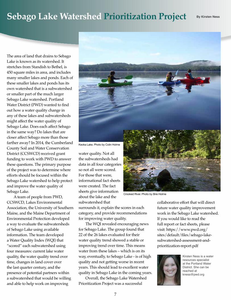
Sebago Lake Watershed Prioritization Project By Kirsten Ness
Keoka Lake. Photo by Colin Holme
Crooked River. Photo by Brie Holme
The area of land that drains to Sebago Lake is known as its watershed. It stretches from Standish to Bethel, is 450 square miles in area, and includes many smaller lakes and ponds. Each of these smaller lakes and ponds has its own watershed that is a subwatershed or smaller part of the much larger Sebago Lake watershed. Portland WaterDistrict(PWD)wantedtofindout how a water quality change in any of these lakes and subwatersheds might affect the water quality of Sebago Lake. Does each affect Sebago in the same way? Do lakes that are closer affect Sebago more than those farther away? In 2014, the Cumberland County Soil and Water Conservation District (CCSWCD) received grant funding to work with PWD to answer these questions. The primary purpose of the project was to determine where efforts should be focused within the Sebago Lake watershed to help protect and improve the water quality of Sebago Lake. A team of people from PWD, CCSWCD, Lakes Environmental Association, the University of Southern Maine, and the Maine Department of Environmental Protection developed a way to evaluate the subwatersheds of Sebago Lake using available information. The team developed a Water Quality Index (WQI) that “scored” each subwatershed using four measures: current lake water quality, the water quality trend over time, changes in land cover over the last quarter century, and the presence of potential partners within a subwatershed that would be willing and able to help work on improving
water quality. Not all the subwatersheds had data in all four categories so not all were scored. For those that were, informational fact sheets were created. The fact sheets give information about the lake and the subwatershed that surrounds it, explain the scores in each category, and provide recommendations for improving water quality. The WQI revealed encouraging news for Sebago Lake. The group found that 22 of the 26 lakes evaluated for their water quality trend showed a stable or improving trend over time. This means water from these lakes – which is on its way, eventually, to Sebago Lake - is of high quality and not getting worse in recent years. This should lead to excellent water quality in Sebago Lake in the coming years. Overall, the Sebago Lake Watershed Prioritization Project was a successful
Kirsten Ness is a water resources specialist at the Portland Water District. She can be reached at [email protected]
collaborative effort that will direct future water quality improvement work in the Sebago Lake watershed. If you would like to read the full report or fact sheets, please visit: https://www.pwd.org/sites/default/files/sebago-lake-subwatershed-assessment-and-prioritization-report.pdf
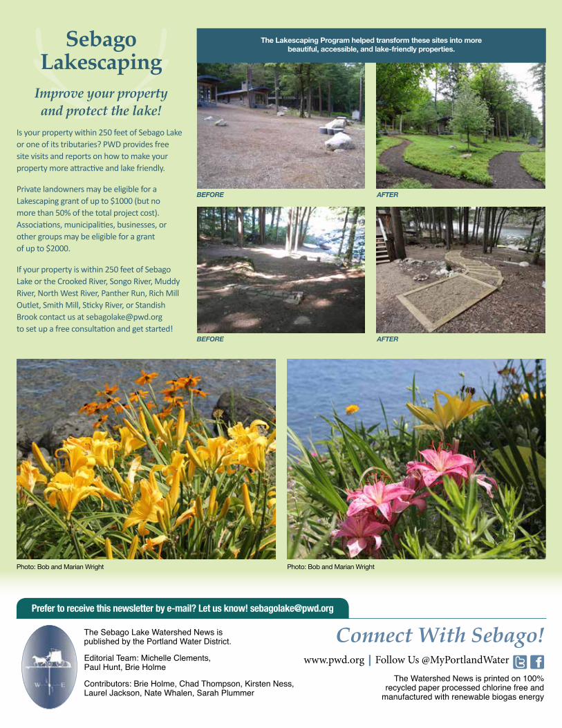
Sebago Lakescaping
Improve your property and protect the lake!
Is your property within 250 feet of Sebago Lake or one of its tributaries? PWD provides free site visits and reports on how to make your property more attractive and lake friendly.
Private landowners may be eligible for a Lakescaping grant of up to $1000 (but no more than 50% of the total project cost). Associations, municipalities, businesses, or other groups may be eligible for a grant of up to $2000.
If your property is within 250 feet of Sebago Lake or the Crooked River, Songo River, Muddy River, North West River, Panther Run, Rich Mill Outlet, Smith Mill, Sticky River, or Standish Brook contact us at [email protected] to set up a free consultation and get started!
BEFORE
BEFORE
AFTER
AFTER
The Lakescaping Program helped transform these sites into more beautiful, accessible, and lake-friendly properties.
The Sebago Lake Watershed News is published by the Portland Water District.
Editorial Team: Michelle Clements, Paul Hunt, Brie Holme
Contributors: Brie Holme, Chad Thompson, Kirsten Ness, Laurel Jackson, Nate Whalen, Sarah Plummer
The Watershed News is printed on 100% recycled paper processed chlorine free and
manufactured with renewable biogas energy
Connect With Sebago!www.pwd.org | Follow Us @MyPortlandWater
Prefer to receive this newsletter by e-mail? Let us know! [email protected]
Photo: Bob and Marian Wright Photo: Bob and Marian Wright