polluted groundwater threatens hawaiian coral … pollution, according to a study ... the authors...
TRANSCRIPT

U.S. Department of the InteriorU.S. Geological Survey
Cover Story
https://soundwaves.usgs.gov/
U.S. Department of the InteriorU.S. Geological Survey
Cover Story
(Hawaiian Coral continued on page 2)
Sound Waves Volume FY 2018, Issue No. 176March 2018
Polluted Groundwater Threatens Hawaiian Coral ReefsBy Helen Gibbons and Nancy Grumet Prouty
Coral reefs along densely populated shorelines are especially vulnerable to the effects of ocean acidification amplified by local pollution, according to a study by USGS scientists reported in the Journal of Geophysical Research: Oceans.
Corals around the world are already stressed by ocean acidification—the gradual decline in seawater pH as the ocean absorbs increasing amounts of CO2 from the atmosphere. Lower pH (greater acidity) slows calcification, the process by which corals and other marine species make their skeletons out of the mineral calcium carbonate. It also increases rates of coral bioerosion—the breakdown of coral by other organisms—and it can cause carbonate skeletons and sand to dissolve.
The authors show that polluted, low-pH groundwater discharging onto a shallow coral reef off Kahekili Beach Park in west Maui, Hawai‘i, further increases seawater acidity and exposes corals to nitrate con-centrations 50 times higher than normal. Such land-based pollution could contribute to the collapse of coastal coral reef ecosys-tems sooner than predicted based on ocean acidification alone.
“What we’ve shown here is that lo-cal stressors work in concert with global changes in ocean conditions to accelerate coral reef decline through nutrient driven-bioerosion,” said Nancy Prouty, lead au-thor of the study.
The recent report synthesizes field and laboratory work done over the past several years (for example, see https://soundwaves.usgs.gov/2016/05/fieldwork.html). To carry out the multifaceted study, research oceanographers from the USGS Pacific Coastal and Marine Science Center in Santa Cruz, California (Prouty, Curt Storlazzi, Peter Swarzenski), and the
USGS St. Petersburg Coastal and Marine Science Center in St. Petersburg, Florida (Kim Yates) joined forces with scientists from the Woods Hole Oceanographic Institution (Anne Cohen) and Hawai‘i’s Division of Aquatic Resources (Darla White). The team analyzed the chemistry of groundwater flowing into the ocean through seafloor springs near the reef, and measured rates of calcification and bioero-sion in coral cores collected near and far from the springs.
Groundwater flowing from seafloor springs at Kahekili consists primarily of wastewater effluent from injection wells at the nearby Lahaina Wastewater Reclama-tion Facility. A previous study using tracer dyes (https://archive.epa.gov/region9/water/archive/web/pdf/lahaina-gw-tracer-study-final-report-june-2013.pdf)
demonstrated a direct connection between the springs and the sewage-treatment plant. The USGS study yielded further evidence of this connection, finding that coral skeletons sampled near the springs contain higher levels of 15N, a nitrogen iso-tope considered diagnostic for sewage and wastewater-treatment processes.
The lower pH of the polluted ground-water slows calcification of new coral skeleton, and the excess nitrates accelerate the growth of organisms, such as algae, bacteria, and sponges, that break down the coral. Bioerosion is a natural process, but if it proceeds more quickly than calcifica-tion, the reef will decline. “In the case of Kahekili Beach Park,” said Prouty, “excess nutrients in the effluent appear to be accel-erating bioerosion.”
Degraded coral reefs at Kahekili Beach Park, west Maui, Hawai‘i. The study’s researchers found little evidence of live coral near groundwater seeps. Photo credit: Peter Swarzenski, USGS.

2March 2018 Sound Waves
CHECK STORIES FOR HYPERLINKS!!!!
Cover Story
Cover Story, continued
To measure rates of calcification and bioerosion, the scientists collected cores of corals near the seep site and almost half a mile to the north. They obtained computerized tomography (CT) scans (series of X-ray images) from the Woods Hole Oceanographic Institution’s Com-puterized Scanning and Imaging Facility (http://csi.whoi.edu/). Analysis of the scans showed that bioerosion of coral off Kahekili Beach Park is proceeding at rates up to 8 times greater than expected for corals growing away from pollution. This bioerosion has drastically weakened lo-cal coral reefs for more than 10 years and could lead to the collapse of the underly-ing reef structure. Losing the reef would mean losing the benefits it provides, such as supporting fish populations and protect-ing the shoreline from coastal hazards like storm waves.
Polluted groundwater is just one of many local stressors that affect corals around the world; others include overfishing, sediment-laden runoff, vessel groundings, and other recreational impacts. The USGS study shows how these pressures can exac-erbate global threats to coral health.
“As the ocean changes, reducing stress-ors at a local scale could be vital for pre-serving coral reefs,” said Prouty.
The USGS study was published in the December 2017 issue of the American Geophysical Union (AGU) Journal of Geophysical Research: Oceans (https://doi.org/10.1002/2017JC013264). It was also featured on AGU’s GeoSpace blog (https://blogs.agu.org/geospace/2017/11/01/polluted-groundwater-eroding-hawaiian-coral-reefs-study-shows/) and reported by the Honolulu Star-Ad-vertiser (https://www.pressreader.com/usa/honolulu-star-advertiser/20171106/281522226359810) and the Associated Press (http://www.mauinews.com/news/local-news/2017/11/scientists-say-sewage-injected-into-ocean-damaging-coral-off-of-kahekili-shoreline/).
(Hawaiian Coral continued from page 1)
Contents
Cover Story 1News Briefs 3Fieldwork 6Staff and Center News 9Publications 10
Sound Waves
Editor Jolene Gittens
St. Petersburg, Florida Telephone: 727-502-8038
E-mail: [email protected] Fax: 727-502-8182
Assistant Editor Laura Torresan
Santa Cruz, California Telephone: 831-460-7468
E-mail: [email protected] Fax: 831-427-4748
Print & Web Layout Editor Betsy Boynton
St. Petersburg, Florida Telephone: 727-502-8118
E-mail: [email protected] Fax: (727) 502-8182
SOUND WAVES (WITH ADDITIONAL LINKS) IS AVAILABLE ONLINE AT URL
https://soundwaves.usgs.gov/
Submission Guidelines
Deadline: The deadline for news items and publication lists for the 176th issue of Sound Waves is Wednesday, April 25, 2018.Publications: When new publications or products are released, please notify the editor with a full reference and a bulleted summary or description.Images: Please submit all images at publica-tion size (column, 2-column, or page width). Resolution of 200 to 300 dpi (dots per inch) is best. Adobe Illustrator© files or EPS files work well with vector files (such as graphs or diagrams). TIFF and JPEG files work well with raster files (photographs or rasterized vec-tor files).
Any use of trade, firm, or product names is for descriptive purposes only and does not imply endorsement by the U.S. Government.
U.S. Geological Survey Earth Science Information Sources: Need to find natural-science data or information? Visit the USGS Frequently Asked Questions (FAQ’s) at URL https://www.usgs.gov/faq/
Can’t find the answer to your question on the Web? Call 1-888-ASK-USGS
Want to send your question to the USGS? Fill out the form here: https://answers.usgs.gov/cgi-bin/gsanswers?tmplt=4
Kim Yates (left) and Nate Smiley of the USGS St. Petersburg Coastal and Marine Science Center measure acidity, nutrient levels, and other characteristics of water sampled near the coral reef off Kahekili Beach Park, Maui, Hawai‘i, in March 2016 (https://soundwaves.usgs.gov/2016/05/fieldwork.html). Photo credit: Nancy Prouty, USGS.
Maps of the island of Maui, Hawai‘i, and the study area off Kahekili Beach State Park. Red dot is the primary seep (seafloor spring) site. Blue triangles are sites of coral cores and seawater samples.
(Hawaiian Coral continued on page 3)

3 Sound Waves March 2018
CHECK STORIES FOR HYPERLINKS!!!!
Cover Story, continued
Cover Story / News Briefs
(Hawaiian Coral continued from page 2)
Cartoon diagram showing how wastewater effluent (yellow arrows) moves from injection wells to underwater springs off Kahekili Beach Park in west Maui, Hawai‘i. Blue arrows show generalized direction of groundwater flow. Green shades: Waikulu Basalt; tan shades: sedimen-tary deposits. Corals are healthier (darker brown) farther from seafloor springs. Not to scale. Highly modified from figure 7 in USGS Scientific Investigations Report 2012–5010 (https://pubs.usgs.gov/sir/2012/5010/).
saltwater
transition zone
fresh waterPACIFIC OCEAN
Kahekili Beach Park sea�oor springs
Wastewater injection wells
WATER TABLE
Computerized tomography (CT) images (dark gray) and photographs of coral cores collected near the seep site (left) and almost half a mile to the north (right) demonstrate greater bioerosion of coral near seep site.
News Briefs
Sound Waves News BriefsEdited by Rex Sanders • March 2018
} New Genetic Test Detects Manatees’ Recent Presence in Fresh or Saltwater
March 19—USGS scientists have de-veloped the first laboratory test that can pick up traces of manatees’ genetic mate-rial in the waterways where they live. Us-ing a water sample collected in the field, the innovative environmental DNA test can reveal whether one or more of the elusive marine mammals has been in the area within the past month. The test can detect the presence of manatees where other methods won’t work, help scientists identify the habitats manatees use and the patterns of their seasonal movements, and inform efforts to bring back wild manatee
populations that are considered close to extinction, said USGS research geneti-cist Margaret Hunter. “Environmental DNA detection is the wave of the future for monitoring species that are difficult to find,” Hunter said. “We’re getting a more complete picture of these wild popula-tions, without disturbing them.”
More: https://www.usgs.gov/news/new-genetic-test-detects-manatees-recent-presence-fresh-or-saltwater
} USGS Authors New Report on Seis-mic Hazard, Risk, and Design for South America
March 14—South America is one of the most earthquake-prone regions of the world and has witnessed tremendous losses throughout recorded history. A recently released USGS report provides probabilistic tools to help engineers as-sess seismic hazards, risk, and building code requirements, potentially saving lives and dollars. The seismic activity in this continent is driven by the South American Subduction Zone and other complex fault interactions. Future hu-man and financial losses can be mitigated through making informed decisions based on where future earthquakes may occur, how often they might occur, and how strong the ground will shake. Such in-formation is the purpose of probabilistic (i.e., based on a mathematical forecast) seismic hazard models that are applied in building codes, insurance models, and public policy.
More: https://www.usgs.gov/news/usgs-authors-new-report-seismic-hazard-risk-and-design-south-america
(News Briefs continued on page 4)
4March 2018 Sound Waves
CHECK STORIES FOR HYPERLINKS!!!!
News Briefs, continued
News Briefs
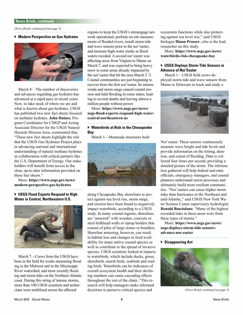
} Modern Perspective on Gas Hydrates
March 8—The number of discoveries and advances regarding gas hydrates has advanced at a rapid pace in recent years. Now, to take stock of where we are and what is known about gas hydrates, USGS has published two new fact sheets focused on methane hydrates. John Haines, Pro-gram Coordinator for CMGP and Acting Associate Director for the USGS Natural Hazards Mission Area, commented that, “These new fact sheets highlight the role that the USGS Gas Hydrates Project plays in advancing national and international understanding of natural methane hydrates in collaboration with critical partners like the U.S. Department of Energy. Our stake-holders will benefit from access to the clear, up-to-date information provided on these fact sheets.”
More: https://www.usgs.gov/news/modern-perspective-gas-hydrates
} USGS Flood Experts Respond to High Water in Central, Northeastern U.S.
March 7—Crews from the USGS have been in the field for weeks measuring flood-ing in the Midwest and in the Mississippi River watershed, and more recently flood-ing and storm tides on the Northern Atlantic coast. During this string of intense storms, more than 100 USGS scientists and techni-cians were mobilized across the affected
regions to keep the USGS’s streamgage net-work operational, perform on-site measure-ments of flooded rivers, install storm-tide and wave sensors prior to the nor’easter, and measure high-water marks as flood waters receded. A second nor’easter was affecting areas from Virginia to Maine on March 7, and was expected to bring heavy snow to some areas already impacted by the nor’easter that hit the area March 2–3. Coastal communities are just beginning to recover from the first nor’easter. Its intense winds and storm surge caused coastal ero-sion and tidal flooding in some states, lead-ing to several deaths and leaving almost a million people without power.
More: https://www.usgs.gov/news/usgs-flood-experts-respond-high-water-central-northeastern-us
} Waterbirds at Risk in the Chesapeake Bay
March 1—Manmade structures built
along Chesapeake Bay shorelines to pro-tect against sea level rise, storm surge, and erosion have been found to negatively impact waterbirds, according to a USGS study. In many coastal regions, shorelines are “armored” with wooden, concrete or steel bulkhead walls or riprap borders that consist of piles of large stones or boulders. Shoreline armoring, however, can result in habitat loss and changes in food avail-ability for many native coastal species as well as contribute to the spread of invasive species. USGS scientists looked at impacts to waterbirds, which include ducks, geese, shorebirds, marsh birds, seabirds and wad-ing birds. Waterbirds can be indicators of overall ecosystem health and their declin-ing numbers can cause cascading effects throughout the rest of the chain. “This re-search will help managers make informed decisions to preserve critical species and
ecosystem functions while also protect-ing against sea level rise,” said USGS biologist Diann Prosser, who is the lead researcher on this study.
More: https://www.usgs.gov/news/waterbirds-risk-chesapeake-bay
} USGS Deploys Storm-Tide Sensors in Advance of Nor’Easter
March 1—USGS field crews de-ployed storm-tide and wave sensors from Maine to Delaware to track and study a
Nor’easter. These sensors continuously measure wave height and tide levels and provide information on the timing, dura-tion, and extent of flooding. Data is col-lected four times per second, providing a detailed picture of the storm. The informa-tion gathered will help federal and state officials, emergency managers, and coastal planners understand storm processes and ultimately build more resilient communi-ties. “Nor’easters can cause higher storm tides than hurricanes in the Northeast and mid-Atlantic,” said USGS New York Wa-ter Science Center supervisory hydrologist Ronald Busciolano. “Many of the highest recorded tides in these areas were from these types of storms.”
More: https://www.usgs.gov/news/usgs-deploys-storm-tide-sensors-advance-nor-easter
} Disappearing Act
(News Briefs continued from page 3)
(News Briefs continued on page 5)

5 Sound Waves March 2018
CHECK STORIES FOR HYPERLINKS!!!!
News Briefs
News Briefs, continued
February 28—The Asian tiger mos-quito—carrier of such diseases as dengue, yellow fever, Rift Valley fever, Chikungu-nya, and Zika—appears to have vanished from Palmyra. Not native to the small atoll 1,000 miles south of Hawaii, Aedes albopict likely came to Palmyra dur-ing World War II. The military imported many other species as well, including the common black rat, whose blood fed many of the mosquitoes. In 2011, to help Palmyra recover from the ecological dam-age wreaked by the non-native rats, land managers implemented an aerial drop of rodenticide that quickly eradicated them. Without rats to feed on, the mos-quitoes were left with only humans to bite. But rather than being bitten more, people eventually were not bitten at all. “Normally we mourn species losses, but without introduced rats and mosquitoes, Palmyra Atoll is as close to paradise as you could imagine,” explained lead author Kevin Lafferty, a USGS ecologist and an adjunct faculty member at UCSB.
More: http://www.news.ucsb.edu/2018/018732/disappearing-act
} Gas Hydrate from Offshore Korea
February 23—For several years the Korean Institute of Geoscience and Min-eral Resources has hosted an international program for geoscience resources. The IS-Geo program draws together federal and private-sector professionals from the international community to discuss a range of specific geoscience and mineral topics. USGS participated in the final week of a three-week program on unconventional oil and gas resources, a week focused on gas hydrates. Discussion topics ranged from fundamental gas hydrate informa-tion about where gas hydrates occur in
nature and how gas hydrates interact with a changing environment, all the way to engineering application issues related to extracting methane from gas hydrate as an energy resource.
More: https://www.usgs.gov/center-news/usgs-south-korea
} Slow Slip Event on Kīlauea Volcano’s South Flank is Expected This Year
February 22—Can you guess when the next slow slip event will happen on Kīlauea Volcano’s South Flank? As a hint, the last one was in October 2015, and be-fore then, events occurred in May 2012, February 2010, and June 2007. If this seems like a pattern, you’re right. Slow slip events are sometimes called “slow earthquakes” or “episodic slip events.” They happen when a fault begins sliding, just like in a regular earthquake, but so slowly that it takes several days to finish instead of several seconds. At Kīlauea, slow earthquakes occur on the nearly flat-lying décollement fault that underlies the volcano’s south flank at a depth of 6–8 km (4–5 mi). This is the same fault that was responsible for the magnitude-7.7 Kalapa-na earthquake in 1975.
More: https://volcanoes.usgs.gov/observatories/hvo/hvo_volcano_watch.html?vwid=1353
} Scientists Study the “Social Networks” of Wildlife
February 22—In the future of wildlife tracking, sea otters have their own social network. Whereas we might carry cell phones or tablets, each sea otter has a small, solar-powered tag clipped carefully to one of its flippers. When the sea otters gather to nap at the ocean’s surface, their tags boot up, and check in with one anoth-er. Who else did the sea otter interact with today, where, and when? Currently, USGS biologists use radio transmitters, binocu-lars, and high-powered spotting scopes to track sea otters from shore. USGS sci-entists have teamed up with the NASA to design two new types of wildlife-tracking tag. “We want the new tags to apply to a broad range of species, from polar bears to songbirds,” says Susan De La Cruz, a wildlife biologist and USGS lead on the project.
More: https://www.usgs.gov/news/usgs-and-nasa-team-help-scientists-study-social-networks-wildlife
} Rising Sea Levels Put Pacific Salt Marshes at Risk For Extinction
February 21—Climate change is dial-ing up the pressure on species around the world. Individual species aren’t the only ones at risk of extinction. In the case of Pacific coastal wetlands, an entire ecosystem type could be wiped out by a rise in the sea level, according to UCLA and USGS research published today in the journal Science. “The bottom line is, especially in California, most of the salt marsh is going to go away by 2100,” said Richard Ambrose, a UCLA professor of environmental health and co-author of the paper. “Some will go away by 2050.” The marshes also offer unique cultural, rec-reational, and educational opportunities. “These are places where people can fish,
(News Briefs continued from page 4)
(News Briefs continued on page 6)
6March 2018 Sound Waves
CHECK STORIES FOR HYPERLINKS!!!!
News Briefs, continued
News Briefs / Fieldwork
canoe, kayak and hike around the coast,” said Karen Thorne, lead author of the pa-per and a researcher with the USGS. “Wet-lands are also great flood protection. After the stormy El Niño last winter, they acted like sponges to absorb that water.”
More: http://newsroom.ucla.edu/releases/rising-sea-levels-put-pacific-salt-marshes-at-risk-for-extinction-study-finds
HeadlinesLaboratory Collaboration to Study
Earthquake Hazards Off Southeast Alaska
(News Briefs continued from page 5)and Western Canada, March 12 https://marine.usgs.gov/news/archive.php#1236
Massachusetts Coastal Storms Impacts. March 6 https://marine.usgs.gov/news/archive.php#1234
Newspaper Story on Earthquake Haz-ards in Santa Rosa, California, Features Information from USGS Scientists, Feb-ruary 21 https://marine.usgs.gov/news/archive.php#1237
USGS Fields Tsunami Questions After Earthquake Off Kodiak, Alaska, Febru-ary 20 https://marine.usgs.gov/news/archive.php#1222
False-Alarm Tsunami Alerts Across the U.S. East Coast, Gulf of Mexico, and Caribbean Prompt Calls to USGS, Febru-ary 16 https://marine.usgs.gov/news/archive.php#1220
For all USGS Coastal and Marine Geol-ogy Program news, see: https://marine.usgs.gov/news/
For all USGS news, see: https://www.usgs.gov/news
Or follow us on Facebook: @coastalandoceanscience, @USGeologicalSurvey; and Twitter: @USGSCoastChange, @USGS
Fieldwork
Dredging Up Clues to the Geologic History and Mineral Resources of the Rio Grande Rise, Southwest Atlantic OceanBy Kira Mizell and James Hein
USGS scientists joined a January–Feb-ruary research cruise to the western Rio Grande Rise, an underwater plateau in the southwest Atlantic Ocean between the Mid-Atlantic Ridge and the coast of Bra-zil. Professor Luigi Javane of the Uni-versity of São Paulo led the expedition. Participants sought to better understand the seafloor topography of the rise, its sedimentary history, and the processes that have formed mineral crusts rich in iron and manganese on its top and flanks.
The iron-manganese (Fe-Mn) crusts were the focus of the USGS participants—research geologist James Hein and Ph.D. student and USGS intern Kira Mizell of the Pacific Coastal and Marine Science Center in Santa Cruz, California. Hein leads a team studying the three main types of seafloor mineral deposits: sulfides that form around seafloor hot springs at mid-ocean spreading ridges, nodules that form on sediment-covered abyssal plains, and Fe-Mn crusts that form on sediment-free surfaces, typically on seamounts (under-water mountains) and larger features like the Rio Grande Rise.
Fe-Mn crusts, also called “seafloor pavements,” precipitate slowly from sea-water, growing just a few millimeters, layer by layer, over thousands to millions
of years. Their chemistry reveals how the ocean has changed throughout millennia. The crusts also contain valuable elements like cobalt, molybdenum, and the very
rare metals tellurium and platinum, which make them of economic interest. Several hundred kilograms of rocks collected dur-
(Dredging Up Clues continued on page 7)
The Rio Grande Rise comprises two major seafloor features: a north-south string of seamounts that forms the eastern Rio Grande Rise, and an elliptical plateau that forms the western Rio Grande Rise, the focus of the January–February research cruise. Black rectangles show areas where the cruise dredged for rock samples. m, meters; km, kilometers.
4000 m 3000 m
2000 m
1000 m
4000 m
5000 m
4000 m
3000 m
2000 m
3000 m
2000 m1000 m
40°0' W 35°0' W 30°0' W
35°0
' S30
°0' S
AREA A1
AREA A2
AREA B
0 100 200 300 400 500 km
Data: GEBCO 30 second grid. Projection: UTM-25S.

7 Sound Waves March 2018
CHECK STORIES FOR HYPERLINKS!!!!
Fieldwork, continued
Fieldwork
ing the January–February cruise are al-ready providing clues to the unusual histo-ry of Fe-Mn crusts at the Rio Grande Rise.
The cruise was conducted from 28 Janu-ary to 21 February aboard the University of São Paulo research vessel (R/V) Alpha Crucis. Funded by FAPESP (São Paulo Research Foundation http://www.fapesp.br/en/), the cruise was part of the Marine E-tech program (http://projects.noc.ac.uk/marine-e-tech/), a UK-led inter-national, multidisciplinary consortium of universities, research centers, and industry contributors with two main goals: (1) to understand the cycling of cobalt, telluri-um, and the rare-earth elements in Fe-Mn crusts, and (2) to determine how to reduce the possible environmental impacts of deep-ocean mineral extraction and metal recovery from seafloor mineral deposits. Hein, a world expert in marine miner-als, was consulted in the development of this E-tech program, which is thus based on his USGS Global Ocean Mineral Re-sources project (https://walrus.wr.usgs.gov/global-ocean-mineral-resources/index.html). Hein was invited to partici-pate in the cruise to share his knowledge of the mineral deposits as well as dredg-ing techniques.
Of the 22 days aboard ship, 15 were packed with various operations, including multibeam mapping to measure seafloor depths, backscatter mapping to gain in-formation about seafloor roughness and composition, rock and sediment sampling, seawater sampling, and laboratory work to measure physical, biological, and chemi-cal properties of various samples, and to
(Dredging Up Clues continued on page 7)
(Dredging Up Clues continued from page 6)
Cut rock samples from the Rio Grande Rise show Fe-Mn crusts (black and gray) growing on various types of iron-rich substrate rocks (pale to dark brown). Photo credit: Kira Mizell, USGS
Dredging operations aboard the research vessel Alpha Crucis. Top: The first dredge with success-ful rock recovery is wrangled back on deck. Photo credit: Kira Mizell, USGS. Bottom left: James Hein collects samples emptied from a fresh dredge. Photo Credit: Chico Vicentini, University of São Paulo. Bottom right: Kira Mizell cuts ferromanganese crusts with a diamond-blade saw to expose their inner structure. Photo credit: James Hein, USGS.
Left: James Hein (white hardhat) monitors dredge operations from the winch shack and explains dredging techniques to Chief Scientist Professor Luigi Jovane (red hardhat) and the ship’s crew. Photo credit: Kira Mizell, USGS. Right: Kira Mizell (left) and colleague Mariana Benites (Univer-sity of São Paulo) pose with marine mineral samples after the seventeenth and final dredge of the cruise. Photo credit: Isobel Yeo, National Oceanography Centre, UK.
8March 2018 Sound Waves
CHECK STORIES FOR HYPERLINKS!!!!
Fieldwork, continued
Fieldwork
study the mineral resource potential of sampled crusts. Hein led the team that used dredges to collect rocks from the sea-floor. His guidance met one of the goals of the cruise: to train Mizell and the Univer-sity of São Paulo researchers on dredging logistics and methods they had not used previously, and to advise them on current understanding and techniques for studying the genesis of Fe-Mn crusts.
In total, the team completed 17 dredge hauls—mostly from the upper parts of the plateau (600- to 900-m water depths)—us-ing a variety of 1-m-wide dredges that recovered several hundred kilograms of an amazing variety of rocks. The
(Dredging Up Clues continued from page 7)samples include ferromanganese crusts, phosphorites, volcanic rocks, limestones, and other rock types. More than 250 samples were cut on a diamond-blade rock saw and described in detail onboard.
The rock samples proved very interest-ing and offered much insight into the his-tory of seawater chemistry and seafloor shape, or morphology, in the region. The Fe-Mn crusts are particularly unusual in that they appear to be heavily phospha-tized, which offers an additional perspec-tive on oceanic environmental changes. Also, some very curious rocks were recov-ered, such as granitic gneiss, a rock typical of continental crust which would not be expected on the plateau. Follow-up studies
using a remotely operated vehicle (ROV), cameras, and larger, heavier dredges will be important to expand on these exciting shipboard findings.
Hein and Mizell are currently working with University of São Paulo scientists to analyze the Fe-Mn crust samples for min-eralogy, chemical composition (including the concentration of potentially economic elements), and age dating. They are con-ducting these analyses in collaboration with and in support of the Ph.D. thesis of University of São Paulo student Mariana Benites, whom Hein is advising with Pro-fessor Jovane. The team looks forward to co-authoring papers about their findings in this unique region.
Recent FieldworkRex Sanders • March 2018
Last month USGS scientists visited more than 10 coastal and offshore loca-tions studying California wildfire contami-nated river sediments, the offshore part of the Montecito debris flow, seafloor mining sediment plumes, and much more. We also had several expeditions cancelled by severe storms in the Northeast. Here’s a quick overview of some fieldwork by our researchers.
• Napa and Sonoma, California: Mea-sure sediment composition and con-taminants from wildfire-burned areas in the Sonoma Creek and Napa River watersheds, March 17. Details: https://cmgds.marine.usgs.gov/fan_info.php?fan=2018-623-FA
• Florida Keys: Serviced and retrieved current meters and sediment instru-ments previously installed on Crocker Reef, March 12-16. Details: https://cmgds.marine.usgs.gov/fan_info.php?fan=2018-301-FA
• Pacific coast of Panama: Monitored coral abundance, calcification, and bio-erosion in the Gulf of Chiriqui and Gulf of Panama, February 26 to March 15. Details: https://cmgds.marine.usgs.gov/fan_info.php?fan=2018-303-FA
• Florida Keys: Multibeam bathymetry survey on Crocker Reef, March 8-15. Details: https://cmgds.marine.usgs.gov/fan_info.php?fan=2018-313-FA
• San Francisco, California: Monitored changes in Ocean Beach sand volume and distribution, March 13. Details:
https://cmgds.marine.usgs.gov/fan_info.php?fan=2018-621-FA
• Cape Cod, Massachusetts: Used drones to collect high-resolution images and maps of Sage Lot Pond, March 9. Details: https://cmgds.marine.usgs.gov/fan_info.php?fan=2018-004-FA
Approximate locations of some recent USGS coastal and offshore fieldwork. Dark blue areas out-line the US Exclusive Economic Zone; purple areas show US Great Lakes waters.
(Recent Fieldwork continued on page 9)

9 Sound Waves March 2018
CHECK STORIES FOR HYPERLINKS!!!!
Fieldwork, continued
Fieldwork / Staff and Center News
• Madeira Beach, Florida: Used drones to collect air photos to evaluate struc-ture-from-motion technique for coastal topography, March 9. Details: https://cmgds.marine.usgs.gov/fan_info.php?fan=2018-315-FA
• Monterey Bay, California: Collected nearshore bathymetry and beach topog-raphy, February 26 to March 2. Details: https://cmgds.marine.usgs.gov/fan_info.php?fan=2018-615-FA
• Offshore Montecito, California: Mapped the offshore extent of the 2018
debris flows, February 26 to March 1. Details: https://cmgds.marine.usgs.gov/fan_info.php?fan=2018-610-FA
• Offshore San Diego, California: Wa-ter sampled to measure the sediment plume created by mining manganese nodules, February 26 to March 1. De-tails: https://cmgds.marine.usgs.gov/fan_info.php?fan=2018-614-FA
• Madeira Beach, Florida: Measured offshore waves, currents, and water depth, February 28.
Details: https://cmgds.marine.usgs.gov/fan_info.php?fan=2018-314-FA
• Plum Island, Massachusetts: Used drones to collect high-resolution images and maps for marsh stability model-ing, February 25-26. Details: https://cmgds.marine.usgs.gov/fan_info.php?fan=2018-015-FA
For a complete list of USGS Coastal and Marine Geology program fieldwork, see: http://cmgds.marine.usgs.gov/data_search.php.
(Recent Fieldwork continued from page 8)
Staff and Center News
Fulbright Scholar Joins Coral Reef Project at Pacific Coastal and Marine Science Center By Helen Gibbons
The Pacific Coastal and Marine Science Center in Santa Cruz, California, recently welcomed Andrew Pomeroy, a Fulbright scholar from Australia who will spend approximately 6 months here conducting research on sediment movement in coral reef systems.
Andrew is a coastal oceanographer and engineer from the Indian Ocean Marine Research Centre in Perth, where he has a joint appointment with the University of Western Australia and the Australian Insti-tute of Marine Science. His research inter-ests (http://www.andrewpomeroy.info) include the interaction of waves, currents, and sediment with benthic communities, such as sea-grass meadows, aquaculture farms, and reef ecosystems.
“I’m eager to work with the scientists here on ways to better understand the physics of sediment transport in coral reefs,” says Andrew. “The Pacific Coastal and Marine Science Center is one of the few places where these processes are be-ing investigated specifically and in detail.”
Andrew received a Bachelor of En-gineering degree with honors from the University of Melbourne in 2006. After several years working for a consulting engineering firm, he undertook graduate
studies with a consortium of European universities (Delft University of Technol-ogy, the Norwegian University of Science and Technology, and Polytechnic Univer-sity of Catalonia) and attained the degree of Master of Coastal and Marine Engi-neering and Management (CoMEM) cum
laude in 2011. His position was funded by the European Commission Erasmus Mundus Programme. For his master’s thesis, Andrew worked with the Dutch ap-plied research institute Deltares, many of whose scientists collaborate with coastal
Andrew Pomeroy in Mauritius in 2017, working with collaborators at the University of Mauritius to establish a reef-to-shoreline project for investigating coastline erosion. Photo credit: Gundula Winter, University of Western Australia.
(Fulbright Scholar continued on page 10)

10March 2018 Sound Waves
CHECK STORIES FOR HYPERLINKS!!!!
Staff and Center News / Publications
Awards, continuedStaff and Center News, continued
researchers at the USGS. In 2016, Andrew received a Doctor of Philosophy degree from the University of Western Australia, awarded for his research into sediment transport processes in fringing coral reefs. In 2017, he was awarded the Fulbright Postdoctoral Scholarship that brought him to the USGS office in Santa Cruz.
Curt Storlazzi, research oceanogra-pher who leads the Pacific Coastal and Marine Science Center’s Coral Reef Proj-ect (https://coralreefs.wr.usgs.gov), is delighted to have Andrew at the center. Curt first met Andrew in 2012 at the Inter-national Coral Reef Symposium in Cairns, Australia, and worked with him a year later on an extensive field campaign by USGS and University of Western Austra-lia scientists at Australia’s Ningaloo Reef (https://walrus.wr.usgs.gov/coralreefs/ReefsToBeaches.html).
Welcome, Andrew!
(Fulbright Scholar continued from page 9)
Andrew Pomeroy samples suspended sediment concentrations within a coral canopy from a remote platform constructed at Ningaloo Reef in western Australia (2013). Photo credit: Michael Cuttler, University of Western Australia.
Publications
Regional Acidification Trends in Florida Shellfish EstuariesBy John Lisle
Increasing global CO2 and local land-use changes coupled with increased nutri-ent pollution are altering the geochemistry of estuaries worldwide. Ocean acidifica-tion-driven changes in estuaries, which support shellfish communities, have direct impacts due to decreasing pH negatively influencing shell production, growth and hardness, and development of immature shellfish. Rates of increasing acidifica-tion are commonly documented in pelagic waters and in a limited number of estuar-ies. Within estuaries, the most common study sites include the confluence between two water sources (e.g., pelagic waters and mouths of estuaries, river-discharge points within estuaries, and groundwater discharge along estuary shorelines). The same changes at the regional scale have not been previously investigated. Florida provides a unique opportunity to evaluate changes in ocean acidification as related to geochemistry within estuaries at a regional scale, which includes two climatic zones: sub-tropical and tropical.
A new study published in Estuaries and Coasts compares pH, dissolved-oxygen, temperature, and salinity data from 10
Florida estuaries that support commer-cial shellfish harvesting and hundreds of
(Story continued on page 11)
Estuary locations in Florida from which water-quality data were analyzed.

11 Sound Waves March 2018
CHECK STORIES FOR HYPERLINKS!!!!
Publications, continued
Publications
shellfish bed stations within those estuar-ies. Historical data from a 28-year period (1980-2008) provided approximately 80,000 independent measurements collect-ed from estuaries on the Atlantic Ocean and Gulf of Mexico coasts of Florida.
Collectively, eight out of the 10 es-tuaries exhibited a decrease in pH over this time period, with an average rate of decrease of 7.3 × 10⁻⁴ pH units per year for estuaries on the Gulf of Mexico and 5.0 × 10⁻⁴ pH units per year for estuar-ies on the Atlantic Ocean coast. Those rates of change in pH are approximately
(Story continued from page 10)2–3.4 times slower than observed in pelagic waters of the Atlantic and Pa-cific Oceans. Other significant trends in geochemistry over this same period of time and within these estuaries in-clude: decreasing dissolved oxygen (nine estuaries), increasing salinity (six estuaries), and increasing temperature (three estuaries).
The data provide a synoptic regional assessment of geochemical trends in Florida estuaries that reflect the com-plexities of changing climate and coastal ocean acidification. These data provide a historical context from which resource
managers can interpret past historical water-quality data and predict changes in the geochemistry in estuary waters that promote the health and production of shellfish and other organisms of commer-cial and ecological significance along the coasts of Florida.
The full citation for the article is:Robbins, L.L., and Lisle, J.T. 2017,
Regional acidification trends in Florida shellfish estuaries—a 20+ year look at pH, oxygen, temperature, and salinity: Estuar-ies and Coasts, https://doi.org/10.1007/s12237-017-0353-8.
Recent Publications
• Bosse, S.B., Flocks, J.G., and Forde, A.S., 2018, Archive of digitized analog boomer seismic reflection data collected during USGS cruise USFHC in Mississippi Sound and Bay St. Louis, September 1989, U.S. Geological Survey data release, https://doi.org/10.5066/F7J67G5B.
• Brenner, O.T., Lentz, E.E., Hapke, C.J., Henderson, Rachel, Wilson, Kathleen, and Nelson, Timothy, 2018, Characterizing storm response and recovery using the beach change envelope: Fire Island, New York Geomorphology, https://doi.org/10.1016/j.geomorph.2017.08.004
• Cook, A.E., and Waite, W.F., 2018, Archie’s saturation exponent for natural gas hydrate in coarse-grained reservoirs: Journal of Geophysical Research B: Solid Earth, https://doi.org/10.1002/2017JB015138
• DeWitt, N.T., Stalk, C.A., Fredericks, J.J., Flocks, J.G., Kelso, K.W., Farmer, A.S., Tuten, T.M., and Buster, N.A., 2018, Nearshore coastal bathymetry data collected in 2016 from West Ship Island to Horn Island, Gulf Islands National Seashore, Mississippi: U.S. Geological Survey Data Series 1081, https://doi.org/10.3133/ds1081.
• Ellis, A.M., Smith, C.G., and Marot, M.E., 2018, The sedimentological characteristics and geochronology of the
marshes of Dauphin Island, Alabama: U.S. Geological Survey Open-File Report 2017–1165, https://doi.org/10.3133/ofr20171165.
• Ellis, A.M., Smith, C.G., and Marot, M.E., 2018, The sedimentological characteristics and geochronology of the marshes on Dauphin Island, Alabama: U.S. Geological Survey data release, https://doi.org/10.5066/F7VM49J0.
• Everhart, C.S., McBride, E.C., Zaremba, N.J., Nelson, P.R., McCloskey, T.A., Smith, C.G., and Flint, M.K., 2018, Radon-222 and water column data related to submarine groundwater discharge along the western margin of Indian River Lagoon, Florida—September 2016 to July 2017 (ver. 2.0, March 2018): U.S. Geological Survey data release, https://doi.org/10.5066/F7QF8S05.
• Foster-Martinez, M.R., Lacy, J.R., Ferner, M.C., and Variano, E.A., 2018, Wave attenuation across a tidal marsh in San Francisco Bay: Coastal Engineering, v. 136, p. 26-40, https://doi.org/10.1016/j.coastaleng.2018.02.001
• Griffin, D.W., Gonzalez-Martin, Cristina, Hoose, C., and Smith, D.J., 2018, 2.3. Global-scale atmospheric dispersion of microorganisms: Microbiology of aerosols, https://doi.org/10.1002/9781119132318.ch2c
• Haller, Christian, Osterman, L.E., Smith, C.G., McCloskey, T.A., and Adams, C.S., 2018, Benthic foraminiferal data from the eastern Mississippi Sound salt marshes and estuaries: U.S. Geological Survey data release, https://doi.org/10.5066/F7MC8X5F.
• Haller, Christian, Smith, C.G., McCloskey, T.A., Marot, M.E., Ellis, A.M. and Adams, C.S., 2018, Benthic foraminiferal data from sedimentary cores collected in the Grand Bay (Mississippi) and Dauphin Island (Alabama) salt marshes: U.S. Geological Survey data release, https://doi.org/10.5066/F7445KSG.
• Hemery, L.G., Henkel, S.K., and Cochrane, G.R., 2018, Benthic assemblages of mega epifauna on the Oregon continental margin: Continental Shelf Research, v. 159, p. 24-32, https://doi.org/10.1016/j.csr.2018.03.004
• Johnson, S.Y., Dartnell, P., Cochrane, G.R., Hartwell, S.R., Golden, N.E., Kvitek, R.G., and Davenport, C.W. (S.Y. Johnson and S.A. Cochran, eds.), 2018, California State Waters Map Series—Offshore of Gaviota, California: U.S. Geological Survey Open-File Report 2018–1023, pamphlet 41 p., 9 sheets, scale 1:24,000, https://doi.org/10.3133/ofr20181023.
(Recent Publications continued on page 12)

12March 2018 Sound Waves
CHECK STORIES FOR HYPERLINKS!!!!
Publications, continued
Publications
• Johnson, S.Y., Dartnell, P., Cochrane, G.R., Hartwell, S.R., Golden, N.E., Kvitek, R.G., and Davenport, C.W. (S.Y. Johnson and S.A. Cochran, eds.), 2018, California State Waters Map Series—Offshore of Point Conception, California: U.S. Geological Survey Open-File Report 2018–1024, pamphlet 36 p., 9 sheets, scale 1:24,000, https://doi.org/10.3133/ofr20181024.
• Lashley, C.H., Roelvink, Dano, van Dongeren, A.R., Buckley, M.L., and Lowe, R.J., 2018, Nonhydrostatic and surfbeat model predictions of extreme wave run-up in fringing reef environments: Coastal Engineering, v. 137, p. 11-27, https://doi.org/10.1016/j.coastaleng.2018.03.007
• Miselis, J.L., Lorenzo-Trueba, Jorge, 2018, Natural and human-induced
variability in barrier-island response to sea level rise: Geophysical Research Letters, v. 44, pp. 11,922-11,931, https://doi.org/10.1002/2017GL074811
• Plant, N.G., Smith, K.E.L., Passeri, D.L., Smith, C.G., and Bernier, J.C., 2018, Barrier-island and estuarine-wetland physical-change assessment after Hurricane Sandy: U.S. Geological Survey Open-File Report 2017–1157, 36 p., https://doi.org/10.3133/ofr20171157.
• Prouty, N.G., Yates, K.K., Smiley, N.A., Gallagher, Christopher, Cheriton, O.M., and Storlazzi, C.D., 2018, Carbonate system parameters of an algal-dominated reef along west Maui: Biogeosciences, v. 15, p. 2467–2480, https://doi.org/10.5194/bg-2018-35
• Robbins, L.L., and Lisle, J.T., 2018, Regional acidification trends in Florida
(Recent Publications continued from page 11)shellfish estuaries: A 20+ year look at pH, oxygen, temperature and salinity, Estuaries and Coasts, https://doi.org/10.1007/s12237-017-0353-8
• Thirumalai, Kaustubh, Quinn, T.M., Okumura, Yuko , Richey, J.N., Partin, J.W., Poore, R.Z., and Moreno-Chamarro, Eduardo, 2018, Pronounced centennial-scale Atlantic Ocean climate variability correlated with Western Hemisphere hydroclimate: Nature Communications, v. 9, https://doi.org/10.1038/s41467-018-02846-4
• Yates, K.K., Moore, C.S., and Lemon, M.K., 2018, Time series of autonomous carbonate system parameter measurements in Middle Tampa Bay, Florida, USA: U.S. Geological Survey data release, https://doi.org/10.5066/P9BAFC7L.