pluvial lake bonneville - university of washingtonfaculty.washington.edu/tswanson/302add/student...
TRANSCRIPT
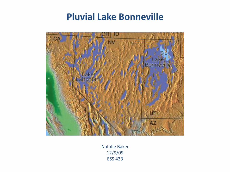
Pluvial Lake Bonneville
Natalie Baker12/9/09ESS 433
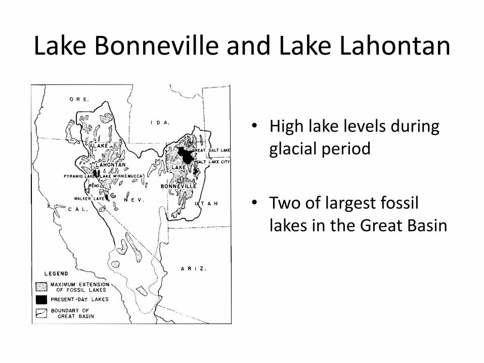
Lake Bonneville and Lake Lahontan
• High lake levels during glacial period
• Two of largest fossil lakes in the Great Basin
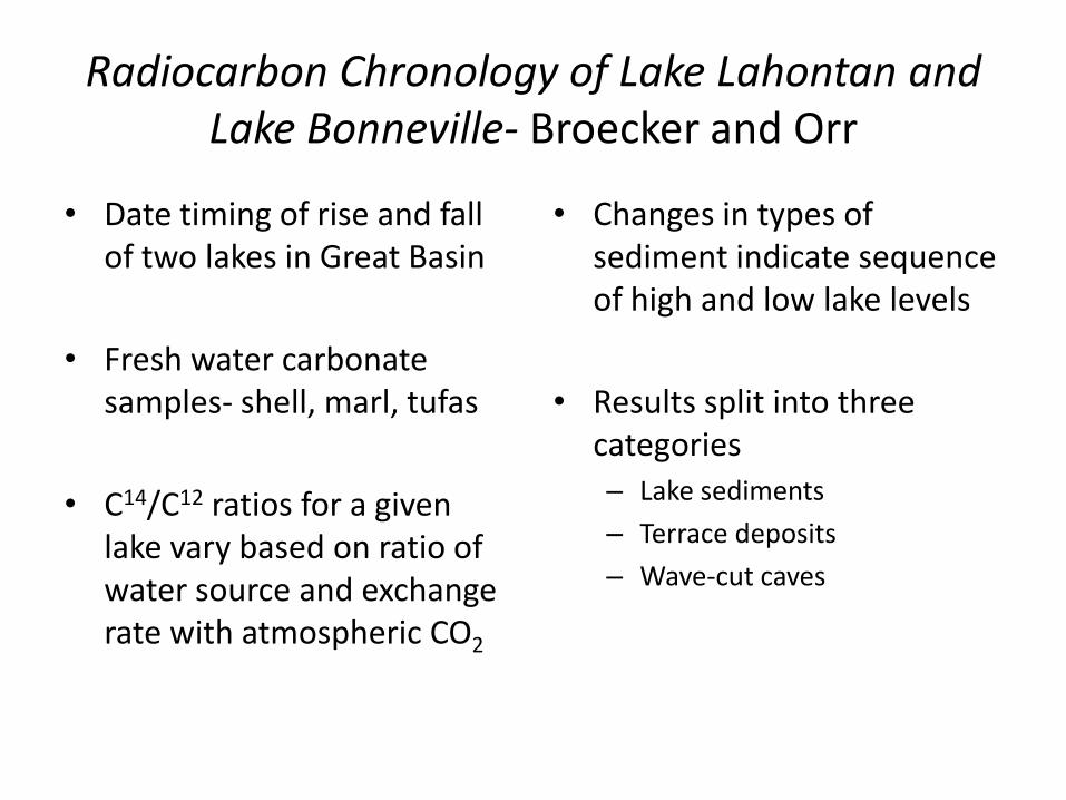
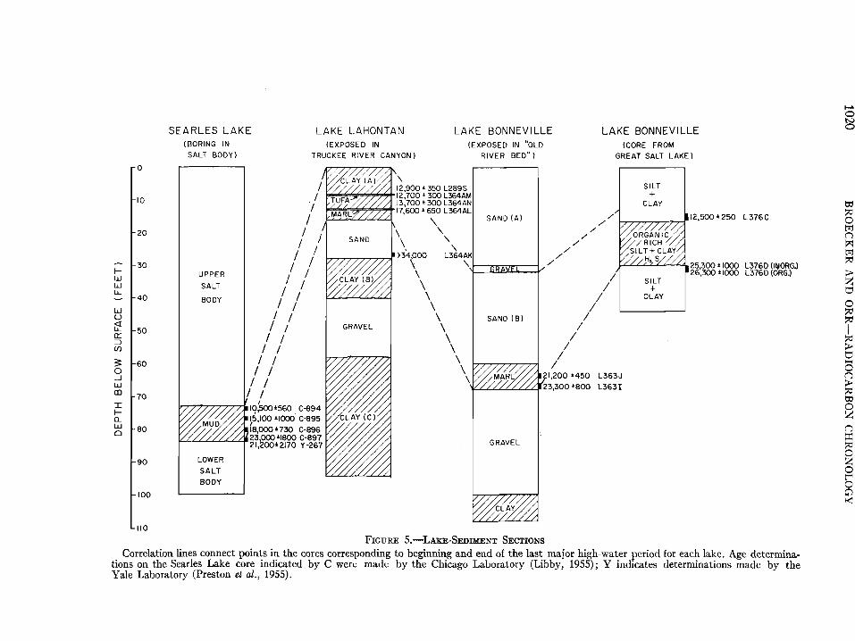
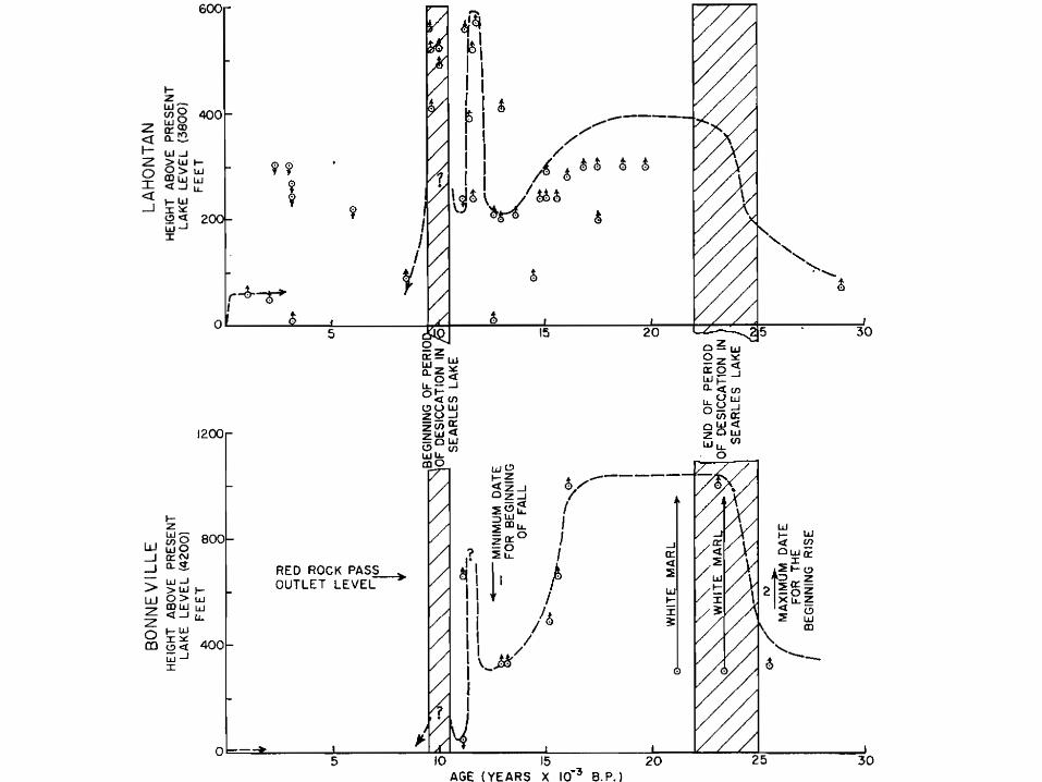
Radiocarbon Chronology of Lake Lahontan and Lake Bonneville- Broecker and Orr
• Date timing of rise and fall of two lakes in Great Basin
• Fresh water carbonate samples- shell, marl, tufas
• C14/C12 ratios for a given lake vary based on ratio of water source and exchange rate with atmospheric CO2
• Changes in types of sediment indicate sequence of high and low lake levels
• Results split into three categories– Lake sediments
– Terrace deposits
– Wave-cut caves

Relation of Lake Level to Climate
• Height of lake (with no outlet) dependent on balance of input and output
• Factors affecting input
– Rate of precipitation
– Rate of evaporation
– Net uptake or release of water by glaciers in basin
• Output depends on evaporation rate per unit area of lake surface area and total area of the lake
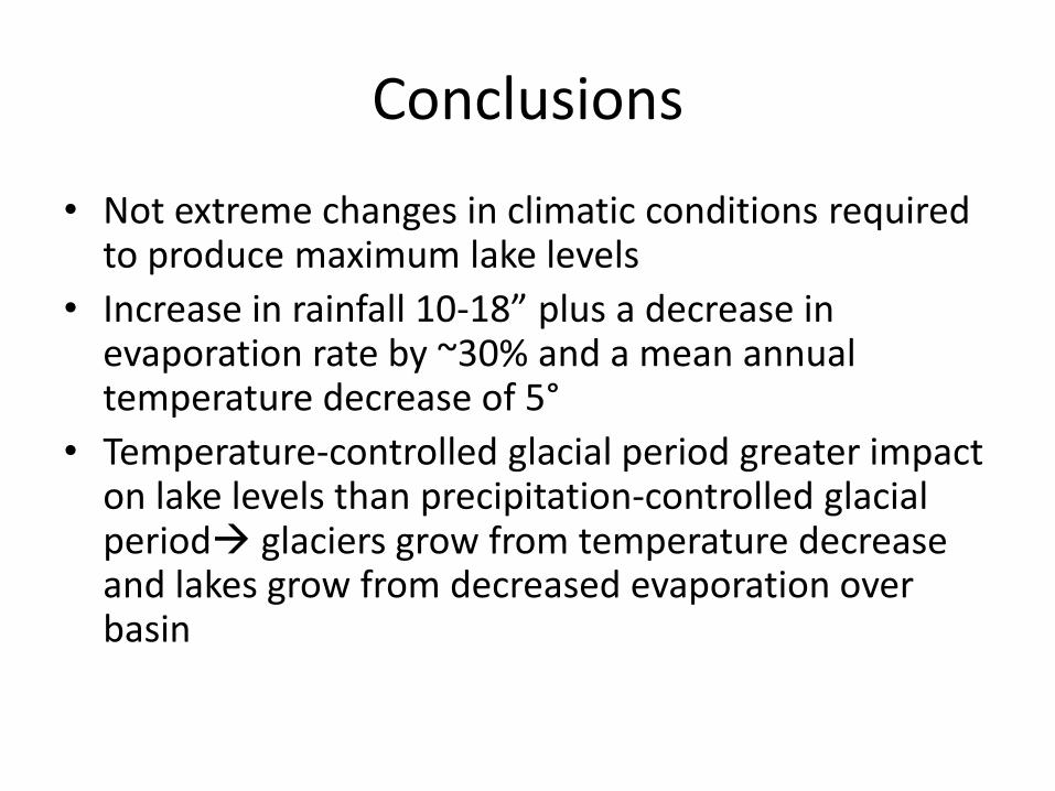
Conclusions
• Not extreme changes in climatic conditions required to produce maximum lake levels
• Increase in rainfall 10-18” plus a decrease in evaporation rate by ~30% and a mean annual temperature decrease of 5°
• Temperature-controlled glacial period greater impact on lake levels than precipitation-controlled glacial period glaciers grow from temperature decrease and lakes grow from decreased evaporation over basin

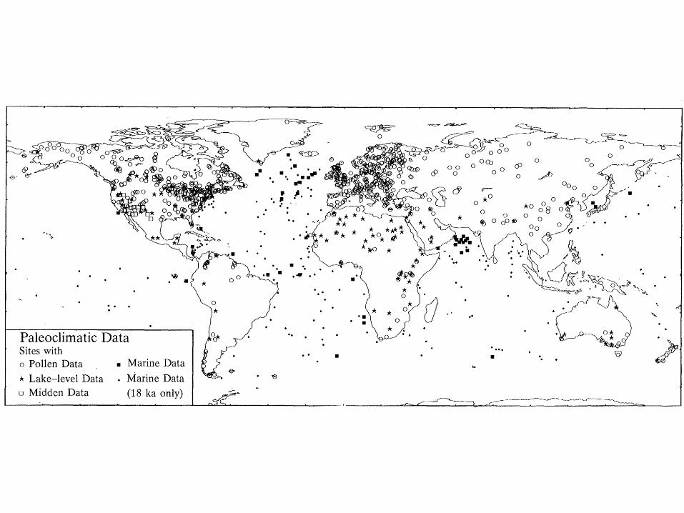
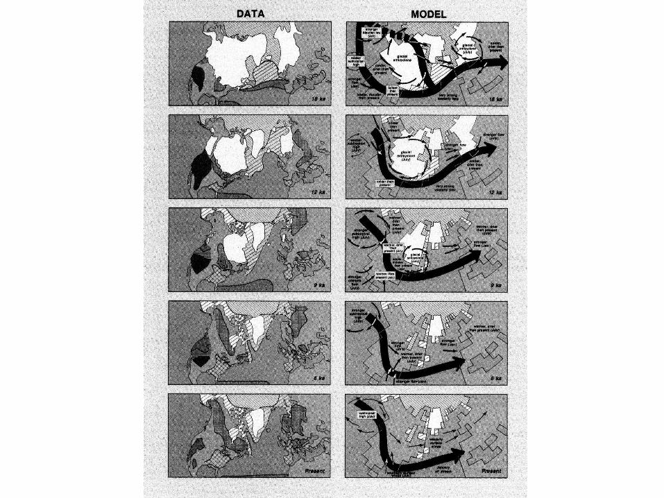
Climatic Changes of the Last 18,000 years: Observations and Model Simulations- COHMAP
• Cooperative Holocene Mapping Project use geologic data to model global and regional climate change
• Goal- improved understanding of the climate system
• 3 types of data to estimate paleoclimate—pollen, lake levels, and marine plankton
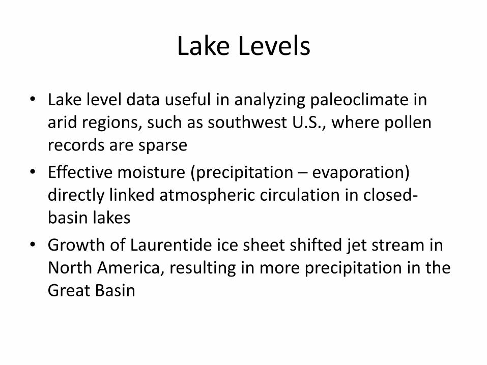
Lake Levels
• Lake level data useful in analyzing paleoclimate in arid regions, such as southwest U.S., where pollen records are sparse
• Effective moisture (precipitation – evaporation) directly linked atmospheric circulation in closed-basin lakes
• Growth of Laurentide ice sheet shifted jet stream in North America, resulting in more precipitation in the Great Basin
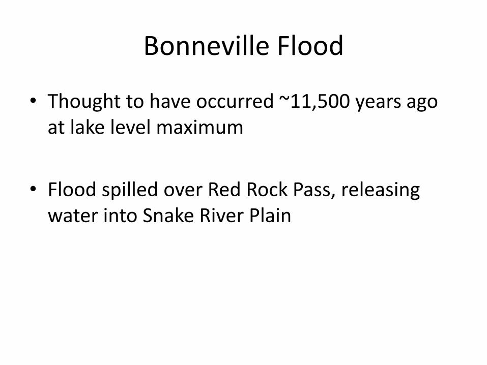
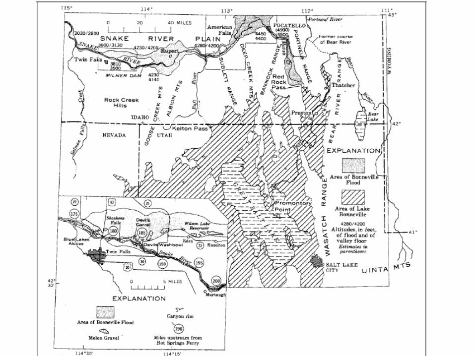
Bonneville Flood
• Thought to have occurred ~11,500 years ago at lake level maximum
• Flood spilled over Red Rock Pass, releasing water into Snake River Plain
References
• Broecker, Wallace S., and Phil C. Orr. "RADIOCARBON CHRONOLOGY OF LAKE LAHONTAN AND LAKE BONNEVILLE." BULLETIN OF THE GEOLOGICAL SOCIETY OF. AMERICA. 69. (1958): 1009-32. Print.
• COHMAP authors. "Climatic Changes of the Last 18,000 years: Observations and Model Simulations." Science. 241.4869 (1988): 1043-52. Print.
• Malde, Harold E. "The Catastrophic Late Pleistocene Bonneville Flood in the Snake River Plain, Idaho." Geological Professional Paper 596. Print.