planning committee agenda 15 february 2018
TRANSCRIPT

www.eden.gov.ukMatthew NealDeputy Chief Executive
Date: 7 February 2018
Town Hall, Penrith, Cumbria CA11 7QFTel: 01768 817817Email: [email protected]
Dear Sir/Madam
Planning Committee Agenda - 15 February 2018Notice is hereby given that a meeting of the Planning Committee will be held at 9.30 am on Thursday, 15 February 2018 at the Council Chamber, Town Hall, Penrith.
1 Apologies for Absence
2 Declarations of Interest
To receive any declarations of the existence and nature of any private interests, both disclosable pecuniary and any other registrable interests, in any matter to be considered or being considered.
3 Planning Issues (Pages 5 - 10)
To note the attached lists of the Deputy Director Technical Services. a) Applications determined under office delegated powers for the month of
January 2018
4 Planning Issues - Applications for Debate (Green Papers) (Pages 11 - 94)
a) To consider the reports of the Deputy Director Technical Services on the following applications:
Item No Application Details Officer
RecommendationPage Number
1 Planning Application No: 17/0928Outline planning permission for use Class B1/B2/B8 development associated access, car parking, landscaping and ecological enhancement measures with all matters reserved except for access.Land at the Junction of A6 and B5035, PenrithPFK
Recommended to:APPROVESubject to Conditions
13

www.eden.gov.uk 2
2 Planning Application No: 17/0156Variation of conditions 2 (plans compliance) relating to site alterations, 6 (landscaping details) and 7 (finishes) attached to approval 12/0696.Land adjacent to Bank Top Yard, Bankside, LazonbyMr C Nichol
Recommended to:APPROVESubject to Conditions
33
3 Planning Application No: 17/0465Outline application for residential development with all matters reserved (as amended).Land to the rear of Mothercroft, MorlandR Towler, Simpson Towler, Chartered Surveyors
Recommended to:APPROVESubject to Conditions 47
4 Planning Application No: 17/1095Outline application for 4 No dwellingsLand adjacent to Bankfoot Farm, Newton ReignyMr A Robson
Recommended to:REFUSEWith Reasons 58
5 Planning Application No: 17/1021Use of land for siting of 25 holiday lodges, manager’s accommodation and associated infrastructureMoss Bank Holiday Park, Great SalkeldMr J Beard
Recommended to:APPROVESubject to Conditions 70
6 Planning Application No: 17/1040Variation of condition 2 (Plans Compliance) to amend house type for plot Nos 48 - 53 and repositioning of plots1 - 3 attached to approval 15/0799Land adjacent Salkeld Road, Fairhill, PenrithMr A McNally - Story Homes
Recommended to:APPROVESubject to Conditions
81
5 Confirmation of Site Visits (if any)
To confirm the date and location of any site visits that may have been agreed.
6 Any Other Items which the Chairman decides are urgent
7 Date of Next Meeting
The date of the next scheduled Planning Committee is 15 March 2018.

www.eden.gov.uk 3
8 Exclusion of Press and Public
To consider whether, in accordance with Section 100A(4) to the Local Government Act 1972, members of the public (including the press) should be excluded from the meeting during discussion of the following items of business on the grounds that they involve the likely disclosure of exempt information as defined in paragraph 6 of Part 1 to Schedule 12A of the Act.
9 Breach of Planning Condition (Pages 95 - 102)
To consider report TES6/18 from the Deputy Director Technical Services which is exempt from publication as defined in paragraph 6 of Part 1 to Schedule 12A of the Act.
Paragraph 6 relates to information which reveals that the authority proposes:
a) To give under any enactment a notice under or by virtue of which requirements are imposed on a person; or
b) To make an order or direction under any enactment.
Yours faithfully
M NealDeputy Chief Executive (Monitoring Officer)
Democratic Services Contact: John Greenbank
Encs
For AttentionAll members of the Council
Chairman – Councillor J G Thompson (Conservative Group)Vice Chairman – Councillor W Patterson (Independent Group)
CouncillorsA Armstrong, Conservative GroupI Chambers, Conservative GroupM Clark, Independent GroupM Eyles, Liberal Democrat GroupD Holden, Liberal Democrat Group
V Kendall, Conservative GroupJ C Lynch, Conservative GroupR Sealby, Conservative GroupH Sawrey-Cookson, Independent Group

www.eden.gov.uk 4
Standing DeputiesD Banks, Independent GroupA Hogg, Conservative GroupM Smith, Independent Group
J Raine, Conservative GroupV Taylor, Liberal Democrat GroupM Rudhall, Liberal Democrat Group
Please Note: 1. Access to the internet in the Council Chamber and Committee room is
available via the guest wi-fi – no password is required2. Under the Openness of Local Government Bodies Regulations 2014 this
meeting has been advertised as a public meeting (unless stated otherwise) and as such could be filmed or recorded by the media or members of the public

PLANNING COMMITTEE
APPLICATIONS DETERMINED UNDER OFFICER DELEGATED POWERS FOR THE MONTH OF January 2018
Agenda Item No.
App No DescriptionParish DecisionApp Type Location Applicant
17/0426 Change of Use PD/PN
K CROPPERShap APPROVEDChange of use of agricultural building to dwellinghouse.
HAUSE FARM BARN, HARDENDALE, SHAP, PENRITH, CA10 3RA
17/0708 Listed Building Mrs M VincentPenrith APPROVEDListed Building Consent for remedial works to repair and refurbish the property.
22 SANDGATE, PENRITH, CA11 7TJ
17/0743 Full Application Mr J WillanPenrith APPROVEDPart retrospective application for exterior walls. OLIVER'S TASTY BITES, 33 GREAT DOCKRAY, PENRITH, CA11 7BN
17/0819 Full Application Mr G OstleCastle Sowerby APPROVEDErection of new dwelling. STONEGARTH, MILLHOUSE, WIGTON, CA7 8HR
17/0877 Reserved by Cond
Mrs D ChesterBrough Sowerby APPROVEDDischarge of conditions 3 (noise) and 4 (drainage) attached to approval 17/0311.
LAND ADJACENT ACCESS TO SOWERBY LODGE, BROUGH SOWERBY, KIRKBY STEPHEN, CA17 4EG
17/0905 Full Application Mr Thompson - Balance Power
Penrith APPROVEDPeak Power Plant comprising of 2no generators with associated flue stack, 1no transformers, service road, oil tank, welfare cabin, switchgear cabin, substation and gas governor.
CAR PARK SITUATED WITHIN, GILWILLY INDUSTRIAL ESTATE, PENRITH, CA11 9BN
17/0921 Full Application Mr & Mrs N HendersonPenrith APPROVEDFirst floor gable, rear and front extension over garage. 9 SYCAMORE DRIVE, PENRITH, CA11 8UG
17/0926 Full Application Mr P HannaWarcop APPROVEDChange of use an attached garage and store to provide additional residential accommodation.
WHITE COTTAGE, WARCOP, APPLEBY-IN-WESTMORLAND, CA16 6PF
17/0929 Reserved by Cond
Mr P Kent - Center Parcs (Operating Co.)
Ltd.
Brougham APPROVEDDischarge of conditions 3 (Site clearance method statement), 5 (Surface and foul water drainage), 6 (Tree protection plan) and 7 (Arboricultural method statement) attached to approval 16/1102.
WHINFELL FOREST VILLAGE, WHINFELL, PENRITH, CA10 2DW
17/0943 Full Application Executors of G R Metcalfe
Brough APPROVEDConversion of barn to dwelling. MILL HOUSE, BLACK BULL LANE, BROUGH, CA17 4DU
17/0945 Full Application Mrs E UttleyPenrith APPROVEDChange of use of offices to form additional residential accommodation.
NORTH FRIARAGE, FRIARGATE, PENRITH, CA11 7XR
17/0946 Listed Building Mrs E UttleyPenrith APPROVEDListed building consent for creation of internal doorway.
NORTH FRIARAGE, FRIARGATE, PENRITH, CA11 7XR
02 February 2018 Page 1 of 5
Page 5
Agenda Item
3

App No DescriptionParish DecisionApp Type Location Applicant
17/0954 Listed Building Mrs N EwbankBolton APPROVEDListed building consent to replace windows on the front.
FERN COTTAGE & MIDTOWN COTTAGE, BOLTON, APPLEBY-IN-WESTMORLAND, CA16 6AR
17/0955 Full Application Mr & Mrs DraneAlston APPROVEDDemolition of existing single storey extension and construction of new single storey side extension.
THE BARN, GARRIGILL, ALSTON, CA9 3DY
17/0957 Reserved by Cond
Mr K WhartonTebay APPROVEDDischarge of condition 3 (foul and surface water) and condition 4 (surface water drainage) attached to approval 17/0444.
11 HIGHFIELD, TEBAY, PENRITH, CA10 3TJ
17/0959 Full Application Mr & Mrs WatsonKirkoswald APPROVEDProposed conversion of barn. BARN ADJACENT BUSKRIGG, RENWICK, PENRITH, CA10 1LA
17/0960 Listed Building Mr & Mrs WatsonKirkoswald APPROVEDListed building consent for proposed conversion of barn.
BARN ADJACENT BUSKRIGG, RENWICK, PENRITH, CA10 1LA
17/0963 Outline Application
Mr D Rawle - Cumbria County Council
Penrith APPROVEDOutline planning application (with all matters reserved) for residential development include associated parking and amenity space.
LAND OFF TYNEFIELD DRIVE, TYNEFIELD DRIVE, PENRITH, CA11 8HZ
17/0967 Full Application Mr S HumphreyPenrith APPROVEDProposed single storey extension to rear and two storey side extension.
FRENCHWOOD, DROVERS LANE, PENRITH, CA11 7RA
17/0972 Advertisement Euro Car Parks LimitedPenrith APPROVEDDisplay of 7 non-illuminated advertisements in supermarket car park.
22-24 KING STREET, PENRITH, CA11 7AG
17/0976 Full Application Mr Martin ScarlettSkelton APPROVEDFirst floor extension above existing single story section of dwelling
TOWN END, LAITHES, PENRITH, CA11 0AW
17/0978 Full Application Mr & Mrs RobinsonBolton APPROVEDProposed rear extension. GLEBE HOUSE, BOLTON, APPLEBY-IN-WESTMORLAND, CA16 6AW
17/0979 Listed Building Mr B ParkerSkelton APPROVEDListed building consent for internal and external alterations including addition of 2no windows to East elevation.
PRINGLE HOUSE, ELLONBY, PENRITH, CA11 9SN
17/0982 Full Application Mr T M GregsonWarcop APPROVEDDevelopment of 2no detached dwellings. EDEN GATE, WARCOP, APPLEBY-IN-WESTMORLAND, CA16 6PL
17/0983 Full Application Mr & Mrs P SowerbyStainmore APPROVEDProposed single storey extension to front elevation. 1 OAKBANK, BARRAS, KIRKBY STEPHEN, CA17 4JD
17/0984 Listed Building Mr R BerryTemple Sowerby APPROVEDListed building consent for works to kitchen. SWAN COTTAGE, TEMPLE SOWERBY, PENRITH, CA10 1SD
17/0985 Listed Building Mr R BerryTemple Sowerby APPROVEDListed building consent for installation of bunded oil tank and associated works.
SWAN COTTAGE, TEMPLE SOWERBY, PENRITH, CA10 1SD
02 February 2018 Page 2 of 5
Page 6

App No DescriptionParish DecisionApp Type Location Applicant
17/0986 Full Application Mr & Mrs J GreenPenrith APPROVEDSingle storey rear extension and alterations to provide new kitchen/dining/sitting area.
62 CROFT AVENUE, PENRITH, CA11 7RL
17/0987 Reserved by Cond
Mr R Wood - Russell Armer Ltd
Yanwath & Eamont Bridge
APPROVEDDischarge of Condition 3) Carriageways and Footpaths attached to planning application 17/0159.
FORMER YANWATH CARE HOME, THE GROTTO, YANWATH, PENRITH, CA10 2LF
17/0989 Full Application Mr B ThornborrowKirkby Thore APPROVEDChange of use of a former methodist chapel to dwellinghouses.
METHODIST CHURCH, CHAPEL LANE, KIRKBY THORE, PENRITH, CA10 1UH
17/0990 Full Application Mr S GallowayPenrith APPROVEDNew Equine Clinic and extensions to reception & waiting area.
THE VETERINARY CENTRE, CARLETON HILL ROAD, PENRITH, CA11 8TZ
17/0992 Full Application PlattGreystoke APPROVEDSingle storey extension to side elevation. NUNSWOOD, ORCHARD DRIVE, GREYSTOKE, PENRITH, CA11 0UD
17/0993 Non-Material Amend
Mr P KentBrougham APPROVEDNon-material amendment for replacement of 7no. lodges with 6.no disabled access lodges attached to approval 16/1102.
CENTER PARCS, WHINFELL FOREST VILLAGE, WHINFELL, PENRITH, CA10 2DW
17/0994 Change of Use PD/PN
Mr A Errington - Messrs J H Errington
Bolton APPROVEDChange of use of agricultural building to dwellinghouse.
EDEN BANK FARM, BOLTON, APPLEBY-IN-WESTMORLAND, CA16 6AY
17/0995 Full Application Mr & Mrs D MorrisonGreystoke APPROVEDExtension to existing agricultural building for storage and livestock.
CLEAR VIEW FARM LODGE, GREYSTOKE, PENRITH, CA11 0SF
17/0996 Reserved by Cond
Mr T BradleyKirkby Thore APPROVEDDischarge of condition 3 (CCTV security) attached to approval 17/0565.
LAND AT KIRKBY THORE INDUSTRIAL ESTATE, KIRKBY THORE, PENRITH, CA10 1XA
17/0997 Cert. of Lawful Electricity North West Ltd
Kirkby Thore APPROVEDCertificate of Lawfulness for erection of lattice tower within fenced compound and ancillary equipment.
ELECTRICITY SUB STATION 35M BRITISH GYPSUM LTD, KIRKBY THORE, PENRITH, CA10 1XU
17/1004 Full Application Mr D HodgsonAlston APPROVEDAlterations to existing rear extension. SCHOOL HOUSE, THE BUTTS, ALSTON, CA9 3JQ
17/1010 Full Application MassinghamPenrith APPROVEDTwo storey extension. FERN BANK, GRAHAM STREET, PENRITH, CA11 9LB
17/1012 Full Application Mr & Mrs S IniffTebay APPROVEDProposed two storey extension. THE ARKE, OLD TEBAY, PENRITH, CA10 3ST
17/1013 Listed Building Mr E Lord - Thomplord Developments Ltd
Kaber APPROVEDListed Building consent for replacement windows. HEGGERSCALE HOUSE, KABER, KIRKBY STEPHEN, CA17 4HZ
02 February 2018 Page 3 of 5
Page 7

App No DescriptionParish DecisionApp Type Location Applicant
17/1017 Full Application Mr & Mrs J A HunterBrough Sowerby APPROVEDChange of use of agricultural land to outdoor equine area.
THORNEY SCALE, SOUTH STAINMORE, KIRKBY STEPHEN, CA17 4DH
17/1019 Full Application C/O AGENTGreat Salkeld APPROVEDProposed manager's dwelling. LAND NEAR MILL GATE, GREAT SALKELD, PENRITH,
17/1024 Full Application Mr & Mrs DaseyPenrith APPROVEDSingle storey extension. LAMLEY HOUSE, GRAHAM STREET, PENRITH, CA11 9LG
17/1025 Full Application Mr G Simpkins - Brough Methodist
Church
Brough APPROVEDProposed disabled access facilities. METHODIST CHAPEL, HIGH STREET, BROUGH, CA17 4BT
17/1027 Non-Material Amend
Appleby Cricket Club - Mr E Brabbins
Appleby APPROVEDNon Material Amendment for removal of raised decking from application 17/0169.
THE CRICKET PAVILION, CHAPEL STREET, APPLEBY-IN-WESTMORLAND, CA16 6QR
17/1029 Cert. of Lawful Mr T. O'MalleyLangwathby APPROVEDCertificate of lawfulness for use of land for the open storage of construction materials and equipment.
LAND AT FERNWOOD, EDENHALL, PENRITH, CA11 8SR
17/1030 Full Application Mrs J HaseldenPenrith APPROVEDCanopy over existing car valeting facilities ULLSWATER ROAD GARAGE, UNIT10 ULLSWATER ROAD BUSINESS PARK, ULLSWATER ROAD, PENRITH, CA11 7EH
17/1033 Tree Works (CA) Ms Julie SandilandsAppleby APPROVEDFell Fir tree in garden which has outgrown its location; Appleby Conservation Area.
THE SHIELING, DOOMGATE, APPLEBY-IN-WESTMORLAND, CA16 6RB
17/1038 Tree Works (CA) Mr Tim Fetherstonhaugh
Kirkoswald APPROVEDT1 Oak: Cut back branches towards roadside to reduce risk to road users; T2/T3 Oaks: Crown reduce by approx. 25%, equating to height reduction of approx. 3m and similar amount off width in all directions to reduce potential hazard to road users; T4 Oak: Fell tree with serious defects on key parts, in interests of public safety; All work as shown on photographs provided; Kirkoswald Conservation Area.
FIELD OPPOSITE 1-6 ROODS PLACE, KIRKOSWALD, PENRITH, CA10 1EF
17/1041 Full Application Mr & Mrs W RaineAlston APPROVEDSingle storey extension. KIRKSIDE, PARK LANE, ALSTON, CA9 3AB
17/1045 Tree Works (CA) John Fleming - Culgaith Parish Council Clerk
Culgaith APPROVEDRemove self-seeded trees from back of wall opposite entrance to Aglionby Farm; Skirwith Conservation Area.
OPPOSITE ENTRANCE TO AGLIONBY FARM HOUSE KIRKLAND ROAD, SKIRWITH, PENRITH, CA10 1RL
17/1046 Full Application Vodafone LimitedMilburn APPROVEDInstallation of 2No. 600mm dishes and all ancillary development.
NATS RADAR STATION, GREAT DUN FELL, APPLEBY,
02 February 2018 Page 4 of 5
Page 8

App No DescriptionParish DecisionApp Type Location Applicant
17/1047 Tree Works (CA) Mr D OversTemple Sowerby APPROVEDRemove Birch tree from front garden; Temple Sowerby Conservation Area.
MEADOWS END, TEMPLE SOWERBY, PENRITH, CA10 1RZ
17/1048 Notice of Intention Mr S RobinsonGreat Salkeld APPROVEDExtension to existing agricultural building. LAND AT WAIN GATE, GREAT SALKELD, PENRITH,
17/1051 Tree Works (CA) Peter LeesonKirkby Stephen APPROVEDRemove Cherry tree overhanging Mickleden; Kirkby Stephen Conservation Area.
MANOR HOUSE, MELLBECKS, KIRKBY STEPHEN, CA17 4AB
17/1052 Non-Material Amend
Mr R Wood - Russell Armer Ltd
Yanwath & Eamont Bridge
APPROVEDNon material amendment to include internal and external alterations to plots 1 - 8 attached to approval 17/0159.
FORMER YANWATH CARE HOME, YANWATH, PENRITH, CA10 2LF
17/1077 Tree Works (CA) Mr F TiffinPenrith APPROVEDMagnolia T1: Crown reduction of no more than 10-15% of leaf area, reducing the lateral extension all around the crown by 20-50cm and reducing the 1 large lateral by 1-2m to reduce loading forces and bring it back in to balance with the retained crown; Penrith New Streets Conservation Area.
GREENHOLME, 3 ARTHUR STREET, PENRITH, CA11 7TT
17/1079 Reserved by Cond
Mr B HodgsonHunsonby APPROVEDDischarge of conditions 3 (materials) and 5 (construction traffic) attached to approval 11/0939.
GARTH HOUSE, LITTLE SALKELD, PENRITH, CA10 1NN
17/1080 Tree Works (CA) Mrs Pam Baskerville-Muscutt
Temple Sowerby APPROVEDT1 / T2 Beech: Fell trees and T3 / T4 Birch: Fell trees; Replant further away from wall with suitable species; Temple Sowerby Conservation Area.
COB COTTAGE, TEMPLE SOWERBY, PENRITH, CA10 1SD
17/1085 Householder PD/PN
Mr BowenBolton APPROVEDPrior notification for rear conservatory. ANGLERS COTTAGE, BOLTON, APPLEBY-IN-WESTMORLAND, CA16 6AW
17/1096 Non-Material Amend
Mr D ArmstrongPenrith APPROVEDNon material amendment for replacement of existing bicycle and refuse stores attached to approval 14/0536.
PEAR TREE YARD, SOUTHEND ROAD, PENRITH, CA11 8HR
17/1099 Tree Works (CA) Caroline FennellTemple Sowerby APPROVEDRemove Rowan T16 and various pruning works to trees on village greens; Temple Sowerby Conservation Area.
TEMPLE SOWERBY VILLAGE GREEN, TEMPLE SOWERBY, PENRITH, CA10 1SB
In relation to each application it was considered whether the proposal was appropriate having regard to the Development Plan, the representations which were received including those from consultees and all other material considerations. In cases where the application was approved the proposal was considered to be acceptable in planning terms having regard to the material considerations. In cases where the application was refused the proposal was not considered to be acceptable having regard to the material and relevant considerations. In all cases it was considered whether the application should be approved or refused and what conditions, if any, should be imposed to secure an acceptable form of development.
02 February 2018 Page 5 of 5
Page 9

This page is intentionally left blank

Agenda Item REPORTS FOR DEBATE
Eden District Council
Planning Committee AgendaCommittee Date: 15 February 2018
INDEX
Item No Application Details Officer
Recommendation
1 Planning Application No: 17/0928Outline planning permission for use Class B1/B2/B8 development associated access, car parking, landscaping and ecological enhancement measures with all matters reserved except for access.Land at the Junction of A6 and B5035, PenrithPFK
Recommended to:
APPROVESubject to Conditions
2 Planning Application No: 17/0156Variation of conditions 2 (plans compliance) relating to site alterations, 6 (landscaping details) and 7 (finishes) attached to approval 12/0696.Land adjacent to Bank Top Yard, Bankside, LazonbyMr C Nichol
Recommended to:
APPROVESubject to Conditions
3 Planning Application No: 17/0465Outline application for residential development with all matters reserved (as amended).Land to the rear of Mothercroft, MorlandR Towler, Simpson Towler, Chartered Surveyors
Recommended to:
APPROVESubject to Conditions
4 Planning Application No: 17/1095Outline application for 4 No dwellingsLand adjacent to Bankfoot Farm, Newton ReignyMr A Robson
Recommended to:
REFUSEWith Reasons
5 Planning Application No: 17/1021Use of land for siting of 25 holiday lodges, manager’s accommodation and associated infrastructureMoss Bank Holiday Park, Great SalkeldMr J Beard
Recommended to:
APPROVESubject to Conditions
Page 11
Agenda Item 4
Agenda Item REPORTS FOR DEBATE
Item No Application Details Officer
Recommendation
6 Planning Application No: 17/1040Variation of condition 2 (Plans Compliance) to amend house type for plot Nos 48 - 53 and repositioning of plots1 - 3 attached to approval 15/0799Land adjacent Salkeld Road, Fairhill, PenrithMr A McNally - Story Homes
Recommended to:
APPROVESubject to Conditions
Page 12
Agenda Item REPORTS FOR DEBATE
Item 1
Date of Committee: 15 February 2018
Planning Application No: 17/0928 Date Received: 27 October 2017
OS Grid Ref: 350337 533776 Expiry Date: 26 January 2018
Parish: Penrith Ward: Penrith North
Application Type: Outline
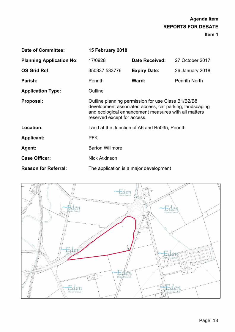
Proposal: Outline planning permission for use Class B1/B2/B8 development associated access, car parking, landscaping and ecological enhancement measures with all matters reserved except for access.
Location: Land at the Junction of A6 and B5035, Penrith
Applicant: PFK
Agent: Barton Willmore
Case Officer: Nick Atkinson
Reason for Referral: The application is a major development
Page 13

Agenda Item REPORTS FOR DEBATE
Item 1
Page 14

Agenda Item REPORTS FOR DEBATE
Item 1
1. Recommendation
It is recommended that delegated power be given to the Deputy Director Technical Services to grant planning permission subject to a Section106 Agreement being entered into to the absolute satisfaction of the Deputy Chief Executive and the Deputy Director Technical Services requiring the provision of a financial contribution for the five year monitoring of the Travel Plan and the Council’s reasonable costs being paid in relation to that Section 106 Agreement. Planning permission is also granted subject to the following conditions:1. The development permitted shall be begun either before the expiration of five
years from the date of this permission or before the expiration of two years from the date of approval of the last of the reserved matters to be approved, whichever is the later.Reason: In order to comply with the provisions of the Town and Country Planning Act 1990.
2. The approval of the details of the scale, layout, external appearance of the buildings, drainage and the landscaping/boundary treatments of the site (called “the reserved matters”) shall be obtained from the Local Planning Authority in writing before any development is commenced.Reason: The application is in outline form only and is not accompanied by full detailed plans.
3. An application for approval of all reserved matters shall be made to the Local Planning Authority before the expiration of five years from the date of this permission.Reason: In order to comply with the provisions of the Town and Country Planning Act 1990.
4. The development hereby permitted shall be carried out in accordance with the documents and drawings hereby approved:
Application Form dated 27 October 2017, received 27 October 2017;
Site Boundary Plan, received 27 October 2017;
Framework Travel Plan, received 27 October 2017;
Transport Assessment, received 27 October 2017;
R G Parkins & Partners Ltd Flood Risk Assessment and Drainage Strategy (ref: K34506/01/FRA/JJ - Rev.A), received 27 October 2017;
RS Acoustic Engineering Ltd Noise Assessment Report, dated October 2017, received 27 October 2017;
Envirotech Ecological Appraisal (ref: 4206 - version 1) received 27 October 2017.
Reason: To ensure a satisfactory development and to avoid ambiguity as to what constitutes the planning permission.
Page 15

Agenda Item REPORTS FOR DEBATE
Item 15. Prior to the commencement of any development, a surface water drainage
scheme, including ongoing management and maintenance, based on the hierarchy of drainage options in the National Planning Practice Guidance with evidence of an assessment of the site conditions shall be submitted to and approved in writing by the Local Planning Authority.The surface water drainage scheme must be in accordance with the Non-Statutory Technical Standards for Sustainable Drainage Systems (March 2015) or any subsequent replacement national standards. No surface water shall discharge to the public sewerage system either directly or indirectly.Thereafter, the development shall be undertaken in accordance with the approved scheme.Reason: To promote sustainable development, secure proper drainage and to manage the risk of flooding and pollution.
6. Foul and surface water shall be drained on separate systems.Reason: To secure proper drainage and to manage the risk of flooding and pollution.
7. No development shall commence until a construction surface water management plan has been agreed in writing with the Local Planning Authority.Reason: To safeguard against flooding to surrounding sites and to safeguard against pollution of receiving surface water systems or watercourses downstream of the site.
8. Prior to the commencement of the development, a foul drainage scheme shall be submitted to and approved in writing by the Local Planning Authority. Thereafter, the development shall be undertaken in accordance with the approved scheme which shall be maintained for the duration of this planning permission.Reason: To protect controlled waters.
9. No work shall commence until the speed reduction on B5305 as shown on drawing number DPL SK001 Rev A has been implemented.Reason: In the interests of highway safety. To support Local Transport Plan Policies: LD7, LD8
10. The carriageway, footways, footpaths, cycleways etc shall be designed, constructed, drained and lit to a standard suitable for adoption and in this respect further details, including longitudinal/cross sections, shall be submitted to the Local Planning Authority for approval before work commences on site. No work shall be commenced until a full specification has been approved. These details shall be in accordance with the standards laid down in the current Cumbria Design Guide. Any works so approved shall be constructed before the development is complete.Reason: To ensure a minimum standard of construction in the interests of highway safety.
Page 16

Agenda Item REPORTS FOR DEBATE
Item 111. Details showing the provision of a vehicle turning space and parking within the
site, which allows vehicles visiting the site to enter and leave the highway in a forward gear, shall be submitted to the Local Planning Authority for approval. The development shall not be brought into use until any such details have been approved and the turning space constructed. The turning space shall not thereafter be used for any other purpose.Reason: To ensure that provision is made for vehicle turning within the site and in the interests of highway safety.
12. The use of the development shall not be commenced until the access has been formed with 10.5 metre radius kerbs, to give a minimum carriageway width of 5.5 metres, and that part of the access road extending 10 metres into the site from the existing highway has been constructed in accordance with details approved by the Local Planning Authority.Reason: In the interests of highway safety.
13. There shall be no vehicular access to or egress from the site other than via the approved access.Reason: To avoid vehicles entering or leaving the site by an unsatisfactory access or route, in the interests of road safety.
14. Details of all measures to be taken by the applicant/developer to prevent surface water discharging onto or off the highway shall be submitted to the Local Planning Authority for approval prior to development being commenced. Any approved works shall be implemented prior to the development being completed and shall be maintained operational thereafter.Reason: In the interests of highway safety and environmental management.
15. The whole of the access area bounded by the carriageway edge, entrance gates and the splays shall be constructed and drained to the specification of the Local Planning Authority in consultation with the Highway Authority.Reason: In the interests of road safety.
16. Before any development takes place, a plan shall be submitted for the prior approval of the Local Planning Authority reserving adequate land for the parking of vehicles engaged in construction operations associated with the development hereby approved, and that land, including vehicular access thereto, shall be used for or be kept available for these purposes at all times until completion of the construction works.Reason: The carrying out of this development without the provision of these facilities during the construction work is likely to lead to inconvenience and danger to road users.
17. Development shall not be begun until a Construction Phase Traffic Management Plan has been submitted to and approved in writing by the Local Planning Authority. The CTMP shall include details of:
pre-construction road condition established by a detailed survey for accommodation works within the highways boundary conducted with a Highway Authority representative; with all post repairs carried out to the
Page 17

Agenda Item REPORTS FOR DEBATE
Item 1satisfaction of the Local Highway Authority at the applicant’s expense;
details of proposed crossings of the highway verge;
retained areas for vehicle parking, manoeuvring, loading and unloading for their specific purpose during the development;
cleaning of site entrances and the adjacent public highway;
details of proposed wheel washing facilities;
the sheeting of all HGVs taking spoil to/from the site to prevent spillage or deposit of any materials on the highway;
construction vehicle routing;Reason: The carrying out of this development without the provision of these facilities during the construction work is likely to lead to inconvenience and danger to road users.
18. No development shall commence within the site until the applicant has secured the implementation of a programme of archaeological work in accordance with a written scheme of investigation which has been submitted by the applicant and approved by the Local Planning Authority.The written scheme will include the following components:i) An archaeological evaluation;ii) A recording programme of the archaeological assets impacted upon by the
permitted development, the scope of which will be dependent upon the results of the evaluation;
iii) Where significant archaeological assets are revealed by the programme of archaeological work, a post-excavation assessment and analysis, preparation of a site archive ready for deposition at a store approved by the Local Planning Authority, completion of an archive report, and submission of the results for publication in a suitable journal.
Reason: To afford reasonable opportunity for an examination to be made to determine the existence of any remains or archaeological interest within the site and for the preservation, examination or recording of such remains.
Informative1. The outline application indicates the approximate presence of a culverted
ordinary watercourse, it should also be noted that Cumbria County Council as Lead Local Flood Authority have permissive powers on ordinary watercourse and it is advised that the applicant contact Cumbria County Council to progress an Ordinary Watercourse Flood Defence Consent.
Page 18

Agenda Item REPORTS FOR DEBATE
Item 1
2. Proposal and Site Description2.1 Proposal2.1.1 The proposal seeks outline planning permission for the creation of an employment site
for B1(Business), B2 (General Industry) and B8 (Storage and Distribution) uses, on land at the junction of the A6 and B5035 (Stoneybeck Roundabout), Penrith. The application seeks approval for access however, all other matters are reserved.
2.1.2 Indicative plans provided by the applicant suggest that up to six buildings could be accommodated on the site, spaced evenly throughout. The site would be accessed via a new access point off the A6 public highway. The access road would run through the site itself servicing each of the proposed buildings. The indicative plans suggest the buildings would range from 90,000 square feet to 19,000 square feet in size. The maximum height of the buildings proposed would be no greater than 12 metres in height.
2.1.3 The proposed development seeks to provide a deliverable and sustainable supply of flexible employment floorspace within the District, in addition to contributing to the ongoing supply beyond the current Development Plan Period.
2.1.4 The proposal would result in alterations to the local highway network, achieved via a reduction in the speed of a section of the B5035 public highway, creating a 40mph zone, and also though the inclusion of a ghost island to enable access to the site. The development would propose a scheme of landscaping for the site, to soften the visual impact of the proposal.
2.1.5 In line with the requirements of the Town and Country Planning (Environmental Impact Assessment) Regulations 2011 (as amended 2015), the application was screened prior to the submission of this planning application. It is considered that whilst the development falls within the criteria of Schedule 2 Development (Infrastructure Projects), the application does not comprise development for which the planning application would need to be accompanied by an Environmental Statement. This position has been reached as is it considered that the proposed development would not have significant impacts upon the environment.
2.1.6 The application is supported by a Framework Travel Plan, Planning Statement, Ecological Statement, Noise Assessment, Flood Risk Assessment, Design and Access Statement and accompanying plans.
2.1.7 Due to the size and scale of the development, the applicant has requested a longer period of five years to implement this planning permission instead of the normal three year period. Under the provisions of the Town and Country Planning Act 1990, the Local Planning Authority is able to approve a longer period for implementation if it is justified. In this instance, it is considered acceptable to grant a longer period for implementation to allow for the necessary preparations of the Reserved Matters to be completed before the development commences.
2.2 Site Description2.2.1 The application site sits within an area of undeveloped agricultural land, approximately
2.5 kilometres north of Penrith. The site is triangular in shape due to its position at the junction of the A6 and B5035 public highways.
Page 19

Agenda Item REPORTS FOR DEBATE
Item 12.2.2 The application site is 7.7ha in size and currently in a low intensive agricultural use,
used predominantly for grazing of animals. The site slopes (broadly), gently downhill in an eastwards direction towards the A6 public highway.
2.2.3 The site is bounded to the north by the A6 and the B5035 to the east. In all other directions the site is bounded by expanses of agricultural land due to the partial rural location of the application site.
2.2.4 To the west of the site runs the M6 Motorway and Junction 41 off which access to the site could be achieved. In addition, to the west of site lies the West Coast Mainline Railway Line located at a distance of approximately 700 metres.
2.2.5 The nearest residential dwellings include a small cluster of properties approximately 60 metres to the east of the site across the A6, and Crossfield Farm, approximately 130 metres to the south. The boundary treatment for the site currently consists of sections of traditional stone walls, hedgerows and intermittent trees.
3. Consultees3.1 Statutory Consultees
Consultee Response
Highway Authority - Cumbria County Council
Responded on the 22 December 2017 raising no objection to the proposal. It was noted that the authority would welcome the proposal to introduce a 40mph speed limit and ghost island right hand turn on the B5305, however, this work would need to be undertaken prior to the development of the site.The framework travel plan provided by the applicant is considered to be acceptable and the authority would welcome the full travel plan after the signing of a Section 106 Agreement. A request for a contribution is made towards the annual monitoring of the Travel Plan over a five year period.Finally a number of conditions were recommended to be included in any decision notice as may be issued for the proposed development.
Environment Agency Responded on the 29 November 2017 raising no objection to the proposal. The Agency noted that the development would be acceptable on the basis that a condition is included in any decision notice as may be issued requiring the submission and approval of a scheme for foul drainage to protect controlled waters.
Page 20
Agenda Item REPORTS FOR DEBATE
Item 1
Consultee Response
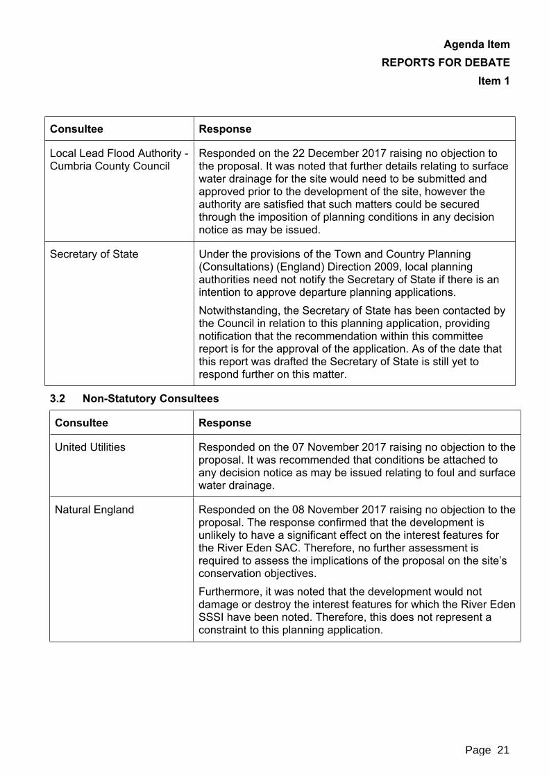
Local Lead Flood Authority - Cumbria County Council
Responded on the 22 December 2017 raising no objection to the proposal. It was noted that further details relating to surface water drainage for the site would need to be submitted and approved prior to the development of the site, however the authority are satisfied that such matters could be secured through the imposition of planning conditions in any decision notice as may be issued.
Secretary of State Under the provisions of the Town and Country Planning (Consultations) (England) Direction 2009, local planning authorities need not notify the Secretary of State if there is an intention to approve departure planning applications.Notwithstanding, the Secretary of State has been contacted by the Council in relation to this planning application, providing notification that the recommendation within this committee report is for the approval of the application. As of the date that this report was drafted the Secretary of State is still yet to respond further on this matter.
3.2 Non-Statutory Consultees
Consultee Response
United Utilities Responded on the 07 November 2017 raising no objection to the proposal. It was recommended that conditions be attached to any decision notice as may be issued relating to foul and surface water drainage.
Natural England Responded on the 08 November 2017 raising no objection to the proposal. The response confirmed that the development is unlikely to have a significant effect on the interest features for the River Eden SAC. Therefore, no further assessment is required to assess the implications of the proposal on the site’s conservation objectives.Furthermore, it was noted that the development would not damage or destroy the interest features for which the River Eden SSSI have been noted. Therefore, this does not represent a constraint to this planning application.
Page 21
Agenda Item REPORTS FOR DEBATE
Item 1
Consultee Response
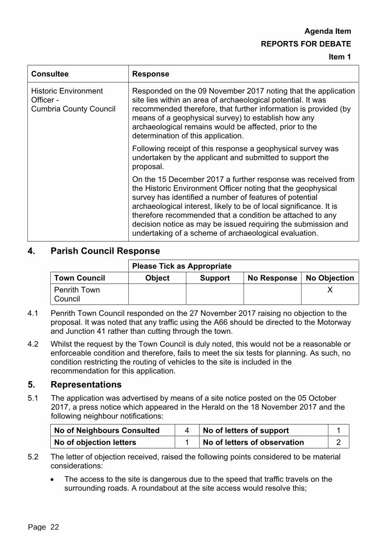
Historic Environment Officer -Cumbria County Council
Responded on the 09 November 2017 noting that the application site lies within an area of archaeological potential. It was recommended therefore, that further information is provided (by means of a geophysical survey) to establish how any archaeological remains would be affected, prior to the determination of this application.Following receipt of this response a geophysical survey was undertaken by the applicant and submitted to support the proposal.On the 15 December 2017 a further response was received from the Historic Environment Officer noting that the geophysical survey has identified a number of features of potential archaeological interest, likely to be of local significance. It is therefore recommended that a condition be attached to any decision notice as may be issued requiring the submission and undertaking of a scheme of archaeological evaluation.
4. Parish Council ResponsePlease Tick as Appropriate
Town Council Object Support No Response No ObjectionPenrith Town Council
X
4.1 Penrith Town Council responded on the 27 November 2017 raising no objection to the proposal. It was noted that any traffic using the A66 should be directed to the Motorway and Junction 41 rather than cutting through the town.
4.2 Whilst the request by the Town Council is duly noted, this would not be a reasonable or enforceable condition and therefore, fails to meet the six tests for planning. As such, no condition restricting the routing of vehicles to the site is included in the recommendation for this application.
5. Representations5.1 The application was advertised by means of a site notice posted on the 05 October
2017, a press notice which appeared in the Herald on the 18 November 2017 and the following neighbour notifications:
No of Neighbours Consulted 4 No of letters of support 1No of objection letters 1 No of letters of observation 2
5.2 The letter of objection received, raised the following points considered to be material considerations:
The access to the site is dangerous due to the speed that traffic travels on the surrounding roads. A roundabout at the site access would resolve this;
Page 22
Agenda Item REPORTS FOR DEBATE
Item 1 The application site is 2.5 kilometres outside of Penrith in open and un-spoilt
country;
The trees screening the site on Stoneybeck Roundabout could be removed at any time, as could those within the highway verge;
There is still capacity at the Gilwilly Industrial Estate which is yet to be filled after so many years. Is there a need for extra capacity in the future;
If the existing space is to be occupied then a package of incentives is needed to encourage occupiers and not just abandon space and create new speculative space in the open country;
The M6 Junction 41 junction is not lit so there will be a safety issue in the winter months resulting from additional HGVs;
The B5035 and A6 are often used as a diversion route if the M6 is closed, with huge volumes of additional traffic coming past the new entrance to the site;
The new anaerobic digester plant in the area has caused a large increase in traffic flows on the road networks which will not be reflected within the figures used in the traffic report. These are largely slow moving agricultural vehicles;
The development would set a precedent for together sites and land between the site and Penrith to be developed in a sprawling and haphazard way;
There is a potential issue with surface water likely to drain into the River Petteril which is not far away.
5.3 The letters of observation raised the following points;
The development appears to be ad-hoc, piecemeal, haphazard, speculative and opportunistic;
If established the development would set a precedent for similar development within the area;
There is likely to be planning policy against this type of development;
The development is premature in terms of the adoption of the local plan;
Any development should only be granted on the condition of the provision of pedestrian cycle access from Penrith;
Workers should be able to travel safely to the site on cycle and on foot;
Improving the cycle access to the site would also enhance the safety of cycles on the Lands End to John o Groats cycle ride which typically passes through Penrith.
5.4 The letter of support raised the following points:
The development of the northern fringe of Penrith and the M6 corridor is the most sensible approach;
There would be interest in moving our business there;
Page 23
Agenda Item REPORTS FOR DEBATE
Item 1 The two largest threats to our business are to growth and progress. The
development is the best location for expansion and relocation of businesses.
6. Relevant Planning History6.1 There is no planning history considered relevant to the determination of this planning
application.
7.0 Policy Context7.1 Development Plan
Eden Local Plan NE1 Development in the Countryside.
Core Strategy DPD Policy: CS1 Sustainable Development Principles
CS2 Locational Strategy
CS3 Rural Settlements and the Rural Areas
CS4 Flood Risk
CS5 Transport and Accessibility
CS12 Principles for Economic Development and Tourism
CS13 Employment Land Provision
CS14 Employment Development in Rural Areas
CS16 Principles for the Natural Environment
CS18 Design of New DevelopmentEmerging Local Plan: LS1 Locational Strategy;
DEV1 General Approach to New Development
DEV2 Water Management and Flood Risk
DEV3 Transport, Accessibility and Rights of Way
DEV5 Design of New Development
EC1 Employment Land Provision
EC3 Employment Development in Existing Settlements
ENV1 Protection and Enhancement of the Natural Environment, Biodiversity and Geodiversity
Due to the advanced stage of adoption of the emerging Local Plan, substantial weight is afforded to the above draft policies in the determination of this planning application.
Page 24

Agenda Item REPORTS FOR DEBATE
Item 1
7.2 Other Material ConsiderationsNational Planning Policy Framework: The presumption in favour of sustainable development
Core planning principles
Requiring good design
Meeting the challenge of climate change, flooding and coastal change;
Conserving and enhancing the natural environment
Annex 1 - Implementation National Planning Practice Guidance Further guidance in relation to Flood Risk and climate change
8. Planning Assessment8.1 Key/Main Planning Issues
Principle
Drainage, Flooding and Pollution
Highways Impacts
Landscape Impacts
Heritage Impacts
Residential Amenity
Environmental and Ecological Impacts
8.2 Principle8.2.1 The planning application is considered to be a departure application, in that the
proposal is not considered to be in line with the development plan for the district. In this instance the Development Plan consists of the Eden Local Plan, the Core Strategy and the emerging Local Plan.
8.2.2 Both the Core Strategy Policy CS2, and within the emerging Local Plan ‘draft’ policy LS1 both seek to focus new and appropriate development towards Key Service Centres such as Penrith, including the provision of employment land. In this instance it is the case that the application site is located within an area of open countryside land outside of any settlement. Notwithstanding, the site is considered to be reasonably well-related to Penrith due to the strong transport links that exist between the two and that the site falls within the administrative area of Penrith. As such, the application site could be considered as an appropriate site for sustainable development following the principles outlined within Core Strategy Policy CS1 and ‘draft’ policy DEV1 of the emerging Local Plan, subject to further site specific considerations detailed within this report.
Page 25

Agenda Item REPORTS FOR DEBATE
Item 18.2.3 Within the emerging Local Plan, ‘draft’ Policy EC3 also seeks to focus new
employment sites to within or adjacent to existing settlements. However, where a proposal does not meet the criteria set within EC3, development may still be acceptable when assessed against the wider employment/economic benefits of the scheme. The criterion for new development includes:
‘Development is of a scale, type and design sympathetic to the location within which is it proposed;
Development would not have an unacceptable impact on highways or other forms of infrastructure;
Development would not cause harm to local amenity, landscape, ecology, historic environment or other environmental and cultural heritage considerations;
The development is capable of achieving appropriate standards of access, servicing, parking and amenity space.’
8.2.4 Furthermore, ‘draft’ Policy EC1 notes that alternative sites will be determined against the criteria listed in Policy EC3. In such circumstances, any proposals for B1, B2 and B8 purposes on unallocated sites which are well related to Penrith; have good transport infrastructure, and which have acceptable effects in terms of landscape character will be looked upon favourably. This position is supported within the National Planning Policy Framework, where there is general support for sustainable development which provides economic benefits and a stronger economy such as the current proposal. Within paragraph 19 of the Framework, it is noted that ‘Planning should operate to encourage and not act as an impediment to sustainable growth. Therefore significant weight should be placed on the need to support economic growth through the planning system.’
8.2.5 Within the Eden Local Plan it is noted that ‘Saved’ Policy NE1 seeks to protect the undeveloped character of the countryside within the Eden area, only permitted development where an overriding need can be demonstrated. This is further supported by Core Strategy Policy CS3 which seeks to protect the open countryside from inappropriate and harmful development.
8.2.6 However, whilst the aims of the Development Plan is to focus new development towards urban areas such as Penrith, this is not considered to be exclusive as such accepting that other areas may be considered. It is considered that neither the Core Strategy or the emerging Local Plan seek to entirely prevent new employment development in the areas of open countryside. Instead, both documents seek to ensure that in such locations, it is important that proposals are assessed against their compliance with the criteria in ‘draft’ Policy EC3 of the emerging Local Plan to fully understand the extent of any adverse impacts and the level of harm which would be generated. It is on this basis that such proposals are determined with regards to whether or not they represent sustainable development and whether they would result in adverse harm.
8.2.7 In assessing whether or not a proposal can be considered as a truly sustainable development, consideration must be given to the economic, social and environmental impacts or gains of the development.
Page 26
Agenda Item REPORTS FOR DEBATE
Item 18.2.8 From an economic perspective, the proposed development represents an opportunity
to deliver a new employment land supporting the town of Penrith and surrounding settlements. The proposal benefits from good transport links without the constraints of being sited within a large urban area. As such, it is considered that the proposed development does have the potential to attract a new and different/varied employment opportunity to the area, providing wider economic and social benefits to Penrith and the wider Eden District. In addition, the application would seek to secure the delivery of employment to the district, which is supported in principle. The proposal makes a significant contribution towards the Council’s target of the provision of 7.7 hectares of new employment land, detailed within the emerging Local Plan.
8.2.9 The environmental dimension of sustainability includes amongst other things, protecting and enhancing the natural and historic environment. This thread runs through both the Development Plan and also the NPPF. In terms of environmental impacts, the extent of the level of harm to be created would not be significantly adverse. The proposal would not result in the loss of any protected or important landscape, nor result in any significant environmental harm to an extent which outweighs the benefits of the proposal. The development would not result in the loss of any important heritage assets or adversely impact upon the character of the local landscape. As such, whilst it cannot be said that the development would enhance the local environment; the proposal would not have an adverse impact upon it.
8.2.10 In terms of the social element of the proposal, it is considered that the proposal would provide a degree of social support to the local community and its services linked to the provision of employment opportunities and through access to jobs. This is considered to be the case due to the site being well-related and easily accessible to Penrith through its direct transport links and short distance between. It must be noted however, that although there are some social benefits to the scheme, the extent cannot be considered significant or extensive in this instance.
8.2.11 As such, for the reasons detailed above, it is considered that the proposal can be considered to broadly represent sustainable development in this instance. Furthermore, it is considered that the principle of the development is largely acceptable, subject to further considerations in relation to drainage, highways, landscape, amenity, heritage asset and environmental impacts.
8.3 Drainage, Flooding and Pollution8.3.1 The application site is located within a Flood Zone 1, being land at lower
risk/vulnerability of flooding. Whilst there have been no concerns raised by objectors to the development in relation to flood risk at the site, concerns have been raised relating to the potential for surface water to pass from the site into the River Petteril with adverse effects.
8.3.2 A culverted water course passes underground and through the site, which must be protected from the risk of any potential contamination or pollution events in the event that the development is approved. No concerns or objections have been raised by either the Environment Agency or Cumbria County Council as Lead Local Flood Authority to the proposal, on the basis that further details are provided at a ‘reserved matters’ stage requiring the submission and approval of appropriate schemes for foul and surface water drainage. This approach is considered to be acceptable due to the limited flood risk at the site. In such circumstances, the applicant would need to
Page 27
Agenda Item REPORTS FOR DEBATE
Item 1demonstrate that suitable foul and surface water arrangements could be engineered to the Satisfaction of Cumbria County Council, the Environment Agency and United Utilities prior to the approval of a reserved matter application, and before any commencement of the development.
8.3.3 The application submission identifies that a small area in the North West corner of site is at medium to high risk of flooding. However, the indicative plans submitted with the planning application demonstrate that an appropriate layout of the site could be achieved without the need to develop this area of the site.
8.3.4 On the basis that further mitigation measures are secured through the imposition of conditions and implemented on site, the proposed development is considered unlikely to result in any adverse impacts upon flooding or pollution to the surrounding area.
8.4 Highways Impacts8.4.1 It is noted that the objector to the development has raised concerns about the
capability of the public highway to safely cope with and absorb the likely levels of traffic generated by the proposed development. The safety of the proposed access is also called into question due to the nature of the speed of traffic travelling along the highway and also the likely slow moving nature of vehicles departing the site.
8.4.2 In consultation with the County Highways Authority, no objection has been raised to the proposed development on the basis that a reduction in the speed limit on the B5305 is reduced to 40mph and also with the inclusion of a ghost island right hand turn. Additionally, a number of conditions have been requested to be included in any decision notice as may be issued. Subject to the inclusion of a such conditions, the Highway Authority is satisfied that an appropriate and safe means of access can be achieved from the site. Furthermore, notwithstanding the objections that have been received, no concerns have been raised in relation to the ability of the surrounding network to absorb the level of traffic likely to be generated, with no safety concerns raised.
8.4.3 In general, it is considered that the site benefits from good transport links by virtue of the close proximity of the A6, B5035 and also the M6 Motorway and Junction 41. This means that the site to be accessed without the need for vehicles to pass through any settlement or built-up residential area. Whilst the proposal may result in an intensification of the use of vehicles along the adjacent highway network, due to the size and standard of the highway network, this does not in itself represent a constraint to the development.
8.4.4 In terms of sustainable infrastructure, it is noted that the application site sits adjacent to a regular bus route along the A6 public highway. Although no details of any bus stops at the application site have been provided, in theory such provision could be put in place in the future should the site be developed, to enable more sustainable means of transport to access the site. Additionally, due to the site being well related to Penrith, it is considered reasonable to ascertain that the site could be accessed by more sustainable modes of transport such as the bicycle.
8.4.5 Therefore, for the reasons detailed above, whilst local concerns in relation to the nature of the local infrastructure are duly noted, it is considered that safe access to the site can be achieved and that the local highway network is capable of absorbing the proposed level of traffic associated with the development without any additional
Page 28

Agenda Item REPORTS FOR DEBATE
Item 1adverse effects. As such, it is considered unlikely that the proposed development would result in any significant or adverse impacts upon the highway network or upon highway safety.
8.5 Landscape Impacts8.5.1 An important consideration in the determination of this outline planning application, is
the extent and nature of the impact of the proposed development upon the character of the area and the surrounding landscape. The application site is within an agricultural field, which is not within an area of any special landscape designation or sensitivity.
8.5.2 The application site is an open countryside setting, within a reasonably open and undeveloped landscape. Whilst the site is not in an elevated position topographically, the development site is fairly prominent in the local landscape due to the close proximity of the adjacent public highways to the north and east. As such there would be a visual impact when approaching the site in either of these directions. It is noted that long ranging views also exist to the site from the M6 motorway to the west
8.5.3 Although the application is at an outline stage currently, indicative plans have been provided indicating the likely size and scale of the proposed buildings to enable some assessment to be made on landscape and visual impacts. The site would be visible in the local landscape, with short and medium ranging views to the north, south and west. The development would be partially softened by the topography of the surrounding landscape, which restricts views of the site from a number of locations and reduces its visual prominence slightly. The development would be partially screened by the proposed landscaping for site, final details of which would be provided at a reserved matters stage.
8.5.4 Whilst the loss of an area of agricultural land is regrettable, this in itself does not warrant the refusal of this planning application due to the relatively limited significance and importance that it makes to the value of the wider landscape character or its setting. The application would result in a considerable change to the character of the application site itself; however it is considered that this would not result in a significantly adverse impact upon the character of the surrounding landscape and wider area, nor result in an unacceptable level of harm to the visual amenity of the area.
8.5.5 Whilst the development would cause a degree of harm to the undeveloped and semi-rural character of the area by virtue of the loss of an area of agricultural land, and the nature of the development itself, it is considered that the level of harm caused would not be significantly adverse. Furthermore, it is considered that the level of harm that would be caused would not outweigh the economic and public benefits of the scheme, in this instance being the creation of a well-related, and accessible employment opportunity for Penrith and surrounding area. The development would be capable of being accommodated into the local landscape without causing an unacceptable level of harm to the visual amenity of the area despite the relative prominence of the site, if a good quality of final design is achieved.
8.5.6 In terms of the design, scale and appearance of the proposed development, it is noted that such matters are not proposed at this stage due to the proposal being outline consent. Therefore, the current application looks predominantly at the principle of the development. Notwithstanding, should planning permission be granted then a high
Page 29

Agenda Item REPORTS FOR DEBATE
Item 1quality design would likely be required at a reserved matters stage due to the prominence of the site.
8.5.7 Therefore, whilst it is noted that the proposed development would result in an impact upon the local landscape due to the loss of open countryside and undeveloped agricultural land, it is considered that the impact would not be significantly adverse. In addition, the level of harm to the local landscape would not outweigh the benefits of the scheme and warrant the refusal of this application.
8.6 Heritage Impacts8.6.1 It is noted that the application site is not located within the setting of any Listed
Buildings or within a Conservation Area. The site is however, positioned within an area of archaeological potential, the extent of which has been partially established through the Geophysical survey undertaken by the applicant.
8.6.2 Within the emerging Local Plan, ‘draft’ Policy ENV10 states that ‘where a development proposal affecting an archaeological site is acceptable in principle, the council will ensure preservation of the remains in situ as a preferred solution. Where in situ preservation is not justified, he development will be required to make adequate provision fort excavation and recording before or during development.’
8.6.3 No objections have been raised to the application by Cumbria County Council’s Historic Environment Officer. Further conditions have been requested to be attached to any decision notice as may be issued, requiring further archaeological works to be undertaken. Such matters would be secured through the imposition of a planning condition requiring implementation on site in accordance with ‘draft’ Policy ENV10.
8.6.4 On the basis that the further mitigation and archaeological works are secured through condition and implemented in full, it is considered that the proposed development would not result in any adverse impacts upon the historic environment or upon any heritage assets.
8.7 Residential Amenity8.7.1 The nearest residential dwelling to the application site are those located approximately
60 metres to the east of the site, across the A6 public highway. These buildings are located off the Stoneybeck roundabout. There are no direct views from the application site to any of these properties due to the existence of mature trees which offer a visual screen. Notwithstanding, whilst these trees may not always be in situ, it is considered that the approximate 60 metre stand-off distance, across the A6 public highway, would be sufficient to ensure that the development would not appear over-bearing or result in any loss of privacy to these properties.
8.7.2 In terms of visual impact, whilst no design details have yet been provided, it is considered that an appropriate final design for the buildings, combined with an appropriate scheme of landscaping would ensure that the development would not result in any significantly adverse impacts upon the visual amenity of any neighbouring residential dwelling.
8.7.3 Although it is acknowledged that a new use would be introduced to the area, this would be balanced against the prominence of the existing highway network, roundabout, a local hotel and train line nearby. Against the backdrop of the existing development, the
Page 30

Agenda Item REPORTS FOR DEBATE
Item 1proposal is considered unlikely to result in any significantly adverse impacts upon local amenity; individually or cumulatively.
8.8 Environment and Ecology8.8.1 The application site is an agricultural green field site, currently used for the grazing of
animals. The entire field would be lost in the event that the proposed development is approved. Accordingly the applicant has undertaken an Ecological Appraisal and assessment of the site, to enable the impact of the development upon the local environment to be assessed.
8.8.2 The outcome of the assessment confirms that the site is of limited ecological value and does not hold any habitats which support protected species. The report includes mitigation measures to provide further environmental protection and enhancements to the area, and notes that the scheme would include some boundary landscape improvements to site.
8.8.3 Therefore, for the reasons detailed above, it is considered that the proposed development would not have a detrimental impact upon the local environment or upon local ecology.
9. Implications9.1 Legal Implications9.1.1 The following matters have been considered but no issues are judged to arise.9.2 Equality and Diversity9.2.1 The Council must have regard to the elimination of unlawful discrimination and
harassment, and the promotion of equality under the Equality Act 2010.9.3 Environment9.3.1 The Council must have due regard to conserving bio-diversity under the Natural
Environment and Rural Communities Act 2006.9.4 Crime and Disorder9.4.1 Under the Crime and Disorder Act 1998, the Council must have regard to the need to
reduce crime and disorder in exercising any of its functions.9.5 Children9.5.1 Under the Children Act 2004, the Council has a duty to safeguard and promote the
welfare of children in the exercise of any of its functions.9.6 Human Rights9.6.1 In determining applications, the Council must ensure that all parties get a fair hearing
in compliance with the provisions of Article 6 under the European Convention on Human Rights, as now embodied in UK law in the Human Rights Act 1998.
10. Conclusion10.1 The proposed development represents a departure from the development plan due to
the semi-rural and open countryside nature of the development. Whilst the development plan seeks to focus employment sites within urban areas such as Penrith, this is not exclusively the case.
Page 31

Agenda Item REPORTS FOR DEBATE
Item 110.2 The application has demonstrated that the proposal would not result in any significantly
adverse impacts upon the local environment, highway network, heritage assets or upon local amenity. There are no statutory consultees to the proposal.
10.3 Whilst there would be a degree of harm caused by the development, this is not considered to be significantly detrimental. The benefits of the scheme, being the development of a new employment site well related to Penrith, are considered to outweigh the level of harm which would be caused.
10.4 The development makes a significant contribution to the Districts supply of new employment land and provision.
10.5 Accordingly, the proposal is recommended for approval.
Jane LangstonDeputy Director Technical Services
Background Papers: Planning File 17/0928
Checked by or on behalf of the Monitoring Officer
Page 32

Agenda Item REPORTS FOR DEBATE
Item 2
Date of Committee: 15 February 2018
Planning Application No: 17/0156 Date Received: 27 February 2017
OS Grid Ref: 354687 539622 Expiry Date: 14 March 2017
Parish: Lazonby Ward: Lazonby
Application Type: Variation of Condition
Proposal: Variation of conditions 2 (plans compliance) relating to site alterations, 6 (landscaping details) and 7 (finishes) attached to approval 12/0696.
Location: Land adjacent to Bank Top Yard, Bankside, Lazonby
Applicant: Mr C Nichol
Agent: Neil Withington Architectural Design
Case Officer: Nick Atkinson
Reason for Referral: This application is before Members as the recommendation is contrary to that of the Parish Council and also at the request of a member of the public.
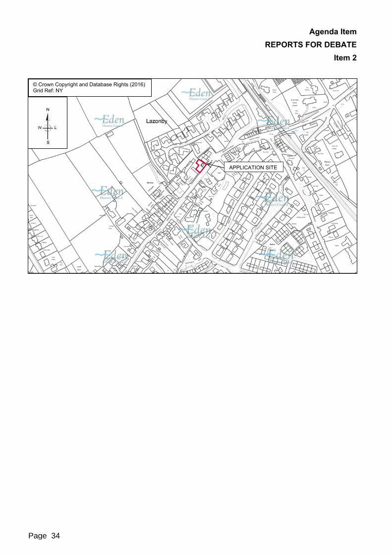
© Crown Copyright and Database Rights (2016)Grid Ref: NY
APPLICATION SITE
Page 33
Agenda Item REPORTS FOR DEBATE
Item 2
© Crown Copyright and Database Rights (2016)Grid Ref: NY
APPLICATION SITE
Page 34

Agenda Item REPORTS FOR DEBATE
Item 2
1. Recommendation
It is recommended that planning permission be granted for the application subject to the following conditions:1. The development hereby granted shall be carried out strictly in accordance
with the plans and documents hereby approved:i) Application Form dated 27 February 2017;ii) Location Plan received 27 February 2017;iii) Proposed Site Plan (ref: 14-020-06B - Rev.C) received 27 February 2017;iv) Proposed Floor Plans (ref: 14-020-02D - Rev.D) received 27 February
2017;v) Proposed South West and North West Elevations (ref: 14-020-04F - Rev.F)
received 03 March 2017;vi) Proposed South East and North East Elevations (ref: 14-020-03E - Rev.E)
received 03 March 2017.Reason: To ensure a satisfactory development and to avoid ambiguity as to what constitutes the planning permission.
2. The whole of the vehicular access area shall be constructed and drained to the specification of the Local Highways Authority.Reason: In the interests of highway safety.
3. The drainage for the development shall be carried out strictly in accordance with the Flow Impact Assessment dated 16 April 2013.Reason: To ensure the satisfactory drainage of the development.
4. Prior to the occupation if any part of the development, landscaping works shall be undertaken in accordance with the drawing ‘Proposed Site Plan(ref: 14-020-06B - Rev.C) received 27 February 2017’. Any trees or other plants which die or are removed within the first five years following the implementation of the landscaping scheme shall be replaced during the next planting season.Reason: In the interests of protecting visual amenity.
2. Proposal and Site Description2.1 Proposal2.1.1 The application is a variation of conditions 2, 6 and 7 attached to planning permission
12/0696. For the purposes of clarity the aforementioned conditions as drafted state:Condition 2 - ‘The development hereby granted shall be carried out strictly in accordance with the details and plans hereby approved (drawing Nos 11-05-05c and 11-05-06b received on 25 April 2013 and 2 July 2013) and shall not be varied other than by prior agreement in writing by the Local Planning Authority.
Page 35
Agenda Item REPORTS FOR DEBATE
Item 2
Reason - To ensure a satisfactory development and to avoid ambiguity as to what constitutes the planning permission.’Condition 6 - ‘No development shall take place until full details of both hard and soft landscape works, including a phased programme of works, have been submitted to and approved in writing by the Local Planning Authority and these works shall be carried out as approved prior to the occupation of any part of the development or in accordance with the programme agreed by the Local Planning Authority. Any trees or other plants which die or are removed within the first five years following the implementation of the landscaping scheme shall be replaced during the next planting season.Reason - In the interests of visual amenity.’Condition 7 - ‘Prior to use on site details of the external finfish materials for the external walls and roof shall be submitted to and agreed in writing with the Local Planning Authority.Reason - In the interests of visual amenity.’
2.1.2 The current application has been submitted to regularise works undertaken at the site since the grant of planning permission 12/0696. The alterations to the previously approved development came to the attention of the authority following receipt of a complaint from a member of the public and a subsequent enforcement investigation by the authority which remains ongoing. The enforcement investigation established that a breach of planning control had taken place following the serving of a Planning Contravention Notice.
2.1.3 During the course of the enforcement investigation the applicant has confirmed that the reason for the variation to the approved plans was due to the need to undertake emergency works required following Storm Desmond. The works were required to stop the site from experiencing a land slip following the extreme and inclement weather experienced at the time. The applicant further confirmed that the second retaining wall was erected following input from a structural engineer.
2.1.4 The main variation sought involves an alteration to a retaining wall located to the rear of the off-street parking area previously approved. The retaining wall has been constructed but on a different alignment to that approved, being positioned approximately 2 metres further back into the site and at an increased height of approximately 1 metre.
2.1.5 Additionally, due to the slope and gradient of the site, which drops approximately4 metres over a distance of 9 metres, a retaining wall was always proposed for the site to stabilise the land and secure the site from any landslips. The applicant has confirmed that upon the commencement of the development, it was established that a second retaining wall was required to be constructed due to a significant risk of landslip that was due to occur during the time of Storm Desmond. The second retaining wall was subsequently constructed to the rear of the proposed property to stabilise the land to the north of the application site. The new retaining wall rises to a height of approximately 3 metres and is positioned in line, but moving away from, the neighbouring property No 1 Bankside.
Page 36
Agenda Item REPORTS FOR DEBATE
Item 22.1.6 The variation to the previous approval also seeks relatively minor alterations to the
external appearance of the building and includes landscaping details for the site, previously conditioned for further submission under planning permission 12/0696. The proposed building would be constructed from facing brickwork and render finished walls, UPVC windows and door openings and a natural slate roof.
2.2 Site Description2.2.1 The application site is approximately 350 square metres in size and is located to the
western side of the B6413 Lazonby to Plumpton Road. The site occupies a prominent street scene position within a reasonably central location within the village of Lazonby.
2.2.2 The site is partially previously developed land due to the prior existence of a single storey telephone exchange building, latterly used as a builder’s store, which was positioned in the eastern corner of the site. This building was demolished following the grant of planning permission 12/0696.
2.2.3 The application site has a steep gradient sloping from north to south across the site. The buildings located to the north of the site are approximately 4 metres higher than much of the application site and the adjacent public highway.
2.2.4 The nearest residential properties to the site are numbers 1-3 Bankside, a small and modern terrace of houses located to the immediate east of the site. There are residential properties located to the north of the site, however these sit significantly higher than the application site due to the sloping gradient noted previously.
2.2.5 To the immediate south of the site is the B6413 public highway which runs parallel along its entire length. It is off this public highway that the site would be accessed.
3. Consultees3.1 Statutory Consultees
Consultee ResponseHighway Authority Initially responded on the 04 April 2017 noting that
there was no objection to the proposal on the basis that there would be no intensification of access to the site.
Local Lead Flood Risk Authority
Responded on the 09 November 2017 making the following comments:‘Although there are changes to the layout these are not significant – there are more areas of paving but it is proposed that this will be of permeable paving so likely to act in a very similar way to natural runoff. There do not appear to be any percolation test results but the soils in that area are generally understood to be very free draining. The roof drainage will be discharging direct to the public sewer so should not cause any problems.’
Page 37

Agenda Item REPORTS FOR DEBATE
Item 2Further comments were noted in relation to the potential impact of the development upon the neighbouring properties to the site:‘I am assuming that the concerns have been raised by the property on the downhill side which looks of modern construction so I would anticipate they should be adequately constructed to prevent water seepage into their properties. If it is them have they said that they experience flooding anyway? Do they have any photographic evidence?Although there are no guarantees I would not expect these changes in this location to have a significant impact on surface water run-off as the permeable paving seems to be proposed and appears to be laid flat on the surface.’
3.2 Discretionary Consultees
Consultee ResponseLazonby Parish Council Responded on the 12 April 2017 registering an
objection to the proposal.United Utilities Responded on the 10 November 2017 confirming that
the proposed surface water discharging from the site into the public sewer is acceptable.
4. Parish Council/Meeting ResponsePlease Tick as Appropriate
Parish Council/Meeting Object Support No Response No View
ExpressedLazonby
Lazonby Parish Council asked that the planning application be refused in its current form and construction of the site be limited to the originally approved plans. The reasons for this request include:
1. ‘The two retaining walls will overshadow the adjacent property, the proposed terracing will lead to an invasion of privacy interfering with the neighbours right to peaceable enjoyment of the his property, these walls and terracing will also restrict the light to his property.
2. The two retaining walls add to the bulk of the property, being visually intrusive from the road and are out of proportion to existing developments in the village.
3. The proposed plans refer to the retention of existing trees; these have already been felled in contravention of the existing planning application.
4. The use of permeable paving on the driveway is of doubtful value as the excavation is already down to bedrock, this will cause run off onto the highway, as
Page 38

Agenda Item REPORTS FOR DEBATE
Item 2has already been experienced during recent wet weather - there is no surface water drainage currently to the site and it is believe discharge of water to the highway is an offence.
5. There appears no provision in the current walls for drainage from the land behind, this is known as a problem and referred to in the follow assessment in the original planning application. The construction of these walls has caused ground water to be diverted under the two adjacent buildings, evidenced by the appearance of moisture in Mr Fisher's cellar area.
6. The increase in ridge height from the original plans will further overshadow the adjacent properties, and is out of proportion to the original plan which mirrored the slope down the hill by reducing the ridge height from the apex adjacent to the barn.
7. The plans make reference to reducing the height of the car parking bay walls. It should be pointed out that this wall is exclusively on the land of the adjoining property which the neighbour owns, permission to reduce the height of this wall has not been sought, nor will it, under any circumstance be granted.’
5. Representations5.1 The neighbour consultations undertaken were the same as the previous planning
application 12/0696.
No of Neighbours Consulted 10 No of letters of support 0No of Representations Received 4 No of neutral representations 0No of objection letters 4
5.2 The letters of objection provided the following comments which have been summarised:
The retaining wall constructed is 2 metres further back and 1 metre higher than the approved plans which obscures the lounge windows of the adjacent property;
The second higher retaining wall is built on higher grounds making an unsightly, high bulk concrete structure that is more in keeping with a commercial premises. This wall also obscures views from the adjacent property;
The two retaining walls are out of proportion to the adjacent residential properties;
There is no drainage behind the retaining walls or let through drainage holes to allow for hydraulic loading. This will force runoff water along the walls and down the hill under the basement of adjacent properties;
The adjacent properties have started to experience damp issues in the basements which had not previously occurred until the retaining walls on the application site were built;
The special construction of the adjacent properties is a concern due to the steep slope of the site on two axis with multi levels on soft sandstone. The drainage of these properties has to deal with water from the application site;
The car parking area has no drainage except for permeable paving. There is insufficient substrate below this area to enable sufficient drainage to occur which is
Page 39
Agenda Item REPORTS FOR DEBATE
Item 2not the case due to concrete foundations and the site being sited on sandstone bedrock;
The amended roofline of the proposed new building will cast shadows on adjacent properties and restrict light;
The amended brick finish, half rendered of the building is not aesthetically pleasing. The original plans were more suitable as they complemented the surrounding properties;
The vernacular style of walls facing onto the public highway in this area is red sandstone. There is no use of sandstone anywhere on the development which would be visually unattractive;
The application relies on reducing the height of the wall between the proposed parking bay and the adjacent property. This wall is not within the applicant’s ownership and no consent will be given to its removal;
The retaining walls as built overshadow the adjacent property;
The retaining walls would result in a loss of local visual amenity for the area;
The proposed plantings will further overshadow the adjacent property and reduce light to the downstairs bedrooms particularly in winter months;
The proposed terrace area on the new site layout will look directly into the bedrooms of the adjacent property and result in a loss of privacy and enjoyment of the property;
The trees on the site noted to be retained have already been felled;
The development would result in an increase on water draining onto the public highway due to the new retaining walls and the limited permeability of the site - this has already been observed during periods of heavy rainfall;
Any water draining onto the highway would cause hazardous conditions for any users;
The flow assessment submitted with the original planning application states that due to the due to the steepness of the site, runoff from the site will spill over the retaining wall along the lower south east site boundary to be collected by the highway drainage which presumably connects to the United Utilities drainage system. This admits that there is a run off problem, no provision has been made to deal with this.
6. Relevant Planning History6.1 The planning history considered most relevant to the site includes:
12/0120 - Demolition of Single Storey Builders Storage Building and the erection of a New Two Storey Dwelling House - withdrawn.
12/0696 - Demolition of a single storey builder’s storage building and the erection of a new two storey dwelling house - approved 28 August 2013.
Page 40
Agenda Item REPORTS FOR DEBATE
Item 2 16/5013 - Enforcement Case for the alleged non-compliance with approved
planning application 12/0696 - still open pending the determination of the current planning application.
7.1 Development PlanSaved Local Plan Policies:There are no ‘Saved’ policies within the Local Plan considered relevant to the determination of this planning application.Core Strategy DPD Policy: CS1 - Sustainable Development Principles CS2 - Locational Strategy CS4 - Flood Risk CS5 - Transport and Accessibility CS7 - Principles for Housing CS18 - Design of New DevelopmentEmerging Local Plan: LS1 - Locational Strategy DEV1 - General Approach to New Development DEV2 - Water Management and Flood Risk DEV5 - Design of New Development ENV1 - Protection and Enhancement of the Natural Environment, Biodiversity and
GeodiversityDue to the advanced stage of adoption of the emerging Local Plan, the draft policies above are afforded substantially more weight in the determination of this planning application in accordance with paragraph 216 of the National Planning Policy FrameworkSupplementary Planning Documents: Housing (2010)
7.2 Other Material ConsiderationsNational Planning Policy Framework: Delivering a wide choice of high quality homes Requiring good design Meeting the challenge of climate change, flooding and coastal change Annex 1 - ImplementationNational Planning Practice Guidance
7.3 The policies detailed above are the most relevant policies relating to this application.
Page 41

Agenda Item REPORTS FOR DEBATE
Item 2
8. Planning Assessment8.1 Key/Main Planning Issues
Principle
Residential Amenity
Landscape & Visual Impacts
Infrastructure8.2 Principle8.2.1 The principle of the development of the site for residential purposes has previously
between established through the prior grant of planning permission 12/0696, which approved the development of a single residential dwelling on the site. The current proposal does not seek to alter or increase the number of dwellings proposed at the site and as such the principle of the residential development of the site remains acceptable.
8.2.2 It is noted that since the time of the previous grant of planning permission, the emerging Local Plan has gain more weight in the determination of planning applications and represents a material policy change. However, within the emerging Local Plan, the village of Lazonby would be designated as a Key Hub within the emerging Local Plan in which there remains support for residential development of an appropriate scale within the village, such as the case for the current application. Therefore, notwithstanding the changes brought about by the emerging Local Plan, this does not alter the previously established principle of the residential development of the site.
8.2.3 The main consideration in the determination of this planning application revolves around the changes to the site and the design of the building from those previously approved. In particular, this relates to alterations to the location of previously approved retaining walls and the inclusion of a second retaining walls. The applicant has confirmed that both alterations are required due to site specific conditions resulting from potential future landslip.
8.2.4 As such, whilst it is considered that the principle of the development of the site still remains, this is subject to further considerations on the impacts of the proposed changes upon local amenity, the Landscape and Visual Impacts and also upon local infrastructure including drainage and highways impacts.
8.3 Residential Amenity8.3.1 One of the main concerns raised by objectors to the application, is the impact of the
development upon the residential amenity of the neighbouring properties, in particular No 1 Bankside which is located immediately adjacent to the application site. The concerns relate to the visual impact of the retaining walls; both the new location of the retaining wall to the rear of the car parking area and the second new retaining wall erected. In addition, concerns have been raised in relation to the new terraced area which would be created between the two retaining walls. It is considered that both of these elements would impact upon the amenity of No 1 Bankside.
8.3.2 In relation to the retaining wall to the rear of the car parking area, whilst further back into the site than previously approved, the extent of which is only by 2 metres. The
Page 42

Agenda Item REPORTS FOR DEBATE
Item 2height of the walls is higher than proposed, however does not rise to a height considered to have a significantly adverse impact upon local amenity. This height is below the height of the adjacent fence line between the two and as such, would be largely screened from view. It is considered that this wall does not appear overbearing to No 1 Bankside, nor result in any loss of light owing to the direction of the wall moving away from the property and not running alongside the boundary of the site.
8.3.3 The second retaining wall does represent more of a visual issue, although the extent is similarly not considered to be adverse for neighbouring amenity. The second retaining wall does rise to a height of approximately 4 metres however, this is also in a direction away from the boundary with Bankside and at a point approximately 12 metres away. The height of the wall at the boundary with the neighbouring property is approximately 4 metres in height, which is again below the height of the existing boundary fence line. The point at which the wall becomes significantly visible is at a distance of approximately 8 metres and moving away from the boundary. As such, it is considered that although the wall would be visible, its impact would not result in over-shadowing, appear over bearing or result in any loss of light.
8.3.4 It is important to note that under the residential permitted development rights, a2 metre high fence could be erected along the boundary between the two properties which would largely screen any views of either of the walls.
8.3.5 A final concern has been noted as the impact of the proposed small terraced area which would be formed on the application site between the two retaining walls. This would measure approximately 3 metres by 6.5 metres in size. Concerns have been raised that the use of this area of the site by any future residents of the property has the potential for direct views into bedroom windows resulting in a loss of privacy. Whilst this point and concern is duly noted, it is considered that this would have also been the case under the previous approval. Whilst the previously approved slope means that the use of this piece of land would have been more difficult and potentially limited, the land levels have not been raised and as such there would be only a limited appreciably greater impact from the proposed site amendment to conditions previously approved. The inclusion of landscape plantings in this area would restrict any direct views into the adjacent property from this area of the site. Although concerns have been raised by an objector to the inclusion of the planting, this will offer mitigation against any adverse impacts upon amenity and could also be undertaken by any future occupier of the property without the need for planning permission.
8.3.6 In considering all of the above points, whilst the concerns in relation to the impact of the development upon are duly noted, on balance it is considered that the impacts of the proposed development would not have a significantly or appreciably greater impact upon local amenity than the previous approval. The proposed amended design largely maintains the scale and massing of the building as previously approved. The extent of the changes and the likely resulting impacts are not considered to be sufficient to warrant the refusal of this planning application on the grounds of amenity impacts. Therefore, on balance it is considered that the impact of the development upon local amenity will not be significantly more adverse than the previous approval.
8.4 Landscape and Visual Impacts8.4.1 It is noted that concerns have been raised by objectors to the proposed appearance of
the building noting that the increased pitch height of the roof would result in
Page 43

Agenda Item REPORTS FOR DEBATE
Item 2overshadowing to the nearest adjacent properties, whilst also raising concerns in relation to the external appearance of the building and the site.
8.4.2 Although the proposal does seek some changes to the proposed design of the building, these are considered to represent a sufficiently minor variation from the previous approval so as not to warrant the refusal of the planning application.
8.4.3 In relation to the design of the building itself, it is noted that whilst a more traditional design and appearance of the building would be preferable the design is ultimately considered acceptable and would not be reasonable to refuse in this instance. It is noted that paragraph 60 of the NPPF advises that ‘decisions should not attempt to impose architectural styles or particular tastes and they should not stifle innovation, originality or initiative through unsubstantiated requirements to confirm to certain development forms or styles.’
8.4.4 The design of the building has previously been considered to be acceptable for the site and in relation to the adjacent modern buildings. Although some elements of the design are different, this is not to an extent considered likely to have any appreciably greater impact upon the character of the area.
8.4.5 Therefore, for the reasons detailed above, it is considered that the proposed variations to the previously approved development would have a largely negligible impact upon the character of the local landscape.
8.5 Infrastructure8.5.1 Concerns raised by objectors to the application in relation to drainage and flooding are
serious considerations for this planning application. As such, consultations have been undertaken with Cumbria County Council as Local Lead Flood Authority and Highway Authority, but also with United Utilities. As the site is not located within a Flood Zone 2 or 3, the Environment Agency need not be consulted upon such applications.
8.5.2 A number of objectors to the application have raised concerns in relation to damp occurring in the basements of adjacent properties since the initial groundworks took place and the retaining walls were installed. The objectors have noted that such issues had not previously occurred in the time since the properties were constructed. This matter has also been raised with the Council’s Building Control Department who have visited the site and investigated the matter further.
8.5.3 It is not currently known what is causing the damp within the basements of the adjacent properties, however there is no firm evidence to suggest that this has arisen from the works undertaken on the application site to date. In consultation with both Cumbria County Council and also United Utilities, neither consultee have raised any concerns with the application, nor the sites ability to be suitably drained in terms of surface water.
8.5.4 In the event that any water from the site is causing damp to occur in the basements of any neighbouring properties, this would be a civil matter between any affected properties and the applicant. This does not represent a material planning consideration in the determination of this application nor a valid grounds for its refusal.
8.5.5 Therefore, notwithstanding the concerns raised by the neighbouring objecting properties, following consultation with United Utilities and Cumbria County Council as Local Lead Flood Authority, it is considered that the proposed development would not
Page 44

Agenda Item REPORTS FOR DEBATE
Item 2result in any adverse impacts upon local flooding, or upon the sites ability to be suitably drained.
9. New Homes Bonus9.1 The prospect of receiving a Bonus is, in principle, capable of being taken into account
as a ‘material consideration’ in determining a planning application. Whether potential Bonus payments are in fact a material consideration in relation to a particular application will depend on whether those payments would be used in a way which is connected to the application and to the use and development of land. For example, potential Bonus payments could be a material consideration if they were to be used to mitigate impacts resulting from development. But if the use to which the payments are to be put is unclear or is for purposes unrelated to the development concerned a decision maker would not be entitled to take them into account when making a decision on a planning application. In this particular case, there are no plans to use the New Homes Bonus arising from this application in connection with this development.
10. Implications10.1 Legal Implications10.1.1 The following matters have been considered but no issues are judged to arise.10.2 Equality and Diversity10.2.1 The Council must have regard to the elimination of unlawful discrimination and
harassment, and the promotion of equality under the Equality Act 2010.10.3 Environment10.3.1 The Council must have due regard to conserving bio-diversity under the Natural
Environment and Rural Communities Act 2006.10.4 Crime and Disorder10.4.1 Under the Crime and Disorder Act 1998, the Council must have regard to the need to
reduce crime and disorder in exercising any of its functions.10.5 Children10.5.1 Under the Children Act 2004, the Council has a duty to safeguard and promote the
welfare of children in the exercise of any of its functions.10.6 Human Rights10.6.1 In determining applications, the Council must ensure that all parties get a fair hearing
in compliance with the provisions of Article 6 under the European Convention on Human Rights, as now embodied in UK law in the Human Rights Act 1998.
11. Conclusion11.1 It is considered that the current application is by no means straight forward and raises
a number of concerns in relation to the acceptability of the proposal in relation to both the amenity of the development upon neighbouring properties and also the potential for drainage from the site to represent an impact upon adjacent land.
11.2 However, when the impacts of the proposed development are considered against the previous planning approval, it is considered that the proposed development would
Page 45

Agenda Item REPORTS FOR DEBATE
Item 2nonetheless be of a scale, form, design and layout which is considered appropriate to its setting and would not have any appreciably greater impact upon the amenities of the occupiers of the adjacent neighbouring properties than previously approved.
11.3 In relation to the drainage impacts of the proposal, it is noted that there are concerns relating to the retaining walls on site and how that would impact both adjacent properties and also the local highway network. Whilst these concerns are noted and not entirely dismissed, in light of the lack of objections from any statutory consultee on such matters, and in the light of any firm evidence to support the concerns raised, it is considered that this does not represent sufficient grounds upon which to refuse the planning application.
11.4 Therefore, whilst finely balanced, it is considered that the proposed development remains acceptable despite the changes to the previous approval in this instance.
Jane LangstonDeputy Director Technical Services
Background Papers: Planning File
Checked by or on behalf of the Monitoring Officer
Page 46

Agenda Item REPORTS FOR DEBATE
Item 3
Date of Committee : 15 February 2018
Planning Application No: 17/0465 Date Received 5 June 2017
OS Grid Ref: 59865 22345 Expiry Date: 1 August 2017
Parish: Morland Ward: Morland
Application Type: Outline
Proposal: Outline application for residential development with all matters reserved (as amended).
Location: Land to the rear of Mothercroft, Morland
Applicant: R Towler, Simpson Towler, Chartered Surveyors
Agent: Robson and Liddle (Rural) Limited
Case Officer: D Cox
Reason for Referral: Officer recommendation is contrary to the view of the Parish Council.
Page 47
Agenda Item REPORTS FOR DEBATE
Item 3
1. Recommendation
It is recommended that delegated power be given to the Deputy Director Technical Services to grant planning permission subject to a Section 106 Agreement being entered into to the absolute satisfaction of the Deputy Chief Executive and the Deputy Director Technical Services requiring the payment of a commuted sum towards affordable housing and the Council’s reasonable costs being paid in relation to that Section 106 Agreement, and subject to the following conditions :1) The development permitted shall be begun either before the expiration of three
years from the date of this permission or before the expiration of two years from the date of approval of the last of the reserved matters to be approved, whichever is the later.Reason: In order to comply with the provisions of the Town and Country Planning Act 1990.
2) Approval of the reserved matters shall be obtained from Local Planning Authority in writing before any development is commenced.Reason: The application is in outline form only and is not accompanied by full detailed plans.
3) The development hereby granted shall be carried out strictly in accordance with the location plan and details as amended hereby approved (drawing number 2), dated as received on 29 August 2017 and shall not be varied other than by prior agreement in writing by the Local Planning Authority.Reason: To ensure a satisfactory development and to avoid any ambiguity as to what constitutes the permission.
4) No consent is given to the layout of the dwellings on drawing number 2, dated as received by the Local Planning Authority on the 5 June 2017.Reason: To define the planning permission.
5) The development shall not commence until the access as approved on the indicative plan C1125-111 has been constructed with the approved visibility splays associated with planning application Ref No 16/0682.
6) The carriageway, footways, footpaths and cycle-ways shall be designed, constructed, drained and lit to a standard suitable for adoption and in this respect full engineering details shall be submitted for approval before work commences on site and until a full specification has been approved. These details shall be in accordance with the standards laid down in the current Cumbria Design Guide. Any works so approved shall be constructed before the development is regarded as complete.Reason: To ensure a minimum standard of construction in the interests of highway safety.
7) The accesses and parking areas shall be designed, constructed and drained to the satisfaction of the Local Planning Authority and in this respect full engineering details, shall be submitted for approval before work commences on site. No work shall be commenced until a full specification has been approved.
Page 48

Agenda Item REPORTS FOR DEBATE
Item 3Reason: To ensure a minimum standard of construction in the interests of highway safety.
8) Ramps shall be provided in the footway opposite the junction, to enable wheelchairs and pushchairs to be safely manoeuvred at the kerb line; and be constructed as part of the development.Reason: To ensure that pedestrians and people with impaired mobility can negotiate road junctions in relative safety.
9) No dwelling shall be occupied until the vehicular access and parking requirements have been constructed in accordance with the approved plan and brought into use. These facilities shall be retained and capable of use at all times thereafter and shall not be removed or altered without the prior consent of the Local Planning Authority.Reason: To ensure a minimum standard of access provision when the development is brought into use.
10) The access and parking/turning requirements, shown on the plan, shall be substantially met before any building work commences on site so that constructional traffic can park and turn clear of the highway. Once complete they shall be retained capable of use thereafter and shall not be altered without the prior consent of the Local Planning Authority.Reason: The carrying out of building works without the provision of these facilities is likely to lead to inconvenience and danger to road users. Retention of the facilities ensures an appropriate standard of parking and access for as long as the use continues.
11) Prior to the commencement of any development, a surface water drainage scheme and means of disposal, based on sustainable drainage principles with evidence of an assessment of the site conditions (inclusive of how the scheme shall be managed after completion) shall be submitted to and approved in writing by the Local Planning Authority. The proposed scheme should meet the requirements of sustainable drainage systems: non-statutory technical standards (March 2015).The surface water drainage scheme must be restricted to existing run-off rates and unless otherwise agreed in writing by the Local Planning Authority, no surface water shall be discharged to the public sewerage system either directly or indirectly.The development shall be completed, maintained and managed in accordance with the approved details.No development shall commence until full details of the surface water system demonstrating that no flooding will occur on any part of the site for a 1 in 30 year event unless designed to do so, flooding will not occur to any building in a 1 in 100 year event plus 30 % to account for climate change, and where reasonably possible flows resulting from rainfall in excess of a 1 in 100 year 6 hour rainfall event are managed in conveyance routes (plans of flow routes) have been agreed in writing with the local planning authority.
Page 49
Agenda Item REPORTS FOR DEBATE
Item 3Reason: To manage flood risk within the development that results from surface water to minimise the risk to people and property
12) No development shall commence until a construction surface water management plan has been agreed in writing with the Local Planning Authority.Reason: To safeguard against flooding to surrounding sites and to safeguard against pollution of the watercourse running through the site.
13) The drainage for the development hereby approved, shall be carried out in accordance with principles set out in the submitted Drainage Strategy and Report written by Tweddell and Slater Ltd proposing surface water discharging into watercourse. No surface water will be permitted to drain directly or indirectly into the public sewer. Any variation to the discharge of foul shall be agreed in writing by the Local Planning Authority prior to the commencement of the development. The development shall be completed in accordance with the approved details.Reason: To ensure a satisfactory form of development and to prevent an undue increase in surface water run-off and to reduce the risk of flooding.
14) Standard construction hours are to apply with any on site development, these being Mon-Friday 08:00-18:00, Saturdays 09:00-13:00, and Sun/Bank Holidays – No activity, unless otherwise agreed in writing with the Local Planning Authority.Reason: In order to secure a satisfactory form of development on the site, and in the interests of neighbouring amenity.
15) Prior to occupation of the development a sustainable drainage management and maintenance plan for the lifetime of the development shall be submitted to the local planning authority and agreed in writing. The sustainable drainage management and maintenance plan shall include as a minimum:a. Arrangements for adoption by an appropriate public body or statutory
undertaker, or, management and maintenance by a resident’s management company; and
b. Arrangements for inspection and ongoing maintenance of all elements of the sustainable drainage system to secure the operation of the surface water drainage scheme throughout its lifetime.
The development shall subsequently be completed, maintained and managed in accordance with the approved plan.Reason: To ensure that management arrangements are in place for the sustainable drainage system in order to manage the risk of flooding and pollution during the lifetime of the development.
16) The occupation of the dwellings shall be limited to a person with a local connection to the locality, or a widow or widower of such a person, or any resident dependants.
Page 50
Agenda Item REPORTS FOR DEBATE
Item 3Locality refers to the parish and surrounding parishes in the first instance. If a property has been actively marketed for at least 6 months and an occupier cannot be found then the definition of locality will be extended out to include the County of Cumbria.A person with a local connection means a person who meets one of the following criteria:
The person lives in the locality and has done for a continuous period of at least three years
The person works permanently in the locality for a minimum of 16 hours per week. Where a person is employed in an established business that operates in multiple locations, their employment activities should take place predominantly inside the locality.
The person has a firm offer of permanent employment, for a minimum of 16 hours per week in an already established business within the locality.
The person has moved away but has a strong established and continuous links with the locality by reason of birth or long term immediate family connections.
The person needs to live in the locality because they need substantial care from a relative who has lived in the locality for at least three years, or needs to provide substantial care to a relative who has lived in the locality least three years. Substantial care means that identified as required by a medical doctor or relevant statutory support agency.
Reason: To provide housing to meet local needs and support the village.Informatives:The applicant has proposed a final discharge point into Morland Beck (Main River) The applicant should be advise to contact the Environment Agency (EA) for advice and potentially the need for a permit.Should any unexpected ground conditions, which could indicate the presence of land contamination (for example unusual colours, odours, liquids or waste materials) be encountered during the development, the Environmental Protection Team should be notified immediately.The level of cover to the water mains and sewers must not be compromised either during or after construction.A separate metered supply to each unit will be required at the applicant's expense and all internal pipe work must comply with current water supply (water fittings) regulations 1999.
2. Proposal and Site Description2.1 Proposal2.1.1 Outline planning permission, as per the amended detail submitted, is sought for
housing on a field to the rear (south) of Mothercroft, and to the east side of Blossom Hill Cottage/ Holly House, High Street, Morland. As amended, the site is shown as gaining both vehicular and pedestrian access to the High Street via a proposed
Page 51

Agenda Item REPORTS FOR DEBATE
Item 3neighbouring field/access point (which was the subject of previous outline application and approval granted (with condition) under 16/0682 for residential development, again with all matters, including types and number of houses, reserved for future consideration.
2.1.2 This present application is therefore only to consider the principle of a housing development on this site only, and not jointly with, or as part of (other than using a shared access) the principle of housing approved on the adjacent site under previous application 16/0682. An “indicative” plan has been submitted which shows a housing layout of 7 detached dwellings, along with the possible link to the adjoining site (16/0682), and indicative shred access (Drawing Ref 1125-111) to and from the High Street.
2.1.3 A Drainage Strategy and report accompanies the planning application, demonstrating that the land can be drained. The application is also accompanied by a Planning Design and Access Statement.
2.1.4 The applicant has confirmed acceptance via the submission of a signed Section 106 Agreement, of the required 12% contribution as a payment towards the Council’s affordable housing aims, and the application is accompanied by a relevant signed Section 106 Agreement.
2.2 Site Description2.2.1 The application site is a sloping, oblong agricultural grazing field located and positioned
between High Street and Water Street, with (proposed) joint shared access (via the adjacent development 16/0682) provided onto the High Street. The site and landfall is down towards Water Street and the site is enclosed by a mixed combination of existing hedgerows and post and wire fencing, and is crossed by a public footpath between the two streets, with a spur link to the neighbouring Mothercroft residential close culs de sac. It is located centrally within the designated Local Service Centre/(Proposed) Smaller Village and Hamlet of Morland.
3. Consultees3.1 Statutory Consultees
Consultee ResponseLocal Highway & Lead Local Flood Authority
Based on the amended plans submitted, no objection to the application subject to condition.
The following are detailed responses as outlined above:3.1.1 Name of Consultee - Details of response received3.2 Discretionary Consultees
Consultee ResponseUnited Utilities No objection subject to condition.Contaminated Land Officer No objection subject to the inclusion of an informative.Housing Development Officer The application should be the subject of an affordable
housing contribution to be secured by the provision of a Section 106 Agreement.
Page 52

Agenda Item REPORTS FOR DEBATE
Item 3
4. Parish Council/Meeting ResponsePlease Tick as Appropriate
Parish Council Object Support No Response No View Expressed
Morland Parish Council
x
4.1 The Parish Council have made the following representation:Morland Parish Council would like to see the following issues resolved before planning is taken any further, whilst not against the development of the site the drainage, surface water run-off and access needs to be looked at in much greater detail and an understanding of the steep gradient demonstrated in the drainage and surface water run off plans. It is alarming that the access is not as stated in the plans, when in fact there is a new house on the access site.DISCHARGE PIPES WILL TRAVERSE LAND UNDER DIFFERENT OWNERSHIP TO APPLICANT.It has been assumed in the Discharge Pipes will pass through the land under different ownership. No approach has been made to these property owners. This should be actioned and permission either granted or refused by the property owners and based on this and a revised Outline Planning Application submitted.SURFACE WATER OUT FALL INTO MORLAND BECKIt has been assumed in the Surface Water Outfall Pipes will pass through the land under different ownership. No approach has been made to these property owners. This should be actioned and permission either granted or refused by the property owners and based on this and a revised Outline Planning Application submitted.It is also assumed that Morland Beck can cope with an increase of flow, however in recent years in times of heavy rainfall this is not the case and the Beck has flooded many times and severe damage to the infrastructure running alongside the beck. ACCESSThe access to the new street via High Street is no longer there as a new property has been built and this dramatically alters the access and the splay distances. This should be addresses and a revised Outline Planning Application submitted.
5. Representations5.1 Letters of consultation were sent to nearby neighbours and a site notice was posted on
the 22 June 2017.
No of Neighbours Consulted 24 No of letters of supportNo of Representations Received 4 No of neutral representationsNo of objection letters 4
5.2 Letters of consultation were sent to nearby neighbours and a site notice was posted on the 22 June 2017.
Page 53

Agenda Item REPORTS FOR DEBATE
Item 35.3 The application was publicised by the posting of a site notice and neighbour notification
letters. Reflecting the nature of previous objection and concern (received under neighbouring application 16/0682), four letters of objection have been submitted in relation to the present application and all are summarised as follows:- inadequate drainage- poor access and road safety impact- possible loss of privacy and adverse amenity impact through overlooking- impact on the mill race- The site is grazing land, a meadow supporting diversity of plant and animal life.- loss of hedgerow, and bio-diversity- loss of view and possible overshadowing - compromise of peace and tranquillity
6. Relevant Planning HistoryRelevant planning history - Application Ref No 16/0682 - Outline Planning Approval (Adjacent site) - Approved - 14 July 2017.
7. Policy Context7.1 Development Plan
Core Strategy DPD Policy: CS1 - Sustainable Development Principles
CS2 - Locational Strategy
CS7 - Principles for Housing
CS18 - Design of New DevelopmentSupplementary Planning Documents: Housing (2010)The Proposed Eden Local Plan (2014-2032) Policy LS1 “Locational Strategy”
Policy LS2 “Housing Targets and Distribution”
Policy DEV5 “Design of New Development”7.2 Other Material Considerations
National Planning Policy Framework: Requiring good design
Page 54
Agenda Item REPORTS FOR DEBATE
Item 3
8. Planning Assessment8.1 Key/Main Planning Issues8.1.1 Location (within designated Village/Hamlet).8.1.2 Access.8.1.3 Drainage.8.2 Principle8.2.1 Following the approval of earlier (neighbouring/Land behind Tanglewood, High Street)
application Ref No 16/0682, this application is for the consideration of the adjacent field and plot for a (indicative only 7 units) housing development, with a shared access via the neighbouring approved site (16/0682) and land off High Street, Morland. As with the adjacent site, all matters relating to this current proposal, and including appearance, landscaping, layout, scale and drainage are to be subject to a future planning application.The application is accompanied by a Drainage Strategy and Report, together with confirmation that the applicant accepts the need to enter the appropriate Legal Agreement (Section 106), as provided, to secure affordable housing provision in accord with adopted Council aims.
8.2.2 The site was part of an allocated housing site under the Eden Local Plan 1996 Saved Policy HS1 - Allocations for Residential Development, although it carries little material weight.
8.2.3 The relevant adopted Local Plan is the adopted Eden Core Strategy, and the proposed Eden Local Plan 2014-2032. Policy CS2 Locational Strategy of the Core Strategy identifies Morland as a Local Service Centre where the focus of development will be ‘small scale development to sustain local services, support rural business and meet local needs, including housing, provision of employment and improvements to accessibility’. The policy also states that ‘….the scale and nature of the development should take into account the capacity of essential infrastructure and should respect the character of the town or village concerned’. This application is in outline only and scale of development is a reserved matter, however an indicative plan has been submitted illustrating that a further 7 residential properties could be accommodated on this particular site (in association with the possible 9 approved on the adjacent site, 16/0682.)
8.2.4 The application site is part of a larger allocated site with the remaining allocation being the field immediately to the south. Concerns had been raised that the development of the previous application site (16/0682) would lead to this current site being a land-locked site, which could not be developed in the future. The plans and details submitted identify a link extending up to the boundary to provide a possible such vehicular access to the adjoining site, and thence via a new joint shared access to be created onto the High Street.
8.2.5 A common concern raised by nearby residents as well as the Parish Council is how the site can be adequately drained. As Lead Local Flood Authority (LLFA) the County Council have confirmed that conditions be attached to any approval, in accordance with the requirements of the United Utilities. The United Utilities (UU), following their review of Drainage Strategy and Report submitted by the applicant, dated received
Page 55
Agenda Item REPORTS FOR DEBATE
Item 35 June 2017 proposing surface water discharge into Morland Beck, have confirmed that the proposal is acceptable in principle, subject to condition. The objectors’ concerns in this aspect are therefore addressed and the proposal is considered acceptable in the light of the relevant aims and criteria concern of adopted Core Strategy Plan Policy CS18.Should the application be approved a drainage condition is recommended that would ensure that a scheme is agreed before any development takes place.
8.3 Residential Amenity8.3.1 A number of objections have been received from nearby residents and the Parish
Council with the main concerns related to the loss of agricultural land; no need for housing; highway safety issues and access; drainage; overlooking and loss of privacy and amenity. Comments raised have been fully considered. Although the application relates to a green field site, it has been allocated for housing within the 1996 Development Plan and is still relevant. The proposed Eden Local Plan identifies Morland as a Smaller Village and Hamlet under Proposed Policy (LS1) - Locational Strategy. Against the backdrop of the above, a residential development proposal of this nature should be restricted as being within an infill site, filling a modest gap between existing buildings within the settlement. The Local Planning Authority remains satisfied that the need for housing on this allocated site should be supported, and Officers (in the light of approved neighbouring development) are satisfied that the location of the application can reasonably be considered as “infill” and therefore in accord with the aims of proposed policy.
8.3.2 The Highway Authority has confirmed that (although the proposal is in outline with all matters reserved) an effectively proposed development of 7 further houses could be acceptable. On the basis of indicative access/splay detail now submitted, the LHA consider, subject to condition that a suitable access to the development can be achieved.
8.3.3 Concerns have been raised by occupiers adjacent to the site regarding possible over-looking and loss of privacy. As already mentioned the application is Outline and the detailed design and layout would be considered at the Reserved Matters stage. Nonetheless, the indicative plans do show that a layout can be achieved that, with conditions restricting overlooking windows (particularly with regard to ‘Tanglewood’), would not have an adverse impact on the neighbouring occupiers. It is considered that the development of this site would not have an adverse impact on the amenity and privacy of nearby occupiers. All matters are reserved.
9. New Homes Bonus9.1 The prospect of receiving a Bonus is, in principle, capable of being taken into account
as a ‘material consideration’ in determining a planning application. Whether potential Bonus payments are in fact a material consideration in relation to a particular application will depend on whether those payments would be used in a way which is connected to the application and to the use and development of land. For example, potential Bonus payments could be a material consideration if they were to be used to mitigate impacts resulting from development. But if the use to which the payments are to be put is unclear or is for purposes unrelated to the development concerned a decision maker would not be entitled to take them into account when making a decision
Page 56

Agenda Item REPORTS FOR DEBATE
Item 3on a planning application. In this particular case, there are no plans to use the New Homes Bonus arising from this application in connection with this development.
10. Implications10.1 Legal Implications10.1.1 The following matters have been considered but no issues are judged to arise.10.2 Equality and Diversity10.2.1 The Council must have regard to the elimination of unlawful discrimination and
harassment, and the promotion of equality under the Equality Act 2010.10.3 Environment10.3.1 The Council must have due regard to conserving bio-diversity under the Natural
Environment and Rural Communities Act 2006.10.4 Crime and Disorder10.4.1 Under the Crime and Disorder Act 1998, the Council must have regard to the need to
reduce crime and disorder in exercising any of its functions.10.5 Children10.5.1 Under the Children Act 2004, the Council has a duty to safeguard and promote the
welfare of children in the exercise of any of its functions.10.6 Human Rights10.6.1 In determining applications, the Council must ensure that all parties get a fair hearing
in compliance with the provisions of Article 6 under the European Convention on Human Rights, as now embodied in UK law in the Human Rights Act 1998.
11. Conclusion11.1 It is considered that the proposal accords with the Development Plan and is not
outweighed by any other material consideration.
Jane LangstonDeputy Director Technical Services
Background Papers: Application Ref No 16/0682, Planning Files.
Checked by or on behalf of the Monitoring Officer
Page 57

Agenda Item REPORTS FOR DEBATE
Item 4
Date of Committee: 15 February 2018
Planning Application No: 17/1095 Date Received: 21 December 2017
OS Grid Ref: 347730 531894 Expiry Date: 15 February 2018
Parish: Catterlen Ward: Hesket
Application Type: Outline
Proposal: Outline application for 4 No dwellings
Location: Land adjacent to Bankfoot Farm, Newton Reigny
Applicant: Mr A Robson
Agent: Planning Branch
Case Officer: Karen Thompson
Reason for Referral: A Member of the Council has called-in the planning application.
Page 58

Agenda Item REPORTS FOR DEBATE
Item 4
1. Recommendation
That the application is refused for the following reasons:i) The development is contrary to the aims and criteria of draft Policy LS1 of the
emerging Eden Local Plan in the absence of sufficient justification;
ii) The development would result in an inappropriate extension to the settlement adversely altering its character and resulting in landscape harm, contrary to draft Policy DEV5 of the emerging Local Plan;
iii) The development proposed unrestricted dwellings with no local occupancy requirements contrary to draft Policy HS2 of the emerging Local Plan;
The adverse impacts of the proposed development significantly and demonstrably outweigh the benefits of the proposed residential development in accordance with paragraphs 14 and 49 of the National Planning Policy Framework.
2. Proposal and Site Description2.1 Proposal2.1.1 The application seeks outline planning permission for residential development on land
adjacent to Bankfoot Farm, Newton Reigny with all matters reserved.2.1.2 As the current proposal is for outline planning permission, at this stage matters relating
to the site layout, form, design, scale and appearance of the buildings, drainage and access would be subject to a further reserved matters application should planning permission be granted. Although at an outline stage the applicant has provided indicative plans demonstrating how the layout of the site could achieve up to 4 detached houses and likely access details.
2.1.3 Notwithstanding the indicative plans submitted, the current application seeks approval for the principle of residential development at the site only.
2.2 Site Description2.2.1 The application site is located on the edge of the village of Newton Reigny, on land
adjacent to traditional agricultural buildings at Bankfoot Farm and which are currently being converted to residential properties. This village edge piece of land is currently an undeveloped and greenfield site in a low intensity agricultural use. The site (0.23 hectares) slopes upward from east to north west and from east to west, with the land to the north west being topographically higher than the village of Newton Reigny.
2.2.2 The site is enclosed by a drystone wall along the road side (the village/Skelton Road), a post and rail fence along the rear side and an agricultural building (within the applicant’s ownership) to the north west.
2.2.3 On the opposite side of the road to the application site is the last residential property before leaving the village in the direction of Skelton - ‘Reigny Cottage’. This property has planning permission for a dwelling in the rear garden/field - 17/0618 - which was allowed as a result of there not being a 5 year housing land supply but also because the new dwelling occupied part of the garden and would result in no significant or demonstrable harm.
2.2.4 The site is not within a conservation area nor are there any listed buildings on the site.
Page 59

Agenda Item REPORTS FOR DEBATE
Item 4
3. Consultees3.1 Statutory Consultees
Consultee ResponseHighway Authority It is considered that the proposal will not have a
material affect on existing highway conditions as the proposed visibility splay of 2.4 metres from the Highway edge by 120 metres in either direction are suitable for a 30 mph speed limit. Therefore the Highway Authority has no objection to the proposal from a highway perspective.
Environment Agency Do not wish to make any comments.Lead Local Flood Authority Although it is noted that there are no flooding issues on
the site, a full drainage plan must be submitted upon full application this must show how surface water is to be treated and where foul water is to be drained. The plan must also show how surface water is to be prevented from draining onto the highway. No objections raised.
3.2 Discretionary Consultees
Consultee ResponseUnited Utilities Recommends that the applicant implements the
scheme in accordance with the recommended surface water drainage hierarchy. A water main runs along the boundary of the site. United Utilities will not permit development in close proximity to the main.
County Archaeologist Site lies in an area of archaeological potential in the medieval village. Should planning permission be granted, an archaeological valuation and where necessary a scheme of archaeological recording of the site be undertaken in advance of development.
4. Parish Council/Meeting ResponsePlease Tick as Appropriate
Parish Council/Meeting Object Support No Response No View
ExpressedCatterlen Parish Council
4.1 ‘With regard to the application 17/1095 the Catterlen Parish Council wishes to register objection for the following reasons.
Page 60

Agenda Item REPORTS FOR DEBATE
Item 41. The application form part 5 ‘assessment of flood risk’ is incorrect, in that there is a
known danger of ground and surface water run off which will effect lower level properties and dwellings including the Sun Inn.
2. This green field site with underground springs and high water table is not appropriate for residential development.
3. The application is an attempt to extend the boundary of the built environment of Newton Reigny Village.
4. Due to lack of any footway, and poor highway sight lines, the Parish Council is not satisfied that pedestrian, and vehicular safety issues have been properly addressed.’
5. Representations5.1 Letters of consultation were sent to nearby neighbours and a site notice was posted on
9 January 2017.
No of Neighbours Consulted 8 No of letters of support 0No of Representations Received 6 No of observations/neutral
representations1
No of objection letters 5
5.2 Letters of objection raised the following material considerations to the application:
The application site is on an incline and the land can absorb, hold and steadily release a significant quantity of rainwater at times of high rainfall. If the site is built upon, that rainfall has nowhere to go other than directly into the existing inadequate drain provision, which has potential to significantly increase the flood risk to a number of properties at the bottom of the village.
There have been two major floods in 10 years and several minor floods; the worst being in December/January 2015.
To pipe the surface water across the road and into the river would only increase the amount of water on the flood plain upstream of the road and footbridge.
There is a potential for flash flooding. The amount of hard surfaces within the proposed development, along with inadequate drainage is a recipe for disaster, putting people’s homes at risk
No reference to affordable housing but there is a need to give young people and families in the village the opportunity to remain in the area.
The access to the site would have a significant impact on road safety due to volume, variety and speed of traffic that comes through the village, and in an area where there are no pavements, the roads are narrow and no street lighting at this end of the village.
Access to the site is just within the 30mph limit and below the brow of the hill.
The development is at odds with the character of the village at this end of Newton Reigny, where all other properties stand in their own grounds and each has its own access to the main road. The layout is more suburban development with too many properties in a straight line. Represents overdevelopment of this agricultural site.
Page 61

Agenda Item REPORTS FOR DEBATE
Item 4
6. Relevant Planning HistoryApplication No Description Outcome16/1018 Change of use of agricultural land to
domestic curtilage to include proposed new vehicular access with improved visibility, detached garage, greenhouse and shed at Reigny Cottage
Approved13 February 2017
17/0336 Conversion and demolition of agricultural barns to form two dwellings at Bankfoot Farm
Approved 26 June 2017
17/0618 Erection of single detached dwelling and change of use of other land to residential curtilage ancillary existing dwelling at Reigny Cottage.
Approved14 September 2017
18/0037 Erection of a single detached dwelling and change of use of other land to residential curtilage ancillary to existing dwelling at Reigny Cottage
Live
7. Policy Context7.1 Development Plan
Eden Local Plan: ‘Saved’ Policy NE1 Development in the Countryside
Core Strategy DPD Policy: CS1 Sustainable Development Principles CS2 Locational Strategy CS3 Rural Settlements and the Rural Areas CS5 Transport and Accessibility CS7 Principles for Housing CS16 Principles for the Natural Environment CS18 Design of New DevelopmentEmerging Local Plan: LS1 Locational Strategy; DEV1 General Approach to New Development DEV4 Infrastructure and Implementation DEV5 Design of New Development HS1 Affordable Housing HS2 Housing in Smaller Villages and Hamlets
Page 62
Agenda Item REPORTS FOR DEBATE
Item 4 ENV1 Protection and Enhancement of the Natural Environment, Biodiversity and
Geodiversity ENV10 The Historic EnvironmentDue to the advanced stage of adoption of the emerging Local Plan and following confirmation from the Planning Inspector, substantial weight is now afforded to the above draft policies in the determination of this planning application.Supplementary Planning Documents: Housing (2010)
7.2 Other Material ConsiderationsNational Planning Policy Framework: The presumption in favour of sustainable development Core planning principles Delivering a wide choice of high quality homes Requiring good design Conserving and enhancing the natural environment Annex 1 - Implementation
8. Planning Assessment8.1 Key/Main Planning Issues
Principle Landscape and Visual Impact Affordable Housing Contribution Infrastructure Other Matters
8.2 Principle8.2.1 In terms of the principle of this application, consideration and assessment of its
acceptability is made in relation to the policies contained within the Development Plan and to the National Planning Policy Framework (NPPF). This consists of the ‘saved’ policies of the Local Plan (adopted in 1996), the districts Core Strategy (2010) and the draft Policies within the emerging Local Plan (2014- 2032).
8.2.2 In terms of weight, of increasingly more significance is the emerging Eden Local Plan (2014-2032), which in accordance with paragraph 216 of the NPPF, is now being afforded significant weight in the determination of planning applications as a consequence of its advanced stage of adoption. That weight has increased since the completion of the major modification consultation period on the 21 August 2017 and consequently, the plan is now at a more advanced stage. It is noted that a further consultation exercise was undertaken in December 2017 which was completed on the 22 January 2017. This relates to very specific issues, which are, the Town Plans for both Alston and Kirkby Stephen, Policy DEV3 entitled ‘Transport, Accessibility and Rights of Way, HS2 entitled ‘Housing in the Smaller Villages and Hamlets’ and ENV10 entitled ‘The Historic Environment’. On reviewing the consultation responses on the major modifications process there were no unresolved matters related to the proposal
Page 63

Agenda Item REPORTS FOR DEBATE
Item 4for Penrith, the three towns and the 13 key hubs providing for the majority of Eden’s supply of housing. This position has been confirmed by the Planning Inspector for the emerging Local Plan.
8.2.3 In effect whilst the district is still temporarily unable to demonstrate a five year land supply, it is acknowledged that if further housing numbers are required, these would be directed in the locations established under draft Policy LS1 in terms of locational strategy - effectively, the key hubs and Penrith rather than locations designated as ‘villages or hamlets’ or indeed ‘local service centres’ unless overriding exceptions can be demonstrated.
8.2.4 Within the emerging Local Plan draft Policy LS1 designates the village of Newton Reigny as a ‘Smaller Village and Hamlet’, which is considered to be of limited sustainability in terms of housing development due to the lack of facilities, shops, services, schools and public transport links. In such locations, the development of greenfield sites would only be permitted in exceptional circumstances and restricted to infill sites which fill a modest gap between existing buildings within the settlement, or rounding off which provides a modest extension beyond the limit of the settlement to a logical and defensible boundary. In both circumstances housing development would be further limited to meeting a local connection criteria, secured through a Local Occupancy condition in accordance with draft Policy HS2 of the emerging Local Plan.
8.2.5 In the case of the current proposal, the development is not considered to be infill or rounding off development and proposes no local occupancy restrictions. The application would clearly represent an extension to the footprint of the settlement into surrounding undeveloped and open countryside land, beyond the existing development limit of the settlement. Whilst there are two agricultural buildings at the north west of the site, this is not considered to form part of the settlements built form and are therefore not considered to be a defensible boundary. To the south and south west of the site are expanses of unrestricted land which demonstrates that the site is not within the current settlement limit of the village and does not represent an ‘infill’ development.
8.2.6 Furthermore, in light of the application site occupying a village edge location, the site is surrounded by expanses of open and rolling countryside and agricultural land to the north, south and west. Although there are stone walls diving field boundaries, it is considered that there are no strong or defensible boundaries to the north or west, which would prevent or restrict the development from flowing out into the surrounding undeveloped countryside. As such, the development cannot be considered to be a rounding-off development.
8.2.7 The application therefore in its’ siting, location and with the justification as submitted, is not considered to “exceptionally” comply with the criteria concerns and aim of draft Policy LS1 of the emerging Local Plan. Therefore, the application is contrary to the Development Plan.
8.3 Five Year Housing Land Supply8.3.1 t is noted that planning applications must be determined in accordance with the
Development Plan unless material considerations indicate otherwise. At the present time, Eden District Council is technically unable to demonstrate a five-year housing land supply as required by the National Planning Policy Framework (NPPF). At the present time Eden can demonstrate 3.33 year supply of available and deliverable housing land. Therefore, in accordance with paragraph 49 of the Framework “relevant
Page 64
Agenda Item REPORTS FOR DEBATE
Item 4policies for the supply of housing should not be considered up to date of the local planning authority cannot demonstrate a five-year supply of deliverable housing sites”. As such, the development plan policies relating to the supply of housing are considered out-of-date and afforded less weight in the planning assessment.
8.3.2 Furthermore, the NPPF notes within paragraph 14 that “where the development plan is out-of-date, planning permission should be granted unless…the adverse impacts would significantly and demonstrably outweigh the benefits when assessed against the policies in the NPPF...or specific policies in the NPPF indicate development should be restricted”.
8.3.3 This position is supported by a recent Supreme Court judgement in Suffolk Coastal District Council (Appellant) v Hopkins Homes Ltd and anor (Respondents) Richborough Estate Partnerships LLP and anor (Respondents) v Cheshire East Borough Council (Appellant) [2017] UKSC 37 has provided further clarity and case law on how the impacts of paragraphs 14 and 49 of the National Planning Policy Framework are to be applied to applications for housing development in the absence of a five year housing land supply. This ruling emphasised that the test set out in paragraph 14 covers all aspects of a proposed development and not just related to polices that restrict housing. Furthermore, the ruling makes it clear that paragraph 14 is the primary test to be considered rather than the National Planning Policy Framework taken as a whole.
8.3.4 However, notwithstanding the above Court Judgement, the Council can still have regard to its housing policies in the planning balance when it falls short of the five year housing land supply. In a further recent Court ruling the Judge advocated that there will be many cases in which restrictive policies, whether general or specific in nature, are given sufficient weight to justify the refusal of planning permission despite there not being up-to-date under the policy in paragraph 49 of the NPPF in the absence of a five-year supply of housing land (Suffolk Coastal DC v. Hopkins Homes Ltd. [2016] EWCA Civ 168). Even if a policy is ‘out of date’ it does not become irrelevant; it must not be ignored or not applied. The weight to be given to such a policy will be for the decision maker.
8.3.5 As noted previously, due to the advanced stage of adoption and confirmation from the Planning Inspector, draft Policy LS1 of the emerging Local Plan is afforded substantial weight in the determination of this planning application. The proposed development is not in compliance with the policy LS1 to such an extent that this in itself demonstrates significant and demonstrable harm which would cause irreparable, permanent harm to the character and setting of the settlement to an extent which would outweigh the benefits of the scheme. For this reason, the proposal is not considered to represent a sustainable or appropriate development.
8.3.6 Of further significance in relation to the Council’s lack of a five-year housing land supply, is that once the emerging Local Plan is adopted, the Council will be able to demonstrate a 6.41 years housing land supply. This assessment is based upon information held as at 01 April 2017 and the following sites delivering housing within the next five years:i) sites under construction;ii) sites with planning permission;iii) allocated sites;
Page 65

Agenda Item REPORTS FOR DEBATE
Item 4v) sites awaiting a Section 106 Legal Agreement;vi) a small windfall allowance.
8.3.7 Therefore, whilst Paragraph 14 is triggered by this application, the proposal fails to meet the test of sustainable development due to the conflict with draft Policy LS1 of the emerging Local Plan. On this basis the proposed development is not considered to constitute sustainable development and planning permission should be refused. The principle of the development in this location is not established and cannot be supported.
8.4 Landscape and Visual Impacts8.4.1 A further consideration in the determination of this planning application is the impact of
the proposed development upon the character and visual appearance of the local landscape. The Council’s Development Plan largely seeks to protect the open countryside from unjustified and inappropriate development.
8.4.2 The application site is positioned immediately adjacent to the last building group in the village on the southern side of the road leading out towards Skelton which signifies the end of the built up area and the start of the open countryside. Due to the location of the application site and the nature of the topography of the surrounding landscape, the site would be largely prominent within the local landscape owing to the rise in the land and the dominant public views available.
8.4.3 On the opposite side of the road, approximately a third of the way up the application field on the other side of the road, is a detached dwelling - Reigny Cottage which has secured planning permission (17/0618) at Planning Committee on 14 September 2017 for a dwelling over part of an approved rear garden extension/agricultural field and would be opposite the proposed development site. The application was supported mainly due to the lack of a five year housing land supply and also on the grounds that the new dwelling would not result in demonstrable harm to the surrounding area since the one and a half storey dwelling would be on land lower than the road with only the roof visible behind the existing stone wall.
8.4.4 However, since that application (17/0618) was approved, significant weight has been given to the emerging Eden Local Plan, and it is now considered that the proposed development site cannot be viewed as an infill or rounding off site as there are no defensible boundaries to the west and north west of the site. As such, the application is not compliant with the emerging Local Plan Policy LS1 and the principle of housing in this location is not supported.
8.4.5 It is considered that the application proposes an extension of the settlement, the scale of which is questionable in terms of its size, into surrounding open-countryside with no justifiable need demonstrated. The appropriateness of the scale of the development is also questionable. Due to the importance that this landscape has upon the character of the village, it is considered that the proposal represents an unjustified and therefore, ultimately an unacceptable loss of an area of agricultural and undeveloped land. It is considered that an inappropriate extension to the footprint of the settlement would result in a degree of landscape harm and likely adversely alter the character of the settlement, contrary to draft Policy DEV5 of the emerging Local Plan.
Page 66
Agenda Item REPORTS FOR DEBATE
Item 48.5 Residential Amenity8.5.1 This application is in Outline and only an indicative layout plan has been submitted
which shows four detached dwellings fronting the village road. The Eden Housing SPD recommends a minimum distance of 21 metres between principle windows and 13 metres between a main elevation and a blank gable. However, the proposed new dwelling opposite the site at Reigny Cottage faces away from the village road with only secondary windows (ensuite/wc windows) facing towards the boundary dry stone wall/road.
8.5.2 Therefore, the proposed new dwelling would be unlikely to result in any adverse impacts upon local residential amenity.
8.6 Flooding and Environmental Impacts8.6.1 Several objections from local residents (and including the Parish Council) are
concerned that the proposed development of the field including hard surfaced areas associated with such development would increase the run-off from the field resulting in flooding on the lower part of the village.
8.6.2 Policy CS4 of the districts Core Strategy confirms that development ‘should have regard to the flood zone typologies’. In regard to the emerging local plan, draft Policy DEV2 entitled ‘Water Management and Flood Risk’ confirms that ‘new development’ should ‘meet the sequential approach to development in flood risk areas’.
8.6.3 Although the concerns of the objectors and the Parish Council are duly noted, the application site is located within a Flood Zone 1, being at the lowest risk of flooding. In addition, it is noted that no objections to the proposal have been registered to the application by either the Environment Agency or by Cumbria County Council in its role as Lead Local Flood Authority. Whilst no drainage details have been provided at this outline stage, there is no suggestion that adequate drainage could not be achieved for the site in the event that planning permission was granted. Due to the outline nature of the application, it would be appropriate for further details to be secured though the imposition of condition and considered at a Reserved Matters Stage in light of the lack of objection or concerns raised by any statutory consultee and that the site is positioned within a Flood Zone 1.
8.6.4 Therefore, it is considered that matters relating to flood risk do not represent sufficient justification for the refusal of this application in this instance.
8.7 Historic Environment8.7.1 The application site is located within an area of archaeological potential in the medieval
village. Archaeological earthworks remains survive at various locations in Newton Reigny including opposite the proposed development site. It is therefore considered that the construction of the proposed development have the potential to disturb archaeological assets of local significance.
8.7.2 Within the Development Plan, Policy CS17 of the Eden District Core Strategy confirms the principles for the built environment, relevant to areas such as designated Conservation Areas should seek to ‘conserve and enhance buildings, landscapes and areas of cultural, historic or archaeological interest including conservation areas, historic parks and gardens, area of archaeological interest…’. Policy ENV10 - The Historic Environment of the emerging Eden Local Plan states that ‘where a development proposal affecting an archaeological site is acceptable in principle, the
Page 67
Agenda Item REPORTS FOR DEBATE
Item 4Council will ensure preservation of the remains in situ as a preferred solution. Where in situ preservation is not justified, the development will be required to make adequate provision for excavation and recording before or during development’.
8.7.3 Based on the comments from the County Historic Environment Officer, in a condition should be attached to any planning approval to secure an Archaeological evaluation; recording programme; and archive report where necessary.
8.8 Infrastructure8.8.1 Concerns have been raised by objectors regarding the access, pedestrian safety and
the speed of traffic along the road adjacent to the application site.8.8.2 Although approval for access is not being sought through this outline application,
matters pertaining to safe and acceptable access to a site are important considerations. The applicant has provided indicative details of the proposed access point which would follow the existing site access onto the main village thoroughfare along with relevant visibility sight lines.
8.8.3 The County Highway Authorities have advised that based on the details submitted, the proposal will not have a material affect on existing highway conditions.
9. New Homes Bonus9.1 The prospect of receiving a Bonus is, in principle, capable of being taken into account
as a ‘material consideration’ in determining a planning application. Whether potential Bonus payments are in fact a material consideration in relation to a particular application will depend on whether those payments would be used in a way which is connected to the application and to the use and development of land. For example, potential Bonus payments could be a material consideration if they were to be used to mitigate impacts resulting from development. But if the use to which the payments are to be put is unclear or is for purposes unrelated to the development concerned a decision maker would not be entitled to take them into account when making a decision on a planning application. In this particular case, there are no plans to use the New Homes Bonus arising from this application in connection with this development.
10. Implications10.1 Legal Implications10.1.1 The following matters have been considered but no issues are judged to arise.10.2 Equality and Diversity10.2.1 The Council must have regard to the elimination of unlawful discrimination and
harassment, and the promotion of equality under the Equality Act 2010.10.3 Environment10.3.1 The Council must have due regard to conserving bio-diversity under the Natural
Environment and Rural Communities Act 2006.10.4 Crime and Disorder10.4.1 Under the Crime and Disorder Act 1998, the Council must have regard to the need to
reduce crime and disorder in exercising any of its functions.
Page 68
Agenda Item REPORTS FOR DEBATE
Item 410.5 Children10.5.1 Under the Children Act 2004, the Council has a duty to safeguard and promote the
welfare of children in the exercise of any of its functions.10.6 Human Rights10.6.1 In determining applications, the Council must ensure that all parties get a fair hearing
in compliance with the provisions of Article 6 under the European Convention on Human Rights, as now embodied in UK law in the Human Rights Act 1998.
11. Conclusion11.1 The proposed development would result in the loss of a greenfield site at Newton
Reigny which is not considered to be an infill or rounding-off development, contrary to the requirements of draft Policy LS1 of the emerging Local Plan. The application does not meet the locational criteria of draft Policy HS2 of the emerging Local Plan, by proposing unrestricted residential dwellings in a Smaller Village and Hamlet.
11.2 The development would result in a degree of landscape harm by virtue of being an inappropriate and unjustified extension of the settlement into surrounding open countryside land.
11.3 Accordingly, the proposal is recommended for refusal.
Jane LangstonDeputy Director Technical Services
Background Papers: Planning File
Checked by or on behalf of the Monitoring Officer
Page 69
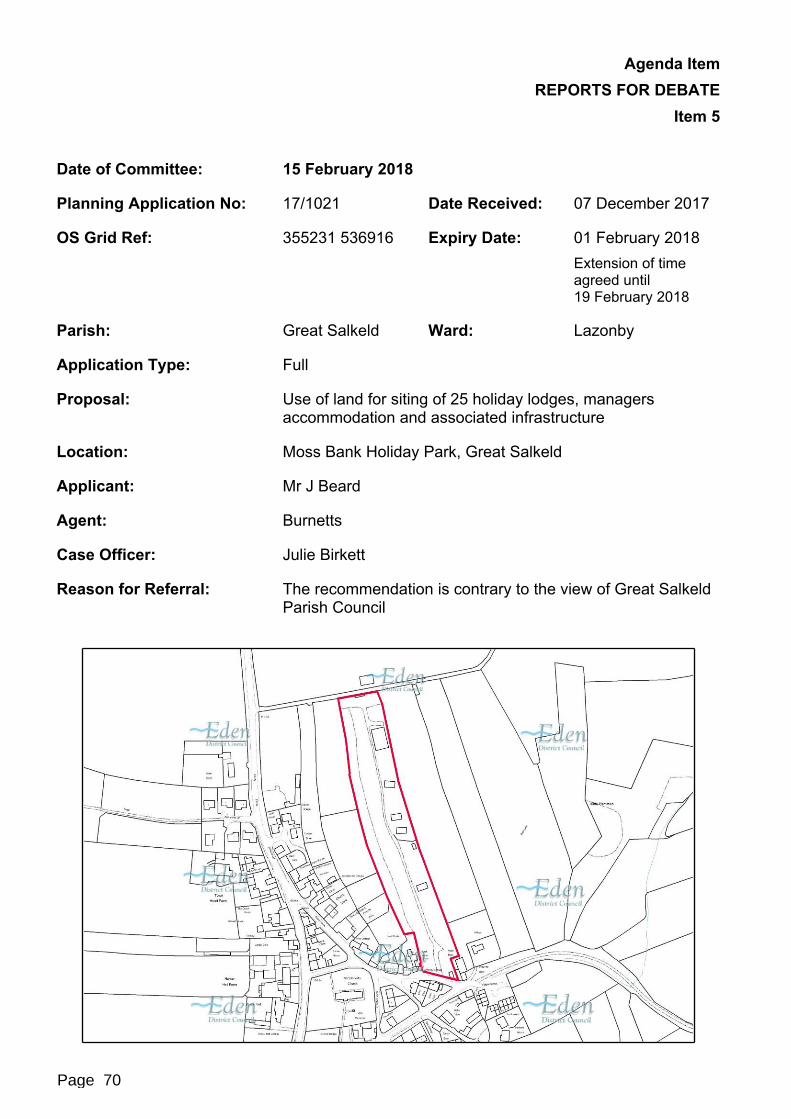
Agenda Item REPORTS FOR DEBATE
Item 5
Date of Committee: 15 February 2018
Planning Application No: 17/1021 Date Received: 07 December 2017
OS Grid Ref: 355231 536916 Expiry Date: 01 February 2018Extension of time agreed until19 February 2018
Parish: Great Salkeld Ward: Lazonby
Application Type: Full
Proposal: Use of land for siting of 25 holiday lodges, managers accommodation and associated infrastructure
Location: Moss Bank Holiday Park, Great Salkeld
Applicant: Mr J Beard
Agent: Burnetts
Case Officer: Julie Birkett
Reason for Referral: The recommendation is contrary to the view of Great Salkeld Parish Council
Page 70

Agenda Item REPORTS FOR DEBATE
Item 5
Page 71

Agenda Item REPORTS FOR DEBATE
Item 5
1. Recommendation
It is recommended that planning permission be granted subject to the following conditions:1. The development permitted shall be begun before the expiration of three years
from the date of this permission.Reason: In order to comply with the provisions of the Town and Country Planning Act 1990 as amended by Section 51 of the Planning and Compulsory Purchase Act 2004.
2. The development hereby granted shall be carried out in accordance with the drawings hereby approved:i. MBL/GS/JB/P.01 and MBL/GS/JB/P/08 rev A received on 6 December
2017,ii. MBL/GS/JB/P/10 received on 2 February 2018.Reason: To ensure a satisfactory development and to avoid any ambiguity as to what constitutes the permission.
3. Not more than 26 caravans shall be sited at any one time on the land edged red on the submitted plan and they shall only be sited as shown on drawing No MBL/GS/JB/P/08 rev A received on 6 December 2017.Reason: For the avoidance of doubt and to safeguard the amenities of the area.
4. The 25 holiday caravans hereby approved shall be used for holiday use only and shall not be used as a sole or principal residence by any person.Reason: The site is one which does not accord with the Council’s region or national guidance in respect of the spatial distribution of residential accommodation for housing.
5. The Manager’s Accommodation caravan as shown on drawing No MBL/GS/JB/P/08 rev A shall not be occupied otherwise than by the proprietor/manager or a member(s) of staff of Moss Bank Lodge Park together with any dependants living with such person(s).Reason: As permission would not be granted for residential accommodation in this location for occupation by persons unconnected from the business.
6. The visibility splays at the access to the site shall be maintained. Within these splays nothing shall be permitted to be placed or grow which exceeds a height of one metre above road level.Reason: In the interest of highway safety.
7. Prior to the commencement of any development, a surface water drainage scheme, based on the hierarchy of drainage options in the National Planning Practice Guidance with evidence of an assessment of the site conditions (inclusive of how the scheme shall be managed after completion) shall be submitted to and approved in writing by the Local Planning Authority.
Page 72

Agenda Item REPORTS FOR DEBATE
Item 5The surface water drainage scheme must be in accordance with the Non-Statutory Technical Standards for Sustainable Drainage Systems (March 2015) or any subsequent replacement national standards and unless otherwise agreed in writing by the Local Planning Authority, no surface water shall discharge to the public sewerage system either directly or indirectly.The drainage scheme submitted for approval shall also be in accordance with the principles set out in the Statement of Drainage Principles dated 18 June 2014.Reason: To promote sustainable development, secure proper drainage and to manage the risk of flooding and pollution. This condition is imposed in light of policies within the NPPF and NPPG
8. Foul and surface water shall be drained on separate systems.Reason: To secure proper drainage and to manage the risk of flooding and pollution.
9. Not later than 12 months from the first occupancy of any of the new holiday caravans hereby approved, landscaping of the site shall be undertaken in accordance with drawing No MBL/GS/JB/P/10 received on 2 February 2018.Any trees or plants which, within a period of 5 years thereafter, die, are removed or become seriously damaged or diseased shall be replaced in the next planting season with others of similar sizes and species unless the Local Planning Authority gives written consent to any variation.Reason: To safeguard the visual amenities of the area.
2. Proposal and Site Description2.1 Proposal2.1.1 The proposal is for full planning permission for the siting of 25 holiday lodges and a
manager’s lodge on the existing caravan site at Moss Bank Holiday Park at Great Salkeld.
2.1.2 The application proposes a total of 26 lodges/caravans with associated works to create the pitches, parking and turning areas, balconies, drainage and landscaping.
2.2 Site Description2.2.1 Moss Bank Holiday Park is located on the eastern side of the village of Great Salkeld.
The site extends to the north within the boundaries of the historic field pattern and is approximately 1.6 hectares in area.
2.2.2 There are residential properties around the entrance and along the western boundary. A public right of way runs across the field to the east. The site is within the Great Salkeld Conservation Area.
2.2.3 There is already planning permission in place for 14 holiday lodges and an owner’s/manager’s lodge to be sited on the land (ref 05/0991 and 17/0862). Currently only 4 of the approved holiday lodges and the manager’s lodge are on site. The site has recently changed ownership and the new owner intends to site the other 10 approved holiday lodges.
Page 73

Agenda Item REPORTS FOR DEBATE
Item 5
3. Statutory Consultees
Consultee Response
Highway Authority Responded on the 3 January 2018. They consider that given the existing use of the property the proposal is unlikely to have a material effect on existing highway conditions. They have therefore confirmed that they have no objection to the proposal.
Local Lead Flood Authority Responded on the 3 January 2018 and confirmed the Lead Local Flood Authority (LLFA) surface water map show minor flooding to the centre of the site that indicate 0.1 per cent (1 in 1000) chance of occurring each year and the Environment Agency (EA) surface water maps do not indicate that the site is in an area of risk. Flood Zone 2 and 3 are some 150m east of the site.The developer should demonstrate how they will deal with surface water discharge from the site and measures taken to prevent surface water discharging onto the public highway or onto existing neighbouring development. A condition has been recommended to ensure proper site drainage.
United Utilities Responded on 2 January 2018 and confirmed they have no objection to the proposal provided that two conditions are attached to any approval. The conditions related to the foul and surface water being drained on separate systems and full details of a surface water drainage scheme being approved prior to work starting on site.
Conservation Officer The overall proposal to increase the number of lodges on the site is not considered to be sympathetic to or enhance the significance of the Conservation Area.
4. Parish Council ResponsePlease Tick as Appropriate
Parish Council Object Support No Response No ObjectionGreat Salkeld X
4.1 Great Salkeld Parish Council has confirmed they have the following objection;“The Parish Council were unanimous in objecting to this proposal. They were careful to take into account the considerable feedback that they had each received from concerned residents. Councillors resolved that they were very concerned about the significant increase in the number of cabins on the site (from 14 cabins to 25 cabins), being particularly concerned about the impact on traffic, as the area surrounding the entrance to the site comprises a single track road which is a popular walking area and
Page 74

Agenda Item REPORTS FOR DEBATE
Item 5there is a primary school bus stop just around the corner. Councillors acknowledge that 14 lodges have already been approved, but objected to the proposed size and scale of the new project. Councillors ask that the application be considered by the Planning Committee due to the complexities of the site and feel that a site visit must be carried out for the impact of the proposal to be fully understood.”
5. Representations5.1 The application was advertised by means of a site notice posted on the 20 December
2017 and the following neighbour notifications:
No of Neighbours Consulted 27 No of letters of support 2No of objection letters 19 No of neutral representations 1
5.2 It is not possible to convey, word-for-word the comments we have received within this report. However, the key issues raised in the representations have been summarised as follows:Objections The proposal will result in extra traffic. The roads leading to the site are narrow
and used by many pedestrians. The extra traffic would therefore result in safety issues.
The lane is already busy and pedestrians are at risk due to the lack of pavements.
The site access is close to the village playground, this is not a good combination.
The increase in numbers will create a significant visual impact, increased noise and disturbance to residents.
Significant impact on the adjacent properties along the western boundary.
Trees are proposed to be cut down.
The number of caravans is overpowering within the village.
The form of the lodges is out of character with the traditional sandstone architecture of the village.
Adverse impact on the character of the conservation area.
The village already has a plentiful supply of holiday accommodation, which are rarely fully booked.
This is not a sustainable location. The only local amenity is the pub; there is no public transport and shop. Visitor would be dependent on private cars.
An application for 24 caravans/lodges has already been refused.
Occupancy should be limited to 10 months a year.
The revised layout is overdevelopment providing limited amenity and recreational facilities.
The sewers do not have enough capacity.
Unlikely to benefit the local economy, other than the local pub.
Page 75
Agenda Item REPORTS FOR DEBATE
Item 5Support The proposal is unlikely to significantly increase traffic.
The site is an asset to the village.
A few more lodges will not make a great deal of difference.
The lodges are not fully occupied all at the same time.
6. Relevant Planning History6.1 In October 2005 planning permission was refused (ref 05/0579) for the use of this site
as a holiday chalet development. The application proposed the siting of 24 holiday lodges and an office/reception lodge. The application was refused, contrary to recommendation, by the Planning Committee for the following reason:“The proposed development by virtue of its large scale would be out of scale and character with the area to the extent that it would have a substantial detrimental impact upon Great Salkeld village, a village lacking in a range of support services and facilities, contrary to Policy NE1 (Development in the Countryside) and Policy TM2 (Small Scale Tourism Development) of the Eden Local Plan 1996.”
6.2 In January 2006 planning permission was granted, by the Planning Committee for the siting of 14 holiday chalets and one cabin for use as a reception/office and shop for the site and wider village (ref 05/0991). This permission has been part implemented and currently 4 of the holiday chalets/lodges and the receptions/office lodge are on site.
6.3 In November 2017 permission was granted (ref 17/0862) for the approved reception/office and shop lodge to be used as a reception/office and owner’s/manager’s accommodation. The residential use was approved for a 2 year period as the 4 holiday lodges currently on site do not alone justify the need for on-site manager’s accommodation. The applicant has stated that he plans to develop the park and site the remaining approved lodges. The temporary permission was granted to allow this to happen and work has since commenced on site.
6.4 Also in November 2017 permission was granted to vary the external appearance of the approved lodges (ref 17/0863). Permission was granted for the external walls to be dark grey with stone clad skirts below.
7.0 Policy Context7.1 Development Plan
Emerging Local Plan (2014-2032) LS1- Locational Strategy EC -Tourism Accommodation and Facilities ENV10 - The Historic EnvironmentCore Strategy DPD Policy: CS1 - Sustainable Development Principles CS3 - Rural Settlements and the Rural Areas CS12 - Principles for Economic Development and Tourism CS15 - Tourism and the Visitor Economy CS17 - Principles of the Built (Historic) Environment
Page 76

Agenda Item REPORTS FOR DEBATE
Item 5 CS18 - Design of New Development
7.2 The policies detailed above are the most relevant policies relating to this application. Due to the stage of adoption of the emerging Local Plan, substantial weight can now be afforded to the above policies in the determination of this current planning application.
7.3 Other Material ConsiderationsNational Planning Policy Framework (NPPF): Core planning principles Requiring good design Conserving and enhancing the historic environment
8. Planning Assessment8.1 Key/Main Planning Issues
Principle Highways Great Salkeld Conservation Area Amenity Drainage
8.2 Principle8.2.1 Emerging Local Plan Policy EC4 - Tourism Accommodation and Facilities permitted
tourism proposals subject to specific criteria. The policy is split into large scale and small scale proposals. Small scale under the terms of this policy refers to sites of up to 20 units or pitches. This application proposes 26 pitches in total. This means in policy terms this proposal is for large scale development and the following criteria should be met:
The development proposed improves the range or quality of tourism accommodation and facilities in the area.
The site is close to the strategic road network.
They offer substantial economic benefits to the district.
The development offers the highest possible standards of siting, design and landscaping.
The traffic generated by the proposal will not have an unacceptable impact on nearby settlements or the local network.
Arrangements have been made to provide access by means other than the private car.
The tranquillity and dark skies associated with the open countryside are not compromised.
8.2.2 It should be noted that this proposal relates to an existing holiday lodge site. The application proposes the siting of 26 lodges, but in reality the application would permit only 11 additional lodges. The application includes the previously approved lodges to ensure, if permission is granted, that the whole site is covered by one permission.
Page 77

Agenda Item REPORTS FOR DEBATE
Item 58.2.3 It is considered that the proposal does meet the criteria listed above.
The site is the only caravan site in Great Salkeld. The proposed lodges would provide quality tourism accommodation which is not available elsewhere in the settlement.
The site is close to the existing road network.
The additional lodges would result in more tourists visiting the site and bringing money to the area. This could be a substantial benefit to the local pub and the businesses in the surrounding villages.
The siting and design of the proposal is considered to be appropriate for this site within the conservation area. A condition is proposed to secure appropriate landscaping.
The proposal has the potential to increase traffic using the local roads. Cumbria County Council as the Local Highway Authority has confirmed the proposal is unlikely to have a material effect on existing highway conditions. It is therefore considered that the impact would not be unacceptable.
There is no public transport links to Great Salkeld, but the site is within 5 miles of Penrith which has a mainline train station. It is also considered that many visitors to the site will take advantage of the local countryside for walking and cycling, rather than relying on their cars.
The site is adjacent to the village, so the minimal lighting which will be required is unlikely to comprise the tranquillity of the area.
8.2.4 It is therefore considered that the principle of the development is acceptable, subject to further considerations on highway safety, the impact upon Great Salkeld Conservation Area, the amenity of the area and site drainage.
8.3 Highway Safety8.3.1 The majority of the objection letters received raise concerns about the impact that this
proposal would have on the local roads which can be used to access the site from the B6412 road, which runs through the village. These local roads pass the church, former primary school, the playground, the pub and residential houses.
8.3.2 This application proposes an additional 11 lodges, over the 15 which are already approved. This increase in the numbers of lodges is likely to lead to a small increase in the number of vehicles using the local roads, but it is not considered that this would lead to a material change in highway safety. The Local Highway Authority has confirmed that they have no objection to the proposal, as it is unlikely to have a material effect on existing highway conditions.
8.4 Great Salkeld Conservation Area8.4.1 Policies ENV10 and CS17 require proposals to conserve and where appropriate
enhance the significance of Eden’s heritage assets and their setting. Great Salkeld Conservation Area is a heritage asset so it needs to be considered whether the proposal would conserve the character of the area.
8.4.2 This site is on the eastern edge of the village and has no impact on the prominent central buildings, the village green or the general form of the village. The site lies within
Page 78

Agenda Item REPORTS FOR DEBATE
Item 5one of the long narrow fields which radiate from the buildings in the village. These historic field patterns form part of the significance of the conservation area.
8.4.3 The Council’s Conservation Officer has raised concerns about the proposal. She believes that the increase in the number of lodges on the site would be unsympathetic and would fail to enhance the significance of the conservation area. However, given the current use of the site and the existing permission which allows 15 lodges to be sited it is considered that the proposal would not cause substantial harm to the character of the conservation area.
8.4.4 The proposal would result in the site being used in a more intense way, as more lodges would be sited in the same area. The additional lodges would increase the visual bulk of the development when seen from the public footpath which runs to the east of the site and possibly in long range views from the east. It is not considered that the additional lodges would have a significant impact on the character of the conservation area. The dark grey finish which is to be used on the new lodges would be visually recessive and the existing landscaping would break up the mass of the lodges and screen the site from the remainder of the conservation area. These two factors would further reduce the impact of the additional lodges.
8.4.5 The proposal has no impact of the historic field pattern and the site is screened from the remainder of the village by the existing landscaping which runs along the western boundary of the site. It is proposed to maintain this landscaping and this can be secured with a condition if permission is granted. It is therefore considered that the proposal would conserve the character of the conservation area.
8.5 Amenity8.5.1 Policies DEV5 and CS18 require proposals to protect the amenity of existing residents.
There are residential properties to the south and west of the site. The proposal would not result in lodges being closer to any of these properties than the scheme which is already permitted under 05/0991. The increase in the number of lodges would lead to an increase in activity on site, but given the distances to the residential properties it is not considered that this would have a detrimental impact on the amenity of the local residents.
8.5.2 It is therefore considered that the proposed scheme will comply with policies DEV5 and CS18 and the requirements of the NPPF.
8.6 Drainage8.6.1 The submitted details propose for the foul drains to connect to the main sewer and
surface water will drain to a soakaway. The previous permission for the 15 units included a soakaway area in the field to the east of the site. No details of the proposed soakaway have been provided in this application. It is therefore considered that a condition is necessary to secure details of the surface water drainage system to ensure the proposal does not increase flood risk elsewhere. This condition would be in line with the recommendations of the Lead Local Flood Authority and United Utilities.
9. Implications9.1 Equality and Diversity9.1.1 The Council must have regard to the elimination of unlawful discrimination and
harassment, and the promotion of equality under the Equality Act 2010.
Page 79

Agenda Item REPORTS FOR DEBATE
Item 59.2 Environment9.2.1 The Council must have due regard to conserving bio-diversity under the Natural
Environment and Rural Communities Act 2006.9.3 Crime and Disorder9.3.1 Under the Crime and Disorder Act 1998, the Council must have regard to the need to
reduce crime and disorder in exercising any of its functions.9.4 Children9.4.1 Under the Children Act 2004, the Council has a duty to safeguard and promote the
welfare of children in the exercise of any of its functions.9.5 Human Rights9.5.1 In determining applications, the Council must ensure that all parties get a fair hearing
in compliance with the provisions of Article 6 under the European Convention on Human Rights, as now embodied in UK law in the Human Rights Act 1998.
10. Conclusion10.1 It is considered that the principle of the proposal is acceptable. The proposal would
increase the number of lodges which could be sited from 15 to 26. It is considered that these additional lodges and the small increase in associated activity will not adversely affect highway safety or have a significant impact on the Great Salkeld Conservation Area. The proposal is of an appropriate scale and design and will help to support the rural economy. As such it is recommended that the application is approved subject to the conditions set out above.
Jane LangstonDeputy Director Technical Services
Background Papers: Planning File
Checked by or on behalf of the Monitoring Officer
Page 80
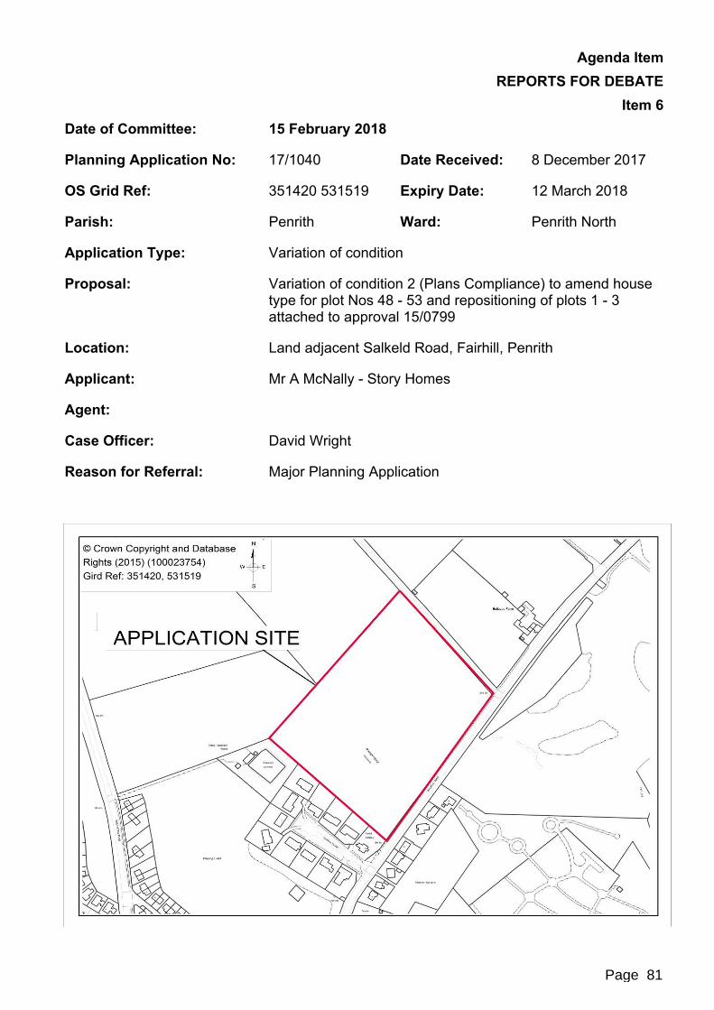
Agenda Item REPORTS FOR DEBATE
Item 6Date of Committee: 15 February 2018
Planning Application No: 17/1040 Date Received: 8 December 2017
OS Grid Ref: 351420 531519 Expiry Date: 12 March 2018
Parish: Penrith Ward: Penrith North
Application Type: Variation of condition
Proposal: Variation of condition 2 (Plans Compliance) to amend house type for plot Nos 48 - 53 and repositioning of plots 1 - 3 attached to approval 15/0799
Location: Land adjacent Salkeld Road, Fairhill, Penrith
Applicant: Mr A McNally - Story Homes
Agent:
Case Officer: David Wright
Reason for Referral: Major Planning Application
Page 81

Agenda Item REPORTS FOR DEBATE
Item 6
1. Recommendation
It is recommended that planning permission be granted subject to the following conditions:Time Limit for Commencement1) The development hereby permitted shall be begun before the 21 December
2019.Reason: In order to comply with the provisions of the Town and Country Planning Act 1990 as amended by Section 51 of the Planning and Compulsory Purchase Act 2004.
Approved Plans2) The development hereby granted shall be carried out in accordance with the
drawings hereby approved:
site location plan 402 - STO - 050 (A1)
site location plan 402 - STO - SD - 00. 01 (A3)
detailed site layout 402 - STO - 100 Revision I (incorporating amended line work detail to Green Lane footpath and main spine road)
detailed site layout 402 - STO - 101 revision A (incorporating amended line work detail to Green Lane footpath and main spine road)
general arrangements plan SL121. 90. 9. GA revision D
wider concept masterplan 402 - STO - 503 (revision B)
proposed elevation treatments 4O2 - STO - 102
Proposed Elevation Treatment layout drawing number SL121.90.9.ETL rev D
proposed boundary treatments 402 - STO - 103
Proposed Boundary Treatment layout drawing number SL121.90.9.BTL rev D
Proposed Hard surface layout drawing number SL121.90.9 HSL rev D
proposed 3-D pictorial views 402 - STO - 701
proposed street scenes 402 - STO - 700 revision A
proposed site access arrangement plan JN0837 - drawing - 0005
flood risk assessment and surface water strategy for 069/FRA1B
mitigation strategy for drainage within SPZ14069 - C - D9 - 01
drainage strategy and exceedance route plan 4069 - FREA05
phase 1 - preliminary Geo environmental appraisal 4069 - G - R001A
site investigation - Geo environmental appraisal 4069 - G - R002
Page 82

Agenda Item REPORTS FOR DEBATE
Item 6
arboricultural impact assessment and Method statement August 2015
tree constraints plan 10819. T01 revision P01
tree constraints plan AIA plan 10819. T02 revision P01
tree removal plan 10819. T03 revision P01
tree protection plan 10819. T04 revision P01
landscape masterplan 10819_L005 revision A
archaeology DBI and geophysical survey CP535/07 December 07
existing and proposed site levels 402 - STO - 104
proposed site sections 402 - STO - 702
residential travel planlandscaping details
landscape planting plan 1 10819_L001 revision P2
landscape planting plan 2 10819_L002 received 8 December 2017
landscape planting plan 310819_L003 received 8 December 2017
landscape details 10819_L004 received 8 December 2017
landscape masterplan 10819_L005 received 8 December 2017
arboricultural report AIA and AMS rev A dated 11 August 2017.
Planting plan 1 drawing number 10919_L001, received 8 December 2017boundary treatments
boundary details fencing BD - 03 revision a
boundary details brickwall BD - 15
boundary details estate railings BD - 30
boundary details low Stonewall BD - 37
boundary details high Stonewall BD - 50Acoustic Control
Acoustic Control Layout Plan Drawing No SL121.90.9.ACL and dated5 October 2016
house types
fairways development plot schedule rev C, received 8 December 2017
the Acer ACE - PLP 1, PL E1/2
the Rowan R0W - PL P 1, PLP 5, PLE1/2, PL E1/7, PLE5/2
the Westminster WES - PLP 1 (a), PL E1/12 (a), PLE1/14, PL E1/15
the Wellington WEL - PLP 1, PL E1/1
Page 83

Agenda Item REPORTS FOR DEBATE
Item 6
the Boston BOS - PLP 1 (B), PL E1/1 (B)
the Harrow version 2 HAR - PLP2, PLE2/7
the Mayfair M AY - PLP 1 (B), PL E1/1 (a), PLE1/9
the Taunton TAU - PLP 1 (B), PL E1/2 (B), PL E1/11 (B), PL E1/13 (a)
the Sandringham SAN - PLP 1, SAN - PLE1/1, PL E1/3
the Balmoral BAL - PL P1 (A), PL E1/2, PLE1/8, PL E1/12
the Banbury BAN - PLP 1, PL E1/3
the Chester CHE - PLP 2 (a), PLE2/3 (a)
the Stafford STA - PLP 1, PL E1/3 (a)
the Durham version 2 DUR - PLP 1, PLE1/3 (a), PLE14 (a)
the Warwick WAR - PLP 1 - 1, PLP2, PLE1/16, PLE26
the Hastings v3, dated 2 November 2016, received 8 December 2017
the Arundel ARU - PLP 1 (a), PLP4 (B), PL E1/6 (a), PL E4/13 (A), PL E4/14
single detached garage SG 1 - EPS1 (a)
double detached garage DG 1 - EPS 1
The Ascot v2.5, dated 10 January 2018 and received 10 January 2018Reason: To ensure a satisfactory development and to avoid any ambiguity as to what constitutes the permission.
3) That foul and surface water shall be drained on separate systems.Reason: To secure proper drainage and to manage the risk of flooding and pollution.
4) The foul and surface water drainage schemes (inclusive of how the scheme is shall be maintained and managed after completion) shall be completed, maintained and managed in accordance with the following plans/documents:
ID Civils 1:500 engineering layout and drainage schedules drawing number 4069-C-D1-01 Rev F, on the 3 March 2017
External Works and private drainage sheet 1 of 4 drawing number 4069-C-D1-02 rev N, received 8 December 2017
External Works and private drainage sheet 2 of 4 drawing number 4069-C-D1-03 rev L, received 8 December 2017
External Works and private drainage sheet 3 of 4 drawing number 4069-C-D1-04 rev L, received 8 December 2017
External Works and private drainage sheet 4 of 4 drawing number 4069-C-D1-05 rev I, received 8 December 2017
Page 84

Agenda Item REPORTS FOR DEBATE
Item 6
Details of Clay Lining to main drainage excavations ID Civils, on the3 March 2017
1:20 foul manhole general arrangement drawing number 4069-C-D-09- rev D, on the 3 March 2017
ID Civils 1:20 surface water manhole general arrangement layouts sheet 1 drawing number 4069-C-D4-10 Rev D, on the 3 March 2017
ID Civils 1:20 surface water manhole general arrangement layouts sheet 2 drawing number 4069-C-D4-11 Rev D, on the 3 March 2017
ID Civils Detail of connections to existing sewers drawing number 4069-C-D4-14 rev A, on the 3 March 2017
ID Civils Section 104 agreement layout drawing number 4069-C-D6-01 rev C, on the 3 March 2017
ID Civils Sewers Easement Plan Drawing Number 4407-C-D6-02- rev C, on the 3 March 2017
CEMP Deep Excavation Silt Management Drawing Number SL121.90.9.DESM rev C, on the 5 May 2017
CEMP Master Layout Drawing Number SL121.90.9.CEMP rev C, on the5 May 2017
Reason: To promote sustainable development, secure proper drainage and to manage the risk of flooding and pollution. The site lies within a groundwater source protection zone 1 for a nearby public water supply obstruction and as such the site is considered to be particularly sensitive to the input of pollutants at the surface. In accordance with the environment agency position statement in groundwater protection: principles and practice (GP3), the environment agency and United Utilities require the highest specification pipework and design for the sewage system at this site. This condition is imposed in light of policies within the NPPF and NPPG.
5) The development shall be constructed in accordance with the Construction Environmental Management Plan (CEMP) approved on the 10 May 2017 (reference 17/0173) Reason: To promote sustainable development and to manage the risk of pollution. The site lies within a groundwater source protection zone 1 for a nearby public water supply obstruction and as such the site is considered to be particularly sensitive to the input of pollutants at the surface.
6) The construction of the foul and surface water drainage systems shall be subject to a watching brief appointed by the developer. The watching brief appointment shall be agreed with the Local Planning Authority in liaison with United Utilities Water Ltd prior to their appointment and the results provided to the Local Planning Authority and United Utilities in writing. No occupation of the dwellings shall take place until a written validation report has been submitted to and agreed with the Local Planning Authority demonstrating completion of the installation of the liner system and confirmation and assurance that mitigation measures have been constructed/implemented as per the agreed design.
Page 85
Agenda Item REPORTS FOR DEBATE
Item 6Reason: The site lies within a groundwater source protection zone 1 for a nearby public water supply obstruction and as such site is considered to be particularly sensitive to the input of pollutants surface.
7) The public open space shall be managed in accordance with the landscape management plan (approved 10 May 2017, planning reference 17/0173) for the lifetime of the development.Reason: To minimise the risk of pollution to the nearby public water supply obstruction.
8) Prior to the occupation of any dwelling the gateway feature, as approved on the 18 May 2017 (planning reference 17/0204) shall be installed in full and maintained thereafterReason: In the interests of highway safety and to support local transport plan policies: LD7 and LT8.
9) Prior to the occupation of any dwelling, the footways from the junction of Salkeld Road (C3002) and Salkeld Road/Beacon Edge (C3029) to the Green Lane junction shall be improved to form and enable a 1.8 m wide footway along its length, and to be constructed to a form and design to be agreed in writing by the Local Planning Authority.Reason: In the interests of highway safety, accessibility by sustainable transport modes and to minimise potential hazards and to support local transport plan policies: LD 5, LD 6, LD 7 and LD 8.
10) The carriageway, footways, footpaths, cycleways etcetera shall be designed, constructed, drained and lit in accordance with the following plans/documents:
ID Civils Longitudinal Sections (Sheet 1 of 2) drawing number 4069-C-D2-01 Rev E
ID Civils Longitudinal Sections (Sheet 1 of 2) drawing number 4069-C-D2-02 Rev E
ID Civils Roads Construction details drawing number 3953-C-D3-01 Rev D
ID Civils Private Road and drive Construction details drawing number 4069-C-D3-02 Rev O
ID Civils Flow Control Manhole S3 construction details drawing number 4069-C-D4-01 Rev D
ID Civils s7 Flow control manhole construction details drawing number 4069-C-D4-02 Rev E
ID Civils Flow Construction manhole S19 construction details drawing number 4069-C-D4-03 Rev D
ID Civils S30 flow control manhole construction details drawing number 4069-C-D4-04 Rev D
ID Civils details of box culverts drawing number 4069-C-D4-07 Rev B
ID Civils Section 38 Agreement Layout drawing number 4069-C-D7-01 rev A
Page 86

Agenda Item REPORTS FOR DEBATE
Item 6
ID Civils S278 off-site footpath general arrangement drawing number 4069-C-D10-01 Rev B
The above plans/documents shall be constructed in full before the occupation of the ninetieth dwelling hereby permitted.Reason: To ensure a minimum standard of construction in the interests of highway safety and to support local transport plan policies: LD 5, LD 7 and LD 8.
11) The visibility splays providing clear visibility as shown on the submitted plans (JN 0837 - 007/008/009/0010) must be maintained throughout the lifetime of the development. Notwithstanding the provisions of the Town and Country Planning (Gen Permitted Development) (England) Order 2015 (or any order revoking and re-enacting that order) relating to permitted development, no structure, vehicle or objects of any kind shall be erected, parked or placed and no trees, bushes or other plants shall be planted or be permitted to be grown within the visibility splay which obstruct the visibility splays.Reason: In the interests of highway safety and to support local transport plan policies: LD 7 and LD 8.
12) No dwellings shall be occupied until the estate road, including footways and cycleways to serve such dwellings have been constructed in all respects to base course level and street lighting where it is to form part of the estate road has been provided and brought into full operational use.Reason: In the interests of highway safety and to support local transport plan policies: LD 5, LD 7 and LD 8.
13) The whole of each access area, bounded by the carriageway edge, entrance gates and the splays, shall be constructed and drained to the specification of the local planning authority in consultation with the highway authority.Reason: In the interests of road safety and to support local transport plan policies: LD 5, LD 7 and LD 8.
14) Prior to the completion or occupation (whichever comes first) of plots 26 or 27 the adoptable road shown as ‘Roman Link’ on the detailed site layout plan number 402 - STO - 100 - H, shall be completed and constructed, together with all associated mains services, up to the application site boundary.Reason: To ensure that a motor vehicle access arrangement is provided to the adjoining land to the north-west and that the long-term development potential of this land is not prejudiced in order to secure a continuation of the Council’s 5 year housing land supply.
15) The development shall be constructed in accordance with the construction parking plan approved on the 10 May 2017 (reference 17/0173) the designated land shall be used for or be kept available for these purposes at all times until completion of the construction work.Reason: The carrying out of this development without the provision of these facilities during the construction work is likely to lead to inconvenience and danger to road users and to support local transport policies: LD8.
Page 87

Agenda Item REPORTS FOR DEBATE
Item 616) The development shall be constructed in accordance with the Construction
Method Statement (CMS) approved on the 10 May 2017 (reference 17/0173)Reason: To protect the water environment from pollution.
17) The development shall be constructed in accordance with the scheme to treat and remove suspended solids from surface water run-off during construction works approved on the 10 May 2017 (reference 17/0173)Reason: To protect the water environment from pollution.
18) The development shall be constructed in accordance with the Construction Traffic Management Plan (CTMP) approved on the 10 May 2017 (reference 17/0173)Reason: The carrying out of the development without the provision of these facilities during the construction work is likely to lead to inconvenience and danger to road users.
19) The approved landscaping scheme shall be carried out within 6 months of the date of the first occupation of any building or completion of the development whichever is the sooner; any trees or plants/grassed areas which within a period of 5 years from the date of planting die, are removed or become seriously damaged or diseased shall be replaced in the next planting season with others of similar size and species and quality.Reason: To ensure the satisfactory appearance of the site in the interests of visual amenity.
20) The existing trees within the boundaries of the site shall not be lopped, felled or otherwise affected in any way (including raising or lowering soil levels under the crown spread of the trees) and no excavation shall be cut under the crown spread of the trees without the prior written permission of the local planning authority unless otherwise confirmed within the arboricultural report AIA and AMS rev A dated 11 August 2017.Reason: To safeguard the trees in the interest of visual character and appearance of the area.
21) The entire root system of trees to be retained within the boundaries of the site as shown on the approved drawings, indicated by the spread of their branches, shall be protected by stout exclusion fencing until completion of the development as confirmed within the arboricultural report AIA and AMS rev A dated 11 August 2017.Reason: To prevent damage to the trees in the interest of the visual character and appearance of the area.
22) The area beneath the spread of the branches of the trees to be retained within the boundaries of the site and shown on the approved drawings shall not be used for the storage of building materials, plant, machinery or other items, or for vehicular access or for the burning of materials of any kind.Reason: To prevent damage to the trees in the interest of the visual character and appearance of the area.
Page 88

Agenda Item REPORTS FOR DEBATE
Item 623) The specified noise mitigation measures shall be implemented and retained in
accordance with the approved details to ensure the below standards are being met bold within the individual properties hereby approved and within the associated garden areas:Living Room 07:00-23:00 35 dB Laeq (16 hour)Dining Room/area 07:00-23:00 40 dB Laeq (16 hour)Bedroom 07:00-23:00 35 dB Laeq (16 hour)Bedroom 23:00-07:00 30 dB Laeq (8 hour)Bedroom 23:00-07:00 45dB LamaxGarden and Outdoor Amenity Areas: 0700hrs- 2300 50dB LAeq16hrWithin the dwelling houses, where the noise insulation scheme relies on windows being closed to achieve the above-stated criteria, an alternative means of ventilation shall be provided and fixed non-opening windows shall be provided to the relevant rooms. Where noise attenuation is required in respect of the garden and outdoor amenity areas to achieve the 50 dB Laeq,16hour target, an appropriate barrier will therefore be required to acoustically screen garden areas concurrently with the occupation of those respective dwellings in accordance with the requirements of the report by RS Acoustic Engineering Ltd dated 18 August 2016 and the Acoustic Control Layout Plan Drawing No SL121.90.9.ACL and dated 5 October 2016.Reason: To protect the amenity of future residents of the development.
24) Development shall be carried out in accordance with the Schedule of finishes SL121/90/12/SF Rev A document, dated 4 December 2017, received8 December 2017.Reason: To ensure that the materials harmonise with the surroundings.
Note to DeveloperThe grant of planning permission is subject to the Section 106 Agreement dated20 December 2016 requiring the provision of affordable housing, contributions to education, highways infrastructure a travel plan.
2. Proposal and Site Description2.1 Proposal2.1.1 Planning permission (reference 15/0799) has previously been granted for a residential
development consisting of 98 homes and associated infrastructure. This application proposes to vary planning condition (2) from the previous grant of planning permission (15/0799) which required development to be carried out in accordance with approved plans. The proposed amendment of the condition will allow for a different house type on 6 of the approved plots (plots 48 - 53) and to reposition 3 other plots (plots 1 - 3).
2.1.2 The rest of the proposed development remains identical to the previously approved scheme. It should be noted that, due to some of the original planning conditions being discharged other original planning conditions are no longer required or have been
Page 89
Agenda Item REPORTS FOR DEBATE
Item 6amended to reflect documents being approved since the first grant of planning permission.
2.2 Site Description2.2.1 The rectangular site was open agricultural grazing land located on the northern limits of
Penrith but now is a building site as the previous grant of planning permission has been implemented. The site has a 70m frontage onto Salkeld Road, set between the small residential estate of Fairhill Close and the entrance to Green Lane, a rural single track road. Green Lane is located to the south west of a small pocket of agricultural land and the Penrith Golf Course which extends either side of Salkeld Road.
2.2.2 The application site is on elevated land which rises on the northern side of Penrith, with land continuing to rise both to the north east and north west beyond the site boundaries. There is a marked slope across the site which rises in a north easterly direction from the southern corner on Salkeld Road adjacent to Fairhill Close but which also falls along the boundary with Fairhill Close from Salkeld Road down towards the United Utilities reservoir.
2.2.3 The site boundary onto Salkeld Road is bound by a 1m stone wall, with a higher wall backing onto the rear of the residential properties to the south west at Fairhill Close. The boundary onto Green Lane is formed by a partly retaining low stone wall augmented with hedgerow and tree planting.
3. Consultees3.1 Statutory Consultees
Consultee ResponseLead Local Flood Authority No objectionAffordable Housing Officer No objection
3.2 Discretionary Consultees
Consultee ResponseEnvironmental Health No objection
4. Parish Council/Meeting ResponsePlease Tick as Appropriate
Parish Council/Meeting Object Support No Response No View
ExpressedPenrith Town Council
X
4.1 An email was received 8 January 2018:In the absence of additional information relating to the reasons for the change in house type, no comments are submitted on this application.
Page 90
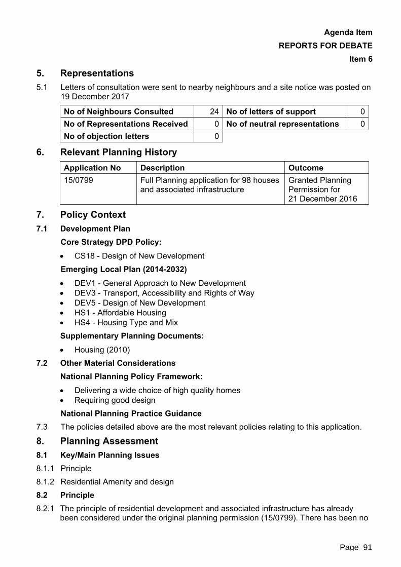
Agenda Item REPORTS FOR DEBATE
Item 6
5. Representations5.1 Letters of consultation were sent to nearby neighbours and a site notice was posted on
19 December 2017
No of Neighbours Consulted 24 No of letters of support 0No of Representations Received 0 No of neutral representations 0No of objection letters 0
6. Relevant Planning HistoryApplication No Description Outcome15/0799 Full Planning application for 98 houses
and associated infrastructureGranted Planning Permission for21 December 2016
7. Policy Context7.1 Development Plan
Core Strategy DPD Policy: CS18 - Design of New DevelopmentEmerging Local Plan (2014-2032) DEV1 - General Approach to New Development DEV3 - Transport, Accessibility and Rights of Way DEV5 - Design of New Development HS1 - Affordable Housing HS4 - Housing Type and MixSupplementary Planning Documents: Housing (2010)
7.2 Other Material ConsiderationsNational Planning Policy Framework: Delivering a wide choice of high quality homes Requiring good designNational Planning Practice Guidance
7.3 The policies detailed above are the most relevant policies relating to this application.
8. Planning Assessment8.1 Key/Main Planning Issues8.1.1 Principle8.1.2 Residential Amenity and design8.2 Principle8.2.1 The principle of residential development and associated infrastructure has already
been considered under the original planning permission (15/0799). There has been no
Page 91

Agenda Item REPORTS FOR DEBATE
Item 6material change in national or local planning policy that would alter the principle of residential development of this scale
8.3 Residential Amenity and design8.3.1 Draft policy DEV5 of the draft local plan requires that development protects the amenity
of existing residents and provides an acceptable amenity for future occupiers. Furthermore draft policy DEV5 requires that development reflects the existing street scene through use of appropriate scale, mass, form, layout and use of materials. The Housing SPD (2010) recommends that there is a separation distance of 21 metres between principal windows and 13 metres between a main elevation and a blank gable wall.Change in house types
8.3.2 The amended condition will enable 6 of the 98 approved homes to be of a different design. Plots 48 to 49 were originally approved to be a Rowan House type and are now being proposed to a Hasting house type. Both house types are three bedroom properties, semi-detached, have brick finishes and pitched roofs.
8.3.3 One of the main changes in the plots is in the size of the properties the Hastings house type at 88 metres square has a larger Gross Internal Area (“GIA”) than the Rowan House type at 84 metres squared.
8.3.4 Plots 50 to 53 were originally proposed to be a Hawthorn house type and it is now proposed to be Ascot version 2.5. Both house types are two bedroom properties, terraced and have brick finishes. The GIA is almost identical with each house type being 65 metres squared.
8.3.5 The change in plot types are subtle and will not cause a major alteration in appearance, design or layout of the street they are situated in. As all of the plots are located within the centre of the development they are not considered to be in a sensitive or prominent location. The new plots will ensure residential amenity is maintained for the future occupiers of the changed plots and the surrounding properties.Repositioning of plots 1 - 3
8.3.6 The garage of plot 1 was previously set back and extended past the rear elevation of plots 1 and 2. It is now proposed to have the garage located so it sits flush with the rear elevation of plot 1. This is due to plots 1 - 3 being set back a further metre to allow for the maintenance of an attenuation tank which is part of a sustainable surface water drainage scheme. Furthermore plot 2 was originally proposed to have 3 parking spaces on the driveway but this has now been reduced to 2.
8.3.7 Plot 2 is now proposed to be 1 metre closer to the plot to the rear, plot 6, but there is a gap of 21 metres between the 2 properties and therefore it is considered that there is no issue of overlooking due to the proposed changes.
8.3.8 The proposed changes to both the plot layouts of 1 -3 and the house types of plots 48 - 53 are minimal and are in compliance with the Council’s Core Strategy, the draft Local Plan and the National Planning Policy Framework.
Page 92
Agenda Item REPORTS FOR DEBATE
Item 6
9. New Homes Bonus9.1 The prospect of receiving a Bonus is, in principle, capable of being taken into account
as a ‘material consideration’ in determining a planning application. Whether potential Bonus payments are in fact a material consideration in relation to a particular application will depend on whether those payments would be used in a way which is connected to the application and to the use and development of land. For example, potential Bonus payments could be a material consideration if they were to be used to mitigate impacts resulting from development. But if the use to which the payments are to be put is unclear or is for purposes unrelated to the development concerned a decision maker would not be entitled to take them into account when making a decision on a planning application. In this particular case, there are no plans to use the New Homes Bonus arising from this application in connection with this development.
10. Implications10.1 Legal Implications10.1.1 The following matters have been considered but no issues are judged to arise.10.2 Equality and Diversity10.2.1 The Council must have regard to the elimination of unlawful discrimination and
harassment, and the promotion of equality under the Equality Act 2010.10.3 Environment10.3.1 The Council must have due regard to conserving bio-diversity under the Natural
Environment and Rural Communities Act 2006.10.4 Crime and Disorder10.4.1 Under the Crime and Disorder Act 1998, the Council must have regard to the need to
reduce crime and disorder in exercising any of its functions.10.5 Children10.5.1 Under the Children Act 2004, the Council has a duty to safeguard and promote the
welfare of children in the exercise of any of its functions.10.6 Human Rights10.6.1 In determining applications, the Council must ensure that all parties get a fair hearing
in compliance with the provisions of Article 6 under the European Convention on Human Rights, as now embodied in UK law in the Human Rights Act 1998.
11. Conclusion11.1 It is considered that the proposal accords with the Development Plan for the following
reasons which are not outweighed by material considerations:The minor amendments to the previously approved scheme are in compliance with policy CS18 of the Council’s Core Strategy, DEV5 of the draft Local Plan and the National Planning Policy Framework.
Page 93
Agenda Item REPORTS FOR DEBATE
Item 6
Jane LangstonDeputy Director Technical Services
Background Papers: Planning File 17/1040
Checked by or on behalf of the Monitoring Officer
Page 94

Document is Restricted
Page 95
Agenda Item 9

This page is intentionally left blank