plan of management - narrandera shire · 6.1.1 aims and scope ... plate 25.0: view to narrandera...
TRANSCRIPT

Narrandera Shire Council
Plan of Management
Narrandera Flora and Fauna Reserve
Lot 7317
DP 1159952
Reserve No. 91721

i
NARRANDERA SHIRE COUNCIL
PLAN OF MANAGEMENT Lot 7317 DP 1159952
Reserve No. 91721
Submitted to: Director Strategic Planning and Organisational Development Narrandera Shire Council 141 East Street NARRANDERA NSW 2700 Attention: Sue Johnson
Ph: 02 6959 5510 Em: [email protected]
Submitted by: Booth Associates Pty Ltd Agribusiness & Environmental Consultants PO Box 1458 Level 1, 61-63 Yambil Street GRIFFITH NSW 2680
Ph: 02 6964 9911
Fx: 02 6964 5440 Em: [email protected] Web: www.boothassociates.com.au ABN: 79 095 414 065
Revision by: Narrandera Shire Council July 2010
Draft November 2009 Version 1 July 2010 Version 2
Adopted October 2011 Privileged: The information herein is of a privileged and private nature and as such, all rights thereto are
reserved.
This document shall not, in part or whole, be lent, reproduced, stored in a retrieval system, or transmitted in any shape or form or by any means electronic, mechanical, photocopying, recording, verbal, left in an exposed and/or unattended position or otherwise used without the prior permission of BA or their duly qualified agents in writing.

Document History:
Date Issued Revision No. Author Reviewed By Approved Comments
29/09/2009 Draft 1 KL Tyson JJ Giannitsopoulos MG Ryan
12/11/2009 Final KL Tyson JJ Giannitsopoulos MG Ryan
Distribution of Copies:
Issue Date Revision No Issued To Quantity
29/09/2009 Draft 1 Sue Johnson – Narrandera Shire Council 1 via email
12/11/2009 Final Sue Johnson – Narrandera Shire Council 1 via mail 1 CD

iii
TABLE OF CONTENTS
1.0 EXECUTIVE SUMMARY ................................................................................................................................................. 1
2.0 INTRODUCTION AND BACKGROUND ......................................................................................................................... 2
2.1 Background ................................................................................................................................................................ 2
2.2 Purpose ...................................................................................................................................................................... 3
2.3 Authorisation ............................................................................................................................................................... 3
2.4 Sources of Information ............................................................................................................................................... 3
2.5 Project Team .............................................................................................................................................................. 3
2.6 Methodology ............................................................................................................................................................... 4
2.7 Limitations .................................................................................................................................................................. 4
2.8 Assumptions ............................................................................................................................................................... 4
3.0 LEGISLATIVE CONTEXT ............................................................................................................................................... 5
3.1 Commonwealth Legislation and Guidelines ............................................................................................................... 5 3.1.1 Environment Protection and Biodiversity Conservation Act, 1999 (EPBC Act) ................................................ 5 3.1.2 Draft National Koala Conservation and Management Strategy 2009 – 2014 .................................................. 5
3.2 State Legislation ......................................................................................................................................................... 5 3.2.1 Environmental Planning and Assessment Act, 1979 (EPA Act)....................................................................... 5 3.2.2 Crown Lands Act, (CLA) 1989 ......................................................................................................................... 5
3.3 Environmental Planning Instruments (EPI’s) .............................................................................................................. 6 3.3.1 State Environmental Planning Policies (SEPP) ............................................................................................... 6 3.3.2 Regional Environmental Plans (REP) .............................................................................................................. 6 3.3.3 Local Environmental Plans (LEP) .................................................................................................................... 6
3.3.3.1 Narrandera Local Environmental Plan 1991 .......................................................................................... 6
3.4 Crown Land and Reserve Trusts ................................................................................................................................ 8
4.0 THE SITE ......................................................................................................................................................................... 9
4.1 Description .................................................................................................................................................................. 9
4.2 Location ...................................................................................................................................................................... 9
4.3 Adjoining Land Uses ................................................................................................................................................. 10
4.4 Existing Features ...................................................................................................................................................... 10
4.5 Local and Regional Context ..................................................................................................................................... 10
4.6 History ...................................................................................................................................................................... 13
4.7 Climate and Biophysical Characteristics .................................................................................................................. 15 4.7.1 Climate ........................................................................................................................................................... 15 4.7.2 Biophysical Characteristics ............................................................................................................................ 15
5.0 COMMUNITY ENGAGEMENT ...................................................................................................................................... 18
5.1 Values and Vision ..................................................................................................................................................... 18 5.1.1 Values ............................................................................................................................................................ 18 5.1.2 Vision ............................................................................................................................................................. 18
5.2 Informal Consultation ................................................................................................................................................ 19
5.3 Formal Community Workshop .................................................................................................................................. 19
5.4 Council Presentation and Workshop ........................................................................................................................ 20
6.0 SITE SURVEYS ............................................................................................................................................................. 21
6.1 Flora and Fauna Survey ........................................................................................................................................... 21 6.1.1 Aims and Scope ............................................................................................................................................. 21 6.1.2 Methodology................................................................................................................................................... 21 6.1.3 Desktop Analysis............................................................................................................................................ 22 6.1.4 Field Survey ................................................................................................................................................... 25 6.1.5 Climatic Conditions ........................................................................................................................................ 27
6.2 Riparian Ecological Assessment .............................................................................................................................. 27 6.2.1 Introduction .................................................................................................................................................... 27 6.2.2 Methodology................................................................................................................................................... 28 6.2.3 Limitations and Assumptions ......................................................................................................................... 29 6.2.4 Team Members .............................................................................................................................................. 29 6.2.5 Riparian Condition Survey Results ................................................................................................................ 29 6.2.6 Discussion of Results ..................................................................................................................................... 30 6.2.7 Conclusion ..................................................................................................................................................... 33
7.0 FUTURE MANAGEMENT ............................................................................................................................................. 34
7.1 Objectives for Management ...................................................................................................................................... 34
7.2 Issues for Management ............................................................................................................................................ 34 7.2.1 Access............................................................................................................................................................ 35
7.2.1.1 Entry .................................................................................................................................................... 35 7.2.1.2 Access Tracks ..................................................................................................................................... 35
7.2.2 Fire Hazard .................................................................................................................................................... 37 7.2.2.1 Fire History .......................................................................................................................................... 37 7.2.2.2 Forestry Activities ................................................................................................................................ 37 7.2.2.3 Fuel Loadings ...................................................................................................................................... 37 7.2.2.4 Fire Management Regime ................................................................................................................... 38
7.2.3 Pest Control ................................................................................................................................................... 38 7.2.4 Weed Control ................................................................................................................................................. 38 7.2.5 Land Use Options .......................................................................................................................................... 40 7.2.6 Grazing........................................................................................................................................................... 40 7.2.7 Cultural Heritage ............................................................................................................................................ 41 7.2.8 Surface Water and Groundwater Management ............................................................................................. 42
7.2.8.1 Flow Regime and Impact of Regulation ............................................................................................... 42 7.2.8.2 Groundwater ........................................................................................................................................ 43 7.2.8.3 Surface Water Quality ......................................................................................................................... 44
Vegetation Conservation and Management ................................................................................................... 45 7.2.10 Core Koala Habitat ......................................................................................................................................... 46 7.2.11 Local and Visitor Use ..................................................................................................................................... 47 7.2.12 Tourism, Promotion and Branding ................................................................................................................. 49
7.2.12.1 Tourism and Promotion ....................................................................................................................... 49 7.2.12.2 Branding .............................................................................................................................................. 50
7.2.13 Strategic Planning .......................................................................................................................................... 50
7.3 Prescriptions for Management and Recommended Work Schedule ........................................................................ 51
7.4 Future Development and Management .................................................................................................................... 52
7.5 Monitoring and Adaptive Management ..................................................................................................................... 65
8.0 CONCLUSION AND RECOMMENDATIONS ............................................................................................................... 66
9.0 REFERENCES .............................................................................................................................................................. 68
10.0 BIBLIOGRAPHY ...................................................................................................................................................... 70

PLATES Plate 1.0: Narrandera Reserve......................................................................................................................................... 2 Plate 2.0: Murrumbidgee River....................................................................................................................................... 13 Plate 3.0: Murrumbidgee River....................................................................................................................................... 13 Plate 4.0: Anabat Location ............................................................................................................................................. 22 Plate 5.0: Anabat Location ............................................................................................................................................. 22 Plate 6.0: Golden Whistler.............................................................................................................................................. 23 Plate 7.0: Flame Robin ................................................................................................................................................... 23 Plate 8.0: Koala .............................................................................................................................................................. 25 Plate 9.0: Brush Tail Possum ......................................................................................................................................... 25 Plate 10.0: Canopy Transect 4 ......................................................................................................................................... 31 Plate 11.0: Debris Transect 4 ........................................................................................................................................... 31 Plate 12.0: Erosion Transect 2 ......................................................................................................................................... 32 Plate 13.0: Bank Erosion Murrumbidgee River ................................................................................................................ 32 Plate 14.0: Entrance to Narrandera Reserve ................................................................................................................... 35 Plate 15.0: 6m Track ........................................................................................................................................................ 36 Plate 16.0: 4m Track ........................................................................................................................................................ 36 Plate 17.0: Service Track ................................................................................................................................................. 36 Plate 18.0: Emerging Blackberry ...................................................................................................................................... 39 Plate 19.0: Black Locust ................................................................................................................................................... 40 Plate 20.0: Unauthorised Horses on the Reserve ............................................................................................................ 41 Plate 21.0: Scar Tree ....................................................................................................................................................... 42 Plate 22 .0 Horseshoe Lagoon ......................................................................................................................................... 43 Plate 23.0: Horseshoe Lagoon ......................................................................................................................................... 43 Plate 24.0: Hornwort......................................................................................................................................................... 44 Plate 25.0: View to Narrandera Nature Reserve Reference Condition ........................................................................ 46 Plate 26.0: Koala in RRG tree in the Reserve .................................................................................................................. 47 Plate 27.0: Tree Hollow from Limb Loss .......................................................................................................................... 48 Plate 28.0: Old Bridge Crossing ....................................................................................................................................... 48 Plate 29.0: Picnic Seat near Beach .................................................................................................................................. 50 Plate 30.0: Temporary Bin................................................................................................................................................ 50 Table
TABLES Table 1.0: Land Use Zones ............................................................................................................................................... 7 Table 2.0: Narrandera Climate Data 11-13 June, 2009 .................................................................................................. 27 Table 3.0: Weed Control at Narrandera Reserve............................................................................................................ 39 Table 4.0: Murrumbidgee River Water Quality ................................................................................................................ 44 Table 5.0: Issues and Recommended Works Schedule and Priorities ........................................................................... 52
FIGURES Figure 1.0: Location of Narrandera Reserve ...................................................................................................................... 9 Figure 2.0: Existing Features Narrandera Reserve .......................................................................................................... 11 Figure 3.0: Regional Connectivities.................................................................................................................................. 12 Figure 4.0: Geology of the Reserve ................................................................................................................................. 16 Figure 5.0: Threatened Species Narrandera Reserve ..................................................................................................... 24 Figure 6.0: Transect and Trap Sites ................................................................................................................................. 26 Figure 7.0: Mapping Units – Narrandera Reserve............................................................................................................ 28 Figure 8.0: Longitudinal Canopy and Transect Location .................................................................................................. 31 Figure 9.0: Regional Connectivities.................................................................................................................................. 64
ANNEXURES Annexure 1.0: Search Results
Annexure 2.0: Flora and Fauna recorded on Narrandera Reserve
Annexure 3.0: Narrandera Climate Data
Annexure 4.0: Pre-European Vegetation Condition

vi
ACRONYMS
BA Booth Associates
CLA Crown Lands Act, 1989
CMA Catchment Management Authority
CWD Coarse Woody Debris
DBH Diameter at breast height
DCP Development Control Plan
DECCW Department Environment, Climate Change and Water
DEWHA Department Environment, Water, Heritage & the Arts
EPA Environmental Planning and Assessment Act, 1979
EPBC Environment Protection Biodiversity Conservation Act, 1987
EPI Environmental Planning Instruments
ESD Ecologically Sustainable Development
GIS Geographic Information System
GPS Global Positioning System
GWMA Groundwater Management Area
ISC Index of Stream Condition
LALC Local Aboriginal Lands Council
LEP Local Environmental Plan
LGA Local government area
LHPA Livestock Health and Pest Authority
LWD Large Woody Debris
NSC Council (Narrandera Shire Council)
MCMA Murrumbidgee Catchment Management Authority
MDBC MurrayDarlingBasin Commission
MI Murrumbidgee Irrigation
NSWFB NSW Fire Brigades
POM Plan of Management
RARC Rapid Appraisal of Riparian Condition
REP Regional Environmental Plan
RFS NSW Rural Fire Service
RLPB Rural Lands Protection Board
RRG River Red Gum

SEPP State Environmental Planning Policy

GLOSSARY OF TERMS
Alluvial Carried by water, usually referring to sediments carried by rivers
Alluvial fan Large fan-shaped pile of sediment that usually forms where a stream‟s velocity decreases as it emerges from a narrow canyon on to a flat plain at foothills of highlands.
Allochthonous Created outside the ecosystem. Commonly used to refer to organic matter produced from photosynthesis in the catchment rather than within the wetland
Anthropogenic Caused by humans, often refers to pollution
Aquatic Relating to water. Although formerly used for inland waters, this term may be used for marine and estuarine waters as well
Aquifer Porous sediments and rocks that can store and yield groundwater
Aufwuchs A German word used to denote the carpet-like growth of algae and small animals that encrust the surface of submerged objects such as rocks, plant stems, etc
Autochthonous Created within the ecosystem. Refers usually to organic matter produced from photosynthesis within the wetland
Benthic Bottom-dwelling. Usually refers to organisms living on the substrate at the bottom of a wetland. This assemblage is collectively known as benthos
Biodiversity Collective term for all the taxa of plants, animals and microorganisms in an area. Sometimes extended to refer to diversity from the scale of genes to habitats and ecosystems
Biofilm Living layer of microorganisms, micro-algae, and other tiny biota coating substrates such as gravel particles, rocks, plants etc
Biota All the organisms of an ecosystem (usually fauna and flora)
Bryophyte A collective term for mosses, hornworts and liverworts
Catchment The drainage basin of a wetland that captures all precipitation that falls on it. Catchments are bounded by watersheds
Channel capacity The volume of river discharge that can be contained within the river banks. When channel capacity is exceeded, over-bank flooding occurs across the floodplain
Community An assemblage of organisms that interact with each other, found in a particular place at a particular time
Ecosystem The combination of a community (biota) and its abiotic environment. Ecosystems are characterised by ecological processes such as the flow of energy and nutrients through food webs
Flood pulse Rise in water level to exceed channel capacity followed by recession. The pulse is illustrated on a hydrograph as the rising limb, peak, and falling limb over time
Floodplain Temporarily inundated lateral river flats, usually of lowland rivers
Fluvial Referring to running waters
Graminoid Includes grasses, sedges and rushes
Hyporheic zone The wetted interstitial zone among sediments below and alongside rivers; inhabited by many animals specialised for a hypogean existence
Lentic Referring to standing water
Lotic Referring to running waters
Macroinvertebrates Larger invertebrates, functionally defined as those retained on a 500 um sieve. Their body length usually exceeds 1 mm
Palaeochannel Abandoned river channel associated with ancestral streams

Plankton Community of tiny organisms, plants (phytoplankton) and animals (zooplankton), freely moving in the open water
Polymictic Conglomerate containing clasts of many different rock types
Recharge area Where surface water from rain, irrigation or streams infiltrates the groundwater or soil water
River regulation Modifications to the flow regime, channel shape or immediate floodplain to control the river for human needs
Riparian zone Any land which adjoins, directly influences, or is influenced by a body of water
Suspended load Fine material entrained by currents and transported down streams in the water column, includes washload, drifting organisms, and particulate organic matter
Water quality A general term describing the suitability of water for a given use (eg human drinking water, stock water, etc)
Water regime The pattern of when, where and to what extent water is present in a wetland. The components of water regime are the timing, duration, frequency, extent and depth, and variability of water presence
Wetland „any area of temporarily or permanently waterlogged or inundated land, natural or artificial, with water that is standing or running, ranging from fresh to saline, and where inundation by water influences the biota and ecological processes occurring at any time.
Page 1 of 70
Narrandera Shire Council – Plan of Management
1.0 EXECUTIVE SUMMARY
The Narrandera Flora and Fauna Reserve is in a poor to moderate ecological condition that has resulted from a history of anthropogenic impact, notably river regulation and grazing. Despite this, the Reserve contains significant values and attributes which should be protected and enhanced, including a viable local Koala population. This report has found that the Reserve offers a range of opportunities which can be promoted for the benefit of the local and wider community. These opportunities relate to the significant ecological, social, cultural, scientific and educational values of the place, its important riparian and ecological assets and attributes and its position within the landscape. Development should only occur where it does not compromise the core values of the Reserve and its important attributes and assets. To this end, the report recommends that Council prepare a master plan for the staged development and rehabilitation of the Reserve and manage and invest in the long term sustainability of the site for the benefit of the Narrandera community and future generations.

Page 2 of 70
Narrandera Shire Council – Plan of Management
2.0 INTRODUCTION AND BACKGROUND
2.1 Background
In late 2008 Narrandera Shire Council (Council), , commenced discussions with Booth Associates (BA) Senior Environmental Consultant, Kelly Tyson about revising the Narrandera Plan of Management (POM) for the area generally known as the Narrandera Common. A number of discussions ensued, whereby Council was informed of the range of aspects generally covered in a POM.BA provided a quotation to the Council on 13 May, 2009, which identified the aspects that the plan should cover. Council contracted with BA to undertake certain planning elements. These included: A GPS site survey of existing features;
A site Flora and Fauna Survey; and
A Riparian Ecological Condition Assessment of the riparian zone.
These were the critical aspects which needed to be covered to ensure that Council understood the context for planning and had a sound idea of the biophysical resources and assets which were required to be managed. BA were originally asked to revise Council‟s Draft POM, however the final approach that was agreed upon was to develop a new POM taking into account what had previously been recorded. This Plan represents the outcome from that process. Council agreed to undertake the following work for inclusion into the draft plan: A GIS map indicating the Real Property description, ownership, tenure, lot boundaries, zoning
and land-use information for the site and surrounding the site;
A water quality assessment – this would include at least two sites along the Murrumbidgee River and the Main Canal. Bundidgerry Creek in periods of low and peak flow; and
A Heritage Assessment or desktop survey. This would involve CMA staff heritage advisors and a representative from the Local Aboriginal Land Liaison Committee to ground truth the site.
BA has attempted to remedy any gaps by undertaking a literature review and through the community consultation as part of the planning process. Plate 1.0: Narrandera Reserve Dense River Red Gum (RRG) Forest intergrades to more open woodland areas as shown in this plate.

Page 3 of 70
Narrandera Shire Council – Plan of Management
2.2 Purpose
The purpose of this report is to prepare a POM for the area generally known as “Narrandera Common”, hereafter referred to as Narrandera Flora and Fauna Reserve.
2.3 Authorisation
This project was authorised by Narrandera Shire Council on 7 May, 2009.
2.4 Sources of Information
This POM has been developed using the following sources of information: The draft POM Lake Talbot, Narrandera Common, Council September 1999;
Findings from Stakeholder Meetings on 18 August, 2009;
Outcomes from the Community Workshop held on24 August, 2009;
Outcomes from Workshop with Council staff and Councillors on 15 September, 2009;
Desktop assessment to determine biophysical attributes of the site;
Literature review, including a review of the Reserve Trust Handbook;
Findings from field surveys conducted during the course of this project including the Flora and Fauna Survey and the Riparian Ecological Condition Assessment;
Online searches of Parish Maps viewed 17 September, 2009.
2.5 Project Team
The project team comprised of: Kelly Tyson, Senior Environmental and Planning Consultant, - responsible for project design, project management, field survey and assessment and primary reporting. Christopher Neilson, Environmental Consultant – responsible for field survey and assessment, GPS survey, report support and review. Jessica Giannitsopoulos, Environmental Consultant – responsible for field support and GPS survey. Steve Hamilton, Associate Consultant – responsible for field survey, support and landscape analysis. Christelle Borella – responsible for mapping. Therese Allen, Field Assistant – responsible for recording survey results. Qualifications and profiles for all professional team members can be viewed and downloaded from www.boothassociates.com.au.

Page 4 of 70
Narrandera Shire Council – Plan of Management
2.6 Methodology
Survey methodologies are identified in Section 6.0of this report. Report methodology includes: Literature Review;
Stakeholder Consultation;
Survey, Analysis and Workshop to identify issues and management prescriptions, values and vision; and
Reporting the above.
2.7 Limitations
The limitations of this report include the following: Council has been unable to undertake all the additional elements required for a comprehensive
Plan of Management which impacts on plan completeness. Little information is available on European and Indigenous cultural heritage and this area requires further investigation; and
The Flora and Fauna Survey was conducted in winter which is not an optimum time of year to identify the full range of species utilising the site. It is possible that survey results represent 50% of potential site biodiversity.
2.8 Assumptions
In preparing this report the following assumption was made: Because of the sites riparian location and the presence of sandhills and scar trees, it has been
assumed that the site is significant to indigenous cultural heritage and may include other artefacts.

Page 5 of 70
Narrandera Shire Council – Plan of Management
3.0 LEGISLATIVE CONTEXT
The legislative framework needs to be considered when preparing a Plan of Management for a Reserve as discussed below.
3.1 Commonwealth Legislation and Guidelines
3.1.1 Environment Protection and Biodiversity Conservation Act, 1999 (EPBC Act)
The EPBC Act is the Australian Government‟s primary piece of environmental legislation. It enables the protection of matters of national and international importance including flora, fauna, ecological communities and heritage significance.
3.1.2 Draft National Koala Conservation and Management Strategy 2009 – 2014
The koala population has suffered decline due to extensive habitat clearing and fragmentation. A potential new threat is “climate change”. The major limitation to the previous strategy was in relation to the issue of recovery actions and their implementation, which this strategy addresses. Local solutions to local issues are suggested which means that the study of the Koala in Narrandera should be actively pursued in management actions for the Reserve.
3.2 State Legislation/ Local Government Act
3.2.1 Environmental Planning and Assessment Act, 1979 (EPA Act)
The EPA Act regulates land use planning in New South Wales. It provides the hierarchy of approvals and assessment criteria. Where activities are proposed, councils are required to undertake environmental assessment to determine potential impacts and mitigation strategies and decide whether development is appropriate.
3.2.2 Crown Lands Act, (CLA) 1989
The CLA is the principal legislation protecting and governing how Crown Land can be used and managed for public benefit. The Act is significant in that it provides for Reserve Trusts, and impacts on how Crown Reserves can be used and managed.

Page 6 of 70
Narrandera Shire Council – Plan of Management
3.3 Environmental Planning Instruments (EPI’s)
3.3.1 State Environmental Planning Policies (SEPP)
The most relevant SEPP for this area is: SEPP No. 44 (Koala Habitat Protection);
SEPP 44 encourages the conservation and management of natural vegetation areas that provide habitat for Koala‟s to ensure permanent free living populations will be maintained over the present range. Local councils cannot approve development in an area affected by the policy without the investigation of core Koala habitat. The policy provides a state wide approach needed to enable the appropriate development to continue while ensuring there is ongoing protection of Koala‟s and their habitat. This has major implications for the subject area, as the Narrandera Reserve is a core koala habitat. This means that a plan of management must be prepared in accordance with any adopted guidelines and consultation is required with the Director General of National Parks and Wildlife Service. This has implications and places an obligation on Council to zone affected land as “environmental protection” or prepare a Develop Control Plan (DCP),or master plan guiding the conservation and development of the land.
3.3.2 Regional Environmental Plans (REP)
Deemed State Environmental Planning Policies Regional Environmental Plans are no longer part of the hierarchy of EPIs and so existing REPs are now deemed SEPPs. No deemed SEPP relates to the subject area.
3.3.3 Local Environmental Plans (LEP)
3.3.3.1 Narrandera Local Environmental Plan1991
The aims of this plan include: “(a) To encourage the proper management, development and conservation of natural and man-made resources within the Shire of Narrandera, by protecting enhancing or conserving:
i Prime crop and pasture land;
ii Timber, minerals, soil, water and other natural resources;
iii Areas of significance for nature conservation;
iv Areas of high scenic or recreational values;
v Riparian land, including the Murrumbidgee River and its tributaries and isolated wetland cultures; and
vi The use of land within its capability.

Page 7 of 70
Narrandera Shire Council – Plan of Management
(b) To encourage public involvement in conserving the environmental heritage of the Shire by:
i Conserving environmental heritage;
ii Integrating heritage conservation into planning and development control processes;
iii Providing for public involvement in matters relating to conservation of the areas environmental heritage; and
iv Ensuring that new development is undertaken in a manner that is sympathetic to and does not detract from the heritage items and their settings, as well as streetscapes and landscapes and the distinctive character that they impart to the land to which the plan applies.”
The Narrandera Reserve has been designated as environmentally sensitive land and has been zoned 2 (v) (village and urban) zone. Land use zones are shown in Table 1. Table 1.0: Land Use Zones
1 Objectives of zone The objectives of this zone are to promote development in existing towns and villages in ways which are compatible with their urban function.
2 Without development consent Nil.
3 Only with development consent Any purpose other than a purpose included in item 4.
4 Prohibited Extractive industries, intensive livestock keeping establishments, mines, offensive or hazardous industries.
Clause 21 of Narrandera LEP, 1991 applies. This clause mandates that certain trees need to be protected as identified in Schedule 5 of the LEP. A number of trees mentioned in this Schedule including the River Oak, Deane‟s Wattle, River Red Gum and Yellow Box are found on the Reserve. Subclause 2 has particular relevance in that stockyards and buildings cannot be erected within an environmentally sensitive area and wetlands cannot be modified, or filled without the consent of the Council. This means that any proposal to erect a structure including stockyards or instigate a flow regime to, for example, the Horseshoe Lagoon, would need Council consent. Subclause 3 means that Council must give particular consideration prior to granting development approval for such proposals to the risks of soil erosion and land degradation, loss of scenic amenity and the loss of important vegetation systems and wildlife habitats. Clause 22 flood liable land, also applies to the area. This clause means that any work conducted on the Reserve requires the development consent of the Council. The implications are that should a master plan or DCP be proposed for the “Common” that would involve the carrying out of work on flood liable land, or the erection of a building, unless it was incidental to agricultural purposes, needs the development consent of the Council. So any proposal to erect car parking facilities, provide tourism or cultural heritage facilities or interpretive signage would require the development consent of the Council. Clause 32 of Narrandera LEP applies to land immediately adjacent to the subject site, being the Narrandera Nature Reserve. The Narrandera Nature Reserve, or the Koala Sanctuary, has been identified as a natural conservation area in Schedule 2 of the LEP and is a designated site on the Register of the National Estate.

Page 8 of 70
Narrandera Shire Council – Plan of Management
The local planning provisions are significant because: They designate the land as environmentally sensitive;
They require consideration of a range of issues before decision making;
They place obligations on Council to undertake master planning for future works via a development control process; and
Decision making must reflect best practice in relation to “core koala habitat”.
3.4 Crown Land and Reserve Trusts
Any decisions involving the long term planning, development and management of the reserve needs to consider the context for planning. The context for planning includes things such as: The statutory framework, to ensure that all decisions made reflect legal requirements;
Best practice, to ensure that all decisions made and activities conducted consider the biophysical attributes of the site, the special values of the site, the issues impacting on the development and management of the site and are appropriately benchmarked; and
Management framework. Because the site is a Crown Reserve Council needs to consider the special management implications as the trust manager of the site. Crown reserves are parcels of Crown land that are in the ownership of Department of Primary Industries - Lands and which are set aside for specific public purposes. The Crown Land Act, 1989 is the primary legislation impacting how Crown reserves are managed and regulated. If Crown Land is set aside for a public purpose it can either be reserved or dedicated. This means that land should only be used in accordance with its primary purpose and which does not impact its primary purpose and the public benefit accruing from that. As trustee of the land, Council can only manage the land in accordance with the Reserve‟s primary use, as stated in the reservation gazettal. However the Crown Lands Regulation, 2006 does provide additional land uses for which reserves can be used under temporary licences. Clause (31) of the Crown Lands Regulation, 2006 discusses temporary licences which Council is able to issue as a trustee of the land in addition to grazing.
These additional uses include permitting: Access through a Reserve;
Advertising;
Camping;
Catering;
Emergency Occupation;
Entertainments;
Exhibitions;
Filming;
Functions; and
Hiring of equipment.

Page 9 of 70
Narrandera Shire Council – Plan of Management
4.0 THE SITE
4.1 Description
The Crown land is known as Lot 7317, DP 1159952, being Reserve No. 91721. For Preservation Fauna, Preservation of Flora and Public Recreation, gazetted 15 February 1980. The site is locally known as Narrandera Common; however the Reserve is not a common.
4.2 Location
The Reserve is located adjoining the Murrumbidgee River, south east of the Narrandera township. The Narrandera Nature Reserve adjoins the Reserve to the south and the Reserve is bounded on the north by the Main Canal/Bundidgerry Creek system. The location of the Reserve is shown in Figure 1.0. Figure 1.0: Location of Narrandera Reserve

Page 10 of 70
Narrandera Shire Council – Plan of Management
4.3 Adjoining Land Uses
The Main Canal and Lake Talbot Reserve is immediately north of the Narrandera Flora and Fauna Reserve. East, south and west of the site is bordered by farmland, comprising irrigated cropping and grazing. There is a Travelling Stock Route to the south managed by Livestock Health and Pest Authority. The Narrandera Flora and Fauna Reserve also adjoins the Narrandera Nature Reserve owned and managed by National Parks and Wildlife Service. Adjoining land-uses are important considerations in managing the health of the land, its ecological attributes and the sustainability of systems.
4.4 Existing Features
Figure 2.0 shows the existing features of the Reserve. The primary feature presented is the myriad of access tracks traversing the site. The aerial photograph shows that the Reserve contains areas which have been adversely impacted by previous land use activities such as community forestry and de-pasturing of livestock. As well the presence of scar trees shows evidence of prior aboriginal occupation. Most of the Reserve comprises River Red Gum (RRG) forest which in places is quite dense. In more elevated sites such as the Sandhills there are more open woodlands with the occasional Yellow Box, Bimble Box, White Cypress Pine and Grey Box.
4.5 Local and Regional Context
With an area of approximately 479ha the site dominates the regional landscape. For the most part it is bounded by the Murrumbidgee River on the south and the Main Canal/Bundidgerry Creek system to the north. The Reserve has significant regional open space connectivity as it is adjacent to the LakeTalbot recreational area and the Narrandera Hills to the north. The Reserve is significant in terms of its position and potential connectivity within the regional landscape. Adjacent terrestrial, aquatic and riparian landscapes are shown in Figure 3.0 and referred to below. Terrestrial features include: The Landervale/Colinroobie Hills to the north;
The Bogolong Hills to the north east;
MassacreIsland to the south east and SnakeIsland to the north;
The Gillenbah and Sandigo Hills to the south
The Corobimilla and Gillenbah Hills to the south west; and
The Cudgel sand hills and NarranderaForest to the west.
In terms of its aquatic and riparian landscapes, significant adjacent features include: Bundidgerry Creek system to the north east, as well as Middle Creek and Oak Creek;
Duck Bend Billabong to the south east;
SandyCreek to the south;
The Gognerah Lagoon to the west;
Poisoned Waterholes Creek to the south east; and
Rocky Waterhole to the north east.

Figure 2.0: Existing Features Narrandera Reserve

Figure 3.0: Regional Connectivities

Page 13 of 70
Narrandera Shire Council – Plan of Management
Downstream of the Reserve is Town Beach which is public recreation Reserve. This Reserve provides essential public access to the Murrumbidgee River. Because the place is significant in terms of its local and regional context, the values attached to the site are extremely significant. This is discussed in Section 1.0: Plate 2.0: Murrumbidgee River Plate 2.0 shows that the Murrumbidgee River bed is sand strata which is typical of a mid/lowland river and that most of the vegetation close to the riverbank of the Reserve comprises dense overstorey of RRG Forest. Plate 3.0: Murrumbidgee River Plate 3.0 shows that the Murrumbidgee River adjacent to the Reserve has a moderate amount of in-stream large woody debris (LWD).
4.6 History
The region was explored by Oxley in 1817 and Sturt in 1829. Sturt was the first white man to pass through the district and he camped on the edge of the Murrumbidgee River, not far from the Reserve. By 1830 squatters had taken up land along the Murrumbidgee River and at Narrandera cattle runs were set up. By 1833 the entire Narrandera frontage of the River had been claimed for farming. From the 1830‟s and by the 1840‟s sheep had taken over these runs. Narrandera was a strategic crossing point for those heading to the Victorian gold fields. In 1860 the government surveyed the area and the village of Narrandera was proclaimed. The Borough of Narrandera was proclaimed in 1885. On 13 February, 1895 this site, including the area north of the main canal was measured and surveyed for the purpose of a permanent town common for landholders to de-pasture their livestock. The area was proclaimed a Permanent Common on 1 October, 1895.

Page 14 of 70
Narrandera Shire Council – Plan of Management
Despite its use as a town common and its importance for the local community to collect firewood and graze stock, the land has a strong association with natural values. The site, including the Lake Talbot area to the north, was proclaimed a Bird and Animal Sanctuary on 7 June, 1929. A summary of the key dates is shown below:
Summary of Key Dates
1829 Sturt camped on the Murrumbidgee river west of the Narrandera Reserve;
1841 Wiradjuri War and possible “MassacreIsland” event;
1842 Borough of Narrandera proclaimed;
1895 1 October Common Proclaimed
Early 1900 Koalas used to exist along the Murrumbidgee River but became extinct during the early part of the 1900‟s.
1929 7 June Bird and Animal Sanctuary Proclaimed
1951 29 June 64.63 hectares dedicated for community forest purposes on the north eastern boundary of the site.
1958 3 October Lake Talbot Reserve gazetted
1965 24 September The Narrandera Nature Reserve (Koala Sanctuary) was proclaimed a Fauna Reserve No. 42 for protecting and studying koalas.
1972 Koalas were released in the Narrandera Nature Reserve.
1974 Additional koalas were released in the Narrandera Nature Reserve.
1978 07 April, Revocation of dedication of 54.63 hectares of community forest
1980 15 February The area was gazetted as a Flora and Fauna and Public Recreation Reserve.
2008 July The Narrandera Nature Reserve Plan of Management was prepared after exhibition from 30 June, to 9 October, 2006.
The Survey Portion Plan shows various amendments but it can be seen that the heavily timbered site included a number of lagoons or wetlands with a road reservation from the current entrance in the vicinity of the current road to the north of the Narrandera Nature Reserve through to the eastern portion boundary.
Page 15 of 70
Narrandera Shire Council – Plan of Management
4.7 Climate and Biophysical Characteristics
4.7.1 Climate
Narrandera has a Mediterranean climate dominated by rainfall predominance in winter and early spring. The average annual rainfall is 470mm Recent rainfall trends have been: Between 1974 and 1989 below average rainfall;
1990 to 2001 above average rainfall; and
Since 2001 a downward trend in precipitation.
4.7.2 Biophysical Characteristics
The Reserve is representative of an Inland Riverine Forest (Keith, 2004). RRG communities occur along the rivers and creeks where the watertable is sufficiently high to saturate the root zone or on areas (like the Reserve) subjected to periodic flooding. In places they form dense forests, but usually occur as open woodland. They usually occur on grey clay soil, but along ephemeral streams they can be associated with sandy soils. Few other tree and shrub species usually occur, but the ground or herbaceous layer is extensive and continuous. The Narrandera Reserve is characterised by dense RRG forest with little mid storey and a grassy understorey. Elevated sections comprise sandhills with more open woodland vegetation. Occasional Yellow Box, Grey Box, Bimble Box, River Oak and Cooba are represented. The ecological condition of the Reserve has been assessed as poor to moderate and Section 5.0and Annexure 4.0 provides further description and analysis. The site is located at the eastern boundary of the Riverine Plain formed by outcropping pre-cainozoic basin bedrock in the foothills of the eastern highlands. The outcrop strikes in a north south line intersecting at Narrandera. The geology comprises Cainozoic alluvial sediments, with two distinct formations of the Tertiary Lachlan Formation (2 million to 12 million years old) and Quaternary Cowra Formation (1 million to 2 million years old).

Page 16 of 70
Narrandera Shire Council – Plan of Management
Figure 4.0: Geology of the Reserve
Geomorphologically, Narrandera is significant. It represents the origin of great alluvial fan deposition which is associated with prior streams. The Murrumbidgee alluvial aquifer ranges in width from about one kilometre at Gundagai to about 20 kilometres upstream of Narrandera. At Narrandera near the Reserve the bedrock boundary is very close to the river and the aquifer narrows to about four kilometres. The mid Murrumbidgee alluvial aquifers overlies Ordovician and Devonian Metamorphoses sediments and granites. Basement contours occur at less than 30 metres. The lower Lachlan Formation includes clear grey quartz, sands and gravel with grey clay lenses from previous floodplain/wetland environments deposited in an environment of high rainfall and humidity. This is overlain by Cowra yellow polymictic sediment of sands, silts, gravels and clays deposited from a semi-arid weathering environment. The site is located near the boundary of two groundwater management zones – 002 (Lower Murrumbidgee) and 013 (Mid Murrumbidgee). The Murrumbidgee River and its associated floodplain contain important environmental assets including nationally listed threatened species and ecological communities, migratory shorebirds protected under International Agreements (JAMBA, CAMBA), RAMSAR sites, and wetlands of national importance. The aquatic ecological community of the lowland sections of the Murrumbidgee River and tributaries downstream of Burrinjuck and Blowering Dams has been listed as an endangered ecological community under the Fisheries management Act. In the region Fivebough Swamp, Tuckerbil Swamp and the Lowbidgee Wetlands are of international importance, particularly for waterbirds. The large number of wetlands located along the Murrumbidgee River between Narrandera

Page 17 of 70
Narrandera Shire Council – Plan of Management
and Carrathool, collectively called the mid Murrumbidgee wetlands, has been listed in the Directory of Important Wetlands in Australia. These wetlands would provide drought refuge when wetlands on other parts of the state are dry (Environment Australia 2001). The Reserve shows evidence of previous wetland environments and a palaeochannel or tributary channel/cut-off meander, the Horseshoe Lagoon traverses the site. Old parish maps show other wetland locations. The Narrandera Reserve is situated within the New South Wales, South-western Slopes bioregion. A protected matters search under the EPBC Act show that the Narrandera local government area (LGA) is impacted by three threatened ecological communities, 21 threatened species and 12 migratory species. The Narrandera Nature Reserve is listed as a state reserve. A combined geographic and habitat search of the Lower Slopes Sub Region of the Murrumbidgee Catchment identified 53 threatened species in the region. The most notable threatened species found on the Reserve is the koala.

Page 18 of 70
Narrandera Shire Council – Plan of Management
5.0 COMMUNITY ENGAGEMENT
The community engagement plan for this project included the following: Values and visioning;
Informal consultation;
Stakeholder consultation; and
Community and Council workshop.
5.1 Values and Vision
5.1.1 Values
The Community Engagement Program identified that the Narrandera Reserve has a range of values, including: Environmental;
Social;
Cultural;
Scientific; and
Educational.
These values attach to the Reserve because of its special ecological attributes and experiences offered by: The existing resident koala population;
The river asset; and
The natural environment and the sites‟ passive recreational opportunities.
5.1.2 Vision
The Narrandera community and the Council has identified the future vision of the area as: Promoting local and visitor use opportunities; and
Enhancing the environment and optimising local and visitor use opportunities and experiences while protecting and conserving the Reserve‟s special environmental attributes, its values and assets.

Page 19 of 70
Narrandera Shire Council – Plan of Management
5.2 Informal Consultation
Council advertised the proposed consultation program so that members of the public were given an opportunity to input into the planning process. On 18 March, 2009 BA project team members made themselves available at the Narrandera Council Chambers between 9:00am and 3:00pm to field enquiries and questions from interested members of the public. Although no individuals approached the consultants from the street, a number of meetings were convened and included the following community representatives: Ken Murphy, Chairman, Council Koala Committee and previous Council General Manager;
John Sullivan, Local resident with a keen interest in the Koala population on the Reserve;
Nick Jensen, adjoining landholder and previous councillor who raised quite a number of issues in respect to the common;
Phil Beaumont, a member of Narrandera Bicycle Users Group (NARBUG), who raised various issues in respect to passive recreational opportunities of the site; and
Kevin Smith, Director of Technical Services, Narrandera Shire Council, who was able to communicate a range of issues including those issues identified by Ian Hardie in respect to Council‟s works program for the common, access issues; and
Discussion with other stakeholders, including Council staff, particularly Sue Johnson and Ian Hardie during the course of the project.
5.3 Formal Community Workshop
This community workshop was held on 24 August, 2009. The purpose of the workshop was to engage the community and give them the opportunity to inform the project team about the Narrandera Reserve and the various issues impacting the site. The workshop covered four important areas including: Values identification;
Issues identification and potential prescriptions for management;
Opportunities; and
Future vision.
As well BA wrote to a range of stakeholders, as identified by the Council, on 11 August, 2009. These stakeholders were advised about the project community engagement opportunities and were given the opportunity to make verbal or written submissions to the project team about the project. Later representatives of the Narrandera Local Aboriginal Lands Councils were invited to attend the community workshop and to inform the planning process. Work shop participants included: Peter Beale –Murrumbidgee Catchment Management Authority (MCMA);
Phil Beaumont – NARBUG;

Page 20 of 70
Narrandera Shire Council – Plan of Management
Dianna McVicke – Narrandera Landcare;
Alastair Hayward – NARBUG;
John Sullivan – Koala Regeneration Centre;
Kath Harrison – NLALC;
Kevin Lyons – NLALC;
Jennifer Parker4 – NARBUG;
Jess Giannitsopoulos – Booth Associates;
Chris Neilson – Booth Associates; and
Kelly Tyson – Booth Associates.
5.4 Council Presentation and Workshop
On 15 September, 2009, Booth Associates presented the findings from the community engagement process to Narrandera Shire Councillors and interested staff. Councillors were provided with an opportunity to input into the planning process and to direct the future vision.

Page 21 of 70
Narrandera Shire Council – Plan of Management
6.0 SITE SURVEYS
As part of the preparation of this report Council contracted BA to undertake the following surveys in relation to the site: Flora and Fauna Survey; and
Riparian Ecological Condition Assessment.
6.1 Flora and Fauna Survey
6.1.1 Aims and Scope
To undertake a flora and fauna survey of the Narrandera Reserve area.
6.1.2 Methodology
The methodology was as follows; Conduct a desktop analysis
Literature review;
Conduct a Flora and Fauna Survey
Page 22 of 70
Narrandera Shire Council – Plan of Management
6.1.3 Desktop Analysis
A number of desktop activities were undertaken to understand threatened species that may exist at the survey site. This included: On-line access of the Atlas of NSW National Parks and Wildlife Service database;
Department of Environment and Climate Change, threatened species database;
EPBC “Protected Matters” search tool; and
Threatened species database for Map No. 23042009 as purchased from NPWS Wildlife Data Unit.
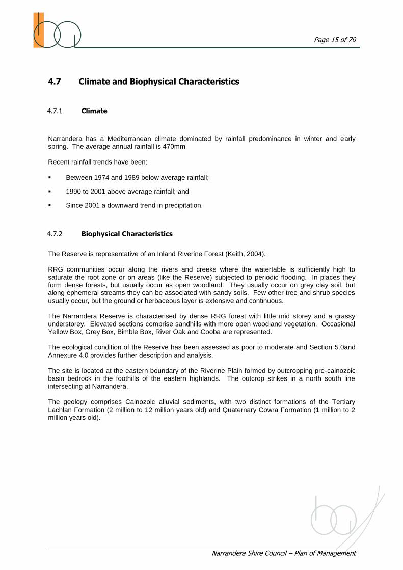
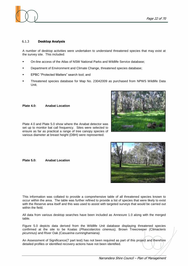
Plate 4.0: Anabat Location Plate 4.0 and Plate 5.0 show where the Anabat detector was set up to monitor bat call frequency. Sites were selected to ensure as far as practical a range of tree canopy species of various diameter at breast height (DBH) were represented. Plate 5.0: Anabat Location This information was collated to provide a comprehensive table of all threatened species known to occur within the area. The table was further refined to provide a list of species that were likely to exist with the Reserve area itself and this was used to assist with targeted surveys that would be carried out within the field. All data from various desktop searches have been included as Annexure 1.0 along with the merged table. Figure 5.0 depicts data derived from the Wildlife Unit database displaying threatened species confirmed at the site to be Koalas (Phascolarctos cinereus), Brown Treecreeper (Climacteris picumnus) and River Oak (Casuarina cunninghamiana). An Assessment of Significance(7 part test) has not been required as part of this project and therefore detailed profiles or identified recovery actions have not been identified.
Page 23 of 70
Narrandera Shire Council – Plan of Management
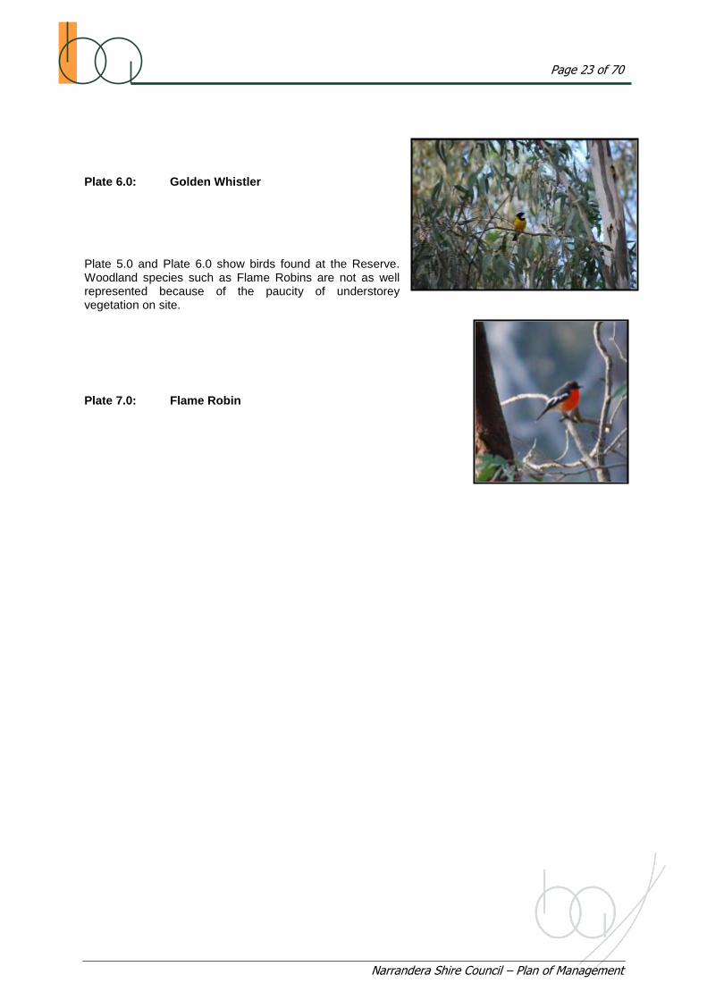
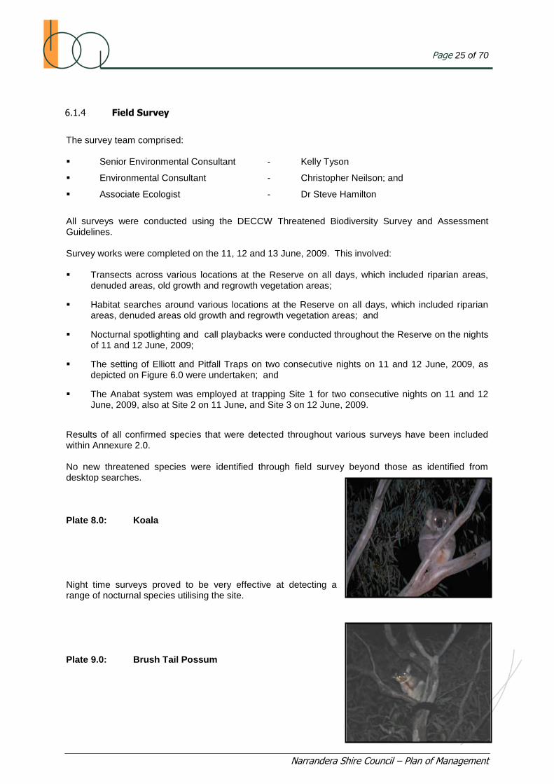
Plate 6.0: Golden Whistler Plate 5.0 and Plate 6.0 show birds found at the Reserve. Woodland species such as Flame Robins are not as well represented because of the paucity of understorey vegetation on site. Plate 7.0: Flame Robin

Figure 5.0: Threatened Species Narrandera Reserve
Page 25 of 70
Narrandera Shire Council – Plan of Management
6.1.4 Field Survey
The survey team comprised: Senior Environmental Consultant - Kelly Tyson
Environmental Consultant - Christopher Neilson; and
Associate Ecologist - Dr Steve Hamilton
All surveys were conducted using the DECCW Threatened Biodiversity Survey and Assessment Guidelines. Survey works were completed on the 11, 12 and 13 June, 2009. This involved: Transects across various locations at the Reserve on all days, which included riparian areas,
denuded areas, old growth and regrowth vegetation areas;
Habitat searches around various locations at the Reserve on all days, which included riparian areas, denuded areas old growth and regrowth vegetation areas; and
Nocturnal spotlighting and call playbacks were conducted throughout the Reserve on the nights of 11 and 12 June, 2009;
The setting of Elliott and Pitfall Traps on two consecutive nights on 11 and 12 June, 2009, as depicted on Figure 6.0 were undertaken; and
The Anabat system was employed at trapping Site 1 for two consecutive nights on 11 and 12 June, 2009, also at Site 2 on 11 June, and Site 3 on 12 June, 2009.
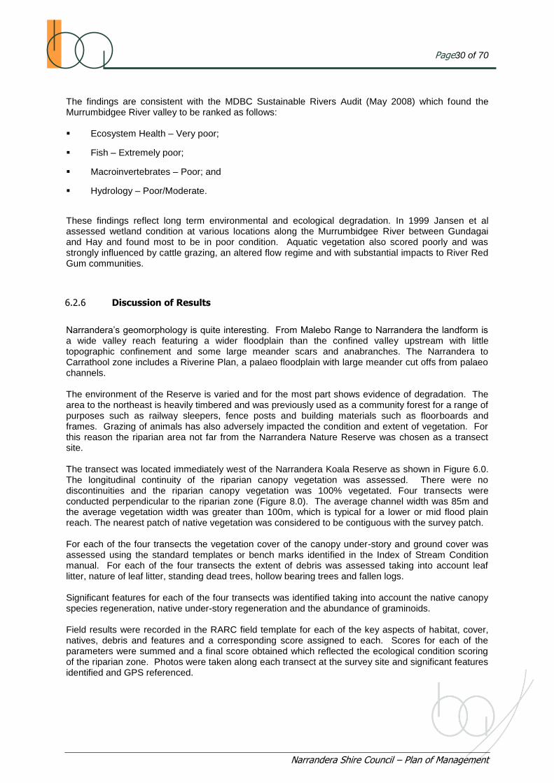
Results of all confirmed species that were detected throughout various surveys have been included within Annexure 2.0. No new threatened species were identified through field survey beyond those as identified from desktop searches. Plate 8.0: Koala Night time surveys proved to be very effective at detecting a range of nocturnal species utilising the site. Plate 9.0: Brush Tail Possum

Figure 6.0: Transect and Trap Sites

Page27 of 70
Narrandera Shire Council – Plan of Management
6.1.5 Climatic Conditions
The Narrandera Reserve was closed during the entire survey due to previous rainfall events. This is normal practice to protect trafficable areas from vehicular damage. However, access was provided to Booth Associates on all days with movement throughout the Reserve area being possible and not restricting survey activities. Climatic conditions for the site at the time of the survey have been included in Table 2.0 as recorded at the Narrandera Golf Club with all June readings provided as Annexure 3.0. Table 2.0: Narrandera Climate Data 11-13 June, 2009
Date Minimum Temperature
up to 9.00am (ºC) Maximum Temperature
from 9.00am (ºC) Rainfall to 9.00am
(mm)
11/06/09 0.0 11.0 0.0
12/06/09 0.2 10.4 0.0
13/06/09 4.4 14.4 0.0
Source: Weatherzone.com.au
Weather conditions at the time of the survey included chilly nights and mornings with moderately mild days.
6.2 Riparian Ecological Assessment
6.2.1 Introduction
The siting of the Narrandera Reserve adjacent to the Murrumbidgee River is significant in terms of the social, recreational, aesthetic and environmental values and opportunities provided to the Narrandera community. Therefore the ecological condition of the riparian environment forms a critical component in any management plan. There are direct influences and aspects between aquatic environment, the Murrumbidgee River, the riparian zone, the adjacent floodplain and terrestrial environment. Council has acknowledged and recognised the importance of the riparian environment of the Reserve in requiring an ecological assessment of the riparian zone to be undertaken.

Page28 of 70
Narrandera Shire Council – Plan of Management
6.2.2 Methodology
The following methodology for the riparian ecological assessment was applied: Desktop assessment was conducted by analysing Goggle Earth Imagery of the Narrandera
Reserve on to identify potential riparian assessment survey sites. To facilitate this the Reserve was divided into spatial mapping units according to typical parameters (topography, landscape, vegetation, biophysical attributes) and degree of anthropogenic impact or disturbance and mapped as shown in Figure 7.0.
This map identifies potentially suitable low impact survey sites shown as along the Murrumbidgee River adjacent to the Reserve west of the Narrandera Nature Reserve and east of First Beach. It was unclear because of the scale of the imagery whether two surveys as initially planned would be necessary or whether one survey would suffice for assessment purposes; and
A literature review was undertaken to identify methods suitable for use. Only two methods were considered to have potential to be used in this situation. The first and preferred method was Jansen‟s Rapid Appraisal of Riparian Condition (RARC) which has been extensively used in south eastern New South Wales and in the Murrumbidgee valley and the Index of Stream Condition (ISC) which is a tool advocated by the Victorian Department of Sustainability and Environment.
Figure 7.0: Mapping Units – Narrandera Reserve

Page29 of 70
Narrandera Shire Council – Plan of Management
An assessment was undertaken of the following components of the riparian zone:
o Riparian canopy vegetation;
o Channel width;
o Proximity of remnant vegetation;
o Canopy understorey and groundcover;
o Debris;
o Significant features
On completion of the survey field records were formalised and tabulated, scores obtained and
results analysed. RARC potential score breakdown was collated as follows; <25 very poor; 25 to 30 poor; 30 to 35 moderate; 35 to 40 good; >40 excellent. Another survey was conducted according to the ISC method at the same location to screen and check for parity and quality of results. The comparison benchmark EVC was EVC 106 for the Victorian Riverina being a Grassy Riverine Forest.
6.2.3 Limitations and Assumptions
The primary limitation with the survey site was that it was located on a bend. This may impact on survey results as condition of banks may reflect erosion from the increased velocity of flow on the outside bends of the channel. To negate this potential impact, consideration was given to whether another survey site or another survey should be undertaken on a straight stretch of river channel to ensure that the overall assessment of the riparian channel within the corridor could be considered within the overall context. However, subsequent ground-truthing of the riparian zone showed that there was insignificant variation in condition irrespective of spatial variations and further assessment was not warranted.
6.2.4 Team Members
The following team members participated in the riparian condition survey: Kelly Tyson, Project Manager - responsible for survey design, field assessment and recording of results; Christopher Nielson, Environmental Consultant and fellow survey member - responsible for survey assessment and recording results; and Therese Allen, Field Assistant - responsible for recording of results.
6.2.5 Riparian Condition Survey Results
The riparian zone was scored at 30 out of a potential 50 which shows the site to be below average in terms of its ecological condition. This poor to moderate rating is consistent with an area which has been subject to river regulation, with a long history of unrestricted public access and anthropogenic disturbances including grazing impact.
Page30 of 70
Narrandera Shire Council – Plan of Management
The findings are consistent with the MDBC Sustainable Rivers Audit (May 2008) which found the Murrumbidgee River valley to be ranked as follows: Ecosystem Health – Very poor;
Fish – Extremely poor;
Macroinvertebrates – Poor; and
Hydrology – Poor/Moderate.
These findings reflect long term environmental and ecological degradation. In 1999 Jansen et al assessed wetland condition at various locations along the Murrumbidgee River between Gundagai and Hay and found most to be in poor condition. Aquatic vegetation also scored poorly and was strongly influenced by cattle grazing, an altered flow regime and with substantial impacts to River Red Gum communities.
6.2.6 Discussion of Results
Narrandera‟s geomorphology is quite interesting. From Malebo Range to Narrandera the landform is a wide valley reach featuring a wider floodplain than the confined valley upstream with little topographic confinement and some large meander scars and anabranches. The Narrandera to Carrathool zone includes a Riverine Plan, a palaeo floodplain with large meander cut offs from palaeo channels. The environment of the Reserve is varied and for the most part shows evidence of degradation. The area to the northeast is heavily timbered and was previously used as a community forest for a range of purposes such as railway sleepers, fence posts and building materials such as floorboards and frames. Grazing of animals has also adversely impacted the condition and extent of vegetation. For this reason the riparian area not far from the Narrandera Nature Reserve was chosen as a transect site. The transect was located immediately west of the Narrandera Koala Reserve as shown in Figure 6.0. The longitudinal continuity of the riparian canopy vegetation was assessed. There were no discontinuities and the riparian canopy vegetation was 100% vegetated. Four transects were conducted perpendicular to the riparian zone (Figure 8.0). The average channel width was 85m and the average vegetation width was greater than 100m, which is typical for a lower or mid flood plain reach. The nearest patch of native vegetation was considered to be contiguous with the survey patch. For each of the four transects the vegetation cover of the canopy under-story and ground cover was assessed using the standard templates or bench marks identified in the Index of Stream Condition manual. For each of the four transects the extent of debris was assessed taking into account leaf litter, nature of leaf litter, standing dead trees, hollow bearing trees and fallen logs. Significant features for each of the four transects was identified taking into account the native canopy species regeneration, native under-story regeneration and the abundance of graminoids. Field results were recorded in the RARC field template for each of the key aspects of habitat, cover, natives, debris and features and a corresponding score assigned to each. Scores for each of the parameters were summed and a final score obtained which reflected the ecological condition scoring of the riparian zone. Photos were taken along each transect at the survey site and significant features identified and GPS referenced.

Page31 of 70
Narrandera Shire Council – Plan of Management
Plate 10.0: Canopy Transect 4 Plate 10.0 shows that a reasonable amount of filtered sunlight is able to reach the forest floor. Plate 11.0: Debris Transect 4 Plate 11.0 shows the forest floor to have a moderate to good amount of debris and CWD. Figure 8.0: Longitudinal Canopy and Transect Location
500m Riparian zone
MurrumbidgeeRiver
100m x 10m wide transect Canopy cover
T4
T3
T2
T1

Page32 of 70
Narrandera Shire Council – Plan of Management
Identified deficiencies included continuous recruitment of canopy species (RRG) as well life forms of understorey species were not always well represented including immature canopy trees, understorey trees and shrubs, herbs, graminoids and bryophytes. Some graminoids were present on close inspection and the freewater zone included lichens, bryophytes, algae, plankton, biofilms and aufwuchs. There was evidence of livestock damage through grazing and damage to vegetation and banks. The site scored well for habitat and debris but not well for the other indicators. The river channel itself contained a reasonable amount of LWD. The native subindex identified canopy trees as predominately native, with little shrub cover and a groundcover that was predominately exotic. There may be little chance of altering this on a large scale and management practices should be directed to improving this indices and ultimately riparian condition. The survey indicates that the riparian zone is of poor to moderate quality and condition. This scoring is likely to be attributed to the following anthropogenic impacts: Uncontrolled grazing by native fauna and pest animals including rabbits and particularly
kangaroos;
A long history of grazing of stock, including sheep, cattle and horses;
Prior community forestry activities; and
A regulated river flow regime.
A discussion of the impacts of river regulation on the changed environment of the Narrandera Reserve is included in Annexure 4.0. Plate 12.0: Erosion Transect 2 View to the northwest of the Transect 2 site showing bank condition impacted by erosion. Plate 13.0: Bank Erosion Murrumbidgee River The survey showed evidence of substantial bank erosion in places. Note the exposed roots most likely as a result of the regulated river flow regime.

Page33 of 70
Narrandera Shire Council – Plan of Management
6.2.7 Conclusion
The riparian zone has been assessed as being in poor to moderate condition. This adversely impacts the attributes and values of the Reserve, its potential long term sustainability, its ability to meet and satisfy existing and future community expectations, and the range of opportunities and experiences which would otherwise be afforded. To ensure these values and opportunities are protected; the “precautionary principle” needs to be advocated by Council in regulating the care and use of the Reserve. Australia has adopted Ecologically Sustainable Development (ESD) as a guiding principle of environmental management.
The precautionary principle is a fundamental component of ESD and is about managing environmental risk. The precautionary principle has been defined as principle of the Rio Declaration (1992).
“Where there are threats of serious or irreversible environmental damage, lack of full scientific certainty should not be used as a reason for postponing measures to prevent environmental degradation.”
This means that the Council should take a precautionary approach in making decisions about the Reserve where there is a lack of scientific certainty. Because scientific uncertainty is likely to exist when considering impacts on natural ecological systems such as the Reserve, this means that Council needs to be careful and cautious in its decision making to ensure that the Reserve and its ecological attributes and systems remain sustainable in perpetuity.

Page34 of 70
Narrandera Shire Council – Plan of Management
7.0 FUTURE MANAGEMENT
7.1 Objectives for Management
The following management objectives have been derived from the consultation undertaken as part of this project and the various issues that have been identified by the project team. The objectives for the future management of the Narrandera Reserve are to: Identify biophysical attributes at the site, to ensure that soil, water and ecological resources are
appropriately managed, conserved and maintained for the benefit of future generations;
Protect the key values of the site including the various ecological, cultural, social, educational and scientific values;
Ensure that the area is managed appropriately in accordance with its attributes and values;
Promote multi-use opportunities of the site where those uses do not compromise site core values and resources and do not jeopardise long term conservation and management objectives;
Rehabilitate ecological systems, processes and places which provide opportunities to enhance the local and visitor experience;
Ensure that the site is maintained and managed in accordance with a long term strategic plan which has been developed in conjunction with the community and stakeholders and directed and committed to by Council and
Ensure that core koala habitat values are protected and any development takes these into account and optimises feeding, habitat, refuge and breeding opportunities.
7.2 Issues for Management
The following management issues for the Reserve have been identified through the consultation process and by the project team: Access;
Fire Hazard;
Pest Control;
Weed Control;
Land Use Options;
Grazing;
Cultural Heritage;
Surface and Groundwater Management;
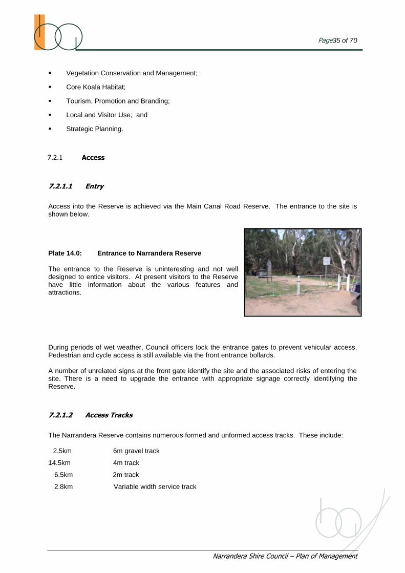
Page35 of 70
Narrandera Shire Council – Plan of Management
Vegetation Conservation and Management;
Core Koala Habitat;
Tourism, Promotion and Branding;
Local and Visitor Use; and
Strategic Planning.
7.2.1 Access
7.2.1.1 Entry
Access into the Reserve is achieved via the Main Canal Road Reserve. The entrance to the site is shown below. Plate 14.0: Entrance to Narrandera Reserve The entrance to the Reserve is uninteresting and not well designed to entice visitors. At present visitors to the Reserve have little information about the various features and attractions. During periods of wet weather, Council officers lock the entrance gates to prevent vehicular access. Pedestrian and cycle access is still available via the front entrance bollards. A number of unrelated signs at the front gate identify the site and the associated risks of entering the site. There is a need to upgrade the entrance with appropriate signage correctly identifying the Reserve.
7.2.1.2 Access Tracks
The Narrandera Reserve contains numerous formed and unformed access tracks. These include: 2.5km 6m gravel track
14.5km 4m track
6.5km 2m track
2.8km Variable width service track

Page36 of 70
Narrandera Shire Council – Plan of Management
Plate 15.0: 6m Track Plate 16.0: 4m Track Plate 17.0: Service Track Plate 15.0, Plate 16.0 and Plate 17.0 show some of the various access tracks which criss-cross the Reserve. Currently there are not clear construction standards applying to the various vehicular, cycling or pedestrian access tracks. These access tracks are shown in Figure 2.0. As well 11kms the Murrumbidgee Loop of the Bundidgerry Walking Track traverses the Reserve. The tracks are used for: Visitor access and through routes including access into Narrandera Nature Reserve;
Walking trails;
Cycle routes;
Fire breaks; and
Service ways.

Page37 of 70
Narrandera Shire Council – Plan of Management
Currently there are no controlled access arrangements and safety issues do exist between different user groups. There is a real and potential conflict between off road recreational vehicles (like motor bikes) and bushwalkers. (NARBUG) have indicated that the Reserve is favoured by keen cyclists and sporting tri-athletes. If the Reserve was connected to the Lake Talbot Reserve system existing social and recreational opportunities could be enhanced. The Murrumbidgee loop of the Bundidgerry walking trail traverses the perimeter of the site, incorporating the Main Canal Reserve. Currently the trail is difficult to follow as a large extent is unmarked and not signposted. While many tracks have been used as fire breaks in the past, it is unclear as to how effective they have been in establishing fuel separation areas and managing fire hazard. Council is currently preparing a fire management plan for the Reserve and any plan to reduce formed access tracks will need to take into account fire management.
7.2.2 Fire Hazard
Because of the extent of vegetation on site and significant amount of LWD, Coarse Woody Debris (CWD) and fine fuel litter, bushfire presents a significant threat to the Reserve‟s ecological resources and those on site during the dry summer months.
7.2.2.1 Fire History
Fire control is a negotiated arrangement between Department of Primary Industries - Lands as a Crown Reserve, the Council as trustee and the NSW Fire Brigades (NSWFB) and NSW Rural Fire Service (RFS). Requests for information indicate, there appears to be no recorded fire history of the site. Anecdotal information from Council and the RFS suggest that grass and bush fires have occurred regularly in the area during summer months, mainly caused by escaped campfires and deliberate ignitions.
7.2.2.2 Forestry Activities
Early in the 20th Century forestry activities were carried out by the Narrandera community on the
Reserve. This continued when the north eastern part of the site was proclaimed as a community forest. There is evidence throughout the Reserve of authorised and unauthorised timber harvesting activities.
7.2.2.3 Fuel Loadings
Significant fuel loads can exist on site from standing dead trees and from LWD, CWD, fine fuel litter and standing dead trees, as well as from existing living vegetation. The drought has exacerbated the dry conditions and resulted in significant areas of litter fall and standing dead trees which has amplified the fire risk.

Page38 of 70
Narrandera Shire Council – Plan of Management
7.2.2.4 Fire Management Regime
The Council has commissioned a bushfire management plan, which will include strategies for fuel management and community safety while still allowing for the needs of the natural environment. As part of this process it is important that a fire management plan for the Reserve be considered and implemented.
7.2.3 Pest Control
The site shows evidence of animal burrows and significant grazing has retarded vegetation recruitment and regeneration. The Livestock Health and Pest Authority (LHPA) have advised that foxes, rabbits and kangaroos have been responsible for significant land degradation issues at the Reserve. The control option for foxes include 1080 econobaits and meat baits and the control options for rabbits include Gastion tablets, Pindone carrot/oats (anticoagulant) and 1080 carrot/oat (mono-flouro acetate), Gastion rabbit control is the only control method that has been conducted in the past on the Reserve. The LHPA recommend that control programmes should be implemented to control pests. Risks to visitors on-site can be managed by restricting access during periods when baiting or culling programmes are in place. Restrictions and guidelines concerning the use of 1080 are outlined in the current pesticide control order 2008. During site surveys a large population of kangaroos were observed on the Narrandera Reserve. Kangaroos impact on the site through grazing and compaction. This impact has been discussed in Annexure 4.0. The Department of Primary Industries – Lands does not support Kangaroo culls on Crown Land.
7.2.4 Weed Control
The Narrandera Traditional Owner River Restoration Project is funded by the MCMA and hosted by the Council. The project employs local Aboriginal people to conduct conservation and land management activities on Crown land within the Narrandera LGA. The main focus includes weed control, tree planting, conservation of river banks and cultural heritage. The project has just completed its second year with funding for a third year recently announced. Indigenous trainees have been employed through the program and undertake TAFE qualifications in conservation and land management. Weeds compete with native plants for sunlight, nutrients and water. They are spread through wind and water movements and through stock grazing through seed translocation via waste products. Stock compaction and grazing adversely impacts on native recruitment and results in invasion of exotic species.

Page39 of 70
Narrandera Shire Council – Plan of Management
As mentioned in Annexure 4.0 the Narrandera Reserve has been significantly impacted by exotic species. Impacts include: Substantial modification of the ground layers by introduced annuals;
Significant infestations of woody weeds such as Blackberry and Boxthorn; and
A range of introduced canopy species occur over the site.
The following table provided by Council shows the current weed control program managed under annual funding from MCMA which has been received over the past two years. Under the agreement, for each year of funding, Council is contracted to maintain the Reserve restored area for an additional 10 years. Table 3.0: Weed Control at Narrandera Reserve Plate 18.0: Emerging Blackberry The riparian restoration group have spent significant resources in weed control including the chipping and chemical control of Blackberry.
Common name Botanical Name Control
Blackberry Rubus fruticosus Chemical control/chipping
Olive Olea europaea Chainsaw/handsaw & chemical control
African Boxthorn Lycium ferocissimum Chainsaw/handsaw & chemical control
CanaryIsland Date Palm Phoenix canariensis Chainsaw/handsaw & chemical control
Peppercorn Schinus areira Chainsaw/handsaw & chemical control
White Cedar Melia azedarach Chainsaw and chemical control
Briar Roses Rosa rubiginosa Chainsaw/handsaw & chemical control
Willows Salix babylonia/fragilis Chainsaw/handsaw & chemical control
Cootamundra Wattle Acacia baileyana Chainsaw
Patterson‟s Curse Echium plantagineum Line trimming
Cleavers Galium aparine/tricornutum Not currently controlled
Scotch Thistle Onopordum acanthium L Hand chipping
Tree of Heaven Ailanthus altissima Chemical control
Horehound Marrubium vulgare Not currently controlled
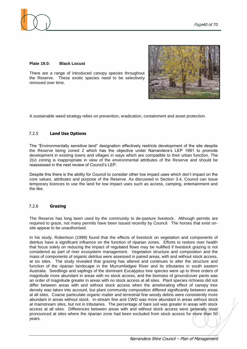
Page40 of 70
Narrandera Shire Council – Plan of Management
Plate 19.0: Black Locust There are a range of introduced canopy species throughout the Reserve. These exotic species need to be selectively removed over time. A sustainable weed strategy relies on prevention, eradication, containment and asset protection.
7.2.5 Land Use Options
The “Environmentally sensitive land” designation effectively restricts development of the site despite the Reserve being zoned 2 which has the objective under Narrandera‟s LEP 1991 to promote development in existing towns and villages in ways which are compatible to their urban function. The 2(v) zoning is inappropriate in view of the environmental attributes of the Reserve and should be reassessed in the next review of Council‟s LEP. Despite this there is the ability for Council to consider other low impact uses which don‟t impact on the core values, attributes and purpose of the Reserve. As discussed in Section 3.4, Council can issue temporary licences to use the land for low impact uses such as access, camping, entertainment and the like.
7.2.6 Grazing
The Reserve has long been used by the community to de-pasture livestock. Although permits are required to graze, not many permits have been issued recently by Council. The horses that exist on-site appear to be unauthorised. In his study, Robertson (1999) found that the effects of livestock on vegetation and components of detritus have a significant influence on the function of riparian zones. Efforts to restore river health that focus solely on reducing the impact of regulated flows may be nullified if livestock grazing is not considered as part of river ecosystem management. Vegetation structure and composition and the mass of components of organic detritus were assessed in paired areas, with and without stock access, at six sites. The study revealed that grazing has altered and continues to alter the structure and function of the riparian landscape in the Murrumbidgee River and its tributaries in south eastern Australia. Seedlings and saplings of the dominant Eucalyptus tree species were up to three orders of magnitude more abundant in areas with no stock access, and the biomass of groundcover pants was an order of magnitude greater in areas with no stock access at all sites. Plant species richness did not differ between areas with and without stock access when the ameliorating effect of canopy tree density was taken into account, but plant community composition differed significantly between areas at all sites. Coarse particulate organic matter and terrestrial fine woody debris were consistently more abundant in areas without stock. In-stream fine and CWD was more abundant in areas without stock at mainstream sites, but not in tributaries. The percentage of bare soil was greater in areas with stock access at all sites. Differences between areas with and without stock access were generally most pronounced at sites where the riparian zone had been excluded from stock access for more than 50 years.

Page41 of 70
Narrandera Shire Council – Plan of Management
Therefore stock present issues because they impact on site biodiversity values. Through grazing and compaction they also adversely impact on successful recruitment and rehabilitation works. Animal health has also been raised as a significant issue and Council as trustee of the land has a duty of care to ensure that unauthorised stock is removed and animal health considered in any relocation. The Department of Primary Industries - Lands advise that grazing of the Reserve is not sustainable and is not viable option within the Reserve. Plate 20.0: Unauthorised Horses on the Reserve
7.2.7 Cultural Heritage
European cultural heritage has been discussed in Section 3.6. Further investigation is needed to identify how the Reserve was used by locals in the early and mid part of the 20
th century. Roy Wade
tells a story of how in the fifties a taxi driver was asked to deliver a man to his home…his home being a hollowed out tree situated in the Reserve. It is important that such stories are not lost as they help to define the heritage of the place. Narrandera also has a rich indigenous cultural heritage which has been investigated by Gammage (1986), Kabaila (1995) and Freeman (1996). The Wiradjuri had three clans with the Narrandera clan being Narrungdera. Pre-European population has been estimated at 2,000.The Shire has many canoe trees, from which bark canoes, shields, or coolamon has been stripped and “possum trees” and hundreds of middens (cooking ovens) near water. Gammage (1986) mentions that in December 1829 Sturt noted that the Narrungdera frequented creeks and swamps rather than rivers. The Reserve is significant for the indigenous community because: It is located adjacent to the Murrumbidgee River and is related to both lentic and lotic
environments;
Scar trees exist on site indicating previous aboriginal occupation and use;
Bundidgerry Creek contains elaborate fish traps (Gammage).
The Reserve is strategically situated amongst a range of important sites in indigenous „oral rememberings‟ including
o Duck Bend and Buckingbong Station;
o Massacre/or Murdering Island;
o Green Swamp; and
o Poisoned Waterholes Creek; It is also not far from
o Town Beach.
It is strongly recommended that the site be ground truthed and further investigated to help identify its cultural significance.

Page42 of 70
Narrandera Shire Council – Plan of Management
Plate 21.0: Scar Tree At least what appeared to be three scar trees were detected by the project team during site surveys.
7.2.8 Surface Water and Groundwater Management
7.2.8.1 Flow Regime and Impact of Regulation
The Murrumbidgee River is a regulated river. Regulation has impacted the riparian environment by changing the frequency, duration, timing and magnitude of flooding with resultant ecological impacts on the floodplain through loss of connectivity. Flooding is the mechanism by which there is an exchange of nutrients between the river channel and the floodplain. Nutrient cycling promotes allochthonous and autochthonous production and riparian health, biodiversity and ecological processes. Page and Frazier (2005; 2006) found that regulation has halved the frequency and duration of bank-full flows to about half which has implications for the ecological health of the riparian environment. The current Murrumbidgee River flow regime is characterised by reduction in magnitude and spatial variation between flow events changed timing of flood events commensurate with the spring/summer irrigation season and more frequent high summer flow events between the storage and irrigation off-takes. Other impacts of regulation include low water temperatures as a result of cold water release from deep storages, effects of weirs and barriers to fish passages, sand slugs, removal of snags and LWD and loss of riparian vegetation through grazing and invasion of feral species. Olive (1997) found that controlling river flow inevitably also affects sediment transport. For example, dams and weirs often act as effective sediments traps, so that discharge waters are often cleaner than the inflows. As a result, discharge waters often have a renewed capacity to erode and transport sediments, causing channel erosion. Thorns & Walker (1992) in a study of the effects of regulation on the Murray River found that most of the sediment transport in the regulated reach occurred during the irrigation season, with most of the sediment (69%) being derived from channel erosion. The Narrandera Reserve and its ecological attributes and on-site processes has been adversely impacted by river regulation in that: There has been the loss and or impairment of existing on-site lotic environments (wetlands);
and
The Horseshoe Lagoon only flows episodically with resultant ecological and biodiversity impacts.
Manipulated flow regimes have resulted in erosion and scouring of banks associated with increased velocity and reduced temporal variations between low and high flow events;
Changing flow conditions of the Murrumbidgee River results in changed morphology, changed sediment loads and distribution patterns and potential impact to the hyperhoic zone, impacting on nutrient, carbon and oxygen exchanges and the connectivity with the groundwater system; and

Page43 of 70
Narrandera Shire Council – Plan of Management
Reserve biological resources have been impaired as a result of the changed flow regimes. For example Briggs et al (1994) found that different species of waterbirds depend on different wetland flow regimes and in general waterbirds need 5 to 10 months inundation of nest trees to breed and there should be 18 months lag between inundation events.
Plate 22 .0 Horseshoe Lagoon Horseshoe Lagoon represents a tributary channel or possibly remnant palaeo channel that apparently flows only occasionally during period of peak flow events. It is connected to the Murrumbidgee River and has the potential to connect to the Main Canal/Bundidgerry Creek system. Plate 23.0: Horseshoe Lagoon Disruption to natural flooding cycle has impacted on seed dispersal and recruitment events and on reserve floristic, composition and structural vegetation attributes. The changed flooding regime is important. Meeson et al (2002) suggests that small floods may not result in significant recruitment to river red gum populations because seed predation may reduce seed supply before and following flooding. Decreases in the frequency of flooding owing to river regulation and water extraction are likely to have exacerbated the influence of livestock on seed supply and thus reduced potential recruitment even further. The lesson is that efforts to rehabilitate large floodplain riparian environments based solely on the return of more natural flow regimes may fail if the effects of factors such as livestock grazing are not managed concurrently.
7.2.8.2 Groundwater
The Narrandera Reserve is located in Zone 3 – Pomingalama to Narrandera of GWMA 013. GWMA 013 has been assessed as a “high risk area”. This means that there is a need to protect the quality of the groundwater resource from degradation. Connectivity exists between surface water and groundwater systems. In Zone 3 the Murrumbidgee River has altered from being a gaining to a losing stream, with significant recent change. These impacts on river height and aquifer recharge. In the vicinity of the Narrandera Reserve the Murrumbidgee River has dropped between 0 to 2 metres.
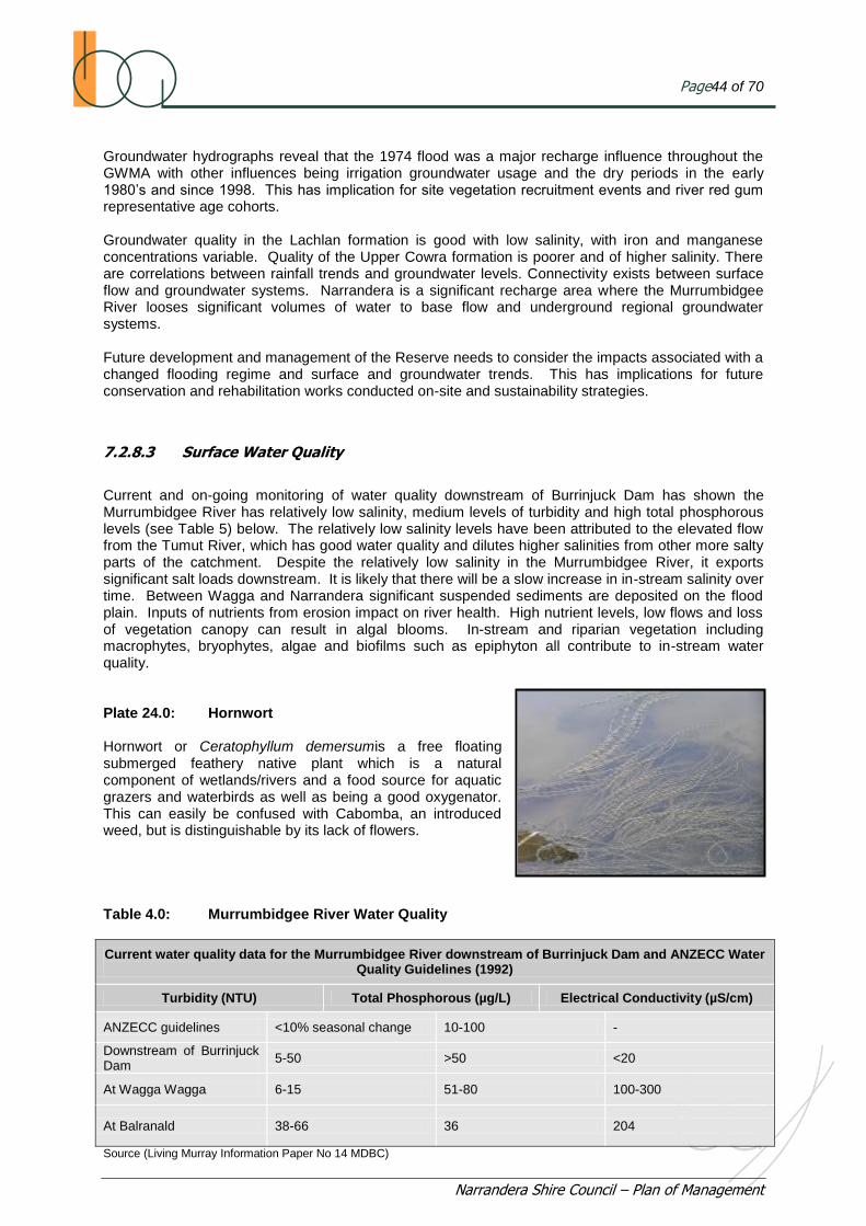
Page44 of 70
Narrandera Shire Council – Plan of Management
Groundwater hydrographs reveal that the 1974 flood was a major recharge influence throughout the GWMA with other influences being irrigation groundwater usage and the dry periods in the early 1980‟s and since 1998. This has implication for site vegetation recruitment events and river red gum representative age cohorts. Groundwater quality in the Lachlan formation is good with low salinity, with iron and manganese concentrations variable. Quality of the Upper Cowra formation is poorer and of higher salinity. There are correlations between rainfall trends and groundwater levels. Connectivity exists between surface flow and groundwater systems. Narrandera is a significant recharge area where the Murrumbidgee River looses significant volumes of water to base flow and underground regional groundwater systems. Future development and management of the Reserve needs to consider the impacts associated with a changed flooding regime and surface and groundwater trends. This has implications for future conservation and rehabilitation works conducted on-site and sustainability strategies.
7.2.8.3 Surface Water Quality
Current and on-going monitoring of water quality downstream of Burrinjuck Dam has shown the Murrumbidgee River has relatively low salinity, medium levels of turbidity and high total phosphorous levels (see Table 5) below. The relatively low salinity levels have been attributed to the elevated flow from the Tumut River, which has good water quality and dilutes higher salinities from other more salty parts of the catchment. Despite the relatively low salinity in the Murrumbidgee River, it exports significant salt loads downstream. It is likely that there will be a slow increase in in-stream salinity over time. Between Wagga and Narrandera significant suspended sediments are deposited on the flood plain. Inputs of nutrients from erosion impact on river health. High nutrient levels, low flows and loss of vegetation canopy can result in algal blooms. In-stream and riparian vegetation including macrophytes, bryophytes, algae and biofilms such as epiphyton all contribute to in-stream water quality. Plate 24.0: Hornwort Hornwort or Ceratophyllum demersumis a free floating submerged feathery native plant which is a natural component of wetlands/rivers and a food source for aquatic grazers and waterbirds as well as being a good oxygenator. This can easily be confused with Cabomba, an introduced weed, but is distinguishable by its lack of flowers. Table 4.0: Murrumbidgee River Water Quality
Current water quality data for the Murrumbidgee River downstream of Burrinjuck Dam and ANZECC Water Quality Guidelines (1992)
Turbidity (NTU) Total Phosphorous (µg/L) Electrical Conductivity (µS/cm)
ANZECC guidelines <10% seasonal change 10-100 -
Downstream of Burrinjuck Dam
5-50 >50 <20
At Wagga Wagga 6-15 51-80 100-300
At Balranald 38-66 36 204
Source (Living Murray Information Paper No 14 MDBC)
Page45 of 70
Narrandera Shire Council – Plan of Management
7.2.9 Vegetation Conservation and Management
The Riparian Restoration Group has revegetated areas on the Reserve close to first and second beach. Recruitment, regeneration and revegetation programmes have been adversely impacted by the following: Lack of a Strategic Plan to identify priorities and objectives for conservation and rehabilitation
works;
Ongoing drought conditions;
Pest, weed; and
Visitor impacts.
There are a range of conservation and rehabilitation opportunities available for the site. Because the riparian zone has been identified as being in low to moderate ecological condition, there is a need to undertake rehabilitation works to improve the ecological condition of the Reserve. Because of the size of the Common, these rehabilitation works should be prioritised so that attention is paid first to the primary and secondary visitor facilities and the entrance facility and the actual riparian zone, including the bank and probably a longitudinal corridor of 50 to 100 metres with a larger spatial extent, including the total extent of the first and second beach areas. Where possible Council should access funding opportunities available under current Murrumbidgee Catchment Management Authority (MCMA) restoration programs. Climate change, flood patterns and fire are all important factors influencing ecological processes and in moulding the occurrence and distribution of the Reserve vegetation mosaic. Previous land use activities have impacted on the condition of the site– for instance forestry operations such as harvesting and thinning and stock grazing have had an impact on site species diversity, abundance and on the ecosystem. Despite this there are opportunities to conduct successful conservation and rehabilitation works on site provided land use and other impacts are managed and an appropriate irrigation regime made available. The opportunities for conservation and rehabilitation on the Reserve include: River restoration works, to better manage the impacts of river regulation erosion and
sedimentation. Although the river channel contains moderate quantities of LWD in stream there is the potential include LWD along banks to stabilise channel banks, minimise sand slugs and direct flow within the channel;
Direct injection of graminoids, or other species identified by the CMA as being suitable into the actual channel banks to promote soil cohesion and bank stability and reduce scouring and soil loss impacts;
Strategic revegetation of high value assets and visitor areas
Only locally endemic plant species to be planted. This reference condition could be similar to a
known site, such as the Narrandera Nature Reserve, or the condition that was prior to European occupation.
The key aspects associated with this are to promote biodiversity and to ensure that adequate attention is given to an appropriate groundcover and appropriate feed trees, preferably a 70/30 mix of Eucalypts and Non-Eucalypts and a mid-layer promoting species such as Acacia Dealbata, Mimosa,(Silver Wattle) to promote suitable habitat for the range of woodland birds existing on the site or with the potential to utilise the site.

Page46 of 70
Narrandera Shire Council – Plan of Management
Any planting schedule should be in accordance with SEPP No.44 as recommended. Implementation of a flow regime (either through the Main Canal or Murrumbidgee River system)
to Horseshoe Lagoon and associated revegetation works. Flow regime may be possible under the NSW Riverbank Program Programme or similar. Council should liaise with Murrumbidgee Irrigation (MI) or DECCW in this regard; and
Revegetate sandhills with representative mixed open woodland vegetation eg Yellow Box, Grey Box etc as distinct from River Red Gum (RRG) communities elsewhere.
Plate 25.0: View to Narrandera Nature Reserve Reference Condition This view to the south east shows the Narrandera Nature Reserve. This site would be a useful reference condition for the Reserve riparian zone. While there are no visitor facilities, the Reserve is open to visitors, bird watchers, naturalists, photographers, and those interested in seeing Koalas in their natural state. The well vegetated riparian zone with little erosion evident is probably due to the absence of stock grazing. The NPWS support a no-stock grazing policy for the Flora and Fauna Reserve.
7.2.10 Core Koala Habitat
The Narrandera Nature Reserve has an introduced koala population which has dispersed into the Reserve. The population has remained stable over the last 40 years with annual population count records of between 50 to 70 koalas. Management of the Reserve needs to consider the various behavioural, feeding and breeding preferences of the koala as well as risks to the population.
Issues include: Re-vegetation programme should include known feed trees as identified in SEPP 44;
Fire control management should include low Intensity fuel and mosaic burning regime which may reduce the risk to the vulnerable Koala population; and
Koala movements should not be impeded or adversely restricted.

Page47 of 70
Narrandera Shire Council – Plan of Management
Plate 26.0: Koala in RRG tree in the Reserve
7.2.11 Local and Visitor Use
Community engagement has revealed that the Reserve is used by local and visitors in the following ways: Koala spotting;
Bush walking (including walking dogs);
Bird watching;
River recreation ( For example; swimming, fishing and canoeing);
Camping; and
Bike riding.
Highlighted issues include: Lack of directional signage;
Lack of amenities, particularly toilets;
Lack of other facilities (For example; BBQ‟s, potable water supply and rubbish bins); and
Dog control.
Note: Second and First Beach do include the occasional canvas bag on a tree, for rubbish
Significant risks related to using the Reserve include: Emergency and incident management;
Accidents;
Tree fall and limb loss; and
Drowning

Page48 of 70
Narrandera Shire Council – Plan of Management
RRG‟s can live up to 700 years or more. Trees can drop limbs or entire trees can fall without warning and there is no way of determining when a tree might fall or drop a limb. Plate 27.0: Tree Hollow from Limb Loss Trees are prone to dropping limbs when they are stressed. Stress may occur through: High wind;
Extreme temperatures or sudden changes in temperature;
Drought;
Fire;
Compaction; and
Flood.
A feature of RRG is that they drop their limbs in times of drought to conserve water. A key requirement for visitor management will be to optimise safety at the Reserve. Access routes should be controlled to promote visitor safety where possible and visitor facilities should preferably be promoted in clearings. Community feedback has been that there is a need to attract visitors, promote awareness of Reserve values and enhance and optimise visitor experience while managing associated risks. An opportunity exists to connect the Reserve to the Lake Talbot area to the north by construction of a new pedestrian bridge at the site of a previous crossing. Plate 28.0: Old Bridge Crossing This old bridge crossing is located to the northeast of the Reserve adjacent to the Main Canal. It is unclear when the crossing was last in use, however it would have enabled access from the Reserve to the Lake Talbot Reserve to the north.

Page49 of 70
Narrandera Shire Council – Plan of Management
7.2.12 Tourism, Promotion and Branding
7.2.12.1 Tourism and Promotion
The Narrandera Reserve attracts a reasonable number of tourists to the site, in particular because of its known koala population. However, limited information is available on site to: Direct visitors to best “koala spotting” areas;
Inform direction with on-site navigation identifiers;
Explain koala relocation history and present key information about koalas; and
Present other interesting facts about the natural environment and the Reserve.
Significant attention should be directed to remedying this situation and to promote tourism through site use and management. It would also be useful to monitor tourists and visitors to identify the magnitude of the attraction of the Reserve and its attributes, including the Koala population. A number of other tourism opportunities have been identified including: Provision of adequate services including potable water supply, toilets, rubbish receptacles,
interpretative signage, defined access routes, car-parking and coach/bus parking facilities; and
Provision of eco tourist opportunities through promotion of the range of natural assets and various aquatic, riparian and terrestrial environments within the Narrandera LGA and the various social, recreational and cultural opportunities afforded.
Note: Department of Primary Industries - Lands advise any future plans for visitor accommodation areas is considered not a compatible use with a Flora and Fauna Reserve. There is a need to ensure the availability of “marketable information” about the Reserve at the Council, the Visitor Information Centre and on-line. Because Second Beach is a primary visitor area, future developments should consider facilities that enrich the social and recreational experiences of visitors and are compatible with the natural environment and the Reserve‟s purpose. These facilities are not limited to, but could include: A children‟s playground or recreational area;
An entertainment area; and
An interpretative display or cultural heritage centre.
Before determining the extent of tourism product development Council should research the demand for eco and nature based tourism.
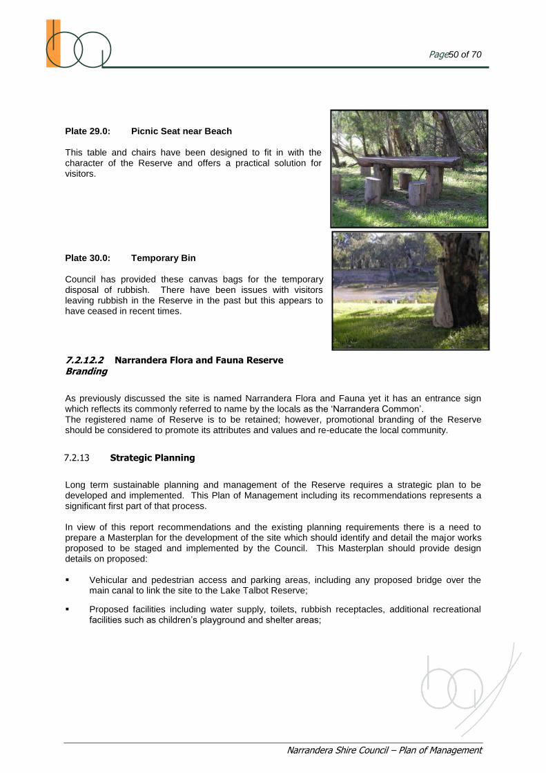
Page50 of 70
Narrandera Shire Council – Plan of Management
Plate 29.0: Picnic Seat near Beach This table and chairs have been designed to fit in with the character of the Reserve and offers a practical solution for visitors. Plate 30.0: Temporary Bin Council has provided these canvas bags for the temporary disposal of rubbish. There have been issues with visitors leaving rubbish in the Reserve in the past but this appears to have ceased in recent times.
7.2.12.2 Narrandera Flora and Fauna Reserve
Branding
As previously discussed the site is named Narrandera Flora and Fauna yet it has an entrance sign which reflects its commonly referred to name by the locals as the „Narrandera Common‟. The registered name of Reserve is to be retained; however, promotional branding of the Reserve should be considered to promote its attributes and values and re-educate the local community.
7.2.13 Strategic Planning
Long term sustainable planning and management of the Reserve requires a strategic plan to be developed and implemented. This Plan of Management including its recommendations represents a significant first part of that process. In view of this report recommendations and the existing planning requirements there is a need to prepare a Masterplan for the development of the site which should identify and detail the major works proposed to be staged and implemented by the Council. This Masterplan should provide design details on proposed: Vehicular and pedestrian access and parking areas, including any proposed bridge over the
main canal to link the site to the Lake Talbot Reserve;
Proposed facilities including water supply, toilets, rubbish receptacles, additional recreational facilities such as children‟s playground and shelter areas;

Page51 of 70
Narrandera Shire Council – Plan of Management
Cultural heritage interpretative facilities;
Interpretative signage, promoting educational themes relating to:
o Indigenous Cultural Heritage, history, stories and artefacts;
o European Cultural Heritage, history, stories and artefacts;
o Koala history and information; and
o Site biodiversity elements.
Directional signage for vehicles, cyclists and pedestrians; and
Entrance Statement. Redesign of entrance to entice visitors and describe the site and the experiences to be found therein.
Development Approval of the “Master plan” is required prior to any works commencing.
7.3 Prescriptions for Management and Recommended Work Schedule
The following table identifies the various issues and the recommended prescriptions for management. For some issues, there will need to be a policy response by the Council. Following adoption by Council and ultimately the Department of Primary Industries - Lands, the policies mentioned here should developed and included in Council‟s Policy Register.

Narrandera Shire Council – Plan of Management
Table 5.0: Issues and Recommended Works Schedule and Priorities
Issue Strategy Action Policy Priority
1 Access Visitor access to and through the Reserve shall be managed and controlled to minimise risk, separate competing user groups and promote the safe and efficient movement of visitors.
Redesign and Reconstruct the entrance of the Reserve to: Identify the key values and assets;
Indicate experiences to be enjoyed at the Reserve;
Identify the risks on entering the Reserve; and
Identify prohibitions/restrictions.
Restrict access into Reserve during periods of wet weather
As required
Restrict motor vehicles and motorbikes to primary visitor access routes unless they are authorised service vehicles.
Restrict visitor access into the Reserve on days where winds exceed TBD km/hr.
Construct and maintain access tracks to a standard commensurate with their level of use. Primary and Secondary tracks to be of a different construction standard and treatment to differentiate and manage their use.
High
Primary and secondary access routes shall be effectively signposted to better inform visitor direction.
Existing access tracks which are not designated as primary or secondary access routes shall be maintained for use by cyclist and pedestrians
High
On Going
Council to maintain fire emergency access routes from Primary and Secondary visitor areas and other visitor sites
Reduce the number of maintained access tracks in the Reserve.
High
2 Fire Hazard Council prepare a Bushfire Management Plan for the Reserve.
Conduct Fire Control Programmes as per the Fire Management Plan.
High
Contingency Planning
Manage fuel loadings on site so they don‟t present a fire hazard.
Control fuel loadings in accordance with procedures recommended in Council Bushfire Management Plan as it applies to the Narrandera Reserve.
On Going
Ensure the site is managed so that visitor use and enjoyment of the site is not compromised and visitor evacuation options are always available.
Maintain fire emergency access routes from primary and secondary visitor areas and other visitor use sites.
On Going
Maintain an Asset Protection Zone of at least 20m around the boundary of the site, unless contrary to the Council Bushfire Management Plan provisions relating to the
On Going

Narrandera Shire Council – Plan of Management
Issue Strategy Action Policy Priority
Reserve.
Ensure fire management strategies take into account potential impacts on and risks to the existing koala population.
Undertake low intensity burns and mosaic pattern burning as a control option to minimise impact to koalas and their habitat on site.
Contingency Planning
Investigate and record Reserve fire history. High
Liaise with CMA and NPWS to develop an Ecological Thinning Programme to optimise biodiversity and mitigate fire hazard. Low
3 Pest Control Monitor and manage pest species so environmental values of the Reserve are protected and rehabilitation and restoration programmes not undermined.
Liaise with DECCW/NPWS staff to identify population estimates that exceed biodiversity sustainability thresholds for the Reserve or are considered excessive because of the degree of impact on Reserve values.
Council undertake pest control programs on Crown Reserves where they are trustee in accordance with best practice and in conjunction with stakeholders including LPIA, LHPA and DECCW.
Council liaise with LHPA to identify, plan and implement rabbit and fox control programs as per the vertebrate pest control manual of LHPA.
Control of pests to be in accordance with LHPA current vertebrate pest control manual.
On Going
Council to remove and relocate stock away from the Reserve and advertise their prohibition within the Reserve.
High
Council to erect a sign at the gateway showing that stock on the Reserve is prohibited because of the adverse impacts to site environmental values.
High
4 Weed Control Improve the ecological condition and resources of the Reserve by managing the invasion and occurrence of exotic species through prevention, eradication, containment and asset protection measures.
Council implement a weed statement, based upon prevention, eradication, containment and asset protection.
High
Allocate and apportion weed control programs to primary and secondary visitor areas and facilities and remainder of the site on a 1:1 basis.
On Going
Erect a sign at the entrance showing that stock on the Reserve are prohibited because of the adverse impacts to site environmental values and future restoration programs.
Redesign Council Weed Control Program to ensure priority areas are given immediate attention. Refer Murrumbidgee Catchment Regional Weeds Strategy
High
Monitor weed control effectiveness in primary and secondary visitor areas and along primary and secondary access routes and where visitor facilities are available.
Monitor

Narrandera Shire Council – Plan of Management
Issue Strategy Action Policy Priority
Selectively remove all exotic tree canopy species and woody weeds from the Reserve. On Going
Existing stock on the Reserve shall be removed and relocated.
If necessary, Council prepare a Weed Management Plan for the Reserve with funding from DPI.
Medium
Selectively remove all exotic tree species. Annual
Monitor weeds control effectiveness in Primary and Secondary Visitor Areas and along Primary and Secondary access routes and where visitor facilities are provided.
On Going
5 Land Use Options Restrict land use options at the Reserve to protect significant attributes, values and assets while optimising the local and visitor experiences in accordance with the identified vision.
Council prepare a masterplan showing the future development of the Reserve in accordance with report recommendations and obtain development approval for staged works.
Land use activities be restricted at the site unless in accordance with the adopted site masterplan.
Remove and relocate stock away from the Reserve.
Stock (cattle, sheep, horses) access and grazing be prohibited from the Narrandera Reserve.
Liaise with DECCW (NPWS) that the boundary between the Reserve and NNR be surveyed and fencing rectified if necessary.
Council to resolve on the facilities to be provided at the Primary Visitor Area including:
Potable water supply;
Short term camping area;
BBQ facilities;
Composting toilet;
Rubbish receptacles;
Emergency equipment and first aid supplies;
Shelter;
Recreational playground; and
“Jamboree” or campsite.
High
Council revegetate the Primary and Secondary Visitor Areas in accordance with a detailed design of those areas as per the Master Plan and Construction Certificates issues for those areas.
High

Narrandera Shire Council – Plan of Management
Issue Strategy Action Policy Priority
Consideration of the following is required: Revegetation of channel banks, riparian zone and Murrumbidgee Loop;
Landscaping to visitor accommodation areas;
Landscaping of any other visitor facilities;
Landscaping/revegetation of Primary and Secondary access routes;
Landscaping of Cultural Heritage Interpretive Facility, Interpretive signage areas and Entrance gateway; and
Rehabilitate and revegetate high visibility areas associated with the Horseshoe Lagoon.
High
6 Cultural Heritage Cultural heritage values and assets of the Reserve be identified and conserved and the rich European and indigenous cultural heritage of the LGA be showcased and promoted.
Council liaise with MCMA to facilitate a cultural heritage assessment of the Reserve and significant associated sites.
High
Council engage with the community to identify and record stories that showcase how the Reserve has been used by the local and indigenous community over the years.
High
Council decide on interpretive signage design and detail that showcase European and indigenous cultural heritage.
Council erect interpretive signage at key places and sites to promote cultural heritage.
Council erect a cultural heritage interpretative facility at the Reserve.
Liaise with DECCW and Local Aboriginal Lands Council and CMA to record Indigenous Cultural events or oral rememberings and conduct an archaeological survey of the Reserve.
High
7 Surface and Groundwater Management
Ensure that landuse within the catchment is managed to protect the supply and quality of surface and groundwater resources.
Where possible ensure that wetland and
Monitor and annually report in Council‟s SOE reporting the health at the Reserve with reference to recruitment events and age cohort distribution, management of pests and exotic species, rehabilitation works implemented and policies adopted and implemented.

Narrandera Shire Council – Plan of Management
Issue Strategy Action Policy Priority
riparian habitats be rehabilitated in accordance with agreed reference conditions.
Liaise with MCMA, MI and DECCW to identify whether there is an opportunity to provide NSW Riverbank Program to important LGA ecological communities.
Undertake physical and chemical monitoring of water quality adjacent to the site in Murrumbidgee River.
Monitor
Liaise with Charles Sturt University and if appropriate Narrandera Fisheries Centre to organise macro invertebrate sampling to help monitor river health and water quality.
Medium
On Going
Review and monitor anthropogenic land use impacts in the catchment and promote the use of soil and water management techniques at the source where possible.
Investigate opportunities to implement a flow regime to Horseshoe lagoon and the Reserve riparian and floodplain environment.
Implement a flow regime to Horseshoe Lagoon and undertake rehabilitation works.
8 Vegetation Conservation and Management
Protect, enhance and manage the ecological and environmental resources of the Reserve for the benefit of the existing community and future generations.
Prepare a masterplan for the staged development of the site, in conjunction with stakeholders, including priority areas for rehabilitation and revegetation works.
All Reserve site revegetation and rehabilitation programs will consider the application and recommendations of SEPP 44, to promote a sound ratio of eucalypt koala feed trees and promote a complex vegetation structure to promote biodiversity and habitat (For example RRG and Ribbon Gum).
Undertake the orderly rehabilitation of the site in accordance with the approved site masterplan.
Liaise with MCMA and other agencies and actively source funding opportunities for proposed rehabilitation works.
Rehabilitate the riparian environment of the Murrumbidgee River through the current river restoration program of MCMA; addressing channel bank erosion through LWD and direct injection of graminoids onto the bank and appropriate revegetation of the riparian zone.
High

Narrandera Shire Council – Plan of Management
Issue Strategy Action Policy Priority
Revegetate the primary and secondary visitor areas in accordance with a detailed design of those areas as per the masterplan and any construction certificates issued for those areas.
Unique landscaping and revegetation treatments shall be provided for vehicular areas, cycling and pedestrian trails so that each are visually distinguishable.
Consideration of the following is required: Revegetation of channel banks, riparian zone and Murrumbidgee Loop;
Landscaping to visitor accommodation areas;
Landscaping of any other visitor facilities;
Landscaping/re-vegetation of Primary and Secondary access routes;
Landscaping of Cultural Heritage Interpretive Facility, Interpretive signage areas and Entrance gateway; and
Rehabilitate and revegetate high visibility areas associated with the Horseshoe Lagoon.
Feed tree species to the area as listed in Schedule 2 of SEPP 44 be used, where practicable in revegetation/rehabilitation programs, for example, RRG and Ribbon Gum.
High
Liaise with MCMA, MI and DECCW to identify whether there is an opportunity to provide NSW Riverbank Program on important ecological communities.
Monitor and annually report in Council‟s SOE Report the health of the Reserve and achievements in riparian zone restoration in terms of Jansens RARC indices.
9 Core Koala Habitat
Ensure the Reserve is managed in accordance with its designation as a Core Koala Habitat and the future development of the Reserve promotes opportunities to augment and improve habitat values and enhances and sustains a viable koala population.
Feed tree species to the area as listed in Schedule 2 of SEPP 44 be used, where practicable in revegetation/rehabilitation programs, for example, RRG and Ribbon Gum.
The Plan of Management for the Narrandera Reserve is to be endorsed by DECCW (NPWS).
Dogs on site shall be required to be leashed.
Council to undertake a planning review of the existing zoning of the site, the values and vision expressed in this POM with a view to recommending future environmental protection zoning of the Reserve.
All Reserve site revegetation and rehabilitation programs will consider the application and recommendations of SEPP 44, to promote a sound ratio

Narrandera Shire Council – Plan of Management
Issue Strategy Action Policy Priority
of eucalypt koala feed trees and promote a complex vegetation structure to promote biodiversity and habitat (For example RRG and Ribbon Gum).
Council be actively involved through a partnership with DECC and CMA in the study of Koalas at the Reserve through innovative monitoring programs and report annually through SOE reporting process knowledge learned. Council should ensure that monitoring includes a range of incidental information including weather conditions, habitat condition, daylight and night time monitoring and if possible comment on the health and attributes of individuals and other features.
The National Koala Conservation Strategy will be considered within the context for planning and management decisions involving the Reserve.
Monitor Koala populations, their location and condition on an annual basis Monitor
10 Tourism, Promotion and Branding
The Reserve is to be managed as a local and tourist asset. And shall be promoted for its values and attributes while promoting and optimising local and visitor use opportunities.
Provide facilities to primary and secondary visitor areas, commensurate with their usage as indicated in this POM (and market research of eco tourism)
Second Beach shall be developed as a primary visitor area and First Beach as a secondary visitor area.
Redesign and reconstruct the entrance of the Reserve to:
Identify the key values and assets;
Indicate experiences to be enjoyed at the Reserve;
Identify the risks on entering the Reserve; and
Identify prohibitions/restrictions.
High
Council decide on urban design standards for: Pedestrian, cycling and vehicular access tracks;
Parking including coach parking;
Directional signage;
Facilitates and structures;
Interpretive signage; and
Fencing.
Prior to the masterplan being finalised and work initiated.
High

Narrandera Shire Council – Plan of Management
Issue Strategy Action Policy Priority
Council decide on how the Reserve will be rebadged and marketed.
The Reserve is developed in accordance with an adopted masterplan in conjunction with stakeholders.
Council permit the community to be involved in the renaming process provided that one or more of the following is applied:
The name reflects the values of the Reserve;
The name reflects Reserve usage opportunities;
The name reflects important biodiversity attributes; and
The name reflects the history of the Reserve.
Council Visitor Information Centre obtain information on the Reserve and its values to promote and market the Reserve as a tourist destination and to promote community awareness of its values. This information be available online, at the council and at the VIC and accessed via Councils website.
High
Liaise with CMA to identify the information required for each interpretative sign covering areas such as:
Vegetation Community (inland Riverine Forest) and mixed Woodland Community
(sandhills);
Geology and Geomorphology;
Cultural Heritage, artefacts;
Cultural Heritage, stories;
Horseshoe Lagoon and wetlands;
Koala‟s; and
Birds;
Settlement of Narrandera etc.
Medium
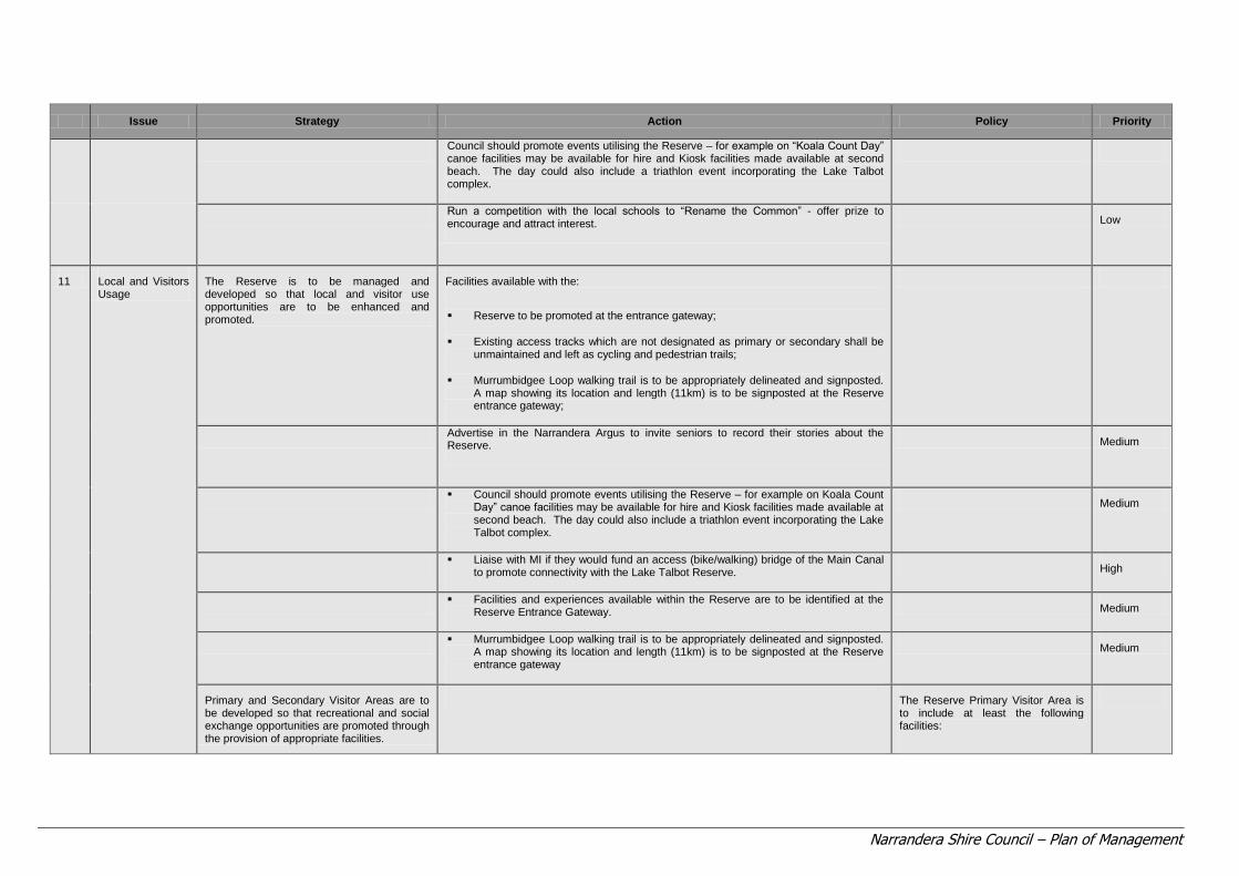
Narrandera Shire Council – Plan of Management
Issue Strategy Action Policy Priority
Council should promote events utilising the Reserve – for example on “Koala Count Day” canoe facilities may be available for hire and Kiosk facilities made available at second beach. The day could also include a triathlon event incorporating the Lake Talbot complex.
Run a competition with the local schools to “Rename the Common” - offer prize to encourage and attract interest. Low
11 Local and Visitors Usage
The Reserve is to be managed and developed so that local and visitor use opportunities are to be enhanced and promoted.
Facilities available with the:
Reserve to be promoted at the entrance gateway;
Existing access tracks which are not designated as primary or secondary shall be unmaintained and left as cycling and pedestrian trails;
Murrumbidgee Loop walking trail is to be appropriately delineated and signposted. A map showing its location and length (11km) is to be signposted at the Reserve entrance gateway;
Advertise in the Narrandera Argus to invite seniors to record their stories about the Reserve. Medium
Council should promote events utilising the Reserve – for example on Koala Count
Day” canoe facilities may be available for hire and Kiosk facilities made available at second beach. The day could also include a triathlon event incorporating the Lake Talbot complex.
Medium
Liaise with MI if they would fund an access (bike/walking) bridge of the Main Canal
to promote connectivity with the Lake Talbot Reserve. High
Facilities and experiences available within the Reserve are to be identified at the
Reserve Entrance Gateway. Medium
Murrumbidgee Loop walking trail is to be appropriately delineated and signposted.
A map showing its location and length (11km) is to be signposted at the Reserve entrance gateway
Medium
Primary and Secondary Visitor Areas are to be developed so that recreational and social exchange opportunities are promoted through the provision of appropriate facilities.
The Reserve Primary Visitor Area is to include at least the following facilities:

Narrandera Shire Council – Plan of Management
Issue Strategy Action Policy Priority
Potable water supply;
BBQ facilities;
Composting toilet;
Rubbish receptacles;
Emergency equipment and first aid supplies;
Shelter;
Recreational playground; and
“Jamboree” or campsite.
12 Strategic Planning The Reserve is to be developed and managed strategically and sustainably so that the values and attributes are protected and local and visitor experiences optimised.
Council prepare a masterplan for the development of the site in accordance with the recommendation of this report.
Development of the Reserve is to be in accordance with the POM and masterplan adopted.
Council to undertake a planning review of the existing zoning of the site, the values and vision expressed in this POM with a view to recommending future environmental protection zoning of the land.
Medium
Council should review and monitor anthropogenic land use impacts in the catchment and promote the use of soil and water management techniques at the source where possible when considering development applications.
Low
Council investigate funding opportunities.
OnGoing

Narrandera Shire Council – Plan of Management
Issue Strategy Action Policy Priority
13 Master Plan
Council to prepare a five year Master Plan for the staged future development of the site, in conjunction with stakeholders, including priority areas for rehabilitation and revegetation works.
The Master Plan to include staging details, and: Site survey of primary and secondary visitor areas;
Location of existing trees and any impacted through development;
Camp accommodation area;
Details of potable water supply, BBQ facilities, toilet facilities, emergency management facilities, children‟s‟ recreational playground area, shelter, shading and entertainment areas.
Cultural Heritage Interpretive facility;
Entrance Statement;
Fencing;
Interpretive Signage;
Proposed landscaping and revegetation works
High
Access roads and trails, bridge staged construction certificates to be issued for various aspects as they are resolved.
Council decide on urban design standards for: Pedestrian, cycling and vehicular access;
Parking including coach parking;
Directional signage;
Facilities and structures;
Interpretive signage; and Fencing.
Council to liaise with Lands and CMA, DECCW and DEWHA to identify and seek further funding opportunities.
The Plan of Management for the Narrandera Reserve is to be endorsed by DECCW (NPWS).
Council refer the draft POM to the MCMA and DECC (NPWS) so that they can provide input into the draft POM for the Reserve.
High
Council decide on how the Reserve will be renamed, rebadged and marketed. High

Narrandera Shire Council – Plan of Management
Issue Strategy Action Policy Priority
Council permit the community to be involved in the renaming process provided that one or more of the following is applied: The name reflects the values of the Reserve;
The name reflects usage opportunities;
The name reflects important biodiversity attributes; and
The name reflects the history of the Reserve.
The Reserve be developed in accordance with a Master Plan in conjunction with Stakeholders.
High
Agree on Signage Theme and erect signs at the entrance and across the Reserve: Directional signs;
Interpretive signs;
Emergency management /Risk signs.
Medium
Council resolve to adopt the policies identified in this POM
High
Council prepare a risk management plan for the Reserve
High
Council liaise with DECCW/NPWS staff to identify population estimates that exceed biodiversity sustainability thresholds for the Reserves or are considered excessive because of the degree of impact on Reserves values.
Medium
Council liaise with DECCW/NPWS staff to identify population estimates that exceed biodiversity sustainability thresholds for the Reserves or are considered excessive because of the degree of impact on Reserves values.
High
Council establish interpretive signage showcasing European and indigenous cultural heritage. Medium
Council erect interpretive signage at key places and sites to promote cultural heritage.
Medium
Council investigate the possibility of implementing a flow regime to Horseshoe Lagoon and undertake rehabilitation works. Medium
14 Monitoring and Management
Council shall ensure that appropriate monitoring and management of the Reserve is conducted to ensure objectives and long term sustainability is not compromised.
Council periodically review the Works Programme to ensure its continuing relevance.
Council via SOE reporting identify and change to the ecological health of the Reserve and its values, attributes and assets
Council shall adopt adaptive management in relation to the Reserve.
Monitor
On Going
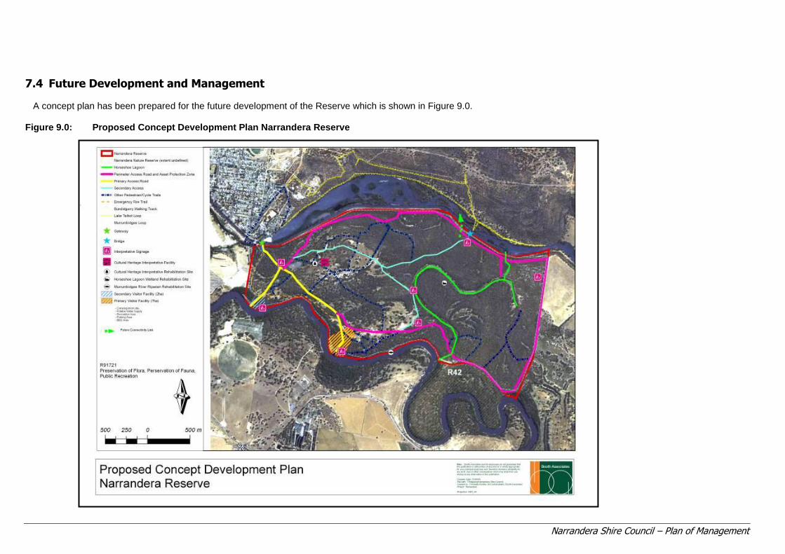
Narrandera Shire Council – Plan of Management
7.4 Future Development and Management A concept plan has been prepared for the future development of the Reserve which is shown in Figure 9.0.
Figure 9.0: Proposed Concept Development Plan Narrandera Reserve

Page 65 of 70
Narrandera Shire Council – Plan of Management
7.5 Monitoring and Adaptive Management This POM has found that the area known as the Narrandera „Common‟ has significant values
and attributes which should be protected and optimised. Therefore it is important that Council recognise that they are required to undertake regular monitoring to ensure that the condition of the Reserve and its assets are not degraded and that the proposed strategies, actions and works that Council does in relation to the site does not impact on the long term objectives.
Issues may emerge into the future which may mean that adaptive management practices may need to be implemented.
Council to consider developing a monitoring, review and evaluation plan.

Page 66 of 70
Narrandera Shire Council – Plan of Management
8.0 CONCLUSION AND RECOMMENDATIONS
The conclusions are: 1. The Narrandera Reserve is in a poor to moderate ecological condition that has resulted from a
history of anthropogenic impact, notably river regulation and grazing.
2. The Reserve contains significant values and attributes which should be protected and enhanced, including a viable local Koala population.
3. The Reserve offers a range of opportunities which can be promoted for the benefit of the local and wider community. These opportunities relate to the significant ecological, social, cultural, scientific and educational values of the Reserve, its important riparian and ecological assets and attributes and its position within the landscape.
4. There are a range of issues which impact on the condition and sustainability of the Reserve, including:
Access;
Fire Hazard;
Pests;
Weeds ;
Land Use Options;
Grazing;
Cultural Heritage;
Surface and Groundwater Management;
Vegetation Conservation and Management;
Core Koala Habitat;
Tourism, Promotion and Branding;
Local and Visitor Use; and
Strategic Planning.
5. Council as trustee of the land has an obligation to manage the land for its long term sustainability
and for the benefit of existing and future generations. This requires adoption of the „precautionary principle‟ in Reserve decision-making.
6. Development should only occur on the Reserve when it does not compromise the core values of the Reserve and its important environmental attributes and assets and is in keeping with the amenity of the place.
7. Council should take a strategic view to the management and development of the Reserve and develop a master plan for the staged development and rehabilitation of the site.
8. Council should through SOE reporting, monitor the ecological attributes on site and the rehabilitation and development works programme implemented in relation to site ecological condition.

Page 67 of 70
Narrandera Shire Council – Plan of Management
It is recommended that: 1. Council manage and invest in the long term sustainability of the site for the benefit of the
Narrandera community and future generations.
2. Council refer the draft POM, in its current form to key stakeholders, to ensure that the draft plan adequately represents and addresses their issues and concerns.
3. Council place the draft plan on public exhibition and the plan finalised, taking into account any submissions made.
4. Following adoption of the POM by the Department of Primary Industries - Lands, Council adopt the policies specified in the draft POM and implement the works schedule within a 5 to 10 year implementation period.

Page 68 of 70
Narrandera Shire Council – Plan of Management
9.0 REFERENCES
ANZECC 1992, Australian water quality guidelines for fresh and marine waters, Australian and New Zealand Environment and Conservation Council, Canberra. Briggs, SV, Thornton, SA&Lawler, WG, 1994a, Management of red gum wetlands for waterbirds, National Parks and Wildlife Service, Lyneham, ACT. Briggs, SV, Thornton, SA & Lawler, WG, 1994b, Relationship between hydrological control of red gum wetlands and waterbirds. 1. Breeding. In SV Briggs, S. A. Thornton and W.G. Lawler (ed.) Management of Red Gum Wetlands for Waterbirds, National Parks and Wildlife Service, Lyneham, Act, www.rzsnsw.org.au/publications/AZ31-1/AZ 31-1_Briggs_Thronton_187-197.pdaccessed 25 September, 2009. Bowmer, Kathleen H, Agriculture for the australian environment-learning from existing practice. Reflections on developing a water sharing plan, www. kathleenbowmer.com.au/pubs/fenner030531.htm?print=1,accessed 10 September, 2009. Department of Land and Water Conservation, 2001, Integrated monitoring of environmental flows, adding value to the natural assets of New South Wales, State Summary Report 1998/1999, New South Wales Department of Land and Water Conservation. Jansen, A&Robertson, AK, 2001a, Relationship between livestock management and the ecological condition of riparian habitats along and Australian floodplain river. Journal of Applied Ecology, 38, pp. 63-75. Murrumbidgee Catchment Management Board, 2003, Murrumbidgee Catchment Blueprint, Department of Land and Water Conservation, Murrumbidgee Catchment Management Committee, 1994, Natural resource management strategy for the murrumbidgee catchment management committee, Wagga Wagga, NSW. Murrumbidgee Catchment Management Committee, 1998, Murrumbidgeecatchment action plan, Murrumbidgee Catchment Management Committee, Wagga Wagga, NSW. Meeson N., Robertson AI & Jansen A, 2002, The effects of flooding and livestock on post-dispersal seed predation in river red gum habitats. Journal of Applied Ecology 39, pp. 247-258. Morton, SR, 1990, The impact of European settlement on the vertebrate animals of arid Australia; a conceptual model,Proceedings of Ecological Society of Australia 16, pp, 201-213. NationalLand and Water Resources Audit, 2000,Australian water resources assessment http://audit.ea.gov.au/ANRA/water/docs/national/Water_Quality.html, accessed 30 June, 2003. New South Wales Government, 1996, New South Wales Wetlands Management Policy. New South Wales Department of Primary Industries,Understanding weed management in NSW, www.dpi.nsw.gov.au/_data/assets/pdf_fild/0005/272093/understanding-weed-management-in-nsw.pdf, accessed 10 September, 2009. New South Wales Department of Primary Industries, Forests, New South Wales Ecologically Sustainable Forest Management, Plan ecologically sustainable forest management riverina region, 2008. Olive, LJ, Olley, JM, Murray, AS and Wallbrink, PJ, 1994, Spatial variation in suspended sediment transport in the Murrumbidgee River, NSW, Australia, IAHS Publication,pp. 224, 241-250.
Page 69 of 70
Narrandera Shire Council – Plan of Management
Olley, JM, 1995, Sources of suspended sediment and phosphorus in the MurrumbidgeeRiver, CSIRO, Division of Water Resources. Page, KJ& Nanson, GC, 1996, Chronology of murrumbidgee river, palaeochannels on the riverine plain, south eastern Australia, Journal of Quaternary Science, 11 (4), pp. 311-326. Page, Ken, Read, Arthur, Frazier, Paul, Mount, Nick (nd) “The effect of altered flow regime on the frequency and duration of bankfull discharge: Murrumbidgee River, Australia”. Robertson, AI, & Rowling, RW, 2000, Effects of livestock on riparian zone vegetation in an Australian dryland river,Regulated Rivers-Research & Management 16(5), pp. 527-541. Robertson, 1999, Regulated rivers, research and management, Volume 21, Issue 5, pp. 567-578, accessed 25 September, 2009. Rowe, M, Department of land and water conservation, Current status of native vegetation in the riverina.www.csu.edu.au/herbarium/riverina/chapters/chapter1.pdf, accessed 10 September 2009. Sainty, GR & Jacobs, SWL, Water Plants in Australia, Sainty and Associates, Sydney 2003. Spencer, C, Robertson AI, & Curtis, A, 1998, Development and testing of a rapid appraisal wetland condition index in south eastern Australia, Journal of Environmental Management, 54, pp. 143-159. Sturt, C, 1833. Two expeditions into the interior of southern Australian during the years 1828, 1829, 1830 and 1831,Maryborough, Victoria, Hedges and Bell. Frazier, P &Page K, 2006, The effect of river regulation on floodplain wetland inundation, Murrumbidgee River, Australia, Marine and Freshwater Research 57, pp.133-141. Page, K, Read , A, Frazier, P & Mount , N, 2005, “The effect of altered flow regime on the frequency and duration of bankfull discharge: Murrumbidgee River, Australia, River Research and Applications, Volume 21, Issue 6, pp. 567-578. Davies, P, Harris, J, Hillman, T, & Walter, K, 2008, Sustainable rivers audit, A report on the ecological health of rivers in the Murray-Darling basin, 2004-2007, Report 1, MDBC.

Page 70 of 70
Narrandera Shire Council – Plan of Management
10.0 BIBLIOGRAPHY
Weatherzone.com.au. National Parks and Wildlife Service Atlas of New South Wales. DECCW Threatened Species database. EPBC Protected Matters Search Tool. National Parks and Wildlife Service Data Map 2304 2009. Threatened Species Biodiversity Survey and Assessment Guidelines DECCW.