picacho solar facility application for a comprehensive ...€¦ · power import to assist arizona...
TRANSCRIPT
Picacho Solar Facility
Application for a
Comprehensive Plan Amendment in an
Unincorporated Area of Pinal County, Arizona
PZ-PA-002-17
Prepared for
Pinal County
Submitted by
Prepared by
2017
1
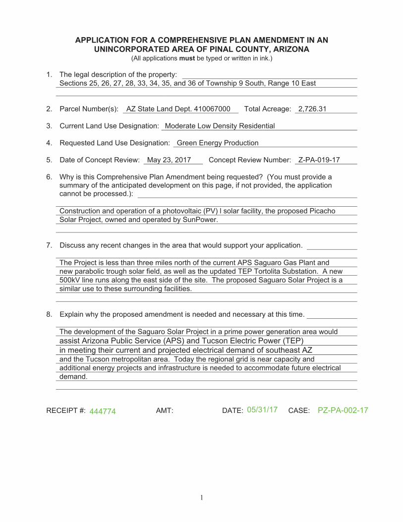
APPLICATION FOR A COMPREHENSIVE PLAN AMENDMENT IN AN UNINCORPORATED AREA OF PINAL COUNTY, ARIZONA
must
PZ-PA-002-1705/31/17444774
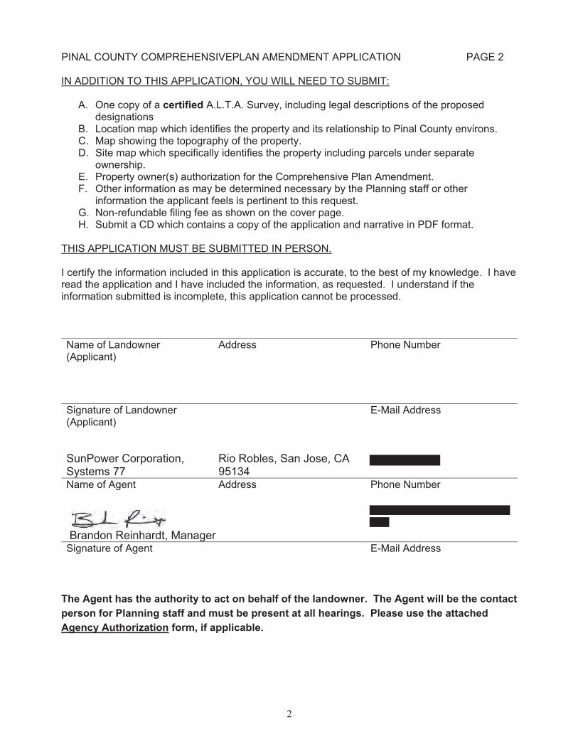
2
certified
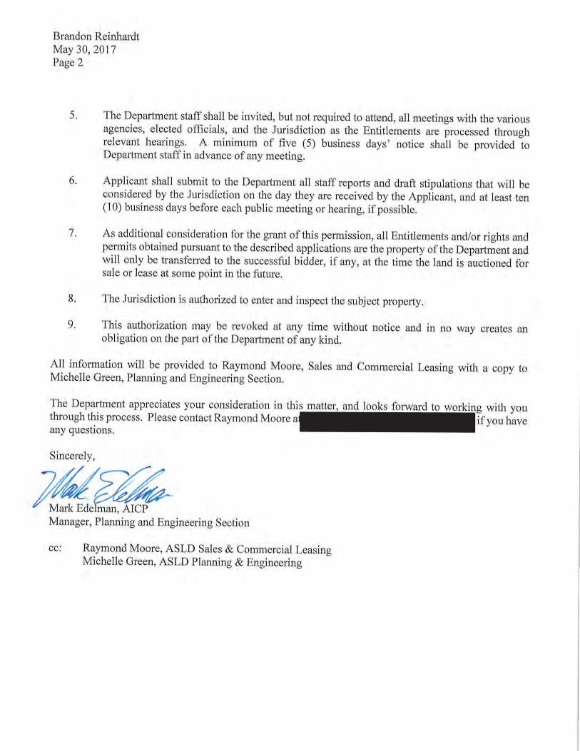
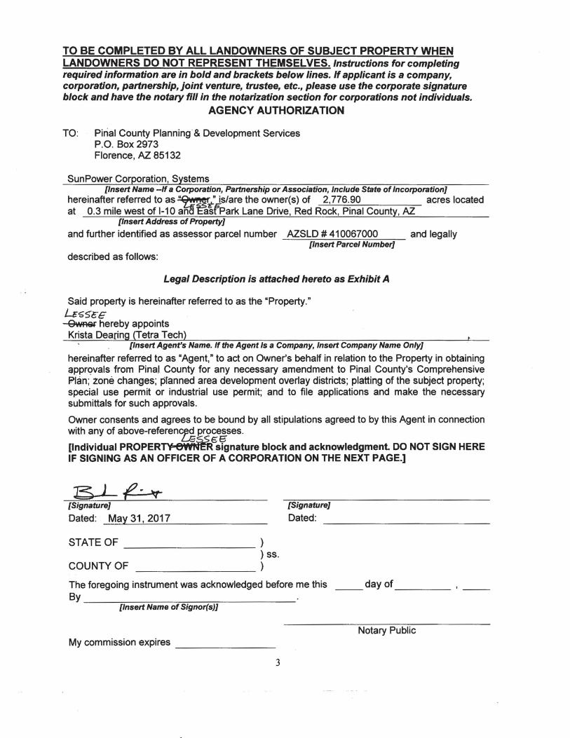
The Agent has the authority to act on behalf of the landowner. The Agent will be the contact
person for Planning staff and must be present at all hearings. Please use the attached
Agency Authorization form, if applicable.
3
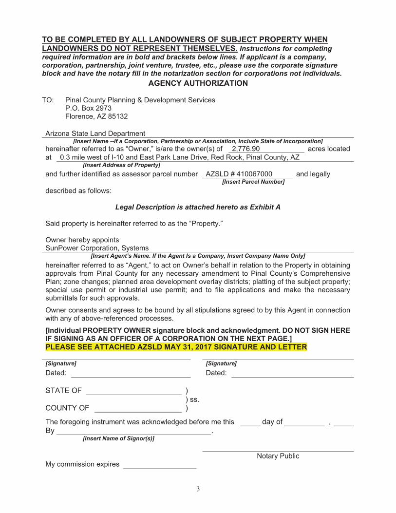
TO BE COMPLETED BY ALL LANDOWNERS OF SUBJECT PROPERTY WHEN LANDOWNERS DO NOT REPRESENT THEMSELVES.
AGENCY AUTHORIZATION
[Individual PROPERTY OWNER signature block and acknowledgment. DO NOT SIGN HERE IF SIGNING AS AN OFFICER OF A CORPORATION ON THE NEXT PAGE.]
PLEASE SEE ATTACHED AZSLD MAY 31, 2017 SIGNATURE AND LETTER
Picacho Solar Facility
Application for a
Major Comprehensive Plan Amendment
To Allow a Photovoltaic Power Generation Facility
Z-PA-002-17
Prepared for
Pinal County
Submitted by
Prepared by
May 31, 2017
(Revised June 8 & 30, July 12, and August 15, 2017)
SunPower Corp. iii Tetra Tech, Inc. Major Comprehensive Plan Amendment May 31, 2017
TABLE OF CONTENTS
1.0 Executive Summary ............................................................................................................... 1
1.1 Proposed Land Use ........................................................................................................1
1.2 Location AND Accessibility ..........................................................................................1
1.3 Site Suitability ................................................................................................................2
1.4 Public Services/Utilities .................................................................................................2
2.0 Project Narrative .................................................................................................................... 3
2.1 Introduction ....................................................................................................................3
2.2 Physical Setting, Existing Uses, and Relationship to Surrounding Land Uses .............4
3.0 Comprehensive Plan Amendment Criteria ............................................................................ 6
3.1 Consistency with Pinal County’s Vision Components ..................................................6
Sense of Community ..................................................................................................... 6
Mobility and Connectivity ............................................................................................ 6
Economic Sustainability ............................................................................................... 6
Open Spaces and Places ................................................................................................ 7
Environmental Stewardship .......................................................................................... 7
Happy, Healthy Residents ............................................................................................. 8
3.2 Consistency with the Plan’s Key Concepts Illustrated on Land Use, Economic, and
Circulation Graphics ...............................................................................................................8
Consistency with the Land Use Designation Shown on the Graphics .......................... 8
Consistency with the Mixed Use Activity Center Concept .......................................... 8
Consistency with the Planning Guidelines Described in the Land Use Element ......... 8
Quality Employment Opportunities County-Wide ....................................................... 9
Viable Agriculture, Equestrian and Rural Lifestyle ..................................................... 9
System of Connected Trails and Preservation of Open Space ...................................... 9
Natural Resource Conservation .................................................................................. 10
Wetland Resources...................................................................................................... 13
Water Resources, Public Facilities/Services, and Infrastructure Support................... 13
4.0 References ............................................................................................................................ 15
LIST OF TABLES
Table 1. Listed Species Act that May Occur in the Project Area ..........................................11
LIST OF FIGURES
Figure 1. Proposed Project Parcels
Figure 2. Existing Land Use
Figure 3. Proposed Land Use
Figure 4. Future Land Use
Figure 5. Wetlands Map and Wildlife Corridor Map

iv
LIST OF APPENDICES
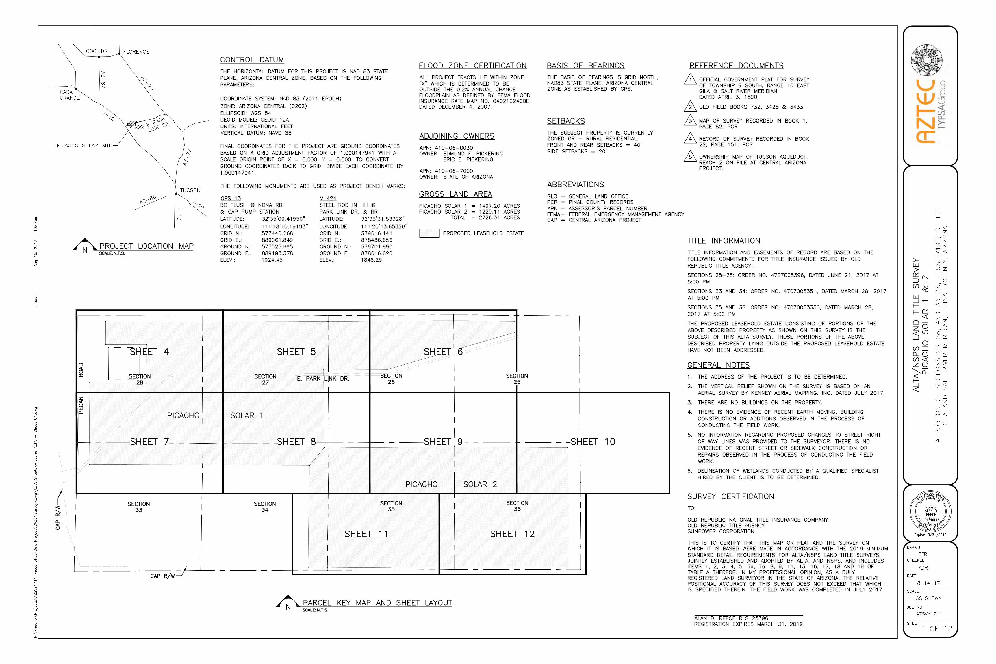
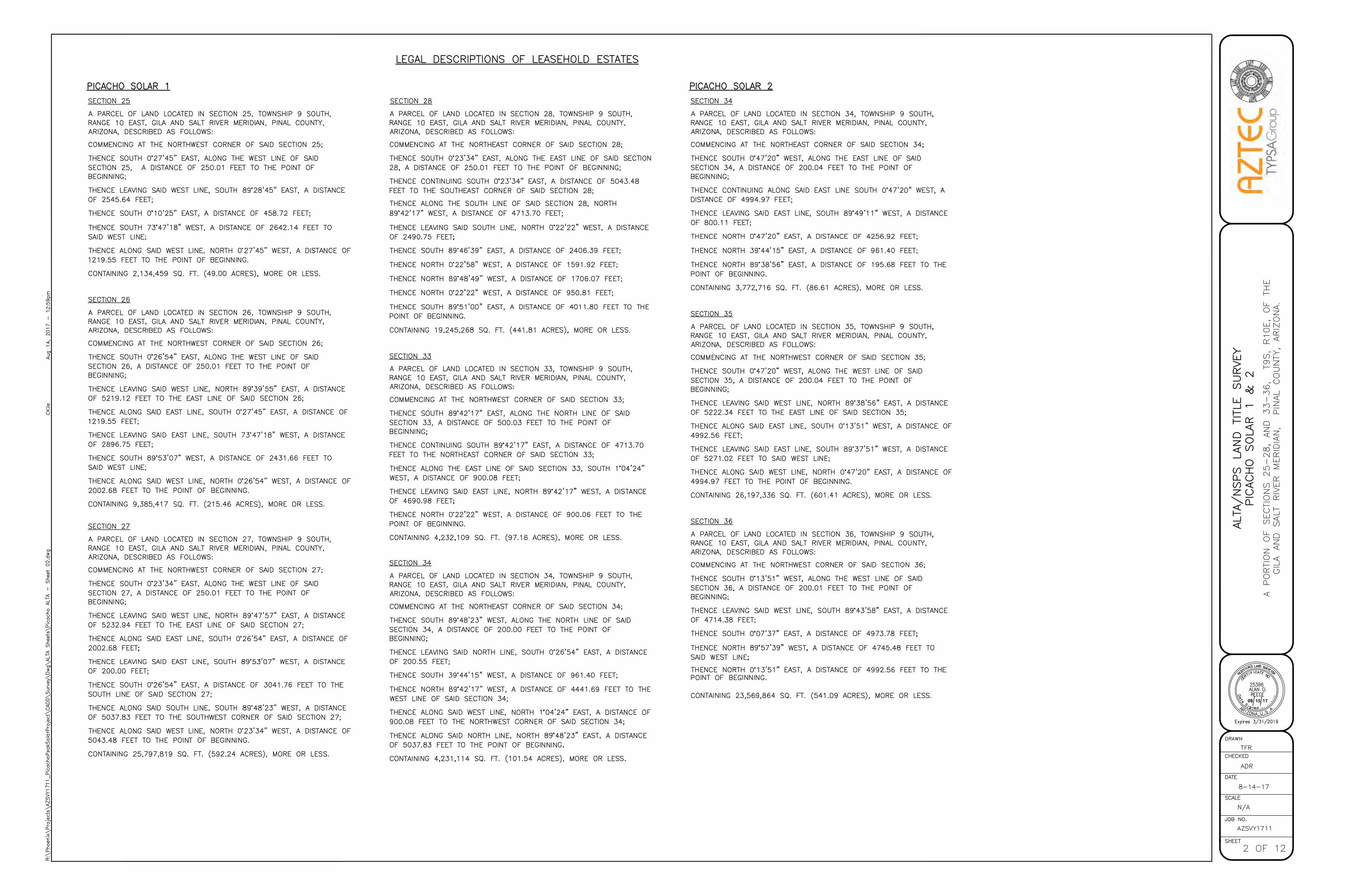
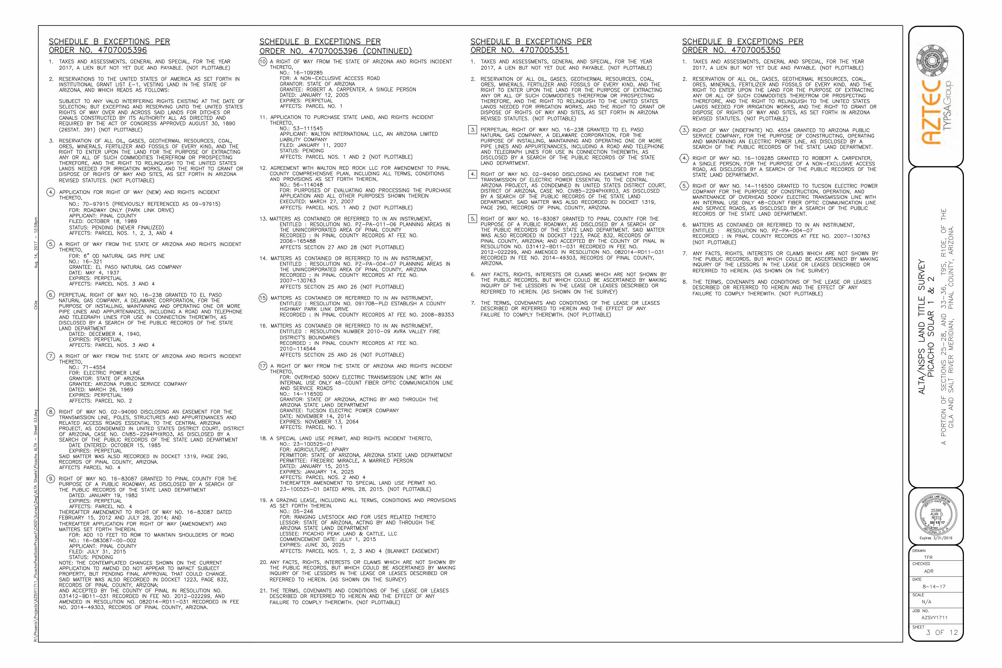
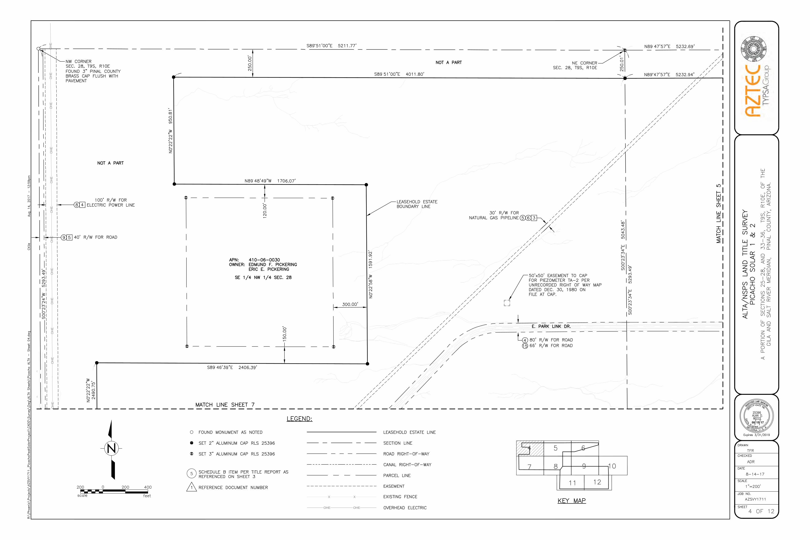
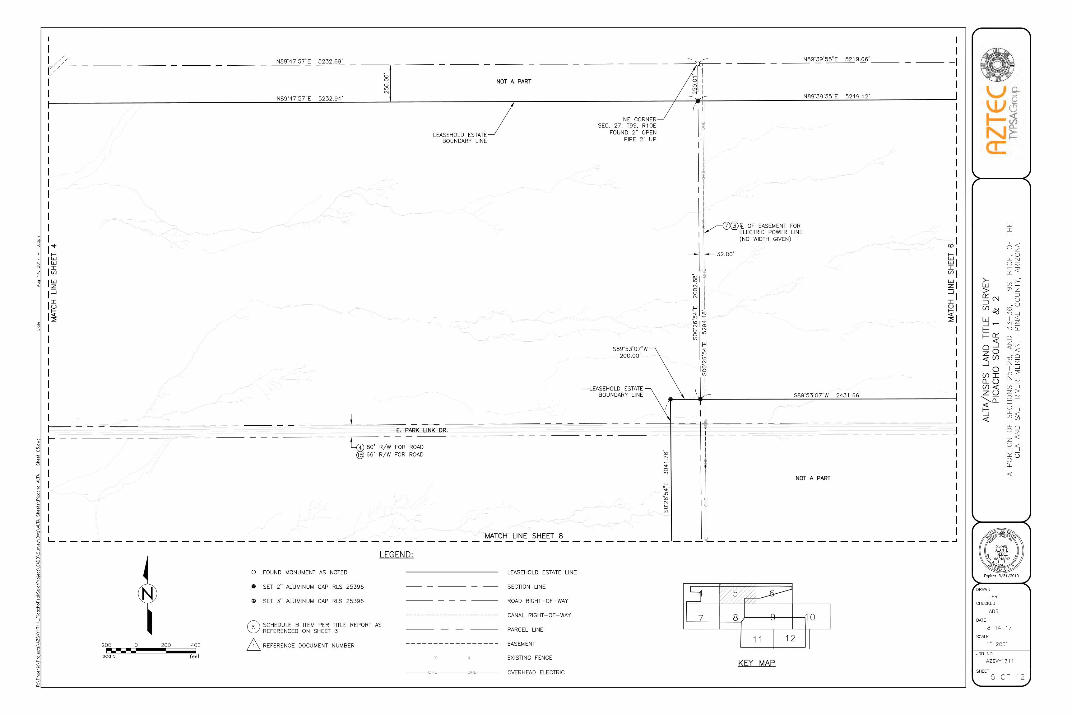
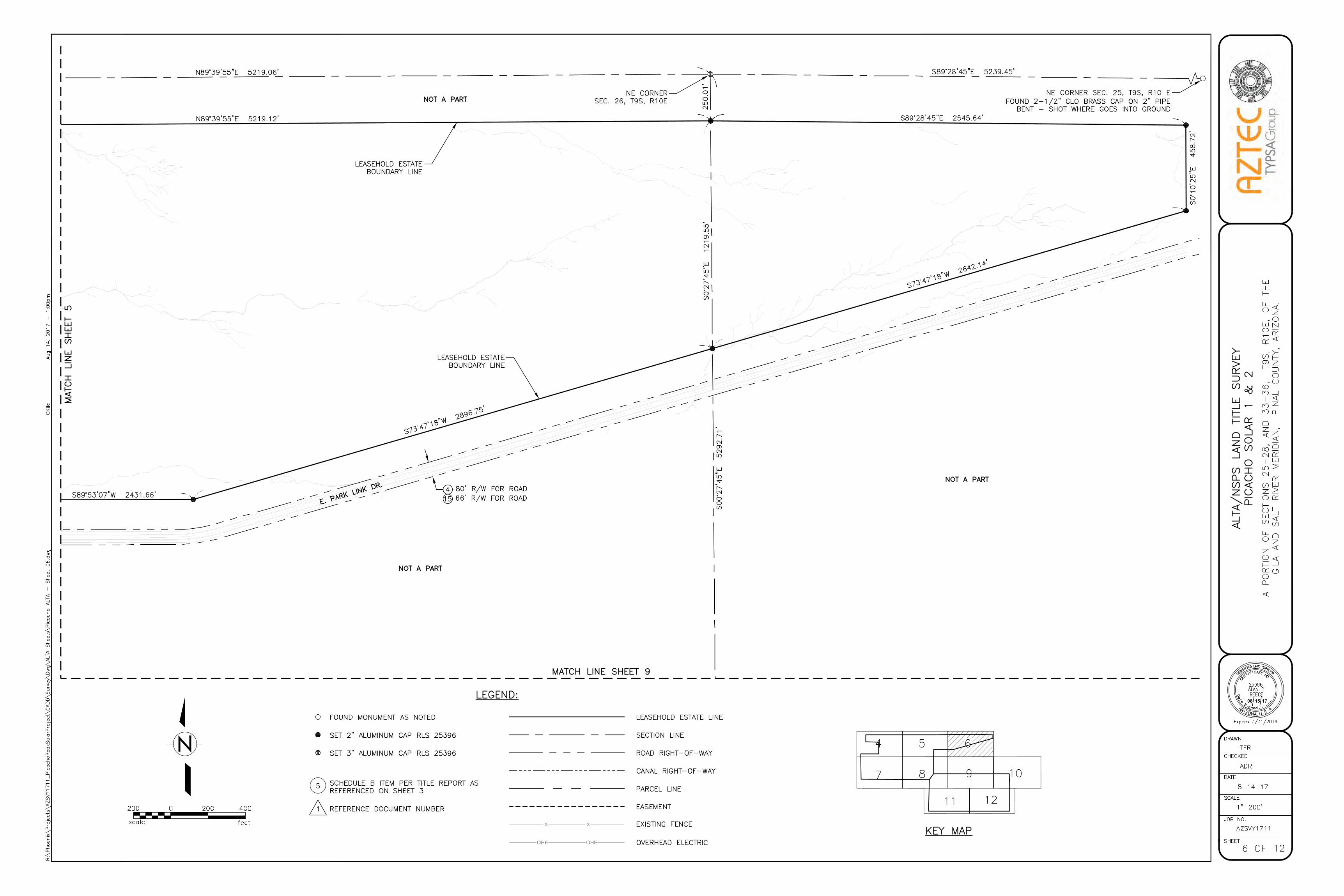
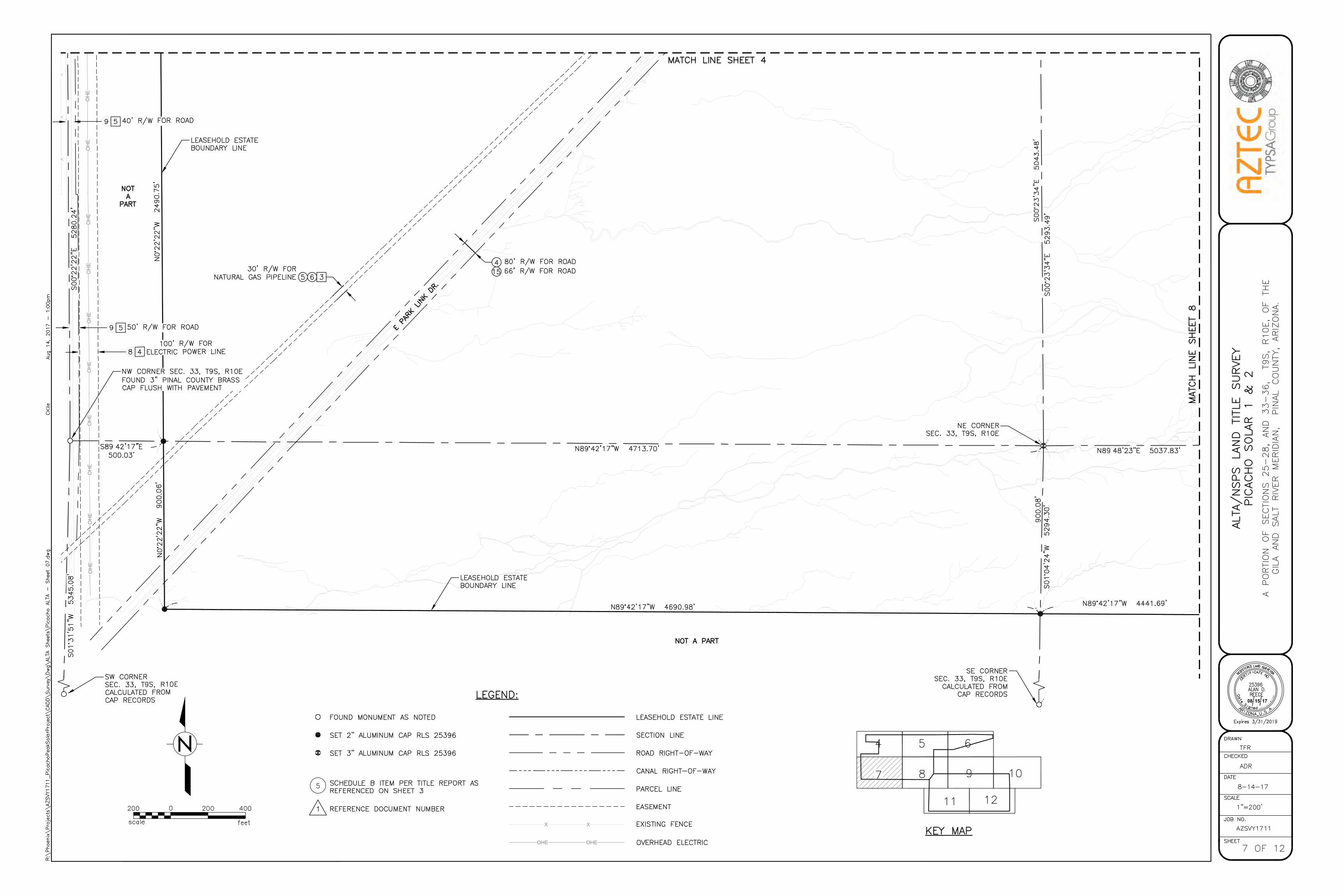
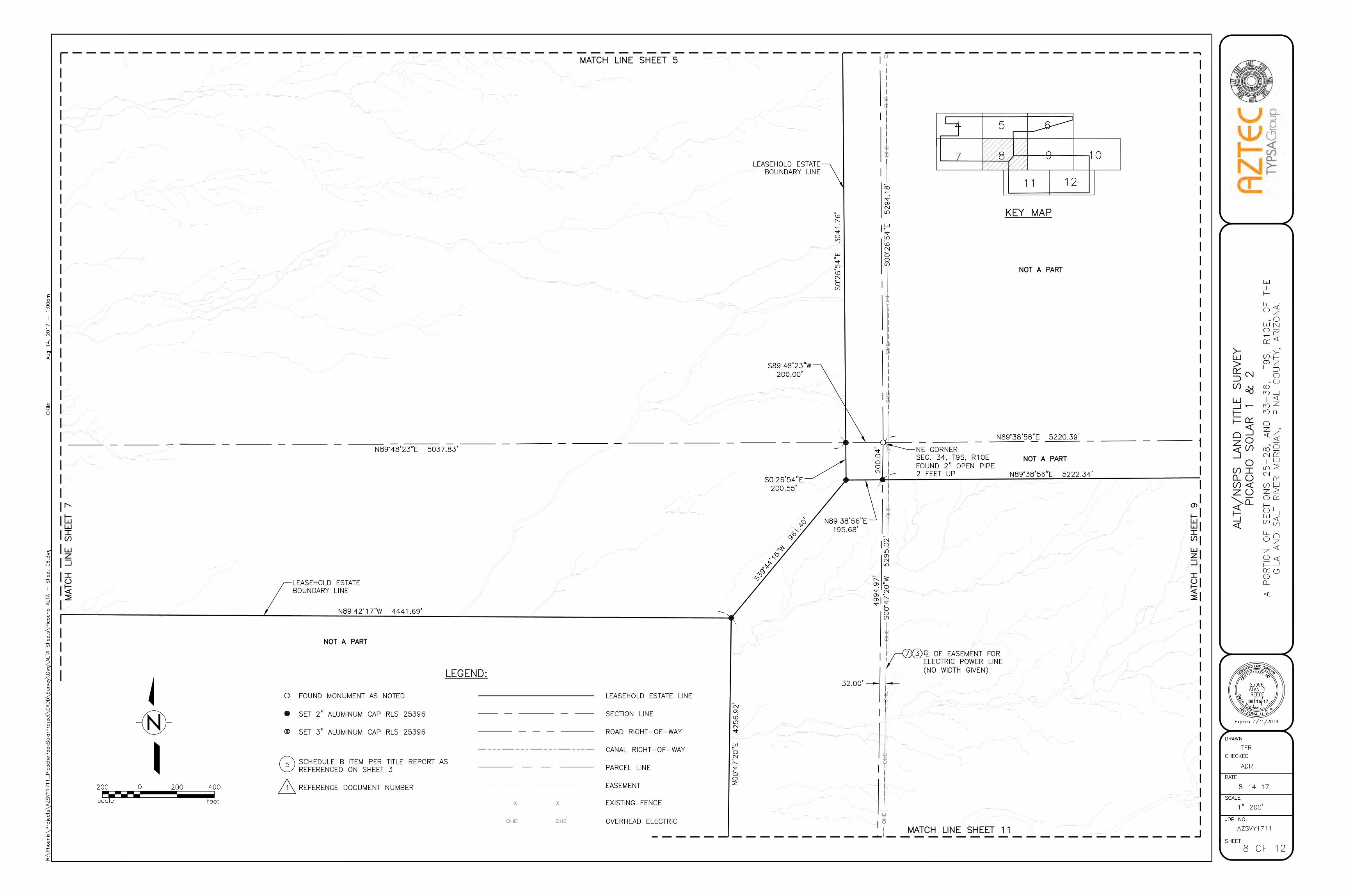
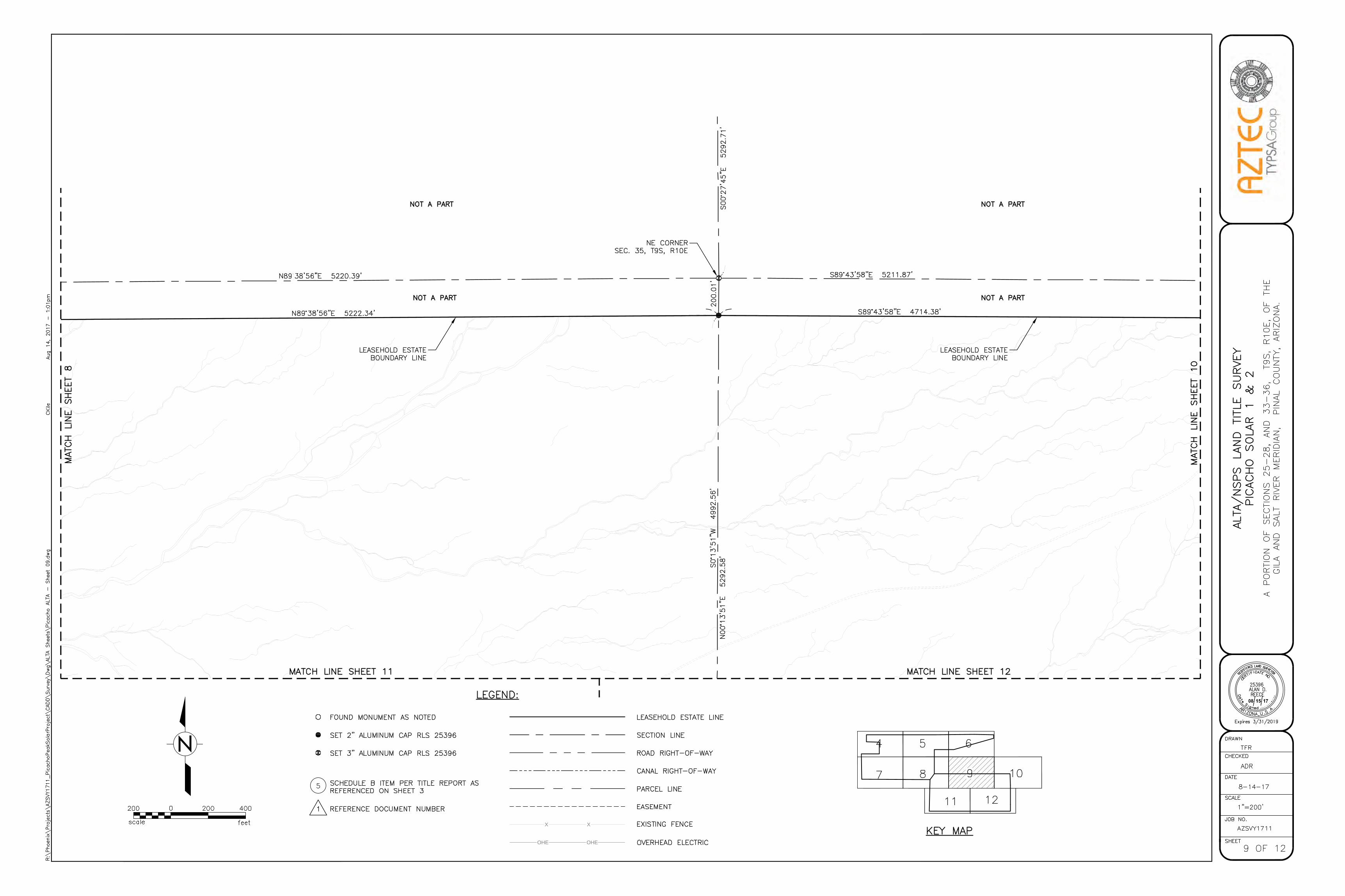
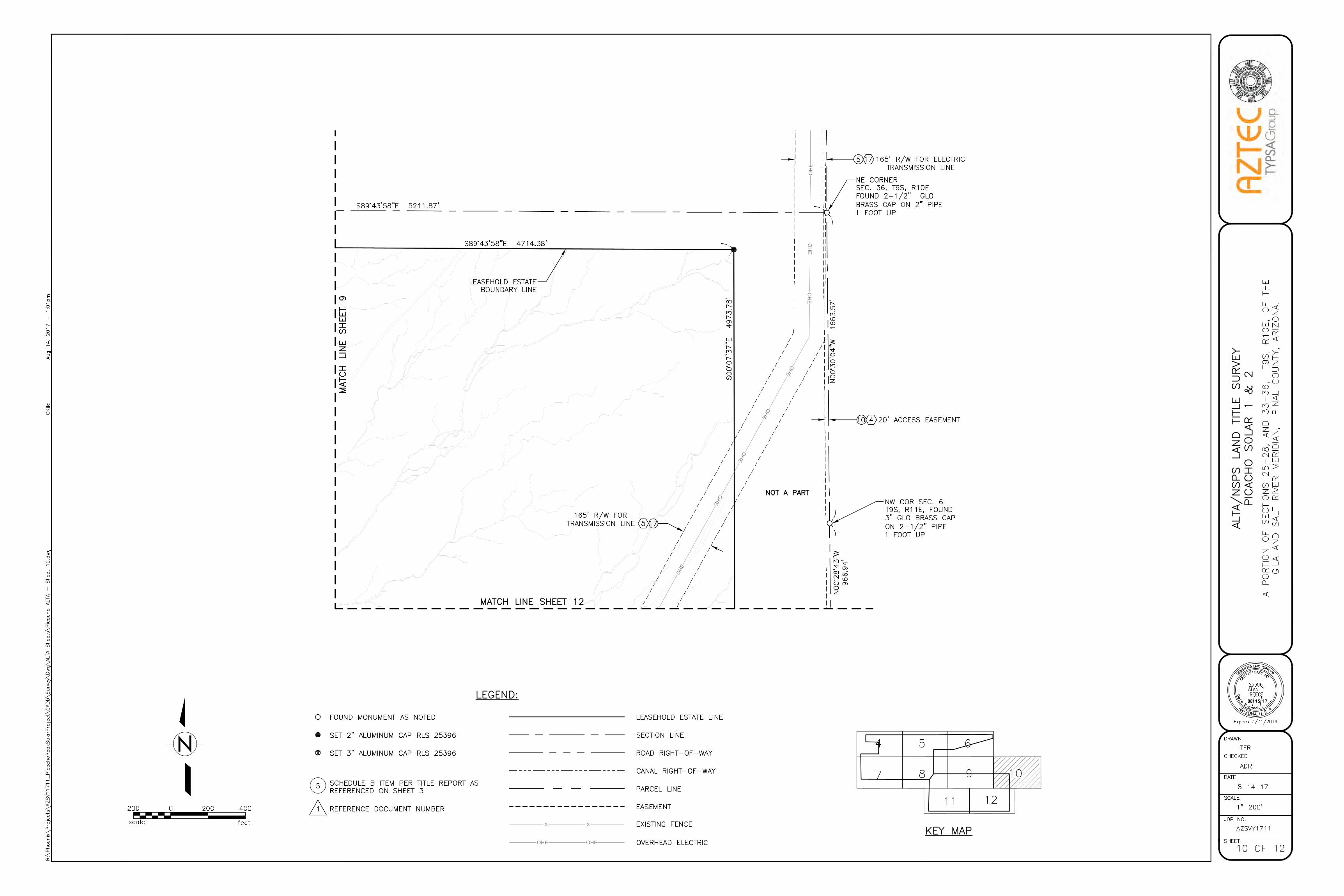
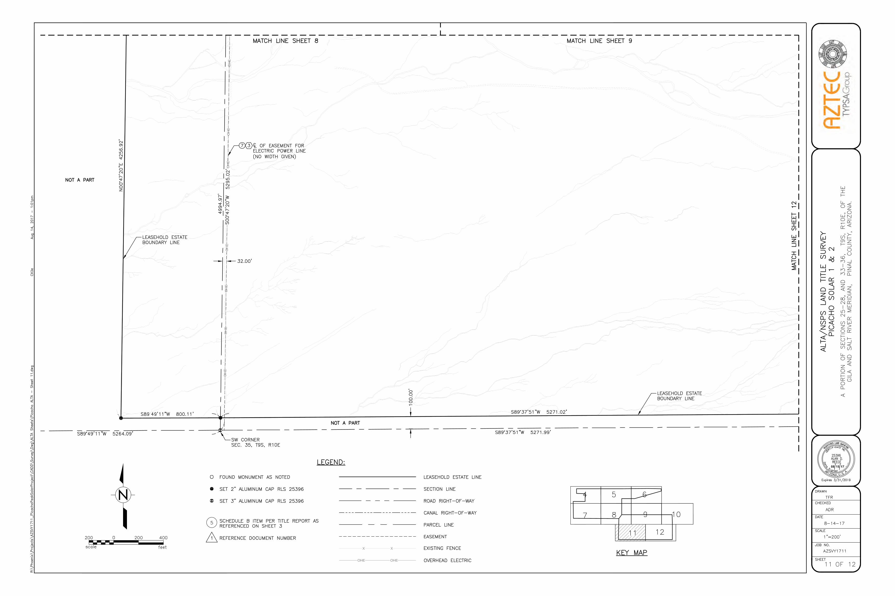
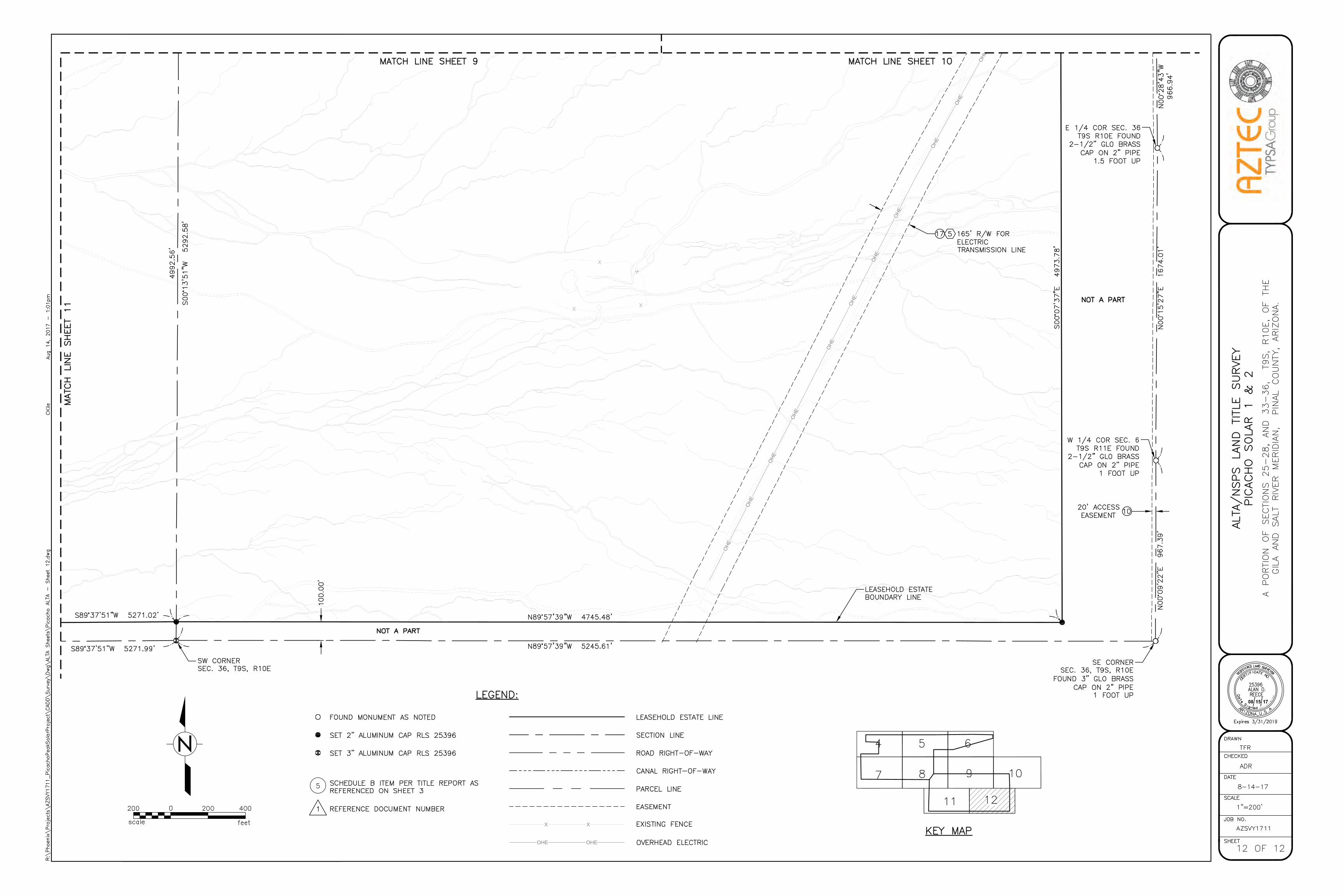
Appendix A. ALTA Survey
Appendix B. Photographs and Energy Flow Diagram of a Typical PV Solar Facility
SunPower Corp. 1 Tetra Tech, Inc. Major Comprehensive Plan Amendment May 31, 2017
1.0 EXECUTIVE SUMMARY
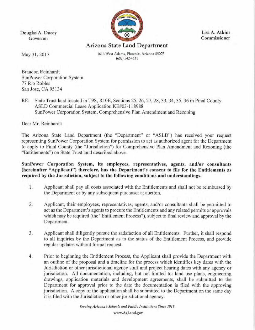
SunPower Corporation, Systems (SunPower) is requesting an amendment to the 2009 Pinal County
Comprehensive Plan (Comprehensive Plan, or Plan) in order to construct and operate the proposed
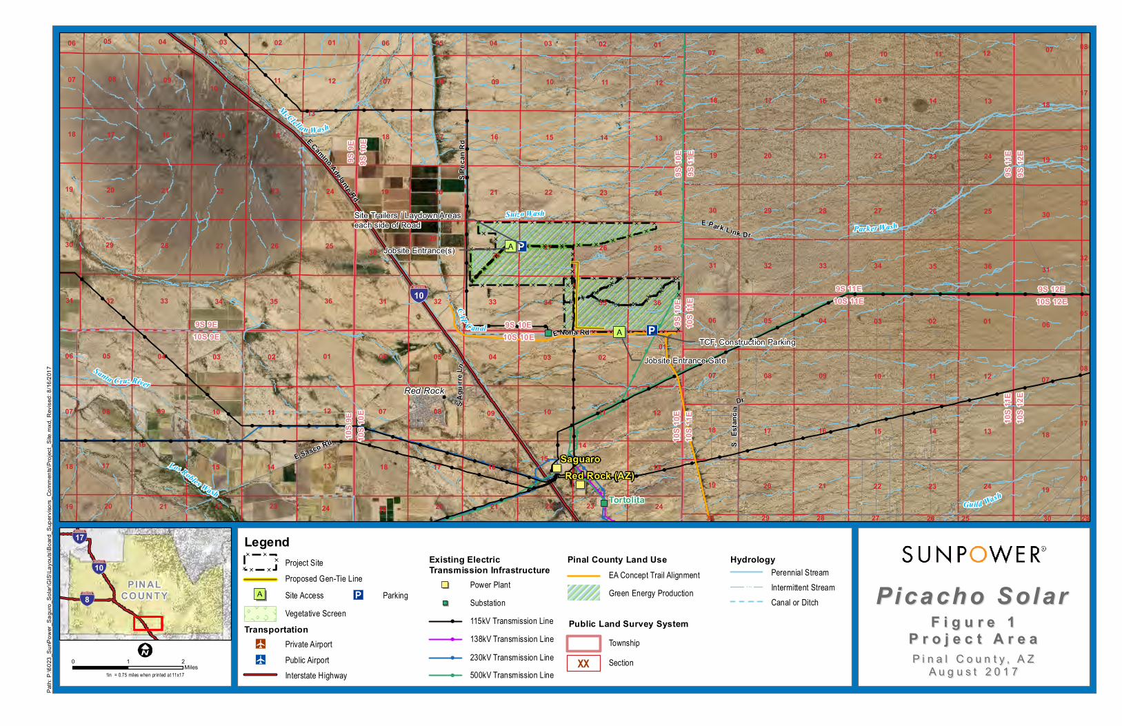
Picacho photovoltaic (PV) solar facility (Project) on approximately 2,726.31 acres of vacant land
managed by the Arizona State Land Department (ASLD) (Figure 1). The Project site is located
on parts or all of Sections 25, 26, 27, 28, 33, 34, 35, and 36 of Township 9 South, Range 10 East
with Parcel Number 410067000 (Appendix A).
The proposed Project will include a PV field with an expected electrical output of 400 megawatts
(MW). The Project will require generation intertie (gen-tie) transmission lines and additional
infrastructure including battery storage.
Paved rural roads provide access to the site and adjacent properties. East Park Link Drive divides
the site while East Mona Road runs along the south side of the site. Interstate 10 (I-10) is located
approximately 0.3 mile west of the site.
The amendment is needed to change the Comprehensive Plan land use designation for the site from
Moderate Low Density Residential to Green Energy Production Services for the Project site.
Subsequently, granting a zoning district change from General Rural (GR) to Industrial (I-3) would
allow development of the Picacho facility in a prime power generation area, which would provide
power import to assist Arizona Public Service (APS) and Tucson Electric Power (TEP) in meeting
their current and projected electrical demand of southeast Arizona and the Tucson metropolitan
area. Because the regional grid has been operating at near capacity, additional infrastructure is
needed to accommodate future electrical demand.
The Project will tie into the grid as early as 2020, and 2 to 4 years are expected to be needed for
the scheduling, planning, design, and construction of the facility in several phases of build-out.
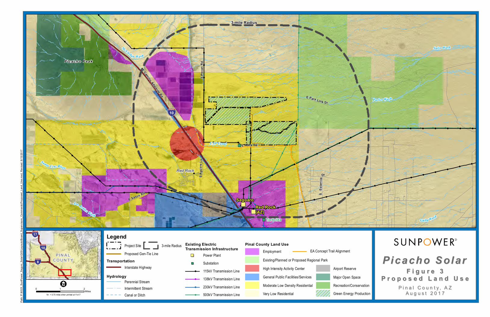
1.1 PROPOSED LAND USE
The Project site and land surrounding the Project site are currently designated as Moderate Low
Density Residential. This application for proposed amendment is requested to change the land
designation from Moderate Low Density Residential (Figure 3) to Green Energy Production
(Figure 4). The land use change would be consistent with supporting public utility infrastructure
and energy uses including the APS Saguaro and TEP Tortolita Substations south of the Project
site, and high-voltage transmission lines located near the eastern boundary of the site.
1.2 LOCATION AND ACCESSIBILITY
The Project site is located in the Sonoran Desert in west-central Pinal County (also referred to
herein as “the County”) approximately 32 miles northwest of Tucson. The site consists of
relatively flat, undeveloped Arizona State Trust land that is administered by the ASLD (Appendix
A).
SunPower Corp. 2 Tetra Tech, Inc. Major Comprehensive Plan Amendment May 31, 2017
The Project site can be accessed from the I-10 frontage road via East Park Link Drive and East
Mona Road. I-10 and the Union Pacific Railroad are located approximately 0.3 mile to the
southwest of the site.
1.3 SITE SUITABILITY
Both the Project site and the region are well suited for the proposed changes to the Comprehensive
Plan. The primary criteria for determining the location of the power generation facilities include
the existence of compatible adjacent and nearby land uses, minimal topographic variability, and
the proximity to existing electrical infrastructure, major transportation corridors, utility corridors,
and electrical load centers.
1.4 PUBLIC SERVICES/UTILITIES
There are numerous electrical distribution lines, communication cables, and canals within the
vicinity of the site (Figure 1). The Project site is less than 3 miles north of the current APS Saguaro
Gas and Solar Power Plant and the TEP Tortolita Substation adjacent to the east side of I-10 and
Union Pacific rail facilities. Immediately east of the site is a 500-kV transmission line.
SunPower Corp. 3 Tetra Tech, Inc. Major Comprehensive Plan Amendment May 31, 2017
2.0 PROJECT NARRATIVE
2.1 INTRODUCTION
This narrative report provides the required information to support the request for a Major
Comprehensive Plan Amendment (MCPA) for the Project located in west-central Pinal County.
SunPower is requesting this amendment in order to construct and operate a solar power generating
facility on the Project site. The proposed Project is expected to include a PV solar field with an
expected electrical output of up to 400 MW. The Project will also require gen-tie transmission
lines and additional project infrastructure including battery storage.
Should the MCPA receive approval from Pinal County, SunPower will apply for a zoning change
from the Project site’s current GR zoning district to an Industrial (I-3) zoning district in order to
allow for the development and operation of the solar generating facility.
Transmission lines of 115 kilovolts (kV) or greater are subject to Arizona’s Power Plant and
Transmission Line Siting Law, codified in Title 14, Chapter 3, Article 2 (R14-3-219) of the
Arizona Revised Statutes (ARS) §40-360 et seq. An Arizona Corporation Commission (ACC)
Certificate of Environmental Compatibility (CEC) will be required to allow construction and
operation of Project because the proposed gen-tie lines connecting the solar facility to the existing
substation will be greater than 115 kV. All required environmental studies and public scoping
activities for the proposed Project will be incorporated into a CEC application pursuant to the
requirements of ARS §40-360 et seq.
Consistency with the Comprehensive Plan will be necessary in order for ACC to grant the CEC.
Completing Pinal County’s Comprehensive Plan Amendment process ensures Pinal County’s
authority and opportunity for review prior to the CEC process. The public scoping process
conducted as part of the Pinal County zoning district change application process will supplement
the CEC public involvement requirements.
Changing the Comprehensive Plan land use designation for the site from Moderate Low Density
Residential to Green Energy Projection for the Project site, and subsequently granting a zoning
district change from GR to I-3, would allow development of the Picacho facility in a prime power
generation area, which would provide power import to assist APS and TEP in meeting their current
and projected electrical demand of southeast Arizona and the Tucson metropolitan area. The
regional grid has been operating at near capacity, and additional infrastructure is needed to
accommodate future electrical demand.
Both the Project site and the region are well suited for the proposed changes to the Comprehensive
Plan. The primary criteria for determining the location of the power generation facilities include
the existence of compatible adjacent and nearby land uses, minimal topographic variability, and
the proximity to existing electrical infrastructure, major transportation corridors, utility corridors,
and electrical load centers.
SunPower Corp. 4 Tetra Tech, Inc. Major Comprehensive Plan Amendment May 31, 2017
The Project site location and layout are provided in Figures 1 through 4. The site is generally level
and located less than 3 miles north of the current APS Saguaro Gas and Solar Power Plant and
TEP Tortolita Substation adjacent to the east side of I-10 and Union Pacific rail facilities.
2.2 PHYSICAL SETTING, EXISTING USES, AND RELATIONSHIP TO
SURROUNDING LAND USES
The Project site is located in the Sonoran Desert in west-central Pinal County approximately 32
miles northwest of Tucson (Figure 1). The site consists of relatively flat, undeveloped Arizona
State Trust land that is administered by the ASLD.
The Project area consists of land managed by the ASLD, the Bureau of Reclamation (BOR), and
private land under the jurisdiction of Pinal County (Figure 2). Major features in the site area
include the Central Arizona Project (CAP) Canal, I-10, Picacho Mountains, Picacho Peak State
Park, Union Pacific Railroad, Saguaro Power Plant, a military training facility, and several existing
transmission lines and local utilities (Figure 1). The area is a mixture of flat agricultural and
desert/scrub land, small mountains (including the Picacho Mountains), and several ephemeral
washes.
The Project site can be accessed from the I-10 frontage road via East Park Link Drive and East
Mona Road. Immediately adjacent to the site in all directions is undeveloped land except for the
CAP Canal that forms the southern and western boundaries of the site (Figures 1 thru 4).
Agricultural areas are located to the north of East Park Link Drive. I-10 and the Union Pacific
Railroad are located approximately 0.3 mile to the southwest of the site. On the west side of I-10
is the unincorporated residential community of Red Rock. Picacho Peak State Park is located
approximately 5 miles northwest of the site. There are no areas designated as Open Space within
the proposed Project site, and the proposed Project would not impact known recreational areas.
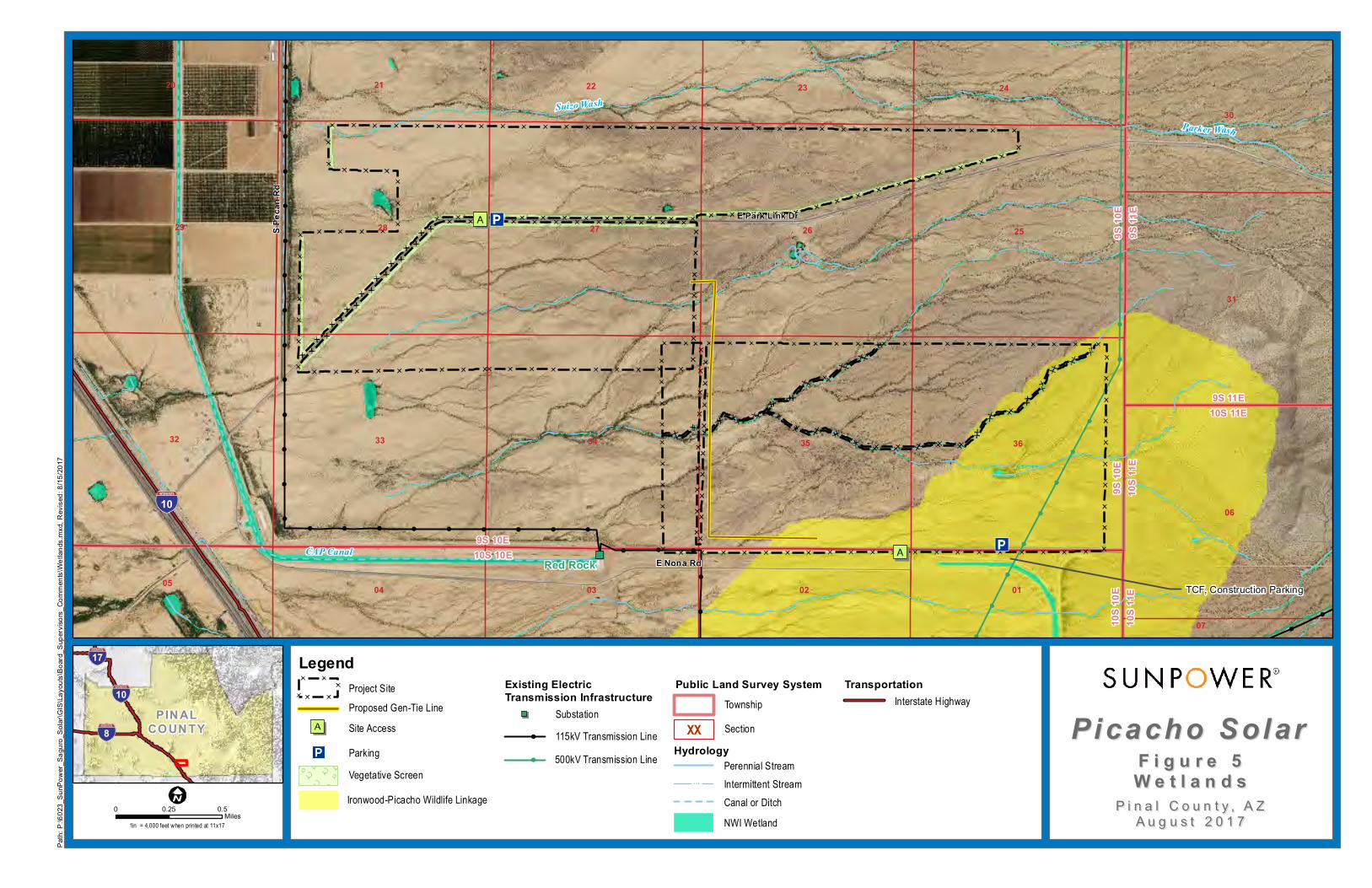
The Ironwood-Picacho Wildlife Linkage crosses the southeastern section of the Property (Figure
5). SunPower will exclude the wildlife linkage area from the Project footprint, and will consult
with Arizona Game & Fish to establish a buffer between the facility and the corridor.
The Project site is located in an area designated by the Comprehensive Plan as Moderate Low
Density Residential. This designation intends to “provide for a larger lot development pattern with
options for suburban residential pattern. Suitability is determined by location access, existing land
use patterns and natural and man-made constraints” (Pinal County 2009). Areas designated as
Moderate Low Density Residential are intended as suburban residential areas with an expected
one to 3.5 dwelling units per acre.
As an alternative to the proposed Picacho site, SunPower evaluated the General Public
Facilities/Services area located south of the community of Red Rock on the west side of I-10 and
the railroad. The alternative site was not selected because of the following reasons related to
spanning the gen-tie line across I-10 and the railroad to tie into the Tortolita Substation:
The lengthy and costly consultation and permitting process required by the Federal
Highway Administration for utility crossings and encroachments on the National Highway
System and/or the Interstate Highway System.

SunPower Corp. 5 Tetra Tech, Inc. Major Comprehensive Plan Amendment May 31, 2017
The fact railroad companies enact their own rules regarding the issuance of permits for
transmission line crossings of railroad tracks while being immune to statutory deadlines to
act on permit requests; SunPower is reluctant to work within a permitting process in which
there is little control over schedule.
The logistics and costs of traffic control on both I-10 and the railroad during construction
and maintenance of the gen-tie line.
SunPower Corp. 6 Tetra Tech, Inc. Major Comprehensive Plan Amendment May 31, 2017
3.0 COMPREHENSIVE PLAN AMENDMENT CRITERIA
The SunPower-proposed amendment request conforms to the goals, objectives, and policies of the
current Comprehensive Plan by meeting the criteria outlined in the Plan’s compliance checklist
(Pinal County 2009, Appendix A). The following sections are written in response to the Plan’s
compliance checklist:
Consistency with Pinal County’s Vision Components, and
Consistency with the Plan’s Key Concepts
3.1 CONSISTENCY WITH PINAL COUNTY’S VISION COMPONENTS
The vison components of the Comprehensive Plan include Sense of Community; Mobility and
Connectivity; Economic Sustainability; Open Spaces and Places; Environmental Stewardship;
Heathy, Happy Residents; and Quality Educational Opportunities.
Sense of Community
Is the proposal consistent with the Sense of Community vision component?
The proposed amendment is consistent with the Sense of Community vision component. The
Project site is located with the Moderate Low Density Residential land use (Pinal County 2009,
Chapter 3). This designation allows medium to high density residential, commercial, and
employment (office and light industrial) land uses. Adjacent parcels to the Project site are vacant
except for the CAP Canal west and south of the site, and a transmission line along the east
boundary of the site that ties into the Saguaro Gas and Solar Power Plant approximately 3 miles
south of the site. The proposed amendment would be consistent with the Sense of Community
vision described in the Plan by consolidating energy facilities in an area that contains similar and
compatible land uses, as well as vacant land.
Mobility and Connectivity
Is the proposal consistent with Mobility and Connectivity vision component?
The proposed amendment is consistent with the Mobility and Connectivity vision component.
Under the goals, objectives, and policies outlined in Chapter 4 of the Plan, the County will evaluate
the transportation impacts of all proposed Plan amendments and rezoning on Pinal County’s
regional transportation system. The proposed Project would have minimal impact on planned land
uses from traffic because the operation of the solar facility will require fewer than six employees.
There would be a temporary increase in traffic volume during the construction phases due to
delivery of equipment and supplies, and commuting construction workers. Existing roads and
railroads are sufficient to accommodate the anticipated construction traffic.
Economic Sustainability
Is the proposal consistent with the Economic Sustainability vision component?
The proposed amendment is consistent with the Economic Sustainability vision component. The
central theme of the Economic Development element of the Comprehensive Plan (Pinal County
SunPower Corp. 7 Tetra Tech, Inc. Major Comprehensive Plan Amendment May 31, 2017
2009, Chapter 5) focuses on the County’s ability to provide quality employment opportunities for
its residents by setting specific goals, objectives, and policies. Two main goals that address this
vision are:
1. Encourage a full range of quality jobs for County residents, and increase the jobs per capita
ratio.
2. Encourage sustainable development consistent with the County’s environmental
preservation philosophy.
The SunPower proposed amendment would promote economic diversity and employment
opportunities in the area by providing direct and indirect employment during the construction and
operation of the proposed Project. Additionally, power generated by the proposed facility could
potentially support residential growth and job creation by providing clean, safe, affordable,
efficient, and sustainable electricity to local communities and the region.
Open Spaces and Places
Is the proposal consistent with the Open Spaces and Places vision component?
The proposed amendment is consistent with the Open Spaces and Places vision component. The
purpose of the Comprehensive Plan Open Spaces and Places (Pinal County 2009, Chapter 6) is to
promote the County’s quality of life by providing passive and active recreational opportunities,
conserving existing natural and cultural resources for the benefit of present future generations.
There are no existing dedicated open spaces or recreational opportunities with the Project area.
However, the Comprehensive Plan and Pinal County Open Space and Trails Master Plan (LSD
2007) (also referred to herein as “Master Plan”) indicate that the BOR intends to include a 10-foot-
wide paved, non-motorized path adjacent to the CAP Canal located on the west and south boundary
of the Project site. The proposed amendment is not expected to conflict with the proposed BOR
trail, and would not be in conflict with the planned land use. During site development, SunPower
would coordinate with the BOR to ensure that SunPower complies with all required setbacks from
the canal. If necessary after discussions with the BOR, SunPower would also incorporate
construction mitigation measures to ensure that construction activities do not interfere with the
operation of the canal or visitor experience along the proposed pedestrian path.
Environmental Stewardship
Is the proposal consistent with the Environmental Stewardship vision component?
The proposed amendment is consistent with the Environmental Stewardship vision component.
Having developed other solar projects in Pinal County, SunPower takes pride in incorporating
environmental stewardship and conservation practices throughout the construction and operation
phases of their projects and is committed to minimizing impacts to natural and cultural resources
resulting from the proposed Project. SunPower places a high priority on intergovernmental and
interagency communication and cooperation, and will develop the proposed Project in compliance
with all county, state, and federal laws, regulations, and guidelines.
Solar energy generation conserves natural resources and minimizes water use. The conversion of
open-range grazing to solar power generation protect the xeroriparian habitat lining the washes on
SunPower Corp. 8 Tetra Tech, Inc. Major Comprehensive Plan Amendment May 31, 2017
the Property site from over-grazing, and would reduce water use. The proposed PV panels will be
cleaned using SunPower’s panel cleaning robot that uses 75-percent less water than manual
cleaning methods. The robotic cleaning method uses approximately ¼ cup of water per panel.
Protecting habitat, the minimization of water use, and the use of renewable energy sources are both
vision elements of the Comprehensive Plan (Pinal County 2009, Chapter 7). The addition of 400
MW of solar energy to the overall energy supply in the region will help to fulfill renewable energy
goals.
Happy, Healthy Residents
Is the proposal consistent with the Happy, Healthy Residents vision component?
The proposed amendment is consistent with the Happy, Healthy Residents vision component. The
vision articulated by county residents stresses Economic Sustainability, Sense of Community,
Environmental Stewardship, Mobility, and Connectivity, and Heathy, Happy Residents as key
components (Pinal County 2009, Chapter 8).
The proposed amendment would be consistent with this vision and would contribute toward the
County’s goal of maintaining long term financial stability by generating revenues and contributing
to the tax base, while providing clean, safe, affordable, and sustainable energy to the region.
3.2 CONSISTENCY WITH THE PLAN’S KEY CONCEPTS ILLUSTRATED ON
LAND USE, ECONOMIC, AND CIRCULATION GRAPHICS
The Comprehensive Plan includes Key Concepts (Pinal County 2009, Appendix A) that are
illustrated on the Land Use, Economic, and Circulation maps.
Consistency with the Land Use Designation Shown on the Graphics
Land uses in the area surrounding the Project site are designated as Moderate Low Density
Residential as indicated on the Land Use and Economic Development graphic (Pinal County 2009,
Pg. 57). This application for proposed amendment is requested to change the land designation
from Moderate Low Density Residential to Green Energy Production. The land use change would
be consistent with supporting public utility infrastructure and energy uses including the Saguaro
and Tortolita substations south of the Project site, and high-voltage transmission lines located near
the eastern boundary of the site.
Consistency with the Mixed Use Activity Center Concept
The Project site is immediately adjacent to a High Intensity Activity Center. The Project is consistent with the Mixted Use Activity Center Concept by providing a tax base and an employment center.
Consistency with the Planning Guidelines Described in the Land Use Element
The Project is located within the West Pinal Growth Area, which is described in the
Comprehensive Plan as the “heart of the Sun Corridor Megapolitan Area”, planned
for urbanization bordering Native American communities with expansion of new housing
and
SunPower Corp. 9 Tetra Tech, Inc. Major Comprehensive Plan Amendment May 31, 2017
commercial development (Pinal County 2009, Pg. 3). The proposed amendment would contribute
additional power generation and infrastructure within this Growth Area.
Quality Employment Opportunities County-Wide
The proposed amendment is consistent with the Economic Development element by providing
quality jobs during the construction and operation of the facility.
Viable Agriculture, Equestrian and Rural Lifestyle
The proposed amendment would cluster utility development in an area that now supports existing
utility uses, thus limiting impacts to agriculture, or sprawl. The site contains vacant land used for
grazing.
Researchers have found that solar facilities can raise temperatures in their immediate environments
by as much as 5.4 to 7.3 degrees Fahrenheit. The degree of this effect varies depending on the
season. While the PV heat island effect is detectable during the day, significant warming was
primarily during the evening hours because the PV panels require time to cool down after sunset.
However, studies have indicated that the heat island effect is highly localized to within a 90-foot
radius, beyond which the heat dissipates (Barron-Gafford, et al. 2016).
System of Connected Trails and Preservation of Open Space
The proposed amendment is consistent with the Comprehensive Plan (Pinal County 2009, Chapter
6) and the Pinal County Open Space and Trails Master Plan (LSD 2007). The Comprehensive
Plan’s vision is to site specific proposed open space and trails based on the suitability of activities,
surrounding land uses, ecological factors, topography, viewsheds, and cultural resources. The
Master Plan promotes quality of life of the region by providing areas of passive and active
recreational opportunities, while conserving existing resources such as natural scenic beauty, view
corridors, wildlife habitat, agricultural resources designated at risk, and cultural heritage for the
benefit of present and future generations.
There are no existing dedicated open spaces, designated scenic resources, or designated view
corridors within the Project area. However, in November 2015, the Pinal County Board of
Supervisors approved the Master Plan for the Pinal County segment of the CAP National
Recreational Trail (Pinal County 2016). Pinal County is currently working on an agreement with
the BOR to implement the plan to construct the non-motorized, multi-use trail adjacent to the BOR
Canal that bounds the site to the west and south.
The visual sensitivity of a landscape is affected by the viewing distances at which it is seen, such
as up close or far away. The visual sensitivity of a landscape is also affected by the travel speed
at which a person is viewing the landscape (high speeds on highway, low speeds on a trail, or
stationary at a residence).
Highway and roadway users are primarily drivers of vehicles; at standard roadway speeds, their
views are of moderate duration and they are fleetingly aware of their immediate surroundings.
Roadway users would have low sensitivity to changes in the project area because passing
landscape becomes familiar and their attention is typically focused on the roadway and traffic
rather than on passing views.
SunPower Corp. 10 Tetra Tech, Inc. Major Comprehensive Plan Amendment May 31, 2017
The proposed Project will be visible from the summit of Picacho Peak, which is at an elevation of
3,370 feet above mean sea level (msl) (the site is at approximately 1,950 msl), and at a distance of
approximately 4 miles northwest of the site. The developed recreational facilities of the park
(campgrounds, trailheads, and trail to summit) are located on the northeast side of the peak
approximately 6 miles northwest from the Project site. The current view of the Project site from
the summit of Picacho Peak shows a flat area of the desert that has been disturbed by grazing.
Man-made features including I-10, the railroad, developed agricultural land, and an ostrich farm
are located between Picacho Peak and the proposed facility. The proposed solar facility would be
visible from the summit of Picacho Peak, and would contrast with adjacent vegetation. There are
no feasible mitigation measures that can be implemented to preserve the existing landscape
character while developing the proposed solar facility. However, SunPower will develop the
Project using Oasis Series PV panels that are coated with advanced anti-reflection material that
results in low glare. The panels will also be designed to track the sun from east to west, which will
cut down on their visual impact from viewers at Picacho Peak located north of the site.
The Project’s facility lighting will be designed to provide the minimum illumination needed to
achieve safety and security objectives. Lights will be used only on the maintenance building and
the switchyard. The lights will be directed downward and shielded to focus illumination on the
desired areas only and avoid light trespass into adjacent areas. Lenses and bulbs will not extend
below the light shields.
Pedestrians on the proposed CAP National Recreational Trail would be traveling at a slow pace
and would be highly sensitive to changes in views. SunPower will install wildlife-friendly fences
with slats or similar view-screening materials as approved by Pinal County in all perimeter fencing
adjacent to the CAP National Recreational Trail. Additionally, drought-tolerant plants, species to
be determined through consultation with landscape experts and approval by Pinal County, will be
planted along the fence at 500-foot intervals in areas adjacent to the CAP National Recreational
Trail (Figure 5).
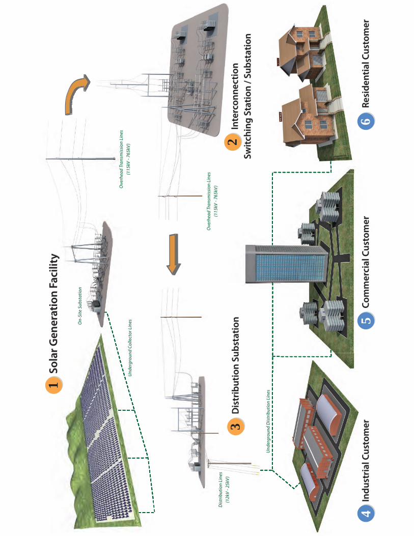
Site infrastructure related to the proposed Picacho Solar Project would consist of the PV panel
arrays, a small (i.e., 20-foot by 30-foot) metal maintenance and office building, battery storage, a
potential groundwater well, the gen-tie line, and a site boundary fence. Photographs and an energy
production diagram of a typical PV solar facility are presented in Appendix C. While the precise
design of panel systems varies by manufacturer and model and is subject to modification as
technologies evolve, the photographs provide an accurate indication of the system that would be
operated on the Project site. Panels would not exceed 10 feet in height; this gives the project a
much lower profile than that of a single-story building. Rows of panels are spaced nearly 18 feet
apart, allowing continued wildlife movement between rows.
The site boundary fence will be designed with small openings and/or a gap between the fence and
the ground to allow reptiles and small mammals to move about.
Natural Resource Conservation
SunPower has considered potential impacts of the proposed Project, and will mitigate any potential
impacts to natural or cultural resources by minimizing ground disturbance where possible.
SunPower Corp. 11 Tetra Tech, Inc. Major Comprehensive Plan Amendment May 31, 2017
Construction and operation of the Project will be compliant with all county, state, and federal laws,
regulations, and guidelines.
SunPower is conducting detailed environmental studies, including pedestrian biological, cultural,
and wetlands surveys for the site, and is in progress of preparing comprehensive reports. Results
of the preliminary review of the Project site are described below.
Biological Resources
Vegetation at the site is characteristic of the Lower Colorado River Subdivision of the Sonoran
Desert Desertscrub biome (Turner and Brown 1982). The CAP Canal has influenced the
vegetation conditions. Mesquite (Prosopis velutina) and creosote bush (Larrea tridentate) account
for a large portion of the cover upslope of the canal.
Wildlife in the Project area is likely characteristic of the Desertscrub biome. Open areas with
sparse or no vegetative cover, including those that have been disturbed or altered (the site is
currently heavily grazed), can also be important to some species of wildlife, notably the burrowing
owl (Athene cunicularia). The CAP Canal, I-10 and the frontage road, and the Union Pacific
Railroad form adverse effects on wildlife movement as these features are significant obstacles to
movement. However, the Ironwood-Picacho Wildlife Linkage located along the southeast section
of the Project and across the 1.5-mile underground segment of the CAP that allows for unimpeded
wildlife movement through the area. SunPower will consult with AZGFD and CAP to design the
solar facility to avoid potential impacts to the wildlife linkage.
Riparian habitat in the Project area is xeroriparian (extremely dry and lacking humidity and water).
These riparian habitats are generally associated with an ephemeral water supply and are important
habitat for migratory birds.
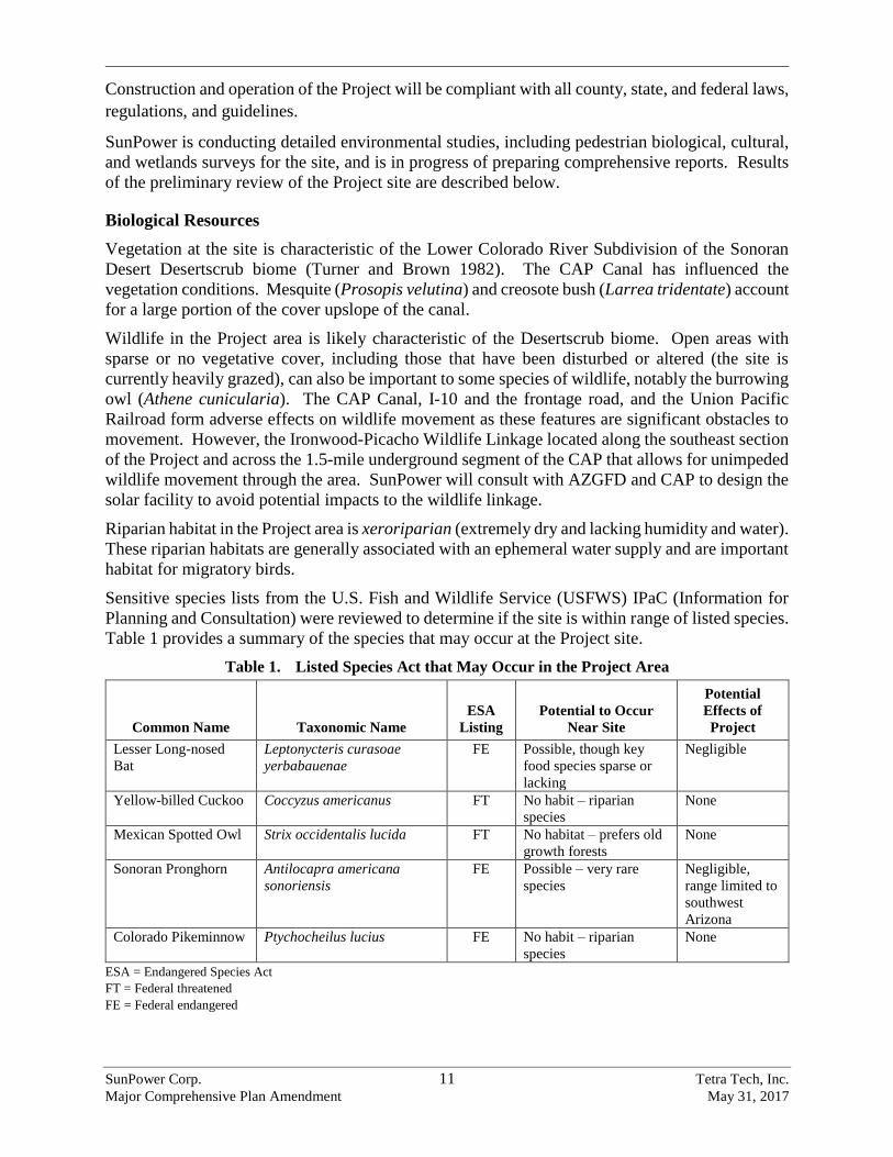
Sensitive species lists from the U.S. Fish and Wildlife Service (USFWS) IPaC (Information for
Planning and Consultation) were reviewed to determine if the site is within range of listed species.
Table 1 provides a summary of the species that may occur at the Project site.
Table 1. Listed Species Act that May Occur in the Project Area
Common Name Taxonomic Name
ESA
Listing
Potential to Occur
Near Site
Potential
Effects of
Project
Lesser Long-nosed
Bat
Leptonycteris curasoae
yerbabauenae
FE Possible, though key
food species sparse or
lacking
Negligible
Yellow-billed Cuckoo Coccyzus americanus FT No habit – riparian
species
None
Mexican Spotted Owl Strix occidentalis lucida FT No habitat – prefers old
growth forests
None
Sonoran Pronghorn Antilocapra americana
sonoriensis
FE Possible – very rare
species
Negligible,
range limited to
southwest
Arizona
Colorado Pikeminnow Ptychocheilus lucius FE No habit – riparian
species
None
ESA = Endangered Species Act
FT = Federal threatened
FE = Federal endangered
SunPower Corp. 12 Tetra Tech, Inc. Major Comprehensive Plan Amendment May 31, 2017
Starting on August 15, 2017, SunPower will conduct a biological assessment at the site, and will
prepare a Biological Evaluation (BE) report to summarize findings for the Project. The BE will
summarize any state or federally protected species that may occur or have the potential to occur
within the Project area including the Tucson shovel-nosed snake, Sonoran desert tortoise, western
burrowing owl, Gila monster, and the Kit fox.
The BE will provide narrative descriptions of all protected species investigated and report whether
suitable habitat was identified. SunPower will report any direct observations or evidence of
protected species using the Project area, and all final determinations for each species will be based
on expert opinion. SunPower will describe the dominant overstory and understory vegetation
communities observed within the Project area and provide a plant list of common species observed
within the project limits, including any non-natives. The BE will provide appendices for the
following:
A summary of AGFD’s Species of Greatest Conservation Need (SGCN) and
recommendations,
A plant evaluation to summarize plant species present within the Project area that are
protected under Arizona Department of Agriculture’s Native Plant Law, and
A bird evaluation to summarize birds protected under the Migratory Bird Treaty Act and
Birds of Conservation Concern that may have potential to be present within or use the
Project area.
The Project will require clearance of select vegetation within the footprint of the facility. The
ASLD does not require mitigation for development projects that disturb Arizona State Trust Lands
(Moore 2017). However, SunPower will tag all listed plants located within the footprint of the
facility and file a Notice of Intent with the AGFD. SunPower will arrange to have all protected
under the listed native plants that are located in the construction area to be either salvaged or moved
to an undisturbed location on the Project site.
Cultural Resources
In compliance with the National Historic Preservation Act and State Historic Preservation Act,
SunPower conducted a Class III cultural resources survey of the Project site from August 1 to 15,
2017.
SunPower examined the AZSITE online database, which includes recorded from the Arizona State
Museum (ASM) and Arizona State University, to determine the location of any previously
conducted archaeological surveys or previously recorded archaeological sites within a 1-mile
radius of the Project area. Approximately 24 previously recorded sites are located within or very
close to the Project site.
Archaeologists conducted a full pedestrian survey of the solar facility following ASM and State
Historic Preservation Office (SHPO) inventory standards and guidelines. Archaeologists walked
parallel transects spaced not more than 20 feet apart, recording all isolated occurrences and
mapping and recording archaeological sites identified in the Project area. A Registered
Professional Archaeologist (RPA) who meets the National Secretary of the Interior’s professional
SunPower Corp. 13 Tetra Tech, Inc. Major Comprehensive Plan Amendment May 31, 2017
standards led the fieldwork. The findings of the archaeology survey will be included in a Class III
survey report.
Wetland Resources
SunPower conducted a preliminary jurisdictional delineation within the proposed disturbance
corridors associated with the solar facility and access roads (Figure 5). Scientists trained and
experienced in the U.S. Army Corps of Engineers (USACE) protocols for conducting routine
wetland delineations assessed the Project area to determine the extent of wetlands and other Water
of the U.S.
The National Hydrography Data, National Wetlands Inventory, aerial photography, and
topographic maps were used to prioritize locations of potential wetland areas for field assessment
and to identify the connectivity of area drainage systems. The regional USACE Arid Supplement
was used to document characteristics of wetland hydrology, hydrophytic vegetation, and hydric
soils. No wetlands or other Waters of the U.S. were delineated during the preliminary
jurisdictional delineation. A letter of No Effect will be prepared and submitted to the USACE.
Water Resources, Public Facilities/Services, and Infrastructure Support
Planned utilities and services on the site would include water and electricity. The Project is
anticipated to use substantially less water than typical farmlands within the region. As stated
earlier, the proposed PV panels will be cleaned using SunPower’s robotic cleaning method that
uses approximately ¼ cup of water per panel.
SunPower intends to either install a groundwater well or transport water to the site from a local
source for the minimal site water demands and uses.
The Project is located in the northern part of the Avra Valley Sub-basin of the ADWR Tucson
Active Management Area. If SunPower decides to install a groundwater well at the site, available
hydrogeologic data will be assessed, including but not limited to:
ADWR 55- and -35 well records database
ADWR Groundwater Site Inventory (GWSI) (water level and water quality)
ADWR hydrographic maps and survey reports
USGS National Water Information System (NWIS) (publications, water level and water
quality)
Arizona Geological Survey (AZGS) maps and reports
Available hydrogeologic data will be reviewed to identify local aquifer conditions including:
Depth and direction of water movement
Lithology and aquifer parameters
Well yields
Water quality
SunPower will also assess and identify all applicable groundwater supply permits and certificates
required for the Project. Since the Project area is located on ASLD land within the boundaries of
SunPower Corp. 14 Tetra Tech, Inc. Major Comprehensive Plan Amendment May 31, 2017
the ADWR Tucson Active Management Area, SunPower will be required to comply with ASLD
and ADWR statutes and rules for developing a groundwater supply.
Development of the Project would not impact existing water quality or drainage features. The site
would be designed to pass stormwater through or around the site and release it in a manner similar
to existing conditions. SunPower will prepare a hydrologic analysis and hydraulic design for
watersheds and drainage structures on the Project site that will include:
Site Hydrology – Develop site hydrology to determine flood peaks.
Existing and Future Conditions Hydraulic Analyses and Mapping – Calculate the ponding
depth upstream of the CAP Canal using either 1-Dimensonal or 2-Dimensional floodplain
analyses.
Erosion Hazard Investigation – Identify locations where local vertical or lateral erosion is
likely to occur and provide mitigation measures to reduce risks associated with such
hazards.
Based on the results of the hydrologic analysis, SunPower will coordinate with Pinal County staff
to determine the need for a Floodplain Use Permit application.
The Pinal County Sheriff’s Office provides law enforcement services in the Project area. Both the
Red Rock and Avra Valley Fire Departments serve the Project area. No new or additional public
services resulting from the proposed amendment are anticipated.
SunPower Corp. 15 Tetra Tech, Inc. Major Comprehensive Plan Amendment May 31, 2017
4.0 REFERENCES
Barron-Gafford, G.A. et al. 2016. The Photovoltaic Heat Island Effect: Larger solar plants increase
local temperatures. Scientific Reports 6.
LSD (Logan Simpson Design). 2007. Pinal County Open Space and Trails Master Plan. Available
at: http://www.pinalcountyaz.gov/OpenSpaceTrails/Pages/Home.aspx. Accessed April
20, 2017.
Moore, Ray. 2017. Application of the Arizona Department of Agriculture Native Plant Law to
Arizona State Land Department Land. Personal Communication between Ray Moore
(AZSLD) and Dr. Dan Bunting (Harris Environmental) on August 12, 2017.
Pinal County. 2009 (Revised 2015). Pinal County Comprehensive Plan. Available at:
http://www.pinalcountyaz.gov/CommunityDevelopment/Planning/Pages/CompPlan.aspx.
Accessed April 16, 2017.
Pinal County. 2016. CAP Recreation Trail. Available at:
http://www.pinalcountyaz.gov/OpenSpaceTrails/Pages/CAPRecTrail.aspx. Accessed on
April 25, 2017.
Turner, R.M., and D.E. Brown. 1982. Sonoran Desertscrub. In D.E. Brown (ed), Biotic
Communities in Desert Southwest-United States and Mexico.

SunPower Corp. Tetra Tech, Inc. Major Comprehensive Plan Amendment May 31, 2017
Figures
Jobsite Entrance GateTCF, Construction Parking
Jobsite Entrance(s)
Site Trailers / Laydown Areaseach side of Road
E Nona Rd
E Park Link Dr
E Sasco Rd
E Camino Adelante Rd
SAgu
irreL
nS P
ecan
Rd
SEs
tanc ia
Dr
Suizo Wash
Guild Wash
Parker Wash
McClella n Wash
Santa Cruz River
Los Robles Wash
CAP
C anal
10
Tortolita
Red Rock
01
19
06
34
17
07
05
14
26
2220
20
06
28
23
07
07
21
18
26
14
24
10
15
17
14
10
09
17
25
12
19
12
20
22
34
23
08
17
05 05
36
19
21
02
15
06
02
24
17
29
04
19
33
2424
08
01
35
27
17
04
08
05
35
10
36
01
13
21
14
08
30
16
2732
18
25
31
32
01
18
20
26
19
23
18
17
29
16
13
28
31
16
09
16
13
03
15
33
04 02
05
03
03
08
07
15
27
12
14
11
11
28
02
33
24
11
30
03
12
15
03
09
09
18
05
22
07
19
27
11
01
07
20
22
24
23
21
16
20
31
25 25
09
20
21
11
07
22
30 30
07
2923
29
29
04
16
06
18
08
21
1211
10
12
18
19
30
28
18
14
22
3632
15
06
19 23
30
06 0208
13
31
29
3534
26
0908
20
17
32
13
13
04
10
10
9S 10
E9S
9E
9S 10E10S 10E
9S 10
E9S
11E
9S 10
E10
S 11
E
9S 9E10S 9E
10S 12E9S 12E
10S
12E
10S
11E
9S 12
E9S
11E
10S
9E10
S 10
E
10S
10E
10S
11E
9S 11E10S 11E
Red Rock (AZ)Saguaro
17
10
8PIN AL
COUN TY Picacho SolarPicacho Solar
P i n a l C o u n t y , A ZP i n a l C o u n t y , A ZA u g u s t 2 0 1 7A u g u s t 2 0 1 7
Path:
P:\6
023_
SunP
ower_
Sagu
ro_So
lar\G
IS\La
youts
\Boa
rd_Su
pervi
sors_
Comm
ents\
Proje
ct_Sit
e.mxd
, Rev
ised:
8/16/2
017
Legend
Power Plant
115kV Transmission Line
500kV Transmission Line
Existing ElectricTransmission Infrastructure
0 21Miles
1in = 0.75 miles when printed at 11x17
F i g u r e 1F i g u r e 1P r o j e c t A r e aP r o j e c t A r e a
Project Site
Vegetative Screen
Interstate Highway
Canal or DitchIntermittent StreamPerennial Stream
Transportation
Hydrology
138kV Transmission Line230kV Transmission Line
Green Energy Production
Pinal County Land Use
TownshipSection
Public Land Survey System
Proposed Gen-Tie Line EA Concept Trail Alignment
XX
Substation
Private AirportPublic Airport
Site Access Parking

Pi c ac h o P e a k
E Nona Rd
E Park Link Dr
E Sasco Rd
E Camino Adelante Rd
SAgu
irreL
nS P
ecan
Rd
SEs
tanc ia
Dr
Suizo Wash
Guild Wash
Parker Wash
McClella n Wash
Santa Cruz River
Los Robles Wash
CAP Canal
10
Tortolita
Red Rock
Red Rock(AZ)
Saguaro
17
10
8PIN AL
COUN TY Picacho SolarPicacho Solar
P i n a l C o u n t y , A ZP i n a l C o u n t y , A ZA u g u s t 2 0 1 7A u g u s t 2 0 1 7
Path:
P:\6
023_
SunP
ower_
Sagu
ro_So
lar\G
IS\La
youts
\Boa
rd_Su
pervi
sors_
Comm
ents\
Exist
ing_L
andu
se_1
0-3.m
xd, R
evise
d: 8/1
5/201
7
LegendExisting ElectricTransmission Infrastructure
0 21Miles
1in = 0.75 miles when printed at 11x17
F i g u r e 2F i g u r e 2E x i s t i n g L a n d U s eE x i s t i n g L a n d U s e
Project Site
Interstate Highway
Canal or DitchIntermittent StreamPerennial Stream
Transportation
Hydrology
Proposed Gen-Tie Line
Pinal County Land UseEmploymentExisting/Planned or Proposed Regional ParkHigh Intensity Activity CenterGeneral Public Facilities/ServicesModerate Low Density ResidentialVery Low Residential
EA Concept Trail Alignment
115kV Transmission Line
500kV Transmission Line
138kV Transmission Line230kV Transmission Line
SubstationPower Plant
Airport ReserveMajor Open SpaceRecreation/Conservation
3-mile Radius
3-mile Radius
Pi c ac h o P e a k
E Nona Rd
E Park Link Dr
E Sasco Rd
E Camino Adelante Rd
SAgu
irreL
nS P
ecan
Rd
SEs
tanc ia
Dr
Suizo Wash
Guild Wash
Parker Wash
McClella n Wash
Santa Cruz River
Los Robles Wash
CAP Canal
10
Tortolita
Red Rock
Red Rock(AZ)
Saguaro
17
10
8PIN AL
COUN TY Picacho SolarPicacho Solar
P i n a l C o u n t y , A ZP i n a l C o u n t y , A ZA u g u s t 2 0 1 7A u g u s t 2 0 1 7
Path:
P:\6
023_
SunP
ower_
Sagu
ro_So
lar\G
IS\La
youts
\Boa
rd_Su
pervi
sors_
Comm
ents\
Prop
osed
_Lan
d_Us
e.mxd
, Rev
ised:
8/15/2
017
LegendExisting ElectricTransmission Infrastructure
0 21Miles
1in = 0.75 miles when printed at 11x17
F i g u r e 3F i g u r e 3P r o p o s e d L a n d U s eP r o p o s e d L a n d U s e
Project Site
Interstate Highway
Canal or DitchIntermittent StreamPerennial Stream
Transportation
Hydrology
Proposed Gen-Tie Line
Pinal County Land UseEmploymentExisting/Planned or Proposed Regional ParkHigh Intensity Activity CenterGeneral Public Facilities/ServicesModerate Low Density ResidentialVery Low Residential
EA Concept Trail Alignment
115kV Transmission Line
500kV Transmission Line
138kV Transmission Line230kV Transmission Line
SubstationPower Plant
Airport ReserveMajor Open SpaceRecreation/Conservation
3-mile Radius
3-mile Radius
Green Energy Production
Pi c ac h o P e a k
E Nona Rd
E Park Link Dr
E Sasco Rd
E Camino Adelante Rd
SAgu
irreL
nS P
ecan
Rd
SEs
tancia
Dr
Suizo Wash
Greene Canal
McClellan Wash
Sant a Cruz River
Parker Wash
Guild Wash
Los Robles Wash
CAP Canal
10
Red Rock
Tortolita
RedRock (AZ)
Saguaro
17
10
8PIN AL
COUN TY Picacho SolarPicacho Solar
P i n a l C o u n t y , A ZP i n a l C o u n t y , A ZA u g u s t 2 0 1 7A u g u s t 2 0 1 7
Path:
P:\6
023_
SunP
ower_
Sagu
ro_So
lar\G
IS\La
youts
\Boa
rd_Su
pervi
sors_
Comm
ents\
Futur
e_La
nd_U
se.m
xd, R
evise
d: 8/1
5/201
7
Legend
Substation115kV Transmission Line230kV Transmission Line500kV Transmission Line
Existing ElectricTransmission Infrastructure
0 21Miles
1in = 0.75 miles when printed at 11x17
F i g u r e 4F i g u r e 4F u t u r e L a n d U s eF u t u r e L a n d U s e
Project SiteInterstate Highway
Canal or DitchIntermittent StreamPerennial Stream
Transportation
Hydrology
Proposed Gen-Tie LineEA Concept Trail AlignmentProposed Green Energy Production
Power Plant
Private
State TrustBureau of Land ManagmentCentral Arizona Project
Jurisdiction
Study Area
3-mile Radius
TCF, Construction Parking
E Nona Rd
E Park Link Dr
S Pec
an R
d
Suizo Wash
Parker Wash
CAP Canal
10
Red Rock
06
2628
05 0204
21
27
20
29
31
07
33
24
03
22
01
25
30
3632
23
3534
9S 10E10S 10E
9S 10
E9S
11E
9S 10
E10
S 11
E10
S 10
E10
S 11
E
9S 11E10S 11E
17
10
8PIN AL
COUN TY Picacho SolarPicacho Solar
P i n a l C o u n t y , A ZP i n a l C o u n t y , A ZA u g u s t 2 0 1 7A u g u s t 2 0 1 7
Path:
P:\6
023_
SunP
ower_
Sagu
ro_So
lar\G
IS\La
youts
\Boa
rd_Su
pervi
sors_
Comm
ents\
Wetla
nds.m
xd, R
evise
d: 8/1
5/201
7
Legend
115kV Transmission Line500kV Transmission Line
Existing ElectricTransmission Infrastructure
0 0.50.25Miles
1in = 4,000 feet when printed at 11x17
F i g u r e 5F i g u r e 5W e t l a n d sW e t l a n d s
Project Site
Vegetative Screen
Interstate Highway
Canal or DitchIntermittent StreamPerennial Stream
Transportation
Hydrology
TownshipSection
Public Land Survey SystemProposed Gen-Tie Line
XXSubstation
Site AccessParking
NWI WetlandIronwood-Picacho Wildlife Linkage

SunPower Corp. Tetra Tech, Inc. Major Comprehensive Plan Amendment May 31, 2017
APPENDIX A
ALTA SURVEY
OH
EO
HE
OH
EO
HE
OH
EO
HE
OH
EO
HE
OH
EO
HE
OH
EO
HE
X X
OHE OHE
OH
EO
HE
OH
E
OH
EO
HE
OH
E
OH
EO
HE
OH
EO
HE
X X
OHE OHE
X X
OHE OHE
OH
EO
HE
OH
EO
HE
OH
EO
HE
OH
EO
HE
OH
EO
HE
X X
OHE OHE
OH
E
OH
E
OH
E
OH
E
OH
E
OH
EO
HE
OH
EO
HE
OH
EO
HE
OH
EO
HE
OH
EO
HE
X X
OHE OHE
X X
OHE OHE
O
H
E
O
H
E
OH
EO
HE
O
H
E
O
H
E
O
H
E
O
H
E
OH
E
X X
OHE OHE
OH
E
OH
E
OH
E
OH
E
OH
E
OH
E
OH
E
OH
E
X X
OHE OHE
O
H
E
O
H
E
O
H
E
O
H
E
O
H
E
O
H
E
O
H
E
O
H
E
O
H
E
O
H
E
O
H
E
X X
OHE OHE
SunPower Corp. Tetra Tech, Inc. Major Comprehensive Plan Amendment May 31, 2017
APPENDIX B
PHOTOGRAPHS AND ENERGY FLOW DIAGRAM
OF A TYPICAL PV SOLAR FACILITY
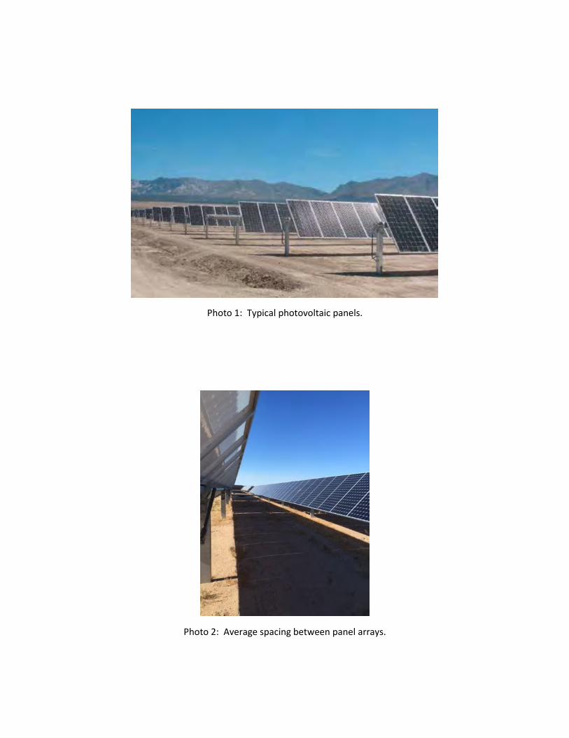
Photo 1: Typical photovoltaic panels.
Photo 2: Average spacing between panel arrays.
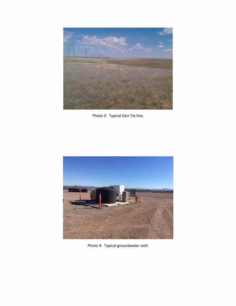
Photo 3: Typical Gen-Tie line.
Photo 4: Typical groundwater well.
˲
¼»
®¹®±
«²
¼ Ý
±´´
»½¬
±®
Ô·²
»
Ѳ
óÍ·¬
» Í
«¾
¬¿
¬·±
²
Ѫ
»®¸
»¿
¼ Ì
®¿²
³·
·±
² Ô
·²»
øïï
ëµ
Ê ó
éê
ëµ
Ê÷
Ü·
¬®·¾
«¬·
±²
Ô·²
»
øïî
µÊ
ó î
ëµ
Ê÷
˲
¼»
®¹®±
«²
¼ Ü
·¬®
·¾«
¬·±
² Ô
·²»
ͱ
´¿®
Ù»
²»
®¿¬·
±²
Ú¿
½·´·
¬§Í
±´¿
® Ù
»²
»®¿
¬·±
² Ú
¿½·
´·¬§
1
ײ¬»
®½±
²²
»½¬
·±²
Í©
·¬½¸
·²¹
ͬ¿
¬·±
² ñ
Í«
¾¬
¿¬·
±²
ײ¬»
®½±
²²
»½¬
·±²
Í©
·¬½¸
·²¹
ͬ¿
¬·±
² ñ
Í«
¾¬
¿¬·
±²
2Ü
·¬®
·¾«
¬·±
² Í
«¾
¬¿
¬·±
²Ü
·¬®
·¾«
¬·±
² Í
«¾
¬¿
¬·±
²3
ײ¼
«¬
®·¿
´ Ý«
±
³»
®×²
¼«
¬®·
¿´ Ý
«¬
±³
»®
4Ý
±³
³»
®½·¿
´ Ý«
±
³»
®Ý
±³
³»
®½·¿
´ Ý«
±
³»
®5
λ
·¼
»²
¬·¿
´ Ý«
±
³»
®Î
»·
¼»
²¬·
¿´ Ý
«¬
±³
»®
6
˲
¼»
®¹®±
«²
¼ Ý
±´´
»½¬
±®
Ô·²
»
Ѳ
óÍ·¬
» Í
«¾
¬¿
¬·±
²
Ѫ
»®¸
»¿
¼ Ì
®¿²
³·
·±
² Ô
·²»
øïï
ëµ
Ê ó
éê
ëµ
Ê÷
Ü·
¬®·¾
«¬·
±²
Ô·²
»
øïî
µÊ
ó î
ëµ
Ê÷
˲
¼»
®¹®±
«²
¼ Ü
·¬®
·¾«
¬·±
² Ô
·²»
Ѫ
»®¸
»¿
¼ Ì
®¿²
³·
·±
² Ô
·²»
øïï
ëµ
Ê ó
éê
ëµ
Ê÷
Ѫ
»®¸
»¿
¼ Ì
®¿²
³·
·±
² Ô
·²»
øïï
ëµ
Ê ó
éê
ëµ
Ê÷