physical geography of the middle east north africa & southwest asia
TRANSCRIPT
Physical Geography of the Middle East
North Africa & Southwest Asia

The Middle East
• A region comprised of areas in Southwest Asia and North Africa
• 3000 years ago, it was the center of various trade routes between Europe, Africa, and Asia.
• It has been known for its turbulent history, often being conquered by domestic and foreign groups. This has led to a multitude of diverse ethnic and cultural groups in the region.
Factors of Settlement
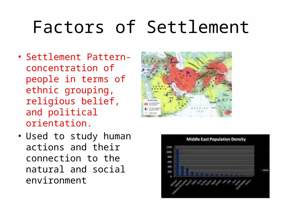
• Settlement Pattern- concentration of people in terms of ethnic grouping, religious belief, and political orientation.
• Used to study human actions and their connection to the natural and social environment
Factors of Settlement
• Physical Factors- most settlements cluster near bodies of water such as rivers and gulfs. People also settle:– areas that have access to fresh water – low-lying areas near fertile soil– temperate and mild climate regions
• Human Factors- people settle in areas where they have access to:– natural resources, – economic activities, – transportation routes.
So….Where were the first settlements located?
• Fertile Crescent – Once known as the Tigris and Euphrates River
Valley– Mesopotamia
• Nile River Valley
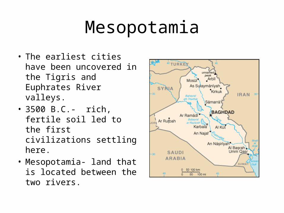
Mesopotamia
• The earliest cities have been uncovered in the Tigris and Euphrates River valleys.
• 3500 B.C.- rich, fertile soil led to the first civilizations settling here.
• Mesopotamia- land that is located between the two rivers.

Nile River Valley
• The annual flooding of the river brought nutrients to the soil and allowed farmers to grow crops in abundance.
• Farmers were able to predict the floods and farming became more reliable.

Nile River Valley
• Farmers retained water for later use by developing an irrigation system.
• Irrigation- the artificial application of water to assist in the growing of crops in dry areas and during periods of little rainfall.

Nile Delta at Night: What Can You Tell Me About This Picture?
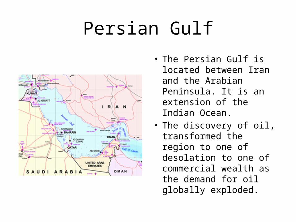
Persian Gulf
• The Persian Gulf is located between Iran and the Arabian Peninsula. It is an extension of the Indian Ocean.
• The discovery of oil, transformed the region to one of desolation to one of commercial wealth as the demand for oil globally exploded.

The Sahara• The largest desert in the
world, stretching from the Atlantic Ocean to the Red Sea.
• Temperatures can rise to over 130 degrees.
• The desert consists of sand, mountains, gravel, and rock formations.
• Underground water supplies, called aquifers, can come to the surface. They can create an oasis.– In an oasis wildlife and
vegetation can survive.
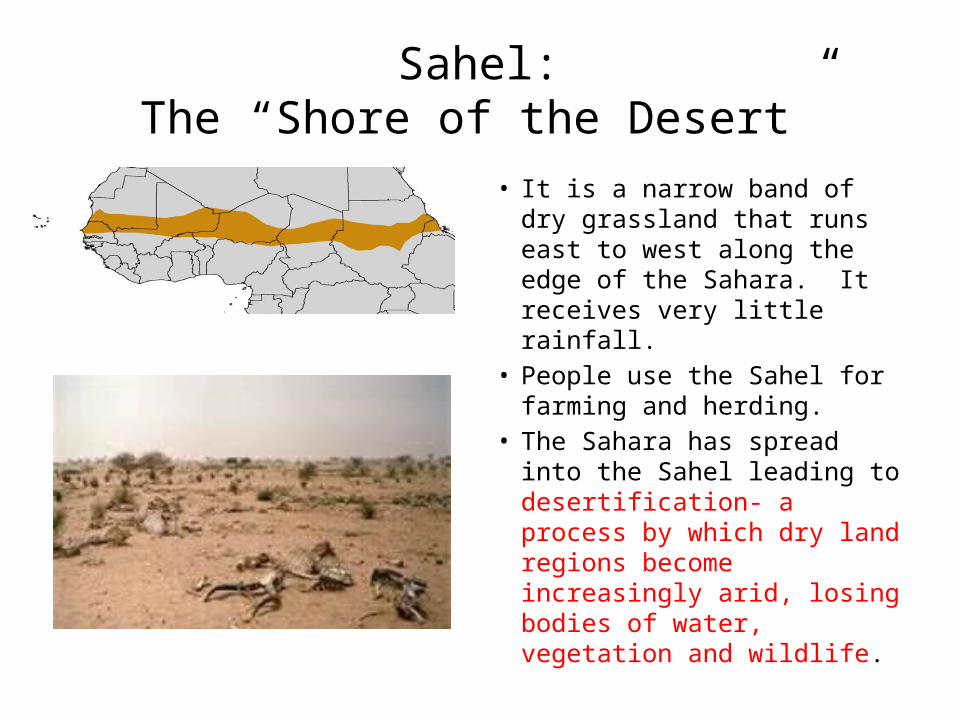
Sahel:The “Shore of the Desert”
• It is a narrow band of dry grassland that runs east to west along the edge of the Sahara. It receives very little rainfall.
• People use the Sahel for farming and herding.
• The Sahara has spread into the Sahel leading to desertification- a process by which dry land regions become increasingly arid, losing bodies of water, vegetation and wildlife.