photomontage booklet for proposed
TRANSCRIPT
Photomontage Booklet for ProposedLittleton Wind Farm
Autumn/Winter 2021

1
Viewpoint 1: View from Local Road in the townland of Leigh approximately 1km west of the proposed development. VP1 on Viewpoint Locations Map. !
! !
!
!
!
!
!
!
!
!
!
!!_̂
")
")
")
")
")
")
")
!(
!(
!(
!(
!(
!(
!(
!(
!(
!(
!(
!(
!(
!( !(
!(!(
!(
!(!(
!(
!(
!(
!( !(!( !(
!(
!(
VP4
VP2
VP3
VP6
VP7
VP5
VP1
Johnstown
Urlingford
Twomileborris
Littleton
NewBirmingham
Ballinunty
Killenaule
Horse andJockey
Ballinure
LisheenCrossroads
Moyne
Gortnahoe
Legend
") Viewpoints
!( Towns
! Littleton WF Turbine
!( Lisheen WF Turbine
!( Gurteen Lower WF Turbine
_̂ Littleton Briquette Factory
Boundary
±
Littleton Wind FarmViewpoint Locations
RM
Ordnance Survey Ireland Permit No. EN 0035621© Ordnance Survey Ireland Government of Ireland.
Drawn by:DWG No. Scale: Date: 28/09/2021BNM-PG-LN-VP-01 @A21:40,000
Littleton Bog
Lanespark Bog
Longfordpass Bog
Legend
Littleton WF Turbines
What is a Photomontage?
A typical tool utilised in the assessment of the visual impact of a wind farm is a Photomontage. Photomontages are visualisations that superimpose an image of a proposed development upon a photograph or series of photographs and are used to illustrate the potential impact of a development on the existing landscape. A number of photomontages will accompany the planning application as part of the Landscape and Visual Impact Assessment (LVIA) for the proposed wind farm. Within this booklet you will find samples of the photomontages which will form part of the LVIA for this proposed development.
To view a larger copy of the viewpoint map shown here please refer to the A2 double sided map included in the project consultation pack.

2 3
Viewpoint 2: View from the Good Shepard Cemetery at Gortnahoe, approximately 2.5km northeast of the proposed development. VP2 on Viewpoint Locations Map.
Viewpoint 3: View from Kilcooley Abbey, approximately 4.5km northeast of the proposed development.VP3 on Viewpoint Locations Map.
Legend
Littleton WF Turbines
Legend
Littleton WF Turbines

4 5
Viewpoint 4: View from the Local Road in the townland of Bawnreagh, approximately 1.1km east of the proposed development.VP4 on Viewpoint Locations Map.
Viewpoint 5: View from the Regional Road (R639), north of Littleton, in the townland of Ballydavid and approximately 2.5km west of the proposed development.
VP5 on Viewpoint Locations Map.
Legend
Littleton WF Turbines
Legend
Littleton WF Turbines
6 7
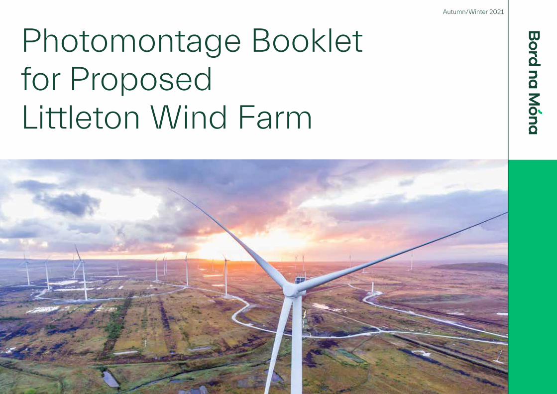
Viewpoint 6: View from the Regional Road (R689) in the townland of Poynstown, approximately 2.1km east of the proposed development.VP6 on Viewpoint Locations Map.
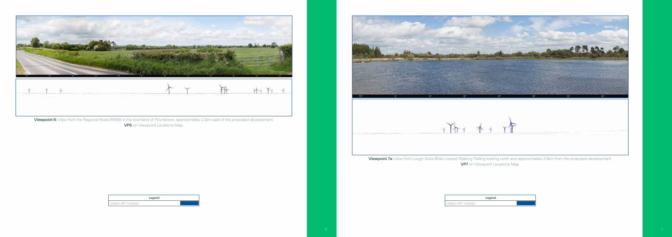
Viewpoint 7a: View from Lough Doire Bhile Looped Walking Trailing looking north and approximately 2.4km from the proposed development.VP7 on Viewpoint Locations Map.
Legend
Littleton WF Turbines
Legend
Littleton WF Turbines

Viewpoint 7b: View from Lough Doire Bhile Looped Walking Trailing looking south and approximately 0.8km from the proposed development. VP7 on Viewpoint Locations Map.
Legend
Littleton WF Turbines
Notes
