peter jones - dgps guy july 14, 1999 bmw moa national rally rhinebeck, new york or toy? tool gps on...
TRANSCRIPT

Peter Jones - DGPS Guy
July 14, 1999
BMW MOA National Rally
Rhinebeck, New York
orToy?
Tool
GPS On The Motorcycle:

Peter Jones - DGPS Guy
• U.S. Coast Guard for 17 years.
• Former enlisted helicopter flight mech / SAR crew and avionics technician.
• First commissioned billet: U.S. Coast Guard Navigation Center, Alexandria, VA– Command & Control of DGPS & LORAN
• DGPS Management and some operations.

GPS On The Motorcycle
• GPS 101
• User equipment comparisons
• Waypoint & route management
• Software tools and Internet resources
• Neat adjuncts
• Discussion
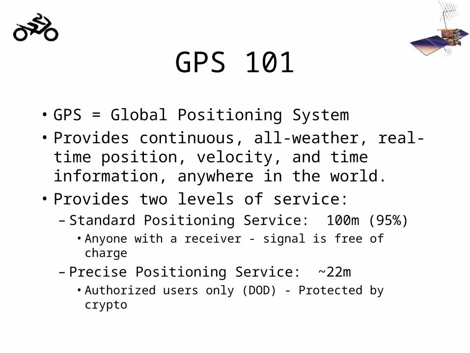
GPS 101
• GPS = Global Positioning System
• Provides continuous, all-weather, real-time position, velocity, and time information, anywhere in the world.
• Provides two levels of service:– Standard Positioning Service: 100m (95%)
• Anyone with a receiver - signal is free of charge
– Precise Positioning Service: ~22m• Authorized users only (DOD) - Protected by crypto

GPS 101: User Base
• Traditional navigators (marine & aviation)• Surveyors & chart makers• Agriculture• Utilities (timing)• New technologies and applications
– “Intelligent Transportation Systems”– Self-piloting cars– You name it...
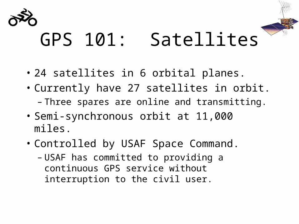
GPS 101: Satellites
• 24 satellites in 6 orbital planes.
• Currently have 27 satellites in orbit.– Three spares are online and transmitting.
• Semi-synchronous orbit at 11,000 miles.
• Controlled by USAF Space Command.– USAF has committed to providing a continuous
GPS service without interruption to the civil user.

GPS Satellite “Birdcage”
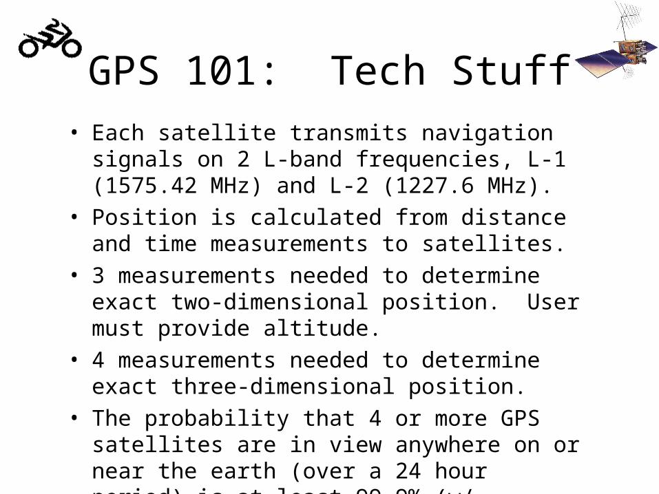
• Each satellite transmits navigation signals on 2 L-band frequencies, L-1 (1575.42 MHz) and L-2 (1227.6 MHz).
• Position is calculated from distance and time measurements to satellites.
• 3 measurements needed to determine exact two-dimensional position. User must provide altitude.
• 4 measurements needed to determine exact three-dimensional position.
• The probability that 4 or more GPS satellites are in view anywhere on or near the earth (over a 24 hour period) is at least 99.9% (w/ complete constellation).
GPS 101: Tech Stuff
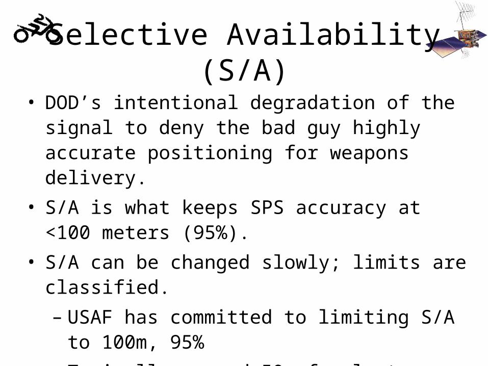
Selective Availability (S/A)
• DOD’s intentional degradation of the signal to deny the bad guy highly accurate positioning for weapons delivery.
• S/A is what keeps SPS accuracy at <100 meters (95%).
• S/A can be changed slowly; limits are classified.
– USAF has committed to limiting S/A to 100m, 95%
– Typically around 50m for last couple years.
• PPS has S/A filtered out by crypto equipment.
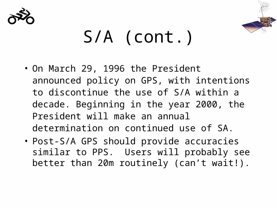
S/A (cont.)
• On March 29, 1996 the President announced policy on GPS, with intentions to discontinue the use of S/A within a decade. Beginning in the year 2000, the President will make an annual determination on continued use of SA.
• Post-S/A GPS should provide accuracies similar to PPS. Users will probably see better than 20m routinely (can’t wait!).
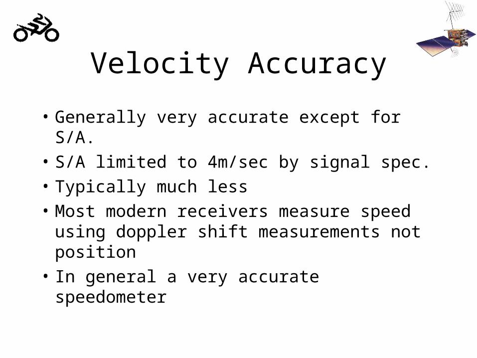
Velocity Accuracy
• Generally very accurate except for S/A.
• S/A limited to 4m/sec by signal spec.
• Typically much less
• Most modern receivers measure speed using doppler shift measurements not position
• In general a very accurate speedometer
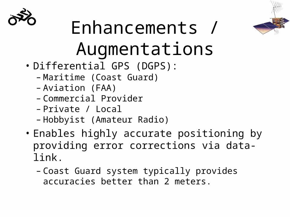
Enhancements / Augmentations
• Differential GPS (DGPS):– Maritime (Coast Guard)– Aviation (FAA)– Commercial Provider– Private / Local– Hobbyist (Amateur Radio)
• Enables highly accurate positioning by providing error corrections via data-link.– Coast Guard system typically provides accuracies
better than 2 meters.

GPS Outages
• Simply Put: It Doesn’t Happen.
• Internet-based warnings are worth what you paid for them.
• The Reality:– Very limited area ECM testing could affect
users. Unlikely to have serious affect because government agencies (FAA, USCG, etc.) are watching out for users (hey, we’re here to help!).
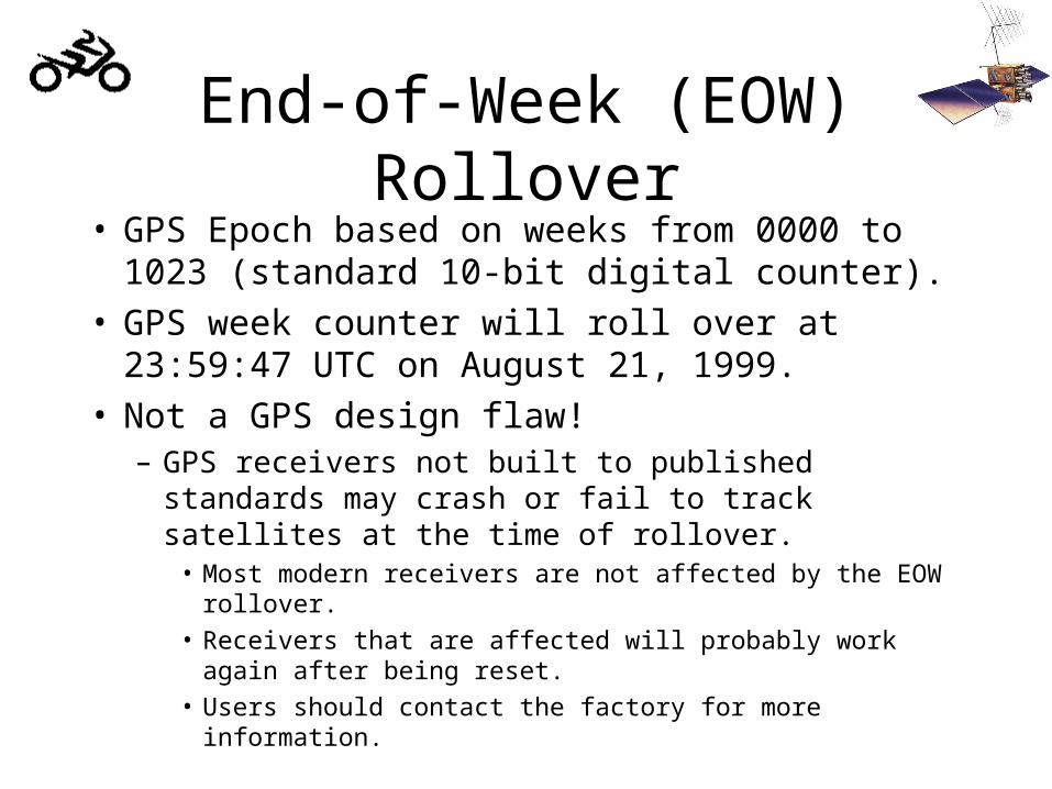
End-of-Week (EOW) Rollover• GPS Epoch based on weeks from 0000 to 1023
(standard 10-bit digital counter).• GPS week counter will roll over at
23:59:47 UTC on August 21, 1999.• Not a GPS design flaw!
– GPS receivers not built to published standards may crash or fail to track satellites at the time of rollover.
• Most modern receivers are not affected by the EOW rollover.
• Receivers that are affected will probably work again after being reset.
• Users should contact the factory for more information.

Consumer Hardware• Garmin
– Seem to have the best software support– Popular among hobbyists– Diverse product line
• Lowrance / Eagle– Competitively priced– Some neat features– Perhaps not as much software
• Both have excellent customer service rep.
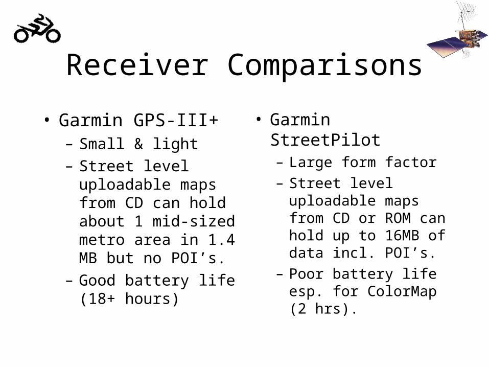
Receiver Comparisons
• Garmin GPS-III+– Small & light
– Street level uploadable maps from CD can hold about 1 mid-sized metro area in 1.4 MB but no POI’s.
– Good battery life (18+ hours)
• Garmin StreetPilot– Large form factor
– Street level uploadable maps from CD or ROM can hold up to 16MB of data incl. POI’s.
– Poor battery life esp. for ColorMap (2 hrs).

Receiver Comparisons (cont.)
• Eagle MapGuide Pro– More RAM than Garmin GPS-III– More flexibility in selecting portions to upload– Lower cost– Some say UI not as intuitive...

Consumer Software
• Commercial:– Street Atlas by DeLorme– Precision Mapping by Chicago Map– Microsoft Expedia / Streets
• Shareware– Waypoint+ – G7TO– GPSy (Mac)
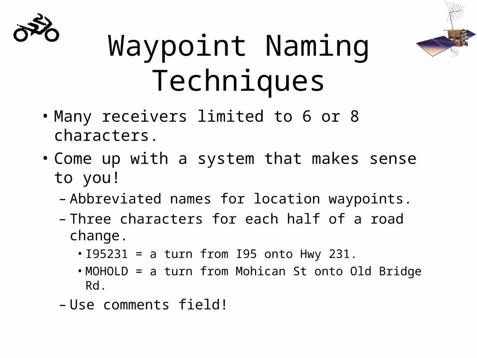
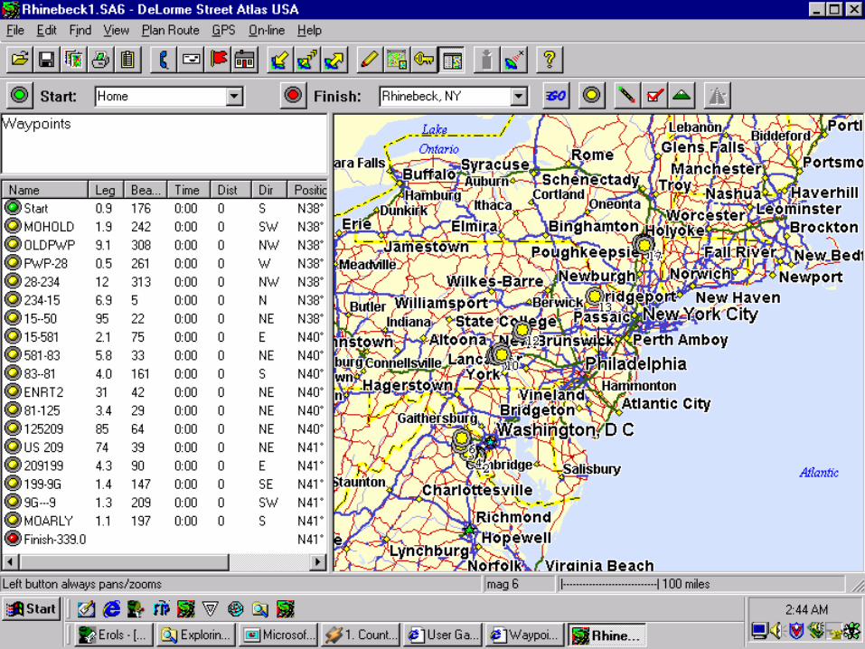
Waypoint Naming Techniques
• Many receivers limited to 6 or 8 characters.
• Come up with a system that makes sense to you!– Abbreviated names for location waypoints.– Three characters for each half of a road change.
• I95231 = a turn from I95 onto Hwy 231.
• MOHOLD = a turn from Mohican St onto Old Bridge Rd.
– Use comments field!
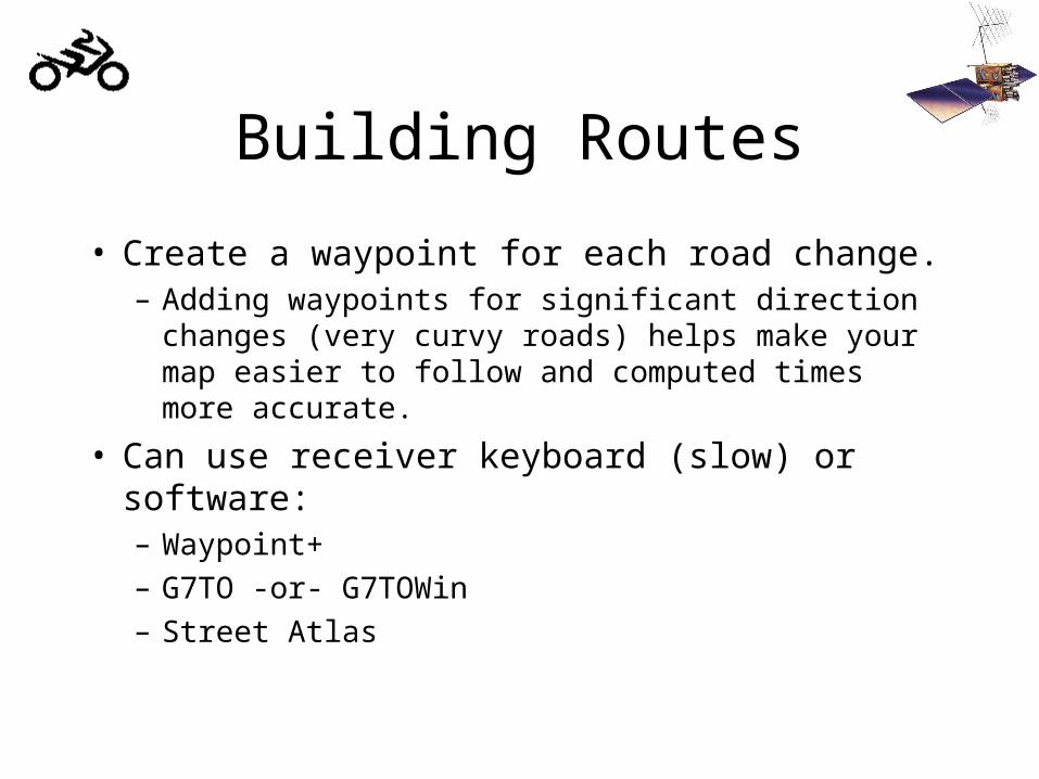
Building Routes
• Create a waypoint for each road change.– Adding waypoints for significant direction changes
(very curvy roads) helps make your map easier to follow and computed times more accurate.
• Can use receiver keyboard (slow) or software:– Waypoint+
– G7TO -or- G7TOWin
– Street Atlas
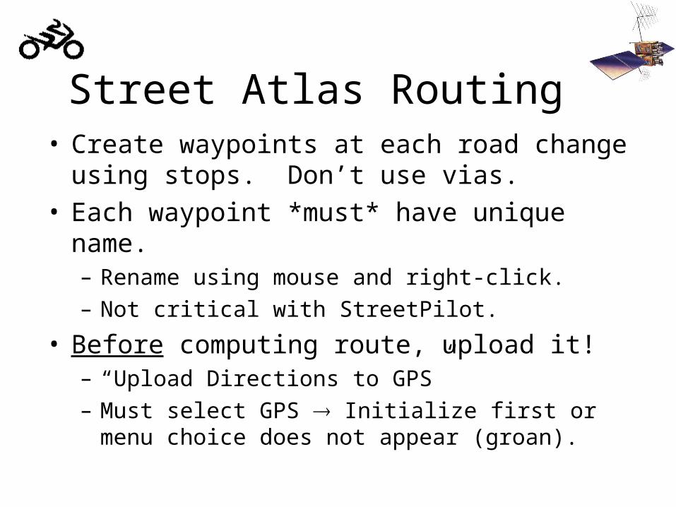
Street Atlas Routing• Create waypoints at each road change using stops.
Don’t use vias.• Each waypoint *must* have unique name.
– Rename using mouse and right-click.
– Not critical with StreetPilot.
• Before computing route, upload it!– “Upload Directions to GPS”
– Must select GPS Initialize first or menu choice does not appear (groan).
Street Atlas Routing (cont.)
• Can still use auto-routing to help select route.– Minor change to route removes superfluous waypoints.
• Quickly builds good routes.– 30 waypoint limit per route (receiver limitation).
– Thanks to unknown IBMWR President for this technique.
• Flaky with StreetPilot– Can still use this technique to build waypoint
list and then load manually or with shareware.

Track Logs• Most units record bread-crumb trail.
• Storage varies with unit. Largest may be in Garmin GPS-III/III+.– Garmin units have adjustable resolution.
• Download using shareware (Waypoint+ or G7TO), then import into Street Atlas.
• Downloading into Street Atlas less flexible.– Limits number of records received– Doesn’t separate track lines or points
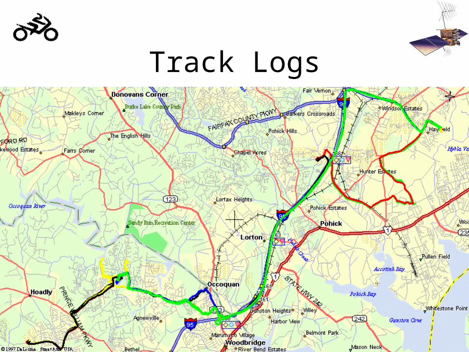
Track Logs

Internet Resources• http://joe.mehaffey.com
– Everything under the sun on GPS.
• http://www.waypoint.org/– Promising waypoint repository.
• http://www.crash.de/wpb/– Motorcycle oriented waypoint database.
• http://www.bridge.de/~tom/garmin.htm– Motorcycle oriented GPS pages.
• http://www.murkworks.net/~erkaneva– Complete U.S. BMW dealer waypoint file!
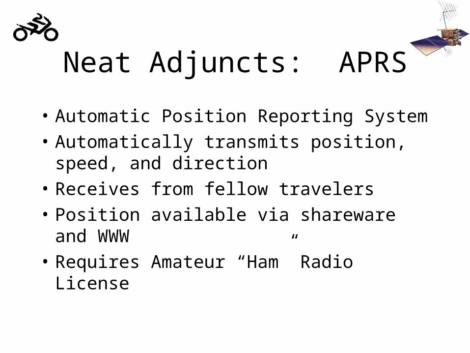
Neat Adjuncts: APRS
• Automatic Position Reporting System
• Automatically transmits position, speed, and direction
• Receives from fellow travelers
• Position available via shareware and WWW
• Requires Amateur “Ham” Radio License