people with special needs and disasters: person-in-environment model gis mapping and...
TRANSCRIPT
People with Special Needs and Disasters:Person-in-Environment Model GIS Mapping and Multi-
Stakeholder Collaborations
Shigeo TATSUKI
Doshisha University, Japan
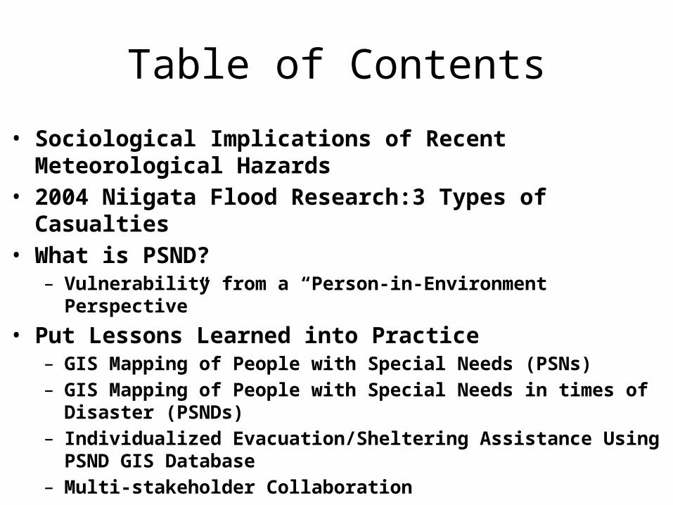
Table of Contents
• Sociological Implications of Recent Meteorological Hazards• 2004 Niigata Flood Research:3 Types of Casualties • What is PSND?
– Vulnerability from a “Person-in-Environment Perspective”
• Put Lessons Learned into Practice– GIS Mapping of People with Special Needs (PSNs)– GIS Mapping of People with Special Needs in times of Disaster (PSNDs)– Individualized Evacuation/Sheltering Assistance Using PSND GIS
Database– Multi-stakeholder Collaboration

0
0.5
1
1.5
2
2.5
3
1913-20
1921-30
1931-40
1941-50
1951-60
1961-70
1971-80
1981-90
1991-00
2001-05
Casualties
M1M2M3M4M5M6
10N
10 Year Averages of Typhoon Disaster Casualties by Magnitudes from 1913 to 2005

新潟日報 2004 年 7 月 15 日

Age Frequency35 3740 4245505560 636570 72,72,7275 75,76,76,78,7880 82,8285 85,88
12 out of 15 Casualties were those who were over the age of 65
Young Old前期高齢者
Old OLD後期高齢者

The Field Study on 7.13 Niigata Flood Disasters of 2004
•3 Types of Casualties
•Not Only Macro- But Also Micro-Hazard Vulnerabilities were Socially Created
Hayashi, H., & Tatsuki, S. The Cause of Death among 7.13 Niigata Flood Disaster Victims, A presentation at the Interim Report Forum for the Investigation of the 2004 July Niigata/ Fukusima/Fukui Heavy Rainfall Disasters, Niigata University, November 19, 2004.
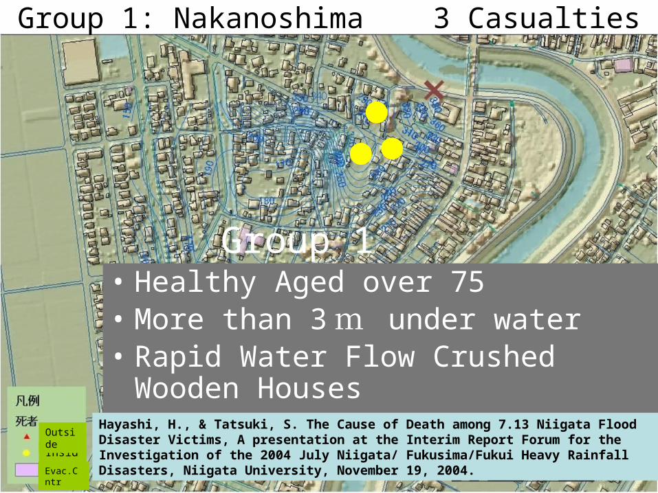
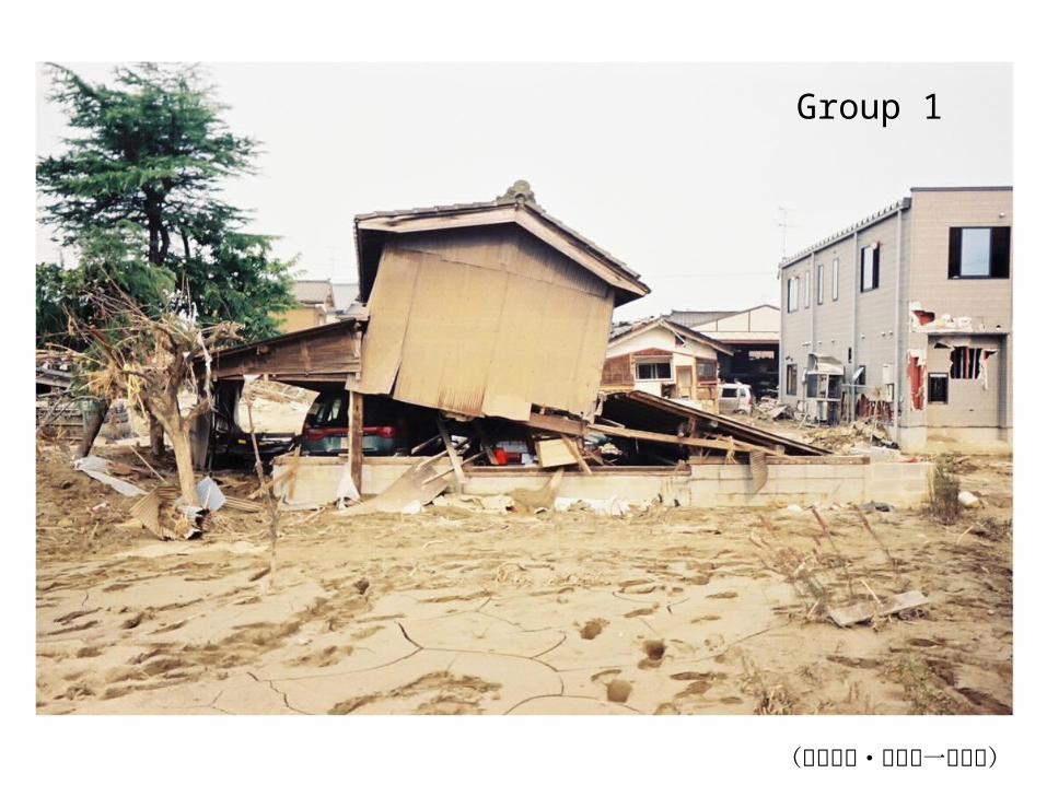
Group 1
Group 1: Nakanoshima 3 Casualties
• Healthy Aged over 75• More than 3 m under water• Rapid Water Flow Crushed Wooden Houses
Hayashi, H., & Tatsuki, S. The Cause of Death among 7.13 Niigata Flood Disaster Victims, A presentation at the Interim Report Forum for the Investigation of the 2004 July Niigata/ Fukusima/Fukui Heavy Rainfall Disasters, Niigata University, November 19, 2004.Inside
Outside
Evac.Cntr
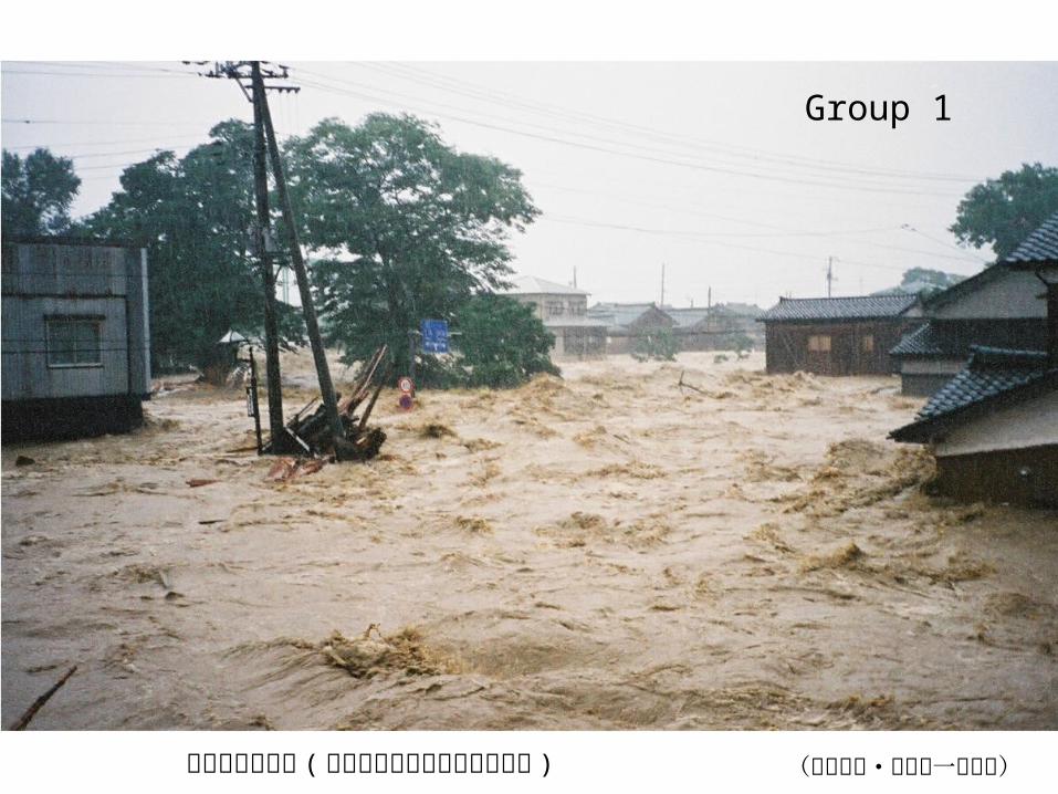
破堤直後の様子 ( 後で数日後の様子があります ) (中ノ島町・室橋嘉一氏撮影)
Group 1
(中ノ島町・室橋嘉一氏撮影)
Group 1

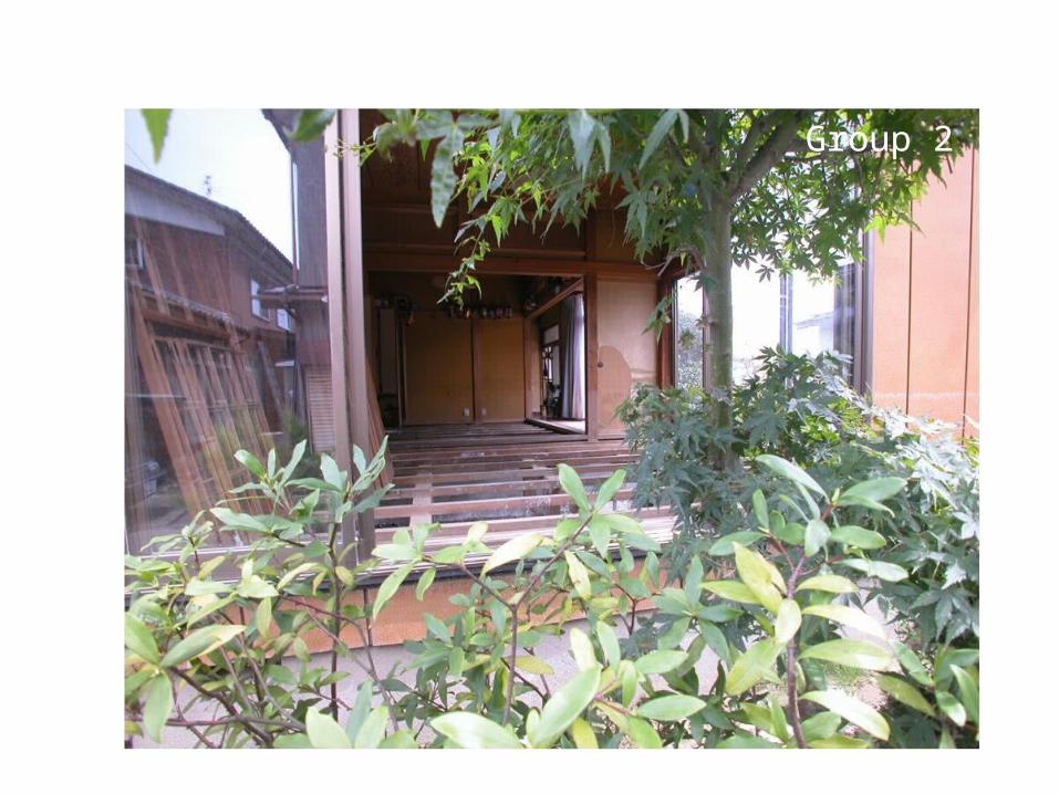
Group 2
Group 2: Near Broken Levee in Sanjo City 5 Casualties
• Younger Victims• Found Outside• 2 Victims were on their way to
Evacuation Center
Inside
Outside
Evac.Cntr
Hayashi, H., & Tatsuki, S. The Cause of Death among 7.13 Niigata Flood Disaster Victims, A presentation at the Interim Report Forum for the Investigation of the 2004 July Niigata/ Fukusima/Fukui Heavy Rainfall Disasters, Niigata University, November 19, 2004.

Group 2
Group 2
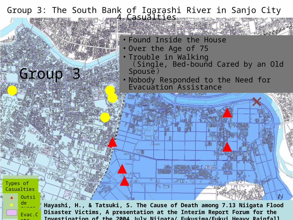
Group 3
Group 3: The South Bank of Igarashi River in Sanjo City 4 Casualties
• Found Inside the House• Over the Age of 75• Trouble in Walking
( Single, Bed-bound Cared by an Old Spouse )• Nobody Responded to the Need for Evacuation
Assistance
Inside
Outside
Evac.Cntr
Hayashi, H., & Tatsuki, S. The Cause of Death among 7.13 Niigata Flood Disaster Victims, A presentation at the Interim Report Forum for the Investigation of the 2004 July Niigata/ Fukusima/Fukui Heavy Rainfall Disasters, Niigata University, November 19, 2004.
Types of Casualties

Group 3
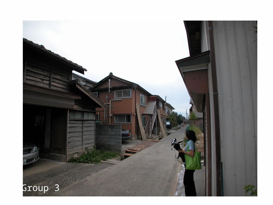
Group 3

Vulnerability as a Function of Hazards, Person, & Environment
Vulnerability is NOT intrinsic to a Person, but is Socially Created

f( , f( Person, Environment )
Estimated Hazard(Flood, Flood Tide, Tsunami, etc.) Level
1. Reliance on Long-term Care Services due to Age, Disability, etc.2. Not Able to Evacuate by Oneself3. Not Able to Survive at Shelter without Special Assistance
Help Available for Evacuation & Sheltering at times of Disaster ?
Person-Environment Profiles
HazardHazard
OverallVulnerability
PSND
People with Special Needs in times of DisasterPeople with Special Needs in times of Disaster

GIS Mapping of People with Special Needs at times of Disaster (PSND)
Kobe City Hyogo Ward Project
(April 2008 to Now)

Hazard Layer
Personal Factor
Environmental Factor
PxE Interaction Factor
V= ƒ ( H, ƒ ( P, E ))
Overall Vulnerability Map
Person-in-Environment Model of Mapping Vulnerability
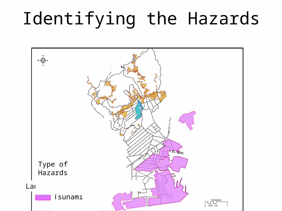
Identifying the Hazards
Flood Landslide Tsunami
Type of Hazards
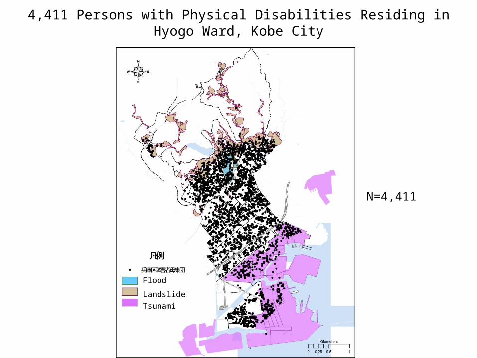
4,411 Persons with Physical Disabilities Residing in Hyogo Ward, Kobe City
N=4,411
Flood Landslide Tsunami

914 Persons with Physical Disabilities were Residing in Hazardous Areas
N=914
Flood Landslide Tsunami

612 (67%) out of 914 PWPD in Hazardous Areas Agreed to Structured Interviews
N=612 (67 %)
Flood Landslide Tsunami

Age/Gender Physical Disability
Housing Fragility
Social Isolation
Physical Immobility
Social Capital
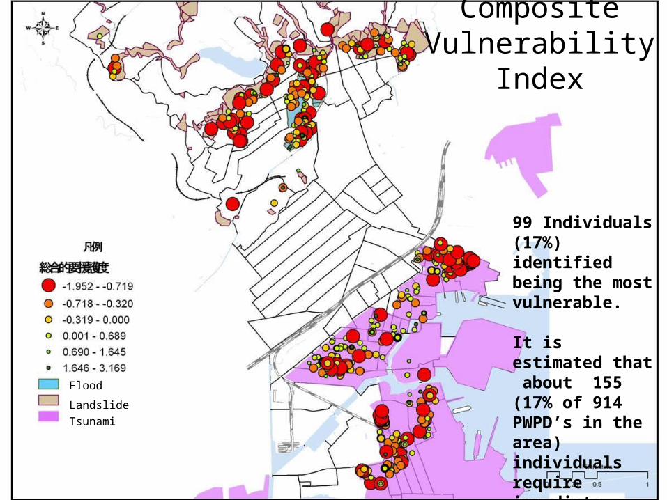
CompositeVulnerability Index
99 Individuals (17%) identified being the most vulnerable.
It is estimated that about 155 (17% of 914 PWPD’s in the area) individuals require immediate attention for evacuation & sheltering planning.
Flood
Landslide Tsunami

Category 1 Category 2
Category 3 Category 4

Overlay of 4-Level Density Map = Overall Density Map

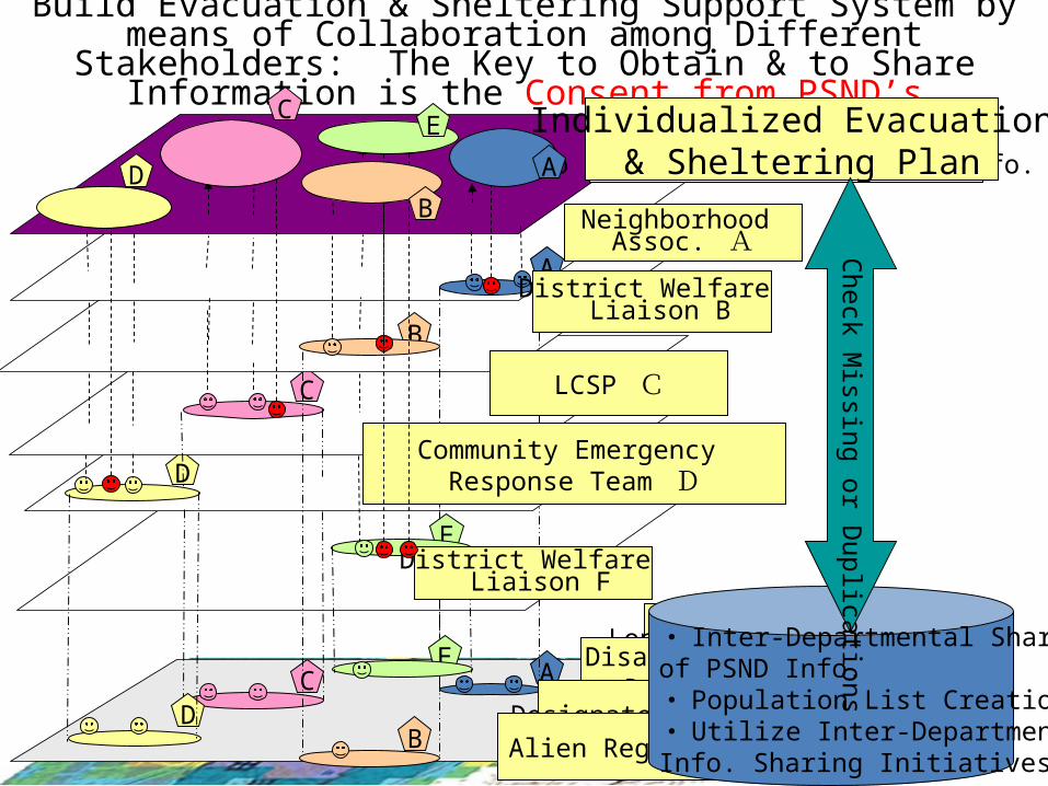
Strategies for Creating Individualized Evacuation & Sheltering Plans
D
C
B
A
A
B
C
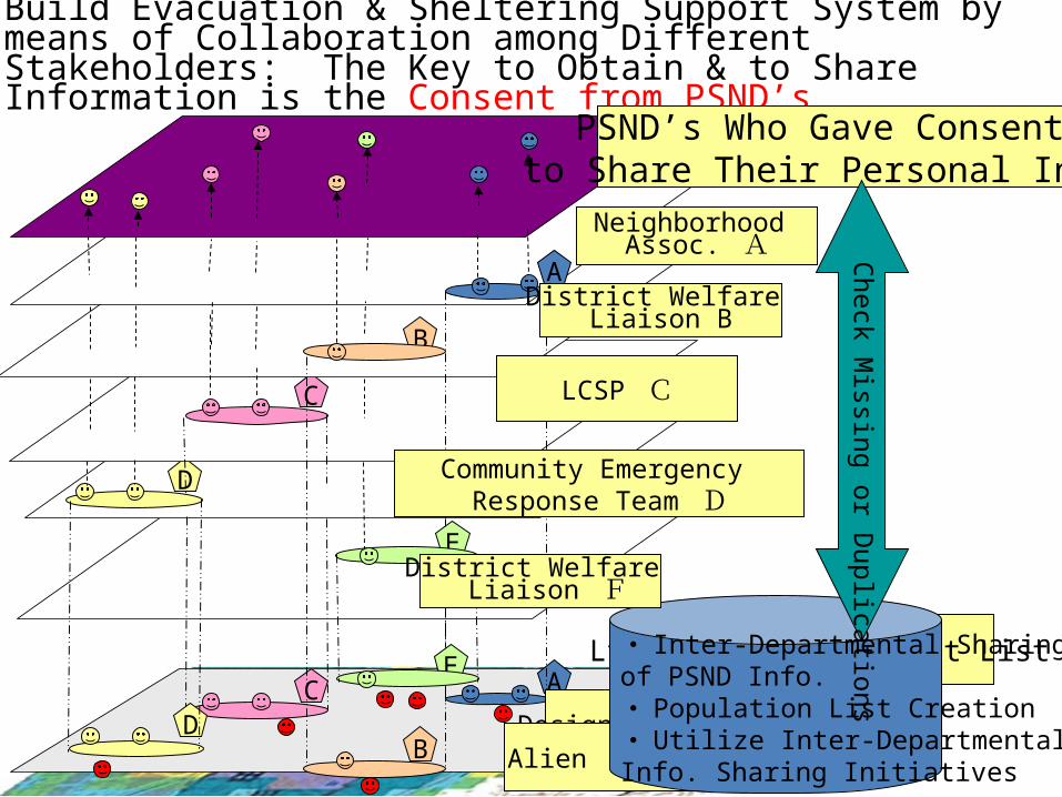
Build Evacuation & Sheltering Support System by means of Collaboration among Different Stakeholders: The Key to Obtain & to Share Information is the Consent from PSND’s
Neighborhood Assoc. A
D
E
E
PSND’s Who Gave Consent to Share Their Personal Info.
LtC Service Recipient ListPSN Db
Designated Diseases Pt.Alien Registration
・ Inter-Departmental Sharingof PSND Info.・ Population List Creation・ Utilize Inter-DepartmentalInfo. Sharing Initiatives
District Welfare Liaison B
LCSP C
Community Emergency Response Team D
District Welfare Liaison F
Check M
issing or Duplications
D
C
B
A
A
B
C
Build Evacuation & Sheltering Support System by means of Collaboration among Different Stakeholders: The Key to Obtain & to Share
Information is the Consent from PSND’s
Neighborhood Assoc. A
D
E
E
PSND’s Who Gave Consent
to Share Their Personal Info.
District Welfare Liaison B
LCSP C
Community Emergency Response Team D
District Welfare Liaison F
Individualized Evacuation & Sheltering PlanD
C
B
E
A
Long-term Care RecipientDisability Benefit
Recipient ListDesignated Diseases Pt.
Alien Registration
・ Inter-Departmental Sharingof PSND Info.・ Population List Creation・ Utilize Inter-DepartmentalInfo. Sharing Initiatives
Check Missing or D
uplications
Resilience Building Through Multi-stakeholder Collaboration
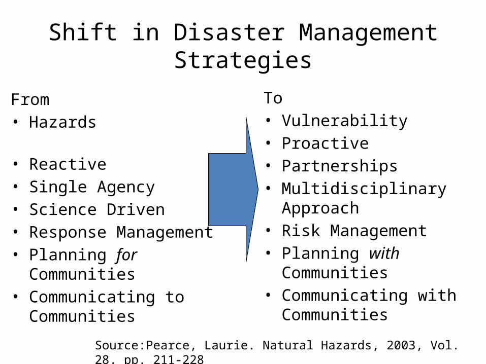
Shift in Disaster Management Strategies
From• Hazards • Reactive• Single Agency• Science Driven• Response Management• Planning for Communities• Communicating to
Communities
To• Vulnerability• Proactive• Partnerships• Multidisciplinary Approach• Risk Management• Planning with Communities• Communicating with
Communities
Source:Pearce, Laurie. Natural Hazards, 2003, Vol. 28, pp. 211-228

Build Trust Among Different Stakeholders Facilitate Effective Collaboration
• The government should have a dialogue with the stakeholders regarding the the result of proposed model of mapping vulnerability.
• Incorporate their feedback to further improve the study.
• These maps can be used as a tool to provide motivation to mobilize community members to provide assistance to the special needs population. This would be difficult to obtain without a compelling visual proof.
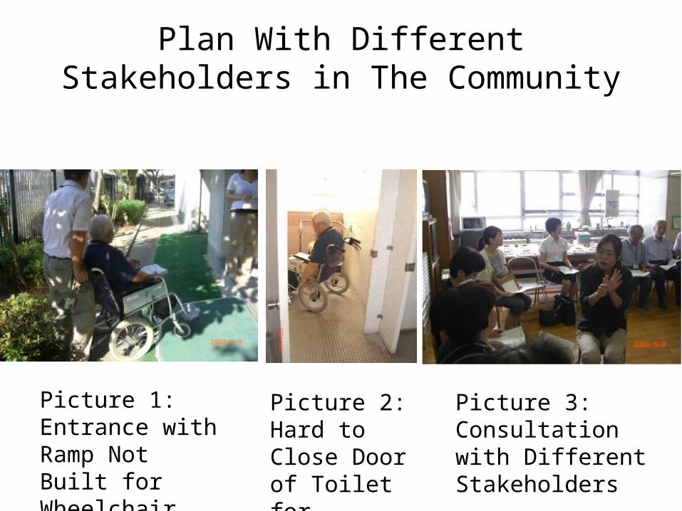
Plan With Different Stakeholders in The Community
Picture 1: Entrance with Ramp Not Built for Wheelchair
Picture 2: Hard to Close Door of Toilet for Disabled
Picture 3: Consultation with Different Stakeholders

Learn From PSND (1)
Evacuation Path of Visually-Impaired Person A

Learn from PSND (2)
Evacuation Path of Hearing-Impaired Person B