penndot extreme weather vulnerability study...
TRANSCRIPT
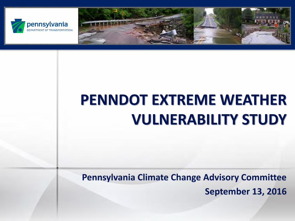
PENNDOT EXTREME WEATHER VULNERABILITY STUDY
Pennsylvania Climate Change Advisory Committee
September 13, 2016

Presentation Outline
Why Study Resiliency?
Highlights of Project Study Tasks
Summary of Study Goals
Next Steps
2
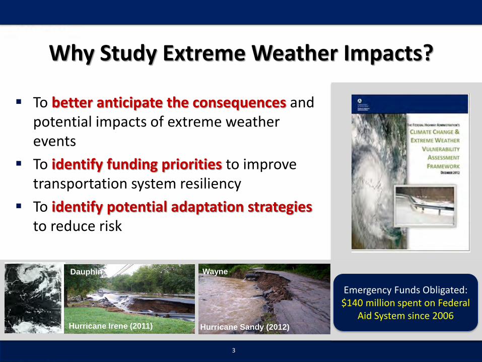
Why Study Extreme Weather Impacts?
To better anticipate the consequences and potential impacts of extreme weather events
To identify funding priorities to improve transportation system resiliency
To identify potential adaptation strategies to reduce risk
3
Hurricane Sandy (2012)Hurricane Irene (2011)
Dauphin Wayne
Emergency Funds Obligated:$140 million spent on Federal
Aid System since 2006

DEP Climate Adaptation Planning
4
Prepared in 2010
“Infrastructure Working Group”
Identified vulnerabilities to climate variables that impact transportation
Identified general adaptation strategies for each vulnerability

Recent Emphasis in Federal Actions
Adds “takes into consideration resiliency needs” to the purposes of statewide and metropolitan planning
5
Section 1201 Metropolitan Transportation Planning: System Resiliency added as a new planning factor
Final Guidance on climate change considerations within National Environmental Policy Act (NEPA) reviews
Provides a framework for agencies to consider the effects of climate change on a proposed action.

6
Adaptation Planning Framework

PennDOT Study Tasks
7
Engage Stakeholders
Identify and Compile
Historic Impactsof Extreme
Weather
Identify How Climate Change
May Affect Future Flooding
Locations
Identify Highest Risk LocationsFor Flooding
Assemble an initial Toolbox of
Strategies to Improve
Resiliency
Study to be completed by December 2016
1 2 3 4 5

Stakeholder Outreach
8
Outreach Methods:• Meetings at PennDOT District Offices (highlighted agencies below)
• Webinar Outreach• Future Coordination with other groups and agencies
PennDOT PEMA MPO/RPO DEP Turnpike
County OEM
PSP TransitHomeland
SecurityDept
Health
DCNR DCED PSU

Themes on Weather Impacts
9
Flooding
Flooding has caused roadway damage and traffic impacts throughout the state
Districts are primarily reactive to repeated flash flooding
Most significant issues have resulted from tropical storms or deficiencies in local drainage systems

Themes on Weather Impacts
10
10
Heat Pavement joint buckling
Practices in place to address Not a major issue for most Districts
Tornado / Earthquake
Has impacted roads and bridges More protocols needed
Major area of focus but hard to predict Processes and procedures in place Snow drifting issue in some areas
Snow

Themes on Weather Impacts
11
Other Impacts of Weather Secondary impacts from weather have often caused most impacts on traffic and road closures
Trees down from wind and storms Utilities
Coal and acid mine drainage have degraded metal pipes under many roads
Land/rock slides a major issue in mountainous areas of state
Retaining wall failures

Compile Historic Impact Data
12

Assessment of PennDOT Data(RCRS – Road Conditions Reporting System)
13
• Visualize Existing PennDOT RCRS data• Compare and Contrast with Stakeholder Input• Report and Summarize Attributes

RCRS Linkage to Rainfall Data
14
• RCRS linked to NOAA precipitation data• What 4-day rainfall (inches) caused closure?• Possible use in other systems like BridgeWatch

Forecast Climate Impact on Flooding
15
Conduct planning level analyses to assess changes to FEMA floodplain mapsbased on climate change
Work with PSU to assess global climate model outputs
Utilize stream gauge, forecast impervious area, and digital elevation data.
Assess inundation of PennDOT roads and bridges based on increased stream depths
Compare to historic data
Analysis for 3 sample Counties:Lycoming, Delaware, Allegheny

Level of Analysis Comparison
16
Use of watershed models like HEC-HMS or Win TR-20
Rainfall data from global models used to estimate flood discharges
More time consuming, costly
Planning Level
Detailed Watershed
PennDOT
Maryland, NJTPA
Minnesota
Iowa
Maryland used HAZUS model to estimate depth grids
PennDOT used regression equations, incorporated projected daily rainfall
More cost effective approach

17
• Existing conditions = FEMA 100yr Floodplain• Forecast impacts of climate change on floodplain • Identify vulnerable roadways and bridges• Include inundation depth projections
Existing Conditions Year - 2050 Year - 2100

18
• Address sea-level rise and storm surge if applicable
Existing Conditions Year - 2050 Year - 2100

Summarizing Analysis Results
19
• Mapbooks• GIS Maps• Thresholds of inundation• Compare and contrast with historic flooding results

Initial Assessment of Risks
20
Understand potential consequences and costs of extreme weather impacts on specific locations
Help PennDOT determine priority locations for more detailed further study (may be watershed driven)
Support for planning and programming of projects (potential integration into DOT/MPO/RPO project prioritization process)
RISK = Vulnerability Rating + Consequence RatingRCRS

Quantify Vulnerability & Consequence
21
Bridge Scour/Structure
Rating
Pavement Condition
Age of Asset / State of Life
Frequency of Flooding
(RCRS)
Location in Existing FEMA
Flood Plain
Future Vulnerability
(sample analysis areas)EXP
OSU
RE
SEN
SITI
VIT
Y
ConsequenceTraffic and
Truck VolumesFunctional
ClassState Detour
Routes
Vulnerability
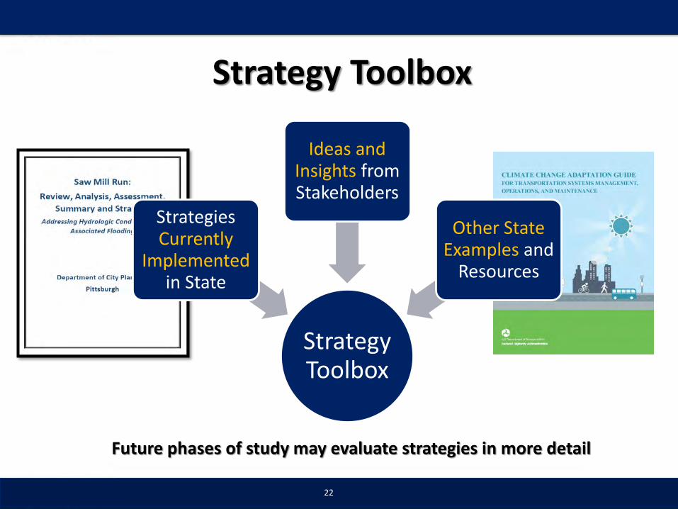
Strategy Toolbox
22
Strategy Toolbox
Strategies Currently
Implemented in State
Ideas and Insights from Stakeholders
Other State Examples and
Resources
Future phases of study may evaluate strategies in more detail

23
PLANNING, COORDINATION AND TRAINING
Strategy Ideas for PennDOT & Planning Partners
Integrate resiliency and vulnerability information into PennDOT and MPO project prioritization process
Improve coordination between state, local and property owners to address stormwater systems on non-PennDOT roadways
Improve coordination between agencies (PEMA, PSP, ACOE, District, County EMA, Municipalities, DEP, Utilities)
Develop metrics to evaluate and monitor extreme weather impacts Establish working groups to evaluate resiliency progress

24
Strategy Ideas for PennDOT & Planning Partners
Summarize and share RCRS data for planning and emergency response preparation (enhance RCRS detail for weather impacts)
Improve integration of resiliency planning efforts (PennDOT, MPO/RPO, Hazard Mitigation plans)
Improve efforts to track and understand past maintenance dollar spending over time related to extreme weather
Build on PennDOT’s study to identify and evaluate extreme weather vulnerabilities within local regions
DATA ANALYSES AND INFORMATION SHARING

25
Strategy Ideasfor PennDOT & Planning Partners
Improve maintenance procedures and armoring of stream banks to prepare for increased flooding events in future
Continue to expand and improve methods and procedures for pre and post flood inspections of roadways, bridges, and streams
Plan for increasing redundancy at roadway locations that may be impacted by storms (ensure secondary roads are maintained and available for use)
Conduct stormwater management studies using a watershed approach including municipalities, PennDOT and DEP
MAINTENANCE AND INSPECTIONS

26
Strategy Ideasfor PennDOT & Planning Partners
Identify updates to PennDOT design manuals based on national research and other university studies
Program projects to improve stormwater capacity, reduce impermeability and ensure adequate maintenance of infrastructure
Work with municipalities to identify the impacts of development on stormwater management.
Identify facilities requiring design upgrade in advance of funding requests
DESIGN

27
Strategy Ideasfor PennDOT & Planning Partners
Identify and integrate technology like web cameras to better monitor storm impacts and flood stages
Continue efforts to ensure equipment needs are coordinated across PennDOT Districts. Develop plans in case more equipment needed.
Evaluate District equipment purchases to address weather events including drill rigs, portable bridges, swing gates, pumps
Integration of automated warning systems to establish road closures and alternative routes
EQUIPMENT, MATERIALS AND TECHNOLOGY

28
Goals & Uses of
PennDOT Study
Identify Vulnerabilities
to Extreme Weather
Where Does PennDOT go from here?
Data Evaluation and
Sharing
Locations / Areas for
Future Study
Viable Strategies and
Local Case Studies
Support MPO/DOT Planning &
Prioritization
Data for Hazard
Mitigation / NEPA
Resiliency
Summary of Study Goals

Project Schedule / Coordination
29
Draft Documents - December 2016
• Draft Report
• Executive Summary
• GIS Data Files and Mapping
Finalize Document (Early 2016)
Plan Communication and Outreach
• Steering Committee and Executive Office Meetings
• Webinar (all stakeholders)

Project Contact
30
PennDOT
Contact
Douglas E. ZimmermanAssistant for Strategic ManagementPennDOT | Office of Planning400 North Street | 8th FloorHarrisburg Pa. 17120
Phone: [email protected] I www.penndot.gov