penn state weather camps sat i sat i - sat ii - nws - radar - radarsat ii nwsradar sfc. map 1 sfc....
TRANSCRIPT

Penn State Weather CampsSat I - Sat II - NWS - Radar - Radar
sfc. map 1 - sfc. map 2 – sfc map 3
-> IR emission PROP to ?
-> Temp and Height ?

Basic Forecast Guidelines

Basic Forecast Guidelines
L
L

Know what to expect! = Climo.JUNE 22

Basic Forecast Guidelines
Climatology Forecast = averages for today
Persistence Forecast = yesterday’s values
Modified Persistence -> Yesterday = First Guess -> Modify based on changes
Conceptual Models

Basic Forecast Guidelines
What causes temperature to change?◦Cloud cover:
Day Vs. Night◦Precipitation:
When it rains T’s tend to be higher/lower? Why?◦Wind and Fronts:
Direction◦N vs. S
Speed◦Day Vs. Night

Basic Forecast Guidelines

Basic Forecast Guidelines

Basic Forecast Guidelines

Penn State Weather Camps
Basic Weather Forecasting Guidelines
Sat I - Sat II - NWS - Radar - Radar
sfc. map 1 - sfc. map 2 – sfc map 3
Afternoon stuff
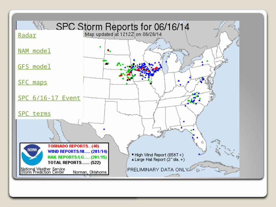
Radar
NAM model
GFS model
SFC maps
SPC 6/16-17 Event
SPC terms

Basic Forecast Guidelines
What causes rain?◦Need clouds!
Will any ole cloud do?◦Moisture supply
Bodies of water – Moisture content of air◦Upward motion:
How does this affect clouds/precip.? Mechanisms for “lift”
◦Fronts – Topography – Low Pressure – Jet stream dist.
◦(In) stability: Warm down low … cold up high!
Basic Forecast Guidelines
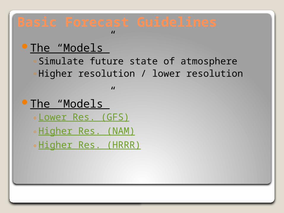
The “Models” ◦Simulate future state of atmosphere◦Higher resolution / lower resolution
The “Models” ◦Lower Res. (GFS)◦Higher Res. (NAM)◦Higher Res. (HRRR)

Your competition !!!
◦The National Weather Service
◦The Weather Channel
◦Accuweather
◦The guy or gal to your left and right