participatory rural appraisal - unnat bharat...
TRANSCRIPT

Methodology for
Participatory Rural
Appraisal(PRA)
Dr. Sandeep Kumar Raut
Town & Country Planning OrganisationMinistry of Housing & Urban Affairs

Background
UBA: Mission & Pilot Survey
Unnat Bharat Abhiyan (UBA) is inspired by the vision of transformational change in rural
Development processes by leveraging knowledge institutions to help build the
architecture
of an Inclusive India.
With the vision of UBA a team of five members, two from IIT Roorkee and one from IIT
Delhi and myself visited Gainthikhata Panchayat to conduct the pilot survey.
Objectives : Pilot Survey
•To obtain the information related to present and previous scenario of the villages
•To find out the basic issues related to the basic infrastructure and amenities
• Spatial Mapping of the information issues
• Best possible solution based on this survey and to get feed back on this

PRA: Origin
• PRA has been evolved from RRA (Rapid Rural Appraisal)
• In mid 80’s the necessity of participation in rural development becameevident and the term PRA was born
• The understanding of PRA came mostly from field rather than academia
• PRA mostly focuses on the empowerment of people throughparticipation
• The sustainability rate of PRA is high due to the participation of thelocal people
• The sense of ownership and belongingness helps to the success ofPRA

DefinitionParticipatory Rural Appraisal (PRA):
It is a participatory method to gather/ collect information by involvement of Rural/
local communities for decision making and implementation of the development
project, “for the Rural community, by the Rural community and with the Rural
Community”.
It is a process to involve the community in planning and decision making.
Community develop their won skills needed to address issues, analyze options
and carry out activities.
Participatory decision making reflects respect for human dignity and creating the
opportunity for individuals to fulfill their responsibility to exercise the right.
“ An approach and methods for learning about rural life and conditions from, with
and by rural people”. (Chambers 1994)

PRA : Components• PRA : Participatory Rural Appraisal Components:
– People
– Knowledge
– Participation
– Planning
– Action
• It is a combination of different approaches to– Share
– Enhance
– Analyze
– Plan
– Act
• The secrets behind the success of PRA are– Decentralization
– Empowerment

Planning Perspective……?
How does Villages make itself as
Sustainable Community Space
COMPREHENSIVEDEVELOPMENT PLANPlanned Development
Growth ImpetusAdequate Infrastructure
Quality of LifeControl Regulation
IMPACTSEconomic Viable Village
Self Sustained InfrastructurePull Factor
Answer is People Participation through PRA techniques.

Before the
project: at
collection
of data
stage
During the
implementation
stage of the
project
After the
complication
of projects for
administration
For
Evaluation
and
monitoring
of the
project
PRACOMMUNITY
PARTICIPATION
Participatory Rapid Appraisal (PRA) and community participation at all stages
of the project:

Principles of PRA
Reversal of learning
To learn from the local people
Learning rapidly and progressively
Exploration, flexible methods, adaptable
Offsetting bias
To be receptive rather than preconceived ideas
Optimizing tradeoffs
Understanding the usefulness of information
Triangulating
Crosschecking and approximation
Principles of PRA
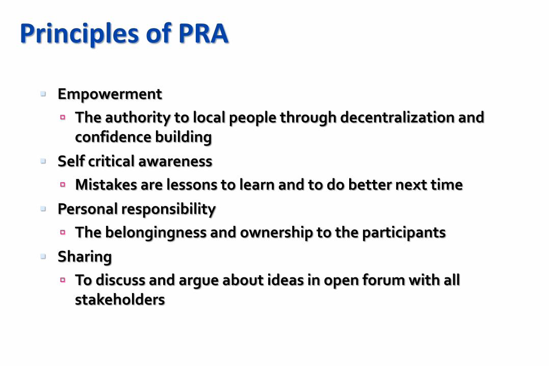
Empowerment
The authority to local people through decentralization and confidence building
Self critical awareness
Mistakes are lessons to learn and to do better next time
Personal responsibility
The belongingness and ownership to the participants
Sharing
To discuss and argue about ideas in open forum with all stakeholders

PRA is an approach to project planning and implementation that integrally involves
the community through the length of the process.
Firstly in PRA process villagers or community will assess their needs and to
customize the project interventions to their priority concerns and the peculiar
circumstances of their community. This will set the objective of the project.
Then, Participatory mapping is required to be prepared. Participatory mapping is
an exercise that uses spatial analysis to gather information about a range of issues
and concerns. Community members themselves are asked to do the drawing.
In drawing participatory maps, the primary concern is not with cartographic accuracy,
but rather with gathering useful information that sheds lights on the objectives of
the project.
A meeting should be called at the convenient place with the help of Sarpanch, and
all Panchayat members, teachers and any other interested persons, (at least one
member of village community should be women) should be invited for the meeting
Process of PRA

Methodology

STEPS OF PRA
– Transects (Systematic walks and observation);
– Informal mapping (Sketch maps drawn on site);
– Diagramming (Seasonal Calendars, flow and causal diagrams, bar charts, chapati diagrams )
– Innovation assessment (scoring and ranking different actions)

TYPES OF PRA METHODS
PRA METHODS
SPACE MAPPING
TIME MAPPING
RELATION METHODS
• Social and Resource map• Participatory Modeling Method• Mobility map• Services and Opportunities map• Transect• Participatory Census Method
• Timeline • Trend Analysis• Historical transect• Seasonal Diagram
• Social Effects, Impact, system, network Diagram, Process Map, Well Being, Ranking, Venn Diagram, Pair-wise ranking, Matrix ranking, Pie, Livelihood analysis, Spider Diagram, body Mapping

W
N
S
EPRA MAPPING

Gainthikhata Panchayat is located 25 k.m away from Haridwar towards Najimabad on the
NH-74. The Panchayat consists of five villages, viz Gainthikhata, Gujjarbasti, Lal Dhang,
Chidiyapur and Norangbad with a population of approximately 15000-17000 .
Gainthikhata Panchayat
In three days visit to the Gaindikhata Panchayat the survey team visited two villages i.e.
Gainthikhata and Gujjarbasti . The team met the villagers, Sarpanch, Teachers and
Patwari of the Panchayat and done primary survey which include RRA (Rapid Rural
Appraisal) based on UBA questionnaire and performed PRA (Participatory rural appraisal)
exercise in these two villages.
The overall response of the Sarpanch, villagers were pretty good.
.
Gainthikhata Panchayat

Gainthikhata Village Participatory MappingInviting a meeting.
Brainstorming the issues
PM begin with sun rise
direction (for north)
Choose the respondent from
the community
Asking the respondent to
draw important landmarks of
village (for example his own
property)
With reference to objective of
the project PRA team ask
about the issues and
problems.
Various colours of pen should be use for different land uses or infrastructure (for
example, red for problems, green for forest, yellow for houses black for roads etc.

Gainthikhata Village Participatory Mapping
There are many ways that this
technique can be adapted to get at
specific types of information that may
be of interest to a particular project.
The territorial map would explore
the villages resources and potentials
A regional map give information of
neighboring villages for common
resources or other resources in large
areas like hospital, college etc.
Historical map, Family resource map,
Cultural map, disaster management
map, Flood map, soil fertility map,
connective map etc.

Gainthikhata Village : PRA Process
We conducted the PRA exercise in the house of the Present Sarpanch. The present and
former sarpanch, the teacher of interschool of the village, the NGO person who is actively
connected with the villagers for last few years and no of villagers participated in this mapping
exercise.
Territorial/ Regional// Historical Mapping
We started with the direction of sunrise for the orientation.
Followed to this we marked the sarpanch house and the NH74.
Gradually with active interaction and participation we started marking other information
like distance of the main road from the village, the location of the amenities, area
covered by the civil forest, position of the holy place (Mandir, Gurudwara, and
Masjid), types of internal road and their connectivity to each other and to main road
which connecting NH-74 to village and information about canal, river and Nahar etc .
We draw each and every detail on the A0 size paper using different color for different
information We used Red color for Household, Sky Blue for water bodies, Dark Blue for the
Holy place, Green for the Forest, Black for road and Pink for issues.
While conducting the PRA we were asking the questions as per UBA form also to the target
group for obtaining information at village level and taking notes of all the responses .

Gainthikhata Village Participatory mapping
NORTH
HOUSES
COMMUNITY
FOREST
CIVIL FOREST
JOINT
FOREST
MANAGEMENT
RELIGIOUS
INSTITUTION
FLOODING AREAS AND ISSUES
SOIL FERTILITY ISSUES
ROAD RELATED ISSUES
CIVIL FOREST

BIO GASS

FODDER STORAGE

Gainthikhata Village : Outcome
Total population is around 6000-7000 with apporimatley1500 household
Located 1.5-2 k.m from NH-74 (few household do live near the NH-74) with a pakka
road constructed in the year of 2006-2007 still in a good condition.
No conveyance (any public or private ) available to travel from village to NH-74
except own vehicle and some villagers go by walk to NH-74.
Six primary Government school and six private primary schools are running
successfully Six Anganwadi centers are also running successfully. No government
hospital, no veterinary hospital and no any training centre is located in the village
of Gainthikhata.
Solar street lights are installed by the new sarpanch of the village. The internal
road is constructed in 2010 but the present situation of the same is not good, The
width of the road is approximately 10ft.

Issues and solution desired by Gainthikhata Villagers
Issues
Problem of drinking and irrigation water
Slope and flood
Seed depot
Cold storage
Potential
Good production of Jamun,
Interventions
Check dam on Nala /jhor
Irrigation work
Drinking water
Cold storage
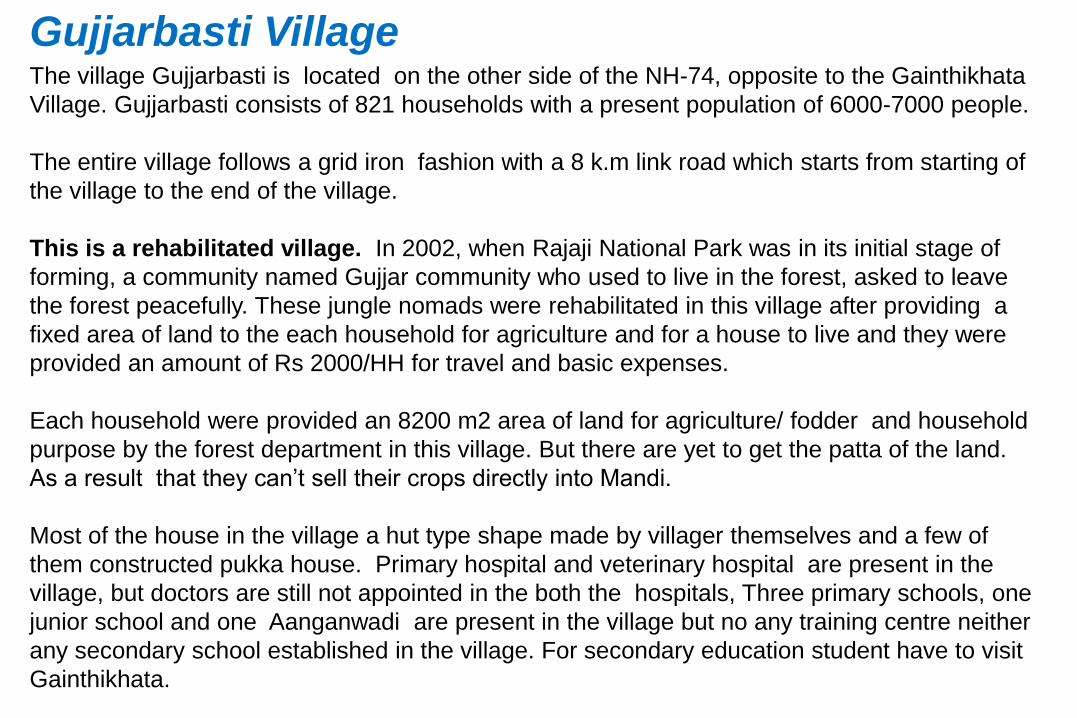
Gujjarbasti Village The village Gujjarbasti is located on the other side of the NH-74, opposite to the Gainthikhata
Village. Gujjarbasti consists of 821 households with a present population of 6000-7000 people.
The entire village follows a grid iron fashion with a 8 k.m link road which starts from starting of
the village to the end of the village.
This is a rehabilitated village. In 2002, when Rajaji National Park was in its initial stage of
forming, a community named Gujjar community who used to live in the forest, asked to leave
the forest peacefully. These jungle nomads were rehabilitated in this village after providing a
fixed area of land to the each household for agriculture and for a house to live and they were
provided an amount of Rs 2000/HH for travel and basic expenses.
Each household were provided an 8200 m2 area of land for agriculture/ fodder and household
purpose by the forest department in this village. But there are yet to get the patta of the land.
As a result that they can’t sell their crops directly into Mandi.
Most of the house in the village a hut type shape made by villager themselves and a few of
them constructed pukka house. Primary hospital and veterinary hospital are present in the
village, but doctors are still not appointed in the both the hospitals, Three primary schools, one
junior school and one Aanganwadi are present in the village but no any training centre neither
any secondary school established in the village. For secondary education student have to visit
Gainthikhata.

Gujjarbasti Village Participatory Mapping
Fodder
Houses
Layout designRELIGIOUS INSTITUTION
FLOODING
AREAS
AND
ISSUES
RESERVED FOREST
RESERVED FOREST
HOUSES
SOCIAL INFRASTRUCTURE

Only two Central governments Yojana provided to the villagers: Indra Awas Yojna and
MNREGA.
2.3 lakh rupee/- granted by the government for cattle shelter and 90-k for toilet facility
to each household.
The water table is varied throughout the village from 70-200ft. In the rainy season due
to not having drains in the village sector road filled with water make difficulty in going
from one side to another side.
On an average each household in the village is 15-20 no of cattle and they produce a
plenty amount of milk which the villagers sell to the big distributor.
One Majid and One Madarsha constructed by the Government and other sixteen Majids
constructed by the villagers on their mutual contribution of their money because link
road is 8 k.m long so people can’t pray their worship easily. Gujjarbasti also covered
by the civil forest name as Chidiyapur.
Gujjarbasti Village
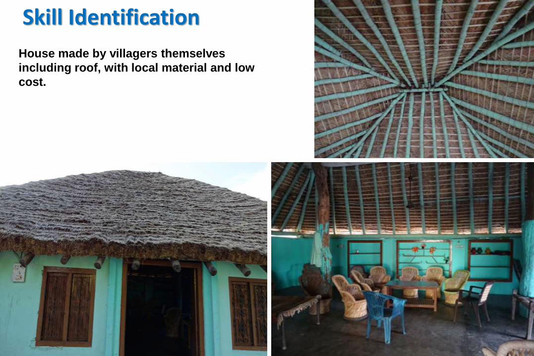
Skill Identification
House made by villagers themselves
including roof, with local material and low
cost.

Main OccupationHouse made by villagers themselves including roof, with local material and low cost.

Typical Housing and Fodder land

Social Infrastructure and Religious Institution
As Gujjarbasti Village is rehabilitated villages nearly every new village settled here
have their own religious center but only one madrasa.

Local Rivulet creating major floods

Issues and solution desired by Gujjarbasti Villagers
Issues
Flooding in link Road and Approach Road
Land ownership
Fodder land to be converted in Agri land and they want to
be part of APMC
High school/ veterinary hospital / Doctor
Nirmal Bharat Abhiyan: water pollution
Health Issue due polluted Drinking water
Potential
Specialization in Animal Husbandry and milk products
Rope making and house making by using local material
Being forest dwellers good knowledge of medicinal plants
Interventions
They want a self help group – micro finance
High potential for setting up a milk chilling plant
Bund construction along the nahar
Nala construction along the link road

• Sent a copy of the letter to District Collector and the receipt of the same: Before
Orientation
• Orientation and Training Program: April-May
• Household and Village Survey, Upload on website to generate Analysis Report and
Participatory Rural Appraisal: May-June-July
• Need Assessment, Plan of Action and upload on website: August-September
• Project Formulation for technology identification and proposing solutions, Upload on
website and submit the proposal to respective Subject Expert Group (SEG)/ Regional
Coordinating Institute (RCI): October-November
• Evolution of the proposal from SEG/ RCI and Submission of shortlisted proposal to NSC for
Approval from Coordinating Institute: December
• Implementation of the Solutions: January- March
WORK PLAN FOR PARTICIPATION INSTITUTE UNDER
UNNAT BHARAT ABHIYAN
